THIS WEEK’S FEATURED WALKS:


ALL TRAILS

The Eamont and Wordsworth Way: The ultimate car-free adventure in the Lake District
A multi-modal, point-to-point route from Penrith to Grasmere, blending riverside paths, lake cruises, and fell walks.
Start: Penrith Station
Distance: ~13 miles walking (22 miles covered, including the lake cruise)
Elevation: 1,975 feet
Duration: 5-8 hours
Difficulty: Moderate (with some changeable conditions)
Navigation: Follow step-by-step on komoot, or download GPX file
About the route
This adventure combines the Eamont Way and Wordsworth Way, with a scenic mid-point cruise on the Ullswater Steamer. Starting at Penrith Station, you'll follow riverside paths to Pooley Bridge, sail across Ullswater, and hike over Grisedale Tarn to Grasmere. It's a journey through rivers, lakes, and fells—all in one, point-to-point route.
I took the train from Manchester, but Penrith is also easily reached from London, Edinburgh, Preston, and Liverpool.

📊 Quick stats
Distance: ~13 miles
Duration: 6–8 hours
Elevation gain: ~2,000 ft
Terrain: Mixed—riverside paths, gravel, fell tracks
Dog-friendly: Yes (with some rules)
Public transport: Direct trains to Penrith; buses from Grasmere via Keswick
Route difficulty
The Eamont Way is flat and beginner-friendly, while the Wordsworth Way involves a steady climb to Grisedale Tarn, with uneven sections and changeable weather.
Walk type: Easy to moderate
Terrain: Tarmac, grassy tracks, rocky paths
Accessibility: Not suitable for wheelchairs or pushchairs
Dog-friendly: Yes—leads required on farmland and during travel
Is this walk suitable for beginners?
Yes, if you’re reasonably fit. The Eamont Way is beginner-friendly, and the Wordsworth Way offers a moderate challenge.
Why you’ll love this walk
✅ A riverside start, a midway lake cruise, and a fell finish—all in one day
✅ Panoramic views from Grisedale Tarn (if the weather’s on your side)
✅ Poetic connections to Wordsworth and Grasmere's famous gingerbread (I always take bag loads home with me!)
✅ Dog-friendly travel options on boat and bus
✅ Easy public transport access

Route highlights
🚶 Penrith to Pooley Bridge (~6 miles)
Start at Penrith Station and follow the Eamont Way through meadows and past Brougham Castle, tracing the River Eamont. Enjoy the quiet before arriving in Pooley Bridge, a perfect stop with cafés and pubs.
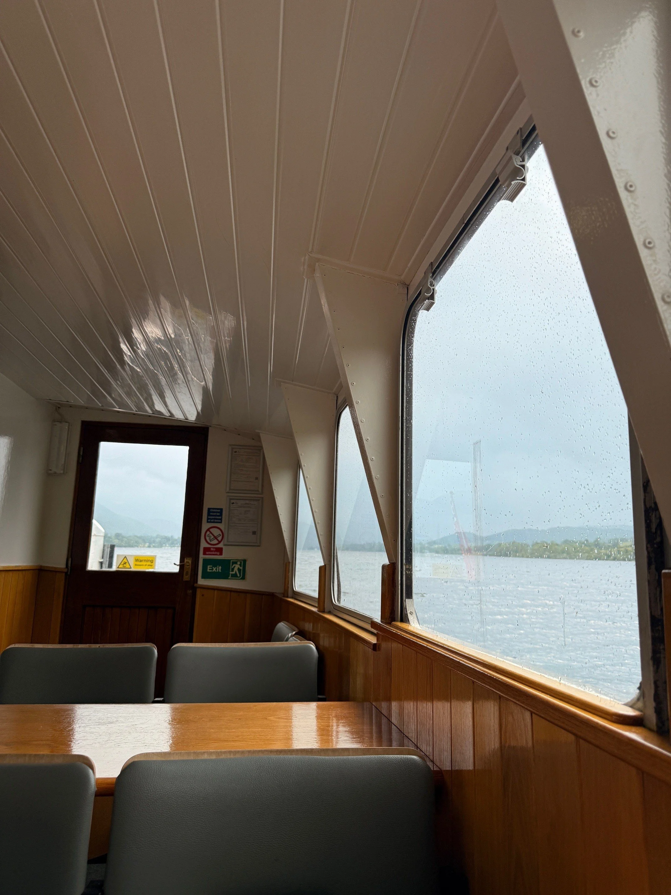
⛴️ Pooley Bridge to Glenridding (Ullswater Steamer)
Cruise past Hallin Fell and Place Fell. Enjoy lake views, spot red squirrels, and relax mid-adventure.
Fare: £16.00 (adult one-way), £10.50 (child), £1.00 (dog)
Family ticket (2 adults + 2 children): £69.75
🥾 Glenridding to Grasmere (~8 miles)
Follow the Wordsworth Way, climbing gently through Grisedale Valley. Highlights include Helvellyn’s slopes, Grisedale Tarn, and the charming village of Grasmere with its literary history.
🐾 Dog-friendly travel tips
🛳️ Ullswater Steamer
Dogs are welcome for £1.00.
Must be kept on a short lead.
Not allowed on saloon seats or upper decks.
Water bowls available at pier houses.
🚌 Stagecoach 555 Bus
Dogs allowed at driver’s discretion, must be on a lead and well-behaved.
Guide and assistance dogs always welcome.
Things to do nearby / Options to extend the route
🏛️ Dove Cottage & Wordsworth Museum
🏔️ Helvellyn or St Sunday Crag for a bigger challenge
🚣♂️ Ullswater activities like kayaking or paddleboarding
🛍️ Keswick for shopping and lakeside cafés

🏨 Where to stay
If you’re making a weekend of it (and honestly, why wouldn’t you?), we stayed at The George Hotel in Penrith. It’s a stone’s throw from the station—literally a five-minute walk, which makes rolling out of bed and onto the Eamont Way trail almost too easy.
I stayed here the night after the walk, and it was a dream. Comfy beds, a bath, a hearty breakfast included (you’ll need the carbs for this one), and a touch of historic charm without being fussy.
If you’re coming from further afield, I recommend central as a good base to get a good night’s sleep before tackling the walk. No faffing with early trains or car parks, just a relaxed start to your adventure.
When’s the best time to go?
📅 May to October for longer days and better weather. Avoid peak summer weekends for quieter paths + lake cruises.

Getting to the starting point
The route starts in Penrith, and is well-connected by:
🚂 Direct trains from Manchester (~1h 40m), London (~3h), Edinburgh (~1h 30m), Preston (~50m), Liverpool (~1h 45m)
🚗 Parking at Penrith (Park & Ride available)
✔️ Good to knows
👟 Footwear: Hiking boots essential
☔ Weather: Pack layers and waterproofs (even in summer)
🧃 Refreshments: Limited options once you leave Glenridding (bring snacks!)
🚌 Return: Bus 555 from Grasmere to Keswick, then connect to Penrith
🐾 Dogs: Lead required in fields, permitted on boat and bus with some restrictions
🔗 Handy links
🧭 Following the route
I use komoot and OS Maps for offline navigation. To follow the full walk step-by-step on komoot, simply click this link here or download the GPX file and upload it to your chosen app, such as OS Maps.

Cwm Prysor Viaduct: an atmospheric walk in Eryri
Don’t miss this hidden gem walk tucked away in the Snowdonia mountains

Start: Lay-by on the A4212, near Llyn Tryweryn (what3words: stack.crouching.scramble)
Distance: 1 mile (to the viaduct and back) or 9 miles out and back to the layby near Trawsfynydd (extended route)
Elevation: 850 feet
Duration: 1-4 hours (depending on your chosen route)
Difficulty: Easy
Navigation: Follow step-by-step on komoot, or download GPX file
About the route
Not far from the A4212 in Eryri (Snowdonia), Cwm Prysor Viaduct spans a lush valley with all the drama of a Highlands rail bridge — and none of the crowds. Built in the 1880s, this nine-arch structure once carried trains between Bala and Blaenau Ffestiniog. Today, it’s part of a scenic walk along a disused railway line where nature has reclaimed the trackbed, giving the trail a wonderfully wild, secluded feel.
If you’ve ever caught a fleeting glimpse of a dramatic rail bridge from the A4212 between Capel Celyn and Trawsfynydd, you’ve probably spotted Cwm Prysor Viaduct — a graceful relic of Victorian engineering. The old Bala and Festiniog Railway once ran through here, and though the trains are long gone, nature has quietly reclaimed the trackbed, turning this into one of Snowdonia’s most atmospheric hidden walks.
You can make this a quick detour or a full linear adventure along the disused line, soaking up views, viaducts, and moody hillsides along the way.
Distance: 1 mile (to the viaduct and back)
Extended route: ~8.8 miles (out-and-back to road near Trawsfynydd)
Time: 1–4 hours depending on route
Start/End Point: Lay-by on A4212 near Llyn Tryweryn
OS Grid Ref: SH 81438 36262
What3words: stack.crouching.scramble
Dog friendly: Yes 🐾
Public transport: None direct — nearest stop is Trawsfynydd

Route difficulty
The trail is relatively flat and easy to follow, but the mud can be a real limiter. Even in dry spells, the railway trackbed holds water like a sponge — so bring sturdy footwear and consider turning back after the viaduct if it’s been raining heavily. That said, the terrain itself is straightforward, and there’s little elevation gain.
Walk type: Easy to Moderate — mostly flat and steady, with no real incline but very boggy in places.
Terrain: Disused railway path, forestry track, and deeply puddled muddy ruts.
Accessibility: Not suitable for wheelchairs or pushchairs — path is uneven and frequently waterlogged.
Dog-friendly: Yes — dogs are welcome on leads, but be aware of sheep along the route and limited visibility in spots.
Why you’ll love this walk
Rarely visited viaduct with huge views
A “path in the sky” reclaimed by nature
Tadpoles, newts, sheep, and solitude
Extendable into a much longer railway hike

Route highlights
From the lay-by to the viaduct
Park in the lay-by just west of Llyn Tryweryn, then hop over the ladder stile to join a forestry road. At the first fork, go left — this is the start of the disused railway. You’ll follow two muddy tyre tracks through a landscape slowly being reclaimed by nature. Tadpoles squirm in puddles, the old cuttings guide your way, and before long, you’ll catch a glimpse of the viaduct.
Cwm Prysor Viaduct
Spanning 450ft across the valley and rising 120ft above the ground, the viaduct is a stunning reminder of the area’s industrial past. Its nine arches feel almost Roman in scale, and the deck (a grass path now) is open for walking thanks to a permissive access agreement. There are spots just before the bridge to view the arches — take care, as the terrain can be uneven.
Beyond the viaduct (optional)
If the conditions are dry and your boots are up for it, continue on. The route hugs the hillside and passes through weathered woodlands and pasture, with panoramic views toward Arenig Mawr. Eventually, the trail meets a single-track road near Trawsfynydd — around 4.4 miles from the start point (one way).
Things to do nearby
Llyn Celyn: Scenic reservoir with a controversial backstory
Arenig Mawr: A quieter Snowdonia summit
Trawsfynydd Lake: Ideal for picnics or extending your walk
Bala: A solid base with cafes and mountain shops

Getting to the starting point
The start is a small lay-by on the A4212. From Capel Celyn, drive west past Llyn Tryweryn and watch for the pull-in on your right. From Trawsfynydd, climb the hill — the lay-by is near the crest. The entrance is a little hidden but marked by a gate and stile.
✔️ Good to knows
This is a permissive path, not a formal right of way
Very limited parking
No signage — use OS Maps or a GPS app
Often muddy — especially beyond the viaduct
Keep dogs under control (lots of sheep)
Public transport won’t get you close
🧭 Following the route
I use komoot and OS Maps for offline navigation. To follow the full walk step-by-step on komoot, simply click this link here or download the GPX file and upload it to your chosen app, such as OS Maps.

Woodland walk with a view: Moel Famau circular
A scenic 2-hour loop in North Wales with peaceful forest trails and wide-open views from the summit

Start: Moel Famau Lower Car Park (CH7 5SH)
Distance: 4.26
Elevation: 850 feet
Duration: >2 hours
Difficulty: Easy-moderate
Navigation: Follow step-by-step on komoot, or download GPX file
About the route
Looking for a short but satisfying walk with forest calm and a big view at the top? This circular route up Moel Famau — the highest hill in the Clwydian Range — is ideal for a half-day outing. Starting from the lower car park, the route gently climbs through a mix of conifer woodland and open hillside before reaching the Jubilee Tower at the summit.
You’ll get cracking views over the Vale of Clwyd and Snowdonia on a clear day, and because it’s a relatively short route, it’s doable even if you’ve only got a couple of hours to spare.
Ideal for: beginner hikers, families, solo walkers, or anyone who just fancies a bit of elevation without a full day commitment.

Route difficulty
Walk type: Easy to Moderate — the incline is steady, with well-maintained paths all the way.
Terrain: Gravel trails, woodland paths, and grassy slopes near the top.
Accessibility: Not suitable for wheelchairs or pushchairs due to the gradient.
Dog-friendly: Yes — dogs are welcome on leads, though be aware of sheep on the upper slopes.
Why you’ll love this walk
🌲 Woodland calm – The initial forest section is quiet, shady, and peaceful — perfect for those who like a bit of forest bathing.
🏔 Big views, low effort – It doesn’t take long to feel like you’re on top of the world. The summit view is surprisingly expansive for such a short walk.
🏰 Historic summit – The Jubilee Tower ruins at the top are a unique feature — originally built to commemorate the Golden Jubilee of George III.
🐾 Great for dogs – Plenty of variety, sniffy woodland, and wide-open space to explore (just keep leads handy around livestock).
📸 Photo spots – The summit is very photogenic, especially with light catching the hills and heather in late afternoon.

Route highlights
Moel Famau Forest Trails
The lower slopes of the walk are tucked into the Moel Famau Country Park, with a network of woodland trails that weave through tall pines. It’s peaceful, well-signed, and great for warming up before the ascent.
Jubilee Tower
The partially ruined tower at the summit is a popular viewpoint — built in 1810 to mark George III’s 50-year reign, but never finished due to lack of funds. Now it’s a scenic perch with panoramic views over North Wales and even out to Liverpool Bay on a clear day.
Panoramic ridge views
From the summit, you’ll get sweeping views of the Clwydian Range, the Dee Estuary, and the peaks of Snowdonia in the distance. It’s especially pretty at golden hour when the hills take on a purpley-gold hue.

Things to do nearby
Loggerheads Country Park – Just a 10-minute drive away, this riverside park offers more woodland walks, limestone cliffs, and a visitor centre with café and loos.
Ruthin – A charming market town with a castle, independent shops, and plenty of places to grab lunch or a coffee post-walk.
Llangollen – Around 30 minutes away, this pretty town on the River Dee makes a great add-on for the day with canal walks, a steam railway, and good pub grub.
Getting to the starting point
By Car
Set your sat nav to Moel Famau Lower Car Park (CH7 5SH). Parking fees apply. The roads up are narrow in places, so take it slow on the final stretch.
By Public Transport
Public transport options are limited. The closest rail stations are Mold and Ruthin, but you’d need a taxi or bike to reach the start point from there.

✔️ Good to knows
Footwear: Walking boots or grippy trainers — the path is mostly solid, but can get slick after rain.
Facilities: Toilets at the car park. Closest cafe facilities can be found at Loggerheads or Mold.
Best time to go: Early mornings or late afternoon for quieter paths and beautiful light.
Map: Moel Famau is part of the Clwydian Range AONB — worth grabbing an OS Explorer 265 if you want to explore more of the area.
🧭 Following the route
I use komoot and OS Maps for offline navigation. To follow the full walk step-by-step on komoot, simply click this link here or download the GPX file and upload it to your chosen app, such as OS Maps.

One of the best woodland walks near Manchester: A scenic loop from Pym Chair
Towering trees, panoramic views, and hidden ruins — this 6-mile Peak District walk has it all.

Start: Pym Chair Car park
Distance: 6 miles
Elevation: 975 feet
Duration: >3 hours
Difficulty: Moderate
Navigation: Follow step-by-step on komoot, or download GPX file
About the route
Sometimes you just need a long walk in the forest.
This circular walk from Pym Chair, nestled in the Goyt Valley, is one of the best hidden woodland walks near Manchester. It combines everything that’s great about walking in the Peak District: peaceful woodland trails, wide-open ridge walks, quiet historical landmarks, and some of the best sunset views in the area.
Starting at Pym Chair car park, the route takes you through dense forest and past the haunting ruins of Errwood Hall, then climbs gently up to St Joseph’s Shrine, and further still to the scenic ridge line of Shining Tor and Cats Tor. On a clear evening, these ridges are the perfect spot for a sunset.
💡 Planning more walks like this? Search Forestry England to find your nearest forest trails and hidden gems.

Route difficulty
Walk type: Moderate — manageable for most, but includes some inclines and uneven ground.
Terrain: Woodland trails, gravel paths, and open moorland ridges. Expect a few muddy patches after rain.
Accessibility: Not suitable for wheelchairs or buggies due to uneven terrain and steps near the ruins.
Dog-friendly: Yes, on leads. Keep an eye out for sheep and ground-nesting birds.
Why you’ll love this walk
🌲 Forest therapy: Walk beneath towering trees and along winding paths that feel far away from the city.
🌄 Sunset-worthy views: Shining Tor and Cats Tor offer panoramic views across Cheshire, the Peak District, and beyond — perfect for golden hour.
🏛 Mysterious ruins: Discover the atmospheric remains of Errwood Hall, a Victorian estate now slowly being reclaimed by nature.
⛪️ Hidden shrine: Tucked into a hillside, St Joseph’s Shrine offers a surprising and spiritual pause, rich with local history.
🐾 Dog-friendly: Well-behaved dogs are welcome on leads, especially around livestock. There’s plenty for them to sniff and explore.
Best woodland walk near Manchester?
If you're based in Manchester or the surrounding area, this walk is a brilliant half-day escape. It’s less than an hour’s drive, but you’ll feel like you’ve stepped into another world.
This loop through the Goyt Valley has a bit of everything: forest calm, hidden history, hilltop drama, and just the right level of challenge. Whether you’re a weekend wanderer or a seasoned hiker looking for a quieter trail — this one’s worth adding to your list.

Route highlights
Pym Chair
A remote-feeling spot with a Forestry England car park (and yes, it’s free). It's the perfect base for exploring this quieter corner of the Peak District. The name comes from a rocky outcrop nearby that resembles a chair, once used as a boundary marker centuries ago. Today, it’s a quiet spot with stunning views west toward Windgather Rocks and east over moorland. It’s also a prime starting point for multiple ridge walks, especially popular with photographers chasing late-afternoon light.
The car park is managed by Forestry England and is often quieter than other hotspots like Mam Tor or Kinder — making it a brilliant base if you want a less-crowded adventure.
Errwood Hall Ruins
These atmospheric ruins are all that remain of a once-grand country house. Built in the mid-1800s, Errwood Hall was once the luxurious home of the Grimshawe family, wealthy industrialists from Manchester. Though now only the stone foundations and arches remain, you can still walk through the footprint of the grand house, imagining the turrets and sweeping staircases that once stood here.
The ruins sit tucked away in the forest, with moss-covered walls and ivy climbing over crumbled windows — it feels a bit like stepping into a forgotten fairytale. In spring, you’ll often find the area dotted with bluebells and rhododendrons, planted by the Grimshawes themselves. It’s a peaceful spot to take a break, explore, and soak up the slightly haunting atmosphere.
St Joseph’s Shrine
Built by the Grimshawe family of Errwood Hall, this small shrine still attracts visitors and walkers. You’ll often find candles, flowers, or quiet reflections left behind. Just a short walk uphill from Errwood Hall, this small, stone-built shelter is tucked into the hillside. It was built by the Grimshawe family in memory of Miss Dolores de Ybarguen, a Spanish companion and teacher who lived with them. The shrine became a site of pilgrimage and quiet reflection and is still looked after today by local volunteers.
Inside, you’ll usually find candles, flowers, rosary beads, and notes left by visitors. Whether you're religious or not, it’s a touching and tranquil spot that adds a surprising layer of history to the walk. And if you’re into your photography, the view from just outside the shrine is especially photogenic, especially in soft morning light.
Shining Tor & Cats Tor
As the highest point in Cheshire at 559 metres, Shining Tor earns its place on any Peak District must-walk list. The path to the summit is steady rather than steep, and once you reach the top, you’ll be rewarded with wide-open views over the Cheshire Plain, Macclesfield Forest, and even out towards Snowdonia on a clear day.
From here, the trail continues along the ridge to Cats Tor — slightly lower in height, but arguably even better for sunsets. The ridgeline is exposed, with big skies and golden grasses that catch the light beautifully in the evening. It’s a great place to linger, grab a snack, and let the world slow down for a bit.

Getting to the starting point
By Car
Pym Chair Car Park is your best bet (postcode area: SK23 7RF). It’s run by Forestry England and is usually free. The drive up is narrow and scenic — go slow and enjoy the views.
By train/taxi
Public transport is limited here, but you can take a train to Whaley Bridge or Buxton, then hop in a taxi to Pym Chair.

✔️ Good to knows
Footwear: Waterproof hiking boots recommended — especially after rain.
Facilities: No toilets or cafés at Pym Chair — come prepared.
Nearby food: Head to Whaley Bridge, Buxton, or Fernilee after your walk for pubs, bakeries, and coffee spots.
🧭 Following the route
I use komoot and OS Maps for offline navigation. To follow the full walk step-by-step on komoot, simply click this link here or download the GPX file and upload it to your chosen app, such as OS Maps.

12 incredible Peak District sunset walks (less than an hour from Manchester)

If you live in Manchester and you're craving a quick escape into nature after work, you don’t need to travel far. The Peak District National Park is right on your doorstep, and it’s packed with stunning spots that come alive at sunset. From dramatic ridges to quiet hilltops, you don’t need to walk for miles for big views and golden skies.
Whether you're looking for an easy evening stroll or a proper post-office adventure, these 12 spots are less than an hour’s drive from Manchester (with one irresistible bonus spot), and offer some of the best sunset views in the region.
1. Chinley Churn & Cracken Edge

Right on the edge of the High Peak, this is a cracking little walk with big views and barely any crowds. The best part? You can start straight from Chinley train station, so it’s a great one to save if you fancy leaving the car at home. Head up past the old quarry and onto the ridge – you’ll get wide open views across to Kinder Scout and South Head, and on a clear evening, the sunset over Manchester is unmatched.
Good to know: It's a bit rocky underfoot, especially near the quarry, so sturdy shoes are a shout. Takes about 1.5–2 hours as a circular.
Navigation: follow the route here.
2. Cown Edge

When it comes to walks with the best sunset views across Manchester, Cown Edge is absolutely the most underrated. It’s near Rowarth, not far from Marple, and it gives you those classic Peak District ridge views without the crowds. The sunsets up here on a clear day are unmatched – you’ll get golden light spilling across the fields and moorland, and views right across the city.
Start from: Monks Road near Chisworth or Plainsteads Farm – easy parking nearby.
Navigation: follow the route here.
3. Mount Famine

Short, steep, and totally worth it. Mount Famine is a compact ridge near Hayfield that gives you fantastic views over to Kinder Scout. It’s a great option if you’ve only got a couple of hours and want to be up high for sunset without doing a massive hike. The summit catches the light beautifully as the sun dips behind the peaks.
Top tip: You can link it with nearby South Head for a slightly longer loop.
Navigation: follow the route here.
4. Shutlingsloe – The "Cheshire Matterhorn"

Nicknamed for its distinctive shape, Shutlingsloe is one of the most iconic hills in the western Peaks. Technically on the edge of the Peak District, this one’s a great one to save for a slightly longer adventure. The walk up from Macclesfield Forest is short but steep, and from the summit you get sweeping views over the countryside. It’s particularly special at sunset, when the light stretches across the ridgelines.
Parking: Trentabank Reservoir car park (Macclesfield Forest).
Navigation: Follow the route here.
5. Curbar Edge

Curbar is one of the Peak District’s classic sunset spots – and for good reason. The edge runs along a dramatic gritstone escarpment, with wide-open views across the Derwent Valley. You don’t need to hike far to get amazing scenery, which makes it ideal if you’re short on time or fancy a more relaxed evening walk. In fact, you can park right on the edge, making it a great one to save if you’re chasing daylight.
Parking: Curbar Gap car park is the most convenient – you’re on the edge in minutes.
Bonus: Combine with Froggatt or Baslow Edges for a longer wander.
Navigation: Follow a circular route here (or park straight at the edge, no walk required).
6. Winnats Pass

If you're after pure drama from your sunset wander, this is the one. The steep limestone cliffs of Winnats Pass look incredible at any time of day, but sunset takes it up a notch. You can walk up onto the ridge for brilliant views over Castleton and Mam Tor, or stay low and watch the light fade through the pass.
Extend your walk: Combine with a short climb up Mam Tor for even more sunset views.
Nice extra: Head into Castleton after for a pint or a bite to eat.
Navigation: Follow the route here.
7. Shining Tor

A gentle ridge walk that rewards you with big views. Starting from the Goyt Valley, the path climbs steadily to Shining Tor – the highest point in Cheshire. It’s a brilliant spot for sunset, with wide skies and the hills rolling away into the distance. If it’s clear, you might even see the Welsh mountains far off in the west.
Route tip: Park at Errwood Reservoir for a straightforward out-and-back route.
Good for: Less challenging hikes with big skies.
Optional: Extend to Cats Tor for a full ridge walk.
Navigation: Follow the route here.
8. Tegg’s Nose Country Park

If you’re after something easy and scenic, Tegg’s Nose is a great option. There are a few short trails to choose from, and the views over Macclesfield Forest and the reservoirs are stunning – especially in the evening light. It’s a peaceful spot that’s easy to access, with a car park and facilities nearby.
Great for: Casual sunset walks, families, solo hikes.
Facilities: Car park, toilets, café (check opening times).
Navigation: follow the route here.
9. Kinder Scout

This is a proper Peak District adventure. Kinder Scout is the highest point in the national park, and sunset from up here is something special. You can hike up from Edale or Hayfield – both routes are steep but well-trodden – and once you’re on the plateau, it feels like another world. The light over the moors as the sun goes down is always worth the effort.
Be prepared: It’s exposed and can get chilly, so pack a torch and some layers.
Tip: Leave time to descend safely – bring a torch and check the weather.
Navigation: Follow the route here.
10. Dragon’s Back (Chrome Hill & Parkhouse Hill)

This one’s a little over an hour from Manchester, but is an absolute must for your sunset bucketlist. The “Dragon’s Back” ridge near Earl Sterndale is one of the most iconic landscapes in the Peaks – think sharp ridgelines and dramatic slopes. It’s a popular sunrise spot, but it’s just as impressive at sunset, with fewer people around and incredible light across the hills.
Worth noting: Some sections are steep and involves a scramble – it’s best done in good weather and decent boots.
Navigation: Follow the route here.
11. Win Hill

Rising above Ladybower Reservoir, Win Hill is a brilliant spot for a sunset hike. You can start from Yorkshire Bridge or Hope and climb steadily through woodland before breaking out onto the summit ridge. From the top, the views are stunning – looking across the water, down the valley, and over to Kinder. It’s peaceful, spacious, and great for taking it all in.
Start from: Yorkshire Bridge Inn or Hope train station for a rewarding uphill hike.
Navigation: Follow the route here.
12. Wingather Rocks

A quiet little viewpoint near Whaley Bridge, and a popular spot with climbers. Wingather Rocks is a great option if you want something low-key but still scenic. The walk up is short, and the rocks make a great place to sit and watch the sun drop behind the hills. It’s not as well-known as other spots, which makes it perfect if you're after a bit of solitude.
Navigation: follow the route here.
Final tips for sunset walks in the Peak District:
Time it right: Check local sunset times and allow at least 30–45 minutes before for golden hour.
Safety first: Bring a headtorch, layers, and a map – even on familiar trails.
Respect nature: Stick to footpaths, leave no trace, and keep dogs under control.
Dragon’s Ascent Challenge: Hike from England’s tallest waterfall to the UK’s highest pub
15 miles of remote moorland, Yorkshire charm, and big-sky views—this epic point-to-point challenge connects two legendary pubs via the mighty Great Shunner Fell and the spectacular Swaledale.

The Dragon’s Ascent at a glance
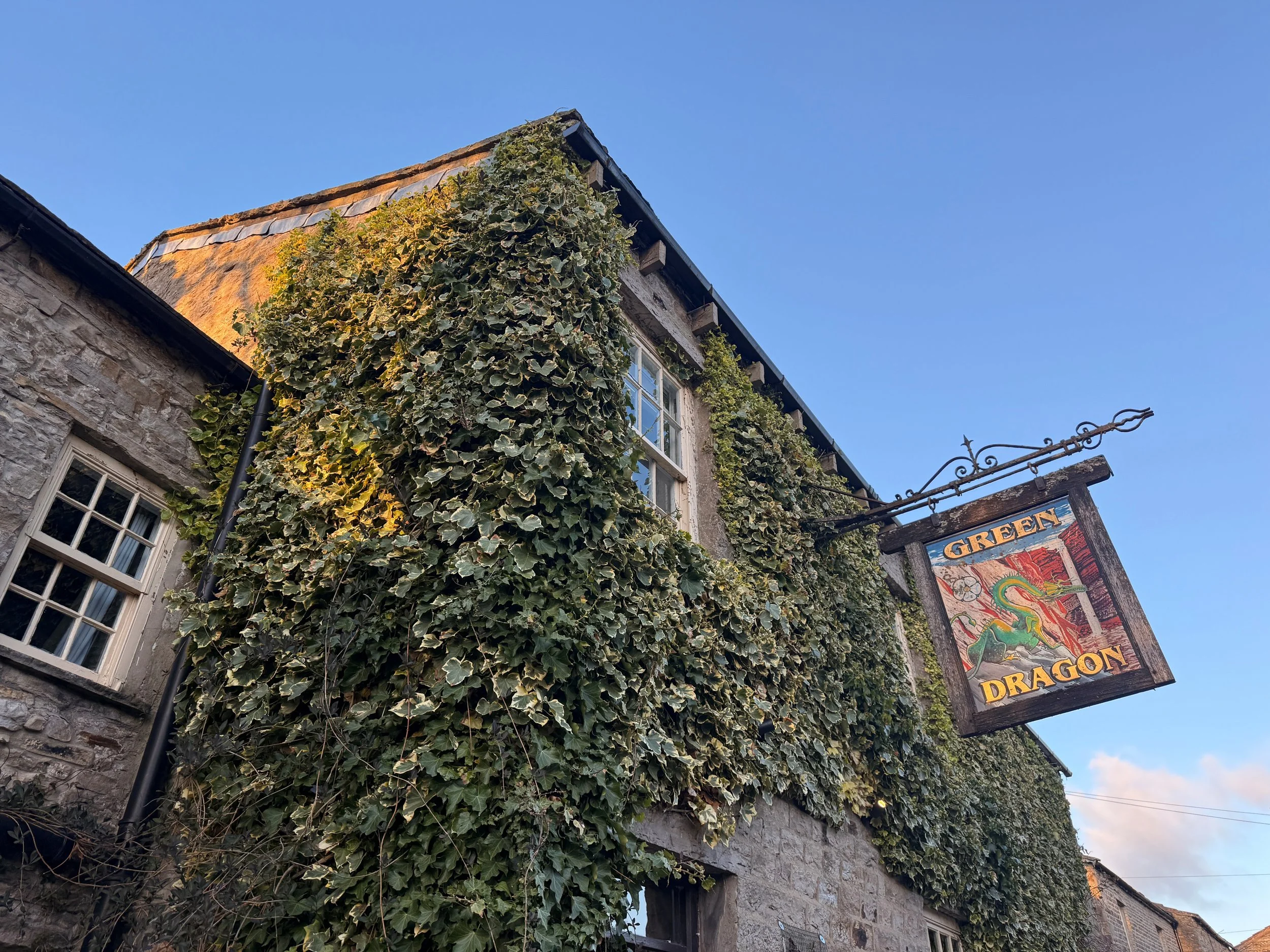
Start: Green Dragon Inn, Hardraw
End: Tan Hill Inn, Richmond
Distance: 15 miles / 25km
Elevation: 3,460 ft / 700m (Great Shunner Fell = 716m)
Time: 4–7 hours
Difficulty: Moderate to challenging
Dog Friendly: Yes – on lead around livestock & cliffs
Well-waymarked? Yes by the Pennine Way + Bridleway
Navigation: Follow on komoot or download GPX file
What is the Dragon’s Ascent Challenge?
The Dragon’s Ascent Challenge is a long-distance route through the Yorkshire Dales National Park, connecting the Green Dragon Inn in Hardraw with the Tan Hill Inn, the highest pub in Britain. Along the way, you'll:
Pass Hardraw Force, England’s tallest single-drop waterfall
Summit the mighty Great Shunner Fell
Wander through Swaledale, one of Yorkshire’s most scenic valleys
Stop for tea in the idyllic village of Thwaite
Catch a glimpse of the iconic Buttertubs Pass
Finish at the famously remote Tan Hill Inn
You can walk or run the route independently like we did, or sign up for the official annual event.

About the route
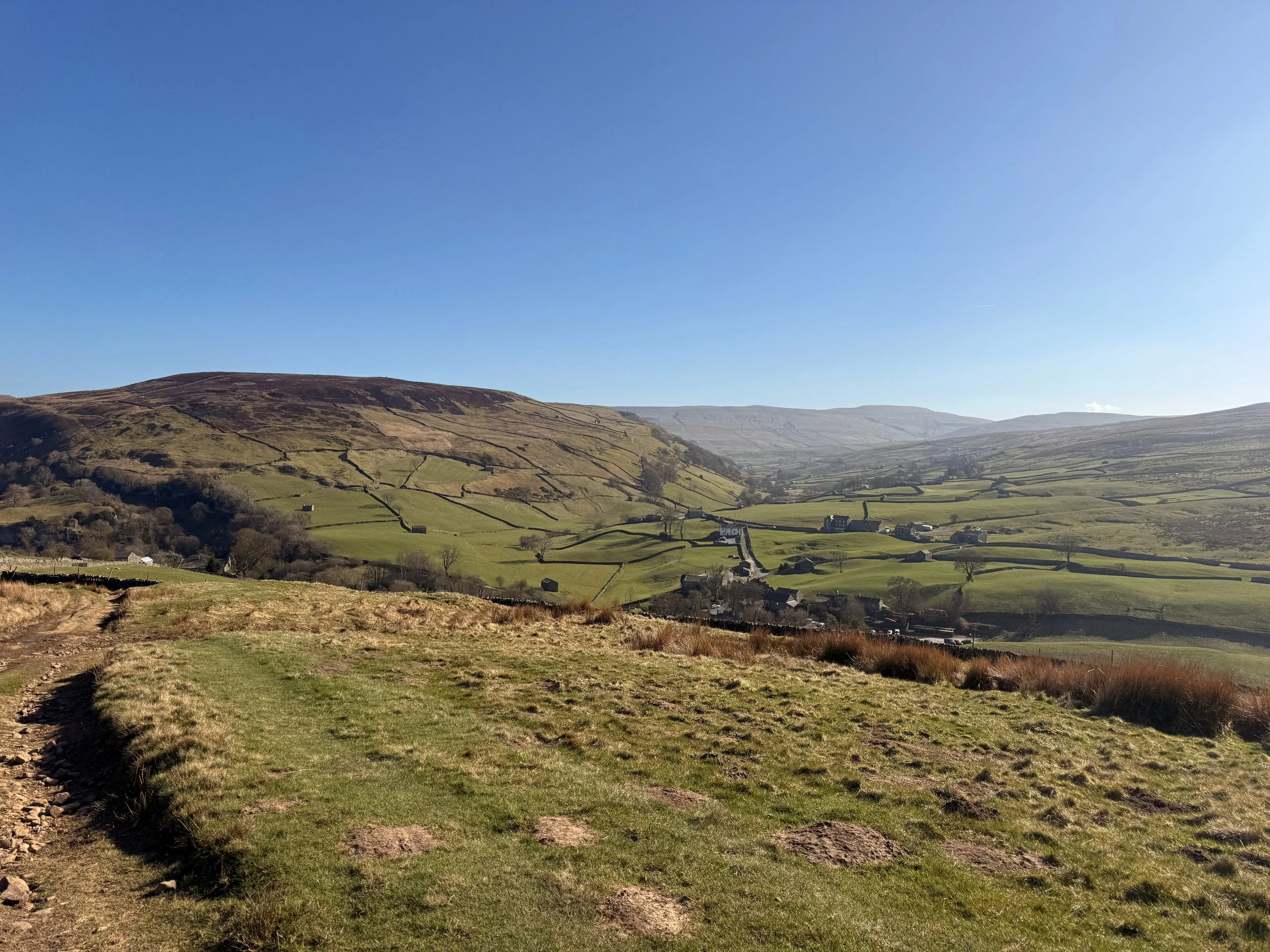
Starting in the pretty village of Hardraw, the path follows the Pennine Way and later the Pennine Bridleway, offering consistently easy-to-follow navigation and incredible variety—think limestone paths, open fells, deep valleys, and traditional Yorkshire villages. The 15.5-mile trail is a satisfying mix of terrain—from steady climbs and stone paths to open moor and riverside track. Most of the route follows the Pennine Way, making navigation easy. You'll ascend Great Shunner Fell, pass through the picturesque village of Thwaite, wind through Swaledale, skirt Buttertubs Pass, and finally reach the wilds around Tan Hill.
It’s long, scenic, and surprisingly varied, with plenty of spots to rest, eat, or detour.
Highlights include:
– A visit to Hardraw Force, England’s tallest single-drop waterfall
– A steady climb to Great Shunner Fell (716m)
– Homemade scones at Kearton Tearooms in Thwaite
– A moody stretch of wild moorland leading to Tan Hill
– Pint and pie at the finish line!
Why you'll love this walk
Wild and beautiful: From rolling meadows to rugged fells, the Dales never disappoint.
Pub-to-pub adventure: Start and end your day with real Yorkshire charm.
A true challenge: Feels like an achievement without being overwhelming or too strenuous.
Tea and cake halfway: Perfect motivation to reach Thwaite’s Kearton Tearooms.
Waterfalls, wildlife, and wow-moments: There’s always something breathtaking to look at along the way (if visibility is on your side, of course).

🧭 Route difficulty
Walk type: Moderate to challenging – the distance and elevation make it a solid day out, but the route is mostly on clear, non-technical paths.
Terrain: Moorland, flagstone paths, boggy sections (especially around Shunner Fell), and grassy trails. Rocky section near Swaledale.
Time needed: 4–6 hours moving time, 7+ with stops.
Navigation: Easy in good weather—just follow the Pennine Way and Bridleway signs. Bring a paper map and download GPX file. Useful for the moorland around Shunner Fell and near Tan Hill if visibility is poor.
Fitness level: Reasonable fitness, especially if aiming to complete in 4–5 hours.
Route overview
1. Start at Green Dragon Inn + Visit Hardraw Force
📍 Hardraw, Wensleydale
Before heading off, pay a quick visit to Hardraw Force, England’s highest single-drop waterfall (100 feet), accessible via the Green Dragon pub garden.
🎟️ Entry fee applies – bring a couple of pounds.
2. Climb to Great Shunner Fell (4 miles in)
Gradual but persistent climb to the summit of Great Shunner Fell—the third highest in the Dales. A stone wind shelter greets you at the top, along with sweeping views toward the Moors and Lake District on a clear day.
🥾 Conditions: Often boggy year-round – gaiters recommended.
3. Descend to Thwaite (~8 miles)
The descent to Thwaite is gentle and scenic, winding into the heart of Swaledale. Stop at the charming Kearton Tearooms for tea and cake—or a light lunch.
🍰 Kearton Tearooms: Open March–Oct, indoor + outdoor seating.
4. Around Kisdon Hill + optional Keld detour
Head north toward Keld, where you'll pass through lush green valleys, hidden waterfalls, and the River Swale. Take a 10-minute detour for Kisdon Force—it’s totally worth it.
5. Wild moorlands + final ascent to Tan Hill
Climb gradually across remote open moors. This stretch is exposed, with little shelter or signage. Keep eyes peeled for Pennine Way markers. Eventually, you’ll spot the Tan Hill Inn seemingly appearing from nowhere. A very welcome sight after 15+ miles.
🧭 Pro tip: In fog or snow, navigation here is trickier—use GPS or OS Map OL30.
🏁 Finish at Tan Hill Inn (the highest pub in the UK)
The highest pub in Britain (1,732 feet), the Tan Hill Inn is a classic stop for weary adventurers. Expect hearty food, a roaring fire, and proper Yorkshire hospitality. They also offer rooms if you want to stay over after your challenge.

How Long Does the Dragon’s Ascent challenge take?
The full 15-mile route typically takes between 4 to 7 hours to complete, depending on your pace, weather conditions, and how often you stop. Here’s a rough breakdown to help you plan:
Pace Estimated time
Trail runners: 2-4 hours
Fast hikers: 4-5 hours
Moderate walkers 5–6 hours
Casual pace with stops: 7+ hours
🥾 Our experience: We completed it in around 5-6 hours moving time at a relatively leisurely pace, with 7 hours total including a tea stop in Thwaite and a slight detour exploring the waterfalls near Keld. I’d definitely leave yourself at least 7 hours so you can enjoy the pitstops along the way.
Things that can affect timing:
Weather: Heavy rain, wind, or fog can slow you down—especially across the moorlands.
Terrain: Parts of the path can be boggy, particularly near Great Shunner Fell.
Stops: Waterfalls, tearooms, photo ops—there are plenty of tempting reasons to pause!
🔄 If you’re doing the challenge as part of an overnight pub-to-pub stay, there’s no need to rush—soak it all in and enjoy the journey.

Logistics & transport tips
🚗 Getting there
Start: Park at the Green Dragon Inn (Hardraw, DL8 3LZ)
End: Tan Hill Inn has a car park if you're arranging a pick-up or shuttle.
🚌 Return Options: This is a one-way route. You can:
Pre-arrange a taxi from Tan Hill back to Hardraw (recommended)
Do it as a there-and-back over two days, staying at each pub
Walk with a friend and leave one car at each end
🗺️ Navigation
The path follows well-signed Pennine Way and Bridleway tracks. Still, it’s smart to carry:
What to pack
Waterproof boots or trail shoes
Waterproof jacket + layers
OS Map OL30 or digital GPX
Power bank
First aid kit
Water + high-energy snacks
Phone + offline route app (Komoot/OS Maps)
Trekking poles (optional for descent)
❓ Frequently asked questions
Can I do the walk in reverse?
Yes, but it’s more fun to finish at Tan Hill with a celebratory drink!
Is it dog-friendly?
Yes, but dogs should be kept on leads—there’s livestock, cliffs, and boggy moorland.
Do I need to train?
It’s not technical, but 15+ miles of hills can be tiring. Try a few 10–12 mile walks first.
Can I do it solo?
Absolutely. But let someone know your plans, especially in winter conditions.

When to do the challenge
Spring–Autumn (April to October) is ideal for good light and conditions.
Summer brings wildflowers to Swaledale and longer days.
Winter is possible but requires prep—some sections become boggy or icy, and moorland visibility can vanish quickly.
Weather tip: Conditions can shift fast on the fells—always bring layers, waterproofs, and a map/GPS device.
Join the official challenge
Held annually, walkers and runners gather to complete the route as part of the Dragon’s Ascent Challenge event:
Supported by trained safety & medical staff
Proceeds go to local Yorkshire charities
Sign up solo or with friends
Accommodation + meals available at start and end

🛏️ Stay the Night
Start: Green Dragon Inn, Hardraw – cosy rooms + waterfall access
Midpoint (Optional): Kearton Country Hotel, Thwaite
Finish: Tan Hill Inn – famously remote, full of character, great food
🍰 Food & Drink
Hardraw: Food + drinks at Green Dragon
Thwaite: Kearton Tearooms for lunch or cake
Keld: Keld Green Café (seasonal)
Tan Hill: Pub meals, snacks, and accommodation
🐾 Dog Friendly?
Yes – but keep dogs on leads near livestock and waterfalls. Some boggy sections might be tricky for smaller pups.

✔️ Good to knows
Difficulty:
Moderate – A long-distance walk with a steady climb up Great Shunner Fell in the first half and some remote, boggy terrain later on. Manageable for most walkers with a good level of fitness.
Footwear:
Sturdy, waterproof walking boots are highly recommended, especially after rain. The path can be boggy and uneven in places, particularly on the ascent to Shunner Fell and across the open moorland.
Dog-friendly:
Dog friendly (on leads). Dogs are welcome along the route but should be kept on leads around livestock and moorland nesting birds. There are streams en route, but it’s worth packing extra water for your pup.
Facilities:
There are toilets and food available at both pubs (start and end), and a tearoom close to midway in Thwaite. Be prepared with essentials and time your rest stops well.
Food & drink:
The Green Dragon Inn (Hardraw) – Pre-walk breakfast or coffee, and a quick visit to Hardraw Force behind the pub.
Kearton Tearooms (Thwaite) – A perfect halfway point with light lunches, tea, and sweet treats.
Tan Hill Inn – Your endpoint! Great for a hot meal and well-earned pint. Accommodation also available.
Optional detour to Keld Green Cafe for extra refreshments.
🧭 Following the route
I use komoot and OS Maps for offline navigation. To follow the full walk step-by-step on komoot, simply click this link here or download the GPX file and upload it to your chosen app, such as OS Maps.


A beautiful circular walk in Yorkshire: Bolton Abbey, Posforth Gill Waterfall & Simon’s Seat
Up for a longer day out? This stunning walk takes you to some of the best hidden gems in the Yorkshire Dales

Start: Bolton Abbey Car Park, BD23 6EX
Distance: 10 miles
Elevation: 1,425 feet
Duration: 4 hours
Difficulty: Moderate
Navigation: Follow step-by-step on komoot, or download GPX file
About the route
Looking for a walk that combines stunning scenery, a bit of history, and a challenge? This 10-mile circular in the Yorkshire Dales ticks all those boxes — taking you from the historic Bolton Abbey, past the charming Posforth Gill Waterfall, and all the way up to the panoramic views found on Simon’s Seat.
Starting at the iconic Bolton Abbey, the route takes you through lush woodlands, before climbing up to Simon’s Seat. Along the way, you’ll visit Posforth Gill Waterfall, a peaceful spot that’s perfect for a picnic or photo stop. The path is well-marked, though some sections can be a little steep and rocky, so it’s best suited to walkers who’re up for a bit of a challenge.

Route difficulty
Walk type: Moderate – This walk is manageable for most walkers, but there are some challenging sections, especially when climbing to Simon’s Seat.
Terrain: Expect a mix of well-maintained paths, rocky stretches, and some steeper ascents, particularly when heading up towards Simon’s Seat. The descent is more gradual but still requires attention due to uneven terrain.
Accessibility: This walk is not suitable for wheelchairs or pushchairs due to the uneven and rocky terrain.
Dog-Friendly: Dog friendly (on leads) around the Bolton Abbey Estate, but are no longer permitted for this full circular walk. Dogs not permitted to the Valley of Desolation or Simon’s Seat. They should also be kept on leads near livestock, waterfalls, and the steeper sections of the route.
Why you’ll love this walk
Stunning scenery: From riverside paths to panoramic hilltop views, and of course the stunning Posforth Gill waterfall.
Historical landmarks: Explore the centuries-old Bolton Abbey ruins and discover some hidden gems along the way.
A rewarding challenge: While not overly strenuous, the climb to Simon’s Seat will definitely make you work for those views. But once you arrive up top, you’ll realise it’s well worth the effort!

Route highlights
Bolton Abbey
You can’t start a walk at Bolton Abbey without taking in the beauty of this historic spot. The abbey ruins are set right next to the River Wharfe, offering a peaceful atmosphere to kick things off. Whether you’re wandering the grounds or admiring the views of the river, it's a perfect place to get into the walking spirit. Plus, the area has some great spots for a bite to eat—if you fancy a pre-walk coffee or a post-hike treat, check out the Abbey Tearooms or the Cavendish Pavillion. Both offer delicious snacks and hot drinks with a view of the abbey and river.
Posforth Gill Waterfall
As you head further into the route, make sure to stop at Posforth Gill Waterfall. This spot feels like something out of a fairytale—quiet, serene, and surrounded by nature. It’s a great place to pause, take a few photos, or simply take a snack break. It’s a perfect hidden gem that you wouldn’t want to miss.
Simon's Seat
Arguably the main event—Simon's Seat. The climb up to this iconic viewpoint is a bit of a challenge, but it’s worth every step. From the top, you'll get 360-degree views of the surrounding Yorkshire Dales. On a clear day, you can spot everything from the Lake District to The Moors.
The River Wharfe
At the start of your walk, you’ll follow the River Wharfe, and it’s one of those peaceful parts of the route that’s perfect to save for a summer’s day.

Options to extend the route
If 10 miles isn’t quite enough, there are a couple of options to extend the walk. After reaching Simon's Seat, you can continue along the ridge for even more spectacular views. Alternatively, head towards the village of Appletreewick for an additional 2-3 miles that will take you through more beautiful valleys and remote paths.
Getting to the starting point
By Car
Bolton Abbey Car Park (BD23 6EX) is the best place to park, and it’s right at the start of the walk. Parking fees apply.
By Public Transport
The nearest train station is in Skipton. From there, you can catch a local bus or taxi to Bolton Abbey, which will take you straight to the car park and starting point.

✔️ Good to knows
Difficulty: Moderate – some steep sections, particularly near Simon’s Seat.
Footwear: Sturdy, waterproof walking boots are recommended, especially if it’s been rainy.
Dog-friendly: Part of the route is dog-friendly, unfortunately dogs are not permitted up to Simon’s Seat.
Facilities: There are public toilets at Bolton Abbey Car Park and a café for post-walk refuelling.
Food & drink: The Bolton Abbey Estate has a café and tearoom for snacks, drinks, or a well-earned meal after your walk.
🧭 Following the route
I use komoot and OS Maps for offline navigation. To follow the full walk step-by-step on komoot, simply click this link here or download the GPX file and upload it to your chosen app, such as OS Maps.

SCENIC LAKE DISTRICT WALK: EXPLORE CLAIFE VIEWING STATION AND WINDERMERE WEST SHORE
Experience the best of the Lake District on this easygoing walk, featuring serene lakeside views, fascinating historic landmarks, and charming local cafés.

Start: Ash Landing Car Park, LA22 0LU
Distance: 3 miles
Elevation: 425 feet
Duration: 1 hour
Difficulty: Easy (with some moderate sections)
Navigation: Follow step-by-step on komoot, or download GPX file
About the route
Looking for a relaxing yet picturesque walk in the Lake District? This 3-mile circular route starts at Ash Landing Car Park near popular Lake District landmark, Claife Viewing Station, before leading you along Windermere’s serene west shore. You’ll enjoy peaceful lake views, historical landmarks, and even have the chance to stop at some lovely cafés along the way.
Perfect for a short morning or afternoon adventure, the walk is mostly flat with gentle inclines, making it ideal for families, couples, and solo walkers.

Route difficulty
Walk type: Easy with gentle elevation.
Terrain: Well-maintained gravel and woodland paths.
Accessibility: Some areas may be unsuitable for wheelchairs or pushchairs.
Dog-Friendly: Yes, but dogs should be on leads near wildlife and busy areas.

Route highlights
Claife Viewing Station
Perched on a hill above Lake Windermere, this historic viewing platform dates back to the 18th century. The station offers panoramic views of Windermere, with colourful stained-glass panels that recreate how Victorian tourists once experienced the scenery.
Windermere West Shore
This tranquil lakeside path is a peaceful alternative to the busier eastern side of Windermere. With frequent benches along the way, it’s the perfect spot to pause and enjoy the views.
Joey's Café
Located near the Claife Viewing Station, Joey's Café serves up delicious coffee and cakes. It’s a great option for a pre-walk breakfast or a mid-route break.
Ferry House
At the end of the west shore path, you'll find Ferry House, the starting point for the historic Windermere Ferry crossing. From here, you can either return along the shore or extend your walk.
Caife Café
After completing your walk, reward yourself with a stop at Caife Café, offering locally sourced treats and excellent lakeside views.

Options to extend the route
Want to make it a longer adventure? Continue walking along the west shore to Wray Castle, adding approximately 4 miles (return) to your route. The additional walk remains relatively flat and offers more fantastic lakeside views, as well as the opportunity to explore the castle's grounds.
Getting to the starting point
By Car
Park at Ash Landing Car Park (LA22 0LU), located near the Claife Viewing Station. Parking charges apply.
By Public Transport
Take a train to Windermere, then catch a bus or taxi to the ferry terminal. From there, ride the Windermere Ferry across the lake and begin your walk at Ferry House.

✔️ Good to knows
Difficulty: Easy, suitable for all levels.
Footwear: Comfortable walking shoes.
Dog-Friendly: Dogs are welcome but must be on a lead in certain areas.
Food & Drink: Joey's Café and Caife Café are both fantastic options for a pre or mid-walk refuel.
Facilities: Public toilets available at Claife Viewing Station and Ferry House.
🧭 Following the route
I use komoot and OS Maps for offline navigation. To follow the full walk step-by-step on komoot, simply click this link here or download the GPX file and upload it to your chosen app, such as OS Maps.

EXPLORE LLANGOLLEN: CASTELL DINAS BRÂN WALK WITH CANOEING OVER PONTCYSYLLTE AQUEDUCT
Explore the historic ruins of Castell Dinas Brân and enjoy stunning views of Llangollen and the Dee Valley, with an optional adventure over the Pontcysyllte Aqueduct.

Start: Llangollen (Parking available at Market Street Car Park, East Street Car Park, and Pavilion Car Park)
Distance: 4 miles
Elevation: 750 feet
Duration: 1.5 hours
Difficulty: Easy (with some moderate sections)
Navigation: Follow step-by-step on komoot, or download GPX file
About the route
Looking for a scenic walk in North Wales? This 4-mile circular walk from Llangollen offers stunning views of the Dee Valley and the surrounding hills. Starting in the charming town of Llangollen, the route gently climbs for fantastic panoramas before looping back down through tranquil woodland and canalside paths.
Or if you’re looking for a real adventure-packed day, you can nip over to the UNESCO-listed Pontcysyllte Aqueduct. It’s the highest canal aqueduct in the world, and you can walk, canoe or take a boat ride over it. One for the adventure bucket list!
Route difficulty
Difficulty: Easy to moderate (Some steep sections on both the ascent and descent)
Terrain: Well-maintained trails with some uneven ground
Dog-Friendly: Yes, but keep dogs on leads near livestock
Route highlights
Scenic Views Over Dee Valley
Enjoy breathtaking views over the River Dee and the picturesque landscape of the Vale of Llangollen. The ascent offers numerous spots to pause and soak in the scenery.
Castell Dinas Brân
Discover the ruins of Castell Dinas Brân, perched high above Llangollen. This medieval fortress offers a fascinating glimpse into Welsh history and provides spectacular panoramic views. The castle ruins are a perfect spot for a break and some memorable photos.
Pontcysyllte Aqueduct
Why not make a day of it? After completing your walk, head to Trevor Basin for a canoeing adventure over the Pontcysyllte Aqueduct. Often referred to as the ‘Stream in the Sky,’ this World Heritage Site offers a thrilling way to experience the canal from a unique perspective.
Canoeing Hire Options: Various operators offer canoe and kayak rentals from Trevor Basin.
Booking Tip: Pre-booking is recommended, especially during weekends and holidays.
Llangollen Wharf
Back in Llangollen, the historic canal wharf offers horse-drawn boat trips, cafes, and local shops. It’s the perfect place to relax and enjoy some proper post-walk grub.

Where to park?
Market Street Car Park
East Street Car Park
Llangollen Pavilion Car Park (Best for larger vehicles or campervans)
Getting to the starting point
By Car: Llangollen is around 1 hour from Chester and 1.5 hours from Manchester.
By Public Transport: Trains to Ruabon, followed by a short bus or taxi ride.

✔️ Good to knows
Best time to visit: The route is beautiful year-round, but early mornings or late afternoons offer the most serene views.
Footwear: Comfortable walking shoes or boots recommended.
Photography tip: Capture the best views from the top of the climb, overlooking the river and town.
🧭 Following the route
I use komoot and OS Maps for offline navigation. To follow the flatter walk step-by-step on komoot, simply click this link here or download the GPX file and upload it to your chosen app, such as OS Maps.

BEST SUNRISE WALK IN THE PEAK DISTRICT: WIN HILL AND LADY BOWER LOOP
This breathtaking Peak District walk offers stunning sunrise views over Ladybower Reservoir and beyond.

Start: what3words: shackles.chucks.butterfly (Small layby or street-side parking. Alternatively, park at Yorkshire Bridge Inn if you plan on being a customer).
Distance: 7 miles (Shorter option: ~2 miles out-and-back)
Elevation: 1,550 feet
Duration: 3 hours
Difficulty: Easy (with some moderate sections)
Navigation: Follow step-by-step on komoot, or download GPX file
About the route
Looking for an incredible sunrise walk near Manchester? This 7-mile circular walk to Win Hill offers some of the most breathtaking sunrise views in the Peak District. The route includes an ascent to Win Hill's summit, where you’ll get panoramic views over Ladybower Reservoir, Bamford Edge, and the surrounding hills, followed by a scenic loop past the dramatic Ladybower plugholes and dam.
If you’re short on time, you can opt for a shorter out-and-back route, reaching the summit in under 40 minutes (approximately 2 miles total).

Route difficulty
Difficulty: Easy-moderate (Steady climb to Win Hill, then easier descent)
Terrain: Well-defined trails, some rocky paths
Dog-Friendly: Yes, but keep dogs on leads near livestock

Route highlights
Win Hill Summit at Sunrise
The climb up to Win Hill is absolutely worth the effort, especially at sunrise. From the summit, you’ll be rewarded with incredible views over Ladybower Reservoir, the Great Ridge, and Kinder Scout. On clear mornings, the golden light floods the valley, and you may even be met with a cloud inversion.
Ladybower Plugholes & Dam
After descending from Win Hill, the walk takes you past the famous Ladybower plugholes—dramatic bellmouth spillways designed to control the reservoir’s water levels. These vast circular drains are mesmerizing when overflowing, creating a giant whirlpool effect. You can also cross Ladybower Dam for more scenic views.
Where to view the plugholes:
Roadside viewpoint near Yorkshire Bridge Inn
Viewing platform across the dam wall
Best seen in winter and spring when water levels are high
Yorkshire Bridge Inn – Perfect post-walk stop 🍻
If you fancy a rewarding breakfast or coffee after your walk, the Yorkshire Bridge Inn is a great spot. They offer a hearty breakfast menu, making it an ideal place to refuel before heading home.
Route difficulty
Full Loop (7 miles): Moderate difficulty due to elevation gain, but well-maintained paths make it manageable.
Shorter Route (2 miles out-and-back): Ideal for those who want a quicker sunrise experience with a rewarding summit.

Where to park?
Shackles.chucks.butterfly (what3words) – Small layby or roadside parking.
Yorkshire Bridge Inn – Parking available for customers.
Heatherdene Car Park (pay & display) – Toilets available; a short walk from Ladybower Dam.
Getting to the starting point
By Car:
From Manchester: ~50 minutes via A57 Snake Pass.
From Sheffield: ~40 minutes via A57.
By Public Transport:
Train to Bamford Station, then a ~25-minute walk to the start.

✔️ Good to knows
Best time to visit: For sunrise, aim to start your walk about an hour before sunrise time.
Footwear: Sturdy hiking boots recommended, as the ascent can be rocky.
Weather: Check the forecast—misty mornings can add to the atmosphere, but strong winds at the summit can be challenging.
Photography tip: The best angles for sunrise shots are from the trig point at the summit, looking east over Hope Valley.
🧭 Following the route
I use komoot and OS Maps for offline navigation. To follow the flatter walk step-by-step on komoot, simply click this link here or download the GPX file and upload it to your chosen app, such as OS Maps.

EASY WALK NEAR MANCHESTER: MILLENIUM WALKWAY
This stunning Peak District walk hovers above a huge natural gorge

Start: New Mills Train Station, High Peak, SK22 3JB
Distance: 4 miles
Elevation: 175 feet
Duration: Less than 2 hours
Difficulty: Easy
Navigation: Follow step-by-step on komoot, or download GPX file
About the route
Looking for an easy yet jaw-dropping walk near Manchester? This 4-mile circular route through New Mills and the dramatic Millennium Walkway offers a perfect mix of industrial history and natural beauty. With minimal elevation and well-maintained paths, it's a great option for those seeking a relaxing yet visually stunning escape.
The walk takes you through The Torrs Riverside Park, past the spectacular Millennium Walkway, and along the Sett Valley Trail. With easy transport links and a great selection of cafés and pubs in New Mills, it’s perfect for your next gentle stroll.

Route difficulty
Walk type: Easy with minimal elevation gain.
Terrain: Well-defined paths, mostly flat.
Accessibility: Not suitable for pushchairs or wheelchairs.
Dog-Friendly: Yes

Route highlights
The Torrs Millennium Walkway
This unique 175-yard aerial walkway is suspended over the River Goyt, hugging the rock face of the dramatic Torrs Gorge. Originally impassable, the walkway was built at the turn of the millennium and is nicknamed the ‘steel spider’s web’ for its striking design.
The Torrs Riverside Park
Known locally as ‘the park under the town,’ this stunning gorge is home to remnants of New Mills’ industrial past. Old mill ruins, rushing weirs, and the convergence of the River Goyt and River Sett make for a striking backdrop.
Sett Valley Trail
Following an old railway line, this scenic and flat path stretches between New Mills and Hayfield, offering beautiful Peak District views.
New Mills Heritage Centre
A great stop for those interested in the town’s industrial history. The centre provides maps, information, and exhibits about New Mills' past, including the Kinder Mass Trespass.
Local Cafés & Pubs
After the walk, stop for a bite to eat in one of New Mills’ many independent cafés. The Sett Valley Café (a little further along the Sett Valley Trail) is a great option for homemade and vegan treats, while the Pride of the Peaks pub offers hearty meals and local ales.
Is this route for me?
This walk is perfect for families, beginners, and those looking for a scenic yet easygoing route.

Options to extend the route: sunset walk to Mellor Cross
Start: New Mills Station
Distance: 4.72 miles
Elevation: 750 feet
Duration: 2.5 hours
Difficulty: Moderate, some uneven terrain
Navigation: Follow along on komoot or download GPX file
Mellor Cross, perched on Cobden Edge, is a spectacular sunset viewpoint near Manchester. The short but rewarding extension from New Mills leads you through open countryside to this peaceful spot, offering uninterrupted views over the Peak District and beyond.
If you want to extend the route further, you can continue towards the Roman Lakes and Mellor Mill ruins for more historical interest and scenic walking trails before looping back to New Mills.

Getting to the starting point
By Car:
You’ll find plenty of parking available in New Mills town centre. We parked at Market Street Carpark (SK22 4AA). Parking costs approximately £2 for 4 hours.
By Public Transport:
New Mills is easily accessible by train, with direct services from Manchester.

✔️ Good to knows
Difficulty: Easy with minimal elevation, moderate if extending to Mellor Cross.
Footwear: Comfortable walking shoes; boots recommended if heading to Mellor Cross.
Dog-Friendly: Dogs are welcome but should be kept on leads near wildlife.
Food & Drink: Plenty of cafés and pubs in New Mills, including the Sett Valley Café and Pride of the Peaks.
🧭 Following the route
I use komoot and OS Maps for offline navigation. To follow the flatter walk step-by-step on komoot, simply click this link here or download the GPX file and upload it to your chosen app, such as OS Maps.

EASY WALK NEAR MANCHESTER: HEALEY DELL
This scenic and historic walk near Manchester is steeped in myth and offers stunning natural beauty

Start: Healey Dell Nature Reserve, Rochdale, OL12 6LW
Distance: 4 miles
Elevation: 375 feet
Duration: Less than 2 hours
Difficulty: Easy
Navigation: Follow step-by-step on komoot, or download GPX file
About the route
Looking for an easy yet breathtaking walk near Manchester? This 4-mile circular route through Healey Dell Nature Reserve offers a perfect mix of history, legend, and natural beauty (and a stunning tea room where you can grab a proper brew, for good measure). With gentle elevation and well-maintained paths, it’s a great one to save if you’re seeking a peaceful escape from the city without a strenuous climb.
From the enchanting Fairies Chapel and stunning Healey Dell Waterfalls to the historic Prickshaw Village and the welcoming Healey Dell Heritage Tea Rooms, this walk is a true hidden gem. You’ll also join parts of the Rossendale Way and Mary Towneley Loop, so there’s plenty of options to extend the route if you’re looking for a longer day out.

Route difficulty
Walk type: Easy circular walk with minimal elevation gain.
Terrain: Well-defined paths, mostly even but with some uneven sections.
Accessibility: Not suitable for pushchairs or wheelchairs.
Dog-Friendly: Yes

Route highlights
Healey Dell Nature Reserve
Once a 19th-century industrial area, this now-thriving nature reserve is known for its lush woodland, dramatic gorges, and rich wildlife. Keep an eye out for rare birds, and remnants of the old railway that once passed through the reserve.
Fairies Chapel
This mystical rock formation, nestled deep within the reserve, is steeped in legend. According to folklore, it was once a sacred site for fairies and spirits. The atmospheric setting, with moss-covered stone and trickling water, makes it easy to see why.
Healey Dell Waterfalls
One of the main attractions of the walk, these cascading waterfalls provide a serene and photogenic stop along the route.
Healey Dell Heritage Tea Rooms
A must-visit! This charming, vintage-style tea room is housed in an old mill building and offers delicious homemade treats, perfect for a mid-walk break.
Prickshaw Village
A hidden gem along the route, this well-preserved 17th-century hamlet feels like a step back in time. With its cobbled streets and traditional stone cottages, it’s a fascinating glimpse into Rochdale’s history.
Rossendale Way & Mary Towneley Loop
Sections of this walk overlap with two renowned long-distance trails. If you’re feeling adventurous, these trails offer fantastic opportunities for extending your route beyond Healey Dell.

Is this route for me?
Unlike more strenuous routes nearby, this walk is ideal for families, beginners, and those wanting a scenic yet manageable walk. It’s also dog-friendly (on leads), so it’s a great one to save for a day out with the little ones and pooches.

Options to extend the route / things to do nearby
If you’re looking to make a full day of it, take a look at these longer options nearby:
Explore the Rossendale Way: Follow this scenic trail deeper into the Rossendale Valley.
Mary Towneley Loop: Extend your hike along this picturesque long-distance route, offering stunning Pennine landscapes.
Hollingworth Lake: A beautiful reservoir just a short drive away, perfect for waterside strolls and picnics.
Healey Stones & Knowl Hill: A slightly more challenging hike nearby, offering panoramic views over Rochdale and beyond.
Blackstone Edge: A dramatic gritstone escarpment on the Pennine Way, ideal for those looking for a longer adventure.
Getting to the starting point
By Car:
Use the postcode OL12 6LW for Healey Dell Nature Reserve car park. Parking is limited, so arriving early is recommended.
By Public Transport:
Rochdale is well-connected by train and bus. The nearest station is Rochdale Railway Station, with buses running regularly to Healey Dell.

✔️ Good to knows
Difficulty: Easy with gentle elevation gain.
Footwear: Sturdy, waterproof boots recommended, especially after rain.
Dog-Friendly: Dogs are welcome but should be kept on leads near wildlife.
Food & Drink: The Healey Dell Heritage Tea Rooms offer fantastic refreshments. Rochdale also has great pubs and cafes for post-walk dining.
🧭 Following the route
I use komoot and OS Maps for offline navigation. To follow this walk step-by-step on komoot, simply click this link here or download the GPX file and upload it to your chosen app, such as OS Maps.

Final thoughts
This easy walk near Manchester is a hidden gem packed with history, legend, and stunning scenery. Whether you’re drawn to the mystical stories of Fairies Chapel, the industrial past of Healey Dell, or simply want to enjoy a peaceful riverside walk with a cracking tea room stop off, this route has something for everyone.
Finding hidden gems like this buried within the city is a good reminder you never have to travel far to reconnect with nature, and this route has quickly become one of the best walks near Manchester for me.

ROWARTH TO LANTERN PIKE AND COWN EDGE
A stunning Peak District walk taking you to two ethels, a perfect sunset spot and a charming country inn

Start: Rowarth Car Park or Little Mill Inn, Rowarth
Distance: 8 miles
Elevation: 1,200 feet
Duration: Approx. 3 hours
Difficulty: Easy-moderate with gentle elevation gain
Navigation: Follow step-by-step on komoot, or download GPX file
About the route
This circular route from Rowarth on the edge of the Peak District offers spectacular views, varied terrain, and a fantastic pub finish. Covering Cown Edge and Lantern Pike, this 8-mile hike includes some of the best sunset views over Manchester, making it a top choice for if you’re searching for a golden hour adventure close to the city. The route also takes you to two Peak District Ethels, Cown Edge and Lantern Pike, both offering stunning panoramic views.
The walk starts at Rowarth Car Park or the historic Little Mill Inn, a charming country pub housed in a former 18th-century corn mill. The route takes you along rolling moorland, up to Lantern Pike, a prominent peak offering panoramic views over the Peak District and Manchester skyline, before taking you past Cown Edge, with its dramatic gritstone cliffs.

Route difficulty
Walk type: Circular, moderate walk with some steeper inclines
Terrain: A mix of well-defined paths, moorland trails, and rocky sections
Accessibility: Not suitable for pushchairs or wheelchairs
Dog-Friendly: Yes, but the route features some stiles and dogs must be kept on leads near livestock and cliff edges

Route highlights
Cown Edge
A breathtaking ridge with spectacular views across the Peak District and beyond. Cown Edge is especially popular for sunset walks, as the golden light illuminates the landscape and offers a stunning backdrop over Manchester.
Lantern Pike
This prominent hill offers 360-degree views across the surrounding countryside. On clear days, you can see as far as Kinder Scout and the Cheshire plains.
Little Mill Inn
A traditional country pub with a warm atmosphere, delicious food, and a working water wheel. Ideal for a pre- or post-walk pint and meal.
Ethel Bagging
This circular route allows you to bag two Peak District ethels along the way.

Is this route for me?
Unlike more strenuous routes nearby like Kinder Scout, this walk offers a more relaxed walk while still offering fantastic views. It’s perfect for:
✅ Walkers seeking a scenic but manageable hike
✅ Those looking for the best sunset views near Manchester
✅ Hikers who enjoy a good country pub stop
Tip: Easy sunset access to Cown Edge
If you only want to catch the sunset at Cown Edge without doing the full walk, there’s a convenient parking layby at What3Words location: fiery.prawn.tequila. From here, it's just a short walk uphill to the ridge, making it an ideal quick sunset spot without the full hike.

Options to extend the route / things to do nearby
If you have extra time, consider:
Exploring Kinder Scout: A short drive away, Kinder Scout offers more challenging hikes and spectacular views.
Visiting New Mills: A lovely town with scenic walks along the Torrs Riverside Park and the famous Millennium Walkway.
Getting to the starting point
Arriving by Car: Parking is available at Rowarth Car Park or the Little Mill Inn (check with the pub if staying for food/drinks). A small fee may apply.
Public Transport: The nearest train stations are New Mills Central and Marple, both offering connections from Manchester and Sheffield. From there, taxis or local buses can take you closer to Rowarth.

✔️ Good to knows
Difficulty: Easy-moderate with some steep sections
Footwear: Sturdy, waterproof boots recommended (some sections can be muddy)
Dog-friendly: Yes, but several stiles en route and dogs on leads near livestock
Food & Drink: The Little Mill Inn is an excellent choice for a post-walk refuel
Facilities: No public toilets along the route, but available at the Little Mill Inn
🧭 Following the route
I use komoot and OS Maps for offline navigation. To follow this walk step-by-step on komoot, simply click this link here or download the GPX file and upload it to your chosen app, such as OS Maps.

STUNNING SUNSET WALK: GRINDLEFORD TO CURBAR EDGE
A scenic Peak District walk with stunning views, a charming village, and excellent cafés and pubs

Start: Grindleford Station, Station Approach, Upper Padley, Grindleford, Hope Valley, S32 2JA
Distance: 7 miles
Elevation: 600 feet
Duration: Approx. 3 hours
Difficulty: Easy-moderate with gentle elevation gain
Navigation: Follow step-by-step on komoot, or download GPX file
About the route
Looking for one of the best scenic walks in the Peak District? This circular route from Grindleford Station offers breathtaking views, gentle inclines, and excellent spots to stop for food and drink. Covering Curbar, Froggatt, and Baslow Edges, this 7-mile hike takes you to one of the best sunset spots in the Peak District.
The route takes you through charming villages and past historical landmarks such as Calver Bridge and Calver Weir, offering a perfect blend of nature and heritage. Whether you're an early riser looking for the best place for sunrise in the Peak District or an evening walker chasing a sunset view over the Derwent Valley, this one is a must-save.

Route difficulty
Walk type: Circular, moderate walk with gentle elevation gain
Terrain: Mostly well-defined paths with gradual ascent; some rocky sections
Accessibility: Not suitable for pushchairs or wheelchairs due to uneven terrain
Dog-Friendly: Yes, but dogs must be kept on leads near livestock and cliff edges

Route highlights
Curbar Edge: Offering panoramic views across the Derwent Valley, Curbar Edge is one of the best places to watch the sunset in the Peak District. A fantastic spot for photographers!
Froggatt Edge: Known for its dramatic gritstone cliffs, this section provides stunning viewpoints and a peaceful walking experience.
Baslow Edge: A quieter but equally impressive edge with stunning views. Keep an eye out for red deer and Highland cows roaming the landscape.
Froggatt Wood: A peaceful woodland area, offering a lovely contrast to the surrounding moorland and a chance to enjoy the area's biodiversity.
Calver Bridge & Calver Weir: Picturesque landmarks steeped in industrial history, perfect for a short break.
The Bridge Inn: A traditional countryside pub near Calver Bridge, ideal for a mid-walk refreshment.
Matilda’s Café: A highly-rated café serving delicious homemade treats, a great place to stop for coffee and cake.
Grindleford Station Café: Famous for its hearty portions and no-nonsense attitude, this café is a classic stop for walkers and cyclists alike.

Is this route for me?
Unlike more strenuous routes like Kinder Scout, this walk offers a more relaxed experience while still delivering spectacular scenery. It’s perfect for:
✅ Walkers looking for a scenic but manageable hike
✅ Those wanting stunning sunset and sunrise views in the Peak District
✅ Dog owners (dogs must be on leads in certain areas)
✅ Hikers who enjoy stopping at cafés and pubs along the route
Tip: if you’re looking for an easy sunset vantage point without the doing the full walk listed here, there is a car park right next to Curbar Edge. The closest parking area to Curbar Edge is the Curbar Gap Car Park, located on Clodhall Lane. This pay-and-display car park charges £4 per day, with free parking available for blue badge holders, National Trust, and RSPB members.
Alternatively, there’s a free layby close to the car park (what3words address ///novels.replays.regal). Both spots are a 5-10 minute walk to the edge, perfect for catching a cracking sunset without the legwork.
Following the route for sunset: to follow this route for sunset, you’ll want to reverse the route so the walk finishes at Curbar Edge (we started here instead).

Options to extend the route / things to do nearby
If you have extra time, consider exploring:
Padley Gorge: A magical woodland with waterfalls and ancient oak trees, perfect for a short detour.
Longshaw Estate: National Trust-managed moorland offering additional walking trails and wildlife spotting.
Stanage Edge: Another famous Peak District escarpment, popular with climbers and hikers.
Getting to the starting point
Arriving By Car: Parking is available at Grindleford Station (fees apply). Additional parking can be found at nearby Padley Gorge car park. Arrive early during peak times.
Public Transport: Grindleford Station is served by trains from Sheffield and Manchester. Check timetables in advance.

✔️ Good to knows
Difficulty: Easy-moderate with gentle elevation gain.
Footwear: Sturdy, waterproof boots recommended (some paths can be muddy after rain).
Dog-friendly: Dogs are welcome but should be kept on leads near livestock.
Food and drink: Plenty of options along the route, from traditional pubs to cosy cafés. Try Matilda’s for coffee and a snack or The Bridge Inn for proper pub grub.
Facilities: Public toilets available at Grindleford Station Café.
🧭 Following the route
I use komoot and OS Maps for offline navigation. To follow this walk step-by-step on komoot, simply click this link here or download the GPX file and upload it to your chosen app, such as OS Maps.

EASY WALK IN CASTLETON: CAVE DALE
This beautiful Peak District walk is easy on the legs but big on views

Start: Cross Street Car Park, Cross Street, Castleton, Hope Valley, Derbyshire, S33 8WH
Distance: 3 miles
Elevation: 700 feet
Duration: 1.5 hours
Difficulty: Easy with gentle elevation gain
Navigation: Follow step-by-step on komoot, or download GPX file
About the route
Looking for a short and scenic walk in the Peak District that’s both easy on the legs and big on views? This charming route from Castleton is the perfect alternative to the more strenuous Mam Tor or the nearby Edale Skyline hikes. At just 3 miles with minimal elevation, it’s an ideal choice for a relaxing day out without compromising on breathtaking scenery.
This gentle circular walk combines Castleton’s historic charm with stunning natural beauty. Starting from Cross Street Car Park, the route takes you through the picturesque village of Castleton before ascending gently to Peveril Castle for sweeping views of the Hope Valley. From there, you’ll venture into the dramatic limestone gorge of Cave Dale, a hidden gem that feels like stepping back in time. The final stretch loops past the famous Peak Cavern, also known as the Devil’s Arse, before returning to the heart of Castleton.

Route difficulty
Walk type: Easy circular walk with minimal elevation gain.
Terrain: Mostly well-defined paths with some uneven sections, especially in Cave Dale. Suitable for most fitness levels.
Accessibility: Not suitable for pushchairs or wheelchairs due to narrow and uneven paths.

Route highlights
Peveril Castle: Perched high above Castleton, this Norman fortress offers panoramic views of the surrounding valleys. A must-visit for history buffs and photographers alike.
Cave Dale: This enchanting gorge, framed by towering limestone cliffs, is a tranquil escape from the busier trails. Keep an eye out for fossils embedded in the rocks!
Devil’s Arse (Peak Cavern): The largest natural cave entrance in the British Isles, this awe-inspiring cavern is steeped in legend and a fascinating stop along the route.
Castleton Village: The walk begins and ends in this charming village, renowned for its cosy pubs, delightful cafes, and unique shops. Don’t miss The Castle Inn, Tilly’s Tearoom, or the artisan shops along the main street.
Is this route for me?
Unlike the challenging climbs of Mam Tor or the lengthy Edale Skyline, this walk is perfect for those seeking a laid-back experience. It’s family-friendly, dog-friendly (on leads), and accessible year-round. Despite its ease, it offers diverse scenery, from historic landmarks to geological wonders, making it one of the best short walks in the Peak District.

Options to extend the route / things to do nearby
If you have extra time, consider exploring:
Mam Tor: A short drive away, this iconic Peak District summit offers incredible views.
Blue John Cavern: Delve into one of Castleton’s famous show caves, known for its rare Blue John stone.
Hope Valley: Extend your adventure with a leisurely bike ride or another walk in this scenic area.
Getting to the starting point
By car: Use the postcode S33 8WH for Cross Street Car Park in Castleton. Ample parking is available, but it’s advisable to arrive early during peak seasons.
By public transport: Castleton is well-served by buses from Hope, which connects to mainline train services.

✔️ Good to knows
Difficulty: Easy with gentle elevation gain.
Footwear: Sturdy, waterproof boots are recommended, especially after rain, as some paths can get boggy.
Dog-friendly: Dogs are welcome but should be kept on leads near livestock.
Food and drink: Castleton boasts an array of pubs, cafes and shops. For a hearty meal, visit The Castle Inn. For lighter bites, try Tilly’s Tearoom or one of the village’s many charming cafes.
🧭 Following the route
I use komoot and OS Maps for offline navigation. To follow this walk step-by-step on komoot, simply click this link here or download the GPX file and upload it to your chosen app, such as OS Maps.

COMBS RESERVOIR TO BLACK EDGE WALK
This beautiful Peak District walk is an absolute must-save for the colder months

Start: The Hanging Gate Pub, Chapel
Distance: 7.59 miles
Elevation: 1,150 feet
Duration: 3.5 hours
Difficulty: Moderate with gentle elevation gain
Navigation: Follow step-by-step on komoot, or download GPX file
About the route
If you’re looking for one of the best Peak District walks in terms of views versus effort, you can’t go wrong with this route up to Black Edge Trig. Starting and ending at cosy country pub, The Hanging Gate, this 7 mile loop is perfect for stretching the legs on a crisp winter’s day, or a gentle stroll in the summer months. The walk takes you around the serene Combs Reservoir before climbing to the summit of Black Edge for breahtaking panoramas of the surrounding countryside.
While the views on this one are unmatched, it’s the two pubs that’re the real show stoppers on this route. If you’ve never visited The Hanging Gate during winter before, this place is a MUST day out in itself. When I say they go out with their Halloween and Christmas decorations, I mean all out.
The second pub at the latter end of the walk, The Bee Hive, is also a firm Peak District favourite.

Route difficulty
Walk type: Moderate circular walk back with some elevation gain and stiles
Parking: The Hanging Gate Pub, Chapel (Check with the pub if parking for the duration of the walk).
Terrain: Moorland trails, grassy paths, and some rocky sections. Be prepared for muddy patches after rain. Some sections can get boggy during the winter months, so definitely boot up for this one.
Walk highlights:
Black Edge Trig Point: Reach this peak for stunning panoramic Peak District views across Derbyshire and beyond.
Combs Reservoir: A peaceful stop with tranquil waters and great photo opps.
The Bee Hive Inn: A perfect spot along the way for a mid-walk pub break with a cracking food menu.
The Hanging Gate: Save this cosy pub for the end, especially if you’re visiting during the festive season to enjoy its famous Christmas decorations.

Route highlights
The Hanging Gate
Start and finish at this charming pub, located in Chapel-en-le-Frith. Known for its welcoming atmosphere and legendary festive décor, it’s an ideal place to relax after your walk.
Black Edge Trig Point
The climb up to Black Edge is rewarded with sweeping views of the Derbyshire countryside. Standing at 507 metres, this vantage point provides a fantastic panorama of the Peak District hills and valleys below.
The Bee Hive Inn
Located en route, The Bee Hive Inn offers hearty meals and refreshments, making it a great mid-walk pub stop. With its friendly vibe, it’s a classic Derbyshire pub experience.
Combs Reservoir
Pass by the picturesque Combs Reservoir at the start of your walk, a serene body of water framed by rolling hills. It’s a great spot to take a break and enjoy the tranquil Peak District scenery.

Where is Chapel-en-le-Frith?
Chapel-en-le-Frith, known as the "Capital of the Peak," is located in Derbyshire’s High Peak district, around 20 miles southeast of Manchester. Easily accessible by train and car, it’s a popular base for Peak District walks and adventures in the surrounding countryside.

Options to extend the route / things to do nearby
Eccles Pike: A short drive away, this hill offers another stunning Peak District viewpoint over the High Peak area.
Castleton: Explore this charming village, famous for its caverns and historic Peveril Castle.
Goyt Valley: A scenic spot for additional Peak District walks, cycling routes, and picnics.

Getting to the starting point
Arriving by car
Park at The Hanging Gate pub in Chapel-en-le-Frith. Just make sure to check with the pub about parking durations.
Public transport
Chapel-en-le-Frith station is on the Manchester-Sheffield line, making this one of the most accessible Peak District walks by train. The starting point is a short walk or taxi ride from the station.
✔️ Good to knows
Difficulty: Moderate, with some inclines and uneven terrain
Footwear: Sturdy, waterproof boots are recommended, especially after rain, as some paths can get boggy.
Dog-friendly: Dogs are welcome but should be kept on leads near livestock and reservoirs.
Food and drink: The Hanging Gate and The Bee Hive Inn offer excellent options for pub food and drinks before, during, or after your walk.
Public transport: Chapel-en-le-Frith station is close to the starting point, located on the Manchester-Sheffield line.
Parking: Parking is available at Honister Slate Mine, which serves as a convenient starting point for the hike to Warnscale Bothy. Parking is £5 all day, or free for Honister customers.
🧭 Following the route
I use komoot and OS Maps for offline navigation. To follow this walk step-by-step on komoot, simply click this link here or download the GPX file and upload it to your chosen app, such as OS Maps.

HIDDEN GEMS: THE BEST LESSER-KNOWN WALKS IN MANCHESTER

When you think of picturesque walks near Manchester, popular spots like Heaton Park or the nearby Peak District may come to mind. But what if you're looking for something a little off the beaten track? If you're keen to explore quieter, lesser-known routes that offer a unique perspective on Manchester's rich landscape and history, this list of hidden gem walks is for you.
Here are some of Manchester's best-kept secrets when it comes to walking trails — perfect for a peaceful stroll or a weekend adventure.
1. Clayton Vale and the Medlock Valley
Distance: 2-5 miles • Difficulty: Easy
Tucked away in East Manchester, Clayton Vale offers a serene escape alongside the River Medlock. This reclaimed green space is a hidden oasis, with winding woodland paths, open meadows, and even a small network of mountain biking trails.
Why You'll Love It: This trail is perfect for a riverside walk surrounded by nature. With an array of wildlife and shaded paths, it's a delightful spot year-round. The Medlock Valley was once an industrial hub, and you can still spot remnants of Manchester's industrial past along the way.
Tip: Combine this walk with a visit to the nearby Etihad Campus for a blend of nature and modern Manchester.
2. Kersal Wetlands and Kersal Dale
Distance: 3 miles • Difficulty: Easy
A stone's throw from Salford, the Kersal Wetlands is a hidden nature reserve that few outside the local area know about. The wetlands are part of a flood protection project, but they've become a sanctuary for birdwatchers and nature lovers.
Follow the paths through the wetlands and connect to the nearby Kersal Dale, a serene, wooded valley. This walk offers a surprising mix of landscapes, from ponds and reeds to old forested areas.
Why You'll Love It: The wetlands offer an unexpected chance to see waterfowl and other wildlife, while Kersal Dale provides a peaceful woodland walk. It's perfect for a quick nature escape close to the city.
Tip: Bring binoculars for some birdwatching, especially in early morning or at dusk.
3. Chorlton Ees and Ivy Green
Distance: 2-4 miles • Difficulty: Easy
While many people know about Chorlton Water Park, fewer venture into the neighboring Chorlton Ees and Ivy Green. This expansive green area offers woodland paths, grassy meadows, and quiet riverside trails along the Mersey.
Why You'll Love It: It's a surprisingly peaceful spot for such a popular suburb. The mixture of wildflower meadows and shady woodlands makes it an excellent place for a leisurely walk or a picnic.
Tip: If you’re visiting in spring, you'll be treated to carpets of bluebells and wild garlic.
4. Boggart Hole Clough
Distance: 1-3 miles • Difficulty: Easy
Steeped in folklore, Boggart Hole Clough is a fascinating woodland park in Blackley. The term "clough" means a steep, wooded valley, and this place lives up to its name with dramatic terrain, hidden ponds, and shaded trails.
Why You'll Love It: This lesser-known park offers a sense of mystery and history. According to legend, the "boggarts" (mischievous spirits) still inhabit the woods. It's a fun, atmospheric walk that feels like stepping into a different world.
Tip: Explore the network of trails to find hidden ponds and unexpected clearings.
5. The Green Corridor in Trafford
Distance: 5 miles • Difficulty: Easy
If you're looking for a longer urban-to-nature walk, the Green Corridor in Trafford connects several green spaces, including Gorse Hill Park, Longford Park, and Turn Moss. The trail seamlessly blends urban life with patches of greenery.
Why You'll Love It: This is a great walk for seeing how green spaces thread through the city's fabric. It’s ideal if you enjoy urban exploring mixed with nature walks.
Tip: Stop off at Longford Park for a coffee at the park cafe.
6. Hulme Community Garden Centre & Surrounding Trails
Distance: 1-2 miles • Difficulty: Easy
For a shorter, more whimsical walk, start at the Hulme Community Garden Centre. After exploring this urban oasis, head out on footpaths around Hulme to see the creative and green side of this vibrant community.
Why You'll Love It: This is an inspiring walk if you're into urban gardening, community projects, or art. It’s a reminder of how urban spaces can be reclaimed and transformed.
Tip: Check out their plant shop for a unique souvenir.

6 STUNNING PUB WALKS BY TRAIN NEAR MANCHESTER

Tired of the same old city walks? You don’t need a car to explore some of the most stunning trails near Manchester. From wild swimming at Gaddings Dam to breathtaking moorland views at The Trinnacle, these stunning pub walks are all easily accessible by train. Enjoy!

1. Gaddings Dam Loop (England’s Tallest Beach)
Start Point: Todmorden Centre (OL14 5QA)
Train from Manchester: 20 minutes from Manchester Victoria
Nestled above Todmorden, Gaddings Dam offers the rare experience of a hilltop beach. Perfect for a sunny day, this route offers wild swimming for the brave and scenic views for those who prefer to stay dry. After exploring the dam, you can extend your adventure to nearby Stoodley Pike, an iconic Pennine monument.
The Walk Details:
Distance: 5.34 miles
Duration: 2–3 hours
Elevation: 660 feet
Navigation: follow step-by-step here.
Post-walk, head back to Todmorden and treat yourself at The Golden Lion pub for a well-earned meal or pint.

2. New Mills Millennium Walkway (The Torrs Circular)
Start Point: New Mills Central Station
Train from Manchester: 20 minutes from Manchester Piccadilly
Discover the hidden gem of The Torrs, a dramatic river gorge beneath the historic town of New Mills. The highlight of this walk is the Millennium Walkway—a suspended bridge that winds along the River Goyt. With a mix of lush greenery and industrial history, this walk is short but packed with charm.
The Walk Details:
Distance: 4 miles
Duration: 1.5 hours
Elevation: 350 feet
Navigation: follow step-by-step here
After your walk, explore New Mills’ cafes and shops. Stop at Revive Cafe for a hearty lunch or pick up a treat at High Street Books & Records.

3. Hathersage and Stanage Edge
Start Point: Hathersage Station
Train from Manchester: 50 minutes from Manchester Piccadilly
A Peak District favorite, this walk starts in the idyllic village of Hathersage and leads to Stanage Edge and the popular Robin Hood’s Cave.
The Walk Details:
Distance: 7 miles
Duration: 3 hours
Elevation: 1,200 feet
Navigation: follow step-by-step here
After tackling the edge, head back to Hathersage where you’ll find pubs and cafes aplenty.

4. Macclesfield Forest & Shutlingsloe (The Cheshire Matterhorn)
Start Point: Macclesfield Station
Train from Manchester: 25 minutes from Manchester Piccadilly
Shutlingsloe, often called “The Cheshire Matterhorn,” is a sharp peak that rewards hikers with sweeping views of the surrounding countryside. The trail starts in the peaceful Macclesfield Forest, winding through tranquil woods before the exhilarating climb to the summit.
The Walk Details:
Distance: 6 miles
Duration: 2–3 hours
Elevation: 1,200 feet
Navigation: follow step-by-step here
The route descends past picturesque reservoirs, offering perfect photo opportunities. Wrap up your walk with refreshments at The Leather’s Smithy, a charming pub on the forest's edge.

5. Solomon’s Temple Walk (A Historic Folly Above Buxton)
Start Point: Buxton Pavilion Gardens (SK17 6BE)
Train from Manchester: 1 hour from Manchester Piccadilly
This scenic walk to Solomon’s Temple combines history and natural beauty. The Victorian folly sits atop Grin Low Hill, offering stunning views of Buxton and beyond. On your way, explore the remnants of historic lime kilns and the surrounding woods.
The Walk Details:
Distance: 5.62 miles
Duration: 2 hours
Elevation: 625 feet
Navigation: follow step-by-step here
Finish your adventure with a visit to Buxton’s famous Georgian architecture or a relaxing tea at one of the town’s many cosy pubs.

6. The Trinnacle Loop (Dove Stone Reservoir)
Start Point: Greenfield Station
Train from Manchester: 35 minutes from Manchester Victoria
High on Saddleworth Moor, The Trinnacle stands as a unique rock formation overlooking Dove Stone Reservoir. The route offers steep climbs, cascading waterfalls, and a bit of optional scrambling for the adventurous.
The Walk Details:
Distance: 4.13 miles
Duration: Less than 2 hours
Elevation: 950 feet
Navigation: follow step-by-step here
For those driving, parking is available at Binn Green Car Park, but spaces fill quickly. Afterward, unwind with a pint at The Clarence Inn or explore the nearby pubs in Greenfield.

STUNNING PUB WALK NEAR MANCHESTER BY TRAIN: PRESTBURY
A scenic 6 mile circular walk near Manchester, combining riverside trails, hidden woodlands, and charming village pubs

Start: Springfields Car Park, Prestbury
Distance: 6.68 miles
Elevation: 375 feet
Duration: 2-3 hours
Difficulty: Easy
Navigation: Follow step-by-step on komoot or download GPX file
About the route
Looking for one of the best woodland walks near Manchester? This scenic 6 mile circular takes you along the Bollin Valley Way, through hidden woodlands, and back to the picturesque village of Prestbury. Perfect if you’re seeking a countryside escape not too far from home, the trail features beautiful bridge crossings over streams, peaceful riverside paths, and the chance to unwind in one of Prestbury’s cosy pubs.
This easy-to-moderate route offers a mix of shaded forest paths, open countryside, and gentle inclines, making it one of the best days out in the Cheshire countryside.

Route overview
Walk type: Easy circular walk with several stiles
Accessibility: Some stiles and uneven ground may not be suitable for pushchairs or those with limited mobility.
Terrain: Mostly flat, clearly marked paths with some inclines. Be prepared for muddy and boggy patches in wet weather.
Parking: Springfields Car Park (Free parking after 3pm, or free all day on Sunday. Correct as of November 2024).
Walk highlights:
Bollin Valley Way: Peaceful riverside paths featuring charming bridge crossings and tranquil water views.
Hidden Woodlands: Shaded trails near Prestbury Golf Club with woodland staircases and babbling streams.
Prestbury Village: End your walk in this idyllic Cheshire village, exploring cosy pubs like The Bridge, boutique shops, and historic buildings.
North Cheshire Way: Enjoy open countryside views along this renowned walking trail.
Optional White Nancy Detour: Add a scenic climb to this iconic Cheshire landmark for panoramic views of the surrounding area.

Route highlights
Prestbury Village
Start and finish in this idyllic Cheshire village, known for its cobbled streets and historic charm. Highlights include:
The Bridge Inn: A historic pub offering hearty meals, cosy rooms, and a welcoming atmosphere.
Local cafes and shops: Perfect for a coffee or snack before or after your walk.
Bollin Valley Way
Follow the Bollin River along this picturesque trail. With scenic bridge crossings, gentle water views, and lush green surroundings, this part of the route is a firm favourite for riverside walks in Cheshire.
Hidden Woodlands (Near Prestbury Golf Club)
A lesser-known highlight, this patch of woodland feels like your very own retreat. The trail meanders through shaded paths, over woodland staircases, and across quaint bridges that span babbling brooks. It’s one of the most tranquil woodland walks near Manchester, and my go-to for a gentle walk close to home.
North Cheshire Way
The trail briefly joins the North Cheshire Way, where you’ll enjoy expansive countryside views before looping back toward Prestbury.

Where is Prestbury Village?
Prestbury Village is nestled in the Cheshire countryside, just 5 miles south of Macclesfield and 12 miles from Manchester. Known for its historic charm, it’s an perfect destination for walkers and visitors seeking a peaceful day out near Manchester. With excellent public transport links and plenty of free parking, it’s an ideal base for exploring the surrounding countryside.

Things to do nearby
Adlington Hall and Gardens: Just a short drive from Prestbury, this historic estate offers stunning gardens and a glimpse into Cheshire’s past.
Macclesfield Forest: For more woodland walks near Manchester, head to Macclesfield Forest for spectacular trails and serene natural beauty. Follow the route here.
Alderley Edge Circular Walk: Another fantastic local route with panoramic views and fascinating history. Follow the full route here.
White Nancy Walk: Just a short drive from the starting point, you can extend your day with a climb up to one of Cheshire’s best viewpoints.

Getting to the starting point
Arriving by car
Park at Springfields Car Park in Prestbury Village. Parking is free after 3 PM Monday-Saturday and all day Sunday. (Correct as of Nov 2024).
Public transport
Prestbury station is on the Manchester-Macclesfield line, with frequent services making this walk one of the best public transport-accessible walks near Manchester.
✔️ Good to knows
Footwear: Waterproof walking boots are recommended, especially in wet weather — some sections get incredibly boggy during the colder months.
Dog-Friendly: Dogs are welcome but should be kept on leads near livestock and rivers. The route passes several stiles.
Food and drink: The Bridge Pub and village cafes are excellent options for a post-walk refuel, or bring a picnic to enjoy by the river.
Parking: We parked at Springfields Car Park in Prestbury Village.
🧭 Following the route
I use komoot and OS Maps for offline navigation. To follow this walk step-by-step on komoot, simply click this link here or download the GPX file and upload it to your chosen app, such as OS Maps.

GLENRIDDING DODD AND SHEFFIELD PIKE, LAKE DISTRICT
This short and scenic Lake District hike offers stunning views of Ullswater and the surrounding fells, perfect for beginners or those seeking a manageable adventure.

Start: Glenridding Village
Distance: 4 miles out and back, with other routes available
Elevation: 1,700 feet
Duration: 2 hours
Difficulty: Easy-moderate with some steep sections
Navigation: Follow step-by-step on komoot, or download GPX file
About the route
If you’re new to hiking or simply looking for a gentler route with insane views, this hike up to Glenridding Dodd and Sheffield Pike offers beginner-friendly terrain, and the chance to tick off two Wainwrights in one short loop. It combines manageable elevation gains with stunning views over Ullswater and the surrounding fells.
The hike begins in Glenridding, a charming village on the shores of Ullswater. It offers an opportunity to summit two Wainwrights: Glenridding Dodd and Sheffield Pike. The shorter variation focuses on Glenridding Dodd, making it an excellent introduction to hiking in the Lake District, while the full loop adds Sheffield Pike for a slightly more challenging adventure.
Both routes reward you with sweeping views of Ullswater, the Helvellyn range, and the rolling fells, making it perfect for both first-time visitors and seasoned walkers looking for a shorter day out.

Route difficulty
Walk type: Beginner-friendly but includes some sustained uphill walking.
Parking: Find ample parking in Glenridding Village
Terrain: Clear paths with rocky sections, particularly on Sheffield Pike.
Best for: Beginners with moderate fitness or experienced walkers seeking a shorter route.
Route highlights
Glenridding Dodd
This compact Wainwright may be small in stature but delivers big on views. Sitting at an elevation of 1,450 feet, it provides incredible panoramas of Ullswater and the rolling fells beyond. It’s the perfect introduction for beginner hikers looking to summit their first Wainwright.
Sheffield Pike
If you’re wanting to push a little further, Sheffield Pike offers a rewarding ascent to 2,232 feet. With views of the Helvellyn Range and Birkhouse Moor, this fell combines moderate effort with stunning scenery, making it an achievable next step for beginners.
Options to extend the route
For a slightly more challenging route, add Birkhouse Moor or explore Glencoyne Bay for a longer adventure. Alternatively, consider descending via Seldom Seen Cottages, a charming historical detour.

Where is Glenridding Dodd?
Glenridding Dodd is located above the village of Glenridding in the Lake District National Park, Cumbria. Part of the Helvellyn range, it rises to 1,450 feet (442 meters) and is one of the smaller Wainwright fells, offering stunning views over Ullswater and the surrounding peaks. Its relatively short ascent makes it an ideal hike for beginners or anyone looking for a shorter, scenic outing.

Why it’s great for beginners
Short distance: The full hike is just 3.87 miles, while the shorter variation is only 2 miles.
Gradual climbs: The inclines are steady and forgiving, avoiding the steep and intimidating slopes of harder Lake District walks.
Clear trails: Well-trodden paths reduce the risk of losing your way.
Accessible starting point: Glenridding is a popular village with ample facilities and public transport links.
Longer route overview
Start in Glenridding: From the village, follow signposts pointing towards Glenridding Dodd. The initial stretch involves a gentle woodland climb.
Summit Glenridding Dodd: Enjoy the stunning views of Ullswater. For the shorter hike, retrace your steps back to Glenridding.
Continue to Sheffield Pike: For the longer hike, follow the trail toward Sheffield Pike. The path gradually climbs, offering a mix of grassy slopes and rocky terrain.
Descend back to Glenridding: Complete the loop by descending through scenic paths overlooking Glencoyne Bay.
Shorter route overview
Start at Glenridding: Begin your hike in the village, heading uphill following signs for Glenridding Dodd. The path starts behind the Glenridding Tourist Information Centre.
Ascend through the woodland: The initial section is a steady climb through a wooded area, with occasional openings offering views of Ullswater.
Reach the summit: After exiting the woodland, the trail becomes steeper but manageable. You’ll soon reach the summit of Glenridding Dodd, where stunning panoramic views await.
Return to Glenridding: Retrace your steps downhill to the village, enjoying a more relaxed descent.
For full navigation with komoot, click this link here.

Getting to the starting point
Arriving by car
Park at Glenridding Pier Car Park (CA11 0PD). Spaces fill up quickly, so arrive early. Charges apply for parking
Public transport
Glenridding is accessible via the 508 Ullswater Explorer bus from Penrith or Keswick, which connects with other major routes. Check timetables before you travel, especially in winter.
✔️ Good to knows
Dog friendly: Dogs are welcome but must be kept on leads near livestock.
Difficulty: Beginner-friendly but includes a steep segment.
Food and drink: Glenridding offers several cafes and pubs, including The Travellers Rest and Fellbites Café, perfect for post-hike treats.
Disclaimer: Always prioritise safety. Even beginner trails can become challenging in adverse conditions. Inform someone of your plans, and consider hiking in a group.
🧭 Following the route
I use komoot and OS Maps for offline navigation. To follow this walk step-by-step on komoot, simply click this link here or download the GPX file and upload it to your chosen app, such as OS Maps.
UPHILL CHALLENGES:


WALKS WITH WATERFALLS:


