THIS WEEK’S FEATURED WALKS:


ALL TRAILS
6 INCREDIBLE WALKS WITHIN 1 HOUR’S DRIVE OF MANCHESTER
Check out our favourite, tried-and-tested walks less than 1 hour from Manchester…

Tired of the same old, over-populated walks? Living in a city doesn't have to mean concrete skyscrapers and canal walks. With so many hidden gems right on our doorstep, our collections are here to get you back to nature... without having to travel too far from home.
There’s no shortage of impressive sights to be found around Greater Manchester, whether you’re into walks that look straight out of Lord of the Rings or short strolls that make you feel straight out a fairytale.
With the Peak District right on Manchester’s doorstep, stunning scenery and dramatic views aren’t as far away as you may think. Take a look at some of our favourite walking spots found on the borders of our region.

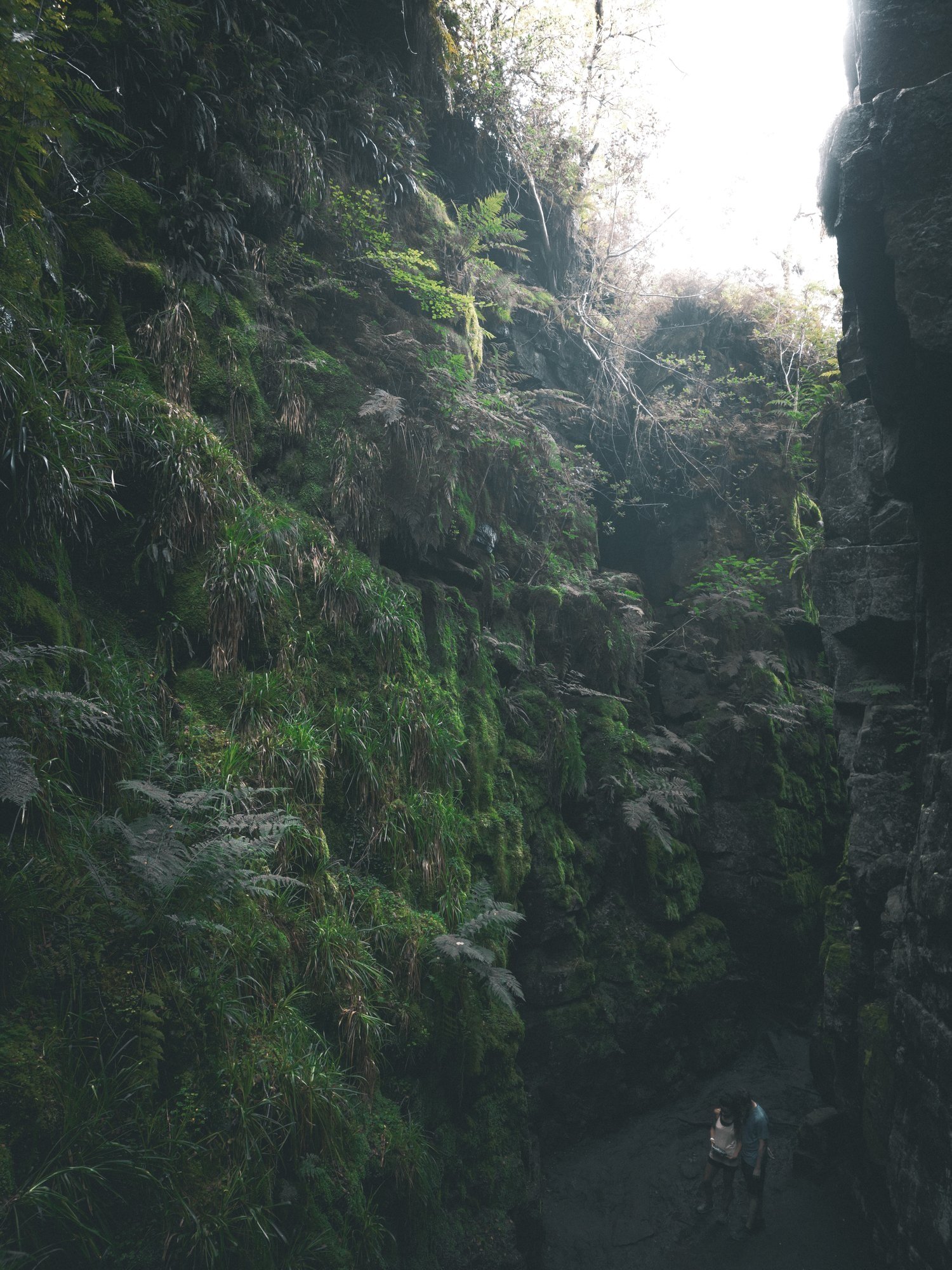
Below the hustle and bustle of the main shopping centre lies New Mill’s (not so) hidden gem: The Torrs. We’ve done this walk a few times, and every time we’re amazed by the astounding natural gorge that lies below.
Expect colourful cliffs, enormous viaducts and a long bridge that transports you to the Goyt Way — making for one of the best lesser-known walks in Derbyshire.
The route
Start: New Mills Central Station
Distance: 4 miles
Elevation: 300 feet
Difficulty: Easy
Duration: 1.5 hours
Navigation: Follow the route step by step here
Public transport
Manchester Piccadilly > New Mills Central (20 mins).

If you’re short on time but keen on big views, this walk’s for you. The Rossendale Valley is an outstanding and distinctive part of beautiful East Lancashire. Set in the South Pennine hills, it’s the perfect setting to escape the city for the day and explore some of Lancashire’s forgotten history.
The route
Start: Clough Head Car Park, 462 Grane Road, Haslingden, Rossendale, Lancashire, BB4 4AT
Distance: 5.6 miles
Duration: 2-3 hours
Elevation: 725 feet
Difficulty: Moderate
Navigation: Follow our route here

Breathtaking scenery? Check. Two iconic Peak District landmarks in one walk? This route has you covered. Starting and ending at the base of Bamford Edge, this walk first takes you up to Bamford Moor and onto Stanage Edge, before heading back through the iconic Bamford Edge — where there’ll be photo opps aplenty.
The route
Start: Heatherdene Car Park, S33 0BY
Distance: 7 miles
Duration: 3 hours
Elevation: 1,150 feet
Difficulty: Moderate
Navigation: Follow our route here
Public transport
Manchester Piccadilly > Bamford (41 min). From the train station, take the 257 bus to the starting point.

The Peak District ‘big one’. If you’re looking for a bit of a challenge on your next Sunday walk, a trip to the highest point in the Peak District is a must.
The route
Start: Bowden Bridge Car Park, SK22 2LH
Distance: 8.15 miles
Duration: Allow approx. 3-4 hours
Elevation: 1,500 feet
Navigation: Follow our route here
Public transport
Manchester Piccadilly > New Mills Central (20 mins). From the train station, take the 358 bus to Hayfield.
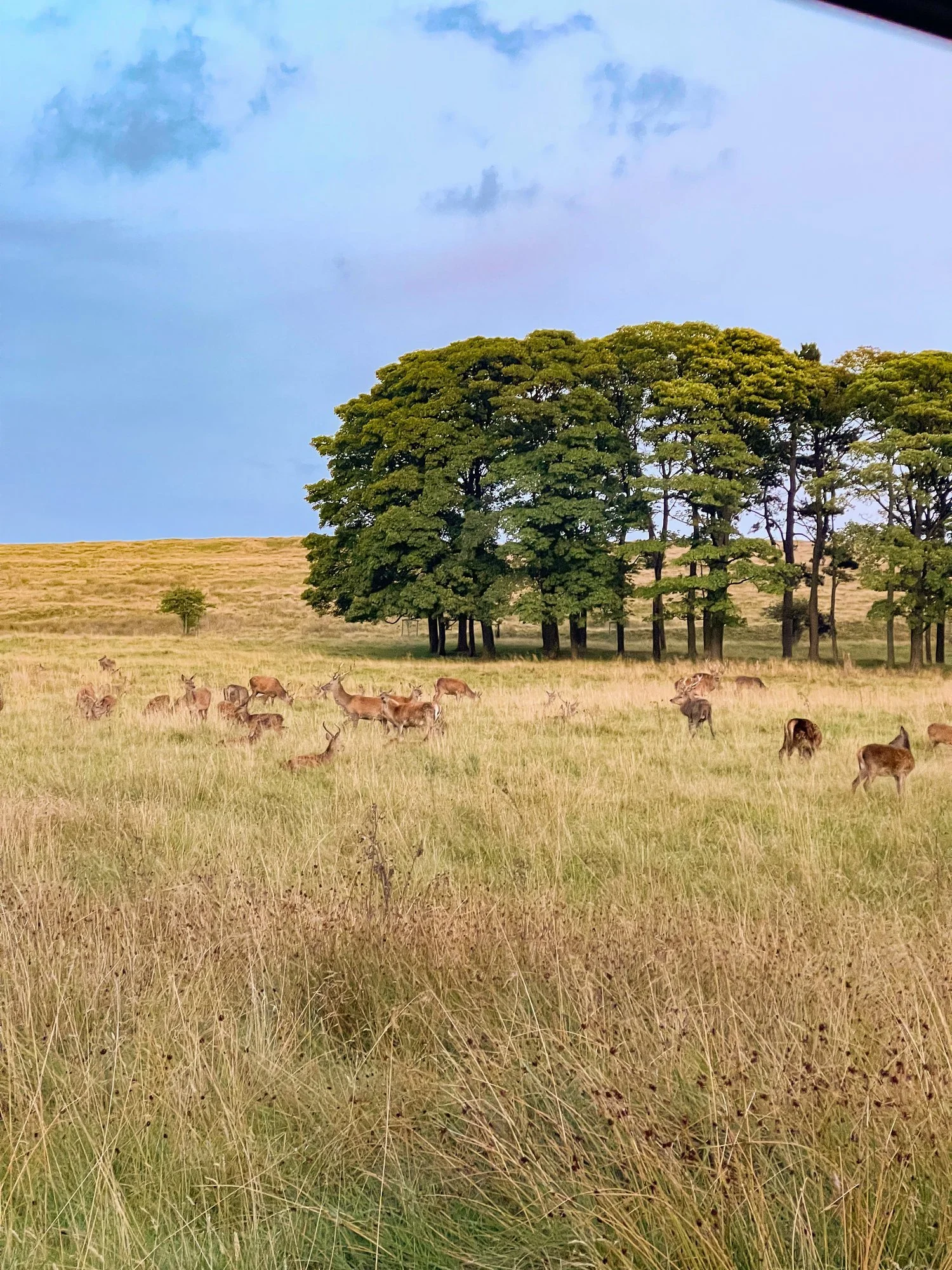
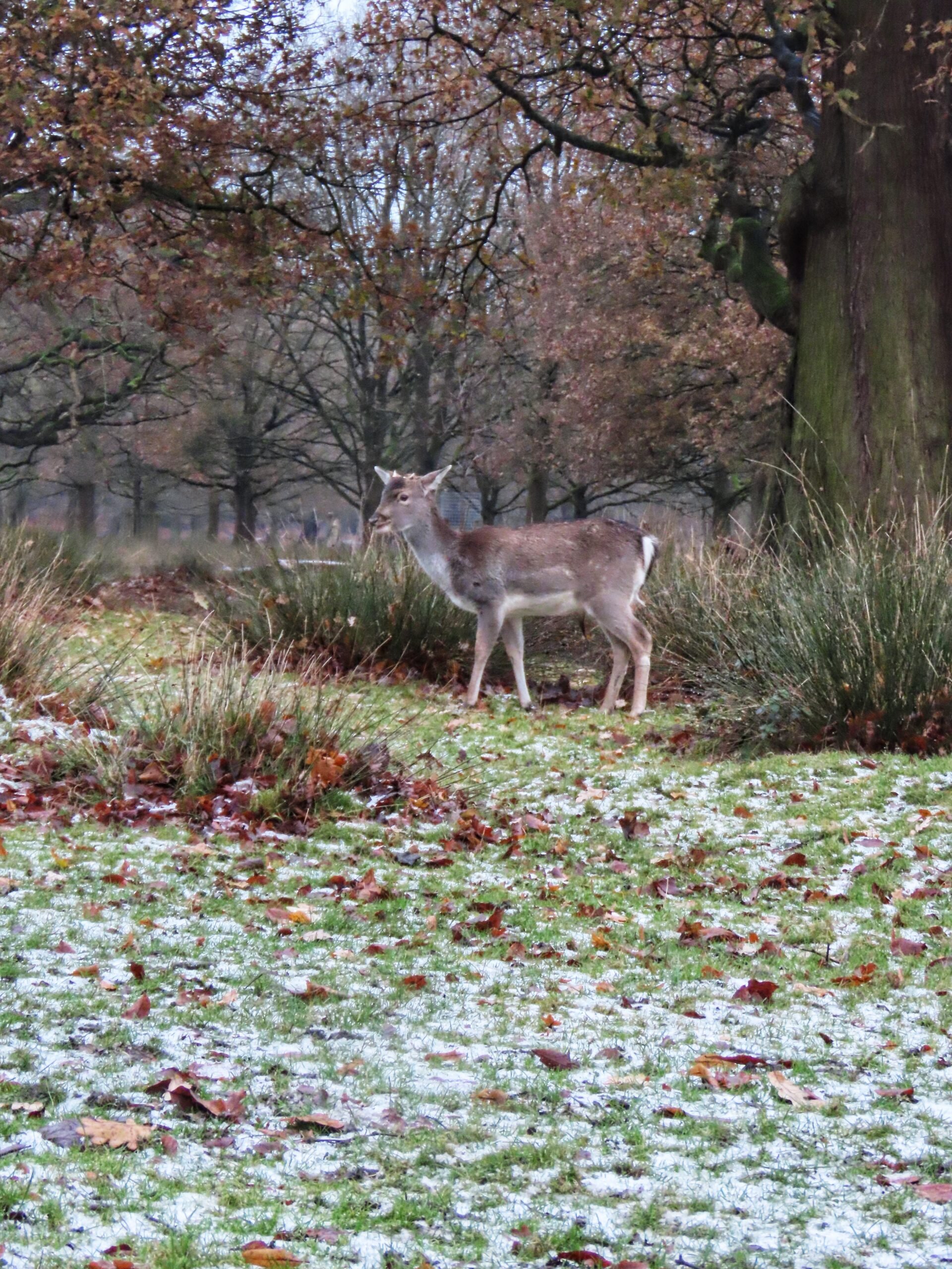
Whether you want to climb to one of the area’s trigs or lay low and stroll around the forest’s multiple reservoirs, Macclesfield Forest is a perfect Sunday day out. The forest is the last remnant of the Royal Forest of Macclesfield and now home to red deer.
The route
Start: Trentabank Visitor Centre, Macclesfield, SK11 0NS
Distance: 3.66 miles
Elevation: 600 feet
Duration: 1.5 hours
Navigation: Follow our route here

With over 15 miles of woodland trails and meadow-lined paths to explore, Hardcastle Crags is a walker’s utopia. Lying just above Hebden Bridge, you’ll be able to take your pick from the town’s many independent shops and cafes once you’ve finished your stroll.
The route
Start: White Lodge Pay and Display Car Park, DE45 1NL
Distance: 5 miles
Duration: 2 hours
Elevation: 625 feet
Navigation: Follow our route here
Public transport
Manchester Victoria > Hebden Bridge (28 mins)
Read more
The Torrs Millennium Walkway – a stunning Peak District walk that hovers above a huge gorge
Macclesfield Forest loop – a magical woodland walk with staggering lake views
Hidden gem - easy walk lancashire walk around Jamestone Quarry
6 INCREDIBLE WALKS WITHIN 1.5 HOUR’S DRIVE OF MANCHESTER
Check out our favourite, tried-and-tested walks less than 1.5 hours from Manchester…

Tired of the same old, over-populated walks? Living in a city doesn't have to mean concrete skyscrapers and canal walks. With so many hidden gems right on our doorstep, our collections are here to get you back to nature... without having to travel too far from home.
There’s no shortage of impressive sights to be found around Greater Manchester, whether you’re into walks that look straight out of Lord of the Rings or short strolls that make you feel straight out a fairytale.
With the Peak District right on Manchester’s doorstep, stunning scenery and dramatic views aren’t as far away as you may think. Take a look at some of our favourite walking spots found on the borders of our region.
Alport Castles, Derwent Valley (1 hour drive)

The route
Distance: 9 miles
Duration: Approx. 3 hours
Elevation: 1,100 feet
Difficulty: Moderate, gradual ascents
Navigation: Follow the route step by step here or download GPX file
Parking
Start: Fairholmes Car Park, Bamford, Hope Valley, S33 0AQ
Toilet facilities at Fairholmes Visitor Centre
Bicycle Hire – Derwent Valley is a great place to explore cycling trails
Good-to-knows
The car park does fill up quickly on weekends, so visit off-peak where possible
There’s a refreshment kiosk at the car park, open everyday 8am until 6pm (later if there is demand), selling takeaway drinks, snacks and hot food.
Public transport
Manchester Piccadilly > Sheffield (50 mins). From here take a bus to Fairholmes Car Park, a stop on several bus routes.


10 WALKS BY TRAIN NEAR MANCHESTER
Need a nature fix? Here’s how to escape the city when you haven’t got a car
If you've found yourself wandering through the local cemetery just to catch a glimpse of nature's greenery, you're likely familiar with the frustration of city life without wheels. And while Manchester has lots of incredible greenspaces (and burial places), there are days when you want to be somewhere wilder with bigger skies and wider views.
Manchester may be known as a flat city, but look to the horizon and you'll see higher ground just waiting to be explored. Roaming these moorlands and hills is in our blood, so let’s roam.
New Mills Millenium Walkway, New Mills (4 miles, 20 mins by train)

Lyme Park, Disley (30 mins by train)

Start: Disley Station
Distance: Various
Lyme Park is one of the National Trust’s most treasured estates. But perhaps lesser-known is the many trails surrounding its grounds just waiting to be explored…
Plus, with over 1,400 acres of rugged moorland, ancient woodlands and formal gardens to explore, Lyme is a great day out if you want to explore with your pooch. In fact, Lyme has always been a place where dogs can enjoy themselves. Dogs lived alongside the Legh family who left Lyme to the National Trust. Discover fantastic walks with your four-legged friend at Lyme.
As one of our favourite places to escape the city, we’ve done our fair share of walks around Lyme and its endlessly stretching countryside. Check out just a few of our favourites below.
NB: Each route listed below does require a walk from Disley station to the starting point.
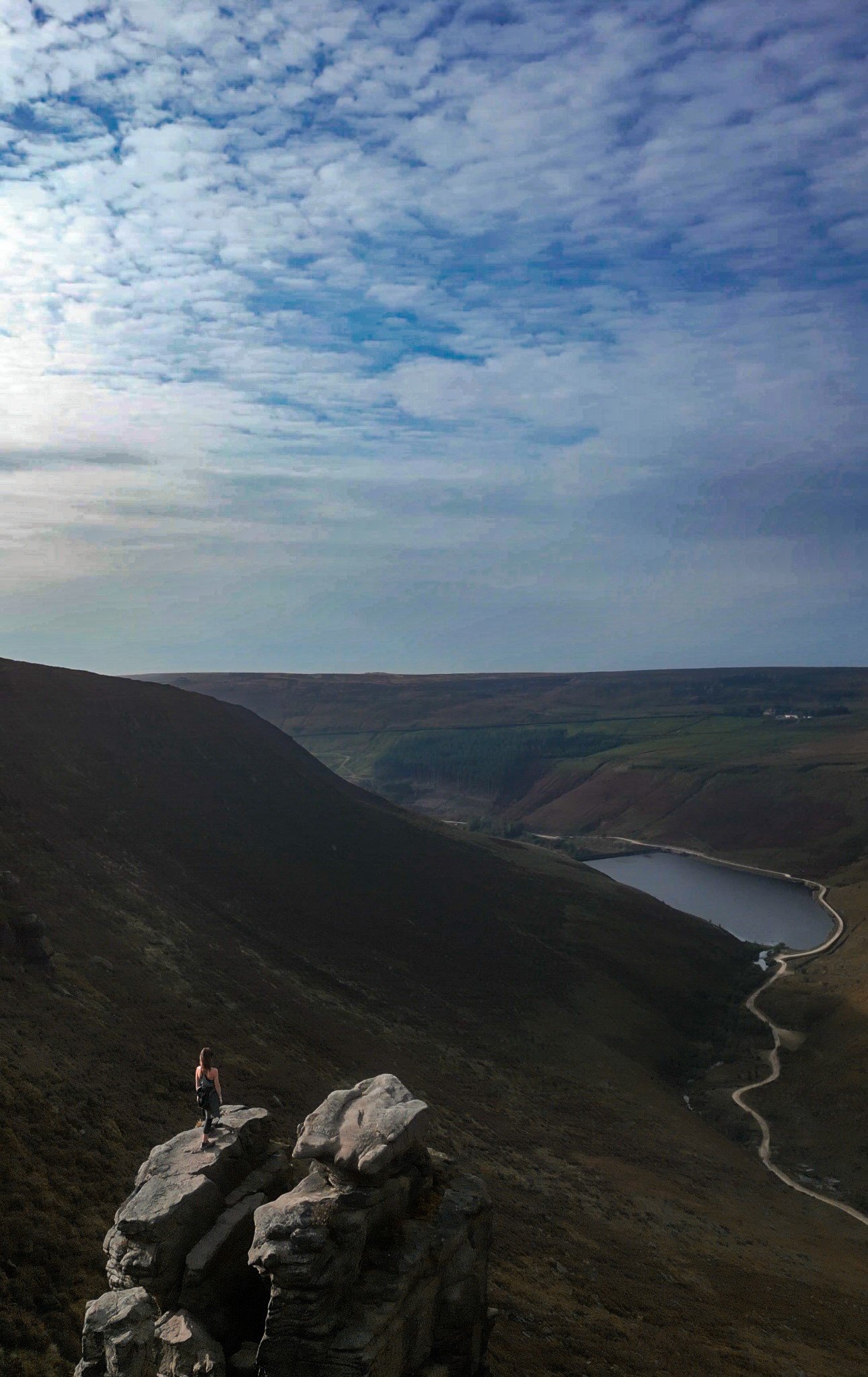
The Trinnacle, Dovestone Reservoir, Greenfield (24 mins by train)

Start: Greenfield Station
Distance: 6 miles
Elevation: 950 feet
Duration: 2-3 hours
Navigation: follow along here
Located high on the hills of Saddleworth Moor, there stands a peculiar rock formation which has well and truly gripped the attention of ramblers from far and wide. Best known as ‘The Trinnacle’, this fork-shaped gritstone pillar juts out from the moorlands above Dovestone Reservoir and has exploded in popularity as of late. The by-product of glacial activity dating back some 14,000 years, the deep valleys and splintered crags characterising the landscape all serve as a reminder of what once was.
Broken away from the main cliffs which loom over the reservoirs after years of weathering, the Trinnacle stands alone – like a trio of high-rise buildings – and is best found along a circular walk known as the ‘The Trinnacle Trail’.
Seven Falls, Tintwistle (38 mins by train)

Start: Hadfield Station
Distance: 5.31 miles
Elevation: 575 feet
Duration: Approx. 2 hours
Navigation: Follow the route here
Looking for a (not so) secret place to take a dip after a day of exploring? Then a trip to Seven Falls in Tintwistle is a must.
Fairy Wood Walk, Hathersage (57 mins by train)

Start: Hathersage Station
Distance: 4.63 miles
Duration: 2 hours
Elevation: 800 feet
Navigation: Follow our route here
Starting and ending in quaint Peak District village, Hathersage, this is a perfect route if you prefer your walks to start and end in a country pub or cosy cafe.
The route follows well-made paths up and out of the village, past the church, through beech woodlands, and up over the tops towards Stanage Edge, before meadnering back down into the village on coutnry lanes.
Winter Hill, Bolton (17 mins by train)

Start: Rivington Hall Car Park*
Distance: 6.15 miles
Duration: 2-3 hours
Elevation: 1,300 feet
Navigation: Follow our route here
This Lancashire walk takes you to two incredible viewpoints in one route. You begin your ascent up to Winter Hill via Rivington Country Park, taking you 1,496 feet high up to the summit.
While there are a variety of routes to choose from, our favourite is this 6 mile walk which takes in arguable the best views and scenery across Bolton, Wigan and the West Pennines Moors.
NB: To access the start of the walk by public transport, take the train from Manchester to Bolton, then board the 192 bus to Rivington.
Harpur Hill, Buxton (1 hour by train)

Start: Buxton Rail Station
Distance: 10 miles
Duration: 3-4 hours
Navigation: Follow the route here
Looking to escape the crowds? Topley Pike Nature Reserve is home to rolling hills, all-to-yourself valleys and stunning surrounds every way you turn, making it the perfect base to escape the hustle and bustle and recharge among some of the best scenery we have on our doorstep.
Winnats Pass, Hope (49 mins by train)

Start: Castleton Visitor Centre, S33 8WN
Distance: 9 miles
Elevation: 900 feet
Duration: 3-4 hours
Navigation: Follow the route here
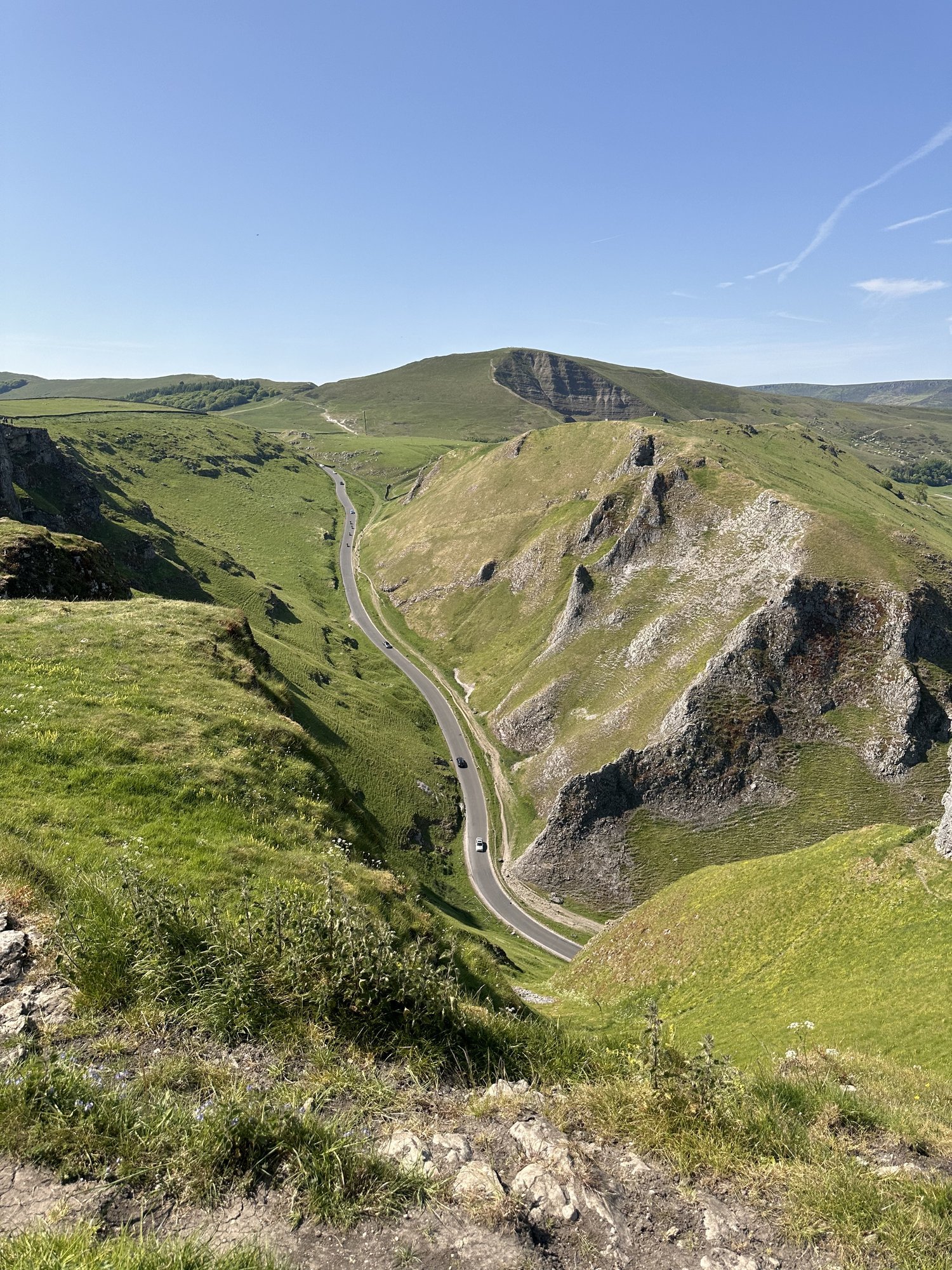
This walk takes you high above Winnats Pass and around Castleton, meaning you can take in this amazing Peak District village from all angles. The start of the route leans towards the challenging side, taking you up a steep and rocky path straight up to Winnats Pass where you’ll be instantly rewarded with incredible views right across The Peak District National Park.
Bamford Edge, Bamford (53 mins by train)

Start: Bamford Station
Distance: 7.53 miles
Elevation: 650 feet
Duration: 2-3 hours
Navigation: follow the route here
This walk offers some of the best views in the Peak District. With just a short climb at the start, you walk towards Bamford Edge and are rewarded with incredible views of Ladybower and Derwent Reservoirs. Want to catch an unreal sunrise with the chance of a cloud inversion? Set off early and you’ll have the ridge almost to yourself — with incredible views right across Hope Valley.
Hardcastle Crags, Hebden Bridge (27 mins by train)
Start: Hebden Bridge Station
Distance: 5 miles
Duration: 2.5 hours
Elevation: 650 feet
Navigation: Follow our route here
Whether you want to mooch around Heptonstall and pay a visit to Sylvia Plath’s resting place, or head on over to Lumb Falls for a wild dip, this walk is perfect for escaping the city for the day.
Want to make it a wild swim walk? Follow our Lumb Falls walk here.
6 INCREDIBLE WALKS WITHIN 2 HOUR’S DRIVE OF MANCHESTER
WALKS NEAR MANCHESTER
Check out our favourite walks less than 2 hours away from Manchester…

Manchester: the heart of everything. From our amazing people to the beautiful buildings and unrivalled culture, we have lots to shout about here in the world’s greatest region.
But all the things that make our city so great, make us appreciate being able to escape every so often even more. And what better way to do just that than spending the day in the wide open.
Whether it's a quiet hillside stroll or strenuous mountain hike, nothing quite blows those cobwebs away like a few hours up on the moors. And with the Peak District right on Manchester’s doorstep, accessing stunning scenery and dramatic views may not be as hard as you think.
We've rounded up some beautiful walking spots found on the borders of our region, proving that you don't have to travel too far from your local area to spend time in the great outdoors.
Start: Gradbach Car Park, SK17 0SU
Distance: 6.65 miles
Duration: 2-3 hours
Elevation: 900 feet
Navigation: follow our route here

Start: Binn Green Car Park, Oldham, OL3 7NN
Distance: 4.13 miles
Elevation: 950 feet
Duration: less than 2 hours
Navigation: follow along here

Distance: 8.32 miles
Time: 2-4 hours
Ascent: 900 feet
Start: National Park Centre, Malham
Navigation link: follow our route here
Start: Castleton Visitor Centre, S33 8WN
Distance: 5.02 miles
Elevation: 900 feet
Duration: allow approx. 2 hours
Navigation: follow the route here

Start: Rivington Hall Car Park, Bolton, BL6 7SD
Distance: 6.15 miles
Duration: 2-3 hours
Elevation: 1,300 feet
Navigation: follow our route here

Start: Arnfield Fly Fishery, SK13 1HP
Distance: 3.31 miles
Elevation: 575 feet
Duration: approx. 1.5 hours
Navigation: follow the route here

FAIRYTALE WALKS NEAR MANCHESTER
Looking for the best walks near Manchester? Look no further… these fairytale walks are perfect for hitting the trail in 2024.
Let’s face it — we need a touch of magic to get us out in the weather we’ve been having lately. So let these fairytale walks guide the way…
1) Lantern Wood, Lyme Park

Start: Lyme Park, Disley
Distance: 6.83 miles
Elevation: 1,050 feet
Duration: 2-3 hours
Navigation: follow our route here
2) Giddy Edge, Matlock

Start: Matlock Town Centre, DE4
Distance: 5.41 miles
Elevation: 1,175 feet
Duration: 2.5 hours
Follow the route here
3) Lud’s Church, Gradbach

Start: Gradbach Car Park, SK17 0SU
Distance: 6.65 miles
Duration: 2-3 hours
Elevation: 900 feet
Navigation: follow our route here
4) Goyt Valley, Peak District

Start: Whaley Bridge, SK23 7LX
Distance: 7.71 miles
Elevation: 1,075 feet
Duration: 2-3 hours
Navigation: follow the route here
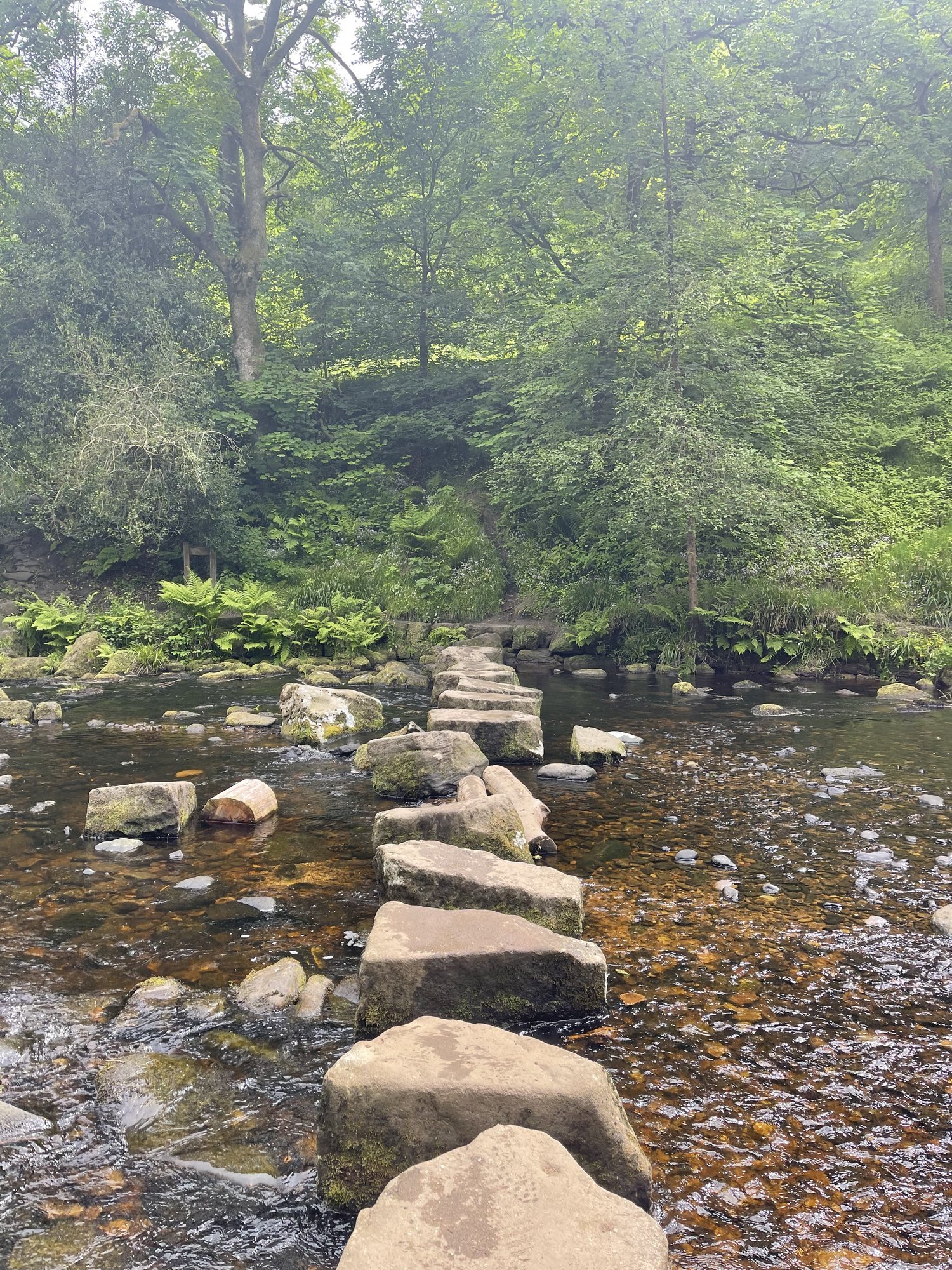
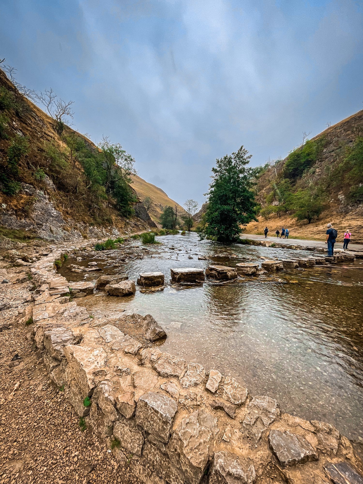
5) Chee Dale Stepping Stones, Buxton
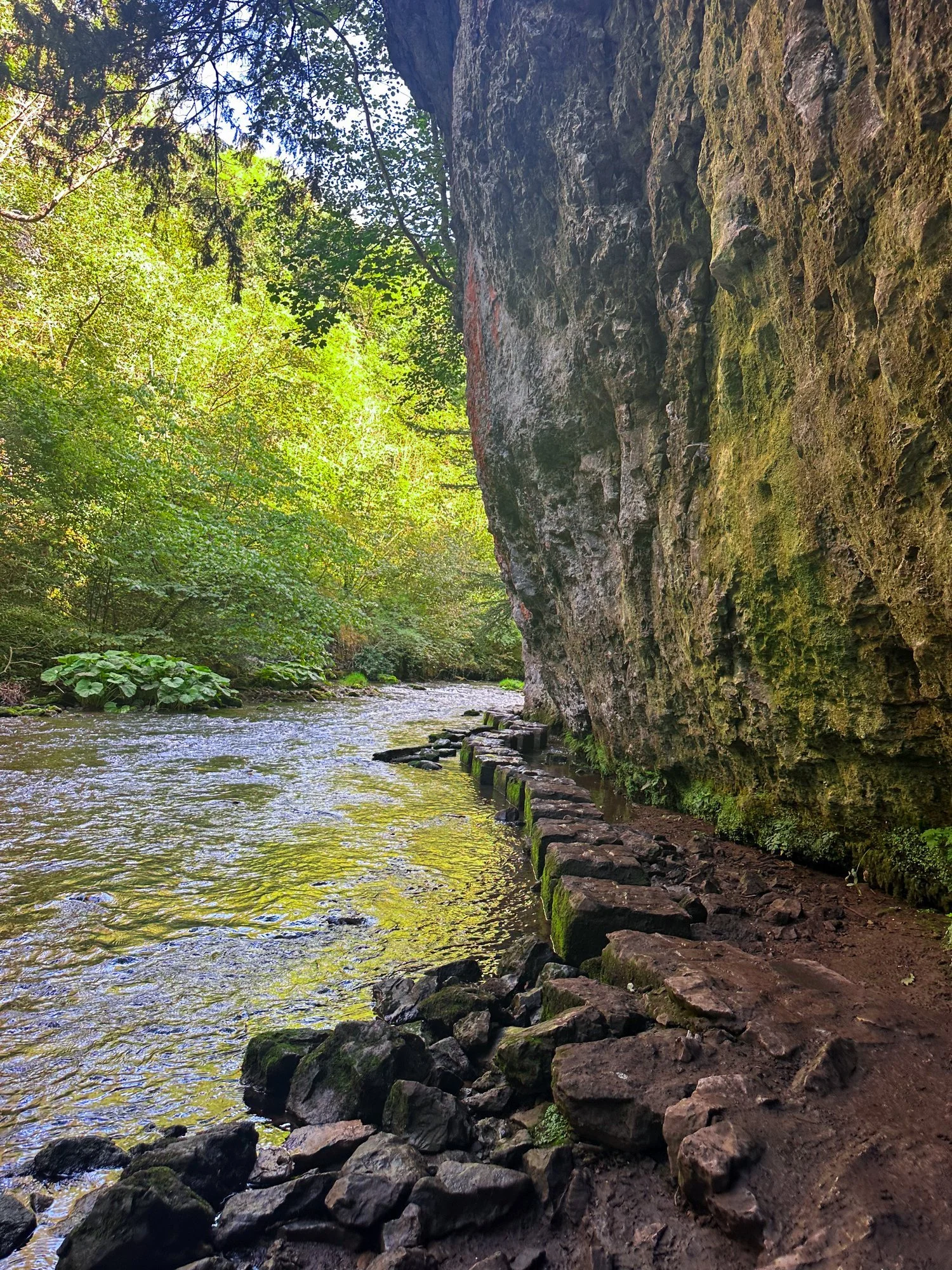
Start: Miller’s Dale Car Park, SK17 8SN
Distance: 5 miles
Duration: Approx. 2 hours
Elevation: 525 feet
Navigation: follow our route here
6) Nine Ladies Stone Circle, Stanton Moor

Start: The Druid Inn, Birchover, DE4 2BL
Distance: 6.81 miles
Elevation: 925 feet
Duration: 2.5 hours
Difficulty: Easy
Navigation: Follow our route here
7) Fairy Wood, Hathersage

Start: Oddfellows Road, Hathersage, S32 1DD
Distance: 4.63 miles
Duration: 2 hours
Elevation: 800 feet
Difficulty: Easy
Navigation: Follow the route step-by-step here

CHRISTMAS DAY WALKS
Check out our tried-and-tested Christmas Day walks
Are you a Christmas Day moocher or a Boxing Day cobweb blower?
We’ve always liked to kick off the big day festivities by heading off on a Christmas walk so we can get home and cosy and fill our boots with Yorkshire puds.
Check out our tried-and-tested places for a Christmas Day wander.
1) Lyme Park

Start: Lyme Park, Disley (alternatively you can complete the walk in reverse by parking at The Coppice)
Distance: 4.23 miles
Elevation: 430 feet
Duration: allow approx. 2 hours
Follow the route here.
2) Dunham Massey
Follow the route we mapped out for The Manc here.
3) Chadkirk Chapel
Start: Chadkirk Chapel, SK6 3LB
Distance: 6.29 miles
Duration: allow approx. 2 hours
Follow the route here.

SIX OF THE BEST PLACES TO WATCH THE SUNSET IN GREATER MANCHESTER
Manchester may be best known for its grey skies and rainy days… but our bustling city is also home to some of the most beautiful sunset spots in the UK.
Check out some of our favourite places to sit back and enjoy the view…
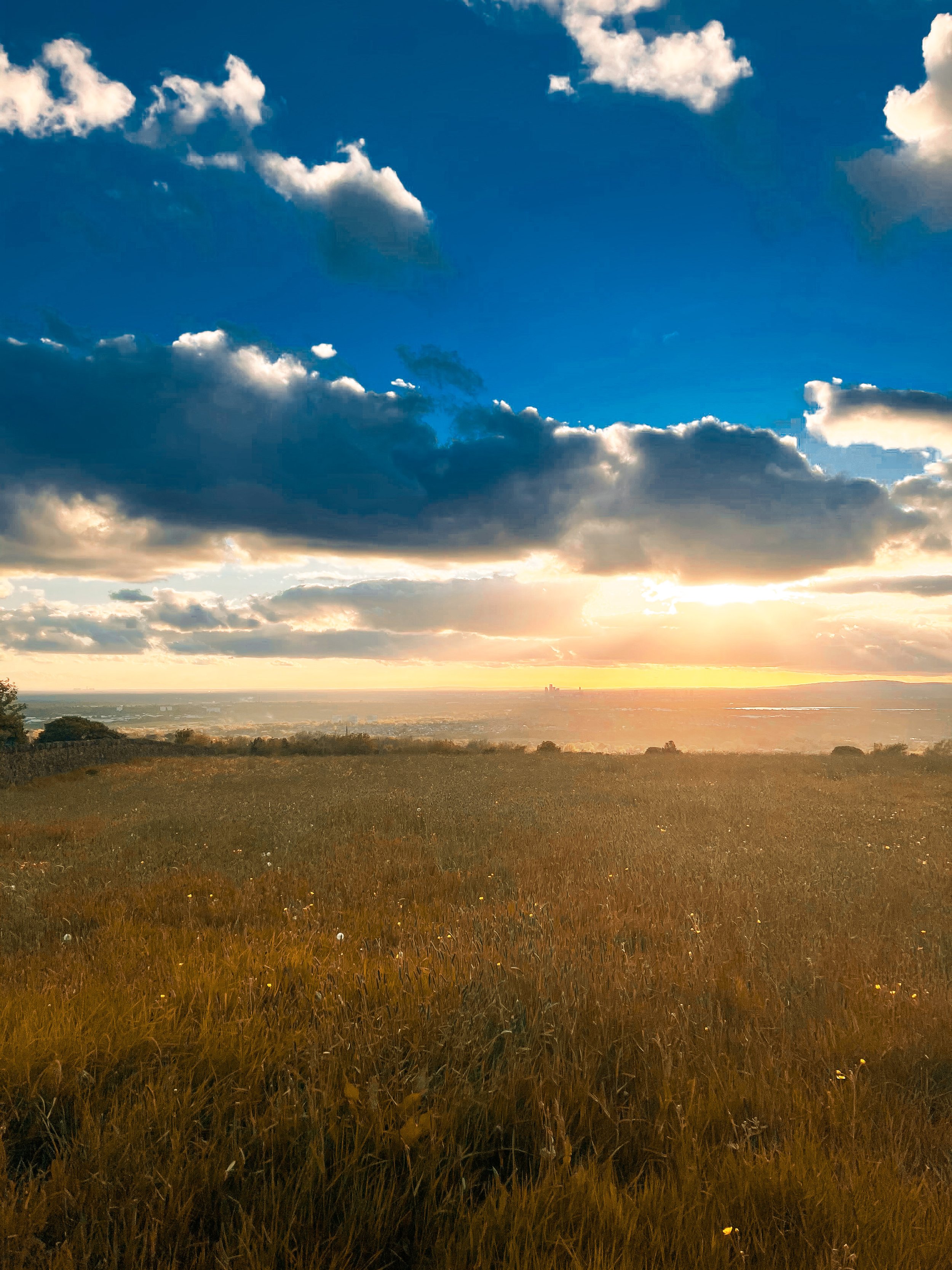
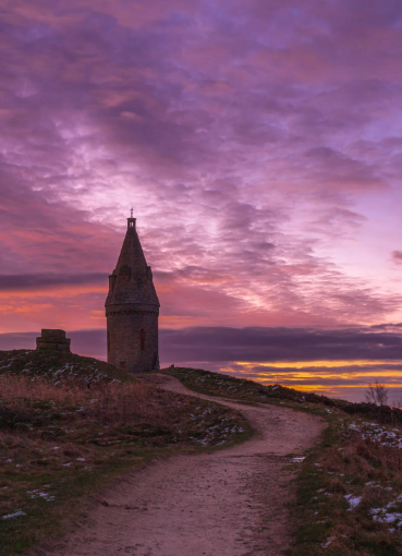
Mellor Cross
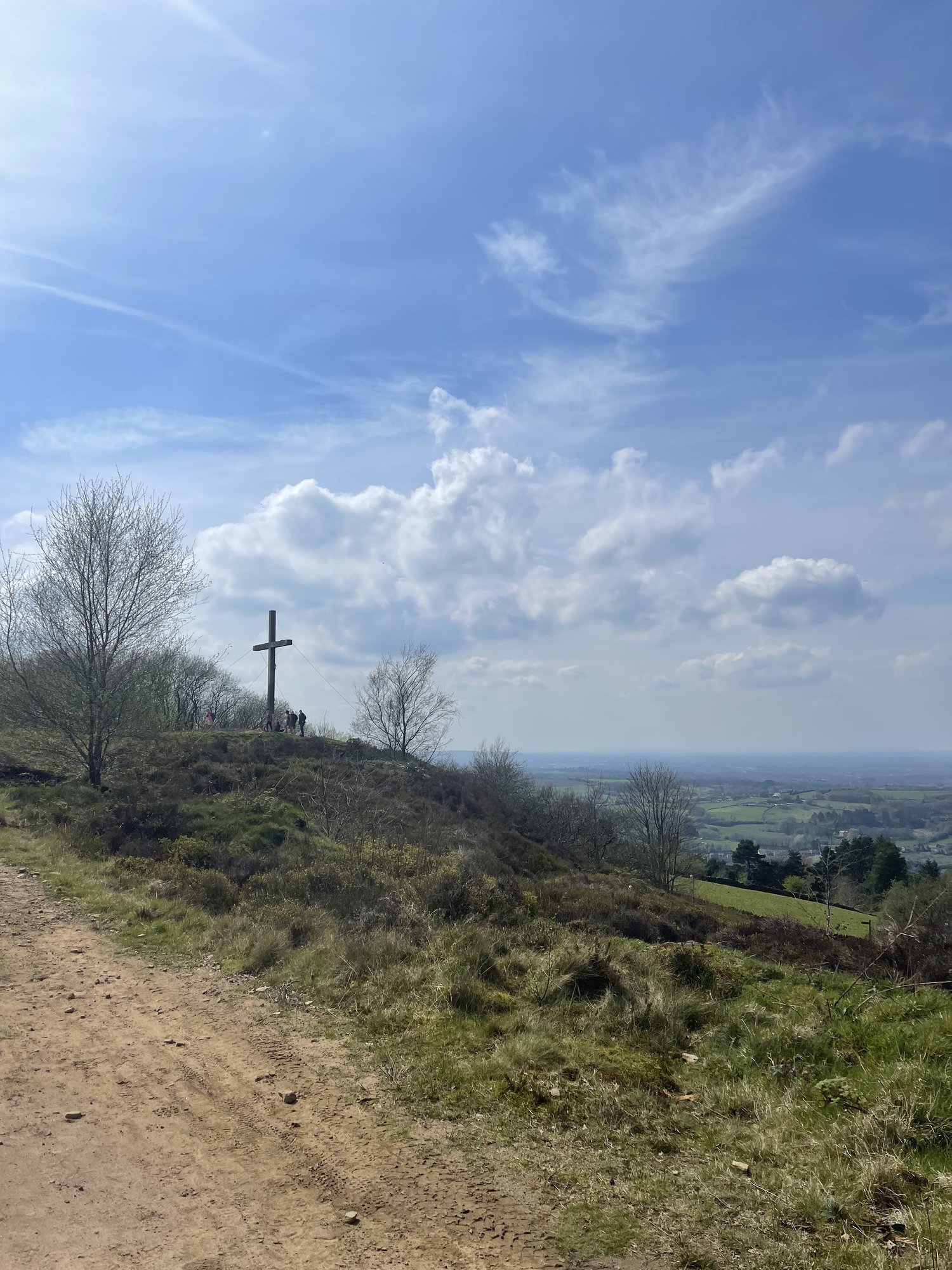
Mellor Cross, close to Cobden Edge, was originally erected in 1970 by a group of local church goers who carried the individual pieces up the steep hill to ensure the cross overlooked the community.
It’s a magical place in and of itself… but especially when you make the trip to watch the sun go down over Manchester’s impressive skyline.
If you’re looking to tie your trip in with a long walk, follow our route here.
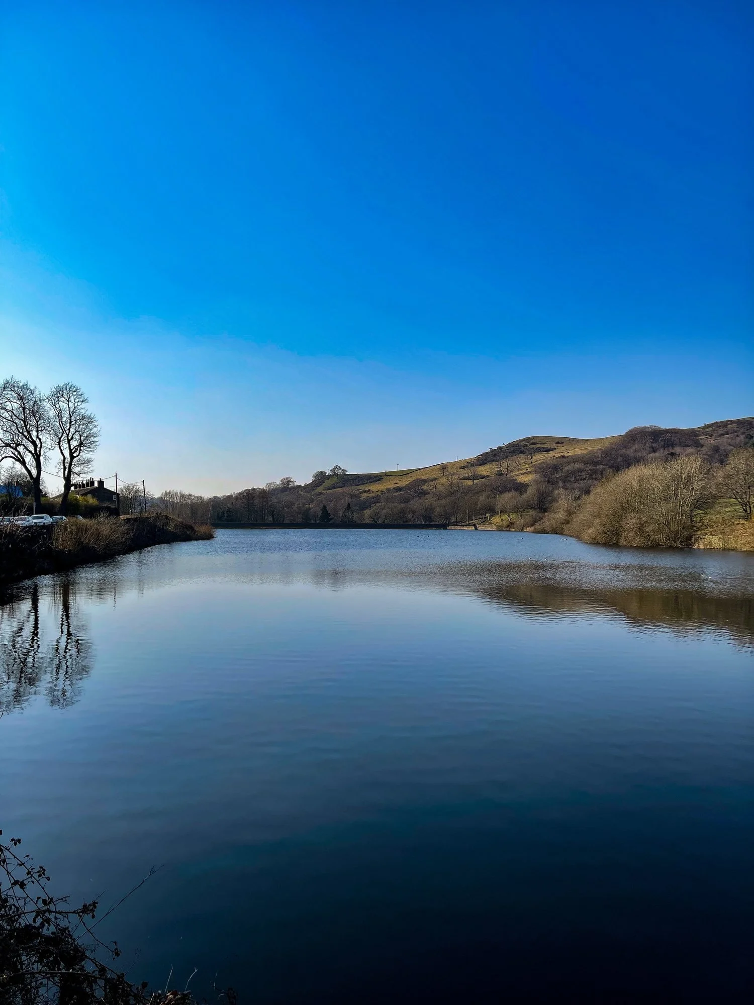
2. Dovestone Reservoir
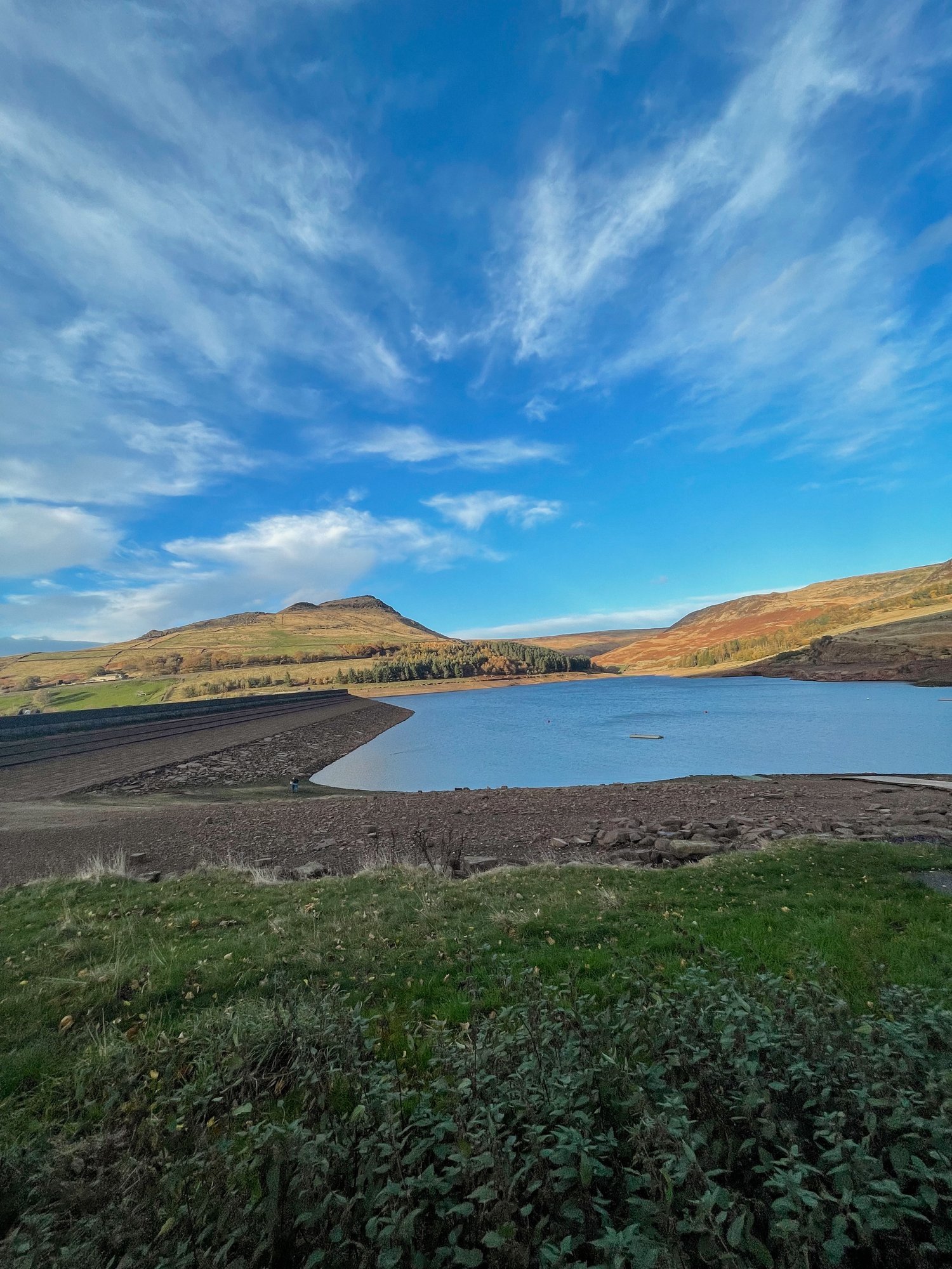
Dovestone Reservoir is located on the edge of the Peak District National Park, just a short drive from Manchester city centre. The reservoir offers stunning views of the surrounding hills and is a popular spot for walkers and cyclists. With its tranquil waters and picturesque scenery, Dovestone Reservoir is the perfect place to watch the sunset.
Fancy making a day of it? Follow our route here.
3. Werneth Low
Werneth Low is a hill located on the border of Greater Manchester and Cheshire, offering breathtaking views of the city and the surrounding countryside. It’s a great spot for a picnic, a walk, or just to relax and take in the scenery. From atop the low, you’ll be able to spot famous landmarks like the Beetham Tower and Jodrell Bank Observatory.
Want to tie in your trip with a long stroll? Follow our walk from Etherow to Werneth Low here.
4. Lyme Park

Lyme Park is a stately home located in Disley, Cheshire, just a short drive from Manchester city centre. The park, which covers over 1,300 acres of land, offers stunning views of the Peak District and is a popular spot for walkers and cyclists. With its beautiful gardens, woodlands, and lakes, Lyme Park is the perfect place to watch the sunset. Our favourite place to watch the sun go down on the grounds of Lyme has to be The Cage! A trip up to this hunting tower is always worth it, especially at dusk… just remember to bring a jacket.
Want to stretch the legs while you’re at it? Follow our long walk to Lyme, here.
5. Salford Quays

Credit: @havsnaps
The Quays is a vibrant waterfront destination in Salford, just a short distance from Manchester city centre. With its modern architecture, museums, galleries, and restaurants, The Quays is the perfect place to spend an evening watching the sunset. The Quays has a striking skyline where you can sit back, relax, and enjoy the view.
6. Hartshead Pike
Despite not being quite as high as nearby Werneth Low, this Tameside hill offers equally rewarding views over Ashton, Oldham, Bury and Cheshire — making it one of the best vantage points to enjoy watching the sun go down on a summer’s eve.

8 BEST WALKS IN THE PEAK DISTRICT
Looking for the BEST walks in the Peak District? Look no further…
The Peak District attracts thousands of tourists each year to its many peaks… and with good reason! Aside from its stunning natural beauty, picturesque landscapes, and endless opportunities for exploration, The Peak District has a charm that many other national parks don’t… with many a quaint northern village to visit along your way.
Luckily for us, this magical place is right on our doorstep — and is certainly high up our list when it comes to planning a hike not too far from Manchester. New to the Peak District? If you’re yet to explore the magnificent trails right on our doorstep, you might as well start with the best first, eh?
To help you on your way, we’ve compiled a list of the BEST 8 walks in the Peak District — they won’t disappoint.
Mam Tor, Edale

Mam Tor is a classic walk in the Peak District, and for good reason! It offers stunning views across the Edale Valley, and is a relatively easy climb for beginners. The trail is well-marked and takes you through the famous Winnats Pass, a narrow limestone gorge. Don’t forget to snap some pictures at the summit and enjoy the panoramic views of the surrounding hills and valleys!
Start: Peak Cavern, Castleton
Distance: 7.41 miles
Duration: 3-4 hours
Ascent: 1,700 feet
Navigation: follow our trail step-by-step here.
2. Kinder Scout, Hayfield
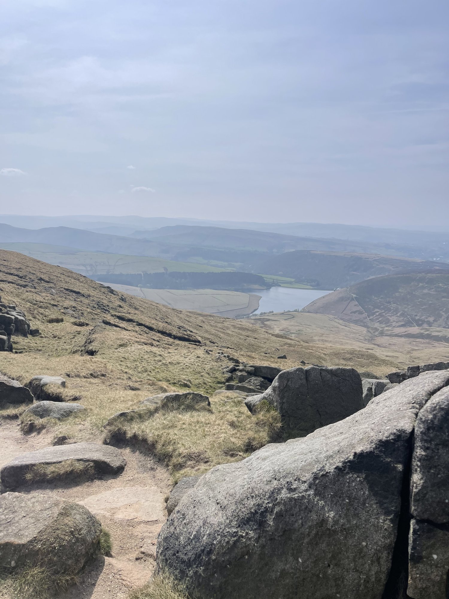
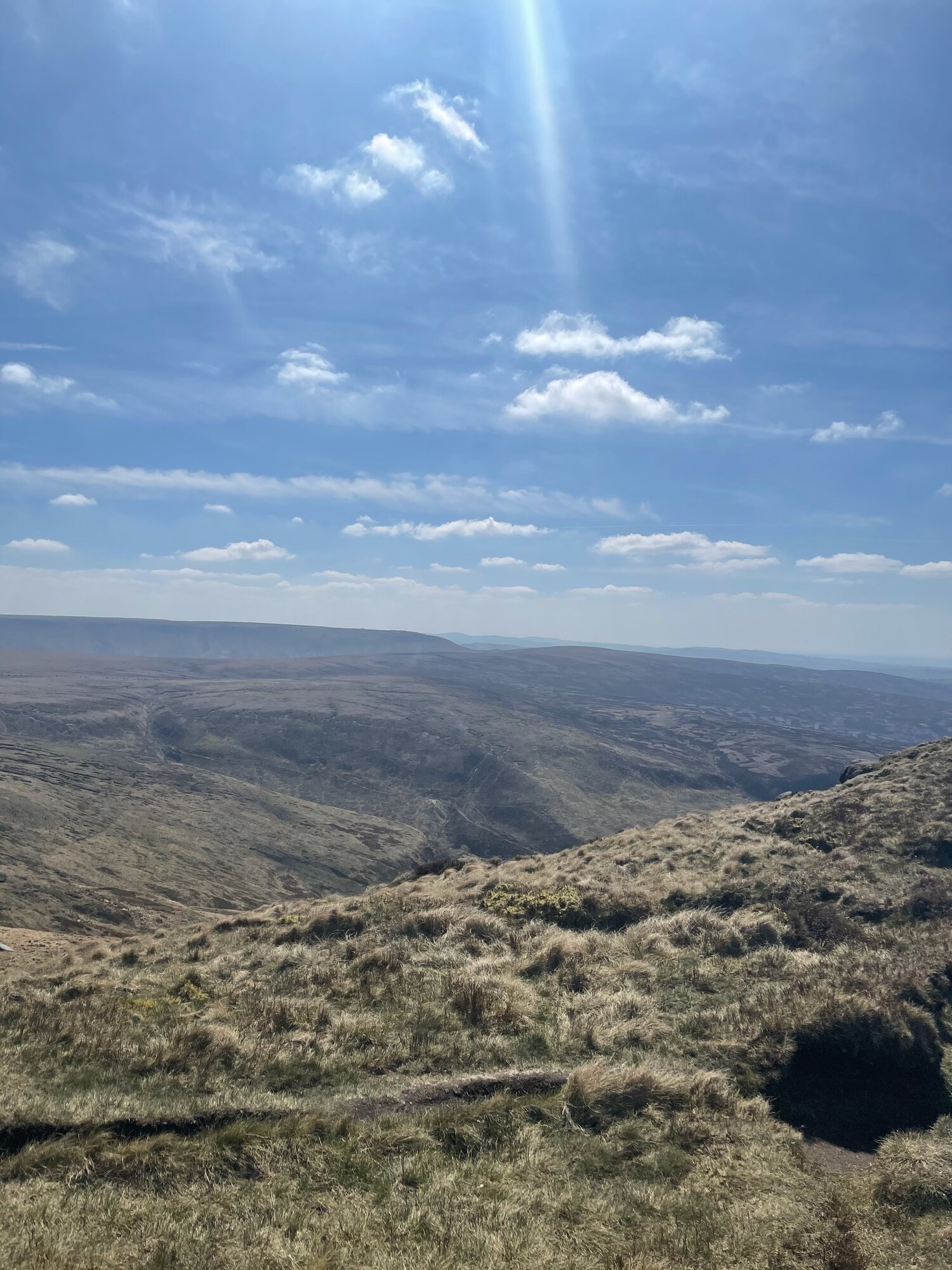
Kinder Scout is the highest peak in the Peak District, and a popular spot for hikers. The walk can be challenging, but the views are worth it! You’ll pass through wild moorland and take in views of the surrounding peaks. If you’re lucky, you may even spot some wildlife along the way. Keep an eye out for mountain hares, red grouse, and even peregrine falcons!
Distance: 8.15 miles
Duration: allow approx. 3-4 hours
Elevation: 1,500 feet
Start: Bowden Bridge Car Park, SK22 2LH
Navigation: follow our route here.
3. Bamford Edge, Hope Valley

Bamford Edge is a stunning ridge walk that offers some of the best views in the Peak District. This is a real treat of a walk, offering some of the best views in the Peak District. With just a short climb at the start, you walk towards Bamford Edge and are instantly rewarded with incredible views of Ladybower and Derwent Reservoirs. Up top, you’ll also find another great vantage point in the form of Win Hill. The easygoing nature of this route makes it a popular location for sunrise and sunset.
Distance: 3.53 miles
Elevation: 650 feet
Duration: 1.5 hours
Start: Heatherdene Car Park, S33 0BY
Navigation: follow the route here.
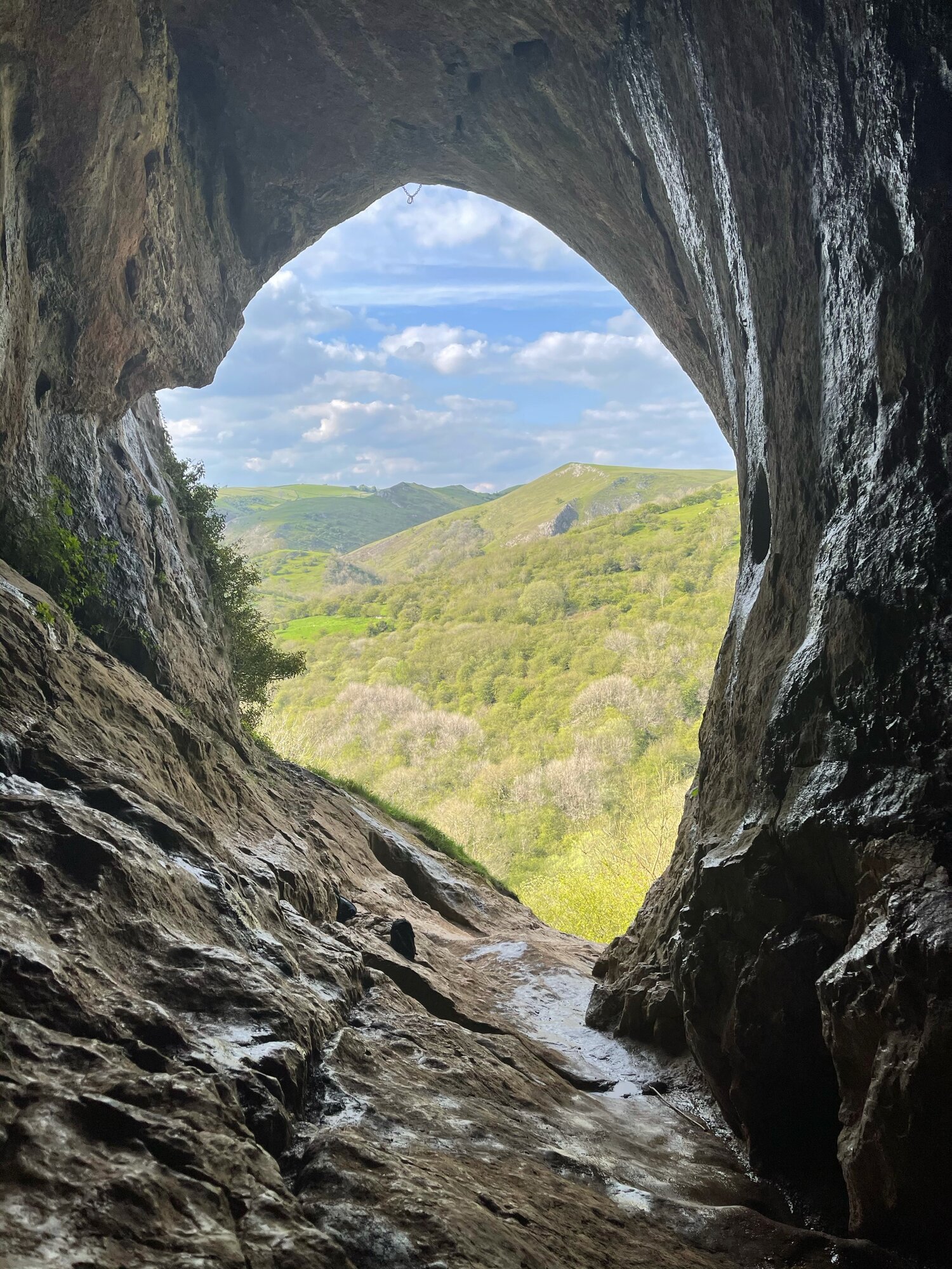
4. Thor’s Cave, Wetton

This is a brilliant route that takes in some of the best landmarks the Peak District has to offer: the beauty of Manifold Valley and the magnificence of Thor’s Cave. Just look at those views!
Thor’s Cave is an iconic natural cavern on the side of the Manifold Valley, making it a perfect spot to reward your efforts after a long day’s walk. Some scrambling to the chamber is required, making it perfect for big kids and little ones alike. There are some steep uphill segments but the views are worth it. The views out into the valley are immense, but do make sure to take care while exploring there are steep drops shortly after the entrance and the surface can be slippery.
Start: Wetton Mill, DE6 2AG
Distance: 7.74 miles
Duration: allow 3-4 hours
Elevation: 1,350 feet
Navigation: follow our route here
5. Padley Gorge and Stanage Edge, Hathersage

Stanage Edge is a popular spot for rock climbers, but it’s also a fantastic walk with stunning views. The trail takes you along the edge of a gritstone escarpment, where you can see views of the Hope Valley and the Dark Peak. Keep an eye out for the resident mountain goats, and take some time to appreciate the natural beauty of the Peak District.
Our favourite circular walk takes in less-populated trails from the busy Stanage Edge routes around Hathersage, with equally impressive views. Starting at Upper Burbage Bridge Car Park just outside of the town centre, this trail takes you to the magical Padley Gorge, before meandering back for a short scramble up Carl Wark — an awe-inspiring rocky tor.
Start: Upper Burbage Bridge Car Park, Hope Valley, S32 1BR
Distance: 5.3 miles
Elevation: 650 feet
Duration: allow approx. 2 hours
Navigation: follow step-by-step
6. Thorpe Cloud, Dovedale
Dovedale is a beautiful valley walk that takes you along the River Dove. The trail is relatively flat and easy-going, making it a great option for families or those looking for a more relaxed hike. The valley is home to a variety of wildlife, including kingfishers and otters. Take some time to appreciate the stunning rock formations, such as Thorpe Cloud and the famous stepping stones!
Thorpe Cloud is a gorgeous limestone hill that attracts thousands of visitors each year thanks to its unique shape. The route up to the summit is easy-to-follow, navigated by blue markers on signposts. With some steep parts that’re a good challenge for beginners, the walk is short and sweet with plenty of options to extend if you’re feeling particularly energetic.
Start: Blore Pastures Carpark, DE6 2BS
Distance: 5.49 miles
Duration: 2.5 hours
Elevation: 1,000 feet
Navigation: follow the route here
7. B52 Crash Site
By no means the easiest walk but defintiely a firm favourite amongst locals, the climb up to Higher Shelf Stones and the Over-Exposed crash site is definitely one of the most rewarding ones close to Manchester.
Starting from Glossop makes for a longer ascent — but if you’re looking to shorten the route, parking on Snake Pass near to the Pennine Way entrance gives you the best of both worlds: a shorter trail with the same amount of rewards.
Unlike a lot of the more strenuous hikes where the best views lie way up top, this route offers you insane views with every step you take.
Along the way, you’ll escape the confines of the valleys in favour of the sanctuary of high moors. The streams you see along the way make for a great respite on a sunny day — but it can get quite boggy so walking boots are a must on this one.
Start: Manor Park, Glossop
Distance: 9.24 miles
Duration: 3-4 hours
Ascent: 1,600 feet
Navigation: follow the route step-by-step here
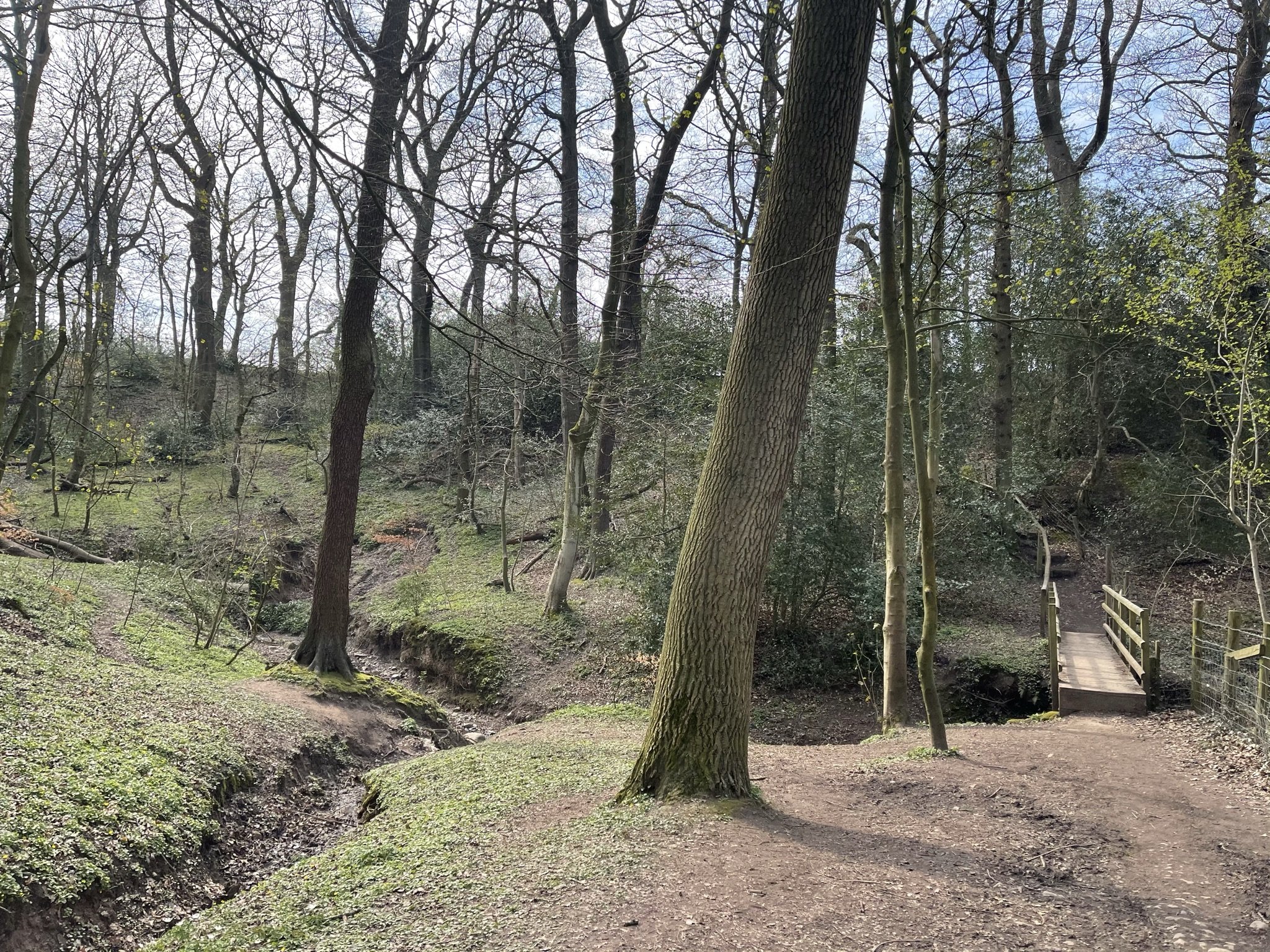
8. Snake Woodlands

Easily missable as you drive along Snake’s Pass (A57), this magical wonderland is hidden from view until you venture down into the woodland adjacent. This stunning pine forest landscape will have you feeling like you’re in the depths of a Canadian national park, much less on the outskirts of Glossop…
Surrounded by rolling hills, pine trees and babbling streams, you won’t be short on fairytale-like scenery on this short circular walk. In fact, this route has a mix of everything: magical woodlands, eerie moorland and even some spooky ruins to boot.
This route in itself is an absolute gem — but if you’re looking to get a few extra miles in, popular Peak District landmarks Higher Shelf Stones and the B52 Crash Site can easily be incorporated.
Start: Hope Woodland Car Park, S33 0AB
Distance: 3.59 miles
Duration: 1-2 hours
Elevation: 400 feet
Navigation: follow the route here.

TOP 10 WALKS NEAR MANCHESTER
Discover the best walks near Manchester with our top 10 local haunts

From the stunning scenery not too far from Peak District to the tranquil greenspaces on the edge the Bridgewater Canal, we've scoured the region to bring you the top hiking trails and nature walks for all skill levels. Lace up your boots and immerse yourself in the natural beauty right here on our very doorstep.
Lyme Park: on the outskirts of SK lies one of our favourite places to recharge… National Trust’s Lyme Park.
Whether you want take a leisurely stroll through the gardens, or venture out into the woodlands for a more challenging hike, you won’t be dissapointed with the breathtaking Peak District views surrounding the grounds.
Location: Disley, Stockport SK12 2NR
Facilities: toilets, parking, cafe, restaurant, playground.
Extend your adventure: follow our long route here.

2. Werneth Low Country Park: Located on a hilltop just above Hyde and Bredbury, Werneth Low offers stunning views right across Manchester city centre. With several walking trails to choose from, as well as a visitor centre that provides information about the area, this is a great place if incredible views and a spot of history is your ideal day out.
Location: Werneth Low Country Park Visitor Centre, Higham Ln, Hyde SK14 5LR
Facilities: parking, toilets, visitor centre.
Extend your adventure: follow our long route here.

3. Tandle Hill Country Park: Just a short drive from Manchester, Tandle Hill is a mixture of magnificent beech woodland and open grassland with a wide panorama of the surrounding countryside. There are several walks around the park and links to Crompton Moor with a range of trails to explore, ranging from easy to moderate.
Tandle Hill is Oldham’s oldest country park. It has 48 hectares of parkland with mature beech, mixed woodland and grassland. There are views across the Manchester Plain and the Pennine Hills.
Location: Tandle Hill Road, Royton, Oldham, Greater Manchester, OL2 5UX
Facilities: toilets, cafe, parking, play area.

4. Etherow Country Park: Located in Stockport, Etherow has a variety of walking trails to explore. With a history stretching back to the 1820s, this country park between Marple and Romiley has everything needed for a wholesome day out.
Growing steadily from its mill and manmade lake days, the park now covers an impressive 200 acres and lies at the heart of the Etherow-Goyt Valley. The park also marks the start of The Goyt Way — a 10-mile trail towards Whaley Bridge.
Location: Compstall, SK6 5JD.
Facilities: toilets, cafe, parking.
Extend your adventure: follow our long walk here.

5. Dovestone Reservoir: Located in Saddleworth, this reservoir offers stunning views of the surrounding hills. There are several walking trails to choose from, ranging from easy to challenging.
Dovestone Reservoir has become increasingly popular in recent years and can get quite crowded. Fortunately, routes like this one exist: taking you on the outskirts of the popular landmark for an even better view of the area, instead.
Location: Dovestone Reservoir, OL3 7NE.
Facilities: parking, toilets.
Extend your adventure: follow our alternative route here.

6. Heaton Park: This expansive park is located just north of Manchester city centre. It has a variety of walking trails to suit all fitness levels, and the views of the city skyline are impressive.
More than just a stroll in the park, Heaton Park is host to cafes, an animal centre, tennis courts, bowling greens, golf course, boating lake, adventure playground and the historic Heaton Hall; an 18th century grade I listed building.
Location: various carparks surrounding. Heaton Park, M25 2SW.
Facilities: toilets, parking, cafe, boating lake, playground, hall and orangery, farm, fair, treetop trek.
Extend your adventure: Heaton Park spans a whopping 600 acres, making it the largest municipal park in the whole of Europe… so you won’t be short of places to walk, or things to do.

7. Chorlton Water Park: Smaller than neighbouring Sale Water Park but arguably much more scenic, Chorlton Water Park makes for a perfect wholesame day out. The park comprises a central lake surrounded by woodland and is pipular with walkers, runners and cyclists alike.
Just south of the park is the River Mersey and the Mersey River Valley — a large area of urban countryside stretching from Manchester to Stockport. Covering many square miles of open green space, the Valley makes getting back to nature in the depths of the city accessible for all.
Location: Maitland Avenue, Chorlton, M21 7WH.
Facilities: carpark, picnic benches, playground, toilets.
Extend your adventure: check out our route to Fletcher Moss here.
8. Reddish Vale Country Park: Reddish Vale Country park spans 161 hectares along the River Tame in the heart of Stockport. It provides a green corridor linking the town centre with Denton in Tameside, and Woodley, Stockport.
There are walks, cycle and bridleways that link with the Goyt, Etherow, Saddleworth and Longdendale trails. There are also long distance routes such as the Midshires Way and Transpennine Trail.
Location: Mill Lane, Reddish, Stockport, Greater Manchester.
Facilities: carpark, picnic benches, cafe, toilets.
Extend your adventure: check out our route around nearby Alan Newton Way here.

9. Hollingworth Lake: This beautiful lake is located just outside of Manchester, and is surrounded by picturesque countryside. The lake itself is a popular spot for fishing and boating, and there are several walking trails that take you around the perimeter.
Hollingworth Lake Country Park in Littleborough was originally built as the main water source for the Rochdale Canal, later developed as a tourist resort in the 1860s. It's a man-made lake that spans 118 acres.
Location: Rakewood Road, Littleborough, Greater Manchester, OL15 0AQ
Facilities: parking, toilets, picnic site.
Extend your adventure: check out routes across the Pennine Bridleway.

10. Sale Water Park: This park is located in Sale, just a short drive from Manchester city centre. It has a number of walking trails to explore, as well as a lake that's popular for fishing and boating.
Location: Rifle Road, Sale, Greater Manchester, M33 2LX.
Facilities: cafe, toilets, parking, water sports.
Extend your adventure: Check out our route across Sale and Chorlton water park.
UPHILL CHALLENGES:


WALKS WITH WATERFALLS:


