THIS WEEK’S FEATURED WALKS:


ALL TRAILS

MOW COP TRAIL, CHESHIRE
Short on time? This easygoing pub walk explores the history of Mow Cop, which straddles the Cheshire and Staffordshire
The route takes in the ruins of the castle and the Old Man o'Mow, a distinctive rock feature in the landscape. Along the way, you'll discover why this site is important to the Primitive Methodists, and see some long-reaching views over the Cheshire and Staffordshire countryside.
Start: Mow Cop, ST7
Distance: 4.66 miles
Duration: 2 hours
Elevation: 650 feet
Difficulty: Easy-Moderate
Navigation: Follow step-by-step on komoot, or download GPX file

Route Highlights:
Mow Cop Castle: Mow Cop ‘castle’ is a folly on the ridge dividing Staffotdshire and Cheshire, and is in the ownership of the National Trust. The folly of Mow Cop was built as a summerhouse in 1754 for Randle Wilbraham I of Rode Hall. It is believed that he built it to enhance the view of the newly constructed Rode Hall, about 3 miles away on the edge of the Cheshire plain.
Mow Cop is often referred to as the home of primitive Methodism. The two founders of the movement were Hugh Bourne 1772-1852, and William Clowes 1780-1851. The first open air prayer meeting took place on 31st May 1807 and attracted over 2,000 people. In 1862 a Memorial church was built on the site of this open air meeting.
Old Man of Mow: The Old Man O’Mow is situated on the site of an ancient cairn that would have been the high point of the land; it would have been as distinguishable a landmark as the Castle is today. It has been suggested that the cairn was a burial mound, and linked to the Bride Stones of Cloud End.
The Gritstone Trail: The Gritstone Trail is a long distance walk of 15 kilometres (9.3miles) which starts at Timbersbrook near Congleton in Cheshire and finishes at Kidsgrove in Staffordshire. The route passes many historical landmarks and features of the area's industrial past including ancient paths, Roman roads, canals and railways. On its way from Cheshire into Staffordshire it takes in Lyme Park, Sponds Hill, Tegg's Nose Country Park, Croker Hill and Mow Cop, it ends at Kidsgove Station which is close to the Harecastle Tunnel on the Trent and Mersey Canal
Macclesfield Canal: The Macclesfield Canal, completed in 1831, winds through 26 miles of Cheshire's picturesque countryside, showcasing elegant stone bridges and impressive locks. While you can enjoy a full day of long-distance walking along the canal, our walk only takes you across a short segment of this historic waterway.
Roe Park Woods: The route leads through Roe Park Woods which is a Site of Special Scientific Interest. The woodlands consist of three separate woods called Hanging, Limekiln Our circular walk passes between Hanging and Limekiln woods on the north-west facing slope of Mow Cop ridge. This woodland is Cheshire’s most extensive area of semi-natural ancient woodland and contains woodland community types rare to the county.
Good to Knows:
Terrain: The route is relatively flat with an uphill section shortly after The Rising Sun. A great excuse for carb loading at the pub.
The Rising Sun Pub: A stone’s throw away from Rode Hall & Gardens and Mow Cop Castle in Scholar Green, found north of Stoke-on-Trent. You’ll pass this cosy pub at the latter end of your walk, where you can expect home cooked food and a warm greeting aplenty.
Accessibility: Undulating terrain that may be unsuitable for buggies and wheelchair users. Please also note that there are no toilet facilities in and around the Mow Cop area.
Dog friendly: This route is dog-friendly, featuring just one stile with room for a dog to pass under, or small dog to be carried over.

Fancy giving this one ago? Check out our full guide on Instagram

WILD BANK TRIG AND SWINESHAW RESERVOIRS WALK
A taste of heather moorland as you climb to the local trig-point, with wide views over Manchester.

Overview: A longer walk featuring a scenic valley and a stiff climb to a fine moorland viewpoint.
Start: Carrbrook, SK15 3PH
Distance: 7.69 miles
Duration: 3 hours
Elevation: 1,550 feet
Difficulty: Moderate
Navigation: Follow step-by-step on komoot, or download GPX file

Route Highlights:
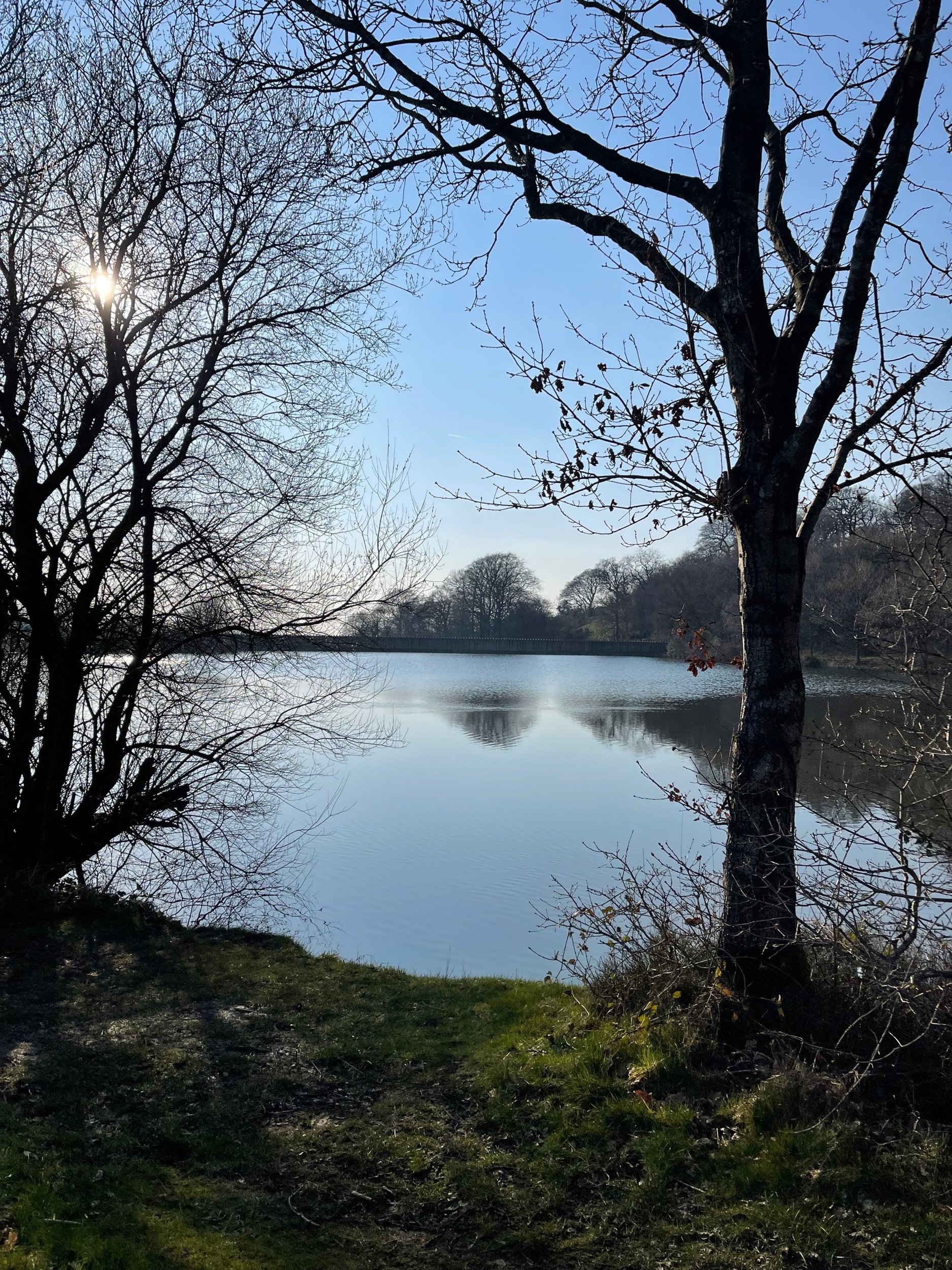
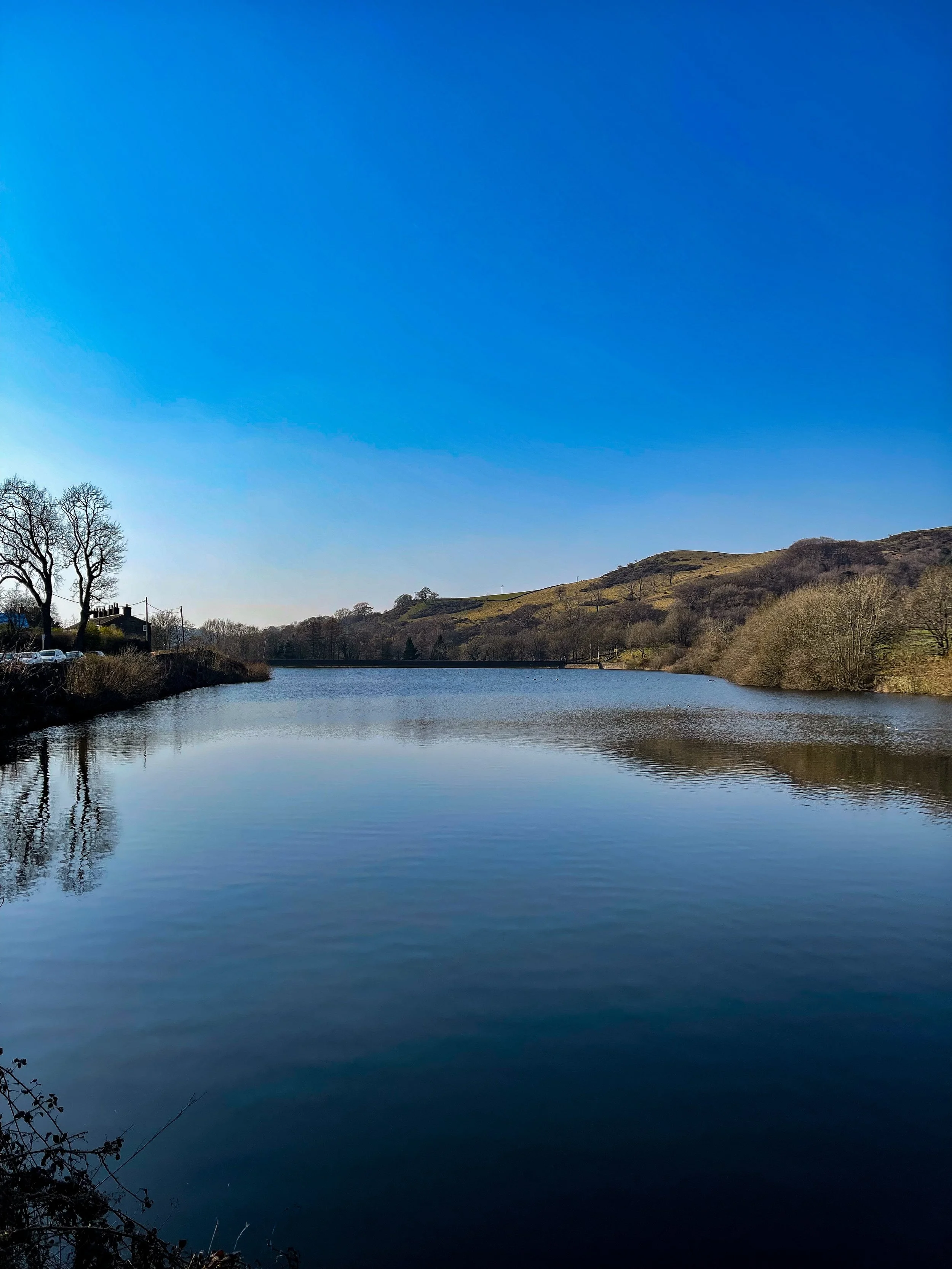
Swineshaw Reservoir: A great pitstop early on in the route, where you can rest up and enjoy the view shortly after the climb up from Carrbrook. Swineshaw Reservoir was one of three reservoirs proposed by the Glossop Commissioners, it was adapted in 1864 by the Glossop Water Company to provide drinking water for Glossop and taken over by the Glossop Corporation Waterworks in 1929 and then the Manchester Corporation Waterworks in 1959. It is no longer in service.
Wild Bank Trig: Your walk includes a climb to the Wild Bank Trig point, offering panoramic views over Manchester, Winter Hill, the Peak District and the Cheshire Plain. It's a fantastic spot to soak in the vastness of the landscape and grab some photos before heading back down to Carrbrook.
Swallows Wood: A lovely spot to shade-seek on a sunny day. This route only briefly passes through the woodland, but you can easily extend the route to have a good explore of the area.
Walkerwood: On the home stretch, you’ll pass through Walkerwood Reservoir. The wooded area surrounding is another great pitstop before you make your way back to Carrbrook.

Good to Knows:
Terrain: The terrain varies from moorland paths to wooded areas, so sturdy footwear is recommended. Some parts of the route are quite steep, so be prepared for uphill climbs.
Weather: Check the weather forecast before setting out as the moorland can be exposed to the elements. Dress appropriately and bring waterproofs if rain is expected.

Public transport options from Manchester:
If you're traveling from Manchester, here are some public transport options to reach Carrbrook:
Bus: Take the 343 bus from Manchester Piccadilly Gardens to Carrbrook, which operates regularly throughout the day. The journey takes approximately 45 minutes.
Train and Bus Combo: Alternatively, take a train from Manchester Victoria to Stalybridge (9 mins), then catch the 343 bus to Carrbrook (20 mins).
Driving: If you prefer to drive, Carrbrook is around a 30-minute drive from Manchester city center. Limited street parking available near the starting point.

DRAGON’S BACK WALK (5 MILES)
Want to feel like you’ve spent the day in Middle Earth? This route’s for you.

Start: Hollinsclough, SK17 0RH
Distance: 5 miles
Ascent: 1,000 feet
Duration: allow approx. 2 hours
Navigation: follow step-by-step

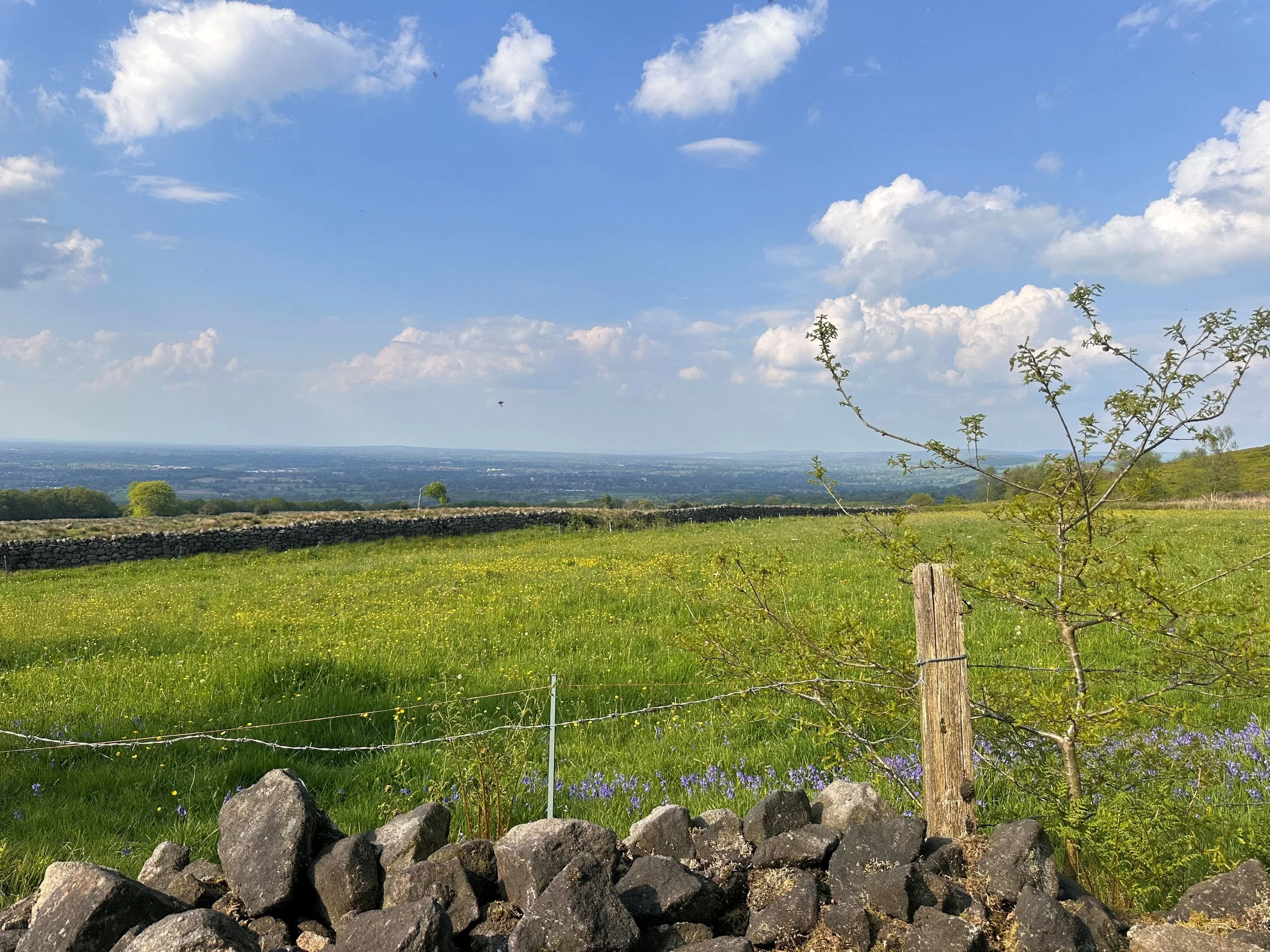
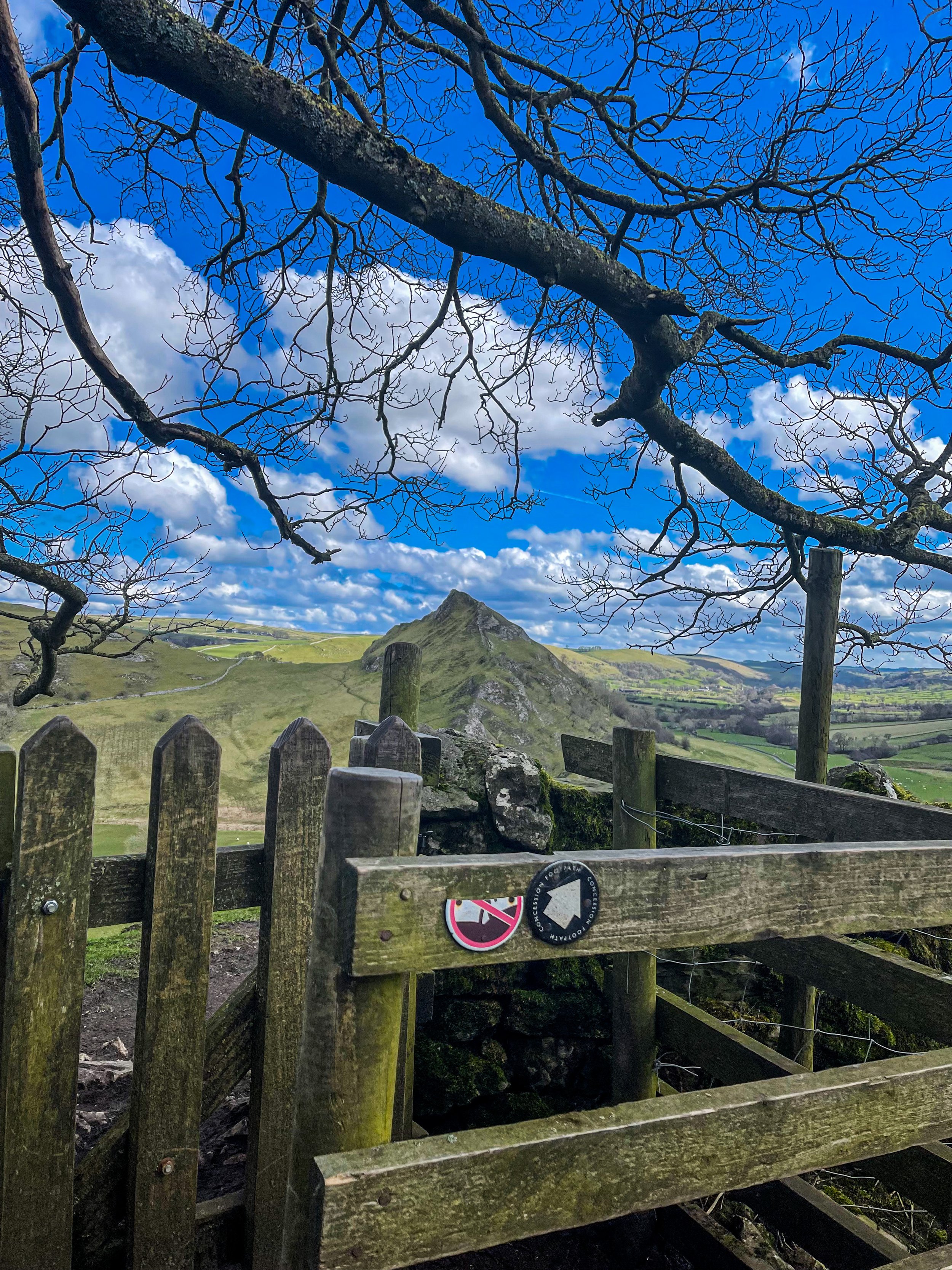
Starting and finishing in the pretty hamlet of Hollinsclough, this walk has it all: magnificent views across the Staffordshire and Peak District wilds, paths criss-crossed with ancient stone walls, and summits galore… taking you through the breath-taking landscapes of the famous Dragon’s Back over the tops of Chrome Hill (424m), before meandering back up Parkhouse Hill (360m).
From here, you descend through untouched farmland and idyllic country lanes to make the return back to Hollinsclough.
With challenging terrain in places, our route to the summit of Parkhouse Hill should only be taken on if you’re confident at scrambling. There’s free street parking in the village but spaces are limited to so plan ahead if you’re arriving by car.

The views of the landscapes surrounding are sure to take your breath away at every part of this route. But the real highlight for us came in the form of a wonderfully idyllic pitstop, The Honesty Shop.
This perfectly stocked café-come-hut-come-shop has all your refuel needs covered, with hot drinks, sweet treats and fresh local produce aplenty. The Honesty Shop has no staff and relies solely on the good nature of passers-by to do the right thing - a comforting reminder that we were far away from the hustle of the city.

The walk can be shorted by cutting out the final ascent over Parkhouse Hill or extended by following your nose to the summit of High Wheeldon.

Another option is to start at The Quiet Woman pub in Earl Sterndale, not far from Buxton. Unsurprisingly, the many routes surrounding the limestone reef knolls of Chrome and Parkhouse Hills make for magnificent views throughout.


WINTER HILL AND RIVINGTON PIKE CIRCULAR
Enjoy this short ascent up to two iconic Lancashire landmarks

Start: Rivington Hall Car Park, Bolton, BL6 7SD
Distance: 6.15 miles
Duration: 2-3 hours
Elevation: 1,300 feet
Navigation: follow our route here
This Lancashire walk takes you to two incredible viewpoints in one route. You begin your ascent up to Winter Hill via Rivington Country Park, taking you 1,496 feet high up to the summit.
While there are a variety of routes to choose from, our favourite is this 6 mile walk which takes in arguable the best views and scenery across Bolton, Wigan and the West Pennines Moors.
After a brisk hike from Rivington Pike you'll soon approach Winter Hill, which reaches an elevation of 1,496 feet. The views from here are nothing short of breathtaking, especially during the winter months when the landscape is adorned with a pristine layer of snow. The panoramic vista extends as far as the eye can see, with the city of Manchester on one side and the rolling hills of Lancashire on the other.

What is Winter Hill?
After reaching the almost dystopian summit of Winter Hill, you may be left thinking “what on earth is this place?”. I know we certainly were.
While the reality of Winter Hill is a little less glamorous than my imagination led me to believe, the transmitting station is a working broadcasting and telecommunications site and is responsible for bringing you all your favourite local TV channels.

Rivington
Just over the border between Greater Manchester and Lancashire, Rivington is a magical landscape where mysterious ruins are nestled between magnificent reservoirs, moor tops and woodland aplenty.
It’s a place that’s packed with wholesome things to do, whether that’s exploring Rivington Terraced Gardens or going on an aerial adventure at Go Ape. The area is so stunning it was even dubbed "the Little Lake District” by the Victorians.

good-to-knows
amenities
The pike snack shack
You’ll pass this quaint little coffee shop at the base of Rivington Pike, offering a selection of hot and cold beverages and snacks.
Location: Rivington Pike Cottage, Horwich, Bolton, BL6 6RU
The Tea Room at Rivington
For a delightful cup of tea and some light bites, visit "The Tea Room at Rivington," nestled in a picturesque spot near Rivington Hall Barn.
Location: Rivington Hall Barn, Rivington Lane, Rivington, Bolton, BL6 7SB
The Rivington PUB and grill
Before or after your hike, stop by "The Rivington," a charming pub near Rivington Pike known for its cosy atmosphere and hearty fare.
Location: Rivington Lane, Horwich, Bolton, BL6 7SB
GO APE
Located close to Bolton and only 30-minutes from Manchester, Go Ape Rivington features exhilarating 13-metre-high platforms, beautiful country views and a zip wire over the reservoir.
Location: Great House Barn, Rivington, Horwich, BL6 7SB
Parking Options
Rivington Pike Car Park
Location: Rivington Pike Car Park, Rivington Lane, Horwich, Bolton, BL6 7SB
Public Transport
If you prefer or require to travel via public transport, you can reach Rivington Pike and Winter Hill by bus or train:
Bus:
The 125 and 575 bus routes have stops near Rivington Pike.
Check the latest bus schedules and routes to plan your journey.
Train:
Take a train to Horwich Parkway station.
From there, you can catch a bus or even walk to Rivington Pike.

Fancy giving it a go? Follow our route here

WINNATS PASS AND ODIN MINE WALK
One of the best Peak District walks just a short drive from Manchester

Start: Castleton Visitor Centre, S33 8WN
Distance: 5.02 miles
Elevation: 900 feet
Duration: allow approx. 2 hours
Navigation: follow the route here

This walk takes you high above Winnats Pass and around Castleton, meaning you can take in this amazing Peak District village from all angles. The start of the route leans towards the challenging side, taking you up a steep and rocky path straight up to Winnats Pass, so consider if this one’s for you before heading out.

The first ascent is steep with scrambling required. Thankfully, a kind soul has left a climbers rope tied to a gate post which gives you all the leverage you need. We’ve been meaning to give this one a go for a while, and it didn’t disappoint.
The route starts near Castleton Visitor Centre where you’ll find a shop, cafe and toilets… among a gorgeous array of nearby pubs, eateries and cafes.
The car park is pay and display, but there’s street parking available nearby (be aware these fill up quickly during peak hours, so we recommend getting down early).

Once atop Winnats Pass, you’ll follow a trail that leads close to the boundary wall and takes you along the top of the pass. Be sure to stop and take in the views on this part of the walk, we were blown away watching the tiny cars winding their way through the Way.
From here, you’ll head along a footpath in the direction of Mam Tor, before taking a detour to Odin Mine: a disused mine thought to be in use since around 1260. The landscape surrounding makes for great exploring, leading you to the collapsed road constructed beneath Mam Tor.

Once you reach Treak Cliff Cavern, look out for signs that tell you about the history of the area. Winnats Pass and the surrounding environment was once under a tropical sea, making the site protected by law due to the many fossils of sea creatures which lived here over 350 million years ago.
The valley was created by melting glaciers which gradually dissolved, creating streams which flowed through and under cracks in the rock. One of these streams created a large underground cave system which eventually collapsed, leaving Winnats Pass you see today!

With so much to see in such a short walk, this is undoubtedly one of our favourite walks when visiting Derbyshire.
Fancy giving it a go? Follow the walk here

GIDDY EDGE WALK
Walk on the wild side along Matlock’s ‘Giddy Egde’

Take on a whirlwind adventure through the heart-stopping heights of Giddy Edge on High Tor in Matlock, while also indulging in the romance of Lover's Walk in Matlock Bath. Prepare to have your adrenaline pumping and your heartstrings tugged as we explore these two enchanting highlights in one route.

Start: Matlock Town Centre, DE4
Distance: 5.41 miles
Duration: 2.5 hours
Elevation: 1,175 feet
Navigation: follow the route here

Giddy Edge, High Tor

Giddy Edge… the name alone sends shivers down your spine! This exhilarating path is not for the faint of heart, but for the adventurous souls seeking an adrenaline rush — this one’s for you. As you walk along the narrow cliff edge, take in the awe-inspiring panoramic views of the Derbyshire Dales and don't forget to capture those Instagram-worthy moments!
Along the way, keep an eye out for the famed rock formations, including the legendary "Cromford Tooth." Rumor has it that touching it brings good luck, but be cautious, for superstitions and precipices don't always mix well!
Lover's Walk, Matlock Bath

Now that you've conquered Giddy Edge, it's time to shift gears and embrace the romantic ambiance of Lover's Walk in Matlock Bath. This picturesque riverside path, flanked by lush greenery, is perfect for lovebirds or anyone seeking a moment of tranquility. The charming Victorian-style lampposts transport you back in time… but if you’re after a post hike snack, the nearby Greggs should bring you back to 2023 in no time.
Attractions not to miss during your visit:
Heights of Abraham
After your adrenaline-fuelled adventure along Giddy Edge, make your way to the Heights of Abraham. This unique hilltop park offers cable car rides that will sweep you up into the clouds, providing breathtaking views of the surrounding countryside. It's a perfect opportunity to catch your breath and marvel at the beauty of Matlock below.
Matlock Bath Aquarium
For those fascinated by marine life, a visit to the Matlock Bath Aquarium is a must. Immerse yourself in the captivating world beneath the waves and explore an array of exotic species. From vibrant tropical fish to mesmerizing jellyfish, this aquatic adventure will leave you in awe.
The Fishpond Pub
Walking can make even the hardiest adventurer thirsty, so be sure to stop by The Fishpond Pub. Nestled in the heart of Matlock Bath, this charming establishment serves up a delightful selection of local ales, craft beers, and refreshing beverages. Unwind in their cosy beer garden or warm up by the crackling fireplace on colder days. Cheers to a well-deserved break!

Ready to brave Giddy Egde? Follow the route here

SANDSTONE TRAIL CIRCULAR
An exhilarating walk exploring two of Cheshire’s most northerly hillforts…

Start: Frodsham Hill Car Park, WA6 6BG
Distance: 4.42 miles
Duration: 2 hours
Elevation: 400 feet
Navigation: follow our route here

Good to knows
Parking at Helsby Hill is limited (around 7-8 spaces!), however there is ample street parking surrounding the starting point.
Facilities are limited on this route… but its remote and unassuming location makes the trip worth it.
Want to make a proper day of it? Why not catch the train? Extend the route a mere mile or so, and you can follow this route straight from Frodsham train station. The train from MCR to Frodsham is 45 minutes direct.

We’ve been meaning to take on the Sandstone Trail for a while… and even though we may have only just scratched the surface with this short loop, it’s safe to say the beauty of the area didn’t disappoint.
The Sandstone Trail is a 34 mile long distance path where the views are stunning, the hills are rolling, and the rocks are seriously cool. (Yes, we did just say that).
We decided to pick the trail up in the historic market town of Frodsham, where the path meanders through ancient woodland (and even an ancient hill fort or two).

But that’s not where this route begins.
Starting at Helsby Hill, we took a rare moment to pause at Frodsham Memorial — a somber yet striking tribute to the brave souls who lost their lives in service. Erected in 1920, the memorial serves as a reminder of the sacrifices made by those who fought in World War 1 and subsequent conflicts.

With a renewed appreciation for the sacrifices of our armed forces — as well as a lingering sadness for those living in parts of the world affected by war — we shook off the moment of reflection to set off on the Sandstone Trail, a winding path that crisscrosses through the rugged terrain of the Cheshire countryside. As we navigated the rocky hills atop the hidden woodland, we marveled at the natural beauty of the area, with its rolling hills, vibrant wildflowers, and sprawling vistas.

Next, we headed for Woodhouse Hill, near the southern end of the Sandstone Trail, where there was once a hill fort, probably dating back to the Iron Age. It can be hard to discern the remains now, but if it’s history you’re after from this trip, you won’t be disappointed by the area’s mystical past.
Along the way, you’ll find pathways that once hosted scenes of battles, hangings and hauntings from countless centuries of British history. As for the fort atop Woodhouse Hill? Current thinking suggests the hilltops were probably first enclosed in the Neolithic era (around 6,000 years ago) to mark them out as special places, before becoming a place of defence and attack in the Bronze age.

With its rich history, stunning architecture, and natural beauty, Frodsham itself is a hidden gem that's just waiting to be discovered.
The town's history can be traced back to the 12th century, when the Normans built a castle on the hill overlooking the River Mersey. Over the centuries, Frodsham grew into a bustling market town, and its strategic location made it an important center of trade and commerce.
Today, Frodsham retains much of its historic charm, with a number of well-preserved buildings and landmarks that harken back to its storied past. But perhaps the most striking feature of Frodsham is its natural beauty. The town is situated on the edge of the stunning Cheshire countryside, providing countless opportunities for outdoor exploration and adventure… that’s what drew us here, after all!

Another natural wonder is Upton’s Cave, the last landmark on our short loop. Of all the caves on the Sandstone Ridge, Upton's Caves are associated with the most stories and legends although they are barely remembered today. Sadly, the area is a popular one, and graffiti and litter tends to be the result. That said, the history of this place isn’t to be scoffed at… it just needs a little more imagination to truly envisage how integral this place once was to society… allbeit a little tainted by our modern civilisaiton.

Fancy heading for the hills? Follow our route here

ETHEROW TO WERNETH LOOP
Discover Greater Manchester’s best hidden gems on this multiple-country park woodland walk

Start: Etherow Country Park, SK6 5DJ
Distance: 9 miles
Duration: 4 hours
Elevation: 1,500 feet
Navigation: follow the route here

Fancy experiencing all the seasons in one day?
Well, you're in luck, because this walk from Etherow Country Park to Werneth Low Country Park and confused mid-winter weather is what Great Manchester does best.
But don’t worry, with stunning scenery throughout and a dash of history thrown in for good measure, this walk is guaranteed to be a crowd-pleaser.

Our journey begins at Etherow Country Park — one of Britain’s first country parks. With 240 acres of greenspace, this place has an abundance of wildlife… and a waterfall you don’t want to miss!
But don't get too distracted by the fauna, because we've got a hill to climb. Yup, after a short stroll around the Keg Pool its time to climb up to Werneth Low Country Park.
Along the way, take a moment to catch your breath and admire the stunning panoramic view. Once atop The ‘Low, you’ll be quickly rewarded with immense views all across Manchester, the Peak District National Park, and the Cheshire Plain.

History buffs, we've got a couple of landmarks for you to check out. The first is the Werneth Low War Memorial, which was erected in 1921 to honor the soldiers who died in the First World War. It's a stunning monument, made of granite and topped with a bronze figure of a soldier.
After resting your legs and taking in the views, we make our way through the woodlands around Charlesworth and Broadbottom — each nothing short of idyllic. The trees are tall and imposing, the paths are winding and mysterious, and the wildlife is abundant. And if you’re up for a detour, the other landmark to check out is the Broadbottom Viaduct, which spans the valley between Broadbottom and Mottram.

Now, I know what you're thinking: a viaduct doesn't exactly sound like the most thrilling pit stop in the world. But trust me, this one is a real beauty. It was built in 1842, it's made of brick, and it has 27 arches. If you're an aspiring artist or photographer, this is the perfect spot to flex your creative muscles.
So, there we have it: a string of local country parks in one gorgeous route.
As local routes go, this one is a true belter.

Ready to follow along? Follow the route here

GOYT DAM
Panoramic views, magical woodlands and peaceful picnic spots are just some of the reasons you’ll want to head to Goyt Valley

Start: Whaley Bridge, SK23 7LX
Distance: 7.71 miles
Elevation: 1,075 feet
Duration: 2-3 hours
Navigation: follow the route here

This relaxed Peak District walk is beautiful in any season, but the way the woods are painted with gorgeous auburn hues come late September should make this route appear high on your list of autumn woodland walks.
Lying just a few miles northwest of Buxton, The Goyt Valley is magical place — one that’s gained popularity from visitors since Victorian times.
Once a prosperous and industrious community, the signs of a time gone by are all but extinct, bar from the ruins of Errwood Hall. Back in 1937, the construction of Fernilee Reservoir completely changed this beauty spot’s landscape, but the area remains a wonderfully peaceful place to visit to this day.

Expect stunning views every way you turn, thanks to a unique landscape which was carved out by successive Ice Ages and the River Goyt. It’s the perfect location for a day of recharging your batteries, with the natural scenery and rolling hills surrounding making for a wonderfully soothing trip outdoors.

With free parking at many of the valley’s landmarks, enjoying a day’s stroll around Goyt Valley is easy — especially if you follow one of the waymarked routes starting from Errwood Car Park.
For us, though, the beauty of this trail starts not in the valley, but in nearby Whaley Bridge. Along the way, expect dense pinewoods and azalea bushes, ruins of worker cottages and even a shrine close to the ruins of an abandoned hall.

And if folklore is more your thing, local legend has it that a highwayman called Pym used to lay in wait to ambush those who used the old packhorse route, hence the name Pym Chair given to one of the peaks in this mesmerising landscape.

Fancy giving this one a go? Follow the route here

THORPE CLOUD
Gothic manors… idyllic tearooms… and a trig point to boot — this walk in Ashbourne has it all

Start: Blore Pastures Carpark, DE6 2BS
Distance: 5.49 miles
Duration: 2.5 hours
Elevation: 1,000 feet
Navigation: follow the route here

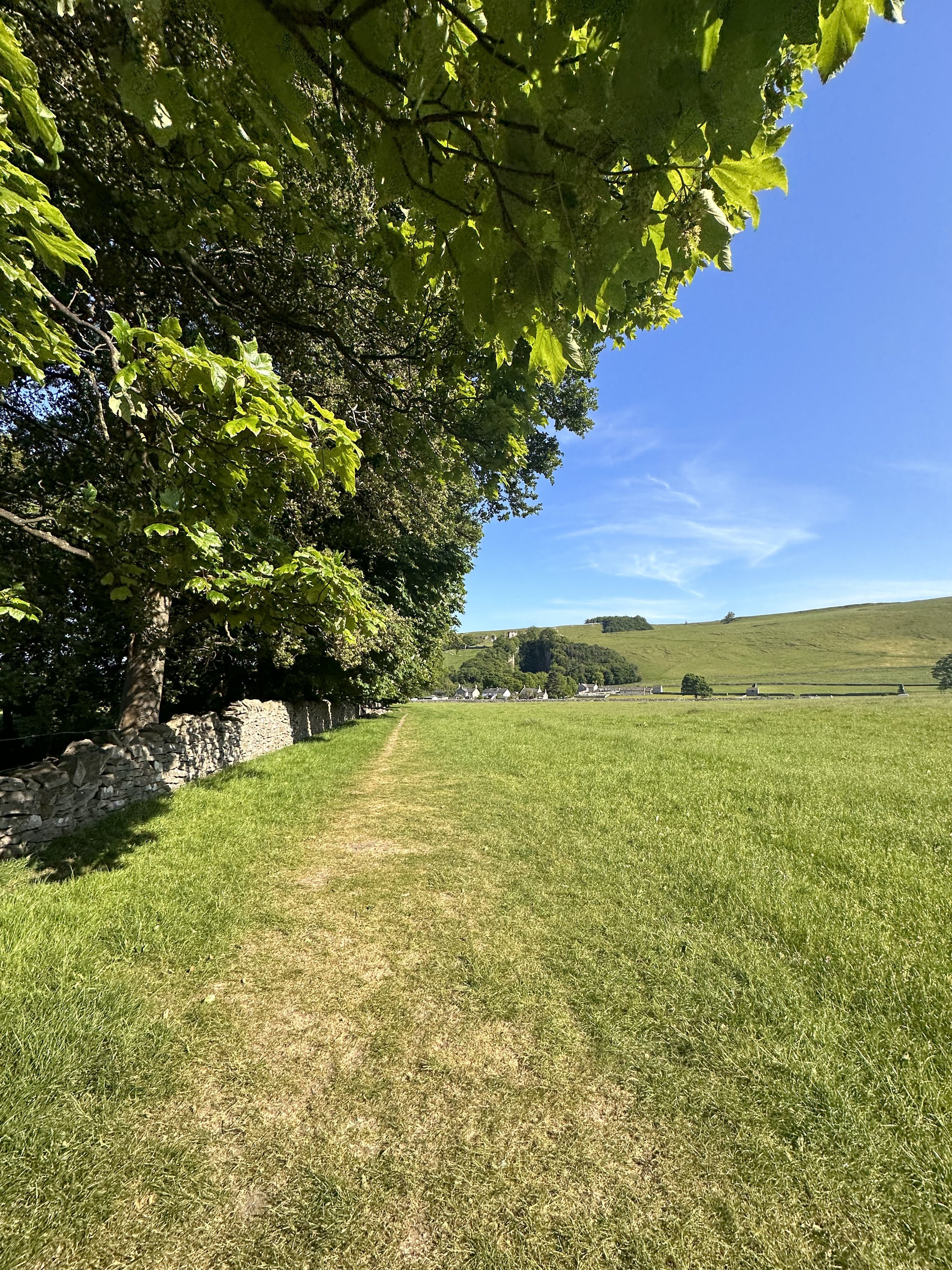
Whether you’re here for the stepping stones across the River Manifold, or fancy indulging in the history of this quaint town’s old manor house, a day trip to Ilam Park is always a good idea.
After a meander around Ilam Hall, our route takes you up Thorpe Cloud as you summit the hill for breathtaking views across the dale, and return home via the stepping stones across the River Dove.

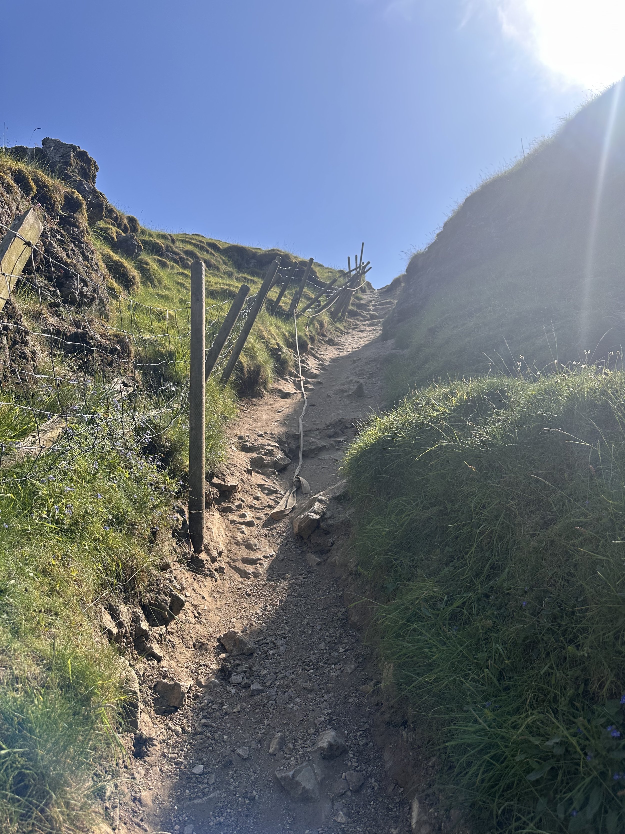
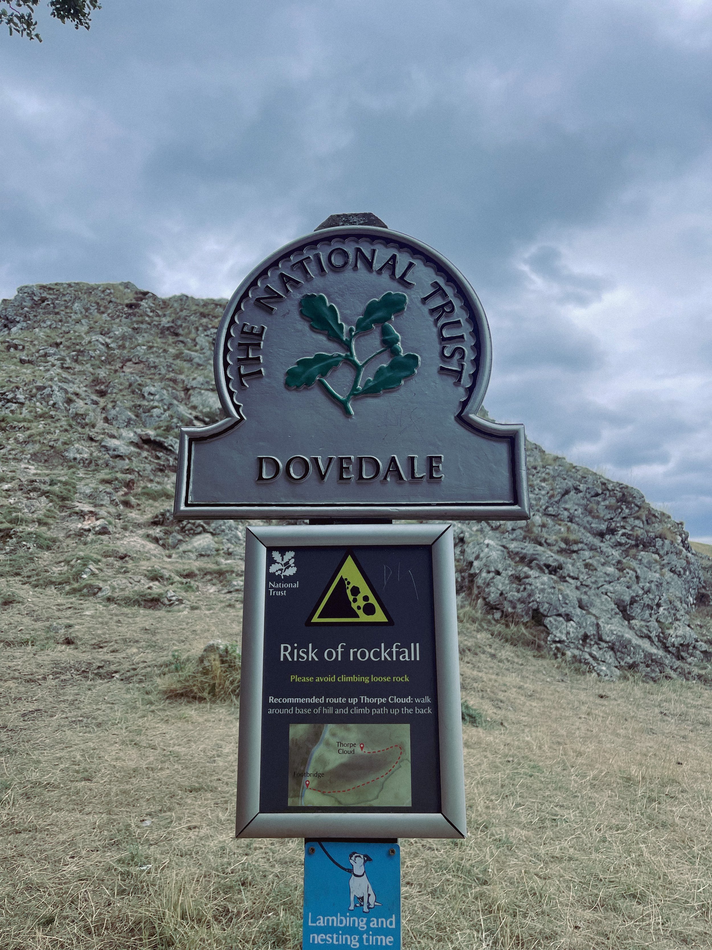
Thorpe Cloud is found in the White Peaks on the southern end of Dovedale — a gorgeous limestone hill that attracts thousands of visitors each year thanks to its unique shape and close proximity to Dovedale Stepping Stones.
The route up to the summit is easy-to-follow, navigated by blue markers on signposts. With some steep parts that’re a good challenge for beginners, the walk is short and sweet with plenty of options to extend if you’re feeling particularly energetic.
The Stepping Stones are a very popular Peak District attraction, so if you’re wanting to explore free from pedestrian traffic, we’d definitely recommend visiting off-peak if that’s an option for you.
That said, they’re a must-do Peak activity… and well worth the visit!

Grab yer hiking boots and follow one of our favourite Peak District walks here

LANTERN PIKE
A stunning stroll around Hayfield’s lesser populated countryside

Start: Sett Valley Trail Car Park, SK22 2JG
Distance: 7.63 miles
Elevation: 1,150 feet
Duration: 3.5 hours
Navigation: follow the route here

If you’re an avid hiker, we’re sure you’re no stranger to the Peak District ‘big one’, Kinder Scout. But have you ever traversed this village’s lesser known trails?
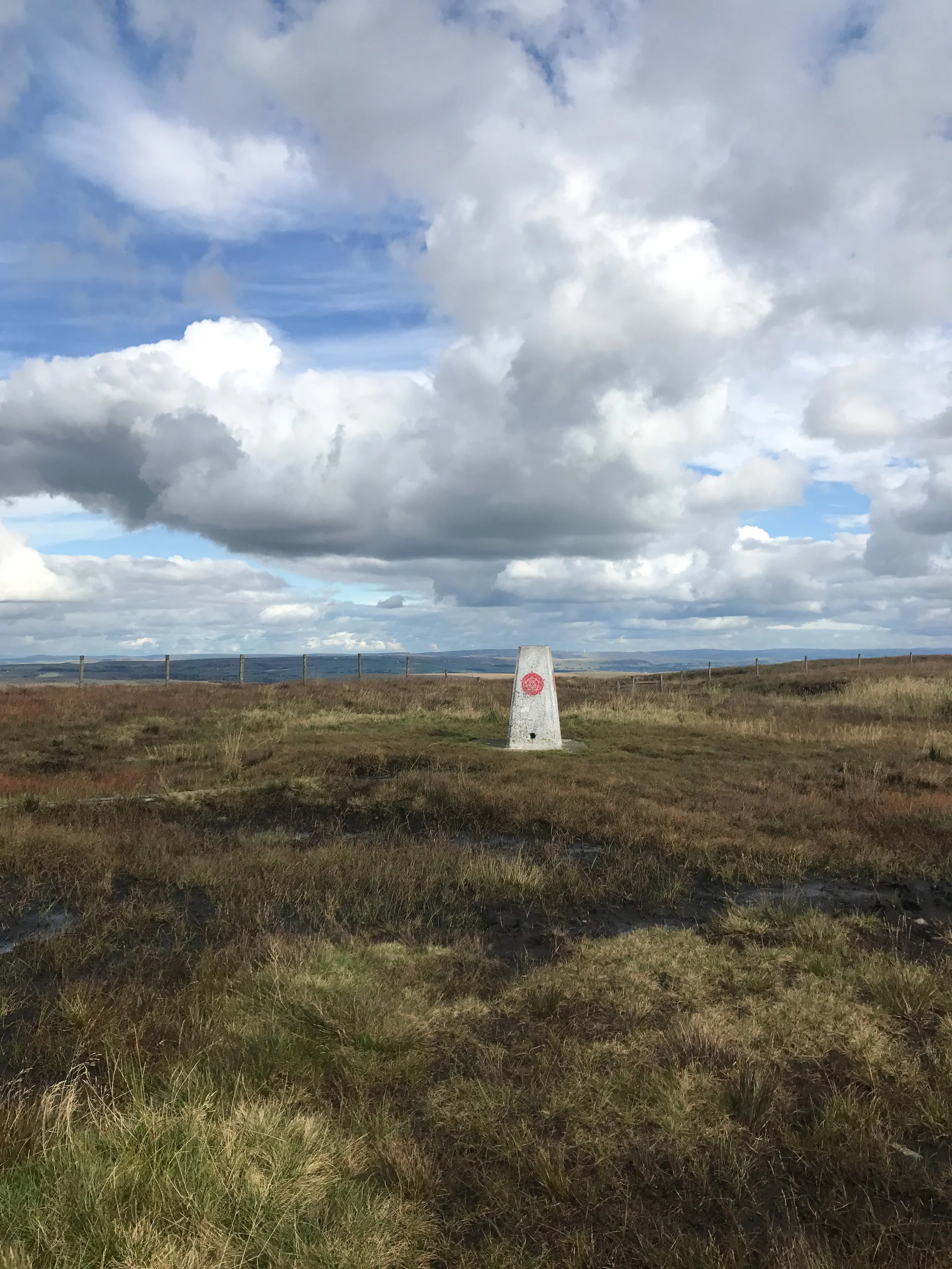
Starting on the Sett Valley Trail. this walk leads you up to the fallen trig point at Lantern Pike, finishing off at one of our favourite country pubs this side of the Pennines, The Little Mill.

As far as trig point routes go, this is a scenic one for sure. The start of the walk takes you along Birch Vale Reservoir along a tree-lined path that’s a haven for wildlife.
From here, you journey onwards to a short climb up towards the Pennine Bridleway where the lane narrows into a stony path just before the base of Lantern Pike. Once you’ve reached this point, it’s smooth sailing up to the rig point atop the summit.
And as for the views when you’ve reached the trig? You’ll instantly forget about the slog up to the summit — rewarded with insane, far-reaching views as far as the eye can see. Expect a patchwork of fields, heather moorland and the magnificence of towering neighbour, Kinder Scout.

Don’t fancy giving the trig challenge? Fear not, The Sett Valley Trail itself makes for an incredible Sunday Stroll with 2.5 miles of traffic-free scenery perfect for walkers and cyclists alike.
The trail follows a former railway line through the beauty of Derbyshire’s countryside, taking you along the Pennine Bridleway between Hayfield and Birch Vale.

And if you’re after ticking off a few trigs in one day, why not extend the walk to include nearby Harry Hut and Burnt Hill?
Or if you fancy following our shorter route, give it a go here!
KERRIDGE HILL LOOP
Discover the beauty of Cheshire from up above with one of the best walks near Greater Manchester

Start: Pool Bank Car Park (Free Parking), SK10 5PS
Distance: 6.88 miles
Duration: 2-3 hours
Elevation: 1,000 feet
Navigation: follow the route here

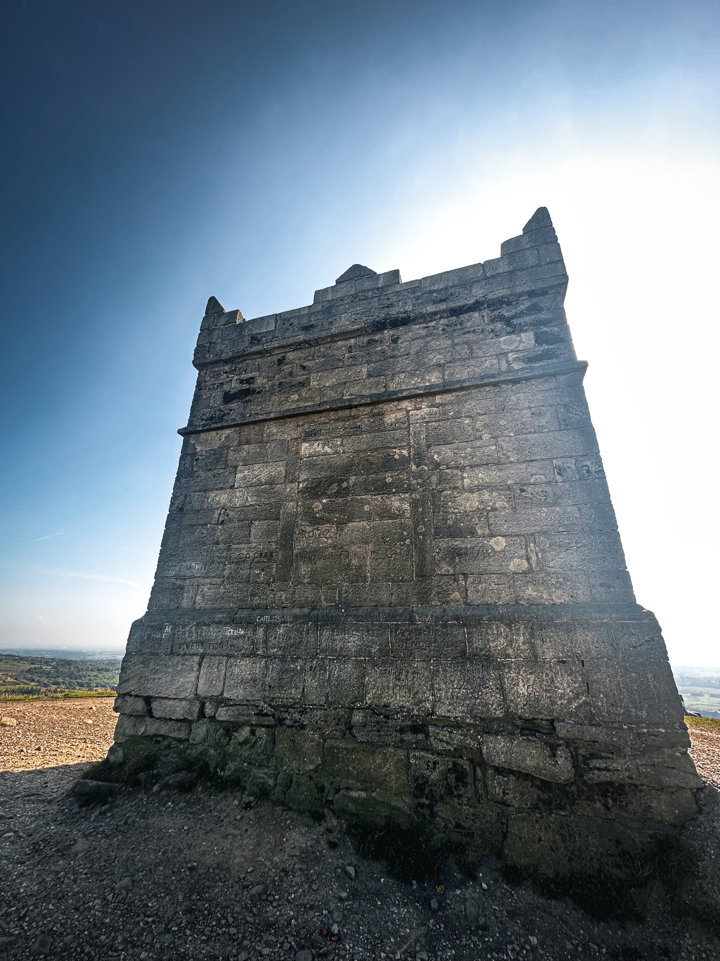
Looking for a bit of history on your next trip outdoors? Look no further than this uphill hike around the Cheshire countryside. Not only does this walk provide excellent views that sweep right across the surrounding area, but you’ll also pass White Nancy fairly early on — a memorial site atop Kerridge Hill, built to commemorate the victory of coalition forces at the Battle of Waterloo.

With its comically shaped physique, White Nancy isn’t your typical historical landmark. Thanks to its lofty position, the site White Nancy sits on had been used as a warning beacon of invasion for centuries, featuring other small structures before Nancy took up residence.
In 1817, the Gaskell family of Ingersley Hall built the structure you see today, in belated commemoration of the victory at Waterloo, 1815. Originally, White Nancy had a door and was used as a summerhouse, but was soon sealed off due to vandalism over the early 20th century.

Whether you’re here for the views or the stories of yesteryear, you’re sure to be taken aback by the undisturbed peacefulness of this route. On a clear day, you can see as far as Snowdonia, Liverpool’s coastal line and the windmills off the Wirral peninsula.

After admiring the views surrounding White Nancy, walking across Kerridge Hill is a must. The route’s quite steep in parts — but the views? So worth it.
So if you’re after a walk that offers incredible views every way you turn, make sure you stop by and see our Nancy soon. With multiple footpaths, woods and fields to explore nearby, you can easily extend this route into a full date out.

Fancy stopping by to see Nancy soon? Follow the route here
TEGG’S NOSE QUARRY
On the western border of the Peak District National Park lies a patchwork of wild woods, blossom-blanketed meadows, awe-inspiring reservoirs and high crags, making for one of the best circular walks in the Greater Manchester area

Start: Tegg’s Nose Country Park, SK11 0AP
Distance: 4.10 miles
Elevation: 525 feet
Duration: allow approx. 1.5 hours
Navigation: follow our route here

Just outside of Manchester, Tegg’s Nose Country Park represents a spectacular alternative to the Cheshire plain, with wild landscapes comprised of craggy hills, open moorland and dense forest.
Tap into your creative side and let your imagination run free as you meander along woodland paths. Mythological stories link the name Tegg’s Nose back to early Norse settlers — perfect for those wanting to feel like they’re half the world away… while being just down the road.

From the visitor centre, stone walls and sturdy barns add to the dramatic character of the steeply sided valleys as you set off on the trail towards the abandoned quarry. The car park provides an excellent base for numerous walks and throughout the year there are many events taking place at the visitor centre, check them out here.

The best part of this loop is the low-effort high-reward views you’ll be greeted with along the way. Despite the distance clocking up only 4 miles, you don’t have venture far to enjoy exhilarating views over the spectacular Cheshire Plain. On a clear day you may even see Liverpool’s cathedrals and Welsh hills beyond.

Situated on a number of old stone quarries, rock dominates the landscape here — with the industrial heritage of the site firmly on view as you trek across the many paths available.

While it may only be a short route, this trail offers incredible views over the beautiful Cheshire landscape that you just won’t find anywhere else. The route descends from Tegg’s Nose Country Park and skirts along the edge of Macclesfield Forest, offering you the best of both worlds.

For easy-to-follow navigation, head to our Komoot!
DRAGON’S BACK LOOP
Want to feel like you’ve spent the day in Middle Earth? This route’s for you.
Start: Hollinsclough, SK17 0RH
Distance: 5 miles
Ascent: 1,000 feet
Duration: allow approx. 2 hours
Navigation: follow step-by-step
Starting and finishing in the pretty hamlet of Hollinsclough, this walk has it all: magnificent views across the Staffordshire and Peak District wilds, paths criss-crossed with ancient stone walls, and summits galore… taking you through the breath-taking landscapes of the famous Dragon’s Back over the tops of Chrome Hill (424m), before meandering back up Parkhouse Hill (360m).
From here, you descend through untouched farmland and idyllic country lanes to make the return back to Hollinsclough.
With challenging terrain in places, our route to the summit of Parkhouse Hill should only be taken on if you’re confident at scrambling. There’s free street parking in the village but spaces are limited to so plan ahead if you’re arriving by car.
The views of the landscapes surrounding are sure to take your breath away at every part of this route. But the real highlight for us came in the form of a wonderfully idyllic pitstop, The Honesty Shop.
This perfectly stocked café-come-hut-come-shop has all your refuel needs covered, with hot drinks, sweet treats and fresh local produce aplenty. The Honesty Shop has no staff and relies solely on the good nature of passers-by to do the right thing - a comforting reminder that we were far away from the hustle of the city.
The walk can be shorted by cutting out the final ascent over Parkhouse Hill or extended by following your nose to the summit of High Wheeldon.
Another option is to start at The Quiet Woman pub in Earl Sterndale, not far from Buxton. Unsurprisingly, the many routes surrounding the limestone reef knolls of Chrome and Parkhouse Hills make for magnificent views throughout.
You can follow our route step-by-step here.
Fancy having a go? Tag us using #getlostmcr, we love seeing your wild adventures!
UPHILL CHALLENGES:


WALKS WITH WATERFALLS:


