ALL TRAILS
The Best Pub Walk Near Manchester: The Torrs Millennium Walkway & New Mills Circular
A spectacular 7-mile walk featuring riverside woodland, the iconic Torrs Millennium Walkway, peaceful canal paths, independent cafés and one of the best pubs in the Peak District.
Start: The Strines Nightingale (recommended), Strines Station or New Mills Central
Distance: 7.32 miles
,Elevation: 750 feet
Duration: 3 hours
Difficulty: Easy (non-technical paths, minimal elevation)
Navigation: Follow step-by-step on komoot, or download GPX file
About the route
If someone asked me to recommend the best pub walk near Manchester, this would be my answer every single time.
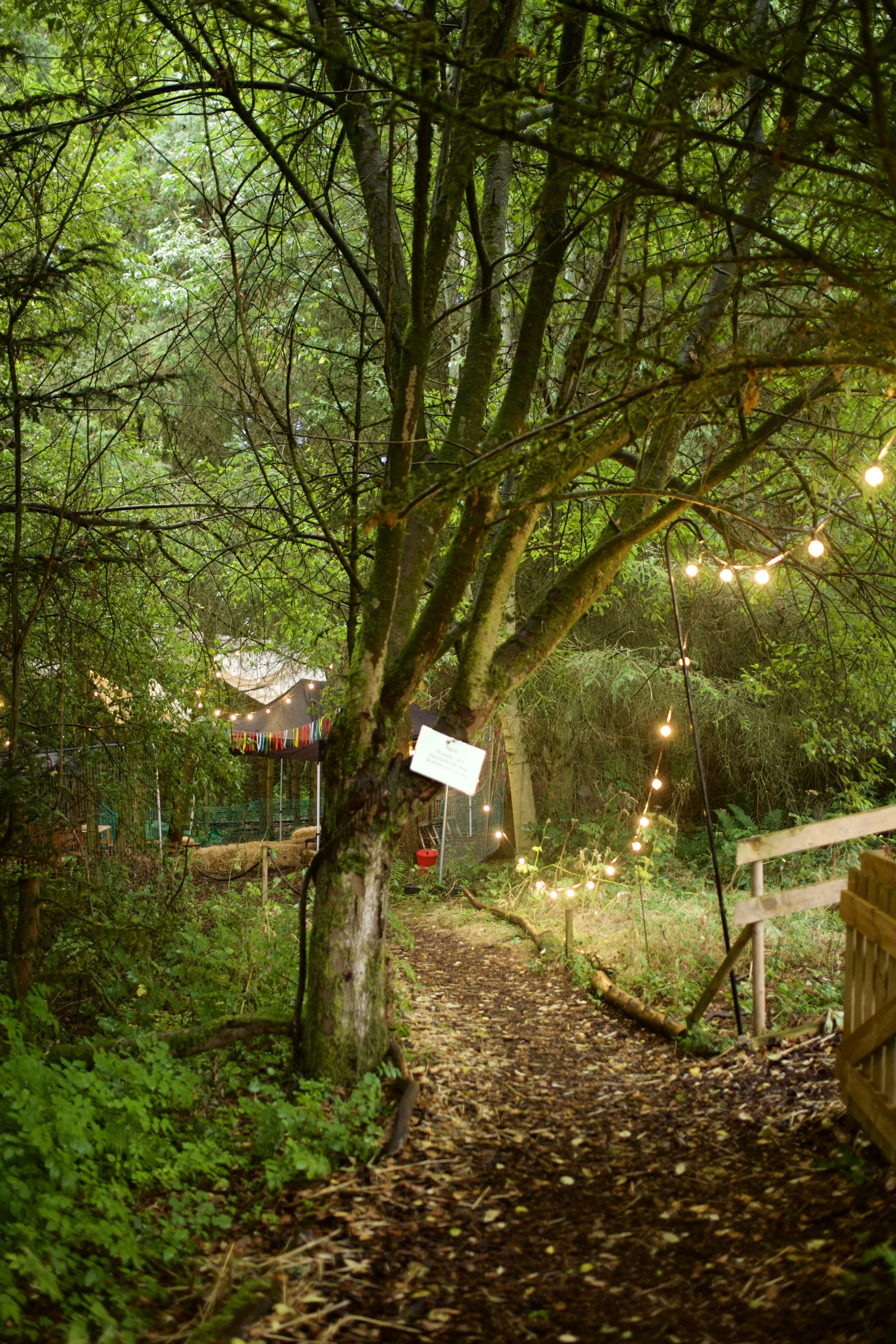
Starting at the dreamy Strines Nightingale pub, this 7-mile circular walk combines everything that makes a great day outdoors. Woodland trails, dramatic river gorges, historic mills, canal towpaths, independent cafés, brilliant pubs and one of the most impressive walkways in Britain—all within easy reach of Manchester.
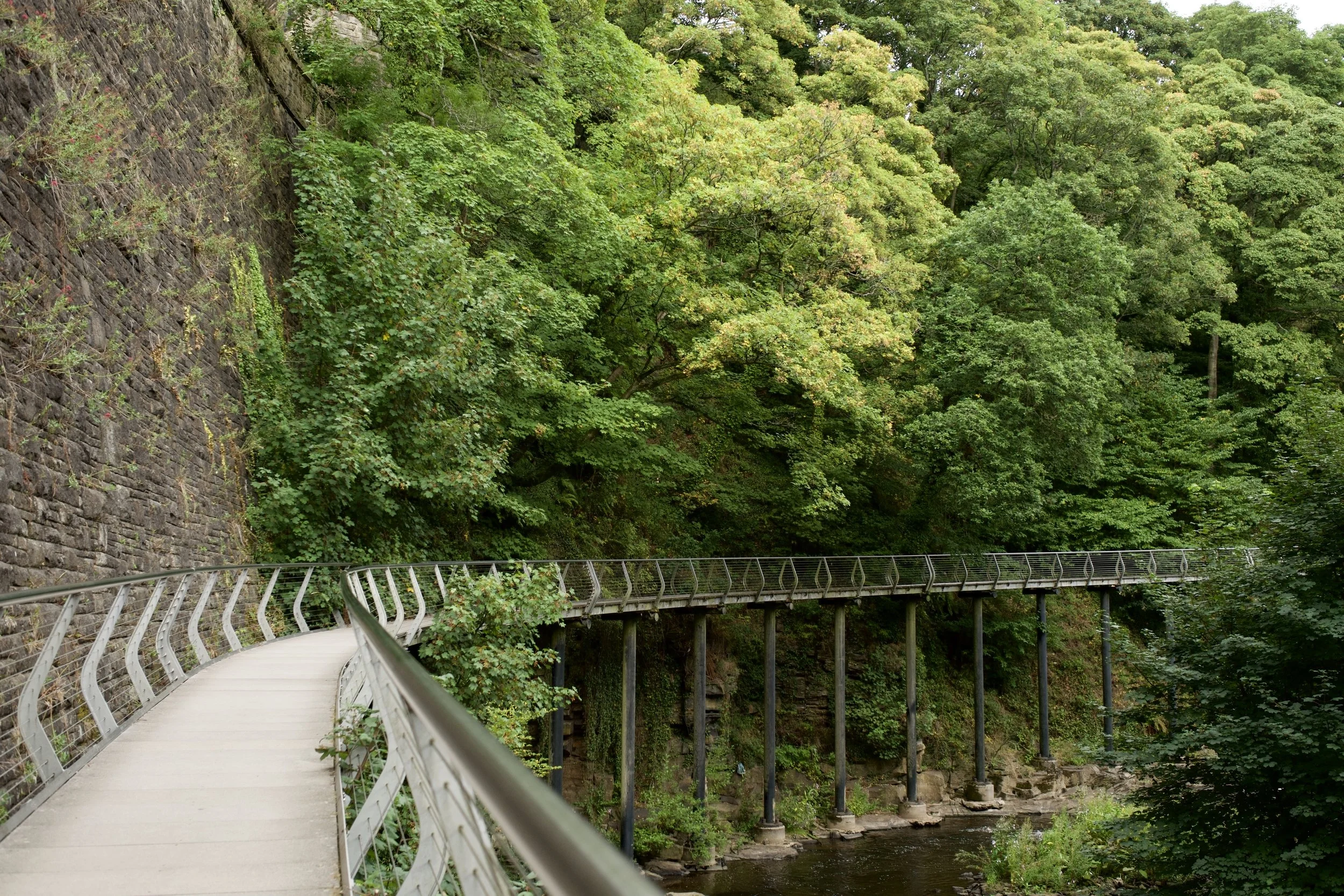
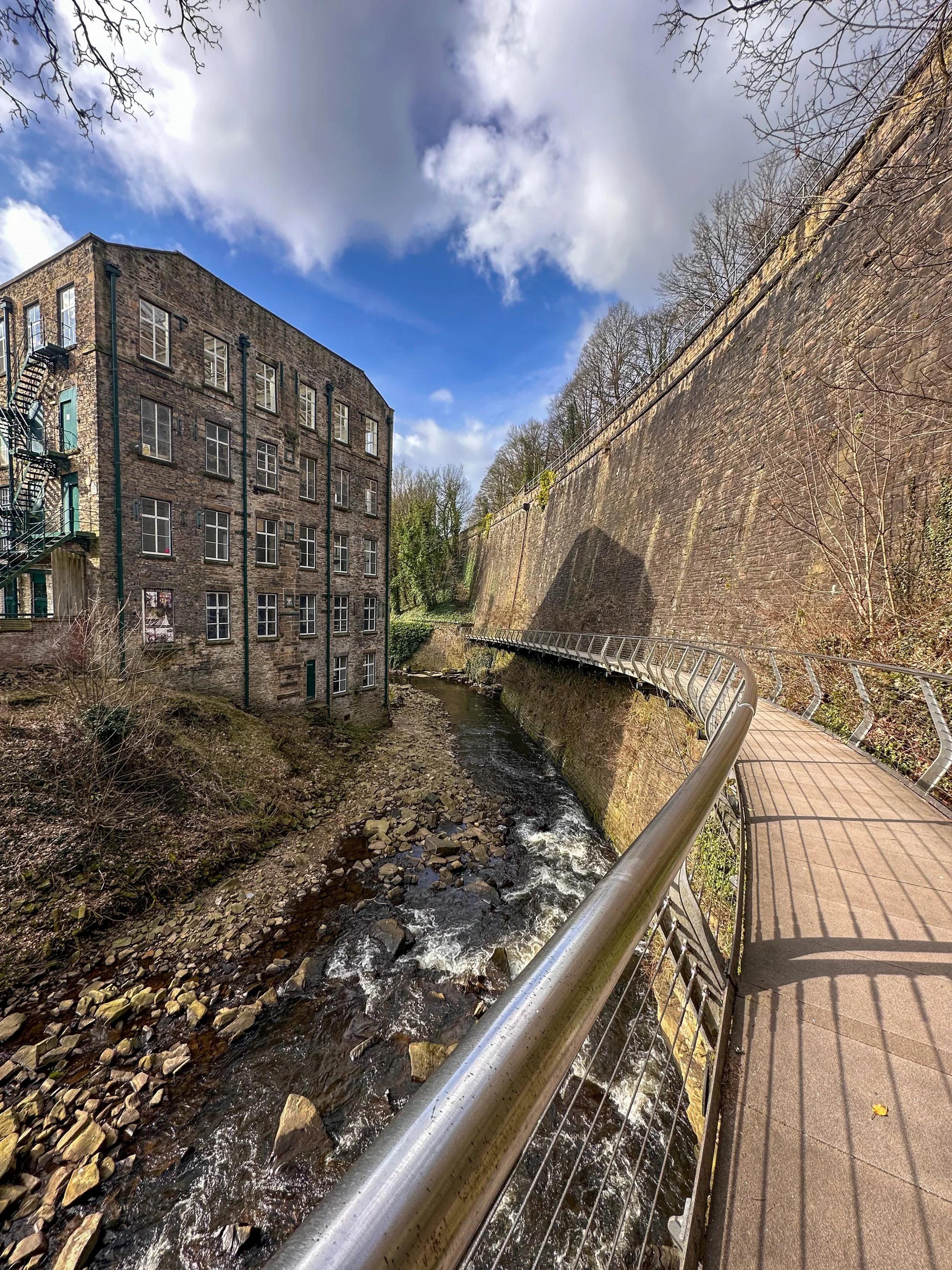
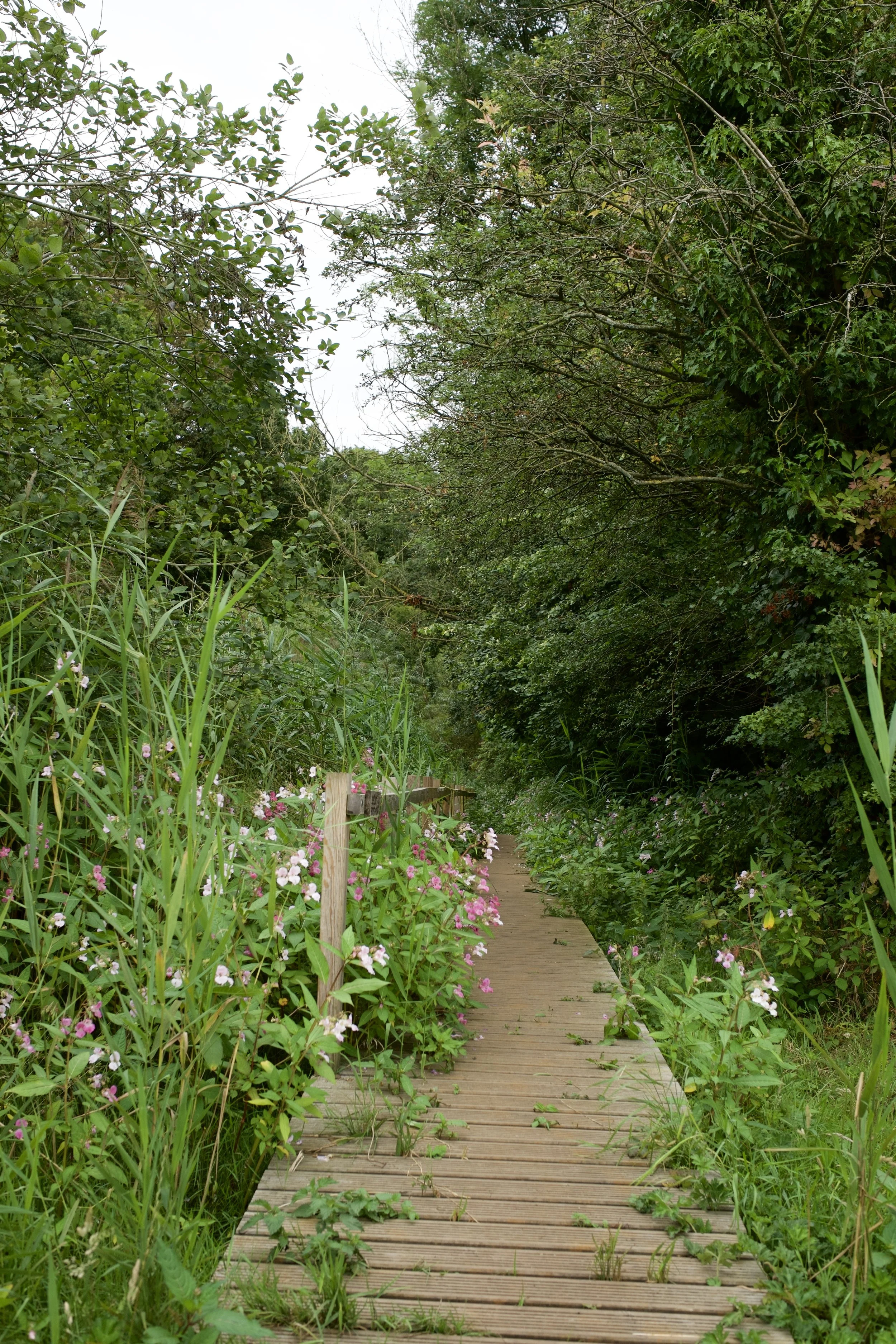
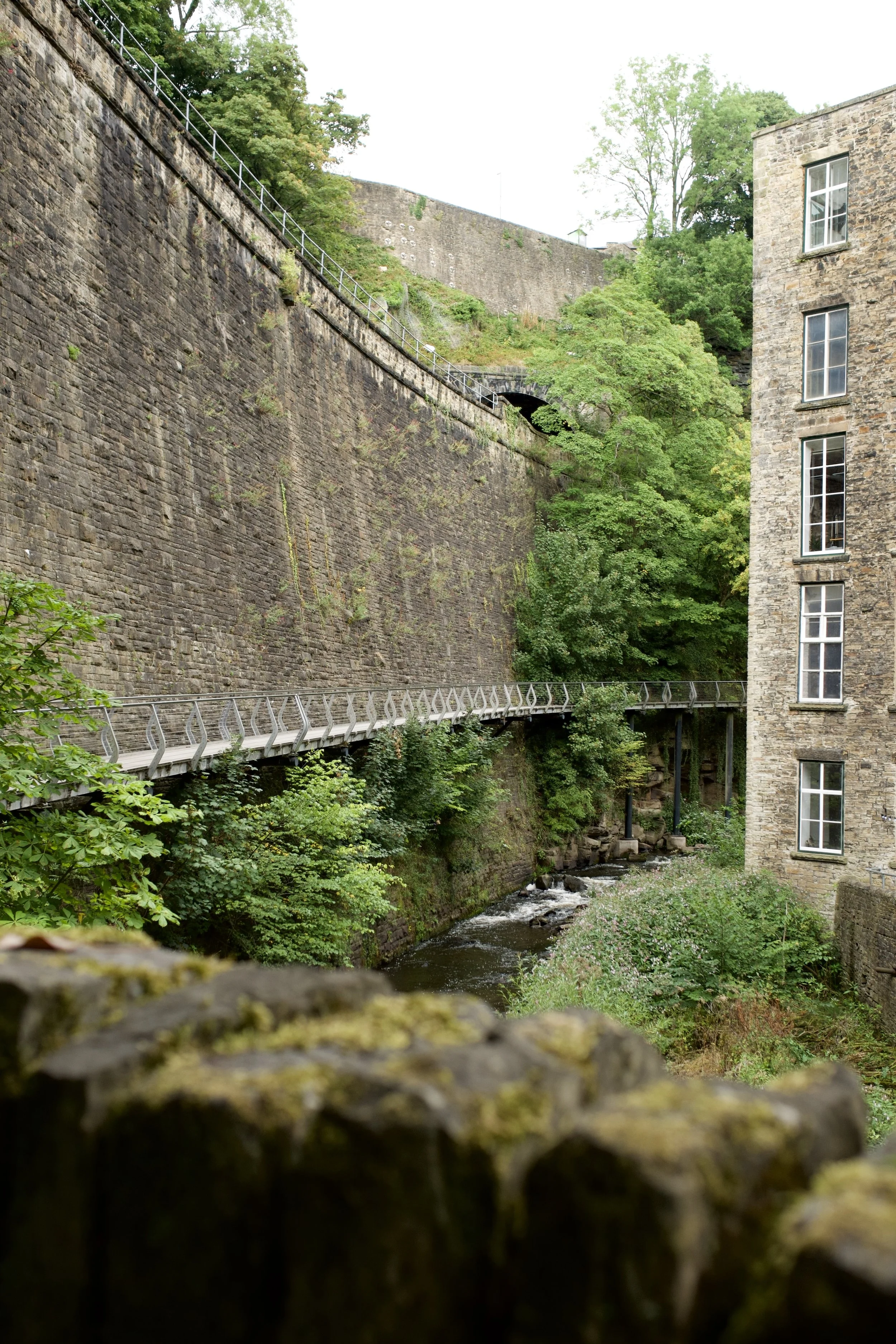
From Strines, the route heads into the vibrant town of New Mills, where you'll descend into the spectacular Torrs Gorge to cross the iconic Torrs Millennium Walkway. Suspended high above the River Goyt, the walkway offers an unforgettable perspective of the gorge below before leading you past the historic Torr Vale Mill and the community-owned Torrs Hydro scheme.
After exploring the Torrs, the walk slows the pace along the tranquil Peak Forest Canal, where colourful narrowboats, waterside wildlife and peaceful towpaths provide a complete contrast to the dramatic gorge you've just left behind.
One of my favourite things about this walk are all the many things you can see and do along the way. New Mills is packed with fantastic independent cafés, bakeries, pubs and little shops, making it somewhere you'll genuinely want to spend some time before heading back.
Finish where you started, back at The Strines Nightingale, for a well-earned pint within the woodland.
For me, it's one of the best day walks you can do within half an hour of Manchester.
Route difficulty: Easy
This isn't a particularly technical walk, but the distance and a handful of gradual climbs mean you'll want a reasonable level of fitness. Expect:
Woodland paths
Canal towpaths
Riverside trails
Some muddy sections after rain
A few steady climbs
Plenty of opportunities for food and drink stops
Route highlights
The Strines Nightingale – Quite possibly one of the best pub gardens near Manchester. Hidden amongst woodland beside the river, it's the perfect place to begin and end your walk. They regularly host outdoor woodland events, live music and seasonal gatherings, giving the place a magical atmosphere.
Torrs Millennium Walkway – One of Derbyshire's most impressive engineering projects. This striking steel walkway clings dramatically to the side of the gorge, suspended above the River Goyt, transforming what was once an inaccessible stretch of valley into one of the Peak District's most memorable walks.
Torr Vale Mill – One of Britain's oldest surviving textile mills, standing proudly above the gorge and offering a glimpse into New Mills' industrial past.
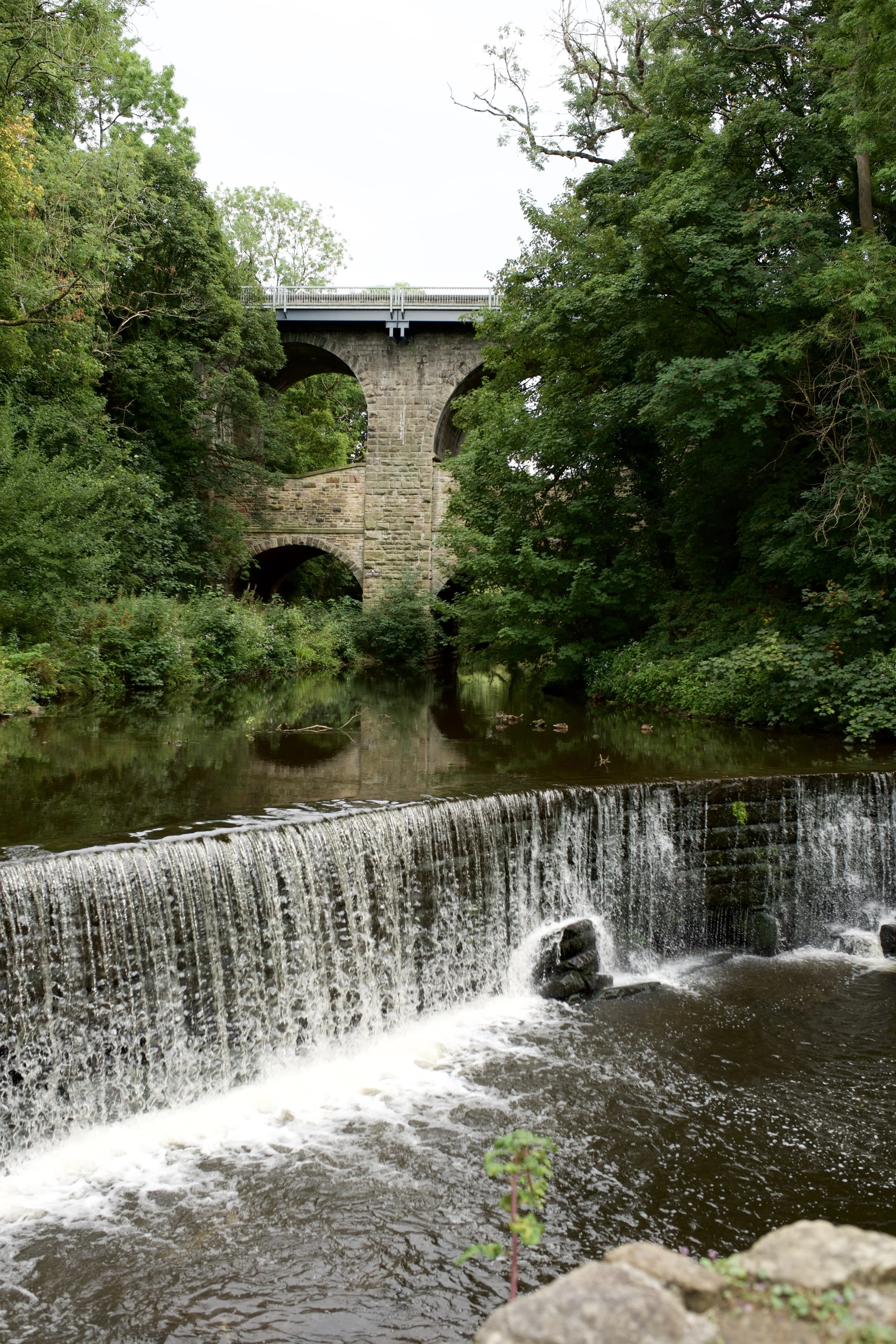
Torrs Hydro – The UK's first community-owned hydroelectric scheme, quietly generating renewable electricity using the same river that once powered the town's cotton mills.
Peak Forest Canal – Peaceful waterside walking, colourful narrowboats and plenty of wildlife make this one of the most relaxing sections of the route.
New Mills – One of Derbyshire's most underrated towns, filled with brilliant independent cafés, bakeries, pubs and quirky local shops.
The story behind the Torrs
This peaceful riverside park was once one of the busiest industrial landscapes in Derbyshire.
Around 200 years ago, the Rivers Sett and Goyt powered a collection of cotton mills that transformed New Mills into a thriving manufacturing town. Huge mills clung to the sides of the gorge while workers' cottages were stacked high above them, all connected by bridges, tunnels and steep cobbled tracks.
As the textile industry declined, many of the mills fell into ruin and the gorge became neglected for decades.
Thankfully, the local community recognised what an incredible place it was. Through years of restoration, the Torrs was transformed into what locals affectionately call "The Park Under the Town"—a beautiful green space where nature and industrial heritage now exist side by side.
The Millennium Walkway, completed in 1999, became the symbol of that regeneration. Curving around the sheer rock face above the river, it finally connected the two sides of the gorge and completed a missing section of the Midshires Way.
Just downstream, Torrs Hydro continues the story by once again harnessing the power of the river—this time to generate clean electricity for the local community.
Is this route for me?
This walk is ideal if you:
Love a proper pub walk
Enjoy varied scenery
Want somewhere easy to reach from Manchester
Appreciate industrial history
Like canal and riverside walking
Enjoy discovering independent cafés and shops
Fancy turning a walk into a full day out
Optional detour: Roman Lakes & Mellor Mill
If you've still got some energy left, or simply want to extend your day out, I'd highly recommend making the short detour to Roman Lakes.
Despite the name, the lakes aren't actually Roman. They were created in the late 18th century as mill ponds supplying water to Mellor Mill, once one of the largest cotton spinning mills in Europe, built by industrial pioneer Samuel Oldknow. Today, woodland trails wind past the lakes and through the remains of the old mill complex, creating one of the area's most fascinating hidden historical sites.
It's a peaceful place to explore and a brilliant add-on if you're interested in local history or fancy stretching the day out a little longer.
If you're short on time though, don't worry, the main route is already packed with enough highlights to make it one of the best walks near Manchester.
Where to eat and drink nearby
One of the biggest strengths of this route is just how many places there are to stop. My favourites:
The Strines Nightingale ⭐ (the perfect place to start and finish)
The Torr Vale Tap
The Beer Shed
The Pride of the Peaks
The Shrub Club
If coffee is more your thing, New Mills has a fantastic collection of independent cafés, bakeries and delis, making it well worth spending an hour exploring the town before heading home.
Getting to the starting point
By car
There are several options for starting this walk. My recommendation is to begin at The Strines Nightingale, where you'll be perfectly placed to enjoy a drink at the end of the walk. Alternatively, there are several public car parks in New Mills if you'd prefer to begin in the town itself.
By public transport
This is one of the easiest Peak District walks to reach without a car.
You can start from:
Strines Station
New Mills Central Station
Bus services stopping at The Strines Nightingale
Whether you're travelling from Manchester or Sheffield, public transport makes this a brilliant car-free adventure.
✔️ Good to knows
Difficulty: Easy-Moderate with a handful of steady climbs.
Footwear: Walking boots are recommended, especially after wet weather when woodland paths can become muddy.
Dog-friendly: Yes, although some sections pass through farmland so leads may be required.
Food & drink: Excellent throughout, with plenty of pubs, cafés and bakeries in New Mills as well as The Strines Nightingale at the start and finish.
Best time to visit: Beautiful all year round, but especially magical in autumn when the woodland surrounding the Torrs has its autumn coat on.
🧭 Following the route
I use komoot and OS Maps for offline navigation.
To follow this walk step-by-step, simply open the komoot route or download the GPX file and upload it to your preferred navigation app.
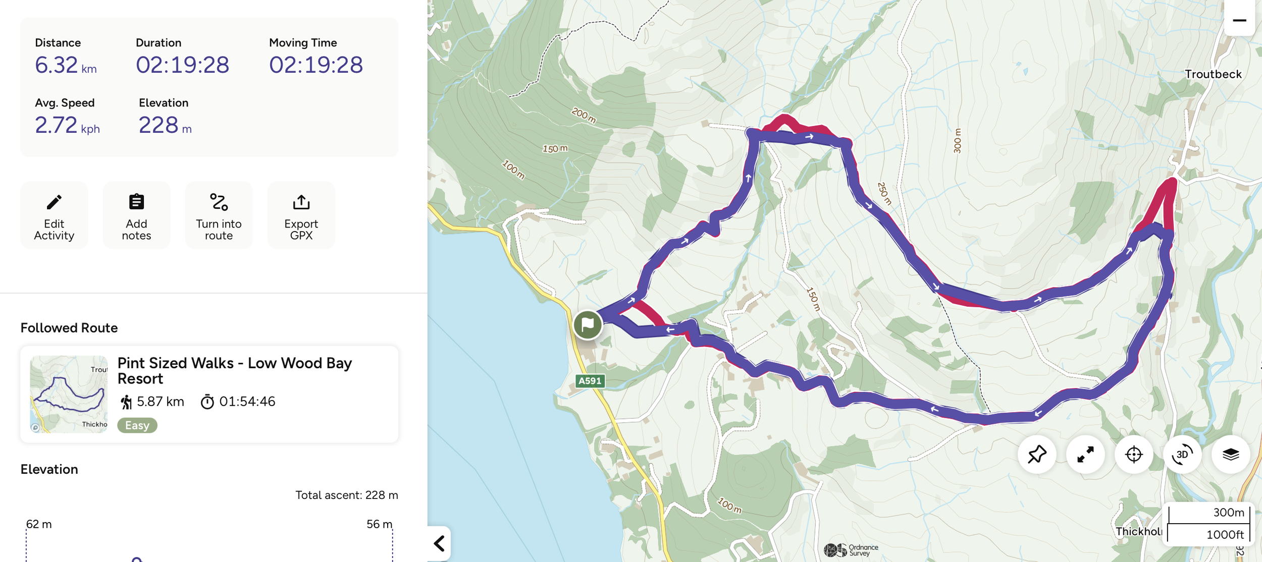
Low Wood Bay to Troutbeck Circular Walk: An Easy Pub Walk with Stunning Lake Views
An easy pub walk with stunning views of Windermere and cafe pitstops
Start: Low Wood Bay (free parking if eating in the pub)
Distance: 3.8 miles
,Elevation: 700 feet
Duration: 2 hours
Difficulty: Moderate (non-technical paths, some elevation)
Navigation: Follow step-by-step on OS Maps, or download GPX file
About the route
If you're anything like me, you'll know that not every great walk has to involve scaling a mountain. Sometimes, all you need is a couple of hours, incredible views and a great pub waiting at the end.
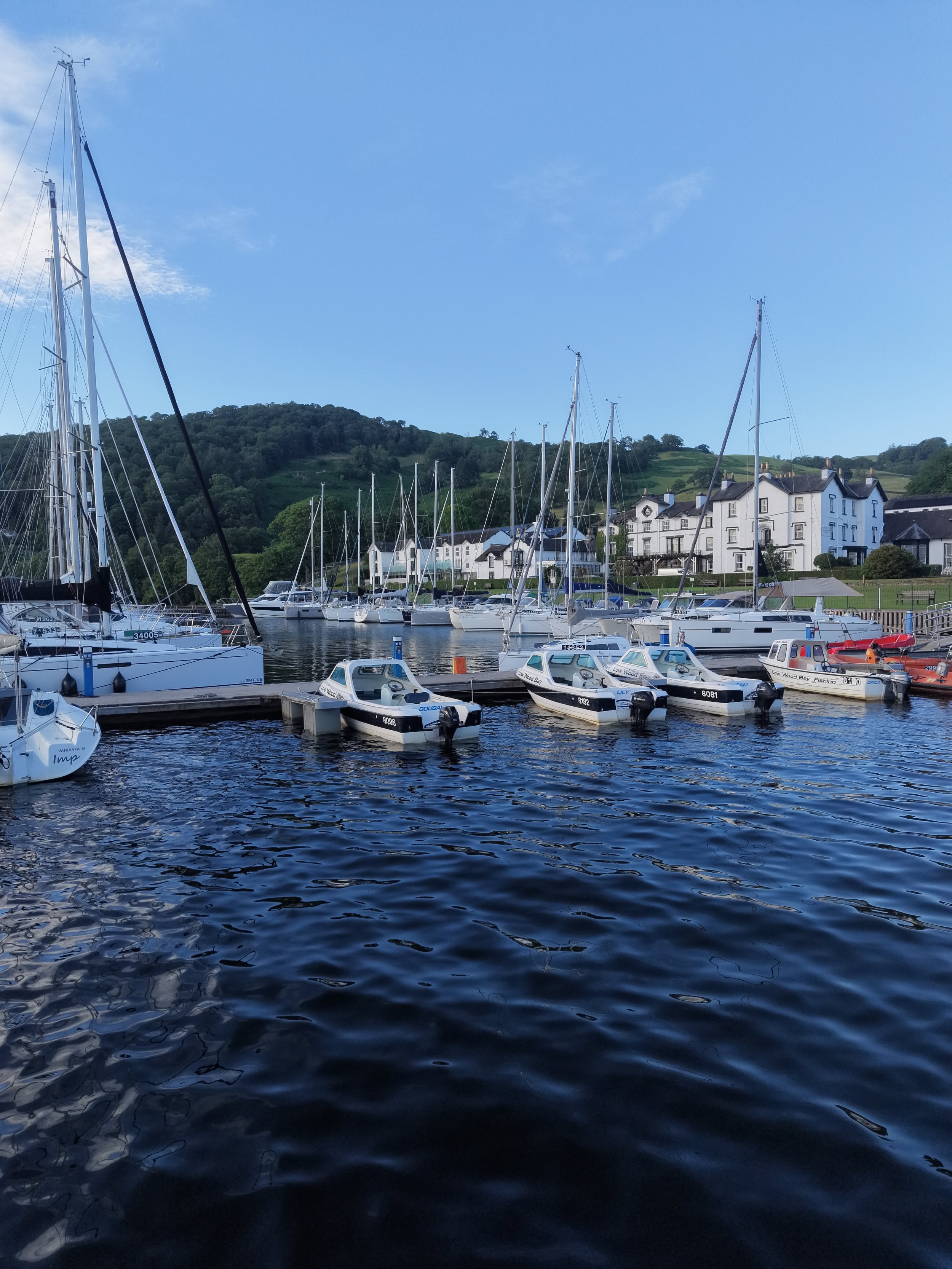
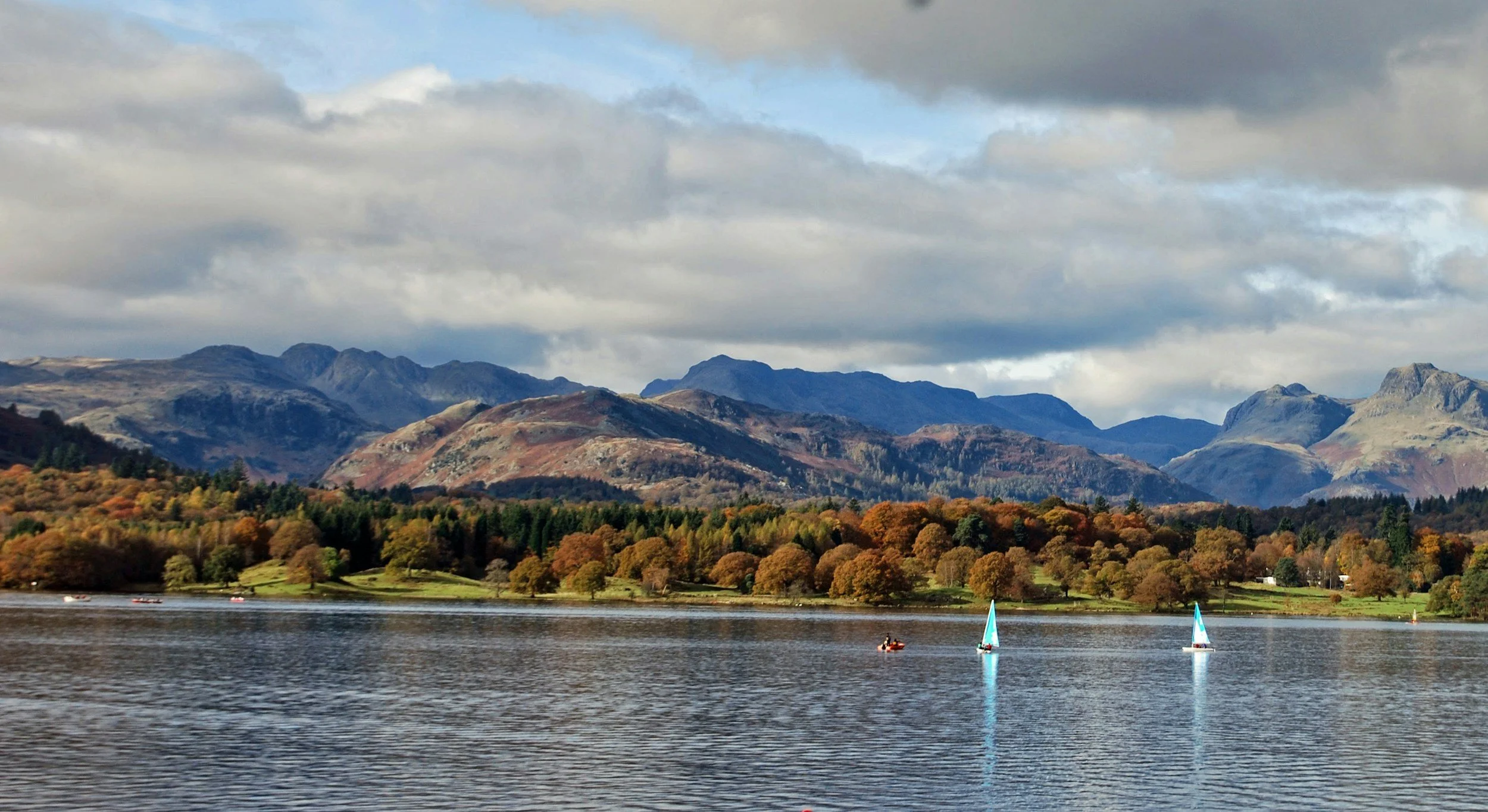
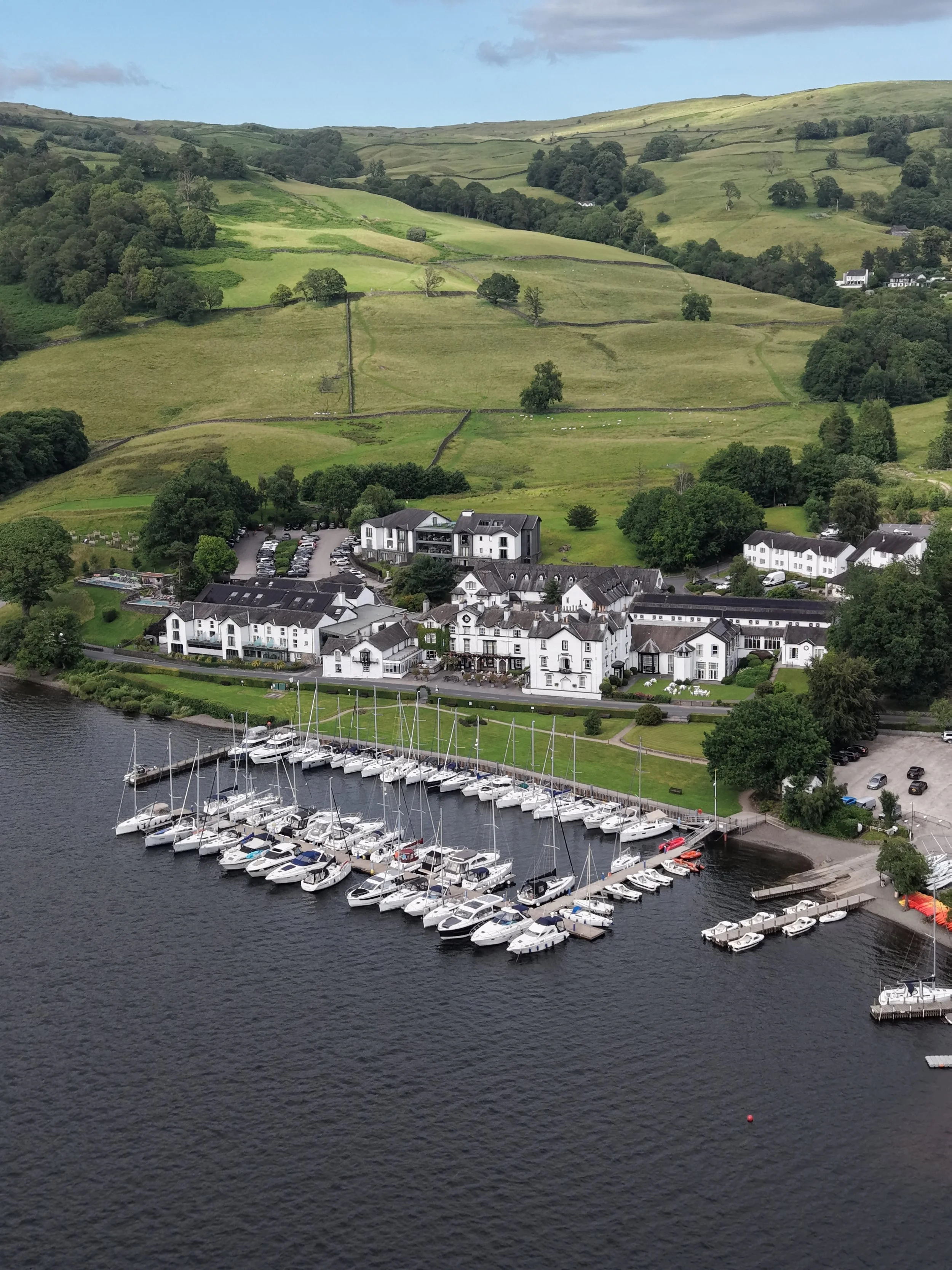
That's exactly what you'll get on this 3.7-mile circular walk from Low Wood Bay. Part of the Pint Sized Walks collection by Ordnance Survey and Thatchers, this route is proof that shorter walks can still deliver big on the views. Think stunning views over Windermere, a coffee stop in the charming village of Troutbeck, peaceful woodland trails alongside Hol Beck and a lakeside pub waiting for you at the finish.
If you're looking for an easy Lake District walk that ticks all the boxes, this one definitely deserves a spot on your list.
Route difficulty: Easy
This short pub walk is a brilliant option if you're looking for a gentler route in the Lake District.
Although there's around 700ft of elevation, it's spread gradually across the route, so there aren't any particularly steep climbs. Most of the paths are easy to walk, although they can become muddy after wet weather, so I'd recommend wearing walking boots or sturdy trail shoes.
Starting from Low Wood Bay, the route gently climbs above Windermere, where you'll be treated to beautiful views across the lake almost straight away.
Is this walk suitable for beginners?
Absolutely.
If you're new to hiking or simply don't fancy tackling one of the Lake District's bigger fells, this walk is a great alternative. You'll still enjoy some incredible scenery without committing to a full day's hike, following easy, non-technical paths, gradual ascents, and lots of places to stop and take in the views.
Route specifics
From here, you'll follow a mixture of quiet country lanes and grassy footpaths, with the scenery constantly changing between open countryside and breathtaking lake views. It's one of those walks where the effort is minimal, but the reward is huge.
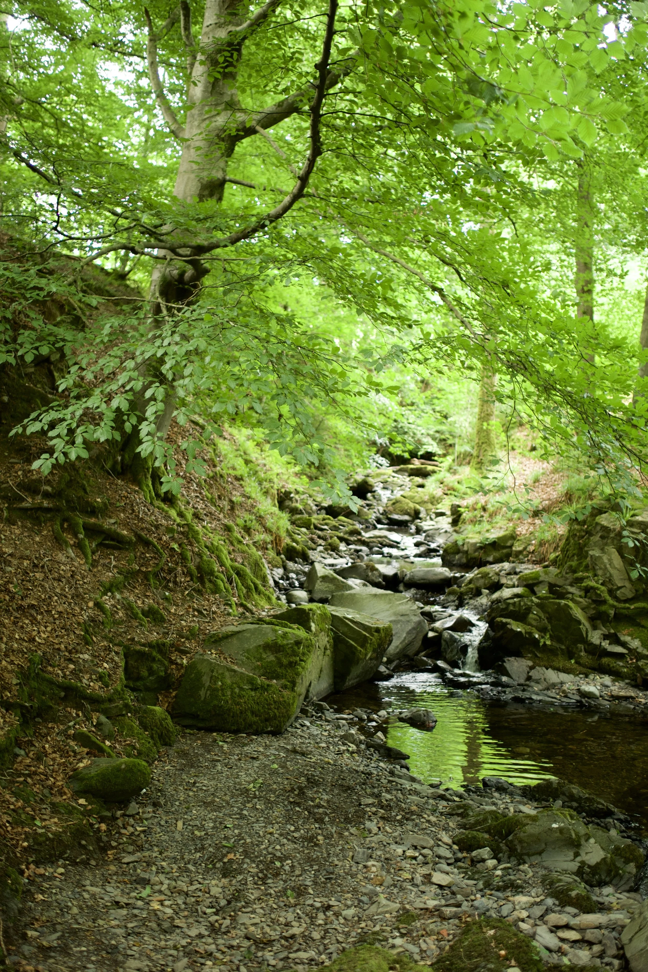
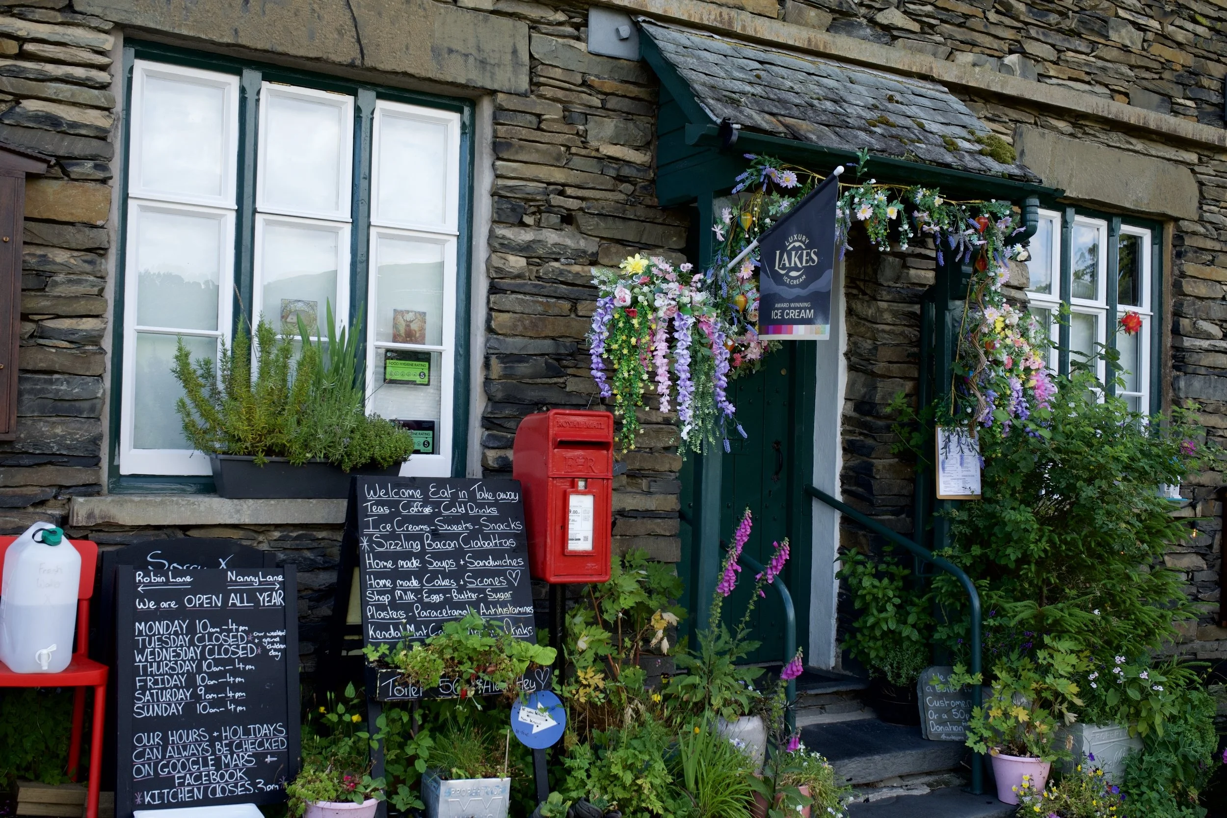
Around halfway round, you'll arrive in the picturesque village of Troutbeck. With its traditional stone cottages and cosy cafés, it's the perfect excuse to stop for a coffee and slice of cake before continuing your walk.
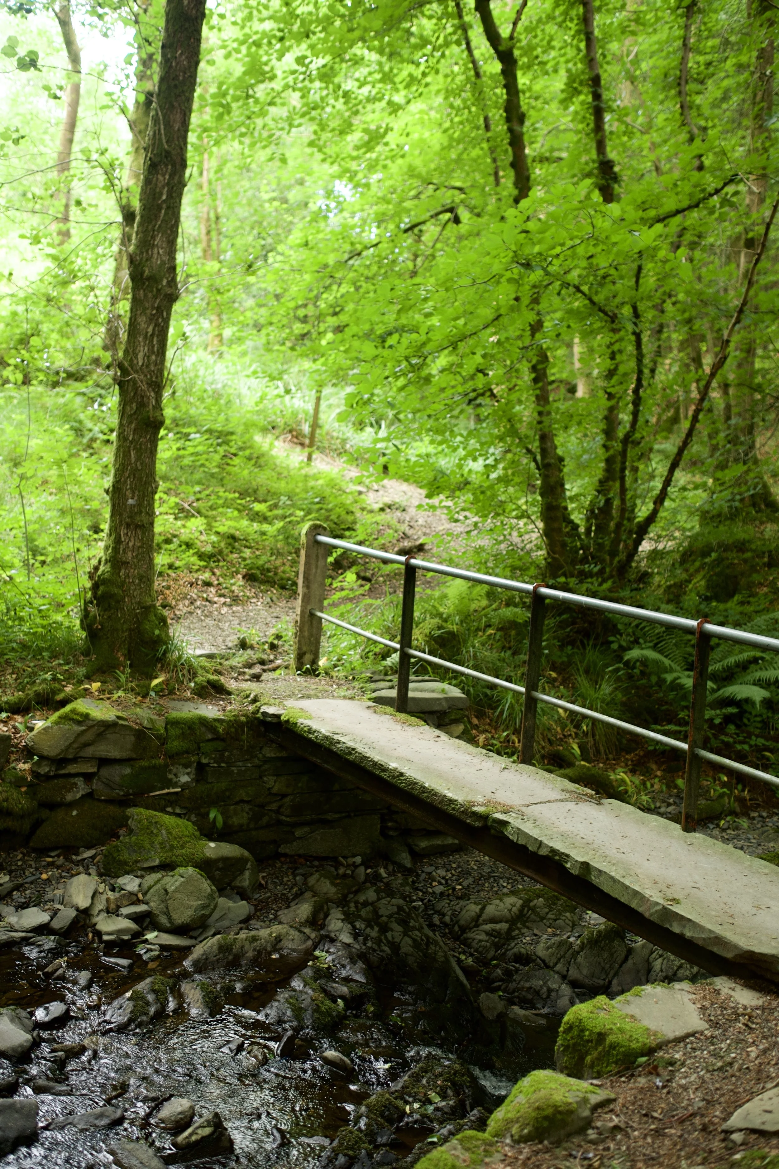
Leaving the village behind, the route heads into peaceful woodland alongside Hol Beck. The shady trails make a lovely contrast to the open views earlier in the walk, before leading you back towards the shores of Windermere.
Finish back at Low Wood Bay, where you can grab some food at one of the restaurants (or head to the cosy pub like we did), and enjoy an ice-cold Thatchers overlooking the lake. I can't think of a much better way to end a walk.
Route highlights
Incredible views across Windermere for much of the route
An easy walk that's suitable for most abilities
Coffee and cake stop in the beautiful village of Troutbeck
Peaceful woodland trails alongside Hol Beck
A lakeside pub waiting for you at the finish
When's the best time to do this walk?
This route is beautiful all year round.
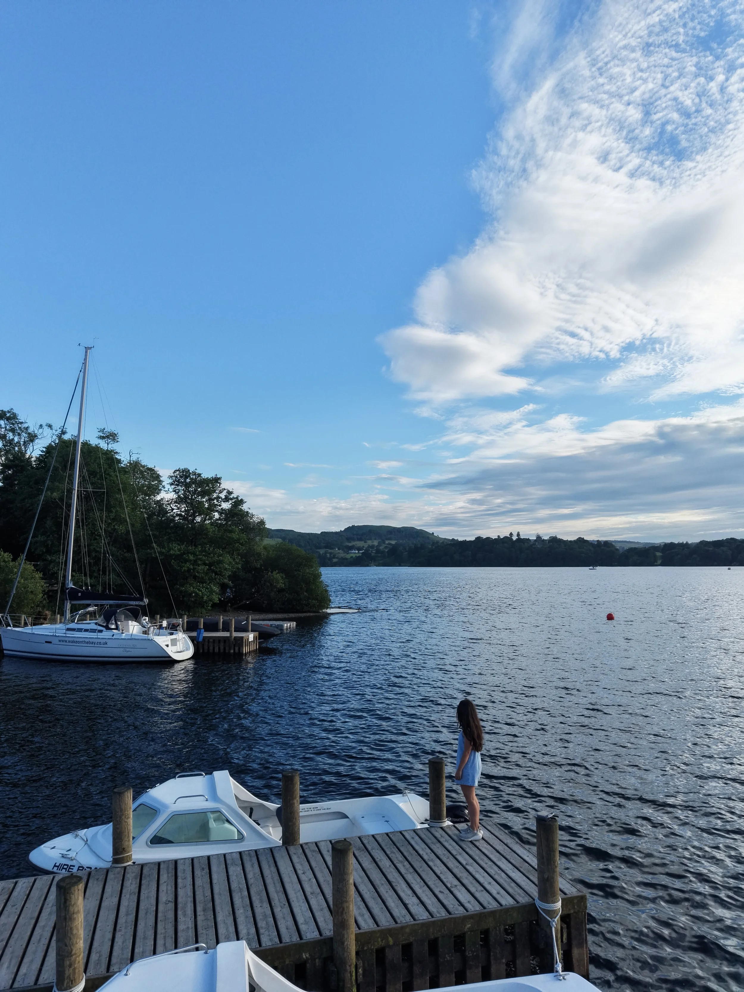
Visit in spring for fresh greenery, summer for long evenings overlooking Windermere, autumn for colourful woodland and winter for crisp, clear views across the lake.
For the quietest experience, I'd recommend heading out on a weekday or setting off early in the morning, or time with sunset for golden hour views across Windermere.
Is this route for me?
One of the best things about this route is that you get all the beauty of the Lake District without needing to tackle one of the area's bigger fells.
This walk is ideal if you:
Love beautiful lake views without a challenging climb
Enjoy stopping for coffee and cake in pretty villages
Are looking for a shorter walk that's easy to fit into your day
Like peaceful woodland trails and quiet countryside
Appreciate finishing a walk with a great pub and a well-earned pint
With just 700ft of elevation spread across 3.7 miles, it's suitable for most walkers with a reasonable level of fitness. The paths are generally easy to follow, although you'll encounter a mix of country lanes, grassy footpaths and woodland trails, which can become muddy after wet weather.
Things to do nearby
If you're making a day of it, there are plenty of other great places to explore nearby.
Explore Ambleside – Just a five-minute drive away, this bustling Lake District town is packed with independent shops, cafés and traditional pubs.
Visit Wray Castle – A beautiful lakeside Victorian castle with walking trails, picnic spots and stunning views across Windermere.
Walk to Stock Ghyll Force – One of the Lake District's most impressive waterfalls, just a short walk from the centre of Ambleside.
Hire a paddleboard or kayak – Head out onto Windermere and experience England's largest lake from the water.
Take a Windermere Lake Cruise – If you'd rather sit back and enjoy the scenery, hop aboard one of the lake cruises that run between Ambleside, Bowness and Lakeside.
Getting to the starting point
By car
The walk starts from Low Wood Bay Resort & Spa, located on the A591 between Ambleside and Windermere. It's around a 5-minute drive from Ambleside and 10 minutes from Windermere.
Parking is available at Low Wood Bay (free if you’re stopping for food), although it's worth checking availability during busy periods.
By public transport
The nearest train station is Windermere, with regular direct services from Manchester, Preston and Oxenholme Lake District.
From Windermere station, you can catch the 555, 599 or Stagecoach 6 bus towards Ambleside or Keswick, all of which stop close to Low Wood Bay. From the bus stop, it's just a short walk to the start of the route.
If you're already staying in Ambleside or Windermere, you can also reach Low Wood Bay on foot or by bus, making this an easy walk to enjoy without a car.
✔️ Good to knows
Distance: 3.7 miles
Allow around two hours, plus extra time for coffee or lunch.
Walking boots are recommended, especially after rain for the grass and wooded section.
Dogs are welcome but should be kept under close control around livestock.
Don't forget your camera – the Windermere views are worth it!
🧭 Following the route
Leave Low Wood Bay and follow the route uphill, where you'll soon be rewarded with panoramic views across Windermere.
Continue towards Troutbeck village, where it's well worth stopping for a coffee before following the trail alongside Hol Beck through peaceful woodland.
The final section leads you back to Low Wood Bay, where you can round off the walk with food and a drink overlooking the lake.
Discover more Pint Sized Walks
This walk is part of the Pint Sized Walks collection by Ordnance Survey and Thatchers – a series of shorter walks across the UK that finish at some of the country's best pubs.
Whether you've only got a couple of hours to spare or you're simply looking for a more relaxed adventure, the collection is packed with scenic routes that prove you don't have to walk all day to enjoy the great outdoors. Find your nearest here.

SCENIC LAKE DISTRICT WALK: EXPLORE CLAIFE VIEWING STATION AND WINDERMERE WEST SHORE
Experience the best of the Lake District on this easygoing walk, featuring serene lakeside views, fascinating historic landmarks, and charming local cafés.

Start: Ash Landing Car Park, LA22 0LU
Distance: 3 miles
Elevation: 425 feet
Duration: 1 hour
Difficulty: Easy (with some moderate sections)
Navigation: Follow step-by-step on komoot, or download GPX file
About the route
Looking for a relaxing yet picturesque walk in the Lake District? This 3-mile circular route starts at Ash Landing Car Park near popular Lake District landmark, Claife Viewing Station, before leading you along Windermere’s serene west shore. You’ll enjoy peaceful lake views, historical landmarks, and even have the chance to stop at some lovely cafés along the way.
Perfect for a short morning or afternoon adventure, the walk is mostly flat with gentle inclines, making it ideal for families, couples, and solo walkers.

Route difficulty
Walk type: Easy with gentle elevation.
Terrain: Well-maintained gravel and woodland paths.
Accessibility: Some areas may be unsuitable for wheelchairs or pushchairs.
Dog-Friendly: Yes, but dogs should be on leads near wildlife and busy areas.

Route highlights
Claife Viewing Station
Perched on a hill above Lake Windermere, this historic viewing platform dates back to the 18th century. The station offers panoramic views of Windermere, with colourful stained-glass panels that recreate how Victorian tourists once experienced the scenery.
Windermere West Shore
This tranquil lakeside path is a peaceful alternative to the busier eastern side of Windermere. With frequent benches along the way, it’s the perfect spot to pause and enjoy the views.
Joey's Café
Located near the Claife Viewing Station, Joey's Café serves up delicious coffee and cakes. It’s a great option for a pre-walk breakfast or a mid-route break.
Ferry House
At the end of the west shore path, you'll find Ferry House, the starting point for the historic Windermere Ferry crossing. From here, you can either return along the shore or extend your walk.
Caife Café
After completing your walk, reward yourself with a stop at Caife Café, offering locally sourced treats and excellent lakeside views.

Options to extend the route
Want to make it a longer adventure? Continue walking along the west shore to Wray Castle, adding approximately 4 miles (return) to your route. The additional walk remains relatively flat and offers more fantastic lakeside views, as well as the opportunity to explore the castle's grounds.
Getting to the starting point
By Car
Park at Ash Landing Car Park (LA22 0LU), located near the Claife Viewing Station. Parking charges apply.
By Public Transport
Take a train to Windermere, then catch a bus or taxi to the ferry terminal. From there, ride the Windermere Ferry across the lake and begin your walk at Ferry House.

✔️ Good to knows
Difficulty: Easy, suitable for all levels.
Footwear: Comfortable walking shoes.
Dog-Friendly: Dogs are welcome but must be on a lead in certain areas.
Food & Drink: Joey's Café and Caife Café are both fantastic options for a pre or mid-walk refuel.
Facilities: Public toilets available at Claife Viewing Station and Ferry House.
🧭 Following the route
I use komoot and OS Maps for offline navigation. To follow the full walk step-by-step on komoot, simply click this link here or download the GPX file and upload it to your chosen app, such as OS Maps.

MALHAM COVE, SHIRE
A magical route through the Yorkshire Dales — waterfalls, fairytale caves and insane views throughout
Looking for best walk in the Yorkshire Dales? Look no further…
Distance: 8.32 miles
Time: 2-4 hours
Ascent: 900 feet
Start: National Park Centre, Malham
Navigation link: follow the trail here
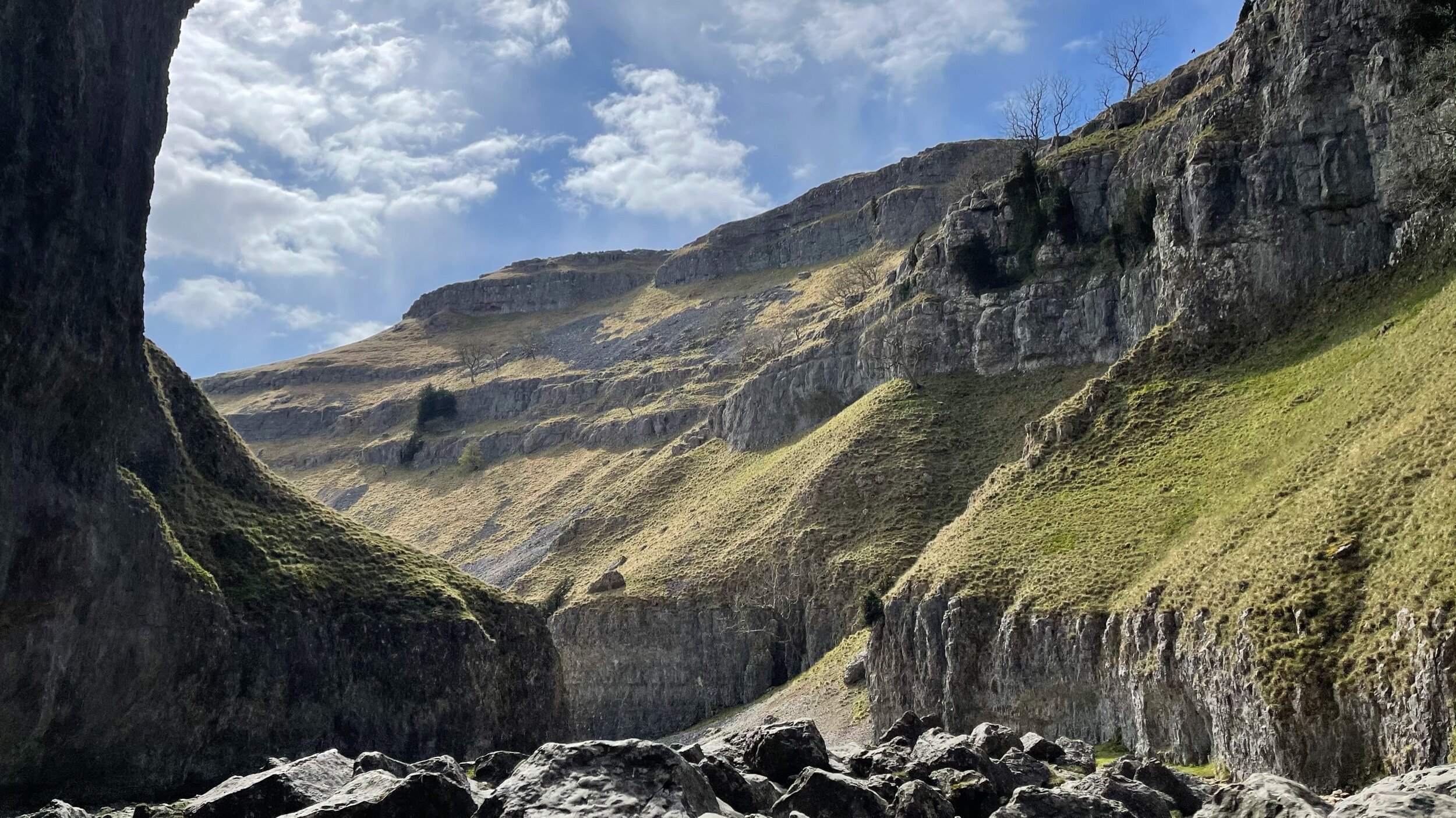
Feel like you might’ve accidentally clicked the wrong link?
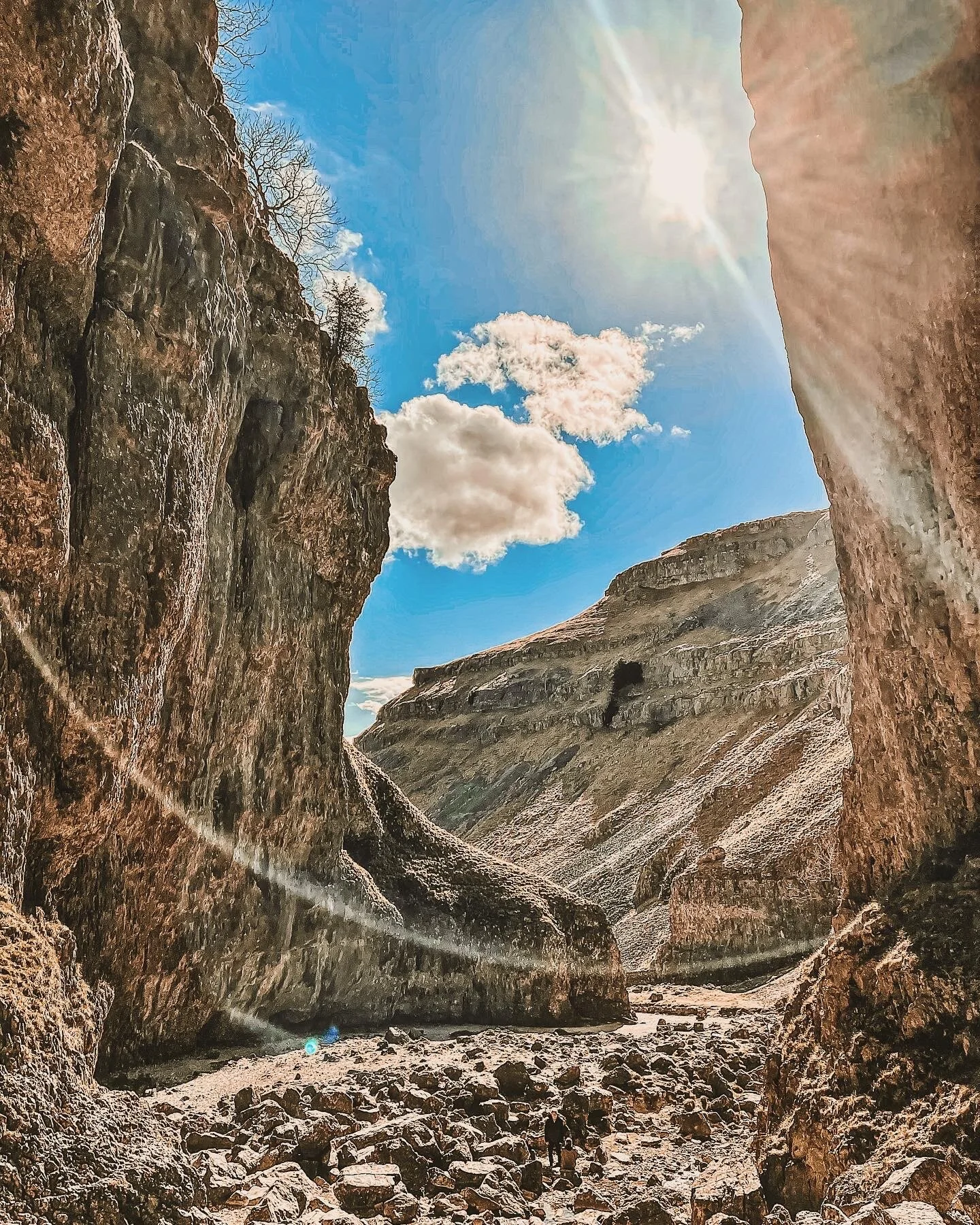
As much as these images feel like another country entirely, they’re still very much within driving distance to our rainy city! This trail truly has it all: not one, but two fairytale-esque waterfalls (Janet’s Foss and Gordale Scar), a hidden cave… and a cove that wouldn’t look out of place in Arizona… and a fairly flat route throughout!
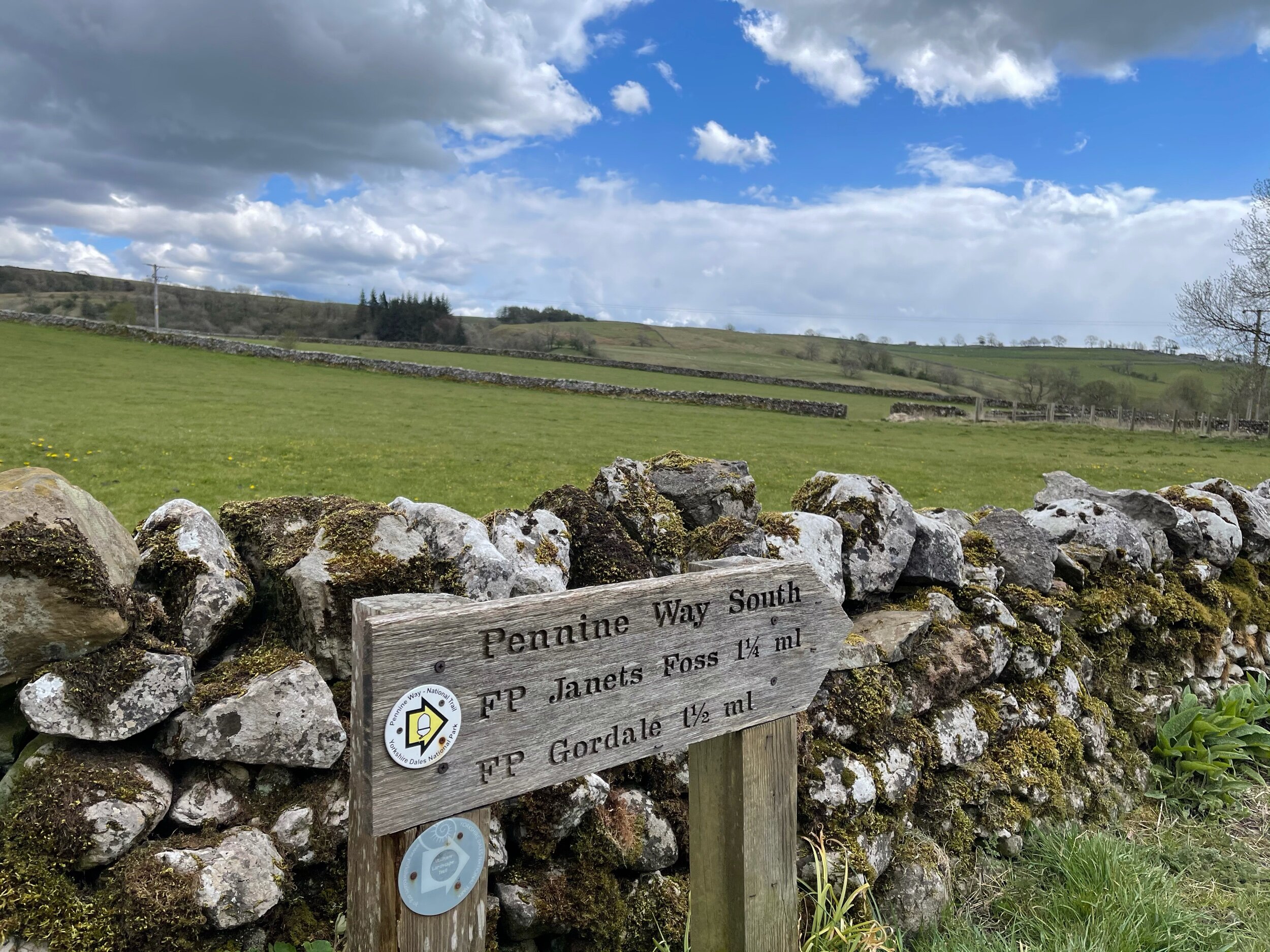
A magnet for families and ramblers alike, Malham, North Yorkshire is home to so many enchating places to explore — that said, it can get pretty busy in the summer months, so if you’re after a less populated stroll, we’d recommend popping down during the week.
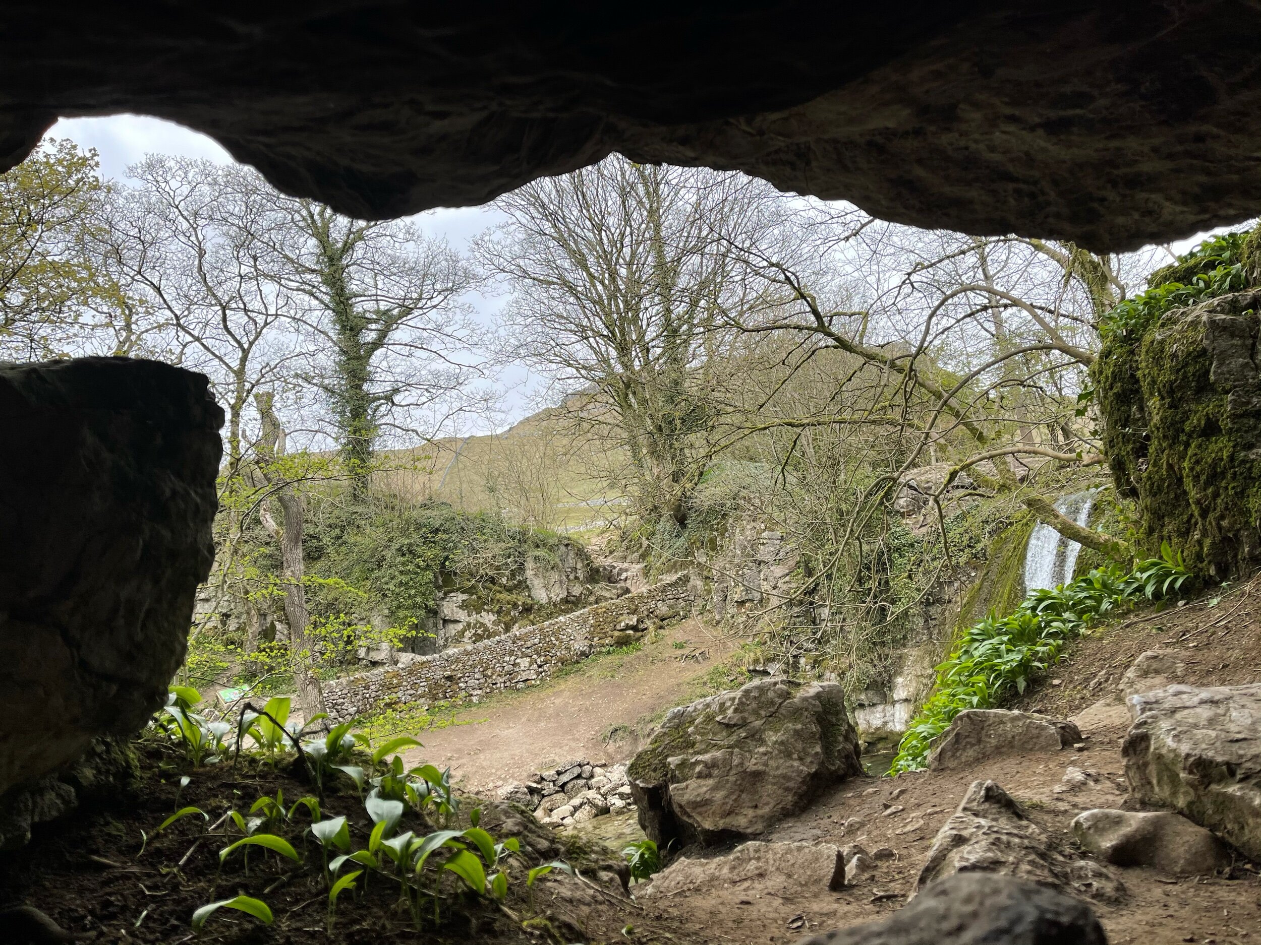
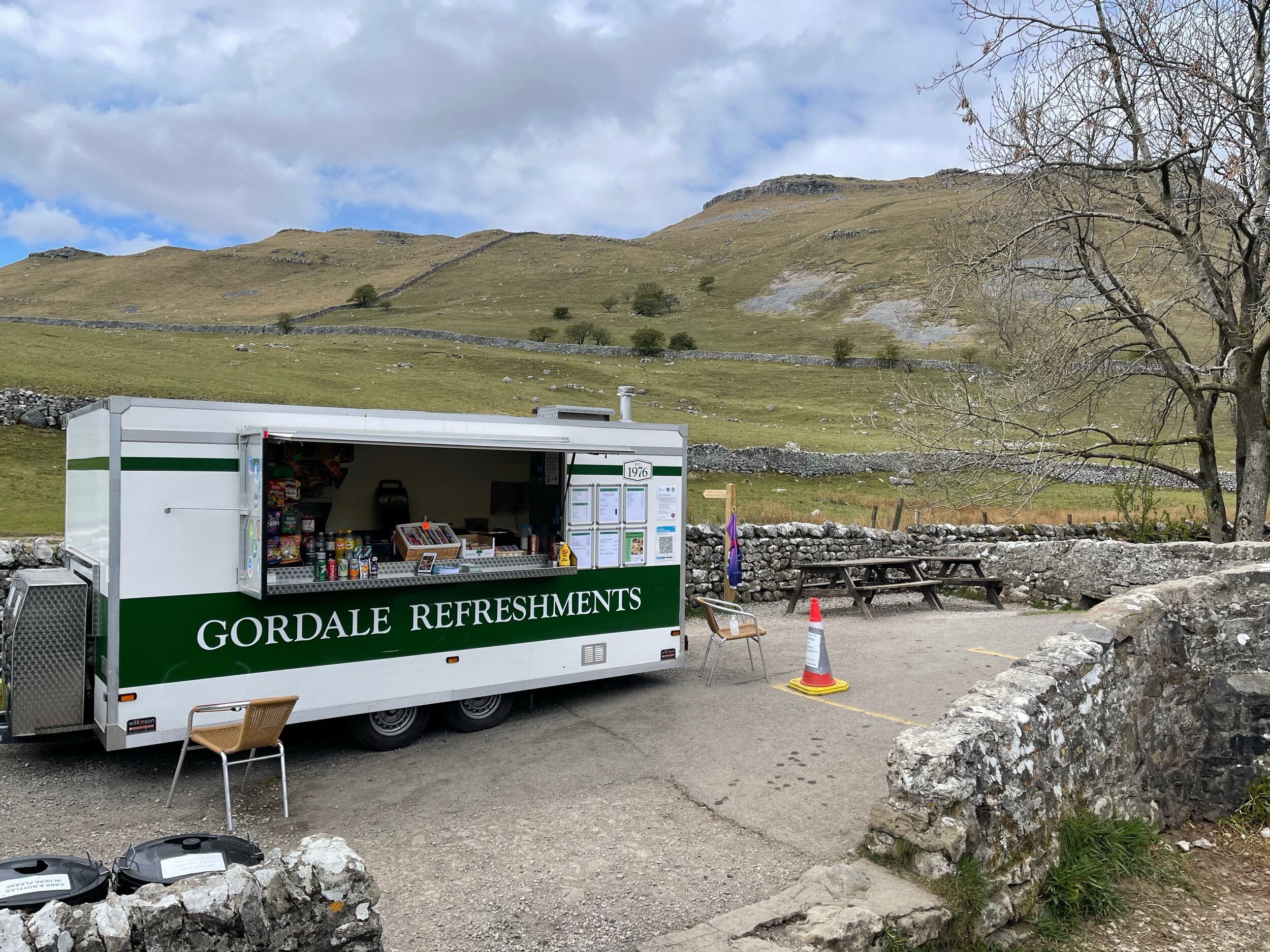
Unlike a lot of other waterfalls in the surrounding area, Gordale Scar allows walkers to discover its beauty without having to undertake a difficult climb en route.
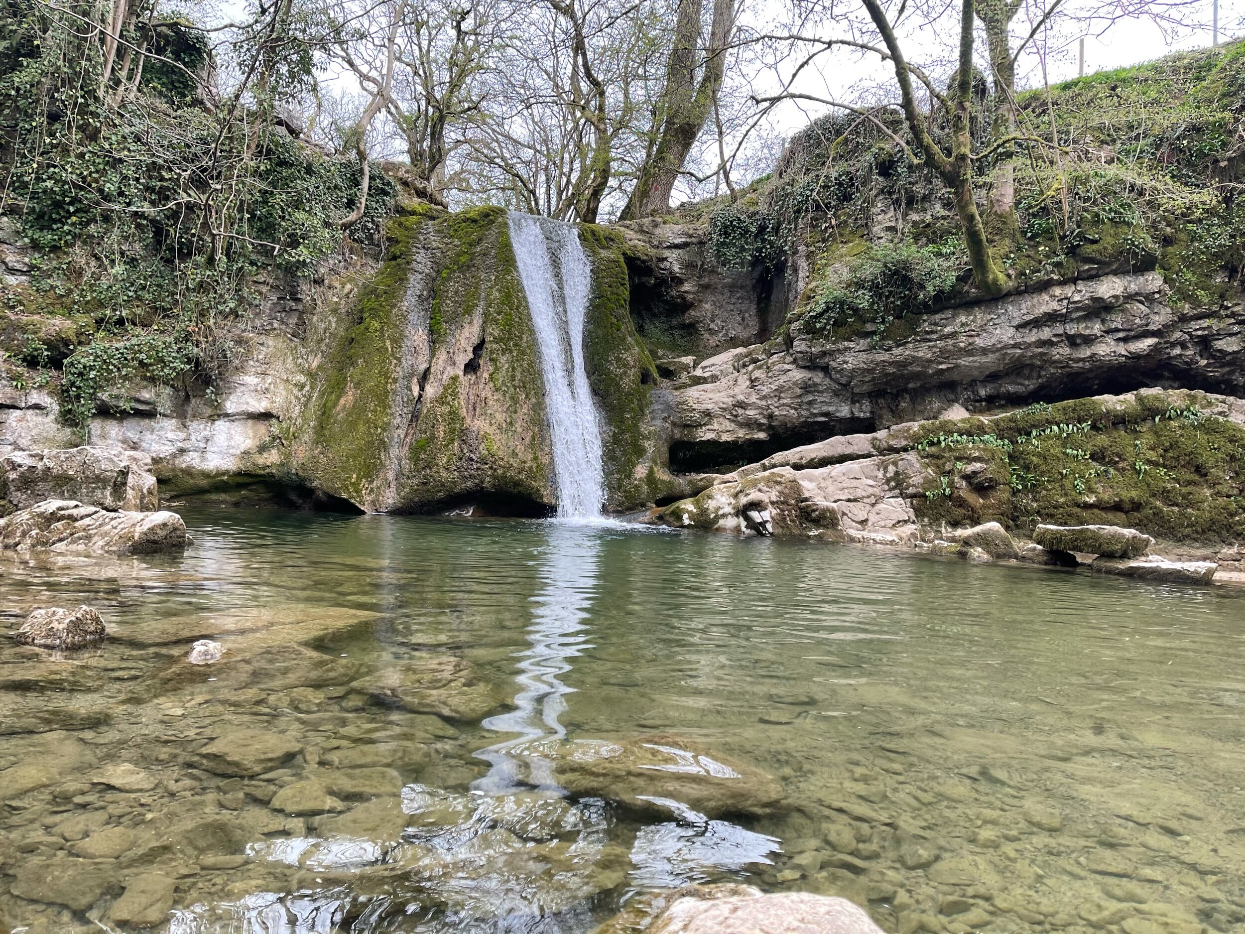
Fancy a dip? Wild swimming has become immensely popular over the past year - and we couldn’t think of a better place to dip a toe in than this one!
All in all, if you’re looking for one of the best walks in the Yorkshire Dale’s — you’re sure to find it in Malham.
Follow the route step by step here — or if you fancy shortening the route, a quick pit stop to the National Park Centre will have you set.
UPHILL CHALLENGES:





WALKS WITH WATERFALLS: