ALL TRAILS

Low Wood Bay to Troutbeck Circular Walk: An Easy Pub Walk with Stunning Lake Views
An easy pub walk with stunning views of Windermere and cafe pitstops

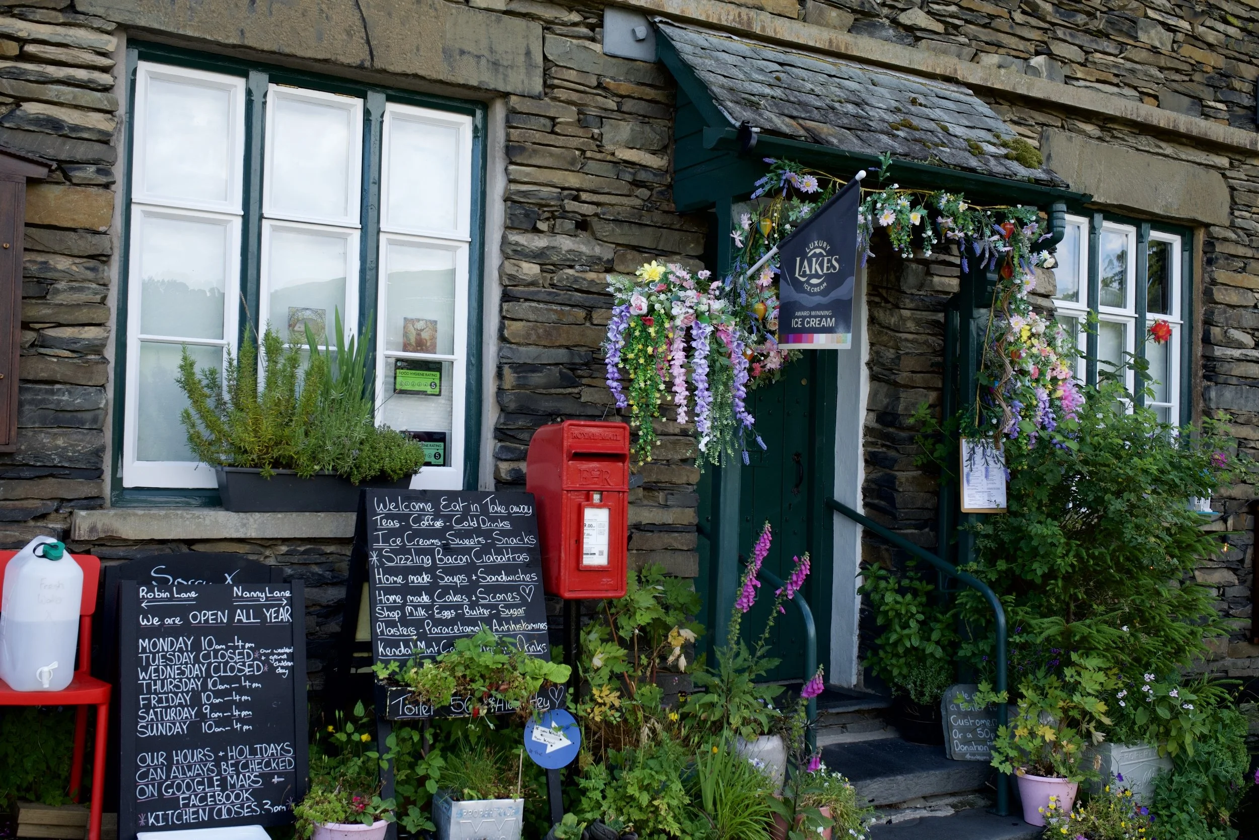
Start: Low Wood Bay (free parking if eating in the pub)
Distance: 3.8 miles
,Elevation: 700 feet
Duration: 2 hours
Difficulty: Moderate (non-technical paths, some elevation)
Navigation: Follow step-by-step on OS Maps, or download GPX file
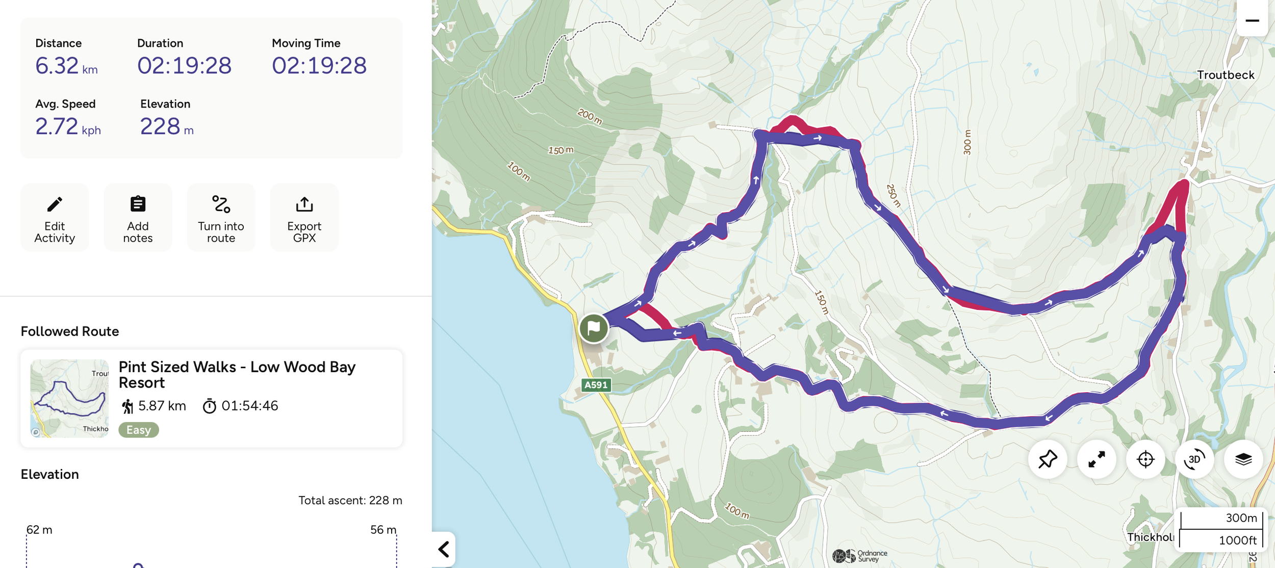
About the route
If you're anything like me, you'll know that not every great walk has to involve scaling a mountain. Sometimes, all you need is a couple of hours, incredible views and a great pub waiting at the end.
That's exactly what you'll get on this 3.7-mile circular walk from Low Wood Bay. Part of the Pint Sized Walks collection by Ordnance Survey and Thatchers, this route is proof that shorter walks can still deliver big on the views. Think stunning views over Windermere, a coffee stop in the charming village of Troutbeck, peaceful woodland trails alongside Hol Beck and a lakeside pub waiting for you at the finish.
If you're looking for an easy Lake District walk that ticks all the boxes, this one definitely deserves a spot on your list.

Route difficulty: Easy
This short pub walk is a brilliant option if you're looking for a gentler route in the Lake District.
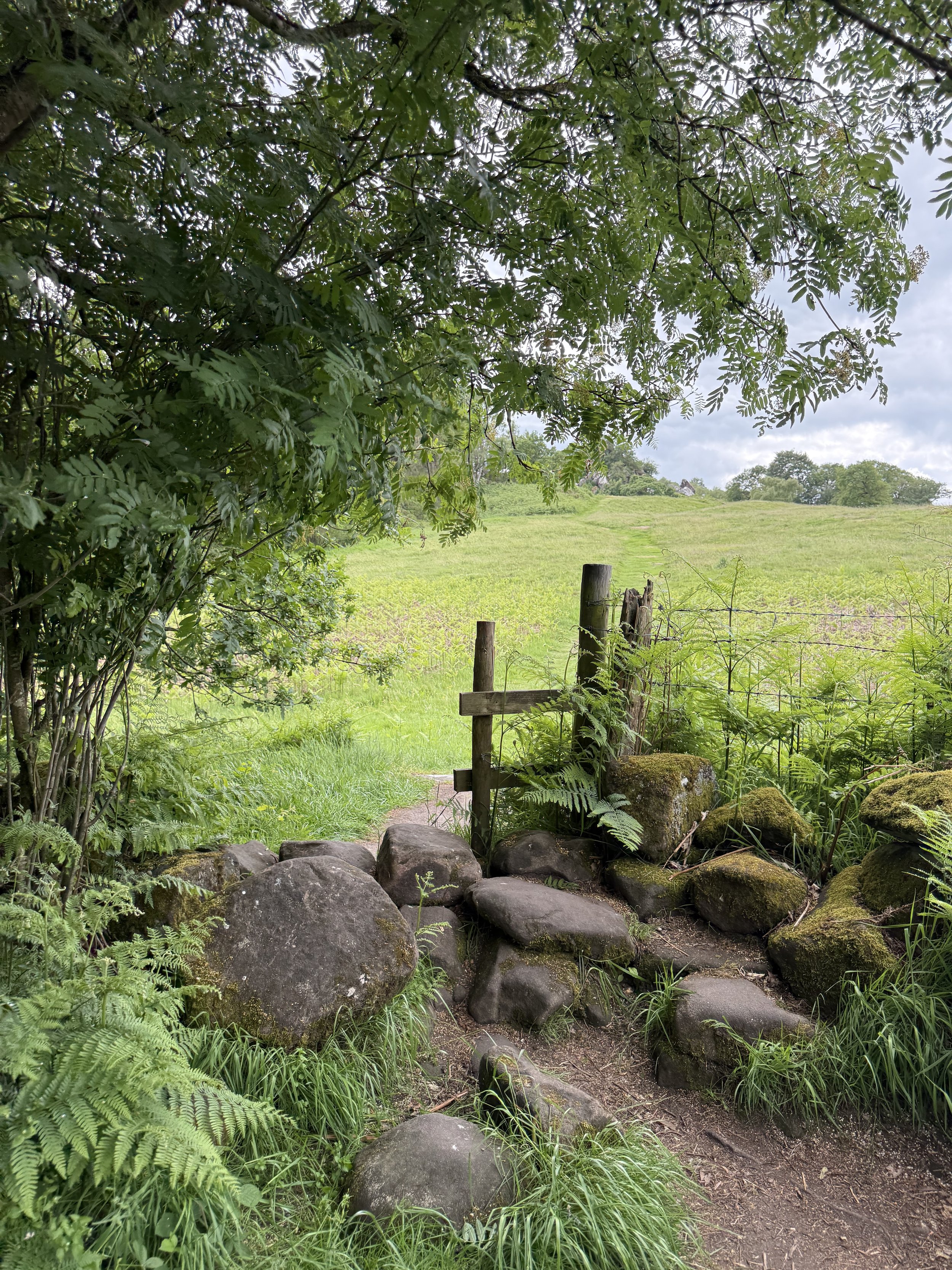
Although there's around 700ft of elevation, it's spread gradually across the route, so there aren't any particularly steep climbs. Most of the paths are easy to walk, although they can become muddy after wet weather, so I'd recommend wearing walking boots or sturdy trail shoes.
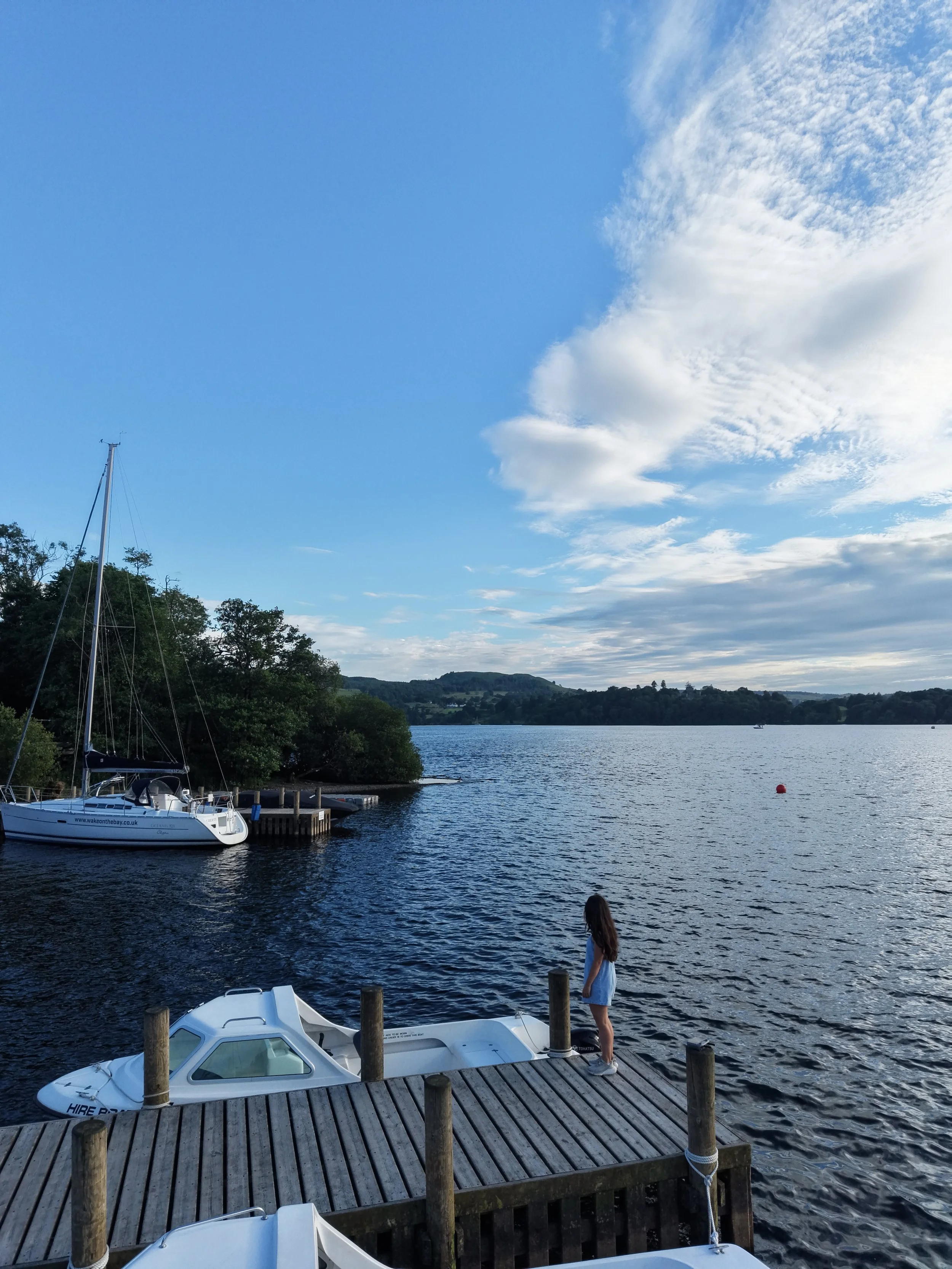
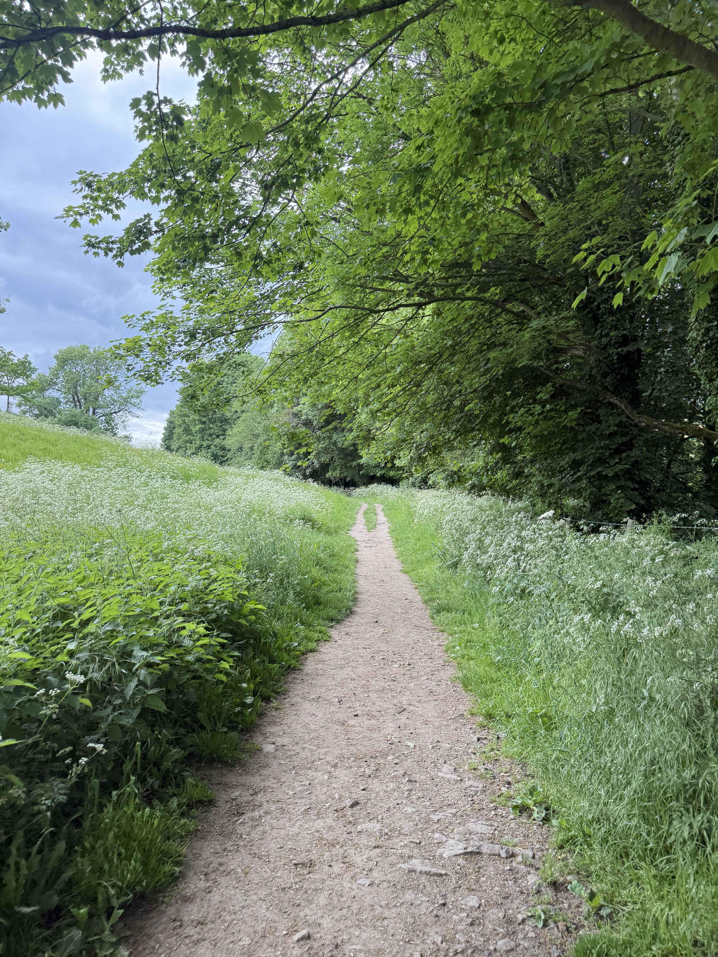
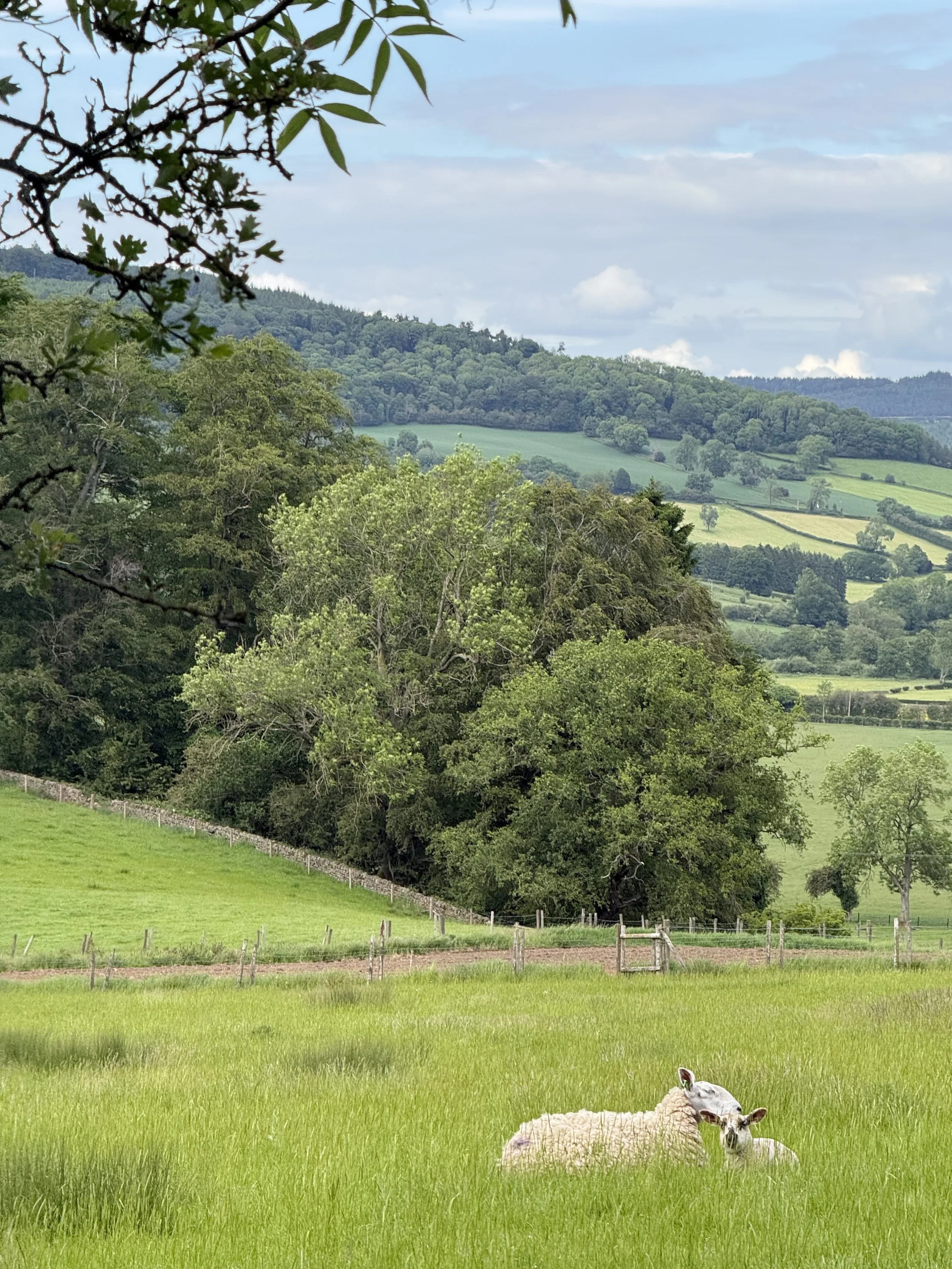
Starting from Low Wood Bay, the route gently climbs above Windermere, where you'll be treated to beautiful views across the lake almost straight away.
Is this walk suitable for beginners?
Absolutely.
If you're new to hiking or simply don't fancy tackling one of the Lake District's bigger fells, this walk is a great alternative. You'll still enjoy some incredible scenery without committing to a full day's hike, following easy, non-technical paths, gradual ascents, and lots of places to stop and take in the views.
Route specifics
From here, you'll follow a mixture of quiet country lanes and grassy footpaths, with the scenery constantly changing between open countryside and breathtaking lake views. It's one of those walks where the effort is minimal, but the reward is huge.
Around halfway round, you'll arrive in the picturesque village of Troutbeck. With its traditional stone cottages and cosy cafés, it's the perfect excuse to stop for a coffee and slice of cake before continuing your walk.
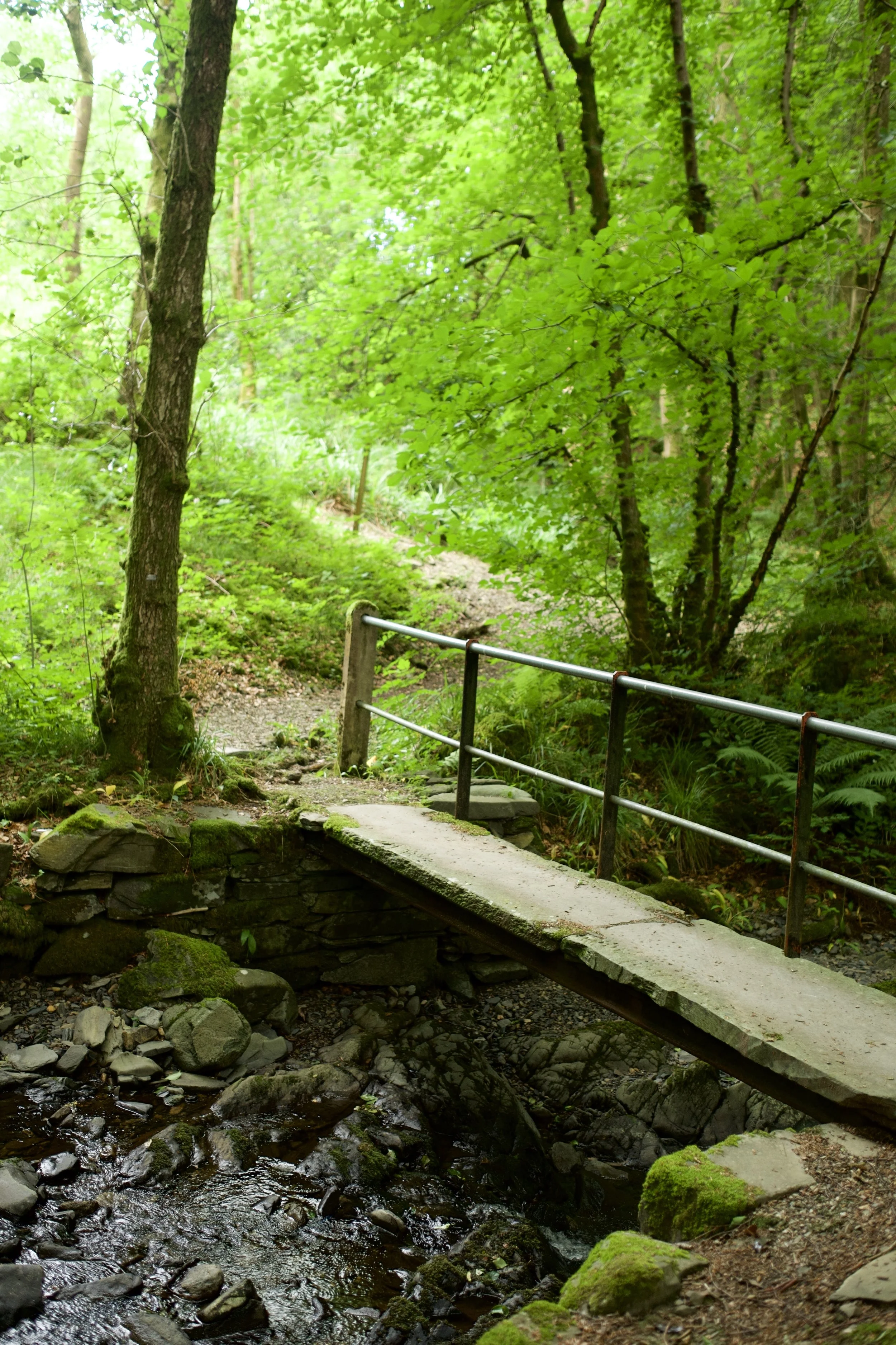
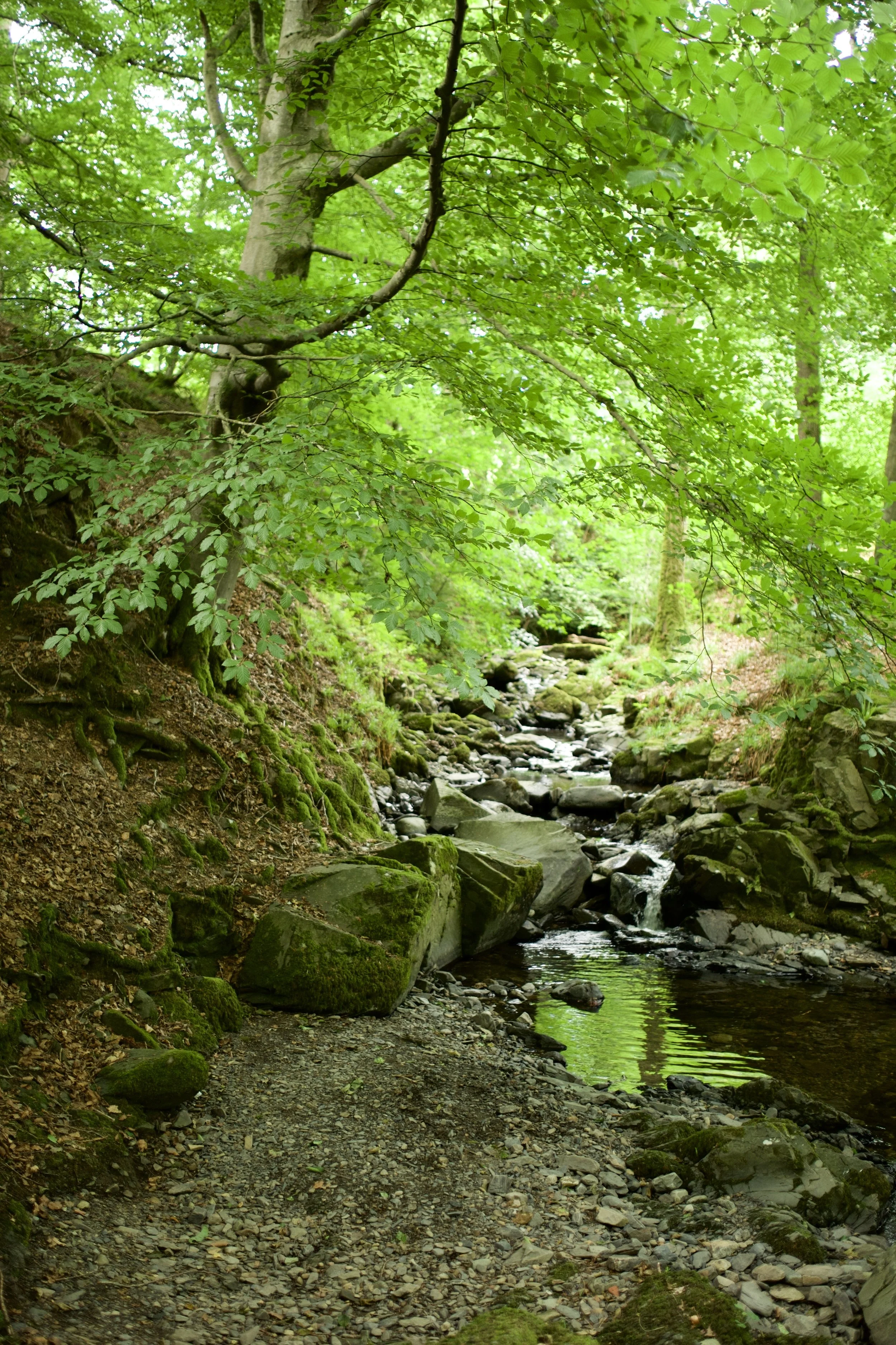
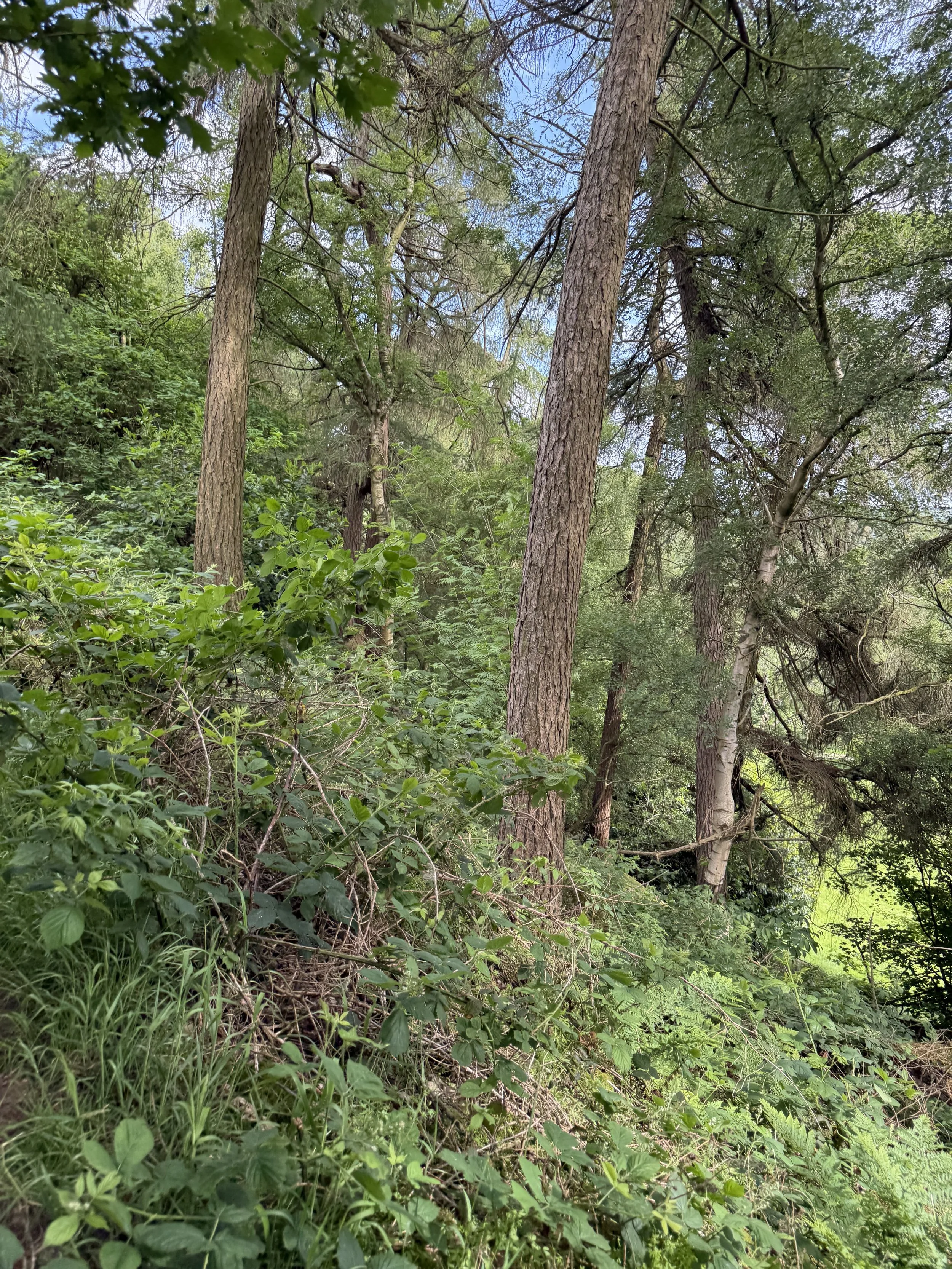
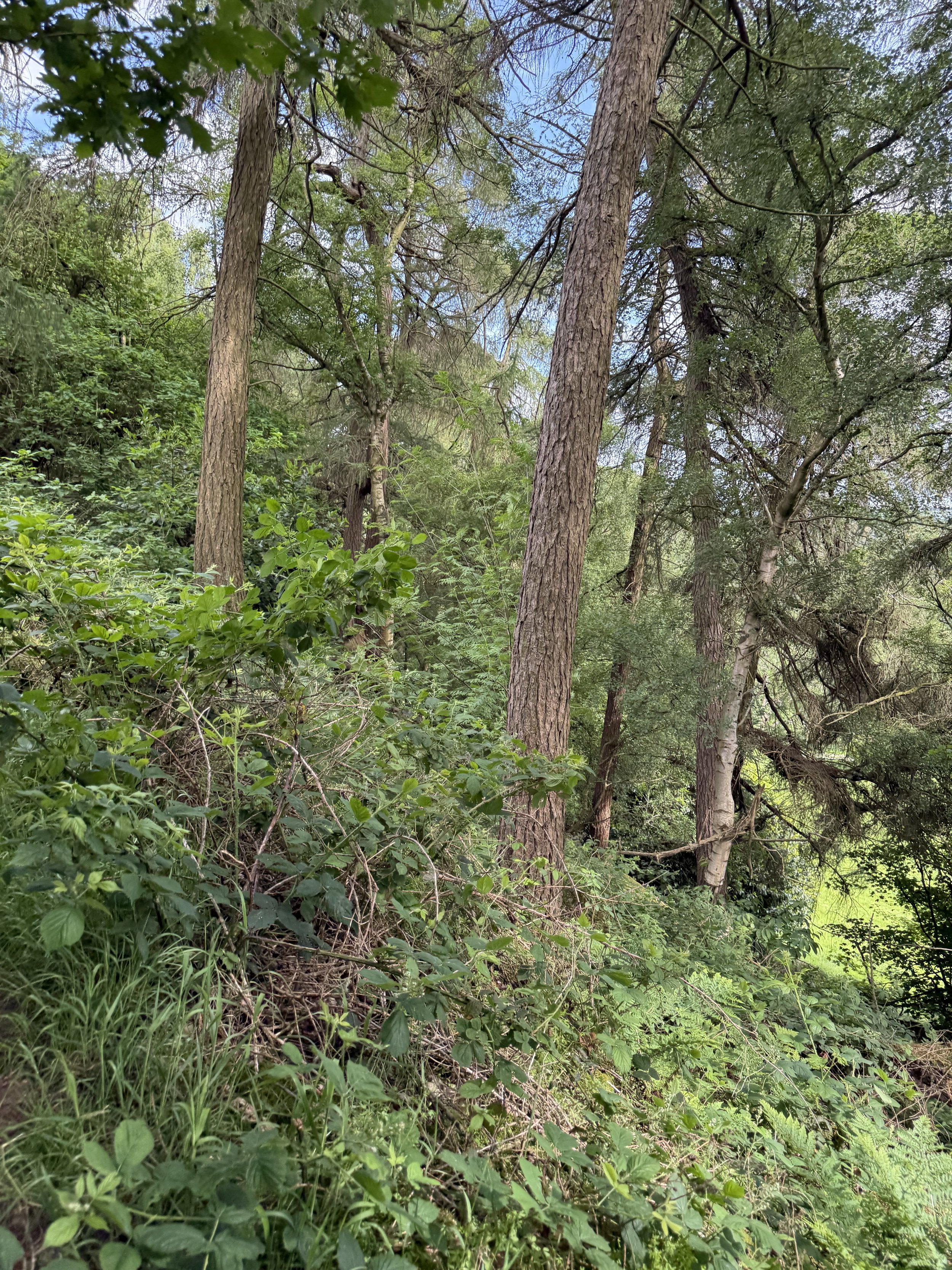
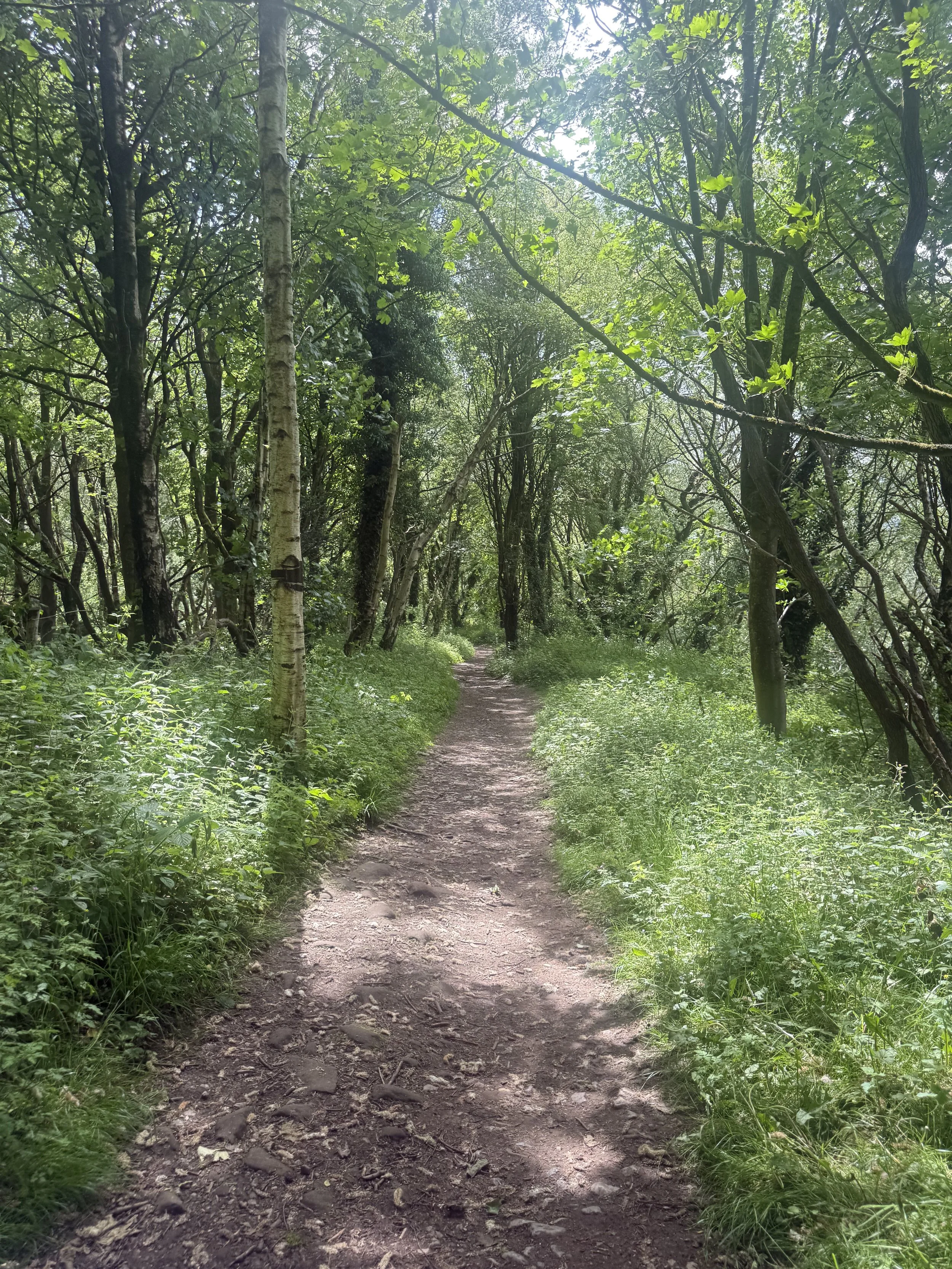
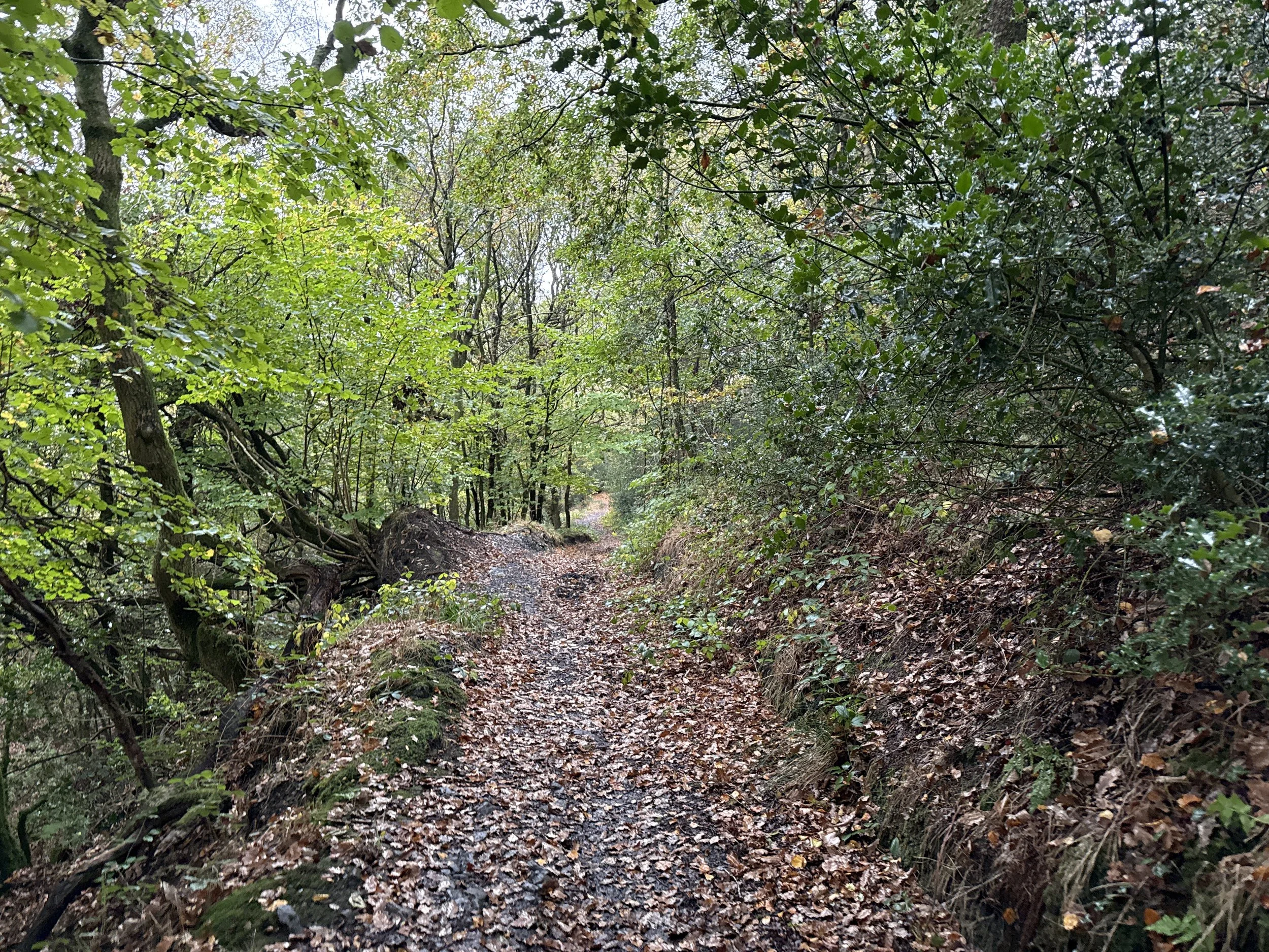
Leaving the village behind, the route heads into peaceful woodland alongside Hol Beck. The shady trails make a lovely contrast to the open views earlier in the walk, before leading you back towards the shores of Windermere.
Finish back at Low Wood Bay, where you can grab some food at one of the restaurants (or head to the cosy pub like we did), and enjoy an ice-cold Thatchers overlooking the lake. I can't think of a much better way to end a walk.
Route highlights
Incredible views across Windermere for much of the route
An easy walk that's suitable for most abilities
Coffee and cake stop in the beautiful village of Troutbeck
Peaceful woodland trails alongside Hol Beck
A lakeside pub waiting for you at the finish
When's the best time to do this walk?
This route is beautiful all year round.
Visit in spring for fresh greenery, summer for long evenings overlooking Windermere, autumn for colourful woodland and winter for crisp, clear views across the lake.
For the quietest experience, I'd recommend heading out on a weekday or setting off early in the morning, or time with sunset for golden hour views across Windermere.
Is this route for me?
One of the best things about this route is that you get all the beauty of the Lake District without needing to tackle one of the area's bigger fells.
This walk is ideal if you:
Love beautiful lake views without a challenging climb
Enjoy stopping for coffee and cake in pretty villages
Are looking for a shorter walk that's easy to fit into your day
Like peaceful woodland trails and quiet countryside
Appreciate finishing a walk with a great pub and a well-earned pint
With just 700ft of elevation spread across 3.7 miles, it's suitable for most walkers with a reasonable level of fitness. The paths are generally easy to follow, although you'll encounter a mix of country lanes, grassy footpaths and woodland trails, which can become muddy after wet weather.
Things to do nearby
If you're making a day of it, there are plenty of other great places to explore nearby.
Explore Ambleside – Just a five-minute drive away, this bustling Lake District town is packed with independent shops, cafés and traditional pubs.
Visit Wray Castle – A beautiful lakeside Victorian castle with walking trails, picnic spots and stunning views across Windermere.
Walk to Stock Ghyll Force – One of the Lake District's most impressive waterfalls, just a short walk from the centre of Ambleside.
Hire a paddleboard or kayak – Head out onto Windermere and experience England's largest lake from the water.
Take a Windermere Lake Cruise – If you'd rather sit back and enjoy the scenery, hop aboard one of the lake cruises that run between Ambleside, Bowness and Lakeside.
Getting to the starting point
By car
The walk starts from Low Wood Bay Resort & Spa, located on the A591 between Ambleside and Windermere. It's around a 5-minute drive from Ambleside and 10 minutes from Windermere.
Parking is available at Low Wood Bay (free if you’re stopping for food), although it's worth checking availability during busy periods.
By public transport
The nearest train station is Windermere, with regular direct services from Manchester, Preston and Oxenholme Lake District.
From Windermere station, you can catch the 555, 599 or Stagecoach 6 bus towards Ambleside or Keswick, all of which stop close to Low Wood Bay. From the bus stop, it's just a short walk to the start of the route.
If you're already staying in Ambleside or Windermere, you can also reach Low Wood Bay on foot or by bus, making this an easy walk to enjoy without a car.
✔️ Good to knows
Distance: 3.7 miles
Allow around two hours, plus extra time for coffee or lunch.
Walking boots are recommended, especially after rain for the grass and wooded section.
Dogs are welcome but should be kept under close control around livestock.
Don't forget your camera – the Windermere views are worth it!
🧭 Following the route
Leave Low Wood Bay and follow the route uphill, where you'll soon be rewarded with panoramic views across Windermere.
Continue towards Troutbeck village, where it's well worth stopping for a coffee before following the trail alongside Hol Beck through peaceful woodland.
The final section leads you back to Low Wood Bay, where you can round off the walk with food and a drink overlooking the lake.
Discover more Pint Sized Walks
This walk is part of the Pint Sized Walks collection by Ordnance Survey and Thatchers – a series of shorter walks across the UK that finish at some of the country's best pubs.
Whether you've only got a couple of hours to spare or you're simply looking for a more relaxed adventure, the collection is packed with scenic routes that prove you don't have to walk all day to enjoy the great outdoors. Find your nearest here.
Nine Ladies Stone Circle Walk: Robin Hood's Stride, Stanton Moor, Rowtor Rocks
A magical Peak District walk with ancient stone circles, hidden caves, and cosy village pubs
Start: Birchover (DE4 2BN)
Distance: 8.91 miles
,Elevation: 1,100 feet
Duration: 3-4 hours
Difficulty: Moderate (non-technical paths, some elevation)
Navigation: Follow step-by-step on komoot, or download GPX file
About the route
Looking for one of the most magical walks in the Peak District? This circular route takes you through ancient woodland, prehistoric landscapes, dramatic gritstone tors, hidden caves, and one of England's most famous stone circles.
Starting in the pretty Derbyshire village of Birchover, you pass the legendary Nine Ladies Stone Circle, explore the fascinating Hermit's Cave, scramble around the impressive Rowtor Rocks, and stand beneath the rock formations of Robin Hood's Stride. Stone circles, dramatic gritstone edges, hidden caves and plenty of folklore – this Peak District walk has it all.
Throw in a couple of brilliant village pubs, sweeping views across the Derbyshire countryside, and over 4,000 years of history, and you've got one of the most magical walks in The Peaks.
Route difficulty
The distance and elevation make this more challenging than some of my easier Peak District walks, but there are no particularly difficult sections + non-technical terrain throughout.
Expect:
Some steady climbs
Woodland paths
Moorland tracks
Route highlights
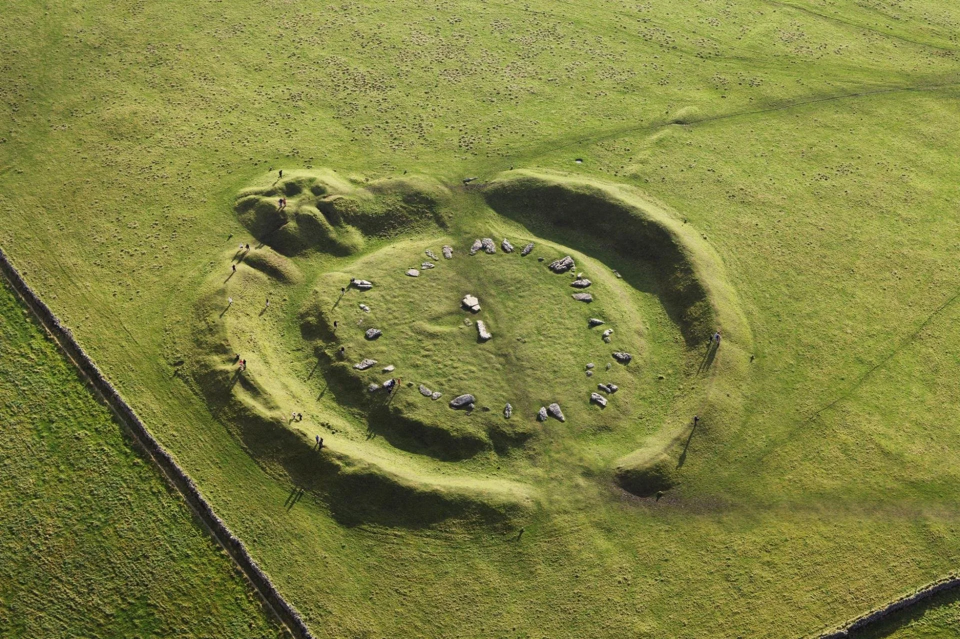
Nine Ladies Stone Circle: One of Derbyshire's most famous prehistoric monuments, dating back around 4,000 years.
Robin Hood's Stride: One of the Peak District's most iconic rock formations.
Stanton Moor: Beautiful heather-covered moorland filled with ancient monuments.
Rowtor Rocks: A fascinating collection of rock formations, carvings and hidden passageways.
Hermit's Cave A tiny cave carved into the rock at the start of your walk.
The Flying Childers Inn: One of the quirkiest (and cosiest) pubs in the Peak District. Great for a midway refuel.
The Druid Inn: The perfect place for a post-walk pint.
The history of Nine Ladies Stone Circle
The Nine Ladies Stone Circle is one of the Peak District's most important prehistoric monuments and is believed to date back to the Bronze Age, making it around 4,000 years old.
The circle consists of nine small standing stones arranged in an oval shape, measuring around 10 metres across. Nearby stands a larger stone known as the King's Stone, which has become part of the site's folklore over the centuries.
Archaeologists believe the monument was likely used for ceremonial or ritual purposes, although its exact purpose remains unknown. Like many prehistoric stone circles across Britain, it may also have had connections to seasonal events, astronomy or local gatherings.
The circle forms part of the wider Stanton Moor landscape, an area rich in archaeology. The moor contains numerous prehistoric monuments, burial mounds and standing stones, making it one of the most historically significant areas in Derbyshire.
The myths and legends of Nine Ladies Stone Circle
Like many ancient monuments, Nine Ladies Stone Circle comes with its fair share of folklore.
The most famous legend tells the story of nine women who were dancing on a Sunday. As punishment for breaking the Sabbath, they were turned to stone where they stood. The nearby King's Stone is said to represent the fiddler who provided the music and suffered the same fate.
Another local tale claims that the stones cannot be counted accurately. No matter how many times you count them, you'll supposedly arrive at a different answer each time.
Over the years, the circle has also become associated with spiritual practices and modern pagan traditions. Visit on solstice, and you’ll find more visitors than usual celebrating the longest/shortest days of the year. Its secluded woodland setting and ancient origins certainly give it an atmosphere unlike anywhere else in the Peak District.
Is this route for me?
Unlike some of the Peak District's steep hill walks, this route focuses more on history, scenery and exploration than big summit climbs.
This walk is ideal if you:
Love ancient history and archaeology
Enjoy discovering hidden landmarks
Want a varied route with plenty to see
Appreciate a good pub stop
Like walks with a bit of local folklore
The route is suitable for most walkers with a reasonable level of fitness, although the nearly 9-mile distance means it's best suited to those comfortable spending several hours on the trail.
Expect public footpaths, woodland tracks, gates, stiles and some rocky sections.
Where to eat and drink nearby
Things to do nearby
If you're making a full day or weekend of it, there are plenty of places nearby worth exploring:
Bakewell
Lathkill Dale
Monsal Trail
Matlock Bath
Getting to the starting point
Parking
This walk starts at the small free public car park on Birchover Road (DE4 2BN), opposite Birchover Stone Ltd.
Capacity: Approximately 20 spaces
Cost: Free
Alternative parking: Additional on-street parking is available through the village.
Location: Ideal for accessing Rowtor Rocks, Stanton Moor, Nine Ladies Stone Circle, and the start of the route.
Public transport
Public transport options are limited for this one, arriving by car is your best bet for an easy day out..
✔️ Good to knows
Difficulty: Moderate with gentle elevation gain
Footwear: Can get muddy after rain, especially through fields - I’d boot up for this one.
Dog-friendly: Some sections cross farmland and cattle fields, keep dogs on leads 🐕
Food and drink: You’ll find food, drink and toilet facilities along this route
🧭 Following the route
I use komoot and OS Maps for offline navigation. To follow this walk step-by-step on komoot, simply click this link here or download the GPX file and upload it to your chosen app, such as OS Maps.
Arbor Low + Monyash Circular Walk
A beautiful Peak District walk with stone circles, cosy pubs & countryside charm

Start: Arbor Low Car Park
Distance: 8.7 miles
,Elevation: 575 feet
Duration: 3-4 hours
Difficulty: Easy-moderate with minimal elevation gain
Navigation: Follow step-by-step on komoot, or download GPX file
About the route
If you’re after a Peak District walk that blends ancient history, peaceful farmland, and a proper pub stop (or two), this one ticks every box. Starting from Arbor Low car park, this circular route takes you through the postcard-perfect village of Monyash, past hidden gems like a donkey sanctuary and cosy pubs, before looping back via open countryside and a cute little honesty shop.
This is a really satisfying loop with a bit of everything: history, your pick of pubs and cafes,, quiet lanes, and wide-open views.
Route difficulty
Easy-Moderate
Nothing too technical here, but the distance makes it more of a half-day adventure. Expect a few gentle inclines and some uneven terrain across fields. There is also a short section at the beginning and end that follows a country road without a pavement, so take care here.
Route highlights
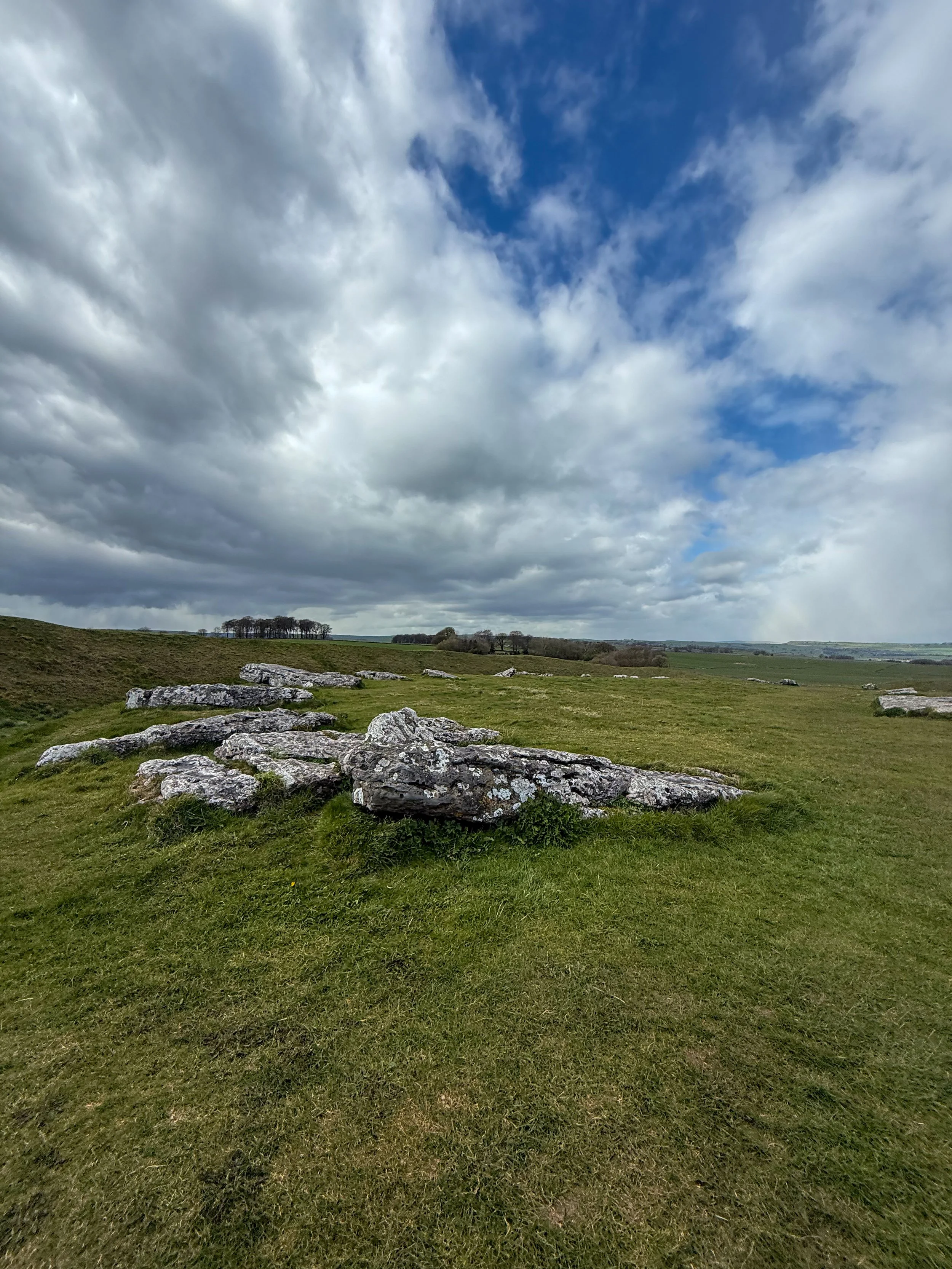
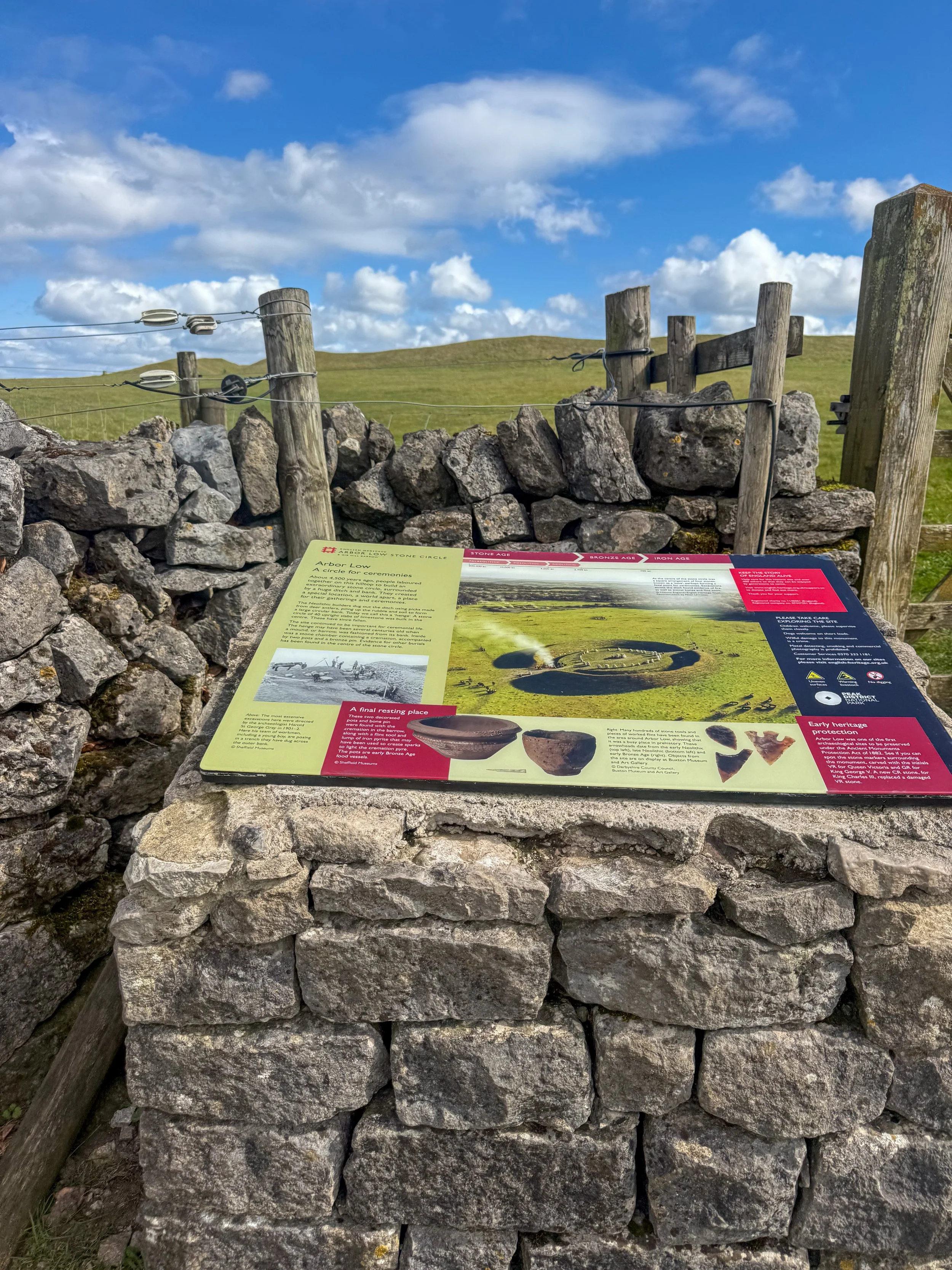
Arbor Low Stone Circle: Often called the “Stonehenge of the North,” Arbor Low is a prehistoric stone circle set within a henge. It’s atmospheric, a little eerie, and completely open to explore—no barriers, no crowds, just history under your feet.
Monyash Village: This is ultimate peak Peak District charm. Think limestone cottages, a village green, and plenty of places to refuel.
The Donkey Sanctuary: A slightly unexpected but wholesome highlight. A lovely little spot to pause and break up the walk. Visits are by appointment only or you can join an open day to meet the donkeys. You can check the latest schedule here.
Stone Shelter: Known as a “kažun,” the limestone round-house was a gift from the Republic of Croatia as part of a series of events to mark its accession to the EU in July 2013.
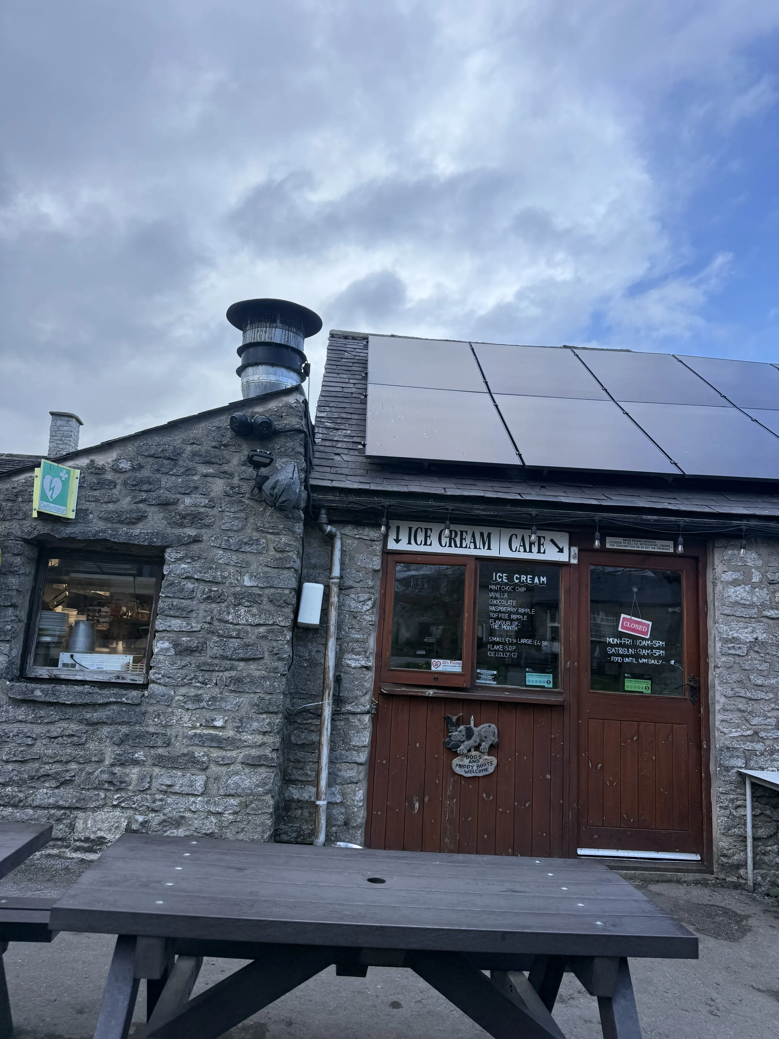
Bike Hire: Along the way you’ll follow a section of the Tissington Trail and pass Parsley Hay, where you can purchase drinks, snacks + rent bikes if you’re looking to make a full day of it.

Is this route for me?
Unlike the higher elevation routes along the neighbouring peaks, this walk is perfect for anyone seeking a lower effort walk in the heart of the Peak District.
The terrain is manageable, but nearly 9 miles means it’s better suited to beginners who are comfortable walking for a few hours.
Expect a mix of public footpaths, gates, and stiles
Key navigation points:
Start at Arbor Low → head towards Parsley Hay + Tissington Trail
Head toward Monyash village
Loop back via country lanes
Getting to the starting point
By car: Arbor Low car park (small fee may apply)
Public transport: Limited—best accessed by car
✔️ Good to knows
Difficulty: Easy with gentle elevation gain
Footwear: Can get muddy after rain, especially through fields
Dog-friendly: Some sections cross working farmland, keep dogs on leads 🐕
Food and drink: You’ll find food, drink and toilet facilities regularly along this route
🧭 Following the route
I use komoot and OS Maps for offline navigation. To follow this walk step-by-step on komoot, simply click this link here or download the GPX file and upload it to your chosen app, such as OS Maps.

Low-effort, big-view hike in the Peak District
The beautiful Peak District walk that’s low on mileage but big on views

Start: Cross Street Car Park, Cross Street, Castleton, Hope Valley, Derbyshire, S33 8WH
Distance: 3 miles
Elevation: 700 feet
Duration: 1.5 hours
Difficulty: Easy with gentle elevation gain (with some rocky terrain and steep descent)
Navigation: Follow step-by-step on komoot, or download GPX file
About the route
Looking for a short and scenic walk in the Peak District that’s easy on the legs and big on views? This low-mileage route from Castleton is the perfect alternative to the higher elevation peaks surrounding the village, but still feels like you’ve been transported to another world.
Starting from Cross Street Car Park, the route takes you through the picturesque village of Castleton before ascending to Peveril Castle for sweeping views of the Hope Valley. From there, you’ll venture into the dramatic limestone gorge of Cave Dale, a beautiful limestone valley that feels like stepping back in time. The final stretch loops past the famous Peak Cavern (the Devil’s Arse) before returning to the heart of Castleton where you’ll find pubs and cafes waiting for you.

Route difficulty
Walk type: Low mileage circular walk with minimal elevation gain. Please note there is a steep descent into Castleton towards the end of the route. This can be avoided by descending via Winnats Pass.
Terrain: Mostly well-defined paths with a rocky, uneven section, especially in Cave Dale. Please note this section of the route can get incredibly slippy during wet or icy conditions and is not suitable for anyone with mobility issues
Accessibility: Not suitable for pushchairs or wheelchairs due to narrow and uneven paths.

Route highlights
Peveril Castle: Perched high above Castleton, this Norman fortress offers panoramic views of the surrounding valleys.
Cave Dale: An enchanting gorge, framed by towering limestone cliffs.. Keep an eye out for fossils embedded in the rocks.
Devil’s Arse (Peak Cavern): The largest natural cave entrance in the British Isles. Steeped in legend and a great pitstop along the route.
Castleton Village: The walk begins and ends in this charming village in the heart of the Peak District National Park, renowned for its cosy pubs, cafes, and independent shops. Don’t miss The Castle Inn, Tilly’s Tearoom, or the artisan shops along the main street.
Is this route for me?
Unlike the higher elevation routes along the neighbouring peaks, this walk is perfect for anyone seeking a lower effort walk in the heart of the Peak District.
Please note, the path along Cave Dale is rocky and uneven and can get incredibly slippy during wet or icy conditions and is not suitable for anyone with mobility issues. There is also a steep descent into Castleton at the latter end of the route which can be avoided by descending via Winnats Pass.

Options to extend the route / things to do nearby
If you have extra time, consider exploring:
Mam Tor: A short walk or drive away, this iconic Peak District summit offers incredible views and is great to time with sunrise or sunset.
Blue John Cavern: Delve into one of Castleton’s famous show caves, known for its rare Blue John stone.
Getting to the starting point
By car: Use the postcode S33 8WH for Cross Street Car Park in Castleton.
By public transport: Take the train to Hope and walk/bus to the starting point.

✔️ Good to knows
Difficulty: Easy with gentle elevation gain but some rocky/steep descents.
Footwear: Sturdy, waterproof boots are a must, especially after rain, as some paths can get slippy and boggy.
Dog-friendly: Dogs are welcome but should be kept on leads near livestock.
Food and drink: Castleton is home to your pick of pubs, cafes and shops. For a proper pub lunch, visit The Castle Inn. Or for lighter bites, try Tilly’s Tearoom or one of the village’s many cosy cafes.
🧭 Following the route
I use komoot and OS Maps for offline navigation. To follow this walk step-by-step on komoot, simply click this link here or download the GPX file and upload it to your chosen app, such as OS Maps.

A walk through Brontë country: The Brontë Way
Wander through the landscapes that inspired a Brontë classic on this popular moorland walk

Start: Haworth Main Street, near the Brontë Parsonage Museum
Distance: 7.5 miles
Elevation: 825 feet
Duration: 2.5-3 hours
Difficulty: Easy (suitable for most walkers)
Navigation: Follow step-by-step on komoot or download GPX file
About the route
This relaxed walk through the Haworth moorlands makes for an ideal day out, ending with beautiful views and historic locations tied to Brontë history.
The route takes you along The Brontë Way, a route rich with Brontë history and scenery that makes you feel like you’ve stepped straight inside the sisters’ novels. The Brontë Way is a 69km (43 mile) long distance footpath which starts at Oakwell Hall ("Fieldhead" in Charlotte Bronte's novel "Shirley") near Birstall in Kirklees near Bradford, and ends at Gawthorpe Hall in Padiham near Burnley in Lancashire's Pendle Witch Country.
This particular walk takes you along a short section of The Way, winding your way past many places of interest to Bronte enthusiasts, including Penistone Hill country park, perched on the moors high above Haworth, the trail to the Bronte Waterfall and on over the Bronte Bridge up to Top Withens (a favourite walk of the Brontes themselves - with Top Withens being suggested as the contentious location for the eponymous Earnshaw house in Wuthering Heights), and of course, the village of Haworth itself.
Route difficulty
Walk type: Easy circular walk with limited elevation gain. Good for most walkers with, includes some uneven paths
Terrain: Mix of paved lanes, gravel paths, grassy trails, and some uneven moorland sections.
Inclines: Mostly gentle, with a short climb up to Top Withens that can be a little steep and exposed.
Surfaces: Some rocky patches and muddy stretches, especially after rain.
Navigation: Well-marked in most places, map/GPX needed for moorland section
Mobility: Not suitable for pushchairs or wheelchairs. This route contains stiles, steps, and narrow gates.
Why you’ll love this walk
A mix of moorland, waterfalls, ruins & literary lore
Great views at Top Withens + waterfall
Quiet in parts (especially the moors), lively in others (Haworth village)
Ideal for a Sunday stroll: nature + tearooms + pubs
Highlights:

Route highlights
Haworth
Your walk begins and ends in the charming Pennine village of Haworth, nestled in the heart of West Yorkshire’s Brontë Country. This historic village is famous as the home of the Brontë sisters (Charlotte, Emily, and Anne) and is filled with cobbled streets, quaint shops, and atmospheric tea rooms that take you back to the Victorian era. In the village centre, you’ll find the Brontë Parsonage Museum, where the sisters lived and wrote their novels, along with several charming cafes and boutiques perfect for exploring before or after your walk.
Don’t miss a visit to the Cabinet of Curiosities for a peek into local Victorian artefacts or the iconic Black Bull pub, often frequented by Branwell Brontë.
Bronte Waterfall
The Bronte Waterfall is a great place to rest on your way to Top Withens (Wuthering Heights), Alcomden Stones or Ponden Kirk (The Fairy Cave). Top Withens (also known as Top Withins) is a ruined farmhouse near which is said to have been the inspiration for the location of the Earnshaw family house in Wuthering Heights.
Just a short distance from Top Withens, the waterfall cascades down the rocks and has long attracted visitors drawn by its natural beauty and literary ties. Charlotte Brontë is said to have found solace here, and it remains a serene spot midway through the walk.
Cabinet of Curiosities
Back in Haworth, step into the Cabinet of Curiosities, a quirky shop filled with Victorian oddities, witchy trinkets, and handmade soaps that I can never seem to leave the village without. This museum-like shop truly is like stepping foot in an old apothecary store, warmly lit by glass globes, fragranced with exotic oils, and packed from floor to ceiling with rich mahogany and glass display cases. Over the years the family-run business has taken on a true labour of love, salvaging many of the shops fittings from chemists, grocery shops and museums to replicate the ‘wonder-rooms’ of a time gone by.
Wuthering Heights Pub
End your walk at the Wuthering Heights pub (close to Top Withens), a cosy spot to enjoy a pint or a hot meal after a day on the moors. This traditional Yorkshire pub has true rustic charm, with a hearty menu and an atmosphere that perfectly complements a moody moorland adventure.
Options to extend the route
For a longer hike, consider adding a detour to nearby Ponden Kirk, a rocky outcrop believed to be the inspiration for Wuthering Heights’ Penistone Crags. This can turn the walk into a full day’s outing, with more moorland views and an optional scrambling segment.

Where is Haworth?
Haworth is in West Yorkshire, England, part of “Brontë Country.” Near Keighley, within reach of Leeds and Bradford. Rural & beautiful, with moors all around.
The picturesque village is renowned worldwide as the home of the Brontë sisters, the celebrated authors of Wuthering Heights, Jane Eyre, and The Tenant of Wildfell Hall. Situated near the larger town of Keighley and easily accessible from Leeds, Haworth is part of the scenic region known as Brontë Country, an area of natural beauty that inspired much of the sisters' work.
The village itself is home to many quaint tea rooms, souvenir shops and a few quirky pitstops you can’t afford to miss. My absolute favourite is The Cabinet of Curiosities, a traditional shop that’s been restored it to its former glory as a Victorian apothecary shop.

Getting to the starting point
Arriving by car
There is limited parking along Main Street in Haworth, with additional spaces near the Brontë Parsonage Museum and pay-and-display lots available for a small fee.
Arriving by public transport
The Keighley Bus Company operates regular services to Haworth from Keighley, making it accessible by public transport from nearby towns and cities.
From Leeds
Train to Keighley (~30 mins)
Catch the Brontë Bus (B1, B2 or B3) to Haworth
From Bradford
Train or bus to Keighley
Catch transfer to the Brontë Bus to Haworth
From Hebden Bridge
Take the Brontë Bus B3 direct to Haworth (via Oxenhope)
From Keighley Station
Key transport hub with trains from Leeds, Bradford & Skipton
Then either the Brontë Bus or the KWVR heritage train to Haworth
Heritage train option
Take the Keighley & Worth Valley Railway (KWVR) steam/diesel service from Keighley direct to Haworth. It runs on weekends and daily in summer — a slower, scenic ride through the Worth Valley. Check the KWVR website for current timetables.
Travel tips:
Bus services are regular but check timetables before visiting, especially Sundays & holidays
Allow time to transfer between Keighley train & bus stations if needed
Heritage train is a great option but not daily — pre-check schedule
Parking is limited in Haworth during busy times, arrive early or use park & ride if available
✔️ Good to knows
Difficulty: This walk has gentle climbs and is suitable for all abilities.
Accessibility: This is a carrier only route. There are some steep steps and rocky paths, particularly around the waterfall itself, which aren’t suitable for pushchairs or wheelchairs. This route includes stiles.
Navigation: The walk to the falls is well signposted, but bring GPX/map for the moorland section.
Food and drink: Plenty of pubs, tearooms and shops available in Haworth at the start and end of the walk, including the café at the Brontë Parsonage Museum.
Parking: Public parking is available near Haworth’s Main Street; charges vary.
🧭 Following the route
I use komoot and OS Maps for offline navigation. To follow this walk step-by-step on komoot, simply click this link here or download the GPX file and upload it to your chosen app, such as OS Maps.
A Peak District Winter Walk: A traffic-free trail through Derbyshire's industrial past
This 8-mile circular starts at Cromford Station, looping along canal towpaths, railway trails and quarry edges (with lots of cafe stops along the way)

Start: Cromford Station, Derbyshire Dales
Distance: 8.92 miles
Elevation: 1,225 feet
Duration: 4 hours
Difficulty: Easy (with some steep sections)
Navigation: Follow step-by-step on komoot or download GPX file
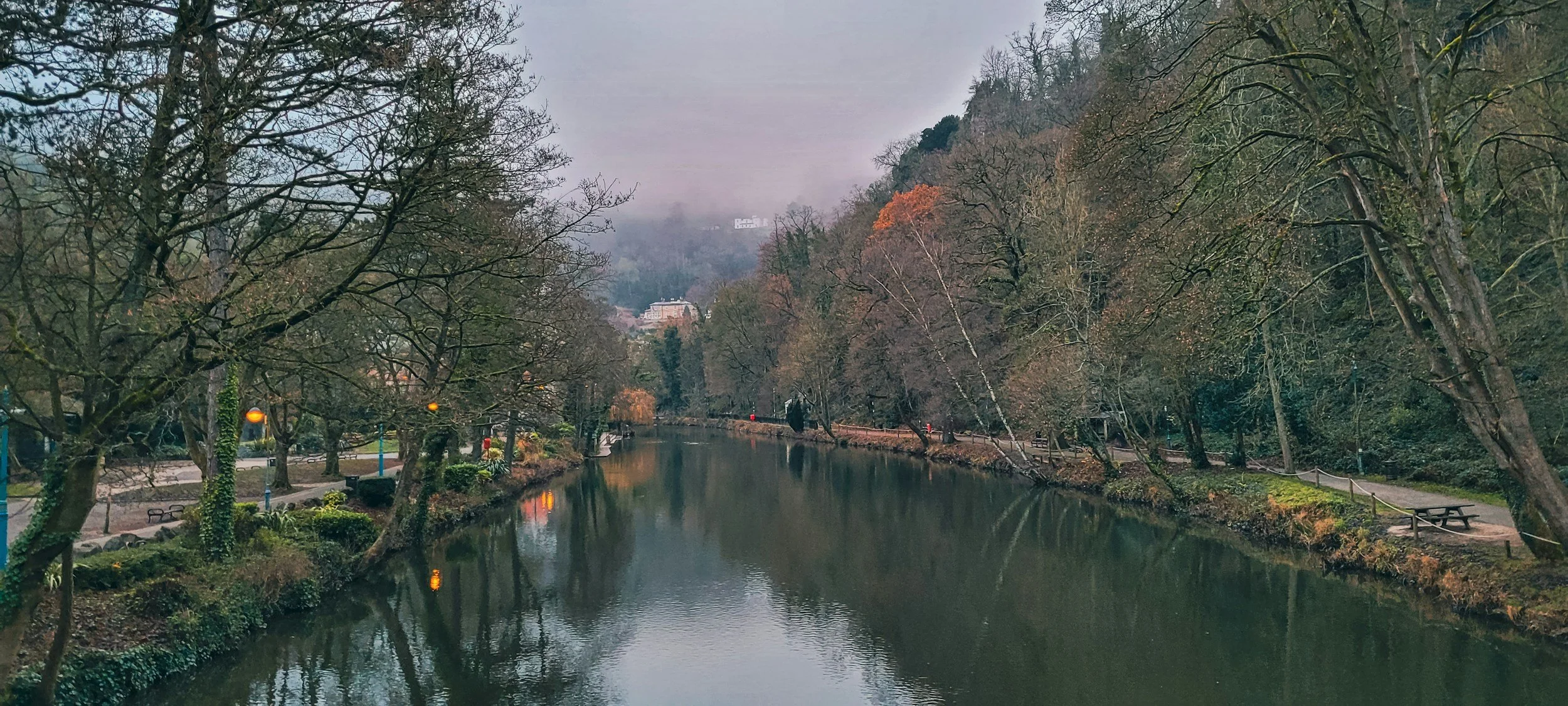
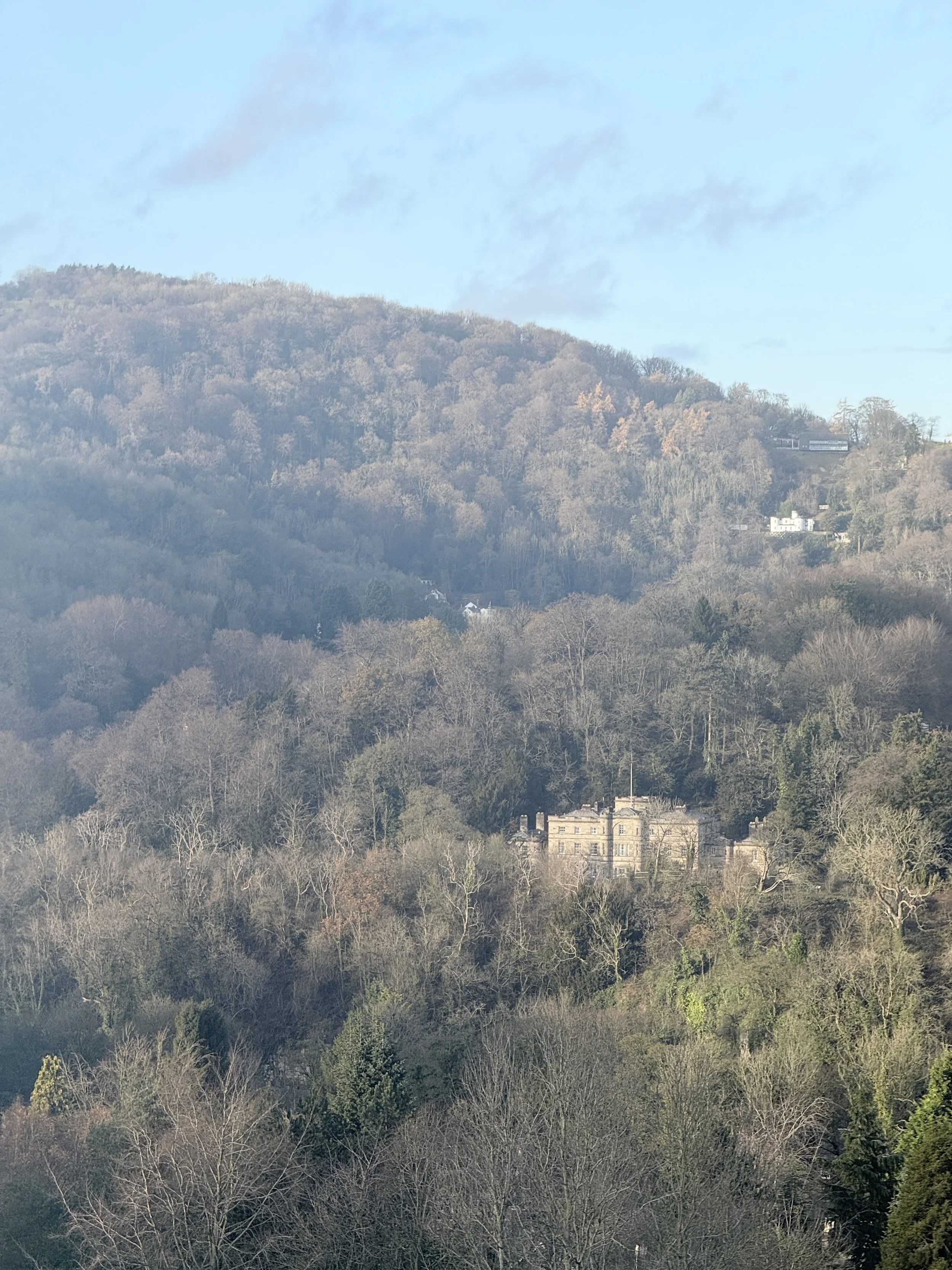
About the route
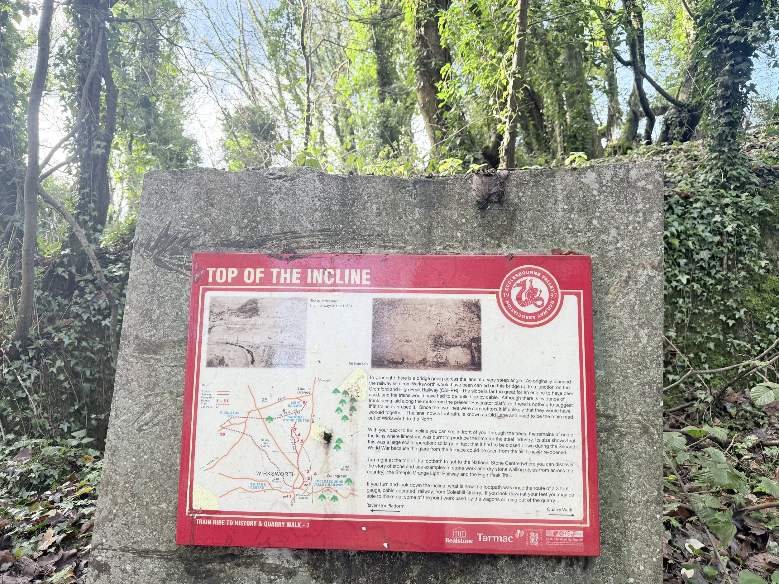
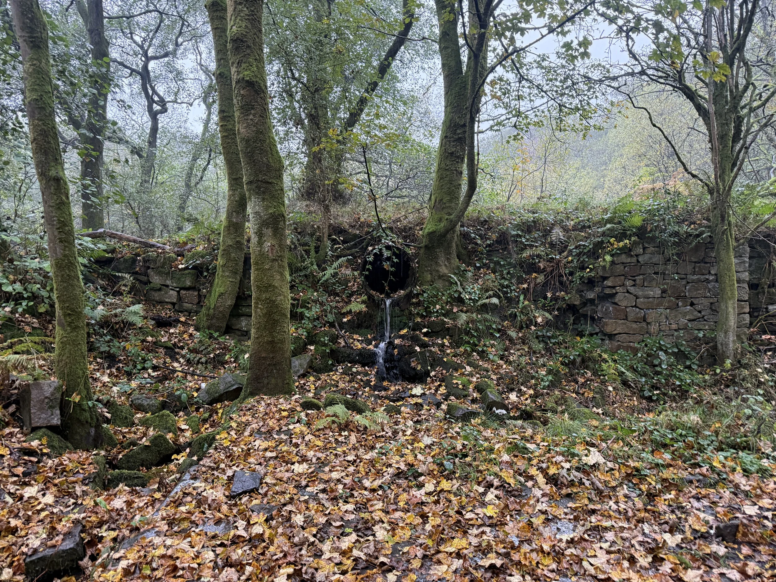
This circular walk sets off from Cromford Station and takes you on a loop through one of the most historically rich corners of the Peak District. You'll pass the world-famous Cromford Mill, stroll beside a peaceful canal to High Peak Junction, climb the old railway incline to meet the High Peak Trail, detour up to a trig point, then loop around Black Rocks, the National Stone Centre, and Stoney Wood's glowing StarDisc before heading back to Cromford.
Expect a blend of stunning scenery, industrial relics and panoramic Peak District views, all without straying too far from a good brew or a pub stop.
Route difficulty
This is a mostly easy-going walk with a couple of short, steep sections — namely the Sheep Pasture Incline and the climb to Bolehill trig. Most of the route follows well-surfaced paths, including the flat canal towpath and the former railway line. There aren’t any technical sections on this walk: the paths are easy to follow. Some sections are suitable for prams, but the trig point and Black Rocks should be avoided if you're wheeling it.
Walk type: Circular
Start/finish: Cromford Station, DE4 3QJ
Terrain: Canal towpath, old railway trail, woodland, moorland edge
Difficulty: Easy–moderate with short steep sections
Good for: Heritage lovers, car-free adventures, varied scenery
Facilities: Toilets, cafes, pubs, bookshops at Cromford Mill and High Peak Junction
Route highlights
Cromford Mill
The world's first successful water-powered cotton mill, built in 1771 by Sir Richard Arkwright. Now home to cafes, bookshops, heritage tours and at Christmas — fairy lights and festive trees.
Cromford Canal
Flat, tranquil and stunning in the colder months. Look out for the Leawood Pump House and other historic canal architecture as you wander toward High Peak Junction.
High Peak Junction
Where canal meets railway — once a key interchange in Derbyshire’s industrial heyday. Pop into the heritage visitor hut if it’s open.
Sheep Pasture Incline
A short, sharp climb that once hauled goods up to the High Peak Railway. These days it hauls your legs up to great views.
Molehill Trig (unofficial name)
A brief detour off the main trail, this trig point rewards you with moorland views across Matlock.
Black Rocks
Dramatic gritstone outcrops popular with climbers. Scramble up for wide views over Cromford and Matlock Bath.
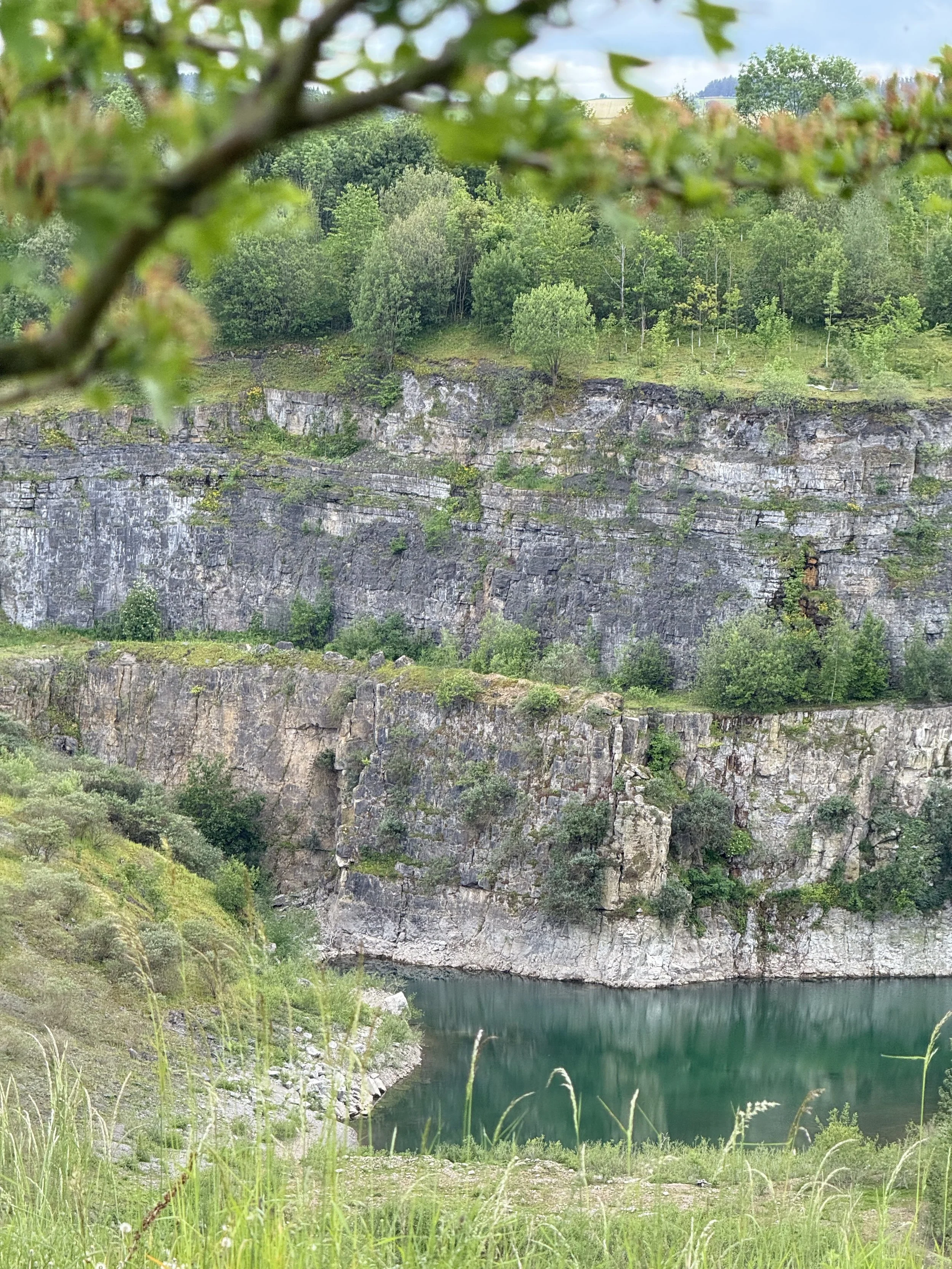
National Stone Centre
Pause to learn about the geology under your boots — or just enjoy the weirdly satisfying rock formations and sculpture trail.
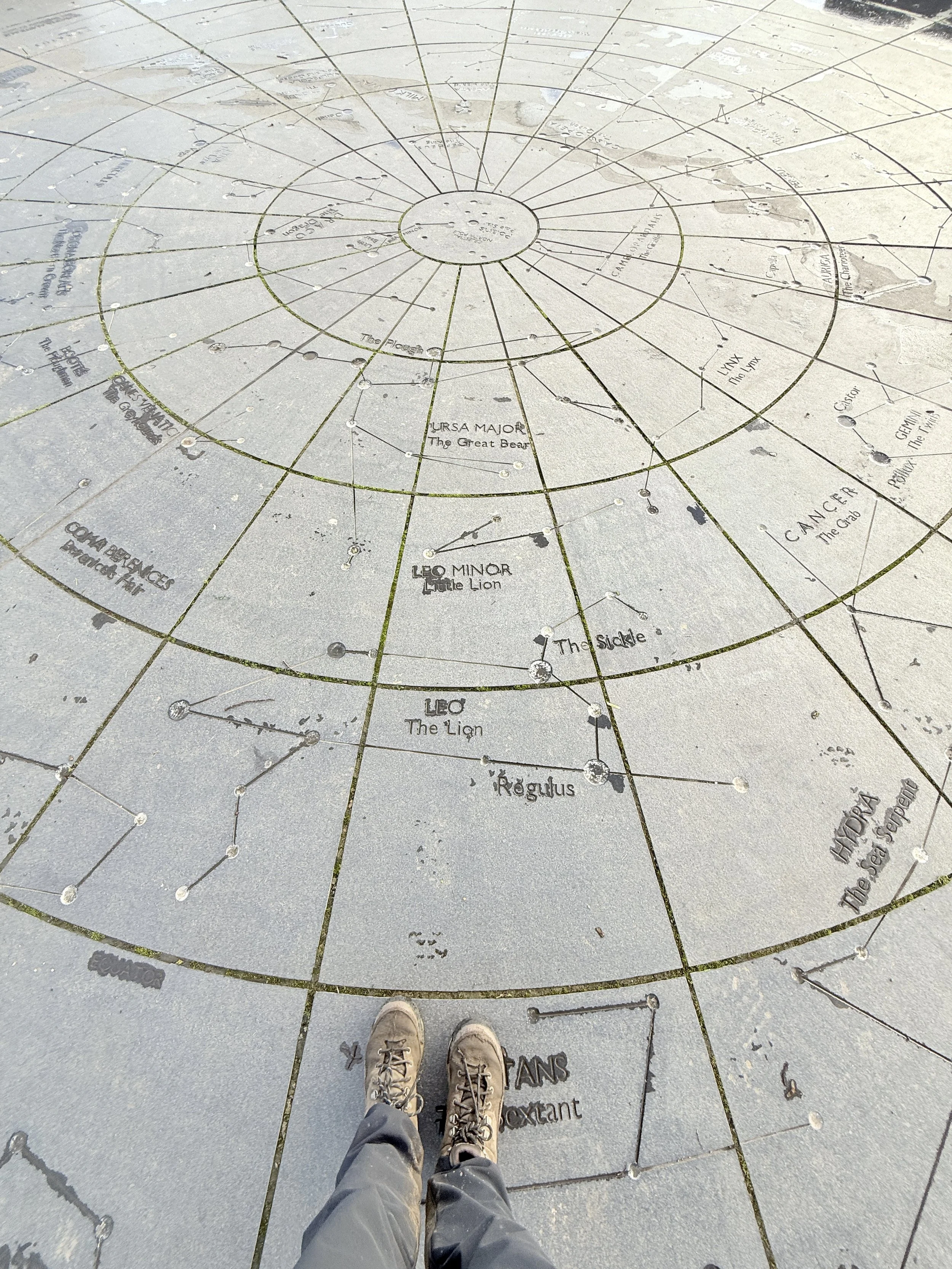
StarDisc, Stoney Wood
Set within a reclaimed quarry above Wirksworth, the StarDisc is a 12-metre granite star chart representing the Northern Hemisphere night sky. It’s surrounded by 12 stone seats — one for each month — and serves as both a public artwork and celestial amphitheatre.
Middle Peak Quarry
A reminder of the area's quarrying past and present — part of the landscape’s working history.
Where is Cromford?
Cromford sits on the edge of the Peak District in Derbyshire’s Derwent Valley. It’s part of a UNESCO World Heritage Site thanks to its role in the Industrial Revolution and is well-connected by train, making it a brilliant base for car-free walks.
Things to do nearby
Visit Cromford Mill and take a guided heritage tour
Browse Scarthin Books — a legendary indie bookshop just over the canal
Ride the Heights of Abraham cable car in nearby Matlock Bath
Explore Lea Wood or Cromford Meadows for bonus easy loops
Pop into the pub or café after your walk — several options in Cromford village
Is this walk suitable for beginners?
Yes — especially if you're comfortable walking for a few hours with a bit of uphill effort. The paths are well-marked and easy to follow, but good footwear is recommended for the steeper/muddier sections. To make it easier, stick to the canal and High Peak Trail sections and skip the Black Rocks and trig point.
Is the route dog-friendly?
Yes! Dogs are welcome on all sections, though leads may be needed around livestock and near the canal. There's fresh water access along the way and plenty of good stick-carrying territory.
When is the best time to do this walk?
Spring to autumn is ideal for wildflowers, dry trails and longer days. The autumn colours in the valley are stunning, while winter brings a festive atmosphere around Cromford Mill. Avoid after heavy rain if you want to keep your feet dry.
How to extend your adventure
Link up with the Limestone Way or Derwent Valley Heritage Way
Add on a short detour to Lea Wood Nature Reserve
Explore Matlock Bath and its arcades, riverside walks and fish and chips
Turn it into a full day with a visit to Cromford Mill museum and café
Getting to the starting point
By train: Cromford Station is on the Derwent Valley Line, with regular trains from Derby and Matlock.
By car: Limited parking near Cromford Wharf or on-street in the village. Arrive early on weekends.
✔️ Good to knows
Wear sturdy boots — it’s not technical but there are steep bits
Dogs welcome, but leads needed around livestock
Toilets and food stops at Cromford Mill, High Peak Junction + National Stone Centre
Suitable for prams if you skip the trig/quarry
OS Map: Explorer OL24 (White Peak)
🧭 Following the route
I use komoot and OS Maps for offline navigation. To follow this walk step-by-step on komoot, simply click this link here or download the GPX file and upload it to your chosen app, such as OS Maps.
Cheesden Valley: a ruined valley ramble near Manchester
A 7.5-mile circular walk through an unexpected pocket of wilderness in Greater Manchester, featuring mill ruins, chimney stacks, pubs, hidden waterfalls and a woodland tearoom just outside Rochdale
Start: Owd Betts lay-by, Edenfield Road, Greater Manchester
Distance: 7.5 miles
Elevation: 725 feet
Duration: 3 hours
Difficulty: Easy (with some slippery sections in the colder months)
Navigation: Follow step-by-step on komoot or download GPX file
About the route
This circular walk begins at the lay-by near the historic Owd Betts pub and loops through the Cheesden Valley — an area rich in industrial heritage and natural beauty. You’ll descend into a wooded gorge, follow Cheesden Brook past the ruins of old mills and weirs, spot a dramatic chimney stack rising through the trees, and pass a tucked-away waterfall before climbing out of the valley to return via moorland paths and a tea stop near Norden.
This route started off as a spontaneous wander while in the area and it turned out to be one of my all-time favourite low-level walks. I wasn’t expecting much from this one, but those walks often turn out to be the best, don’t they?
Route difficulty
This is an easy to moderate walk with a mix of woodland trails, uneven valley paths, and field edges. There’s around 800 feet of elevation, with most of the climbing as you leave the valley mid-route. The paths are generally easy to follow but can be muddy, particularly after rain. Good boots are a must. While it’s low-level in terms of elevation, this is a proper walk—not a gentle parkland stroll.
| Walk type | Circular |
|---|---|
| Distance | 7.5 miles / 12 km |
| Time | 3.5–4 hours (plus stops) |
| Start/finish | Owd Betts lay-by, Edenfield Road |
| Terrain | Valley paths, woodland trails, moorland edge tracks |
| Difficulty | Moderate, with steeper/muddy sections |
| Good for | Unexpected views, industrial history, spontaneous adventures |
| Facilities | Pub, tearoom (limited hours), roadside parking |
Route highlights
Cheesden Lumb Mill: One of many atmospheric ruins along the brook — built in 1786 and now overgrown but still impressive..
Chimney stack: A tall, photogenic relic of Cheesden’s industrial past, rising through the woods like something from a lost world.
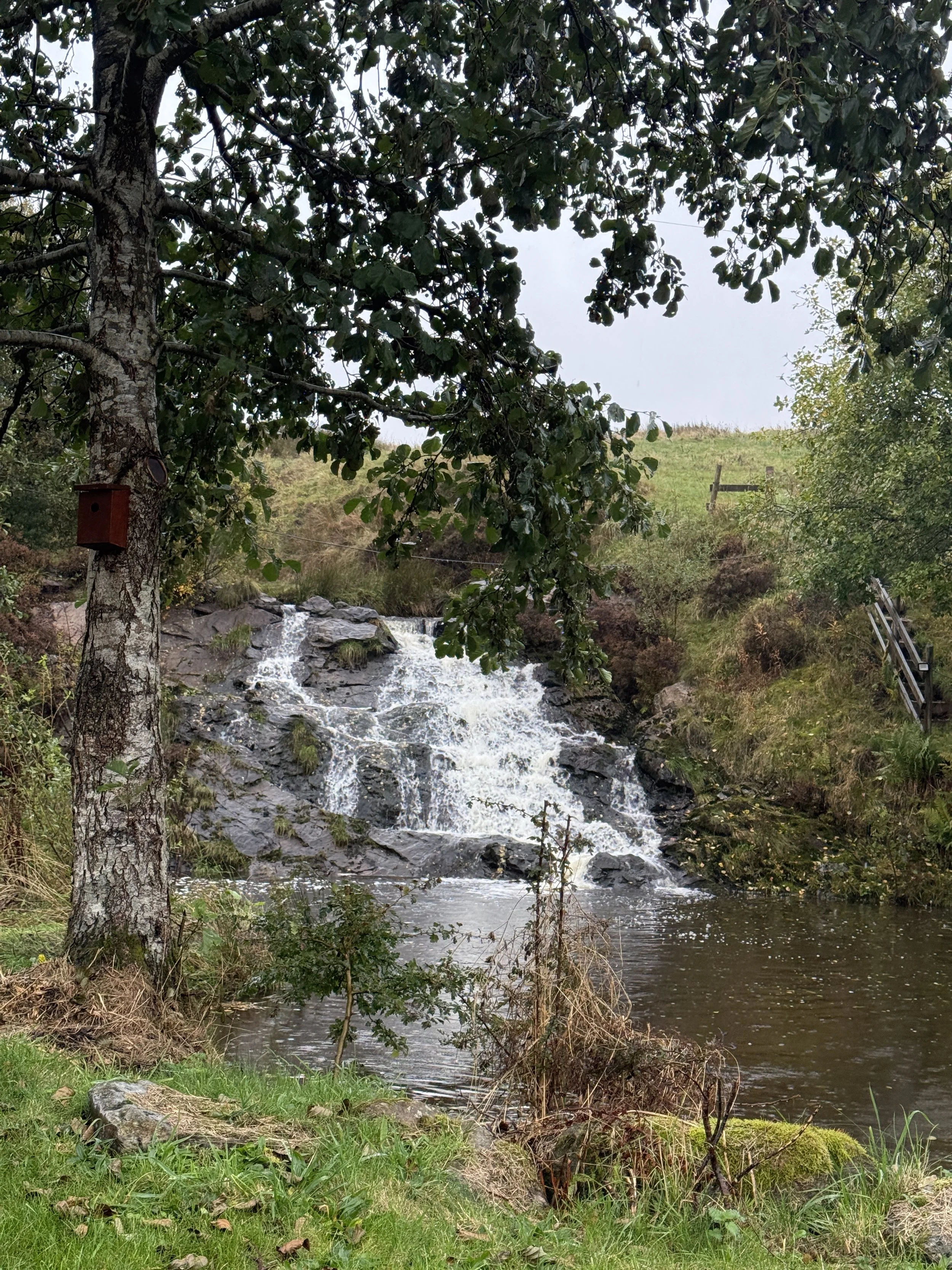
Cheesden Brook & waterfall: Follow the water through the valley and keep an eye out for a waterfall tucked to the side of the trail.
Wildlife sightings: Keep an eye out for wild deer in the woodland near the tea garden (couldn’t believe my eyes seeing wild deer just a few miles outside of Rochdale!).
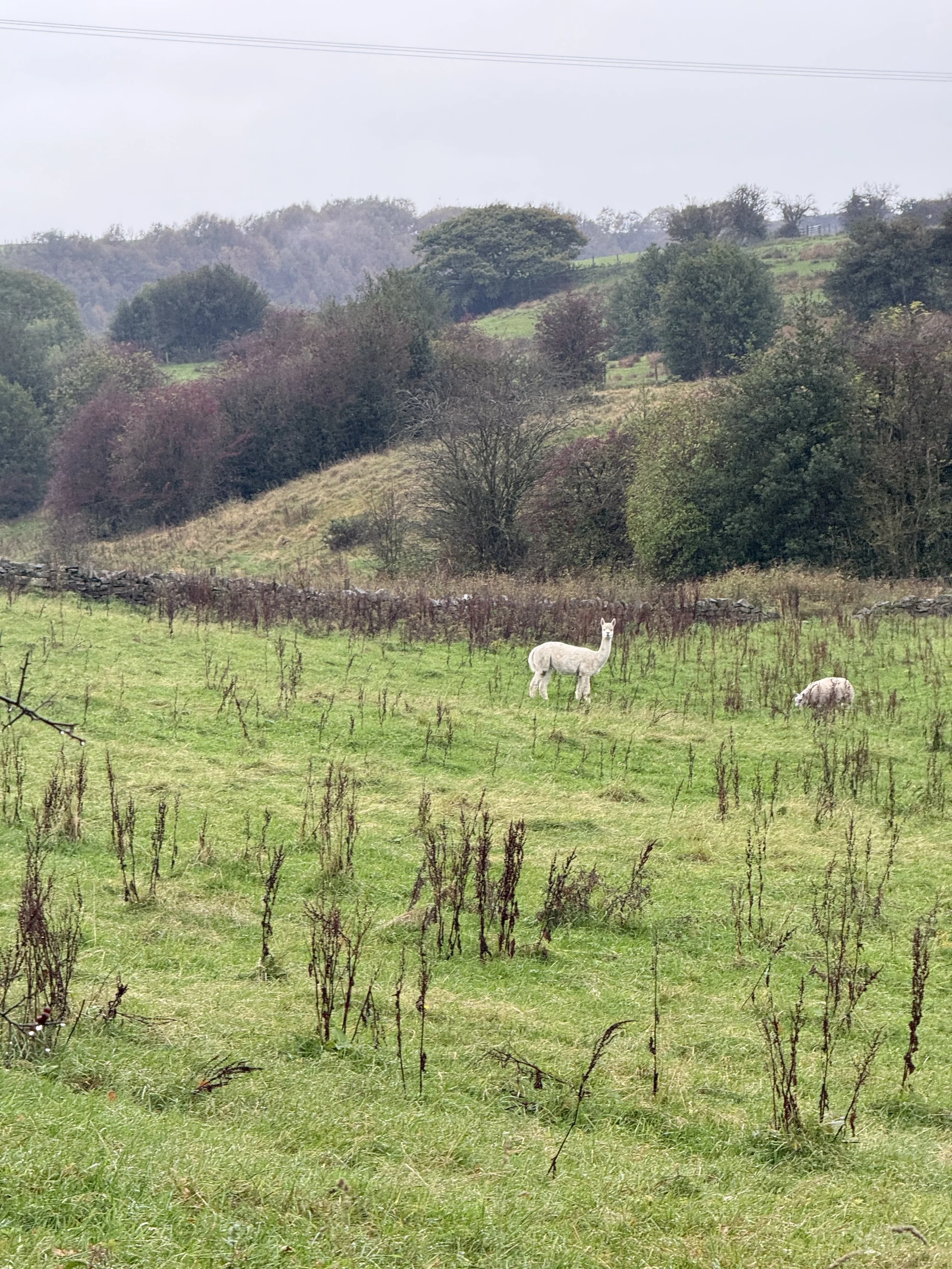
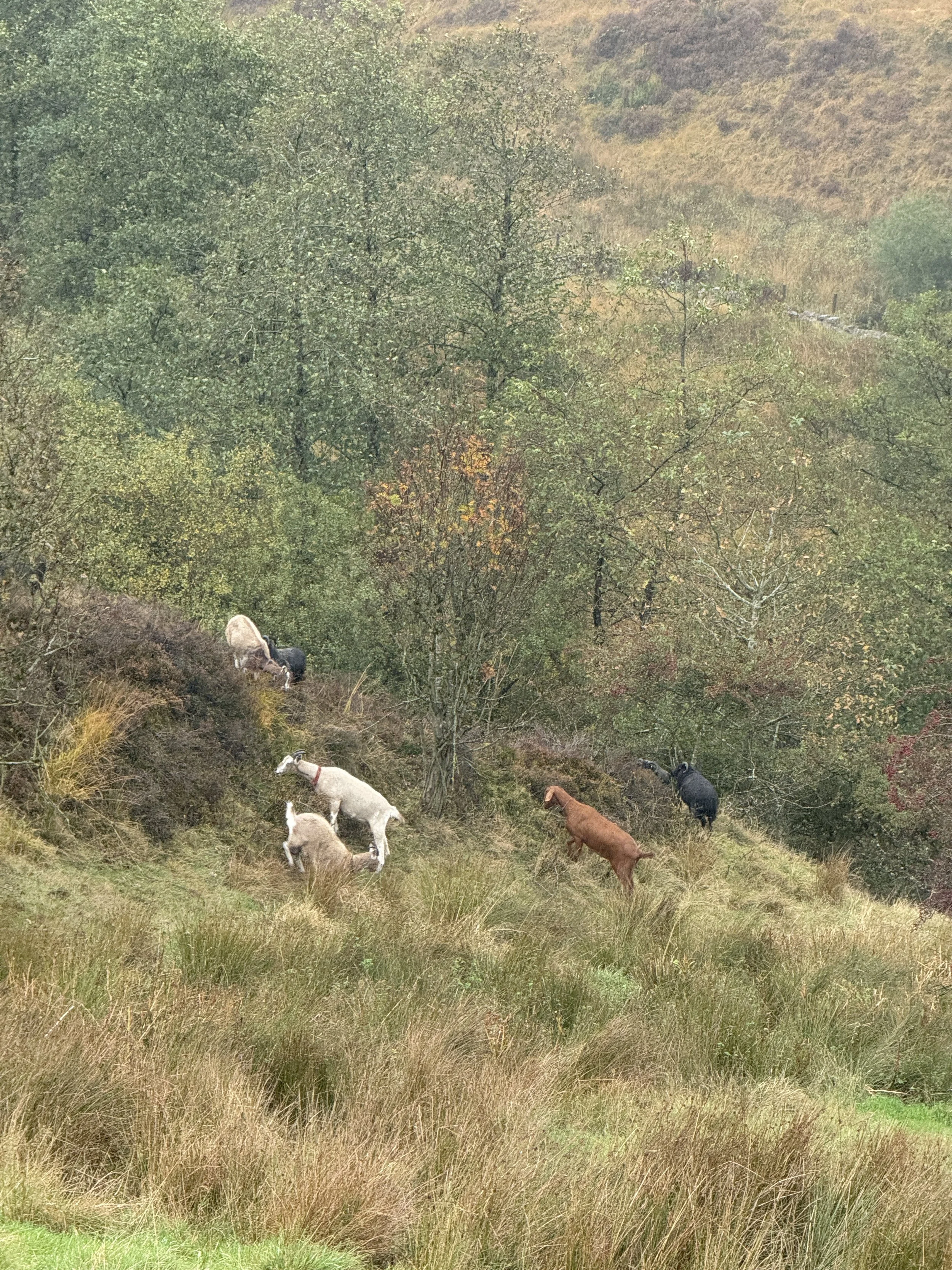
Goats and alpacas: Keep your eyes peeled near the fields and enclosures for goats and alpacas (a highlight of the walk for me!).
Moorland views: As you climb back out of the valley, views open up toward Greater Manchester and beyond.
Millcroft Tea Garden: A beautiful, old-school tea room hidden away in the woodland — only open on Sundays (12pm-6pm).
Where is Cheesden Valley?
Cheesden Valley lies between Rochdale and Edenfield, within the Greater Manchester boundary but feeling far wilder than its postcode suggests. It’s one of the best hidden-gem walks near Manchester — remote-feeling yet surprisingly accessible.
Things to do nearby
Visit Ashworth Moor Reservoir for a bonus short loop or picnic with a view.
Grab a post-walk pint at the Owd Betts pub (check opening times).
Tuck into tea and cake at Millcroft Tea Gardens (only open on Sundays, 12pm-6pm).
Explore more ruins by extending the route along other Cheesden Brook mill sites.
Is this walk suitable for beginners?
Absolutely, with some caveats. If you’re new to walking but happy to cover 7+ miles over a few hours, and don’t mind mud or mild climbs, this route is for you. The terrain isn’t difficult, but some parts can get super muddy, especially after heavy rain. Navigation is straightforward with a downloaded route.
Is the route dog-friendly?
Dogs are welcome throughout most of the route, including the trails and woodland. They must be kept on leads around livestock.
When is the best time to do this walk?
Spring/summer: Green woodland, flowing water, chance of deer sightings
Autumn: Gorgeous leaf colour and atmospheric light (save this one for autumn if you can!)
After rain: The waterfall is fuller, but the paths can be slippery
Avoid heavy downpours: It can get boggy and slow-going
How to extend your adventure
Add on Knowl Hill for extra views and more challenging elevation
Loop around Ashworth Moor Reservoir before or after the main route
Link to nearby moorland tracks if you want a longer day out
Visit the site of Deeply Vale Festival for a quirky local history detour
Getting to the starting point
By car: Park at the lay-by opposite the Owd Betts pub, Edenfield Road, OL12 7TY.
By public transport: Bus routes run from Rochdale and Bury, but you’ll likely need to walk a short way from the nearest stop.
✔️ Good to knows
Wear proper footwear the valley can get muddy, especially after rain
Millcroft Tea Gardens is only open on Sundays (12pm-6pm)
Bring a snack and water refreshment stops may be closed
Use a GPS route or Komoot navigation is mostly simple but a few turns can be missed
Dogs welcome on lead near livestock
Arrive early on weekends the lay-by is small and fills quickly
Mobile signal patchy download maps offline
Facilities: Pub at start/finish (check hours), tea room near Norden, no public toilets en route
🧭 Following the route
I use komoot and OS Maps for offline navigation. To follow this walk step-by-step on komoot, simply click this link here or download the GPX file and upload it to your chosen app, such as OS Maps.

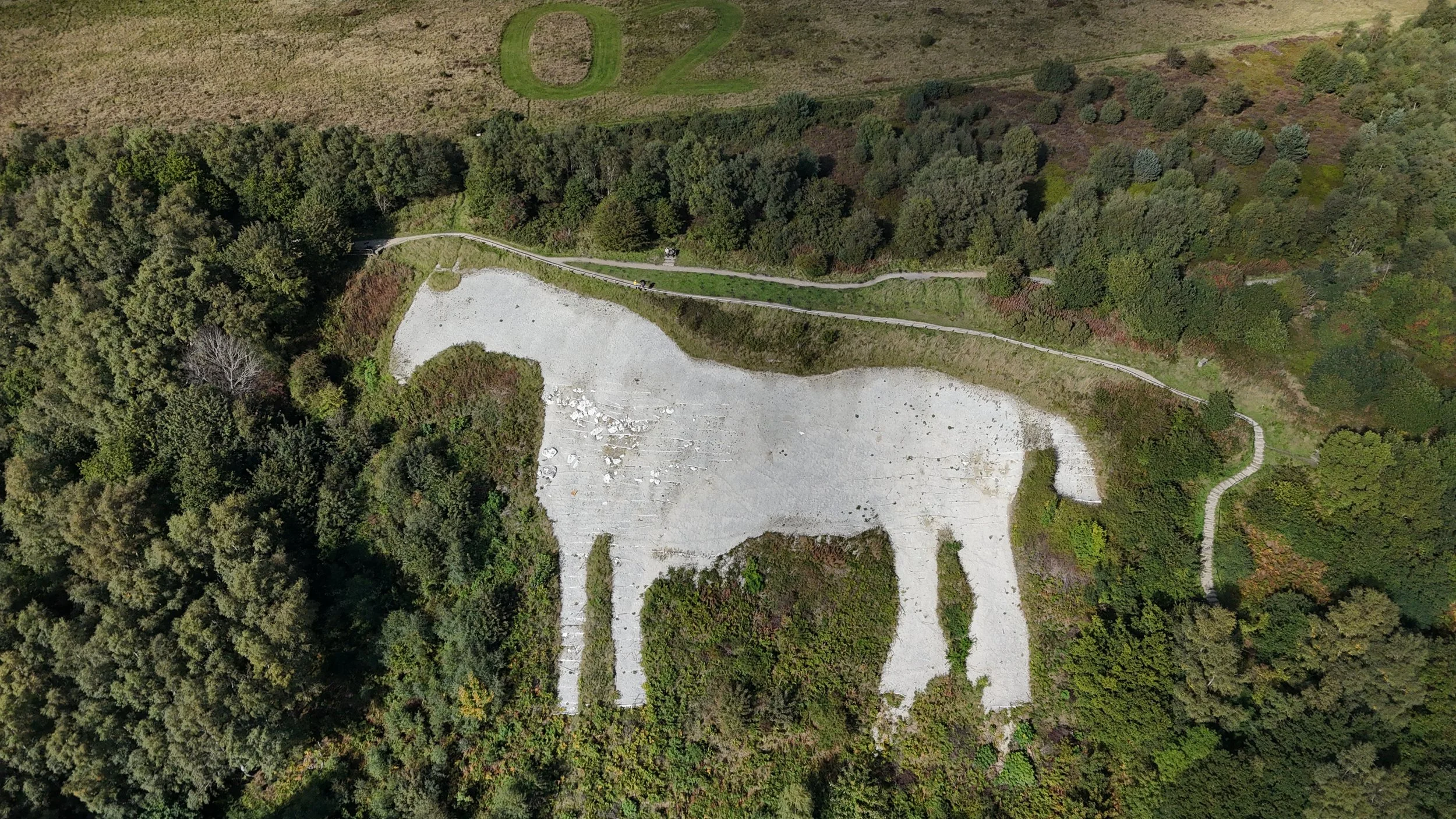
Kilburn White Horse: A walk to the ‘finest view in England’
A circular North York Moors walk featuring iconic chalk carvings, cliff-edge gliders and a tranquil glacial lake
Start: Kilburn, North York Moors National Park
Distance: 7 miles
Elevation: 925 feet
Duration: 3 hours
Difficulty: Easy-moderate (with some steep sections)
Navigation: Follow step-by-step on komoot or download GPX file
About the route
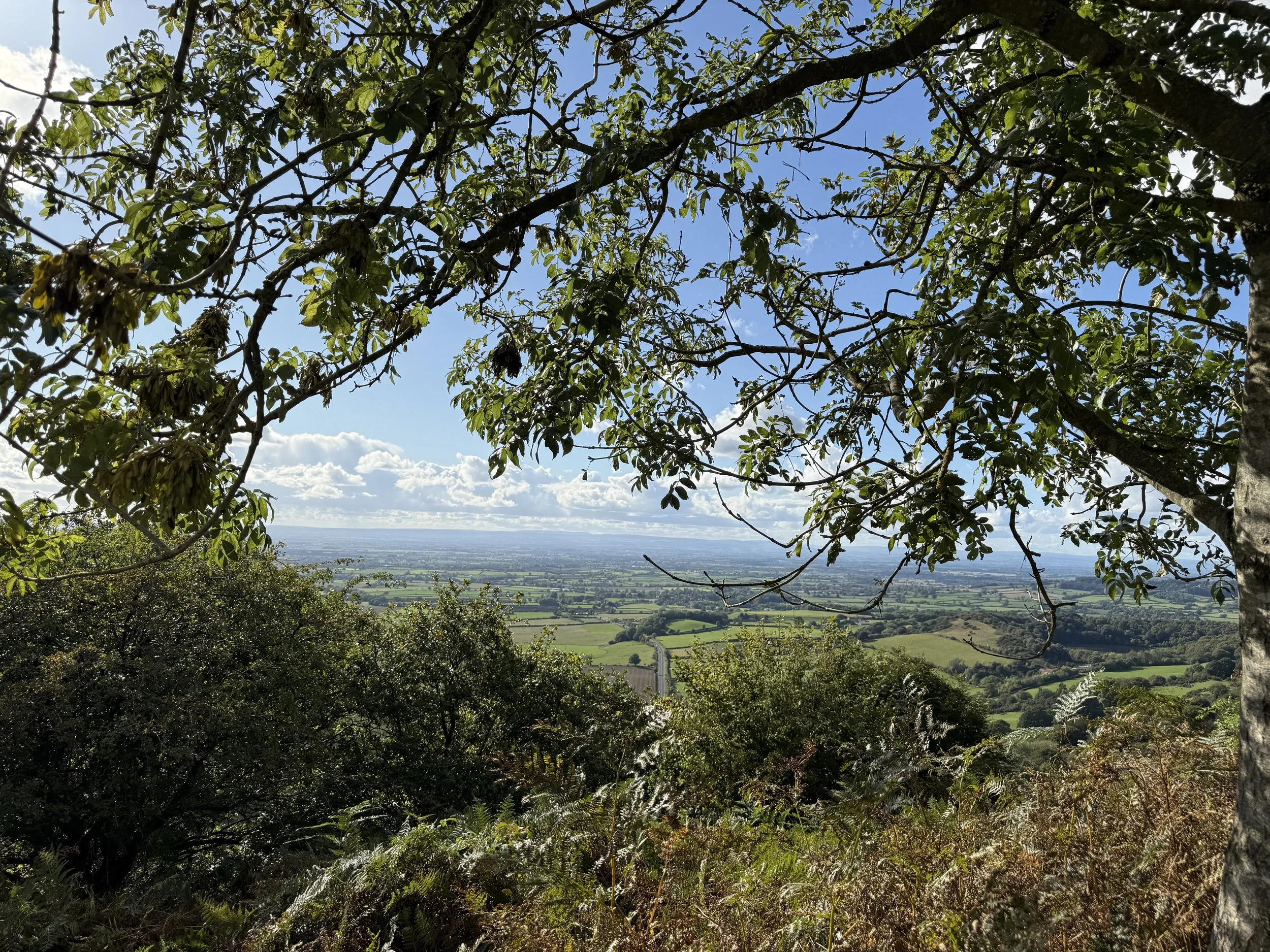
This 7-mile loop explores the dramatic southern edge of the North York Moors, starting in the charming village of Kilburn. The route climbs steadily through Forestry England woodland to reach the Kilburn White Horse—a vast chalk figure etched into the hillside. From here, follow the escarpment path, where gliders from the nearby Yorkshire Gliding Club often drift silently overhead.
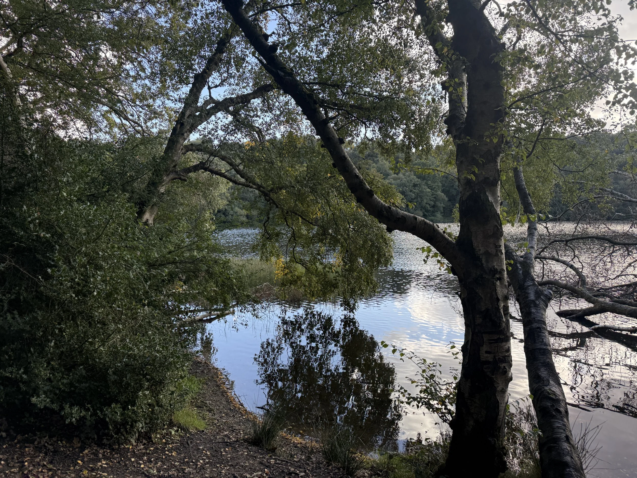
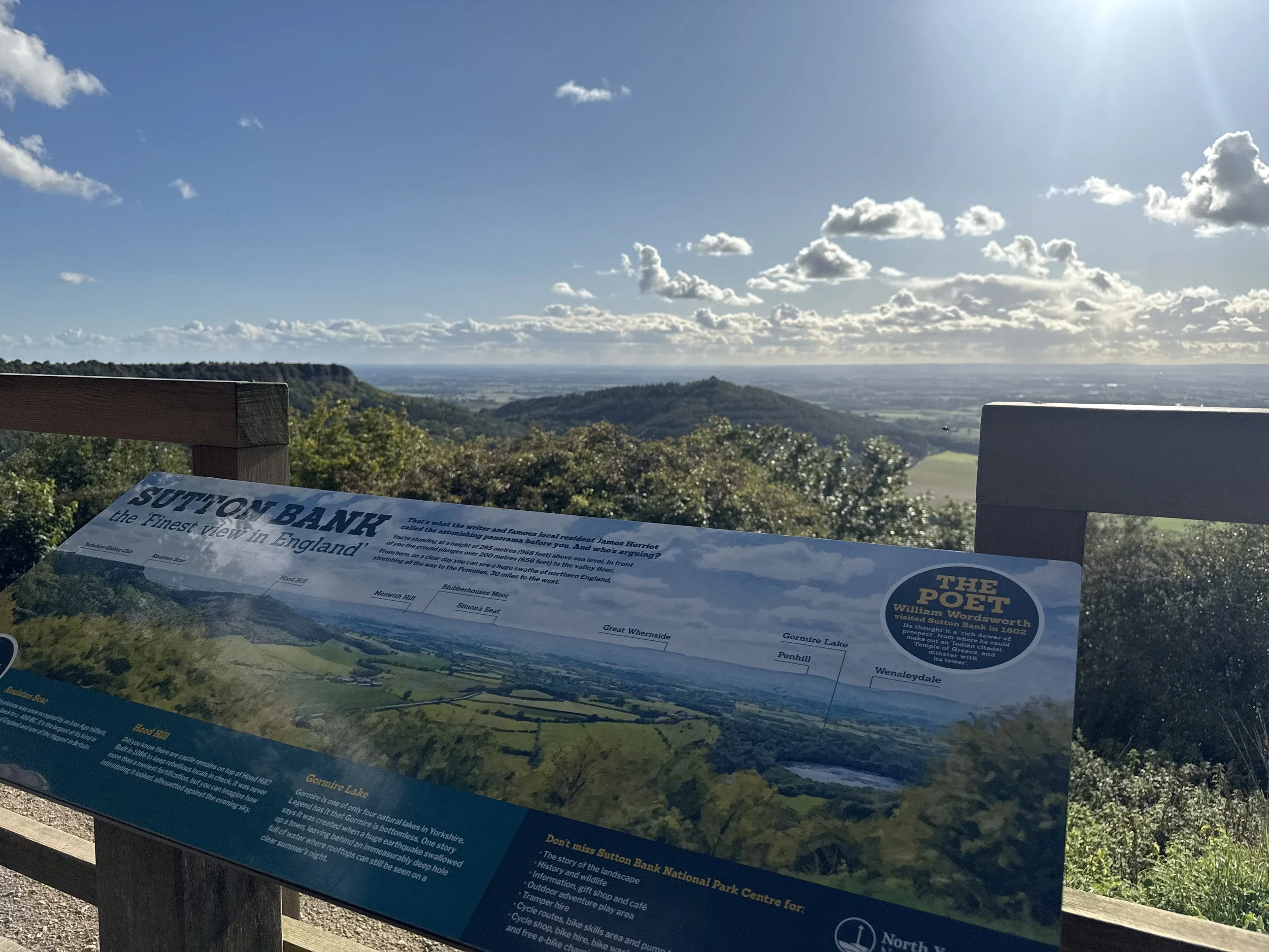
Midway, you can pause at Sutton Bank Visitor Centre, home to a popular tearoom and what James Herriot once called "the finest view in England." The route then descends to the peaceful shores of Gormire Lake, before winding back through woodland and farmland towards Kilburn.
Route difficulty
This is a moderate walk with a mix of woodland trails, escarpment paths and field edges. The climbs up to the White Horse and down to Gormire Lake can be steep and occasionally muddy, particularly after rain. Some sections follow the Cleveland Way and are well-signposted, but having a GPX route helps for the woodland return.
| Walk type | Circular |
| Distance | 7 miles / 11 km |
| Time | 2.5–3 hours (plus stops) |
| Start/finish | Kilburn village or nearby forest car park |
| Terrain | Forest trails, ridge paths, field edges, lake paths |
| Difficulty | Moderate, with some steeper and uneven sections |
| Good for | Big views, hidden lakes, plane spotting, woodland wanders |
| Facilities | Café, loos and visitor centre at Sutton Bank |
Route highlights
Kilburn White Horse
England’s most northerly chalk figure, this striking 318-foot carving dominates the hillside above Kilburn and makes for an epic early viewpoint. You can spot it from miles away—but nothing beats standing right beside it.
Yorkshire Gliding Club
Perched high above the Vale of York, this hilltop airfield adds some unexpected drama to your walk. On a good day, you’ll spot sleek gliders launching from the cliff edge and silently soaring overhead.
Sutton Bank Visitor Centre
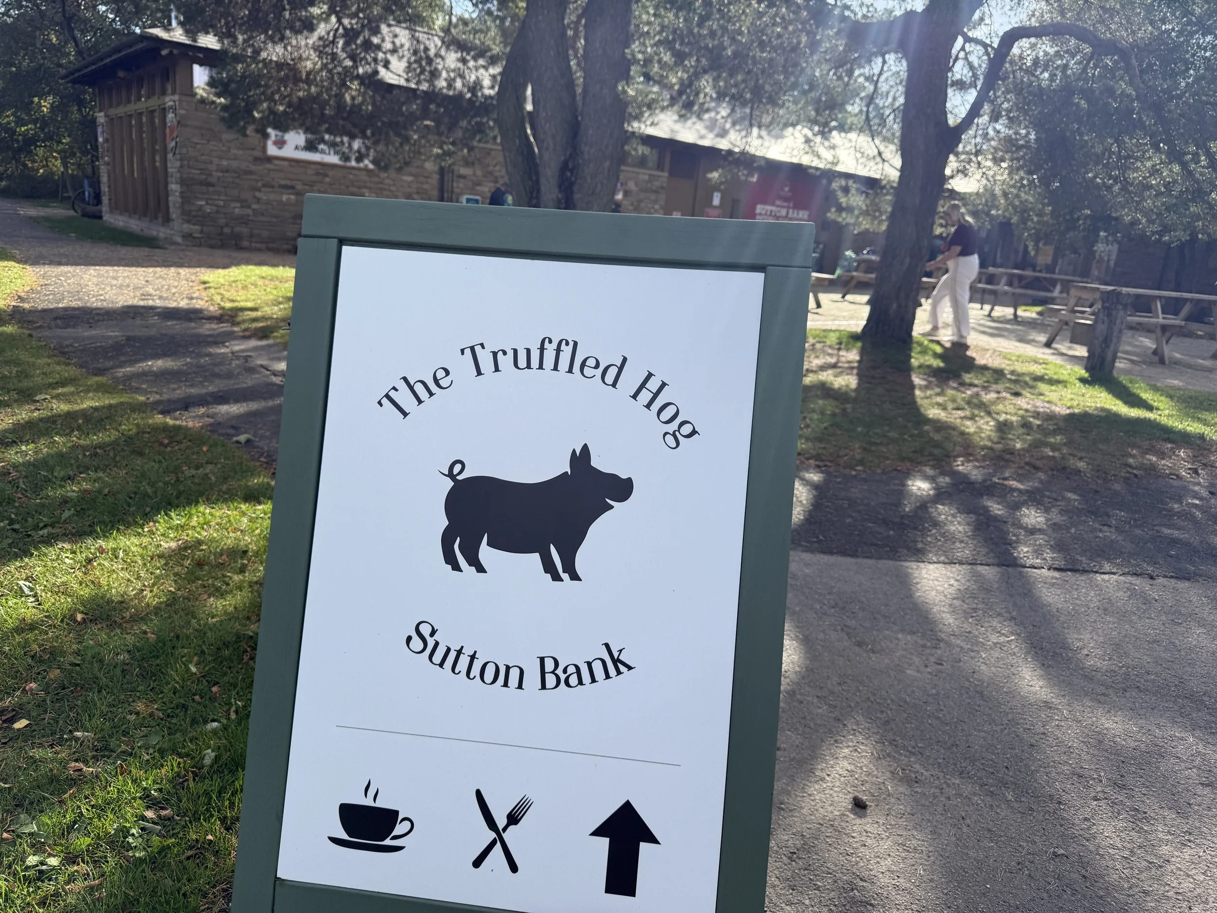
Halfway through the walk, the National Park centre is the perfect place to pause. Grab a cup of tea or cake from The Truffled Hog, refill your water, and enjoy the famous viewpoint overlooking Hood Hill and the valley below.
Gormire Lake
Nestled beneath the cliffs of Whitestone Scar, Gormire is one of the few natural lakes in the North York Moors. Shaded by trees and alive with birdlife, it’s a peaceful spot with local legends of ghostly horses and bottomless depths.
Where is Kilburn?
Kilburn is a small village on the southern edge of the North York Moors National Park in North Yorkshire. It’s best known for the nearby Kilburn White Horse and for its connection to Robert Thompson, the famous ‘Mouseman’ furniture maker. The village sits just off the A170, around 6 miles east of Thirsk, and is a popular starting point for walks along the Cleveland Way and surrounding escarpment.
Things to do nearby
Visit the ruins of Byland Abbey
Explore the Sutton Bank bike trails or hire bikes from the centre
Pop into Kilburn village to see local woodcarver Robert Thompson's Mouseman workshop
Is this walk suitable for beginners?
Yes, with care. The route has clear paths and signage in parts, but the inclines and descents around the escarpment can be challenging for newer walkers. Take your time and wear decent footwear. The halfway café stop helps break things up nicely.
Is the route dog-friendly?
Dogs are welcome throughout most of the route, including the trails and woodland. They must be kept on leads around livestock and near the gliding club. Dogs are also welcome at The Truffled Hog (the cafe at Sutton Bank).
When is the best time to do this walk?
The views from Sutton Bank and the escarpment make this walk special, so aim for clear or partly cloudy conditions. In fog or low cloud, visibility is limited and the best viewpoints may be missed. Always check the forecast and dress accordingly.
Late spring through early autumn offers the best mix of dry trails, active gliders and clearer views. Autumn colours add extra drama in the woods, while summer brings long daylight and ideal picnic conditions. Avoid after heavy rain, as parts of the path can be muddy.
How to extend your adventure
This route links nicely with other trails around the Kilburn and Sutton Bank area. For a longer adventure:
Explore the quiet ridge above Gormire Lake for extra views
Link with the White Rose Walk, which starts at the Kilburn White Horse
Add a climb to Hood Hill, a small peak just south of the escarpment
Include a detour to Byland Abbey for a mix of walking and history
Local legends and folklore
Gormire Lake has long been the subject of folklore. One tale tells of a knight and his horse plunging into the waters from the cliff above, cursed to rise again each century. Some say the lake is bottomless, though it’s actually around 29 feet deep.
Best photo spots
Looking out over the White Horse from the top of the escarpment
Watching gliders from the Cleveland Way ridge
Reflections at the edge of Gormire Lake, especially on calm days
Getting to the starting point
By car: Kilburn is just off the A170 near Thirsk. Park on Low Town Bank Road for direct access to the White Horse climb, or in Kilburn village for a full loop.
By public transport: The nearest rail station is Thirsk. From there, local buses or a short taxi ride will get you to Kilburn.
✔️ Good to knows
Café: The Truffled Hog at Sutton Bank Visitor Centre (open daily)
Toilets: Available at the visitor centre
Dogs: Allowed on leads, though not permitted inside the gliding club café
Footwear: Sturdy boots recommended
Map: Download route in advance as signal can be patchy
Parking: Pay & display at Sutton Bank or free lay-bys near Kilburn
🧭 Following the route
I use komoot and OS Maps for offline navigation. To follow this walk step-by-step on komoot, simply click this link here or download the GPX file and upload it to your chosen app, such as OS Maps.
A Timeless Loop: Waterfalls, Woods & Wandering from Goathland Station
A wander through railway nostalgia, hidden waterfalls and moss-draped woodland in the North York Moors

Start: Goathland Station car park, North York Moors
Distance: 5 miles
Elevation: 675 feet
Duration: 2 hours
Difficulty: Easy (with care around the waterfalls)
Navigation: Follow step-by-step on komoot or download GPX file
About the route
A 5-mile circular walk through the heart of the North York Moors, starting and ending at Goathland Station. This route combines woodland wanders, moorland edges, hidden waterfalls and a quirky little pub tucked into a valley. You’ll walk sections of the old railway trail, dip into the timeless hamlet of Beck Hole, discover Thomason Foss and Mallyan Spout, and loop back through Goathland village.
Time it right and you’ll catch the sound of steam engines echoing through the trees.
Route difficulty
This is a relatively gentle walk with a few sections that require care, particularly near Thomason Foss and Mallyan Spout, where paths can be steep, muddy or uneven. A bit of scrambling is needed in places, and the rocks near the waterfalls can be very slippery, especially after rain.
Most of the route is gentle underfoot, especially along the old rail trail and woodland paths, but caution is advised near water.
Distance: 5 miles / 8 km
Time: 2.5–3 hours with faff and photo stops
Start/finish: Goathland Station car park
Terrain: Woodland trails, old rail paths, rocky sections near waterfalls
Difficulty: Moderate — easy-going in places, steep/slippy near waterfalls
Good for: Waterfall lovers, moody weather wanderers, filming location fans
Facilities: Cafés, pub, loos in Goathland village
Route highlights
Goathland Station: Better known to many as Hogsmeade Station from Harry Potter and the Philosopher’s Stone. It’s also a popular filming location for Heartbeat, the long-running 1960s police drama. Goathland stood in for the fictional village of Aidensfield, and many of the village’s shops and buildings still reference the show today.
The Inn Way & rail trail: A wide, accessible path that traces a former railway line. Perfect for easy walking and glimpses of Victorian engineering.
Beck Hole & Birch Hall Inn: A pint-sized hamlet in a steep-sided valley. The Birch Hall Inn is part pub, part sweet shop, and a worthy detour for a snack or half pint.
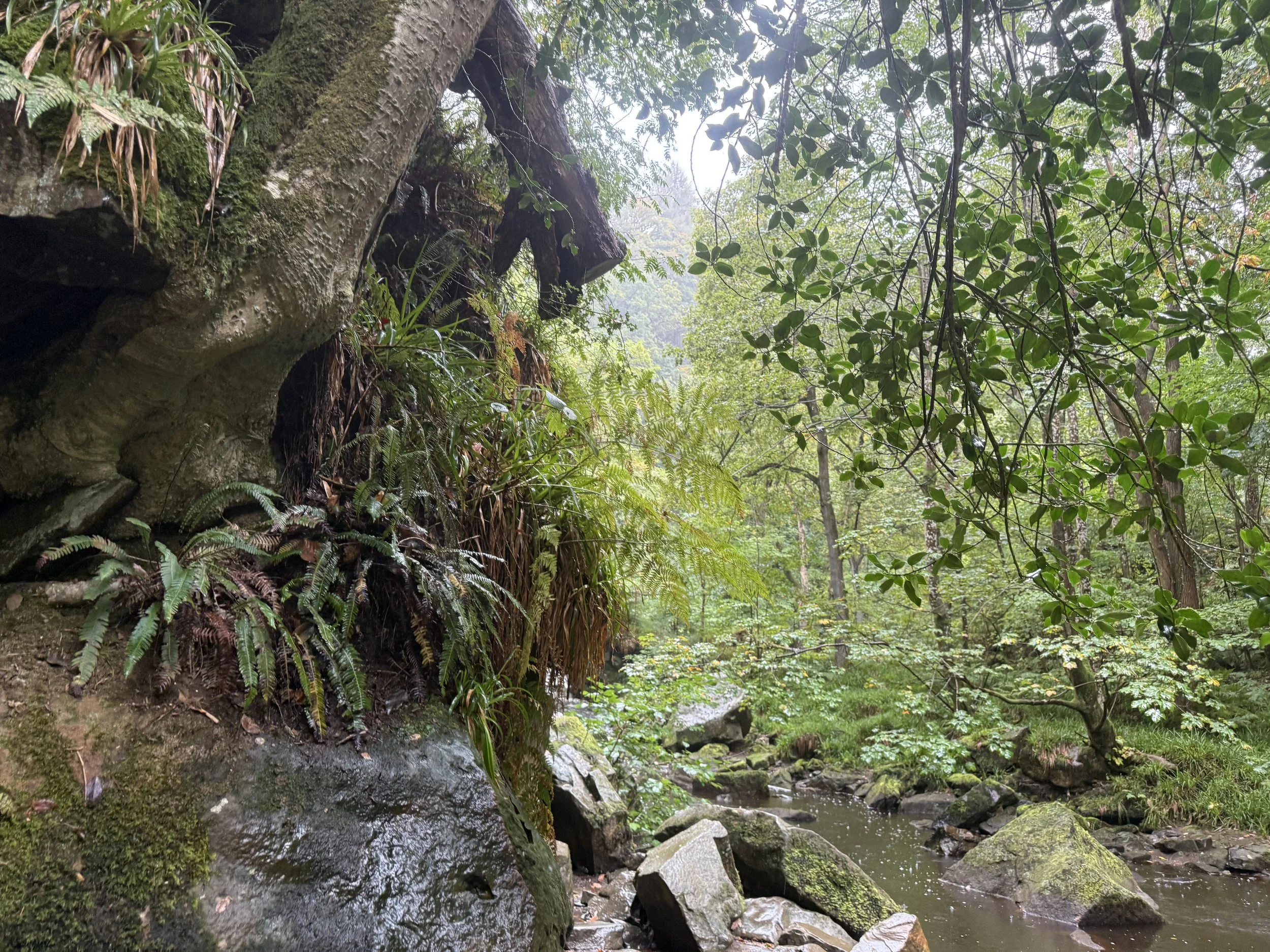
Thomason Foss: A lesser-known but enchanting waterfall, nestled in a quiet wooded gorge. The path is rough in parts but worth the clamber. Care is needed here as the trail becomes narrow and rocky.
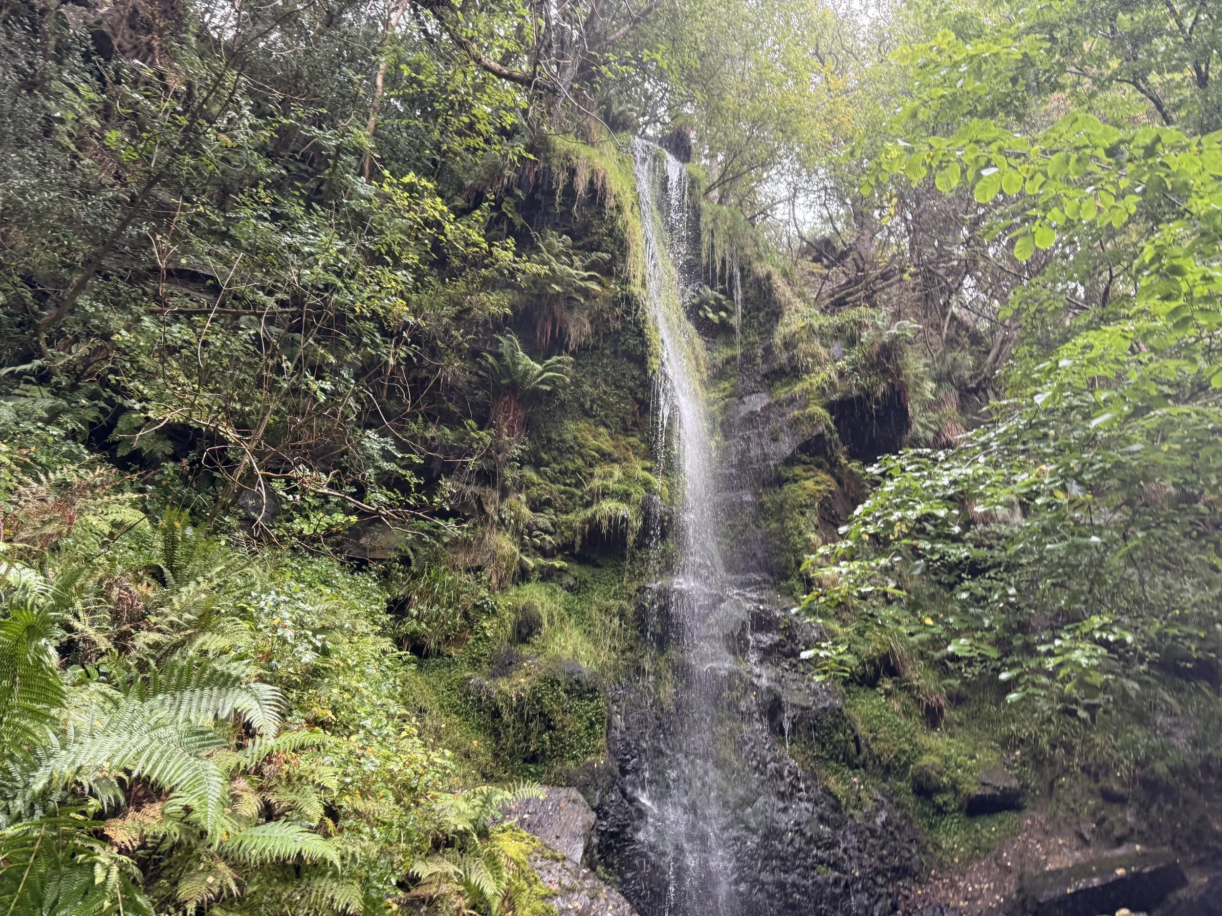
Mallyan Spout: A 70-foot waterfall tucked into a dramatic gorge. Expect mossy rocks, dripping ferns and the soothing rush of water. The route down and back up is steep and can be slippery.
Where is Goathland?
Goathland is a moorland village in the North York Moors National Park, about 9 miles southwest of Whitby. It’s surrounded by rolling heather moorland, pine forests, and old railway lines, and feels beautifully tucked away — yet is surprisingly easy to get to.
It’s best known for its vintage station, Heartbeat filming spots, and easy access to some of the area’s loveliest short walks.
Things to do nearby
Ride the North Yorkshire Moors Railway for a steam-powered view of the surrounding moorland.
Explore the moors on longer circular routes from Goathland or Grosmont.
Visit the Mallyan Spout Hotel for a post-walk cream tea.
Pop into the Goathland Tea Rooms or the Aidensfield Arms (for Heartbeat fans).
Is this walk suitable for beginners?
Yes, with caution. For anyone with impaired mobility, it’s best to skip the Thomason Foss detour and take care near Mallyan Spout. Stick to the main paths and allow time for rest stops.
When is the best time to do this walk?
This route works in any season:
Spring brings wildflowers and fast-flowing waterfalls
Summer offers leafy shade and buzzing wildlife
Autumn makes the surrounds come to life with misty moors
Winter can be magical too, though paths may be icy or boggy
Drizzly weather only adds to the old-world charm, but waterproofs are a must.
How to extend your adventure
Continue from Beck Hole towards Grosmont via the old railway incline for a longer route.
Explore Wheeldale Beck and nearby moorland paths.
Join the Lyke Wake Walk route if you’re after a much bigger day out.
Visit the nearby Hole of Horcum for another classic moorland loop.
Getting to the starting point
By car: Goathland Station has a dedicated car park (pay & display). Arrive early on weekends and holidays.
By train: Take the North Yorkshire Moors Railway steam service (seasonal) or regular train to Grosmont and walk from there (longer route).
By bus: Limited bus services run between Whitby, Pickering and Goathland. Check timetables in advance.
✔️ Good to knows
Facilities: Toilets and refreshments available at Goathland Station and some village cafés
Parking: Pay & display car park at Goathland Station
Refreshments: Birch Hall Inn, cafés in Goathland village, Mallyan Spout Hotel
Dog-friendly? Yes, but leads needed near livestock and steep sections
Accessibility: Not suitable for pushchairs or wheelchairs — uneven, narrow and steep paths
Mobile signal: Patchy — download offline maps
Waterfall warning: Paths near Mallyan Spout and Thomason Foss are steep and slippery — take care after rain
Best for: Mixed weather, film fans, nostalgia lovers
🧭 Following the route
I use komoot and OS Maps for offline navigation. To follow this walk step-by-step on komoot, simply click this link here or download the GPX file and upload it to your chosen app, such as OS Maps.
A walk through Brontë country: Brontë Waterfall and Top Withens
Wander through the landscapes that inspired a Brontë classic on this popular moorland walk
Start: Haworth Main Street, near the Brontë Parsonage Museum
Distance: 5 miles
Elevation: 400 feet
Duration: 2 hours
Difficulty: Easy (suitable for most walkers)
Navigation: Follow step-by-step on komoot or download GPX file
About the route
This relaxed walk through the Haworth moorlands makes for an ideal day out, ending with beautiful views and historic locations tied to Brontë history. The walk from Haworth leads you across scenic moorlands, rich with Brontë history and captivating scenery. The route takes you through open countryside with a dose of literary lore, including Top Withens (thought to be the inspiration behind Heathcliff’s home in Wuthering Heights) and the striking Brontë Waterfall.
Route difficulty
Walk type: Easy circular walk with limited elevation gain. Good for most walkers with, includes some uneven paths
Terrain: Mix of paved lanes, gravel paths, grassy trails, and some uneven moorland sections.
Inclines: Mostly gentle, with a short climb up to Top Withens that can be a little steep and exposed.
Surfaces: Some rocky patches and muddy stretches, especially after rain.
Navigation: Well-marked in most places, map/GPX needed for moorland section
Mobility: Not suitable for pushchairs or wheelchairs. This route contains stiles, steps, and narrow gates.
Why you’ll love this walk
A mix of moorland, waterfalls, ruins & literary lore
Great views at Top Withens + waterfall
Quiet in parts (especially the moors), lively in others (Haworth village)
Ideal for a Sunday stroll: nature + tearooms + pubs 🍵🍺
Walk highlights:
Route highlights
Haworth
Your walk begins and ends in the charming Pennine village of Haworth, nestled in the heart of West Yorkshire’s Brontë Country. This historic village is famous as the home of the Brontë sisters (Charlotte, Emily, and Anne) and is filled with cobbled streets, quaint shops, and atmospheric tea rooms that take you back to the Victorian era. In the village centre, you’ll find the Brontë Parsonage Museum, where the sisters lived and wrote their novels, along with several charming cafes and boutiques perfect for exploring before or after your walk.
Don’t miss a visit to the Cabinet of Curiosities for a peek into local Victorian artefacts or the iconic Black Bull pub, often frequented by Branwell Brontë.
Bronte Waterfall
The Bronte Waterfall is a great place to rest on your way to Top Withens (Wuthering Heights), Alcomden Stones or Ponden Kirk (The Fairy Cave). Top Withens (also known as Top Withins) is a ruined farmhouse near which is said to have been the inspiration for the location of the Earnshaw family house in Wuthering Heights.
Just a short distance from Top Withens, the waterfall cascades down the rocks and has long attracted visitors drawn by its natural beauty and literary ties. Charlotte Brontë is said to have found solace here, and it remains a serene spot midway through the walk.
Cabinet of Curiosities
Back in Haworth, step into the Cabinet of Curiosities, a quirky shop filled with Victorian oddities, witchy trinkets, and handmade soaps that I can never seem to leave the village without. This museum-like shop truly is like stepping foot in an old apothecary store, warmly lit by glass globes, fragranced with exotic oils, and packed from floor to ceiling with rich mahogany and glass display cases. Over the years the family-run business has taken on a true labour of love, salvaging many of the shops fittings from chemists, grocery shops and museums to replicate the ‘wonder-rooms’ of a time gone by.
Wuthering Heights Pub
End your walk at the Wuthering Heights pub (close to Top Withens), a cosy spot to enjoy a pint or a hot meal after a day on the moors. This traditional Yorkshire pub has true rustic charm, with a hearty menu and an atmosphere that perfectly complements a moody moorland adventure.
Options to extend the route
For a longer hike, consider adding a detour to nearby Ponden Kirk, a rocky outcrop believed to be the inspiration for Wuthering Heights’ Penistone Crags. This can turn the walk into a full day’s outing, with more moorland views and an optional scrambling segment.
Where is Haworth?
Haworth is in West Yorkshire, England, part of “Brontë Country.” Near Keighley, within reach of Leeds and Bradford. Rural & beautiful, with moors all around.
The picturesque village is renowned worldwide as the home of the Brontë sisters, the celebrated authors of Wuthering Heights, Jane Eyre, and The Tenant of Wildfell Hall. Situated near the larger town of Keighley and easily accessible from Leeds, Haworth is part of the scenic region known as Brontë Country, an area of natural beauty that inspired much of the sisters' work.
The village itself is home to many quaint tea rooms, souvenir shops and a few quirky pitstops you can’t afford to miss. My absolute favourite is The Cabinet of Curiosities, a traditional shop that’s been restored it to its former glory as a Victorian apothecary shop.
Getting to the starting point
Arriving by car
There is limited parking along Main Street in Haworth, with additional spaces near the Brontë Parsonage Museum and pay-and-display lots available for a small fee.
Arriving by public transport
The Keighley Bus Company operates regular services to Haworth from Keighley, making it accessible by public transport from nearby towns and cities.
From Leeds
Train to Keighley (~30 mins)
Catch the Brontë Bus (B1, B2 or B3) to Haworth
From Bradford
Train or bus to Keighley
Catch transfer to the Brontë Bus to Haworth
From Hebden Bridge
Take the Brontë Bus B3 direct to Haworth (via Oxenhope)
From Keighley Station
Key transport hub with trains from Leeds, Bradford & Skipton
Then either the Brontë Bus or the KWVR heritage train to Haworth
Heritage train option
Take the Keighley & Worth Valley Railway (KWVR) steam/diesel service from Keighley direct to Haworth. It runs on weekends and daily in summer — a slower, scenic ride through the Worth Valley. Check the KWVR website for current timetables.
Travel tips:
Bus services are regular but check timetables before visiting, especially Sundays & holidays
Allow time to transfer between Keighley train & bus stations if needed
Heritage train is a great option but not daily — pre-check schedule
Parking is limited in Haworth during busy times, arrive early or use park & ride if available
✔️ Good to knows
Difficulty: This walk has gentle climbs and is suitable for all abilities.
Accessibility: This is a carrier only route. There are some steep steps and rocky paths, particularly around the waterfall itself, which aren’t suitable for pushchairs or wheelchairs. This route includes stiles.
Navigation: The walk to the falls is well signposted, but bring GPX/map for the moorland section.
Food and drink: Plenty of pubs, tearooms and shops available in Haworth at the start and end of the walk, including the café at the Brontë Parsonage Museum.
Parking: Public parking is available near Haworth’s Main Street; charges vary.
🧭 Following the route
I use komoot and OS Maps for offline navigation. To follow this walk step-by-step on komoot, simply click this link here or download the GPX file and upload it to your chosen app, such as OS Maps.
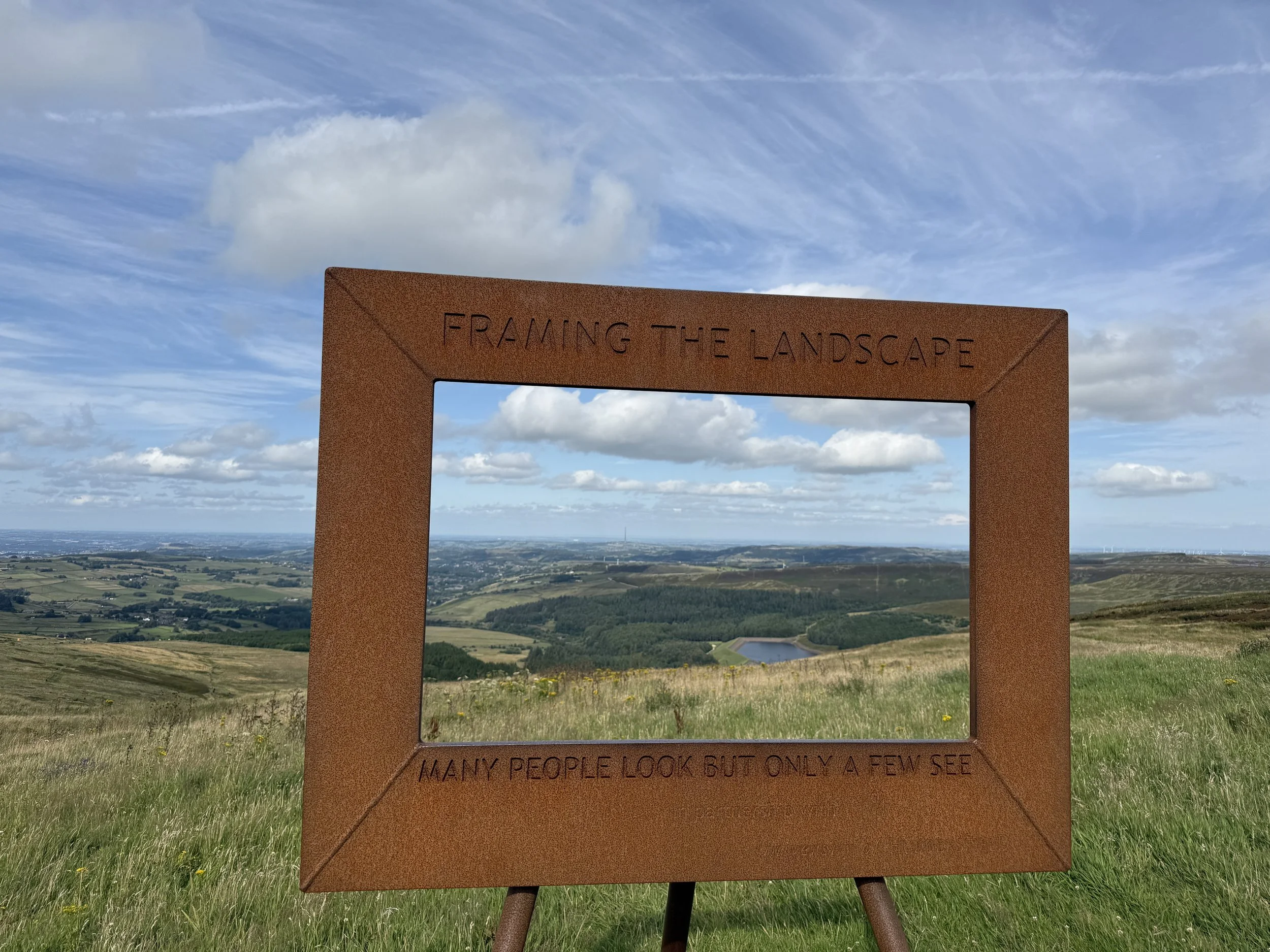
Wessenden Valley Framing the Landscape Walk to Marsden
A stunning circular walk from the Wessenden Head “Framing the Landscape” frame down through the wild and beautiful Wessenden Valley, before finishing in the lively yet picturesque village of Marsden.
Start: Holme Moss Car Park, A6024 (above Holme village)
Distance: 7 miles
Duration: 2-3 hours
Elevation: 900 feet
Difficulty: Moderate – good paths but with some uneven, steep, and exposed sections
Navigation: Follow step-by-step on komoot, or download GPX file
About the route
This high-moor circular starts right beside the Wessenden Head “Framing the Landscape” frame, one of six open-air art installations by Yorkshire artist Ashley Jackson in partnership with the National Trust. It’s perfectly positioned to frame the view down the Wessenden Valley – a glimpse of the epic scenery ahead.
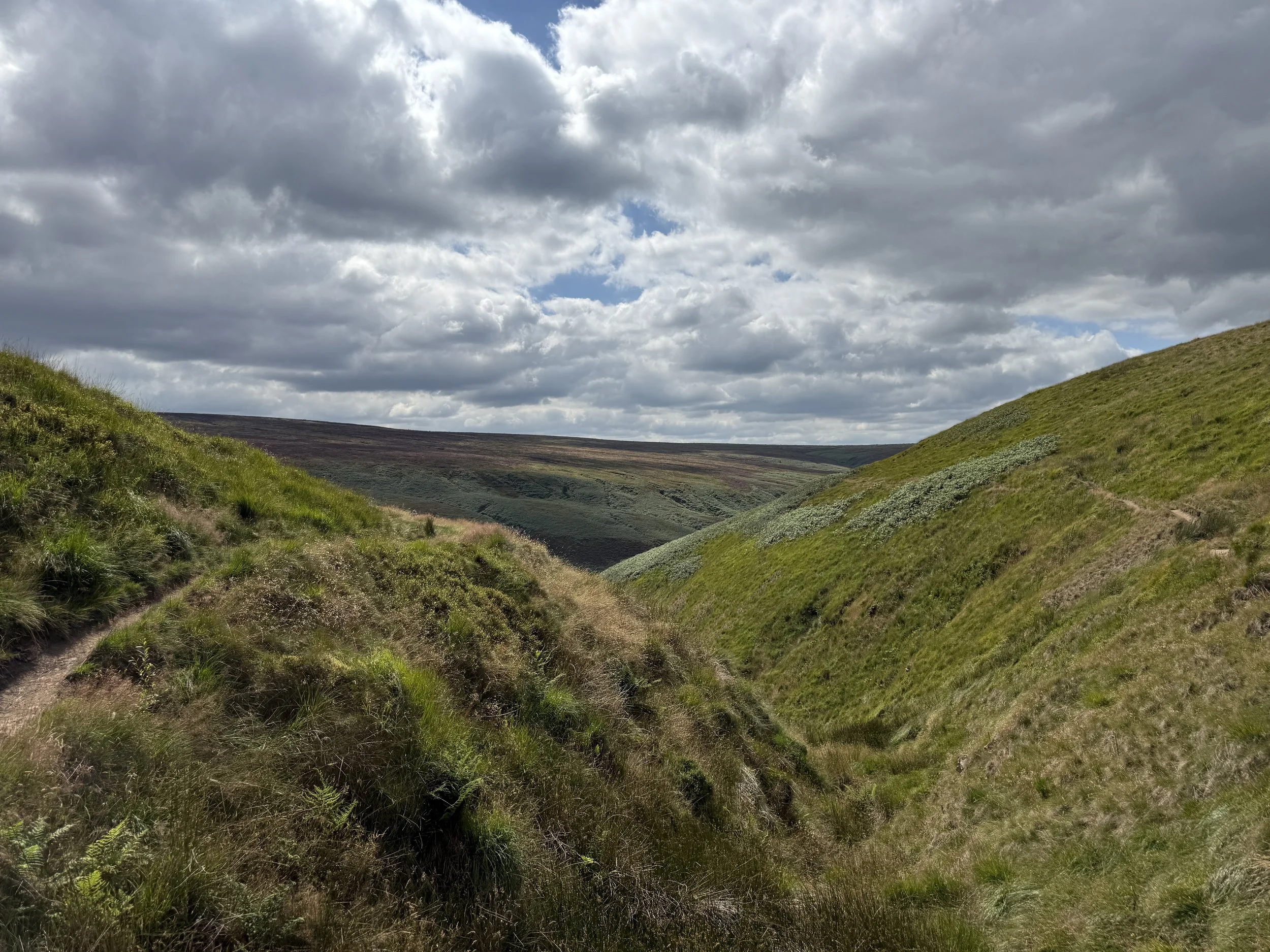
From the layby, the route follows the Pennine Way down into the valley, passing a chain of four reservoirs – Wessenden Head, Wessenden, Blakeley, and Butterley. You’ll stop at Blakeley Clough waterfall, a hidden spot perfect for a summer paddle, before continuing into Marsden.
The return leg climbs gently back onto the moors, with far-reaching views towards Holme Moss and the surrounding hills, before rejoining Wessenden Head Road.
Route difficulty
Moderate. Most of the walk is on clear tracks or reservoir paths, but there are a few steeper climbs, rocky sections, and exposed moorland. A reasonable level of fitness and good footwear are recommended
Route highlights
Wessenden Head frame: A striking start and end point.
Blakeley Reservoir & waterfall: Peaceful, hidden, and beautiful.
Marsden village: A midpoint for coffee, cake, or a pint.
Butterley Reservoir: Impressive curved spillway and waterside path..
Why you’ll love this walk
Start and end at a Framing the Landscape art installation.
Four reservoirs in one loop – each with its own character.
The Blakeley Clough waterfall – a wild swimming/dipping gem.
A mix of valley walking and high-moor views.
Things to do nearby
Standedge Tunnel Visitor Centre – canal history and boat trips.
Holmfirth – moorland market town with shops, pubs, and galleries.
Holme Moss – another nearby frame if you’re collecting them all.
Getting to the starting point
By car: Park in the layby on Wessenden Head Road (HD9 4EU). Free parking for a handful of cars.
By public transport: Bus 352 runs between Holmfirth and Marsden, stopping near the start.
Following the route
I use komoot and OS Maps for offline navigation. Follow the full route step-by-step komoot, or download GPX file and upload it to your preferred app.
Good to knows
Footwear: Waterproof boots advised – moorland and reservoir paths can be wet year-round.
Exposure: This is a high-moor route; bring layers and waterproofs.
Dogs: Allowed, but keep on leads near livestock and on moors in nesting season
Holme Moss Framing the Landscape Walk
A short and easy moorland walk from Holme Moss car park to one of the Peak District’s striking “Framing the Landscape” art installations, with sweeping Dark Peak views from the very start
Start: Holme Moss Car Park, A6024 (above Holme village)
Distance: 8 miles
Duration: 3-4 hours
Elevation: 1,125 feet
Difficulty: Moderate - moorland paths, some uneven ground, a few steady climbs
Navigation: Follow step-by-step on komoot, or download GPX file
About the route
This is a full-day moorland walk that starts high on the A6024 at Holme Moss Car Park, immediately giving you huge views across the Dark Peak.
You’ll visit the Holme Moss “Framing the Landscape” frame, one of six open-air art installations by Yorkshire artist Ashley Jackson, before heading deeper onto the moors towards Snailsden Reservoir. The loop around Snailsden is wonderfully peaceful, with big sky views, heather-clad slopes, and glimpses of Yateholme Reservoir below.
The route has a mix of well-trodden paths and more rugged moorland tracks, making it a satisfying walk without being overly strenuous..
Route difficulty
Moderate. While there are no huge climbs, the distance, exposure, and occasional boggy patches mean it’s best suited to walkers with a reasonable level of fitness and decent footwear.
Route highlights
Holme Moss frame: Perfectly positioned for panoramic Dark Peak views.
Snailsden Reservoir: A quiet, secluded spot surrounded by wild moorland.
Yateholme views: A lovely vantage point over the reservoir and surrounding hills.
High moorland atmosphere: Ever-changing skies and a real sense of space.
Why you’ll love this walk
A unique blend of art and landscape – the Holme Moss frame makes for a standout photo stop.
Varied scenery – open moors, wild reservoirs, and far-reaching valley views.
Peaceful paths – Snailsden is quieter than the better-known Peak District reservoirs.
A satisfying circular route with big skies from start to finish.
Things to do nearby
Holmfirth: Enjoy lunch, coffee, or a browse in the town’s independent shops.
Digley Reservoir: A gentler, low-level reservoir walk just down the road.
The Fleece Inn, Holme: Cosy pub meals in a classic moorland village setting.
Getting to the starting point
By car: Park at Holme Moss Car Park (A6024, above Holme village). Free parking but limited spaces – get there early on sunny weekends.
By public transport: Buses run to Holme village; from there it’s a steep walk up the A6024 (no pavement in places – take care).
Following the route
I use komoot and OS Maps for offline navigation. Follow the full route step-by-step komoot, or download GPX file and upload it to your preferred app.
Good to knows
Footwear: Waterproof walking boots are essential – moorland sections can be boggy.
Navigation: Carry a map or GPX – some moorland paths are less defined.
Exposure: This is a high, open route – expect wind, even on calm days.
Dogs: Allowed on public rights of way (footpaths and bridleways), but keep them on a lead during bird-nesting season.
Dog restriction in place (2024–2029):
Dogs not permitted on the surrounding Open Access moorland (which part of this long route passes through).
How to extend your adventure
You could link this route with other moorland tracks towards Black Hill or Wessenden Head, ticking off another of the “Framing the Landscape” frames in the process.
How to Walk to the Framing the Landscape Frames at Wessenden and Holme Moss
High on the moors above Holmfirth, you might spot something unexpected rising from the heather – giant wooden picture frames.
These aren’t random pieces of garden décor, but part of Framing the Landscape, a series of open-air art installations created by Yorkshire artist Ashley Jackson in partnership with the National Trust. The aim? To celebrate the beauty of the Peak District and Yorkshire’s moorland by literally framing the views that have inspired artists and walkers for generations.
In this guide, we’ll explore two scenic walks to the frames near the village of Holme – one taking in the Wessenden Valley and Marsden, the other leading up to the Holme Moss viewpoint. Both are easy to reach and perfect for combining art, nature, and fresh moorland air.
What is “Framing the Landscape”?
There are six frames in the series, scattered across the northern Peak District, Yorkshire, and surrounding moorland. Each one is carefully positioned to highlight a view Ashley Jackson considers particularly special – from sweeping valleys and rugged tors to reservoirs tucked away between rolling hills.
The frames themselves are sturdy timber structures, big enough to stand in, making them not only striking landmarks but also perfect photo spots. They invite you to pause, step inside, and see the landscape as a living work of art.
The six frames are located at:
Wessenden Head – overlooking the Wessenden Valley and reservoir.
Holme Moss – with panoramic views over the Dark Peak.
Hardcastle crags - stunning woodland near Hebden Bridge.
Roseberry Topping - overlooking one of Yorkshire’s most iconic hills.
Brimham Rocks - framing the dramatic gritstone formations.
Ogden Water - a peaceful reservoir setting near Halifax.
In this guide, we’re focusing on the first two – both easy to reach from the village of Holme – but you could make it a longer-term mission to visit all six.
Walk 1: Wessenden Head to Marsden via the Wessenden Frame
Best for: Moorland views, reservoirs, and ending in a lively village.
Starting from a layby on Wessenden Head Road, this route leads you past the Wessenden “Framing the Landscape” frame – perfectly capturing the valley and Wessenden Head Reservoir – before following the Pennine Way downhill towards Marsden.
Along the way, you’ll pass a string of reservoirs, enjoy vast moorland views, and wander through the dramatic Wessenden Valley. The route takes you to Marsden midway, where cafés, pubs, and bakeries await.
Following the routes
I’ve mapped out two routes for this walk, both starting from the frame. Walk one takes you to a hidden waterfall and up to West Nab trig, while walk two includes a stop off at the pretty village of Marsden for tea, cake, and pints.
Walk 2: Holme Moss Car Park to the Holme Moss Frame
Best for: A short, high-level walk with sweeping Peak District views.
Perched high on the moors just off the A6024, the Holme Moss frame offers some of the best panoramic views in the Dark Peak.
Starting from Holme Moss car park, this is an easy-moderate circular walk that still packs a big scenery punch. On a clear day, you can see for miles – and it’s especially magical at sunset when the hills turn gold.
Why You’ll Love These Walks
Unique photo opportunities – frame yourself in the Peak District.
Flexible distances – make them quick strolls or full hikes.
Year-round appeal – beautiful in sunshine, mist, or snow.
Easy access – parking right by both starting points.
When to Go
These frames are worth visiting any time of year, but for the best photos aim for early morning or golden hour in the evening. In winter, the moors can be wild – layer up and check the forecast before heading out.
Getting There
By car:
Wessenden Head layby: HD9 4EU
Holme Moss Car Park: A6024, above Holme
Both are free and have limited spaces.
By public transport: Buses run between Holmfirth, Holme, and Marsden – check local timetables for the 352 and 355 services.
Good to Knows
Footwear: Even short walks here can be boggy – boots recommended.
Weather: The moors are exposed; conditions can change quickly.
Respect the land: Stick to paths and keep dogs under control (note: dogs aren’t permitted on the West Nab section).

11 STUNNING PUB WALKS BY TRAIN NEAR MANCHESTER

No car? No problem 👇
Manchester has some of the most stunning pub walks on its doorstep, and the good news is you don’t need a car to reach them. From wild swimming at Gaddings Dam to breathtaking moorland views at The Trinnacle, these 10 incredible pub walks are all easily accessible by train.
1. Gaddings Dam Loop (England’s Tallest Beach)

Start Point: Todmorden Centre (OL14 5QA)
Train from Manchester: 20 minutes from Manchester Victoria to Todmorden Station
Nestled above Todmorden, this beautiful Gaddings Dam loop takes you to a hilltop ‘beach’. Perfect for a sunny day, this route offers wild swimming for the brave and scenic views for those who prefer to stay dry. After exploring the dam, you can extend your adventure to nearby Stoodley Pike.
The Walk Details:
Distance: 5.34 miles
Duration: 2–3 hours
Elevation: 660 feet
Route difficulty: Easy-moderate, some steep sections
Navigation: follow step-by-step here.
Post-walk pub: Head back to Todmorden and treat yourself at The Golden Lion for a well-earned meal or pint, or stop off at The Shepherd’s Rest mid-route.
2. New Mills Millennium Walkway (The Torrs Circular)

Start Point: New Mills Central Station
Train from Manchester: 20 minutes from Manchester Piccadilly
Discover the hidden gem of The Torrs, a dramatic river gorge beneath the historic town of New Mills. The highlight of this walk is the Millennium Walkway — a suspended bridge that winds along the River Goyt. With a mix of lush greenery and industrial history, this walk is short but sweet, and one of my favourite local routes.
The Walk Details:
Distance: 4 miles
Duration: 1.5 hours
Elevation: 350 feet
Route difficulty: Easy
Navigation: follow step-by-step here
Post-walk pub: After your walk, explore New Mills’ cafes and shops. Stop at Revive Cafe for a hearty lunch or pick up a treat at High Street Books & Records.
3. Hathersage and Stanage Edge

Start Point: Hathersage Station
Train from Manchester: 50 minutes from Manchester Piccadilly to Hathersage
A Peak District favourite, this circular walk starts in the idyllic village of Hathersage before gently climbing to Stanage Edge and the popular Robin Hood’s Cave.
The Walk Details:
Distance: 7 miles
Duration: 3 hours
Elevation: 1,200 feet
Difficulty: Easy (gentle climbs, mixed terrain)
Navigation: follow step-by-step here
Post-walk pub: After tackling the edge, head back to Hathersage where you’ll find pubs and cafes aplenty.
4. Macclesfield Forest & Shutlingsloe (The Cheshire Matterhorn)

Start Point: Macclesfield Station
Train from Manchester: 25 minutes from Manchester Piccadilly
Shutlingsloe, often called “The Cheshire Matterhorn,” is a sharp peak that rewards hikers with sweeping views of the surrounding countryside. The trail starts in the peaceful Macclesfield Forest, winding through tranquil woods before the exhilarating climb to the summit.
The Walk Details:
Distance: 6 miles
Duration: 2–3 hours
Elevation: 1,200 feet
Navigation: follow step-by-step here
Post-walk pub: The route descends past picturesque reservoirs, offering perfect photo opportunities. Wrap up your walk with refreshments at The Leather’s Smithy, a charming pub on the forest's edge.
5. Solomon’s Temple Walk (A Historic Folly Above Buxton)

Start Point: Buxton Pavilion Gardens (SK17 6BE)
Train from Manchester: 1 hour from Manchester Piccadilly to Buxton
This scenic walk to Solomon’s Temple starts and ends in one of the Peak District’s most-loved towns. Solomon’s Temple is a charming Victorian folly sitting atop Grin Low Hill, offering stunning views of Buxton and beyond. Along the way, explore the remnants of historic lime kilns and the surrounding woods.
The Walk Details:
Distance: 5.62 miles
Duration: 2 hours
Elevation: 625 feet
Difficulty: Easy
Navigation: follow step-by-step here
Post-walk pub: Finish your adventure with a visit to Buxton’s famous Georgian architecture or a relaxing tea at one of the town’s many cosy pubs.
6. The Trinnacle Loop (Dove Stone Reservoir)

Start Point: Greenfield Station
Train from Manchester: 35 minutes from Manchester Victoria to Greenfield
Sitting high on Saddleworth Moor, The Trinnacle stands is a unique rock formation overlooking Dove Stone Reservoir. The route offers steep climbs, cascading waterfalls, and a bit of optional scrambling if you’re wanting to add a slight challenge to the route.
The Walk Details:
Distance: 4.13 miles
Duration: Less than 2 hours
Elevation: 950 feet
Difficulty: Moderate (scrambling sections up the Clough)
Navigation: follow step-by-step here
Post-walk pub: After your walk, unwind at The Clarence Inn or explore the nearby pubs in Greenfield.
7. Prestbury Village Circular

Start Point: Prestbury Station
Train from Manchester: 30 minutes from Manchester to Prestbury
The Cheshire countryside at its best. A relaxed mix of fields, quiet lanes, and leafy woodlands with a beautiful pub finish.
The Walk Details:
Distance: 6 miles
Duration: 2 hours
Elevation: 375 feet
Difficulty: Easy
Navigation: follow step-by-step here
Post-walk pub: After your walk, unwind at The Bridge Inn or cosy up in one of the village’s many coffee shops.
8. Ramsden & Riding Wood (Via Holmfirth)

Start Point: Huddersfield Station
Train from Manchester: Train to Huddersfield or Sowerby Bridge, then 314 Holme Valley Bus Connection towards Holme
The Walk Details:
Distance: 5 miles
Duration: 2 hours
Elevation: 800 feet
Difficulty: Easy (gentle incline)
Navigation: follow step-by-step here
Post-walk pub: After your walk, unwind at The Fleece Inn.
9. Hardcastle Crags, Hebden Bridge (Heptonstall)

Start: Hebden Bridge Station
Train from Manchester: ~45 minutes
A mix of woodland trails and moorland ridge with a riverside mill café halfway round.
The Walk Details:
Distance: 8 miles
Duration: 3 hours
Elevation: 950 feet
Difficulty: Easy (gentle incline)
Navigation: follow step-by-step here
Post-walk pub: After your walk, refuel at The White Lion Inn in Heptonstall.
10. Etherow to Werneth Low

Start Point: Marple Railway Station
Train from Manchester: Train to Marple (26 mins)
This nine mile pub walk truly has it all: a cracking pub, unreal views across Manchester, and my favourite place in Stockport to sit and watch the world go by (the Keg Pool at Etherow Country Park), before winding up at The Hare and Hounds.
The Walk Details:
Distance: 9.7 miles
Duration: 4 hours
Elevation: 950 feet
Difficulty: Easy-Moderate
Navigation: follow step-by-step here
Post-walk pub: Mid-walk, refuel at The Hare and Hounds - or time with sunset for impeccable views over Manchester.
11. B29 Crash Site (Glossop)

Start Point: Glossop Station
Train from Manchester: 30 minutes from Manchester to Glossop
Remote and atmospheric – a moorland walk to a haunting WW2 crash memorial site.
The Walk Details:
Distance: 9.4 miles
Duration: 4 hours
Elevation: 1,700 feet
Difficulty: Moderate (navigation + map essential)
Navigation: follow step-by-step here
Post-walk pub: After your walk, unwind at The Queens Arms in Old Glossop, or head back to Glossop Town Centre for your pick of restaurants, cafes and pubs.

The Tolkien Trail — Walk in the ƒootsteps of J.R.R Tolkien
This trail in Lancashire takes you through the landscapes that inspired Middle-earth.
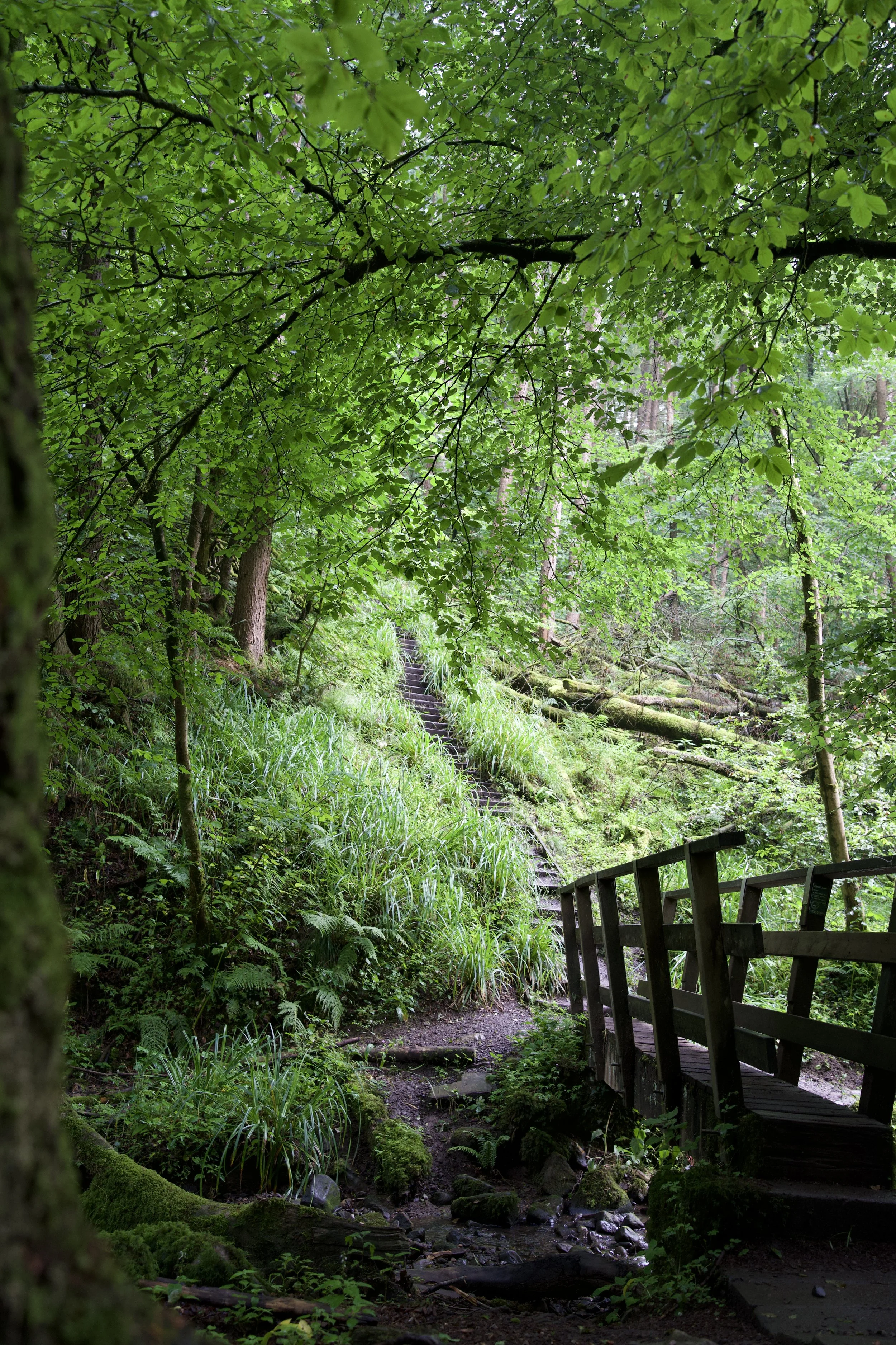
Start: Hurst Green Memorial Hall Car Park
Distance: 6.73 miles
Duration: 2-3 hours
Elevation: 475 feet
Difficulty: Easy
Navigation: Follow step-by-step on komoot, or download GPX file
About the route
A circular walk from Hurst Green Memorial Hall car park, looping past Stonyhurst College, into Over Hacking Wood, alongside the River Hodder, over Cromwell’s Bridge, and back along the Ribble bank and aqueduct. Landscapes here are rumoured to have inspired parts of The Hobbit and The Lord of the Rings.
Route difficulty
This is an easy, beginner-friendly route with no major climbs. Paths can get muddy, but it’s otherwise straightforward and well-marked — perfect for a half-day adventure.
Why is it called the Tolkien Trail?
The trail is named after J.R.R. Tolkien, author of The Lord of the Rings, who spent time at Stonyhurst College during World War II while visiting his son, John, who was training for the priesthood. During his visits, Tolkien is believed to have written parts of The Lord of the Rings, drawing inspiration from the lush Ribble Valley countryside. Local place names like Shire Lane and the River Shirebourn bear striking similarities to the Shire and other elements of Middle-earth, making this a literary and scenic journey all in one.
Why you’ll love this walk
If you’ve ever dreamed of wandering through the Shire, this trail is for you. Peaceful riverside paths, ancient woodland, Tolkien lore around every bend, and a storybook pub stop to warm up mid-way. It’s atmospheric, historical, and just the right amount of whimsical.
Route highlights
Stonyhurst College — where Tolkien stayed during WW2 while visiting his son. Looks like Hogwarts, feels like history.
Shire Lane & River Shirebourn — local names that echo The Shire.
Hacking Boat House — believed to have inspired Buckleberry Ferry.
New Lodge viewpoint — possibly the real-life view from Tom Bombadil’s house.
The Shireburn Arms — cosy pub with LOTR vibes and great food.
Millie’s Café — home-baked cakes and a huge Middle-earth map on the wall.
Over Hacking Wood descent — woodland steps leading to verdant Hodder riverside.
River Hodder, Ribble & Cromwell’s Bridge — historic packhorse bridge said to have featured in local lore.
Views of Pendle Hill from fields above the riverside section — dramatic skyline.
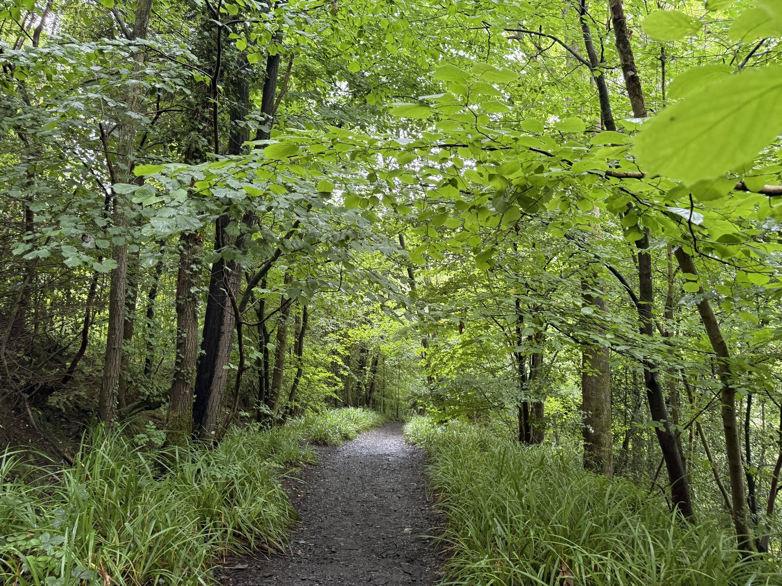
Getting to the starting point
By train/bus: Train to Whalley or Clitheroe, then local buses (Clitheroe–Whalley–Preston) to Hurst Green. Check bus schedules for specifics.
By car: Sat nav to BB7 9QB. Park at the Memorial Hall car park (£5 donation recommended). Limited roadside space.
How to extend your adventure
Stonyhurst College museum (booking required) to explore Tolkien-related history.
Post-walk refreshment at The Shireburn Arms, Bayley Arms, or cake at Millie’s Café.
Extend into Forest of Bowland walks like Pendle Hill or Stocks Reservoir.
Is this walk suitable for beginners?
Yes, if you're okay walking ~3 hours over fields and riverside paths. Expect some mud in wet weather and around woodland stairs. A couple of short climbs but nothing too strenuous. Some of the route is way marked, but boots and route map advised.
When’s the best time to do this walk?
Late spring – early autumn is ideal for wild garlic and bluebells in Over Hacking Wood and clear riverside views. Winter is doable but muddy; waterproof footwear essential.
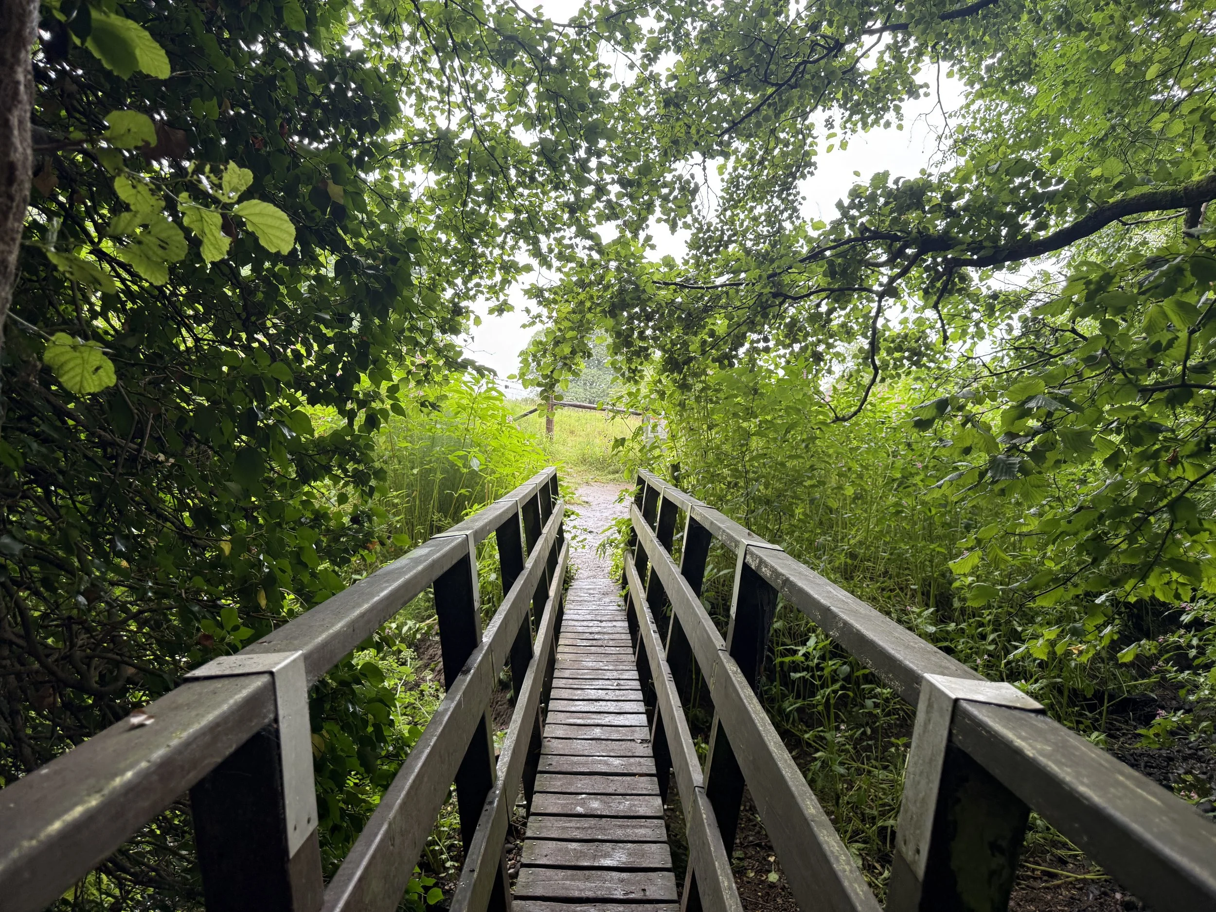
Following the route
I use komoot and OS Maps for offline navigation. Follow the full route step-by-step komoot, or download GPX file and upload it to your preferred app.
Good to knows
Waymarking minimal — Rely on map/GPX.
Footwear essential — Wooded and riverside bits can get muddy.
Dog friendly: Yes, dogs on leads near livestock.
Facilities: Toilets, pubs and café only in Hurst Green.
Countryside code: Close gates, pick up litter, stay on paths.

Best public transport walks near Manchester: Solomon’s Temple
A Peak District wander with woods, pubs, temples and plenty of sweet treats – no car required

Start: Buxton Station
Distance: 9.74 miles
Duration: 4 hours
Elevation: 1,275 feet
Difficulty: Moderate
Navigation: Follow step-by-step on komoot, or download GPX file
About the route
Looking for a cracking Peak District walk that ticks off skyline views, a brewery stop, and an easy train ride home? This 9-mile Buxton loop has a bit of everything: a public transport-friendly wander that’s big on moorland magic and post-walk pub stops.
Starting and ending in Buxton town centre, this 9-mile loop weaves together some of the best walking the area has to offer. You’ll climb up to Solomon’s Temple, climb to Corbar Cross, amble across peaceful moorland paths, and finish up with a well-earned beer at Buxton Brewery’s Trackside taproom. Along the way you’ll walk through parkland, Victorian gardens, and spa-town charm — the best of the Peak District in one day.
Route difficulty
Terrain: Mostly easy-going with a couple of uphill sections (Solomon’s Temple & Corbar)
Good for: Active beginners, solo hikers, or anyone after a moorland fix without needing a car

Why you’ll love this walk
Incredible views from Solomon’s Temple
Quiet, sweeping moorland paths
Trackside beers at Buxton Brewery
A stroll through Buxton’s Pavilion & gardens
Easy to reach by train or bus
Route highlights
Solomon’s Temple – A Victorian hilltop folly with 360° views over Buxton and the White Peak.
Corbar Cross – Hidden in the trees above Buxton, this striking iron cross is steeped in local history and great for a mid-hike breather.
Grin Low Country Park – Woodland trails and limestone grassland with a hint of mystery.
Trackside Taproom – Home of Buxton Brewery and a brilliant spot to fuel up after a long day’s walk.
Pavilion Gardens – A perfect spot for a brew and nosey around the gift shop mid-walk.
Things to do nearby
Buxton Pavilion Gardens – Ideal for a post-walk chill or cake stop
Buxton Museum & Art Gallery – Small, free, and surprisingly brilliant
The Crescent & Thermal Spa – Fancy a soak in some thermal waters? You’ve earned it.
Getting to the starting point
By train: Direct services from Manchester Piccadilly (≈1 hr) – Buxton station is a 5-min walk from the route start.
By bus: Hop on the 199 Skyline from Stockport or the 58 from Macclesfield.

How to extend your adventure
Got more in the legs? You can easily tag on the Dragon’s Back ridge by continuing west from Solomon’s Temple. It adds around 4 miles and takes you up into wild limestone country.
Is this walk suitable for beginners?
If you’re happy walking for 4–5 hours and don’t mind a few hills, this route’s a yes. The trails are clear and easy to follow, but comfy boots are a must.
When’s the best time to do this walk?
Late spring to early autumn is ideal, with longer days and drier trails. That said, this one’s a year-rounder with decent weatherproofs — just expect a few muddy sections in winter.

Following the route
I use komoot and OS Maps for offline navigation. To follow the full route step-by-step on komoot, click this link here or download the GPX file and upload it to your preferred app.
Good to knows
Public toilets at Pavilion Gardens
Picnic spots aplenty near Solomon’s Temple
Dog-friendly, but keep leads handy near livestock

Best public transport walks near Manchester: Upper Goyt Valley walk
A Peak District escape with woods, pubs, boardwalks and three peaceful reservoirs – no car required
Start: Whaley Bridge Station
Distance: 9 miles
Duration: 3-4 hours
Elevation: 950 feet
Difficulty: Moderate
Navigation: Follow step-by-step on komoot, or download GPX file
About the route
Looking for a cracking day walk without a car near Manchester? This scenic loop from Whaley Bridge station weaves through woodland, past not one but three reservoirs, with sweeping valley views and a boardwalk thrown in for good measure. It’s wild in parts, peaceful in others — and it starts and ends right by a trainline, a cafe, and lots of pubs.
Route difficulty
This is a manageable day walk for regular walkers. There are some steady ups and downs, especially through the valley section, and paths can get muddy in wet spells—but there’s nothing technical.
Walk type: Moderate
Terrain: Forest tracks, reservoir paths, gravel and grass trails
Accessibility: Not suitable for wheelchairs or pushchairs
Dog-friendly: Yes, on leads near water and livestock
Why you’ll love this walk
You can hop on the train and be hiking in under an hour
Three reservoirs, a woodland start, and moorland magic
Less trodden than tourist-heavy Peak routes
Peaceful paths and plenty of space to think
Lovely looped route with café options at the end
Route highlights
Hillbridge Wood
A peaceful green canopy to kick things off — look out for bluebells in spring.
Toddbrook Reservoir & dam
Cross the dam for big views and easy boardwalk strolling.
Fernilee Reservoir
More water, fewer people. A lovely stretch for snacks and a breather.
Goyt Valley
Big skies, open views, and winding tracks through heathered hills.
Errwood Reservoir
A scenic high point of the walk, often mirror-like on calm days.

Things to do nearby
Whaley Bridge cafés & pubs
Pop into Café 16 or The Bridge Bakehouse for excellent cake and coffee.
Explore Goyt Valley ruins
Add a mini detour to the old Errwood Hall ruins if you’ve got time.
Bookshop browse in Whaley Bridge
Whaley has a couple of secondhand gems for post-walk mooching.
Getting to the starting point
By train: Take a direct train from Manchester Piccadilly to Whaley Bridge (~50 minutes). Trains run regularly, even on weekends.
By car: Not needed. But if you must, there’s free parking at the station.

Following the route
I use komoot and OS Maps for offline navigation. To follow the full route step-by-step on komoot, click this link here or download the GPX file and upload it to your preferred app.
How to extend your adventure
Continue beyond Bowderdale Head for a full Howgill traverse
Detour east to Aygill Force waterfall
Explore more of the Rawthey Valley on a return loop
Is this walk suitable for beginners?
Yes, with some stamina. It’s not overly steep, but the 9-mile length makes it better suited to walkers with a few rambles under their belt. Pace it out, bring snacks, and enjoy the varied route.
When’s the best time to do this walk?
April to October offers the best conditions - lush trees, dry trails and mellow weather. The boardwalk gets slippery in winter, and the Goyt section can be boggy after heavy rain.

Good to knows
No toilets en route — use Whaley Bridge facilities before you start
Limited mobile signal in the valley—download maps beforehand
Sturdy boots essential after rain
Finish with a café stop — The Bridge Bakehouse is just across from the station

A scenic circular walk to Cautley Spout (the highest waterfall in England)
A wild walk in Yorkshire: don’t miss this thrilling Howgills lollipop loop to England’s highest waterfall

Start: Layby near The Cross Keys Temperance Inn, Sedbergh (what3words: maybe.beaks.redouble)
Distance: 5 miles
Duration: 2-3 hours
Elevation: 1,600 feet
Difficulty: Moderate
Navigation: Follow step-by-step on komoot, or download GPX file
About the route
Tucked into the folds of the Howgill Fells, this satisfying lollipop route climbs from Sedbergh’s fringe to Bowderdale Head and loops around England’s highest above-ground waterfall: Cautley Spout. Starting from the 500-year-old Cross Keys Temperance Inn, you’ll enjoy gentle beginnings, a moderate high-fell climb, and a dramatic waterfall finale.
A path of contrasts, think pastoral lowlands, broad fells, and steep-sided valleys - this is one of the best routes to get a taste of the dramatic Howgill scenery without big scrambles or crowds.
Route difficulty
This is a moderate walk suitable for hillwalkers with a basic level of fitness. The loop section includes some steeper ground, exposed felltops, and one boggy stretch above the waterfall.
Walk type: Moderate
Terrain: Pasture, fell paths, rocky sections near waterfall, occasional bog
Accessibility: Not suitable for wheelchairs or pushchairs
Dog-friendly: Yes, on leads (sheep country!)

Why you’ll love this walk
England’s highest waterfall (200m tiered cascade)
Start and finish at a stunning heritage tearoom
Sweeping views from Bowderdale Head
Varied terrain: meadows, fells, ravines
Route highlights
The Cross Keys Temperance Inn Begin with tea and homemade cake at this historic National Trust inn. It’s one of the oldest temperance inns in England — no alcohol, just charm and good food.
Bowderdale Head Reach the high point of the route with views across the Howgill Fells. Wild, expansive, and surprisingly quiet.
Cautley Spout The showstopper: a dramatic, multi-step waterfall plunging nearly 200m into the valley below. Best viewed after rain, and photo-perfect with long exposure.

Things to do nearby
Sedbergh: England’s official Book Town — indie bookshops galore
Farfield Mill: Heritage craft centre with art and textile exhibits
River Rawthey: Ideal for a post-walk paddle or picnic
Getting to the starting point
By car: From Sedbergh, take the road north toward Cautley. Just past The Cross Keys Temperance Inn, you’ll find a small lay-by for parking (limited spaces, arrive early).
By public transport: Catch a train to Oxenholme, then take a Western Dales Bus (S1T, S1W, S5 or S6 depending on the day) to Sedbergh. On select days (Tues, Thurs, Fri), you can continue on the S5/S6 to the Cross Keys lay-by.
OS Grid Ref: SD 698 969 What3words: (what3words: maybe.beaks.redouble)

Following the route
I use komoot and OS Maps for offline navigation. To follow the full route step-by-step on komoot, click this link here or download the GPX file and upload it to your preferred app.
How to extend your adventure
Continue beyond Bowderdale Head for a full Howgill traverse
Detour east to Aygill Force waterfall
Explore more of the Rawthey Valley on a return loop
Is this walk suitable for beginners?
This is a good step-up for walkers used to lower-level rambles. There are some steep sections, but no scrambling. If you’re building confidence with fell walks, this one ticks all the right boxes.
When’s the best time to do this walk?
Late spring to early autumn (April to September) is ideal. May and June give lush greenery and good waterfall flow. Winter can be icy and boggy.

Good to knows
No toilets at the start (use the pub before or after)
Mobile signal fades on the fells — download offline maps
Waterproof boots essential after rain
Limited parking, especially at weekends
Paths are not always waymarked — GPX or Komoot recommended

Giddy Edge Circular Walk, Matlock — walks by train
Could you brave Giddy Edge? Dubbed the ‘scariest footpath in England’, this circular walk in the Peak District has a mix of everything

Start: Matlock Town Centre (Matlock Station)
Distance: 4.5 miles
Duration: 2 hours
Elevation: 1,000 feet
Difficulty: Moderate
Navigation: Follow step-by-step on komoot, or download GPX file
About the route
This circular walk starts right in the heart of Matlock and climbs up through woodland trails to the lofty limestone crags of High Tor – one of the most dramatic viewpoints in the Peak District. From there, you’ll tiptoe (or stride confidently!) along the infamous Giddy Edge, a narrow clifftop path with jaw-dropping drops and cracking views over the Derwent Valley.
Once you’ve conquered the edge, the route loops gently downhill, winding through leafy paths and finishing with a relaxed wander back into Matlock town – perfect for a post-walk cuppa or pint.
It’s a brilliant half-day adventure that shows off Matlock’s wild side without straying far from creature comforts.
Route difficulty
Moderate – a short but varied 4-miler with a decent bit of uphill. The path up to High Tor is steep and can be slippery after rain, and Giddy Edge has a narrow, exposed stretch that’s not ideal for anyone with vertigo. You’ll need a basic level of fitness and a head for heights, but it’s otherwise beginner friendly. This route isn’t suitable for buggies or wheelchairs, and dogs will need to be on the lead – especially along Giddy Edge.
👣 Distance: 4 miles
⏱️ Time: 2–2.5 hours
📈 Elevation: ~230m gain
🗺️ Terrain: woodland trails, rocky paths, town pavements
⚠️ Tricky bits: steep climb, exposed edge, potentially slippy when wet
Not suitable for: Young children, pushchairs, dogs that pull on the lead (especially on Giddy Edge!)

Route highlights
Giddy Edge — ‘The scariest footpath in England’
This precipitous pathway, with its wrought iron handrail and dizzying heights, was created by the Victorians as a tourist attraction. Giddy Edge, perched in the High Tor Gardens above Matlock Bath, is widely recognised as one of the most ‘dangerous footpaths in the world’. With a 300-foot drop beside it, only the trickier sections are protected by the wrought iron handrails with nothing standing between you and the edge.
Do you need a head for heights to tackle this one?
This trail isn’t nearly as scary as it looks, in my humble opinion. Plus, the views across Matlock Dale are truly stunning, and well worth the effort for those who brave it. There is, however, an exposed drop on the cliff edge, so do take care if you’re bringing little ones.
Matlock Bath
Matlock Bath is dubbed a seaside resort 100 miles from the sea. The picturesque town is packed with chip shops, amusement arcades, ice cream parlours, and candy floss on every corner — everything you’d expect from a proper seaside town. It’s located amongst a beautiful limestone gorge on the River Derwent, and is home to stunning riverside gardens and steep wooded hillsides.
History
Matlock Bath has been a popular tourist attraction since the late 17th century, when the healing properties of its warm spa waters were first discovered. Access to the area was improved in the 18th century, and by the 19th century, Matlock Bath was a place for society’s finest to visit. Lord Byron even dubbed the town ‘Little Switzerland’ on account of its magnificent views and steep, wooded hillsides.
Heights of Abraham
This historic 60-acre hilltop estate features cavern tours, exhibitions, adventure playgrounds and much more, plus regular special events throughout the season. A ticket to the Heights includes:
Cable car journey — Enjoy a return journey on Matlock Bath’s famous cable cars, soaring high above the Derwent Valley.
Great Masson Cavern — This cavern is often dubbed one of the true wonders of Derbyshire. Take a guided tour through an illuminated cavern and discover the secrets of Masson Hill.
Great Rutland Cavern — Join the tour’s Victorian Cavern guides to learn about the history of the miners and showmen that once worked in this underground world.

Getting to Matlock
By car
Reaching Matlock is most convenient by car from most major cities, but it’s also well connected by train. We parked in Matlock town centre (not Matlock Bath), where you’ll find multiple car parks.
By train
Getting to Matlock by train is straightforward, with direct services from several cities and easy connections from others.
Getting to Matlock by Train
From Manchester
While there are no direct trains from Manchester to Matlock, the journey is straightforward with one change:
Route: Manchester Piccadilly → Sheffield → Matlock
Duration: Around 2 hours, depending on connections
Frequency: Around 32 trains per day
For planning and booking, visit The Trainline.
Direct from Nottingham and Derby
There are direct trains from Nottingham and Derby to Matlock. For schedules and booking, visit East Midlands Railway.
Good to knows
Giddy Edge: The climb up to High Tor gardens is steep and somewhat physically demanding. Giddy Edge is unfenced and not recommended for small children.
Toilets: You’ll find toilets dotted around Matlock and Matlock Bath. The toilets in Matlock Bath are 20p entry.
Food and drink: Along the route, you’ll find plenty of pubs, cafes, and fish and chip shops. We stopped off at The Midland on the return end of the walk.
Parking: We parked at the car park on Imperial Road (DE4 3NL), which cost £6 for the full day. You’ll find multiple car parks in both Matlock and Matlock bath, and you can start the route from either of these locations.

The Eamont and Wordsworth Way: The ultimate car-free adventure in the Lake District
A multi-modal, point-to-point route from Penrith to Grasmere, blending riverside paths, lake cruises, and fell walks.
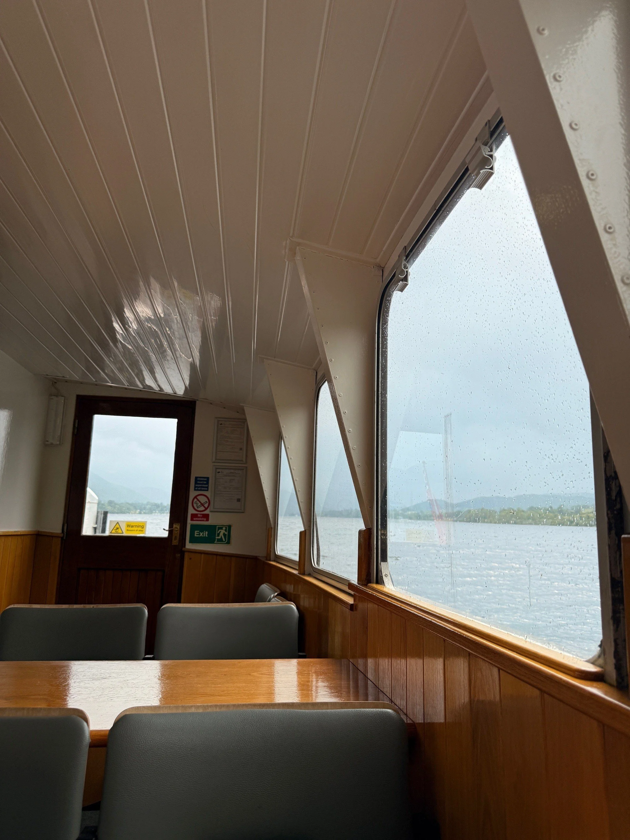
Start: Penrith Station
Distance: ~13 miles walking (22 miles covered, including the lake cruise)
Elevation: 1,975 feet
Duration: 5-8 hours
Difficulty: Moderate (with some changeable conditions)
Navigation: Follow step-by-step on komoot, or download GPX file
About the route
This adventure combines the Eamont Way and Wordsworth Way, with a scenic mid-point cruise on the Ullswater Steamer. Starting at Penrith Station, you'll follow riverside paths to Pooley Bridge, sail across Ullswater, and hike over Grisedale Tarn to Grasmere. It's a journey through rivers, lakes, and fells—all in one, point-to-point route.
I took the train from Manchester, but Penrith is also easily reached from London, Edinburgh, Preston, and Liverpool.

Quick stats
Distance: ~13 miles
Duration: 6–8 hours
Elevation gain: ~2,000 ft
Terrain: Mixed—riverside paths, gravel, fell tracks
Dog-friendly: Yes (with some rules)
Public transport: Direct trains to Penrith; buses from Grasmere via Keswick
Route difficulty
The Eamont Way is flat and beginner-friendly, while the Wordsworth Way involves a steady climb to Grisedale Tarn, with uneven sections and changeable weather.
Walk type: Easy to moderate
Terrain: Tarmac, grassy tracks, rocky paths
Accessibility: Not suitable for wheelchairs or pushchairs
Dog-friendly: Yes—leads required on farmland and during travel
Is this walk suitable for beginners?
Yes, if you’re reasonably fit. The Eamont Way is beginner-friendly, and the Wordsworth Way offers a moderate challenge.
Why you’ll love this walk
✅ A riverside start, a midway lake cruise, and a fell finish—all in one day
✅ Panoramic views from Grisedale Tarn (if the weather’s on your side)
✅ Poetic connections to Wordsworth and Grasmere's famous gingerbread (I always take bag loads home with me!)
✅ Dog-friendly travel options on boat and bus
✅ Easy public transport access

Route highlights
🚶 Penrith to Pooley Bridge (~6 miles)
Start at Penrith Station and follow the Eamont Way through meadows and past Brougham Castle, tracing the River Eamont. Enjoy the quiet before arriving in Pooley Bridge, a perfect stop with cafés and pubs.
⛴️ Pooley Bridge to Glenridding (Ullswater Steamer)
Cruise past Hallin Fell and Place Fell. Enjoy lake views, spot red squirrels, and relax mid-adventure.
Fare: £16.00 (adult one-way), £10.50 (child), £1.00 (dog)
Family ticket (2 adults + 2 children): £69.75
🥾 Glenridding to Grasmere (~8 miles)
Follow the Wordsworth Way, climbing gently through Grisedale Valley. Highlights include Helvellyn’s slopes, Grisedale Tarn, and the charming village of Grasmere with its literary history.
🐾 Dog-friendly travel tips
🛳️ Ullswater Steamer
Dogs are welcome for £1.00.
Must be kept on a short lead.
Not allowed on saloon seats or upper decks.
Water bowls available at pier houses.
🚌 Stagecoach 555 Bus
Dogs allowed at driver’s discretion, must be on a lead and well-behaved.
Guide and assistance dogs always welcome.
Things to do nearby / Options to extend the route
🏛️ Dove Cottage & Wordsworth Museum
🏔️ Helvellyn or St Sunday Crag for a bigger challenge
🚣♂️ Ullswater activities like kayaking or paddleboarding
🛍️ Keswick for shopping and lakeside cafés

Where to stay
If you’re making a weekend of it (and honestly, why wouldn’t you?), we stayed at The George Hotel in Penrith. It’s a stone’s throw from the station—literally a five-minute walk, which makes rolling out of bed and onto the Eamont Way trail almost too easy.
I stayed here the night after the walk, and it was a dream. Comfy beds, a bath, a hearty breakfast included (you’ll need the carbs for this one), and a touch of historic charm without being fussy.
If you’re coming from further afield, I recommend central as a good base to get a good night’s sleep before tackling the walk. No faffing with early trains or car parks, just a relaxed start to your adventure.
When’s the best time to go?
📅 May to October for longer days and better weather. Avoid peak summer weekends for quieter paths + lake cruises.

Getting to the starting point
The route starts in Penrith, and is well-connected by:
🚂 Direct trains from Manchester (~1h 40m), London (~3h), Edinburgh (~1h 30m), Preston (~50m), Liverpool (~1h 45m)
🚗 Parking at Penrith (Park & Ride available)
✔️ Good to knows
👟 Footwear: Hiking boots essential
☔ Weather: Pack layers and waterproofs (even in summer)
🧃 Refreshments: Limited options once you leave Glenridding (bring snacks!)
🚌 Return: Bus 555 from Grasmere to Keswick, then connect to Penrith
🐾 Dogs: Lead required in fields, permitted on boat and bus with some restrictions
🔗 Handy links
🧭 Following the route
I use komoot and OS Maps for offline navigation. To follow the full walk step-by-step on komoot, simply click this link here or download the GPX file and upload it to your chosen app, such as OS Maps.
UPHILL CHALLENGES:


WALKS WITH WATERFALLS:


