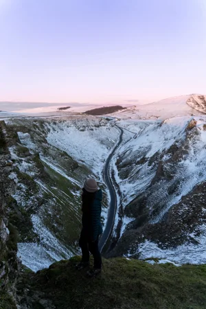
Think the Canary Islands are just all-inclusive resorts and beach holidays? Think again.
Over one unforgettable week, you can hike Spain's highest mountain, wander through ancient cloud forests, stand on lava fields created just a few years ago and end your days swimming in natural volcanic pools beneath towering cliffs.
If you're looking for one of Europe's most underrated adventure destinations, here's exactly how to spend 7 days island hopping around Tenerife and La Palma.

This 7-day adventure itinerary covers two islands in one week: Tenerife and La Palma. It includes the islands’ most jaw-dropping landscapes — from volcanic craters to misty forests, and coastal cliffs to quiet mountain villages — hidden beaches, beautiful waterfalls, natural pools, and some of the best places to stay on both islands.
I planned this itinerary to minimise driving where possible, grouping nearby hikes and attractions together so you can spend less time in the car and more time exploring. Whether you’re escaping the cold in winter or planning a summer adventure holiday, here’s everything you need to know to plan an adventure getaway in La Palma and Tenerife.
At a glance
| Location | Tenerife & La Palma, Canary Islands, Spain |
| Duration | 7 days (5 days in Tenerife, 2 days in La Palma) |
| Ideal for | Hiking, road trips, adventure travel and photography |
| Best time to visit | Year-round (winter for hiking, summer for hiking & beaches) |
| Car hire | Recommended in Tenerife, essential in La Palma |
| Difficulty | Easy to challenging hikes |
| Island hopping | 30–40 minute flight or 2.5-hour ferry |
| Budget | Mid-range (affordable flights, accommodation and car hire available year-round) |
| Day 1 | El Bujero Arch & Los Gigantes viewpoints |
| Day 2 | Montaña Roja sunrise, El Médano & Teide stargazing tour |
| Day 3 | Mount Guajara hike |
| Day 4 | Masca Gorge & Tenerife road trip |
| Day 5 | Mount Teide sunrise, then travel to La Palma |
| Day 6 | Tajogaite Volcano, Caldera de Taburiente & Roque de los Muchachos |
| Day 7 | Los Tilos, Charco Azul & Playa de Nogales |
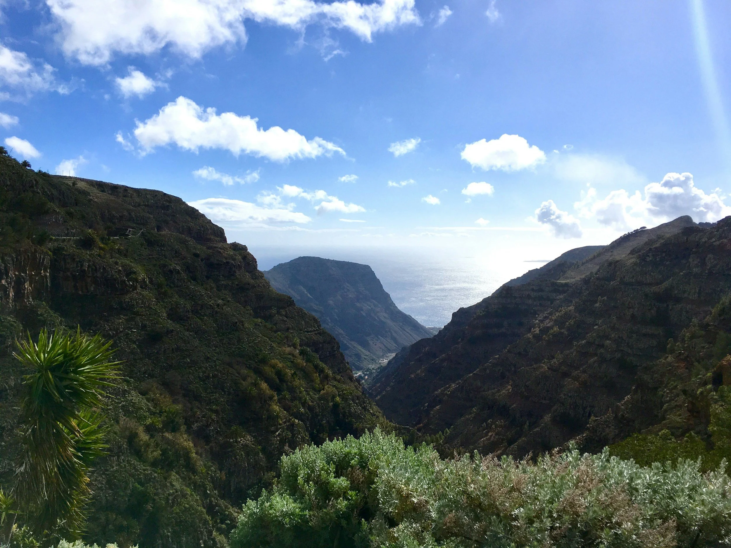
Why visit Tenerife and La Palma in winter?
Dry, mild weather: While the rest of Europe gets drenched, Tenerife stays sunny (especially in the south). Perfect trail conditions, no mud, no soggy boots.
Quieter trails: Many trails are almost empty in winter, especially outside of Christmas and New Year.
Diverse landscapes: From volcanoes to forests, there’s a new kind of terrain every day.
Great for all levels: Whether you’re new to hiking or looking for summit challenges, there’s a trail here for every ability.
Affordable flights: Return flights from the UK often cost less than £80 (ours cost £30 each way from Manchester - without baggage).
Why visit Tenerife and La Palma in summer?
Quieter resorts: Winter is peak season in the Canary Islands - visit early summer to avoid the busy season in the main resorts.
Fantastic swimming spots: Explore volcanic beaches, hidden coves and natural swimming pools at their best.
Warm, but rarely extreme: Thanks to the Atlantic Ocean, temperatures are often more comfortable than many parts of mainland Spain.
Ideal for combining hiking and the beach: Start the day on volcanic trails before cooling off in the sea or natural pools.

Is 7 days enough for Tenerife and La Palma?
Yes—with careful planning, seven days is enough to experience the highlights of both islands. This itinerary gives you five days in Tenerife and two days in La Palma, balancing volcanic landscapes, mountain hikes, coastal walks and natural swimming spots without feeling too rushed. If you have longer, I'd recommend adding an extra day to La Palma to explore more of Caldera de Taburiente National Park.
Where to stay in Tenerife for hiking in winter
Choosing the right base makes a big difference, especially in winter when you’re chasing those sunrise and sunset views. If you’re weighing up where best to stay in Tenerife for an adventure holiday, here’s a quick breakdown:
South (Costa Adeje, Los Cristianos): The south is sunnier and drier year-round, making it ideal if you’re chasing winter sun after a long hiking day. It’s more built-up but has excellent public transport links to Teide and the west coast trails like El Bujero. If you're tackling Teide, El Bujero or Masca early in your trip, staying in the south makes logistics much easier...
North (La Orotava, Buenavista del Norte): Lusher, greener, and a bit more traditional. This region puts you closer to the Anaga forests and Teno Alto, but the weather can be cooler and bus routes into the central mountains (like Teide) are more limited and slower.
Best overall base for hiking
If you want to prioritise trail access over sunbathing, staying around La Orotava or San Cristóbal de La Laguna gives you great access to Tenerife’s most iconic hikes in Anaga and Teno. That said, for Teide (a showstopper on the island) and El Bujero, the south is far more convenient, so splitting your stay will give you the best of both worlds.
My take?
For a winter hiking holiday, Costa Adeje is a solid base. You’ll get the sun, easy access to Teide and hikes along the coast, and more daylight hours to relax after a long trail day. In summer, with longer daylight and milder northern temps, you’ve got more flexibility to explore the island from a northern base. It all just depends on the vibe you’re looking for.
We stayed at Dreams Jardín Tropical in Costa Adeje. It’s a great option if you want a mix of post-hike comfort and sunshine. The pool area is scenic, the breakfast is top-tier, and it’s close to the main bus station — ideal if you’re relying on public transport for early starts.
Best bases at a glance (winter)
| Area | Pros | Cons |
|---|---|---|
| Costa Adeje (South) | Sunniest in winter, easy access to Teide & west trails, good public transport | Far from Anaga, more built-up |
| La Orotava (North) | Great access to Teide & Anaga, traditional charm | Longer trips to west coast trails; cooler and more unpredictable weather |
| San Cristóbal de La Laguna | Excellent public transport hub, near Anaga, airport access | Cooler, less direct access to some hikes |
| Vilaflor | Closest to Teide trailheads, peaceful mountain village | Remote, fewer amenities, car needed |
| Santiago del Teide | Ideal for El Bujero & Masca, quiet but central | Limited for Anaga, fewer transport links |
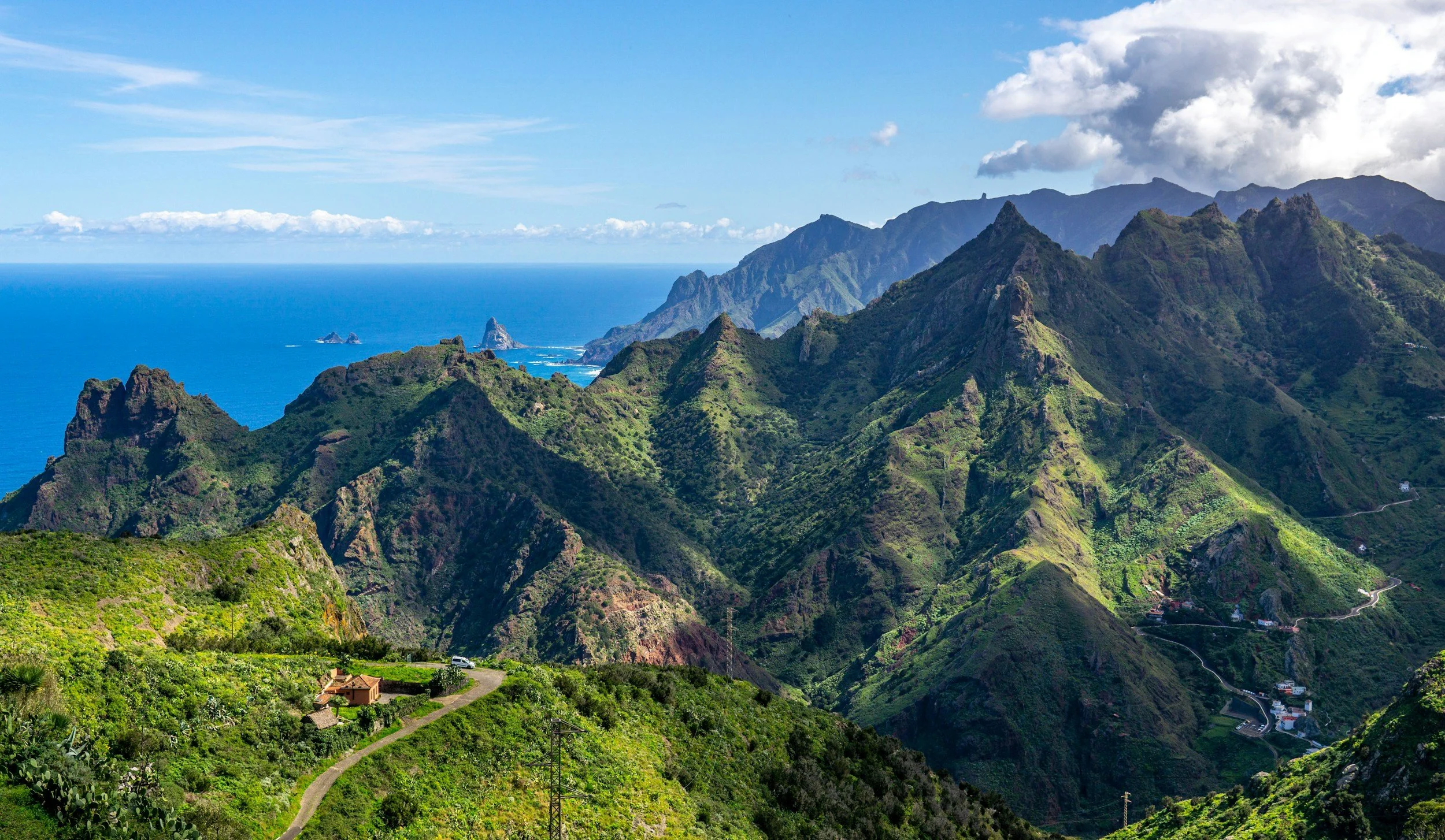
Where to stay in Tenerife for hiking in summer
Choosing where to stay in Tenerife is a little different in summer. While the whole island enjoys warm weather, the north is generally cooler and greener, making it more comfortable for hiking during the hotter months. The south, on the other hand, is perfect if you want to combine mountain adventures with lazy beach afternoons.
South (Costa Adeje, Los Cristianos): Ideal if you're looking for a classic sunshine holiday with hiking thrown in. You'll have easy access to Teide National Park and west coast trails like El Bujero, plus plenty of restaurants, beaches and nightlife to enjoy after a day outdoors. Just bear in mind that daytime temperatures are noticeably warmer than in the north.
North (La Orotava, San Cristóbal de La Laguna): If hiking is your main priority, the north is hard to beat in summer. Temperatures are generally cooler, the forests around Anaga provide welcome shade, and you'll be closer to some of the island's most scenic trails. The atmosphere also feels more traditional and less touristy than the south.
Best overall base for hiking
If you want to prioritise hiking over sunbathing, La Orotava or San Cristóbal de La Laguna make fantastic summer bases. The cooler temperatures make longer hikes much more enjoyable, while still giving you straightforward access to Teide and the north's spectacular landscapes.
My take?
For a summer hiking holiday, I'd choose La Orotava. It's one of the prettiest towns on the island, the climate is more comfortable for walking, and you're perfectly placed to explore both Teide and Anaga. If beach time is just as important as hiking, Costa Adeje is still a brilliant option.
Best bases at a glance (summer)
| Area | Pros | Cons |
|---|---|---|
| La Orotava (North) | Cooler temperatures, excellent access to Teide & Anaga, traditional atmosphere | Further from the main beach resorts |
| San Cristóbal de La Laguna | Great for Anaga, historic centre, good public transport | Less beach-focused |
| Costa Adeje (South) | Perfect for combining hiking with beaches, restaurants and nightlife | Hotter in summer and busier |
| Vilaflor | Closest base for Teide hikes, peaceful mountain village | Limited amenities, car recommended |
| Santiago del Teide | Excellent for Masca, Teno Rural Park & El Bujero | Further from Anaga |
Where to stay in La Palma for hiking in winter
Unlike Tenerife, La Palma is small enough that you can reach most hiking trails within an hour, wherever you stay. Instead your choice comes down to whether you want sunshine, convenience or a historic town atmosphere.
West (Los Llanos de Aridane, El Paso): The sunniest part of the island and the best base for hikers. You'll be close to Caldera de Taburiente National Park, the Tajogaite volcano and many of La Palma's most iconic trails.
East (Santa Cruz de La Palma, Los Cancajos): A great option if you enjoy wandering colourful streets, eating out and staying close to the airport. You'll also have easy access to Roque de los Muchachos and the island's lush laurel forests.
Best overall base for hiking
For most people, Los Llanos de Aridane is the best all-round base. It's close to the island's headline hikes and generally enjoys sunnier weather than the east during winter.
My take?
I'd stay in Los Llanos de Aridane. It offers the perfect balance of convenience, restaurants and quick access to La Palma's spectacular volcanic landscapes.
Best bases at a glance (winter)
| Area | Pros | Cons |
|---|---|---|
| Los Llanos de Aridane | Sunny west coast, close to Caldera de Taburiente & Tajogaite, lots of amenities | Further from the airport |
| El Paso | Central location with excellent hiking access | Quiet in the evenings |
| Santa Cruz de La Palma | Historic town, restaurants, airport nearby | Longer drive to western trails |
| Los Cancajos | Beachfront hotels, natural pools and easy airport access | Less central for hiking |
Where to stay in La Palma for hiking in summer
Summer is one of the best times to experience La Palma's dramatic landscapes. Longer daylight hours make it easy to fit in sunrise hikes, scenic drives and an afternoon swim, while the island's compact size means nowhere is ever too far away.
West (Los Llanos de Aridane, El Paso): The best choice if hiking is your main focus. You'll be close to the island's volcanic trails, Caldera de Taburiente and many of La Palma's biggest natural highlights.
East (Santa Cruz de La Palma, Los Cancajos): A slightly cooler option thanks to the Atlantic breeze, perfect if you'd like to combine hiking with cafés, waterfront walks and exploring the island's charming capital.
Best overall base for hiking
I'd still recommend Los Llanos de Aridane. It's perfectly positioned for exploring the island and gives you easy access to many of La Palma's best hikes.
My take?
For me, Los Llanos de Aridane wins again. It has a relaxed atmosphere, plenty of accommodation and restaurants, and you're never far from a spectacular trail.
Best bases at a glance (summer)
| Area | Pros | Cons |
|---|---|---|
| Los Llanos de Aridane | Sunny west coast, close to Caldera de Taburiente & Tajogaite, plenty of cafés and restaurants | Further from the airport |
| El Paso | Central location with excellent hiking access | Smaller choice of restaurants |
| Santa Cruz de La Palma | Historic centre, cafés, restaurants and airport nearby | Longer drive to western trails |
| Los Cancajos | Beachfront hotels, natural pools and easy airport access | Less central for hiking |
Driving in Tenerife & La Palma
Hiring a car isn't essential for every day in Tenerife thanks to its excellent public transport network, but it gives you far more flexibility (especially if you're hoping to catch sunrise on Mount Teide or explore Masca and the west coast).
La Palma is a different story. While there are buses between the main towns, many of the island's best hikes and viewpoints are difficult to reach without a car, so I'd highly recommend hiring one.
A few things I learnt while driving:
Roads are generally in excellent condition on both islands.
Google Maps worked perfectly throughout our trip.
The most challenging drive was the LP-4 to Roque de los Muchachos, with plenty of tight hairpin bends and steep climbs. I drove it myself and found it manageable. Just allow extra time and take it slowly.
What to pack
|
Before you hike
|
Tenerife and La Palma Adventure Itinerary - Day by day
Day 1: El Bujero Arch + Views Over Los Gigantes
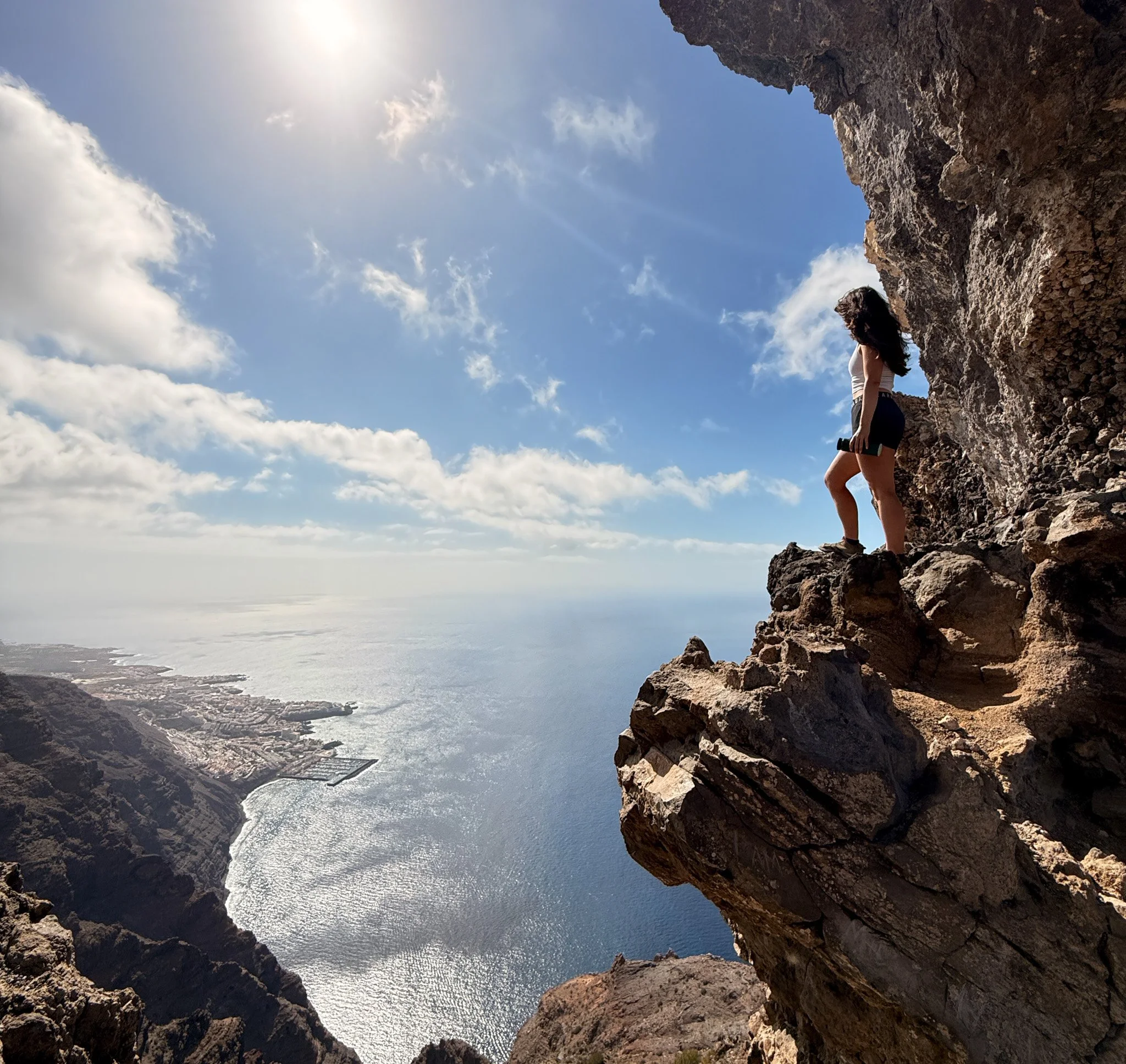
To ease into a week of adventures, this stunning route to El Bujero is the perfect mix of dramatic views and easy transport links. The archway at El Bujero is a view not to be missed, with a short and gentle climb to get there. It’s one of Tenerife’s most underrated spots, with sweeping views over Los Gigantes’ cliffs — and barely a soul on the trail.
About the walk
Start: Tamaimo
Distance: 3-4 miles (out and back)
Difficulty: Moderate
Elevation: 1,600 feet
Duration: 3–4 hours
Getting there: Bus 460 or 325 from Costa Adeje to Tamaimo
Navigation: Follow my route here, or download GPX file
Reaching the starting point
Tamaimo is easy to reach by public transport from the south. The most convenient option is TITSA bus 460, which runs directly from Estación Costa Adeje to Tamaimo multiple times daily. The journey takes around 45–50 minutes, and tickets cost approximately €4–5 one way with a Ten+ card.
Morning departures are usually around 6:30, 8:30, 10:30, and 12:30 — but check the latest schedule on the TITSA website or via the Moovit app.
If you're staying in Los Cristianos, you'll need to connect via Costa Adeje. Expect a total journey time of around 1 hour 15 minutes including transfers.
From the bus stop in Tamaimo, it’s a 10–15 minute walk uphill through the village to the trailhead.
Food tip: Stop in Tamaimo for bolo do caco (grilled garlicky flatbread, and all-round carb deliciousness) at the local Portuguese café. I’d been dreaming of bolo do caco since a trip to Madeira the year prior, and they didn’t miss! A charming little must-stop while wandering around Tamaimo.
Evening stay: Costa Adeje
Day 2: Montaña Roja Sunrise + Chill Day (With Stargazing Tour)

Start your second day with one of Tenerife’s easiest and most scenic sunrise spots. Montaña Roja sits beside El Médano beach, offering sweeping views over the Atlantic with barely a climb.
About the walk
Start: Playa de la Tejita car park
Distance: 3 miles
Difficulty: Easy
Duration: 1.5–2 hours total
Getting there: Drive (25 mins from Costa Adeje), or take bus 470 to El Médano then walk 20 mins
Navigation: Straightforward sandy path to summit, or follow my route here
Reaching the starting point
From Costa Adeje, it’s a short drive east to Playa de la Tejita, where you’ll find a car park right beside the beach. From there, follow the sandy track winding up the rust-red cone of Montaña Roja. If you're on public transport, take bus 470 to El Médano, then follow the promenade path to the start (about 20–25 mins on foot).
This is the perfect hike for your first full day — it’s quiet, short, and incredibly scenic, especially at sunrise when the light hits the red rock.
Tip: Bring a flask of coffee and sit at the summit, where you can watch planes land and the sun rise. Enjoy a beachside brunch in El Médano before heading back.
Bonus: Stargazing at Teide

In the evening, head up to Teide National Park for some of the best stargazing in the world. It’s an official Starlight Tourist Destination, thanks to the lack of light pollution and high elevation.
We booked a tour through GetYourGuide that included hotel pickup, sunset drinks at a popular sunset spot on Teide National Park, telescope viewing, and constellation talks — all for around £30 pp. This was hands down one of the highlights of the trip for me. Those skies!
Stay: Costa Adeje
Day 3: Mount Guajara
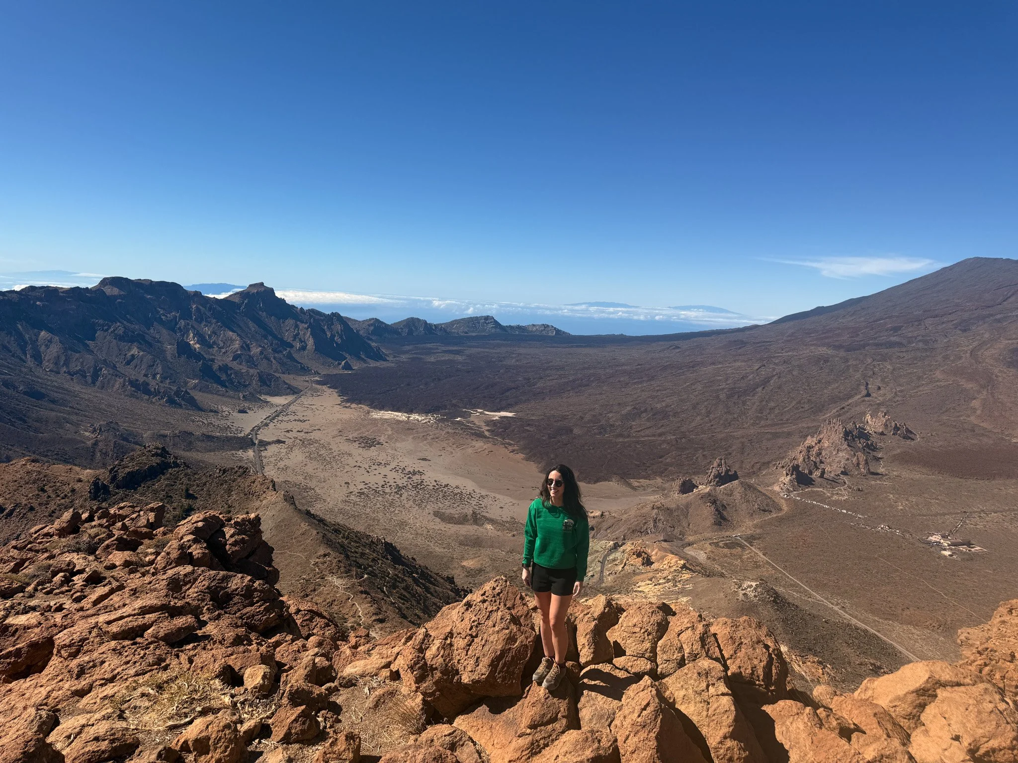
The best view of Teide is from this summit. Guajara is Tenerife’s third-highest peak and a cracking way to spend a full day in the national park. This hike was easily my favourite in terms of the route itself - varied, expansive views, and every part of the route felt like you were walking on an entirely different planet.
Starting behind the Parador hotel, the route loops through open lava plains before climbing a rocky shoulder to the summit. Views across the caldera are vast — and Teide looks even more dramatic from this angle.
Expect a final descent down loose scree, and a quiet summit ridge often above the clouds. On clear days, you’ll see all the way to La Gomera, La Palma and Gran Canaria.
About the route
Start: Parador de Las Cañadas (Teide NP)
Distance: 6.5 mile circular
Difficulty: Moderate–challenging
Duration: 3–4 hours
Getting there: Bus from Costa Adeje, or park at Parador de Las Cañadas (spaces limited - bus advised)
Navigation: Well-marked but remote – take a map or follow my route here. You can also download the GPX file here.
Getting there
From Costa Adeje, it’s about a 1-hour drive to the Parador along the scenic TF-21 mountain road. If you’re taking the bus, TITSA route 342 departs once per day from Costa Adeje bus station around 9:15am and arrives at the Parador around 10:40am. The return bus leaves at approximately 3:30pm, so just remember to plan your hike timing carefully. Driving offers more flexibility, however parking is incredibly limited and can fill up quickly.
Tip: There’s a small café at the Parador — perfect for a pre-hike coffee or post-hike sandwich. Public toilets are available too, and the Parador is one of the few spots in the national park where you can reliably grab something hot to eat.
Stay: Costa Adeje or Vilaflor for an early start
Day 4: Masca Gorge + a road trip around the world’s bendiest road

This was the day I hired a car — and honestly, it was one of the best decisions of the trip. I'd 100% recommend hiring a car for at least one day just to experience this drive. The drive up to Masca is a road trip in itself, full of hairpin bends, dramatic cliffs, and wow-worthy viewpoints. If you’re going to rent a car for just one day, make it this one (with a bonus trip up to Teide National Park - another road trip not to be missed!).
Masca itself is iconic, but it’s not without crowds. If I was to plan this trip again, I’d recommend skipping the main gorge trail (which requires booking + permits) and exploring the less-trafficked ridges above the village instead.
The trail through the gorge itself is beautiful, however it’s now only a one-way, downhill route, introduced to reduce erosion and increase safety after rockfalls. You’ll need to book through an authorised provider and wear a helmet. Prices start at €10–€20 depending on the provider and group size.
If like me the descent of the walk is your least favourite part (thanks, sciatica!), I’d skip the gorge and explore the untouched surrounds instead.
Equally, if hiking downhill without the need for a map is more your cup of tea, then this is a great route for easygoing navigation and stunning views. You’ll just need to arrange travel back to Masca once you reach the end of the trail. Once you reach the coast at Masca Bay, there’s no road access — so most hikers take a boat transfer to Los Gigantes, which costs around €10–€15 and should be booked in advance. From Los Gigantes, you can either drive or take a public bus back to Masca or to your accommodation if you took the bus to the starting point. We opted for the boat + bus combo and it worked out smoothly.
You can also book an excursion through GetYourGuide, which includes gorge entry and return transfers.
Getting there
From Costa Adeje, it’s around 1 hour by car to Masca via the TF-1 and TF-436 — be prepared for a slow, winding drive with incredible views. The road to Masca (TF-436) is one of the most dramatic drives in Tenerife — full of switchbacks, hairpin turns, and jaw-dropping viewpoints. Just drive carefully and give way to buses and oncoming cars on the narrow sections.
To reach Masca by public transport, take bus 460 or 325 to Santiago del Teide, then transfer to bus 355 which goes to Masca. The buses don’t run frequently, so check the TITSA schedule in advance.
Food tip: Café del Valle does excellent smoothies and strong coffee with a view
Stay: Costa Adeje or Santiago del Teide
Day 5 (AM): The Big One: Mount Teide for Sunrise
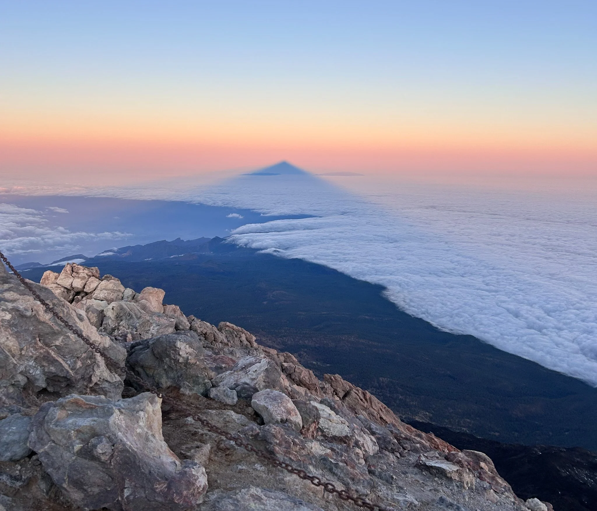
There’s no better way to round off your Tenerife road trip than watching the sunrise from the top of Spain’s highest peak (and the 3rd tallest volcano in the world), before heading off to La Palma for some slower paced adventures.
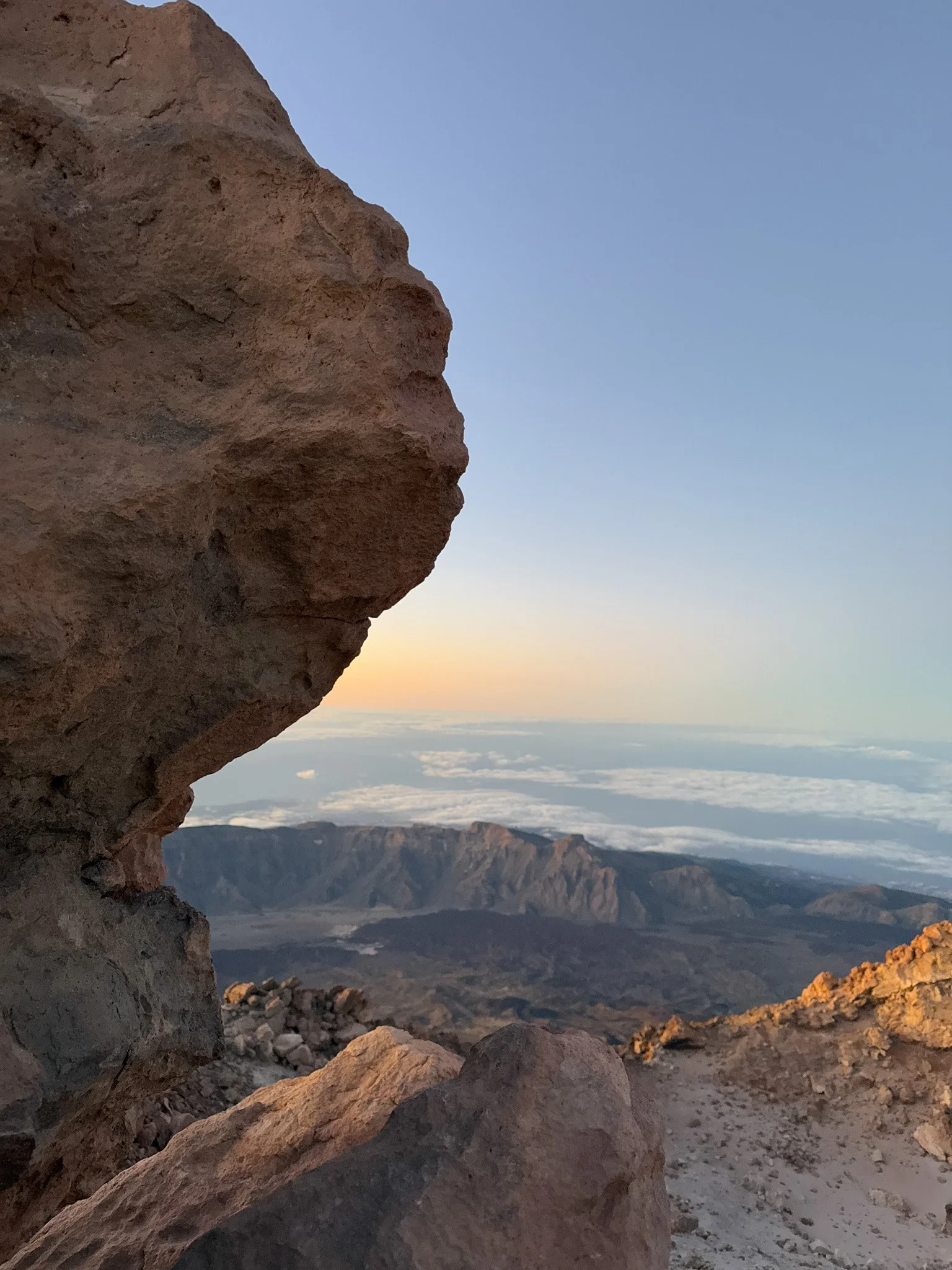
Mount Teide (3,715m) is a surprisingly accessible high-altitude hike for anyone with a reasonable level of fitness. The trail from the Montaña Blanca trailhead is long with gradual elevation, but it’s well-marked and non-technical, with no scrambling or climbing required. If you’ve done a few mountain walks before and can handle the elevation gain, this route is incredibly rewarding and doable without prior mountaineering experience, unlike other peaks at a similar altitude.
Most of the elevation is gradual, with a steep push at the final few hundred metres to the summit.
About the hike
Start: Montaña Blanca trailhead (Teide NP)
Distance: 5.5 miles one way (to summit), 1300+m elevation gain
Difficulty: Challenging (altitude + endurance)
Duration: 3–6 hours up (depending on fitness) / 3–4 hours down, or use cable car
Permit: Required for summit — book ahead at reservasparquesnacionales.es
Navigation: The route from the Montaña Blanca car park is one-way and relatively straightforward to follow, but it’s always a good idea to bring a map and compass for high elevation walks. You can follow the route on komoot or download a GPX file.

What to expect
I hiked up overnight in winter to catch sunrise from the summit. It’s cold, quiet, and 100% worth it — watching the volcano cast a pyramid shadow over the island as the sun rises behind Gran Canaria is a moment I’ll never forget.
To reach the summit for sunrise during winter hours, set off hiking around midnight, and from there, it’s a long, gradual ascent up to the summit (until the final steep few hundred metres). You can either walk back down or take the cable car down (just note the cable car is sometimes not in operation due to high wind speeds, so bring enough supplies and be prepared to walk back to the start if needed).
You’ll need a permit to reach the summit, even if you use the cable car. These book up months ahead — sunrise slots are slightly easier to get, but still need planning. If you miss out, you can still hike to the top station (Mirador de la Fortaleza) without a permit. You can request permits via Tenerife On.
Tip: Bring layers (it can drop below freezing), gloves, snacks, and a buff or hat — there’s no shelter up there. Allow time to adjust to altitude if possible by doing Guajara or a Teide base hike earlier in the trip.
Stay: You can stay right at the base of Teide at the stunning Parador hotel, or allow extra time to travel from your previous base
I walked up and took the cable car down, but I was prepared to walk back down in the event the cable car wasn't running. The cable car is sometimes closed during high winds, so don’t attempt this one unless you’re equipped to hike both up and down (as you likely won’t know whether or not it’s operating until you’re there).

Getting there
From Costa Adeje, it’s a 1h drive to the Montaña Blanca trailhead, located off TF-21. There’s a small layby parking area which fills up early, so arrive by 2am for winter sunrise hikes. There’s no public transport at that time — a rental car or private transfer is essential if starting before dawn. If returning via cable car, the bottom station has a taxi rank and occasional buses during the day.
We descended via cable car (the first cable car in winter is 9am - so be prepared to wait at the cable car station if summiting for sunrise), had a quick coffee stop at the visitor centre, and walked back to the Montaña Blanca trailhead car park. We arrived back in Costa Adeje around 11am, ready to return the hire car before heading to La Palma.
Day 5 (PM): Travel from Tenerife to La Palma
After spending five days exploring Tenerife, it's time to head to La Palma – the Canary Islands' wildest and greenest island. There are two ways to get there, and the best option depends on whether you're planning to hire a car on each island or keep the same vehicle.
Option one: Fly (fastest and easiest) ✈️
If you're planning to rent separate cars on each island (which I'd recommend), flying is by far the quickest option.
Flight time: 30–40 minutes
Airlines: Binter Canarias and Canaryfly
Typical cost: from around €30–70 (£25–60) each way when booked in advance (although last-minute fares can be higher).
Pros
Fastest option
Often surprisingly affordable
Easy to collect a new hire car at La Palma Airport
Cons
You'll need to return your Tenerife hire car at the airport before flying.
Option two: Ferry (best for soaking up the views for longer)
Ferries run several times a day between Los Cristianos (south Tenerife) and Santa Cruz de La Palma.
Journey time: approximately 2.5 hours
Operators: Fred. Olsen Express and Naviera Armas
Typical cost: from around €50–55 (£43–47) per adult each way, although fares vary by departure time and demand.
The crossing itself is surprisingly scenic, and if you're lucky you may even spot dolphins or whales along the way.
Can you take your hire car on the ferry?
Technically yes, but in practice I wouldn't recommend planning your trip around it.
While the ferries allow cars onboard, most rental companies don't allow one-way rentals between Tenerife and La Palma, and many don't permit inter-island travel unless you've agreed it in advance. Even companies that do allow it usually require you to return the vehicle to the island where you collected it, or charge additional fees.
My recommendation
I'd return your Tenerife hire car, then either:
fly to La Palma and collect a second hire car, or
travel as a foot passenger on the ferry before picking up another rental car in Santa Cruz de La Palma.
It's usually the simplest (and often cheapest) way to island hop.
Day 6: Volcanoes & Stargazing
Today is all about experiencing La Palma's incredible volcanic landscapes.
Stop one: Tajogaite Volcano Trail
Start your morning early on one of Europe's newest hiking trails.
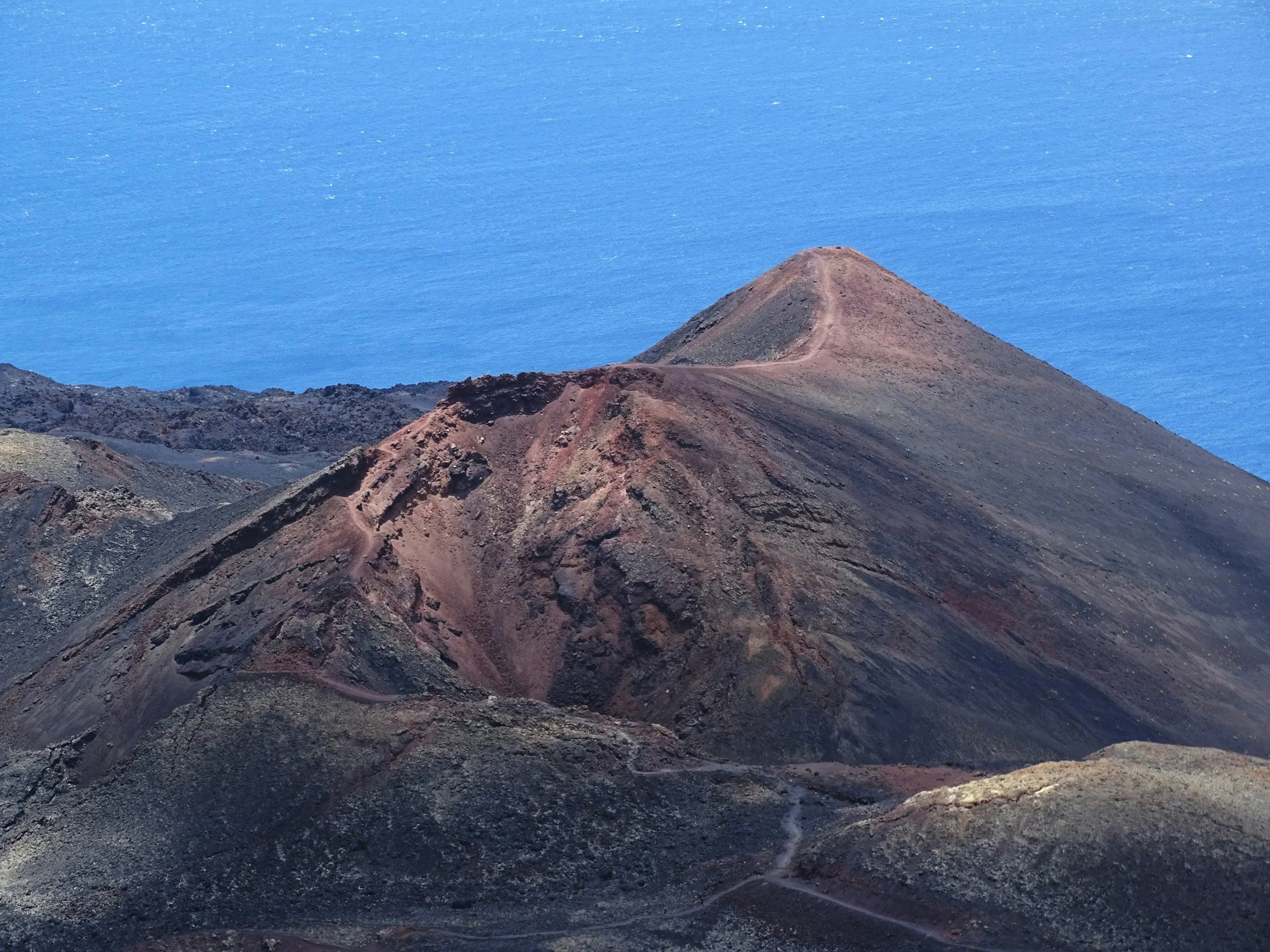
Created by the 2021 eruption, the Tajogaite trail takes you across fresh lava fields and through a landscape that still feels incredibly raw. It's unlike anywhere else in the Canary Islands and offers a fascinating insight into how the island was transformed by the eruption.
Parking: Llano del Jable Visitor Centre
Tip: Access regulations can change, so check whether your chosen route requires a guide or permit before visiting.
Stop two: La Cumbrecita Walk (Caldera de Taburiente National Park)
After lunch, head into Caldera de Taburiente National Park for one of the island's most rewarding short walks.
The La Cumbrecita Circular is an easy trail that loops around spectacular viewpoints overlooking the enormous volcanic caldera. It's the perfect way to experience the national park without committing to a full-day hike.
Distance: 3.3km circular
Time: 1–1.5 hours
Difficulty: Easy
Elevation: Around 150m
Parking: La Cumbrecita car park (parking reservation required during busy periods).
Stop three: Roque de los Muchachos
Finish the afternoon by driving to Roque de los Muchachos.
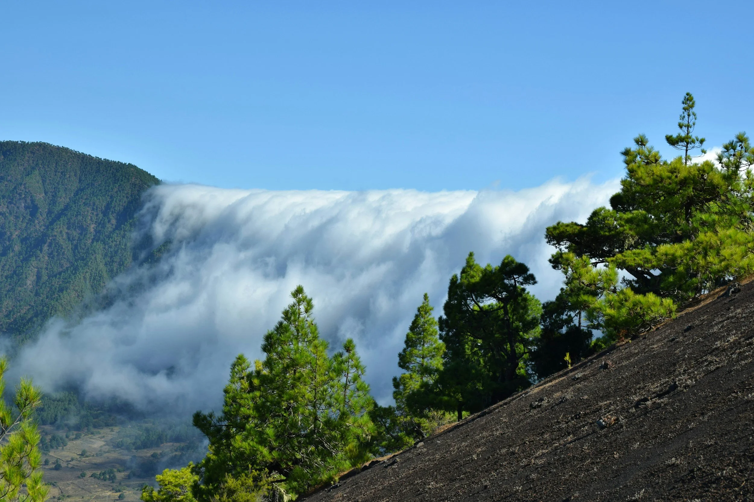
At 2,426 metres, it's the highest point on La Palma and home to one of the world's leading astronomical observatories, and if you visit at the right time, you’ll be treated to a sea of clouds as far as you can see.
Driving tip: The drive up the LP-4 to Roque de los Muchachos is one of the most scenic on the island, but it's also the most challenging drive of this itinerary. Expect plenty of hairpin bends, steep climbs and narrow mountain roads. I drove it myself and found it completely manageable, but it's definitely more technical than the roads around Teide National Park in Tenerife. Allow extra time, take the corners slowly and pull into the viewpoints if you'd like a break—the scenery is incredible.
Timing tip: Arrive before sunset to watch the clouds sink below you before the night sky creeps in.
Evening: Stargazing
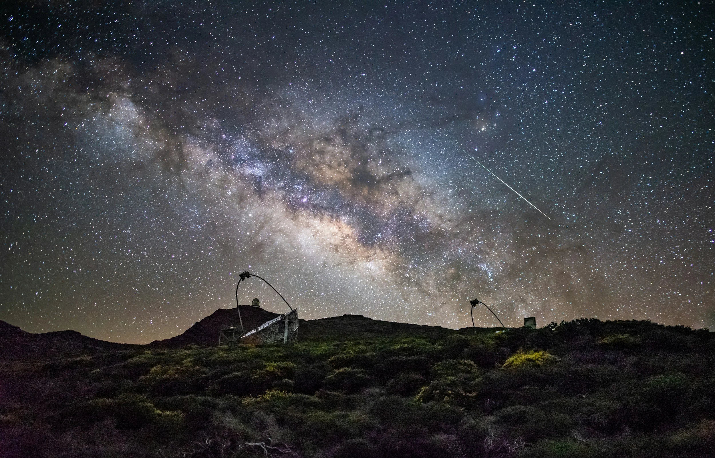
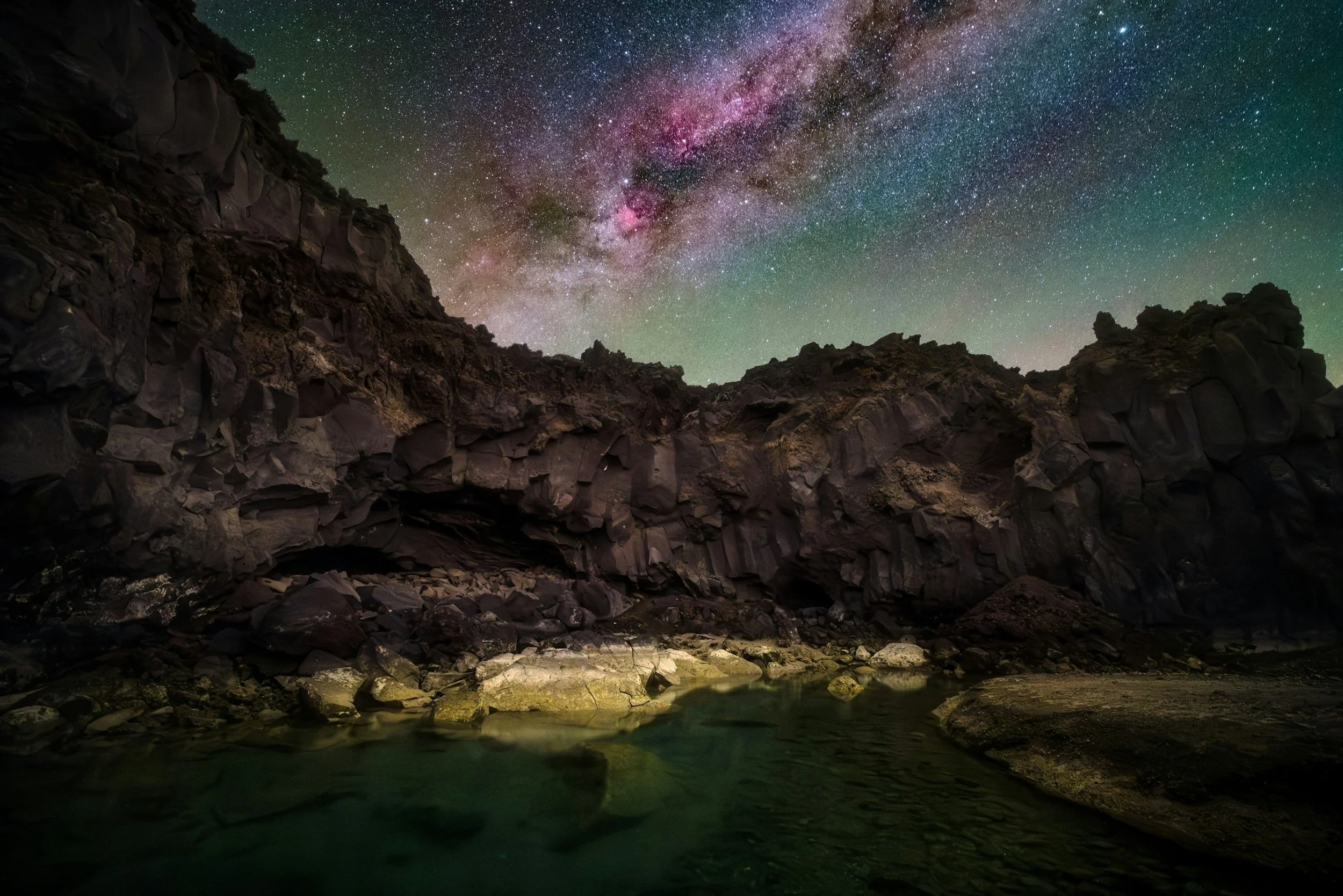
In the evening, don't rush back down the mountain. La Palma is recognised as one of the world's best stargazing destinations thanks to its exceptionally dark skies and strict light pollution laws.
On a clear, moonless night, you'll be able to see thousands of stars with the naked eye, and during Milky Way season the galaxy stretches brightly across the sky — something that's become impossible to experience in many parts of Europe due to light pollution. The combination of high altitude (2,426m), clean air, stable atmospheric conditions and almost no light pollution makes it one of the clearest places on Earth to observe the stars.
Day 7: Rainforest, Natural Pools & Black Sand Beaches
For your final day in the Canaries, I’d recommend discovering La Palma's greener side before ending your adventure on one of Spain's most spectacular beaches.
Stop one: Los Tilos Forest Walk
Begin your morning in Los Tilos, one of Europe's last remaining laurel forests.
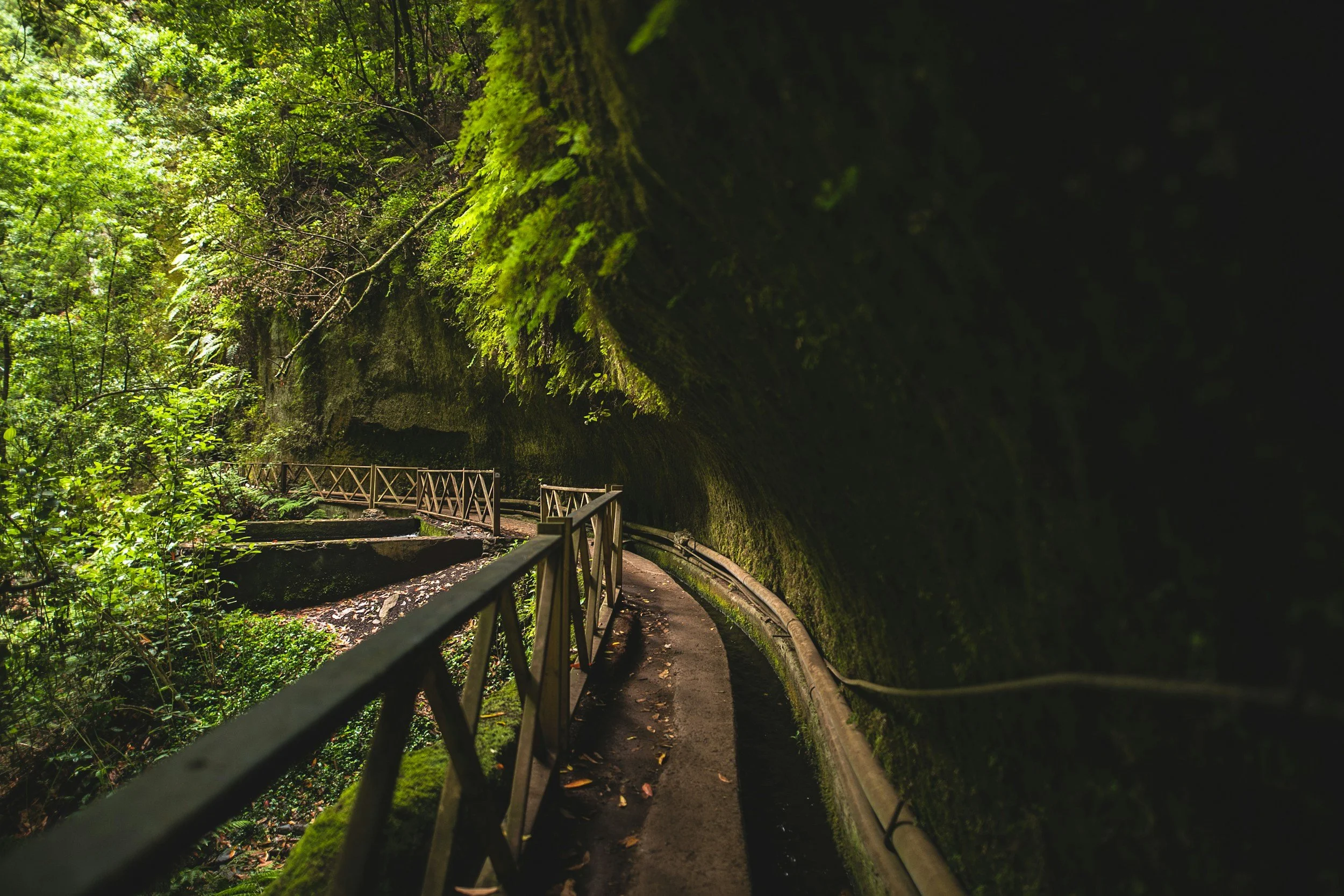
This ancient woodland is part of a UNESCO Biosphere Reserve and feels completely different to the volcanic landscapes you explored yesterday. Towering trees, lush ferns and flowing streams create a magical setting for a gentle walk.
Distance: 2–4km (depending on route)
Time: 45 minutes–1.5 hours
Difficulty: Easy
Elevation: Minimal
Parking: Los Tilos Visitor Centre
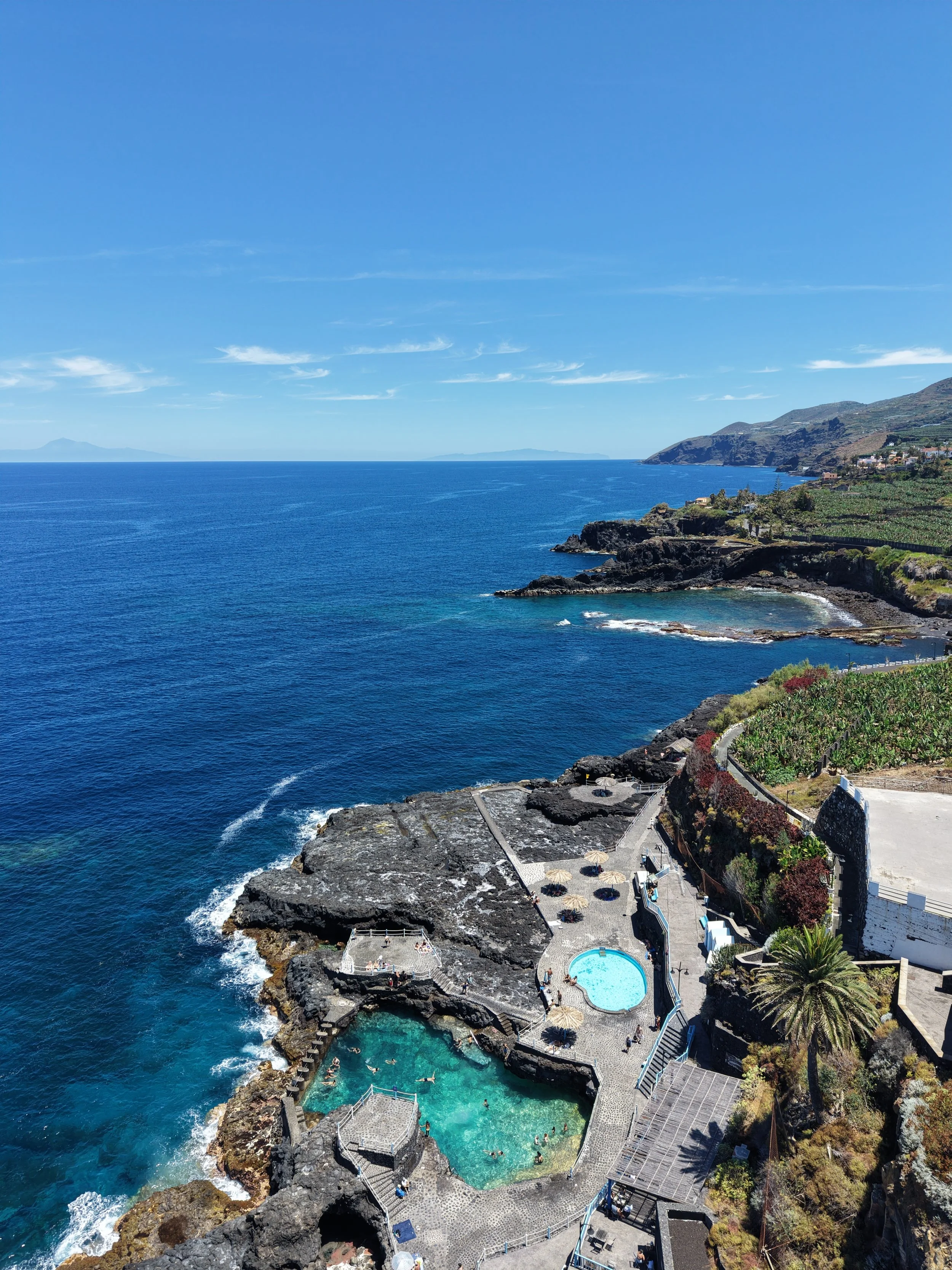
Stop two: Charco Azul
After your walk, head north to Charco Azul.
These natural volcanic swimming pools are one of the island's best places for a refreshing dip. Protected from the Atlantic swell, they're ideal for cooling off after a morning on the trails.
Allow around 1–2 hours here if you'd like to swim and relax.
Facilities include changing rooms, toilets and a small café, making it a great place to stop for lunch or a post-hike swim.
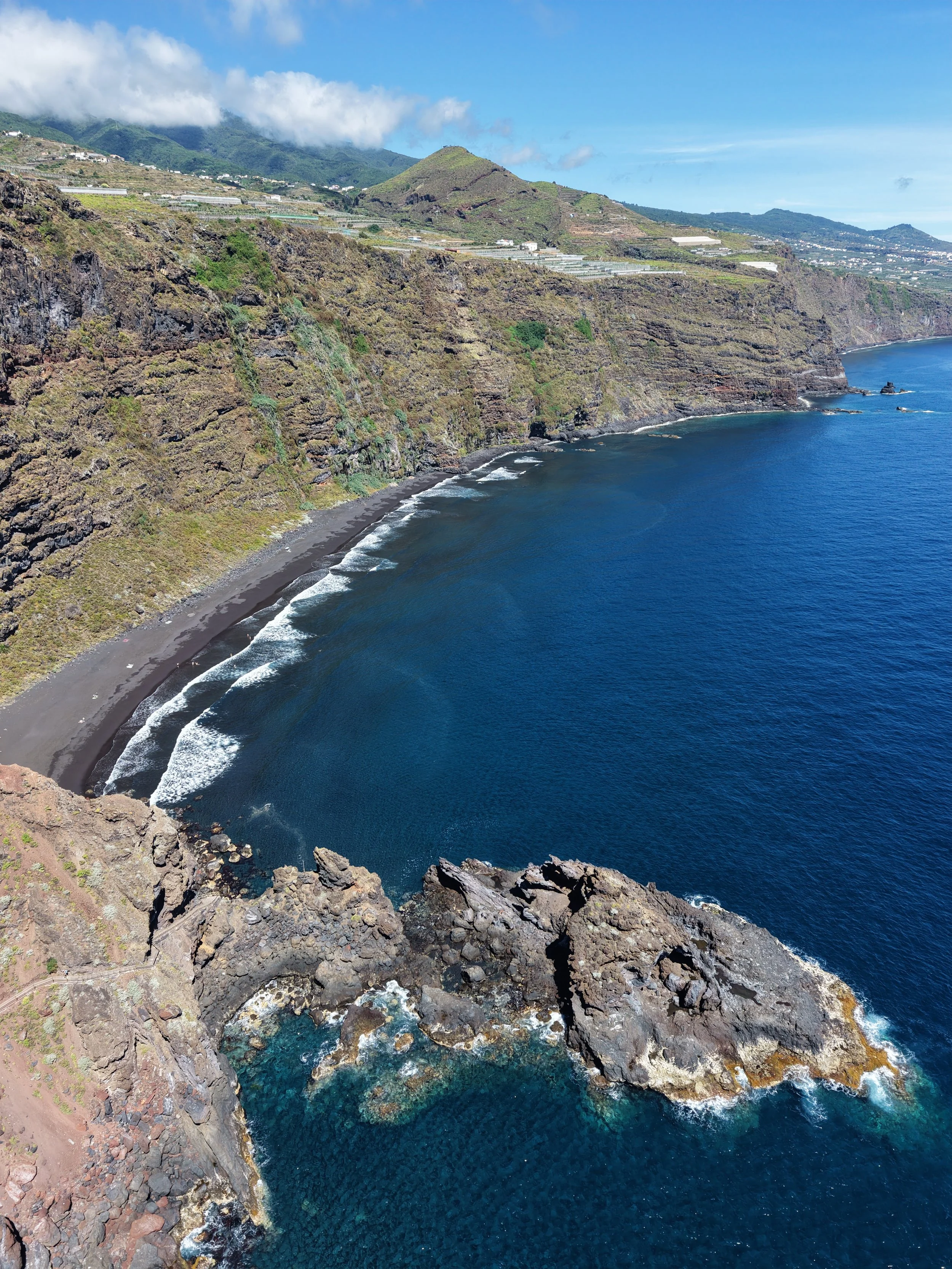
Stop three: Playa de Nogales
And to round off a stunning week of adventure in the Canaries, I’d recommend a dip at Playa de Nogales.
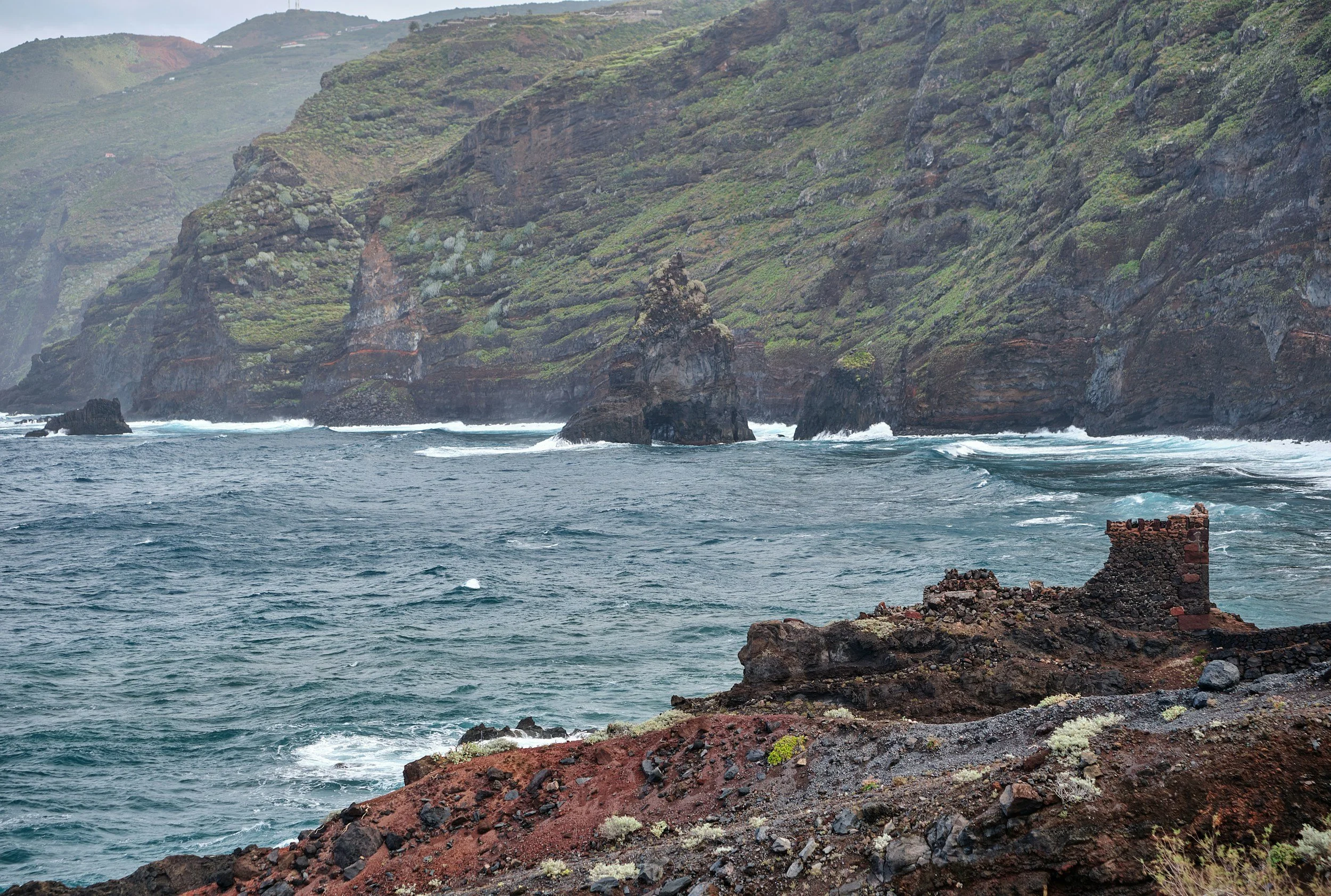
Reached via a short but fairly steep path, this wild black sand beach is backed by dramatic cliffs and is widely considered one of the most beautiful beaches in the Canary Islands.
Walk to the beach:
Distance: 1km return
Time: 20–30 minutes
Difficulty: Easy to Moderate (steep path)
Elevation: Around 100m
Swimming isn't always recommended due to strong currents, but it's an unforgettable place to end your island-hopping adventure.
Final thoughts
After a week exploring Tenerife and La Palma, one thing became very clear to me: the Canary Islands deserve to be known for so much more than beach holidays.
In just seven days you'll hike across volcanic landscapes that feel like Mars, wander through ancient laurel forests, watch the sunrise from Spain's highest peak, swim in natural volcanic pools and end your evenings beneath some of the darkest skies on Earth.
If you're looking for an adventure holiday that combines incredible hiking, dramatic scenery and year-round sunshine, I honestly don't think there's anywhere in Europe quite like these two islands. For me, that's what made this trip so special. Every single day felt completely different — from cloud forests and black sand beaches to volcanic craters and star-filled skies — yet somehow it all fit together into one unforgettable week. If you're looking for an adventure that feels a world away without leaving Europe, I don't think there's a better place to start.
I hope this itinerary helps you experience a side of the Canary Islands that so many people miss.
Gabs x