GADDINGS DAM LOOP (ENGLAND’S TALLEST BEACH)
This 5 mile walk in Todmorden truly has it all — cracking pubs, stunning views and a wild swimming spot to boot

Start: Todmorden Centre, OL14 5QA
Distance: 5.34 miles
Duration: 2-3 hours
Elevation: 975 feet
Difficulty: Easy—Moderate
Navigation: Follow step-by-step on komoot, or download GPX file
About the route
If you like your walks to come with plenty of cafes, pubs and a wild dipping spot mid-route, then this one’s for you. Starting and ending in the thriving market town of Todmorden, this is easily one of my favourite routes up north. Blessed with stunning scenery, magnificent architecture, diverse shops and a thriving art community, Todmorden is the perfect place for a short break or a walking holiday.

Route Highlights:
Todmorden
Known for its stunning Pennine landscape, rich industrial heritage, and a strong sense of community, Todmorden offers a blend of rural tranquility and urban convenience, with a variety of shops, restaurants, and local businesses. The town is also home to a number of historical landmarks, including the iconic Town Hall and the picturesque Rochdale Canal… alongside Stoodley Pike, which you can reach easily along this route. More on that, below.

Gaddings Dam
Gaddings Dam was built in 1833 mainly to supply water for the nearby inhabitants. During this period, there were huge areas of puddled clay in the area that came from a nonporous core which mostly comprised the whole dam itself. Slowly, the dam experienced a series of overhauls that made it look more modern and efficient for today’s time. One of its most significant changes came during 2001 when facilitators decided to drain all the natural water down due to poor conditions.
Fortunately, local groups and activists wanted to preserve it and it was eventually saved from closing. At that time, the dam was also tarnished due to weather increments that forced nearby coordinators to repair some of its facilities. Today, it’s one of the best wild swimming spots close to Manchester — and makes for a cracking day out when paired with this 5 mile walk.
Stoodley Pike
Looking to make a proper day of it? This walk can easily be extended to reach Stoodley Pike, where you’ll find a monument dominating the skyline. Sitting 1,300 feet atop the moors, Stoodley Pike Monument contains a spiral staircase of 39 steps, accessed from its north side, which take you to a viewing platform. If you visit, please be aware that several of the internal steps are in darkness, so it’s useful to have a torch to light your way, as there are no windows. The entrance to the balcony is on the Monument’s west face, some 40 feet above ground level. The views are well worth the walk and the climb!
As we were racing to beat the daylight we didn’t make it to the pike on this particular route, but it can easily be extended to include Stoodley Pike along this route. You won’t regret it.

Where is Gaddings Dam?
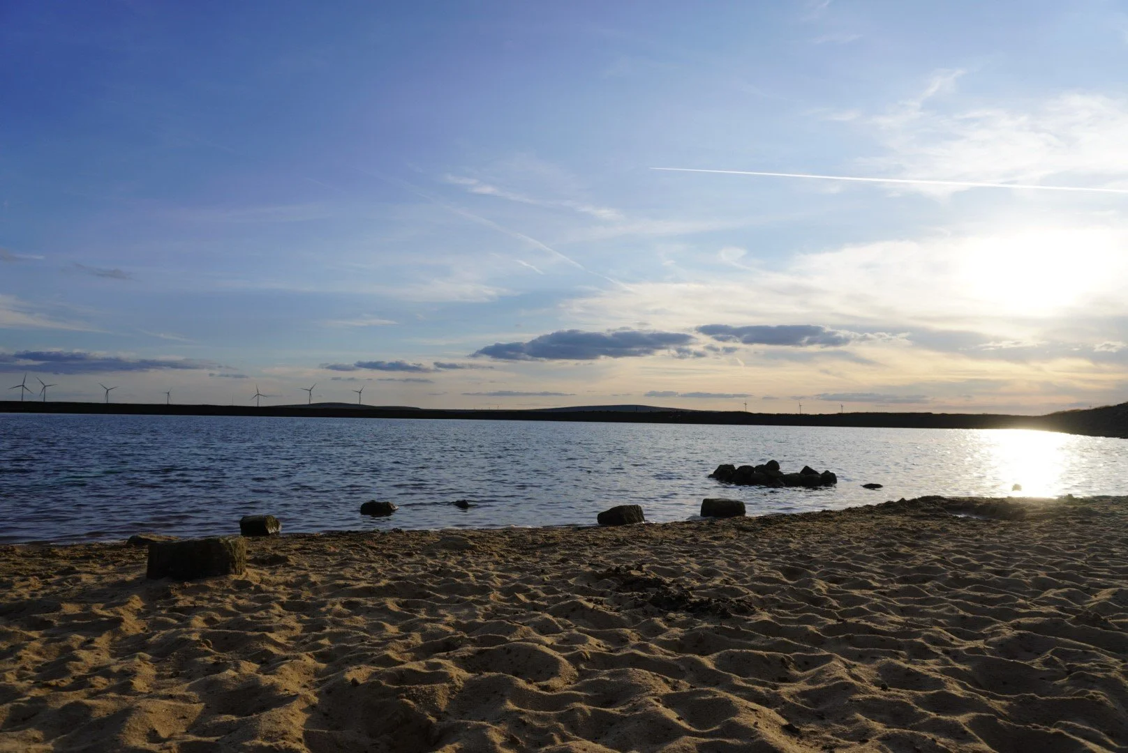
Gaddings Dam can be found in Todmorden, West Yorkshire, at the heap of a plateau that runs from Todmorden to Walsden. At 80 feet above sea level, it’s known as the highest beach in England. Aside from being popular for its panoramic views and hiking trails, it features sandy banks that makes it a peculiar but popular spot for wild swimming.
Swimming at Gaddings Dam
Swimming is allowed at Gaddings Dam. In fact, it’s one of the go-to wild swimming options in the UK and it has very few restrictions. Until recently, Gaddings Dam had been a well-kept secret for both locals and visitors alike for many years. The dam boasts breathtaking views, excellent hiking paths, a sandy beach perfect for lounging, and one of the top wild swimming areas in the county. It’s no surprise that Gaddings Dam is becoming increasingly popular. Its increasing popularity does mean the chances of you having the place to yourself are no longer likely. But choose your timings wisely, and you can still beat the crowds. We visited on a Saturday at sunset and had the place almost to ourselves.
Getting to Gaddings Dam starting point
Public transport
If you're heading to Todmorden by train, there are plenty of easy and direct routes you can take. Trains run regularly from Manchester Victoria, Leeds, or Bradford Interchange. Trains from Manchester Victoria take around 20 minutes, while those from Leeds take around 50 mins. If you're starting in Bradford Interchange, you'll find direct trains that also pass through Halifax and Hebden Bridge.
Arriving by car
If you’re travelling by car, you’ll find plenty of parking in Todmorden centre. Please try to avoid parking near Gaddings Dam as the area gets very congested and causes disruption to local residents. We parked in the free car park on Dale Street (OL14 5QA).
Visiting the Dam
The dam has no road access and can only be reached by foot on a half hour walk on either of two steep very rugged footpaths. Please choose your footwear appropriately.
There are no facilities for swimmers at the dam: no toilets, life guards, changing rooms or cafes.
Please park carefully and respectfully. There is very limited marking in and around the dam. Illegally parked cars have been towed away and parking tickets have been issued. I recommend visiting by train or parking in Todmorden and following our route up to the dam.
Follow the marked paths. Some visitors have created a direct track to the Dam, which is now very eroded and dangerous. There have been serious accidents, requiring fell rescue teams and ambulances. Please stick to the marked paths to keep yourselves and others safe.
If possible try to reach the dam on foot or on public transport. If not following our route, there is an hourly bus, the T6 or T8, from Todmorden bus station to the beginning of the footpaths, departing at 10 minutes past the hour.
Good to knows
Footwear: As with any walk in the glorious UK, sections of this route can get super boggy after heavy rainfall. Definitley boot up for this one unless you’re visiting after a dry spell.
Food and drink: You’ll be spoilt for choice on places to stop on this route. You’ll pass two pubs mid-route and find an abundance at the starting point in Todmorden — alongside plenty of cosy cafes and stunning independent shops.
Parking: If you’re travelling by car, you’ll find plenty of car parks in Todmorden to choose from. We used the free car park on Dale Street (OL14 5QA).
Public transport: Travelling from Manchester? You’ve hit the jackpot with this route: you can reach the starting point via train in 20 mins from Manchester Victoria. Easily one of my favourite public transport walks close to Manchester.
Following the route: I always use OS Maps and komoot for offline navigation. To follow this walk step-by-step on komoot, simply click this link here or download the GPX file and upload it to your chosen app, such as OS Maps.