A Timeless Loop: Waterfalls, Woods & Wandering from Goathland Station
A wander through railway nostalgia, hidden waterfalls and moss-draped woodland in the North York Moors

Start: Goathland Station car park, North York Moors
Distance: 5 miles
Elevation: 675 feet
Duration: 2 hours
Difficulty: Easy (with care around the waterfalls)
Navigation: Follow step-by-step on komoot or download GPX file
About the route
A 5-mile circular walk through the heart of the North York Moors, starting and ending at Goathland Station. This route combines woodland wanders, moorland edges, hidden waterfalls and a quirky little pub tucked into a valley. You’ll walk sections of the old railway trail, dip into the timeless hamlet of Beck Hole, discover Thomason Foss and Mallyan Spout, and loop back through Goathland village.
Time it right and you’ll catch the sound of steam engines echoing through the trees.
Route difficulty
This is a relatively gentle walk with a few sections that require care, particularly near Thomason Foss and Mallyan Spout, where paths can be steep, muddy or uneven. A bit of scrambling is needed in places, and the rocks near the waterfalls can be very slippery, especially after rain.
Most of the route is gentle underfoot, especially along the old rail trail and woodland paths, but caution is advised near water.
Distance: 5 miles / 8 km
Time: 2.5–3 hours with faff and photo stops
Start/finish: Goathland Station car park
Terrain: Woodland trails, old rail paths, rocky sections near waterfalls
Difficulty: Moderate — easy-going in places, steep/slippy near waterfalls
Good for: Waterfall lovers, moody weather wanderers, filming location fans
Facilities: Cafés, pub, loos in Goathland village
Route highlights
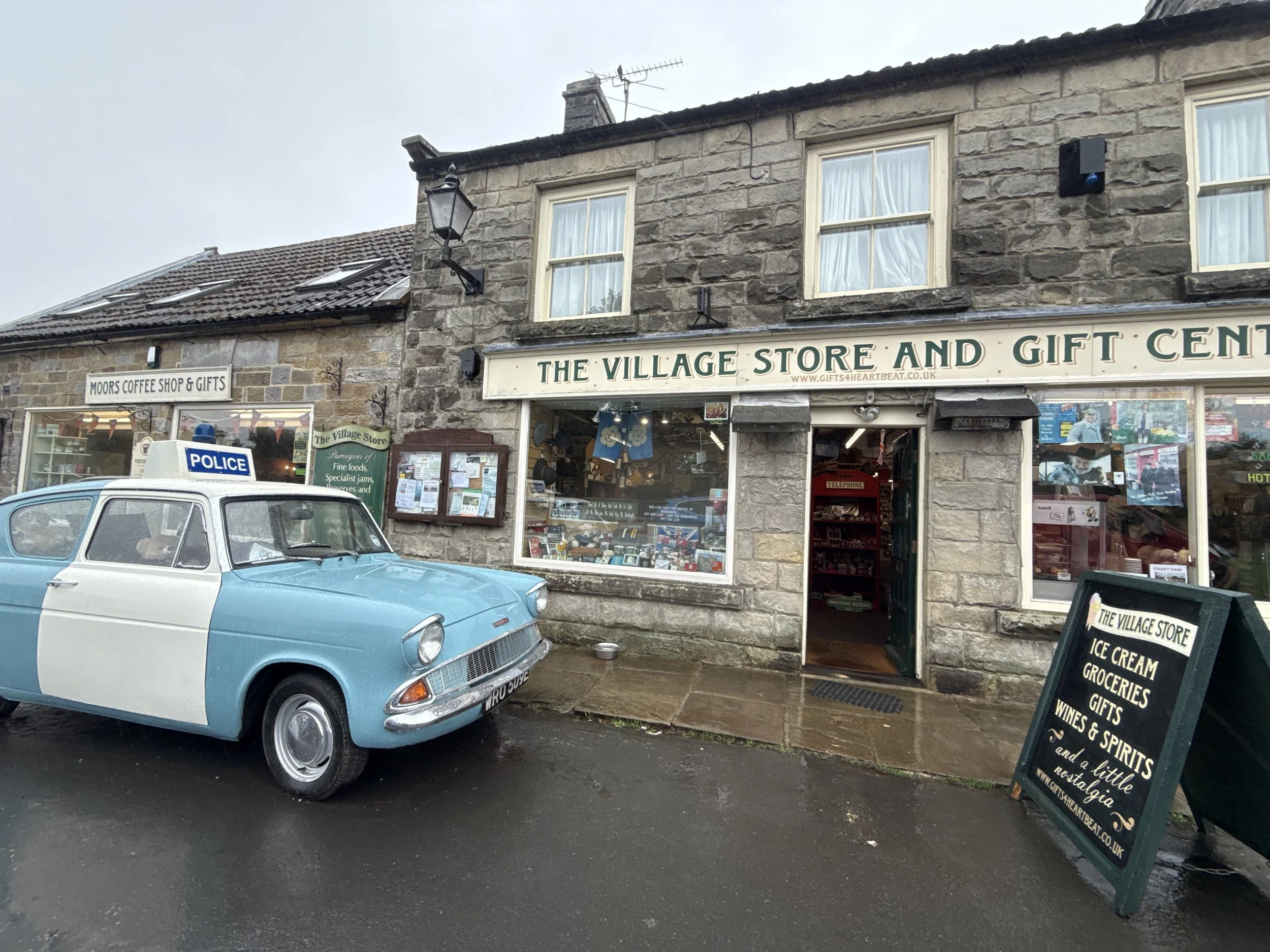
Goathland Station: Better known to many as Hogsmeade Station from Harry Potter and the Philosopher’s Stone. It’s also a popular filming location for Heartbeat, the long-running 1960s police drama. Goathland stood in for the fictional village of Aidensfield, and many of the village’s shops and buildings still reference the show today.
The Inn Way & rail trail: A wide, accessible path that traces a former railway line. Perfect for easy walking and glimpses of Victorian engineering.
Beck Hole & Birch Hall Inn: A pint-sized hamlet in a steep-sided valley. The Birch Hall Inn is part pub, part sweet shop, and a worthy detour for a snack or half pint.
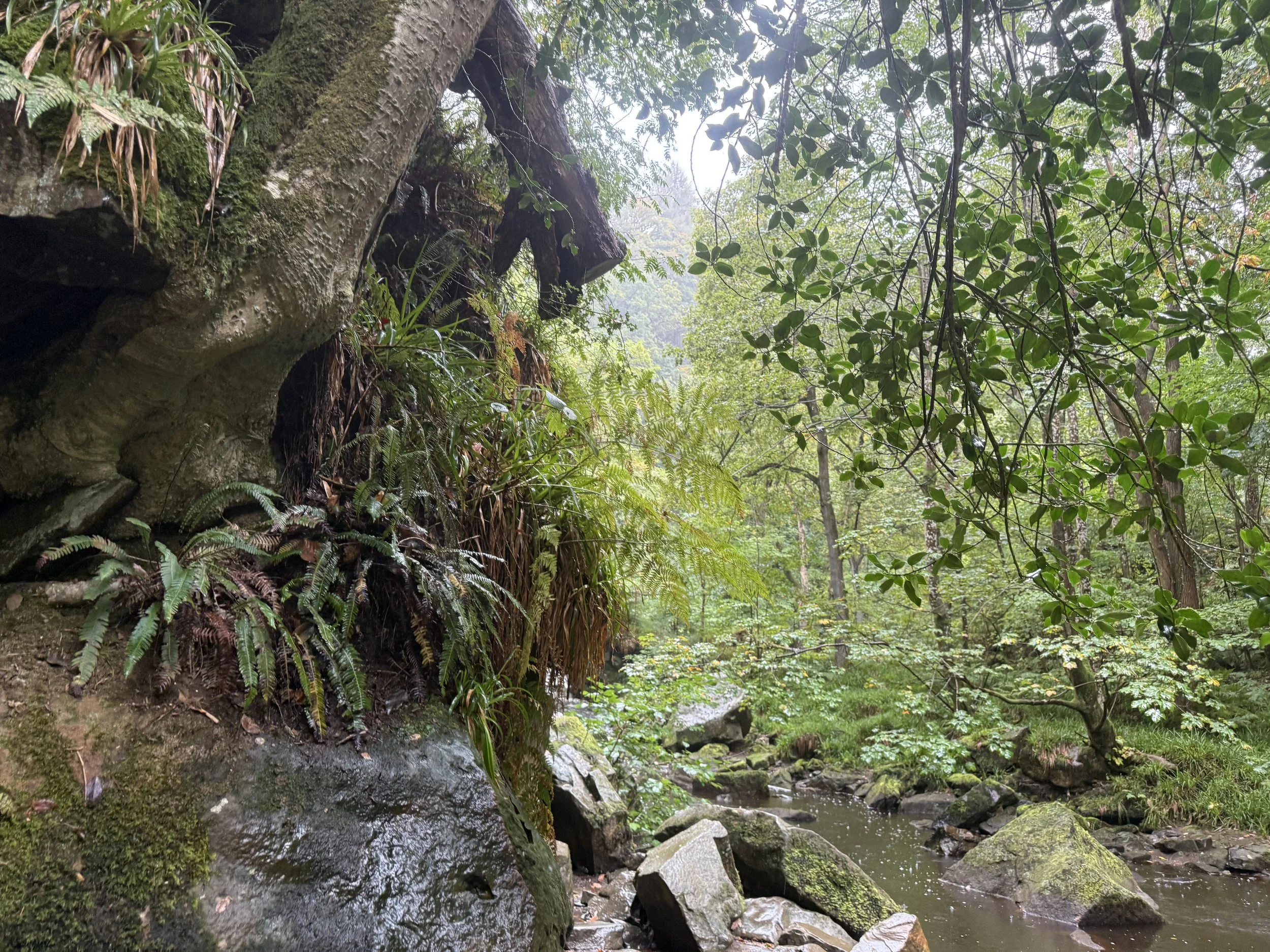
Thomason Foss: A lesser-known but enchanting waterfall, nestled in a quiet wooded gorge. The path is rough in parts but worth the clamber. Care is needed here as the trail becomes narrow and rocky.
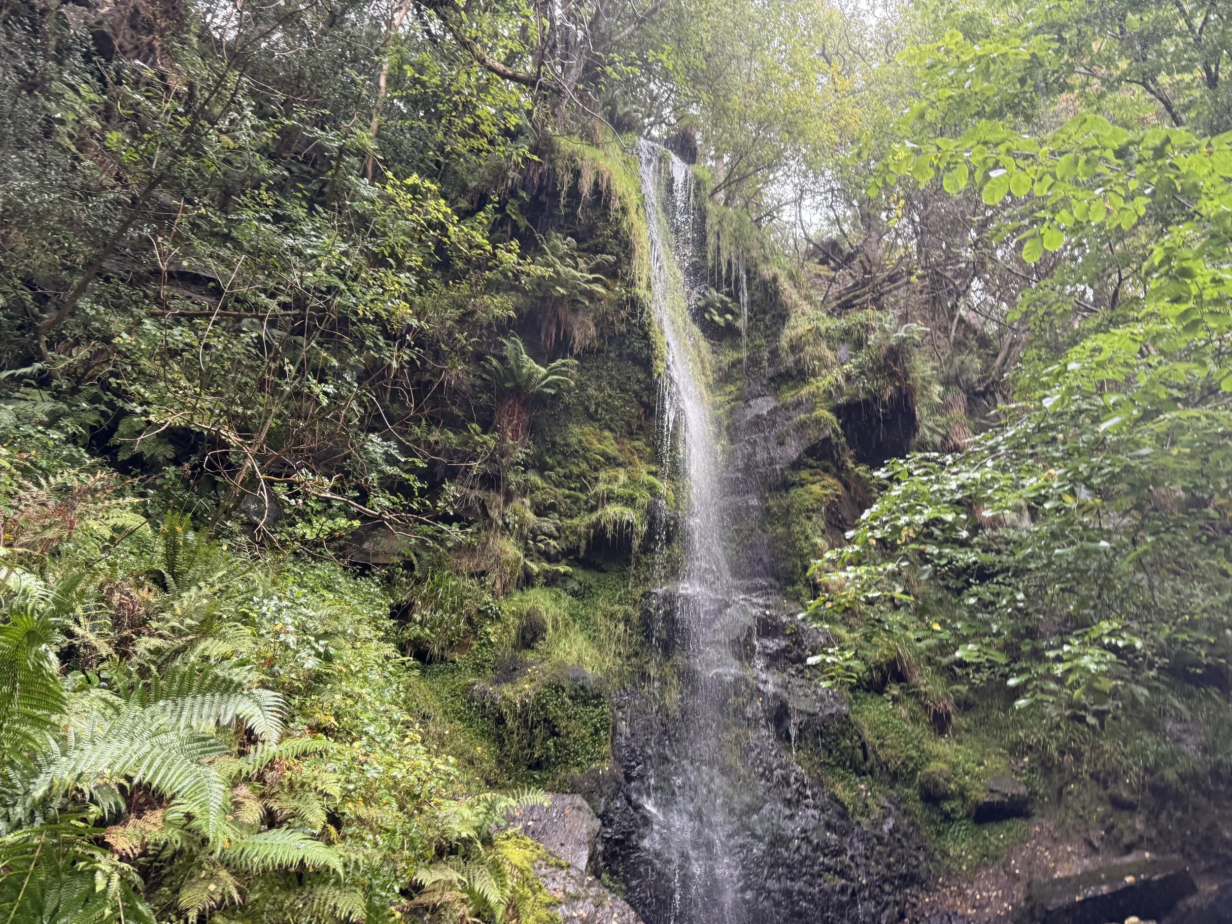
Mallyan Spout: A 70-foot waterfall tucked into a dramatic gorge. Expect mossy rocks, dripping ferns and the soothing rush of water. The route down and back up is steep and can be slippery.
Where is Goathland?
Goathland is a moorland village in the North York Moors National Park, about 9 miles southwest of Whitby. It’s surrounded by rolling heather moorland, pine forests, and old railway lines, and feels beautifully tucked away — yet is surprisingly easy to get to.
It’s best known for its vintage station, Heartbeat filming spots, and easy access to some of the area’s loveliest short walks.
Things to do nearby
Ride the North Yorkshire Moors Railway for a steam-powered view of the surrounding moorland.
Explore the moors on longer circular routes from Goathland or Grosmont.
Visit the Mallyan Spout Hotel for a post-walk cream tea.
Pop into the Goathland Tea Rooms or the Aidensfield Arms (for Heartbeat fans).
Is this walk suitable for beginners?
Yes, with caution. For anyone with impaired mobility, it’s best to skip the Thomason Foss detour and take care near Mallyan Spout. Stick to the main paths and allow time for rest stops.
When is the best time to do this walk?
This route works in any season:
Spring brings wildflowers and fast-flowing waterfalls
Summer offers leafy shade and buzzing wildlife
Autumn makes the surrounds come to life with misty moors
Winter can be magical too, though paths may be icy or boggy
Drizzly weather only adds to the old-world charm, but waterproofs are a must.
How to extend your adventure
Continue from Beck Hole towards Grosmont via the old railway incline for a longer route.
Explore Wheeldale Beck and nearby moorland paths.
Join the Lyke Wake Walk route if you’re after a much bigger day out.
Visit the nearby Hole of Horcum for another classic moorland loop.
Getting to the starting point
By car: Goathland Station has a dedicated car park (pay & display). Arrive early on weekends and holidays.
By train: Take the North Yorkshire Moors Railway steam service (seasonal) or regular train to Grosmont and walk from there (longer route).
By bus: Limited bus services run between Whitby, Pickering and Goathland. Check timetables in advance.
✔️ Good to knows
Facilities: Toilets and refreshments available at Goathland Station and some village cafés
Parking: Pay & display car park at Goathland Station
Refreshments: Birch Hall Inn, cafés in Goathland village, Mallyan Spout Hotel
Dog-friendly? Yes, but leads needed near livestock and steep sections
Accessibility: Not suitable for pushchairs or wheelchairs — uneven, narrow and steep paths
Mobile signal: Patchy — download offline maps
Waterfall warning: Paths near Mallyan Spout and Thomason Foss are steep and slippery — take care after rain
Best for: Mixed weather, film fans, nostalgia lovers
🧭 Following the route
I use komoot and OS Maps for offline navigation. To follow this walk step-by-step on komoot, simply click this link here or download the GPX file and upload it to your chosen app, such as OS Maps.