ALL TRAILS
A walk through Brontë country: The Brontë Way
Wander through the landscapes that inspired a Brontë classic on this popular moorland walk
Start: Haworth Main Street, near the Brontë Parsonage Museum
Distance: 7.5 miles
Elevation: 825 feet
Duration: 2.5-3 hours
Difficulty: Easy (suitable for most walkers)
Navigation: Follow step-by-step on komoot or download GPX file
About the route
This relaxed walk through the Haworth moorlands makes for an ideal day out, ending with beautiful views and historic locations tied to Brontë history.
The route takes you along The Brontë Way, a route rich with Brontë history and scenery that makes you feel like you’ve stepped straight inside the sisters’ novels. The Brontë Way is a 69km (43 mile) long distance footpath which starts at Oakwell Hall ("Fieldhead" in Charlotte Bronte's novel "Shirley") near Birstall in Kirklees near Bradford, and ends at Gawthorpe Hall in Padiham near Burnley in Lancashire's Pendle Witch Country.
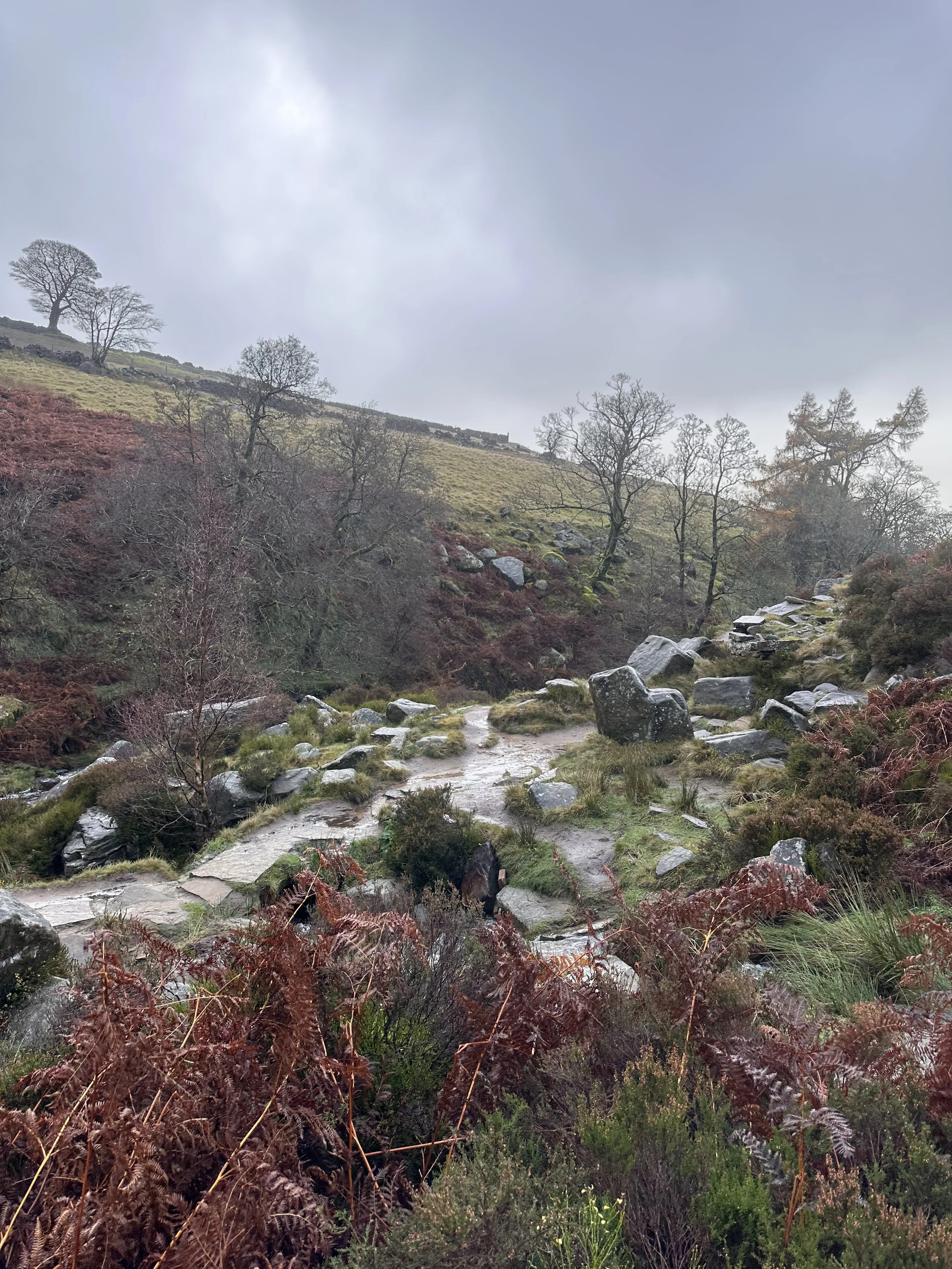
This particular walk takes you along a short section of The Way, winding your way past many places of interest to Bronte enthusiasts, including Penistone Hill country park, perched on the moors high above Haworth, the trail to the Bronte Waterfall and on over the Bronte Bridge up to Top Withens (a favourite walk of the Brontes themselves - with Top Withens being suggested as the contentious location for the eponymous Earnshaw house in Wuthering Heights), and of course, the village of Haworth itself.
Route difficulty
Walk type: Easy circular walk with limited elevation gain. Good for most walkers with, includes some uneven paths
Terrain: Mix of paved lanes, gravel paths, grassy trails, and some uneven moorland sections.
Inclines: Mostly gentle, with a short climb up to Top Withens that can be a little steep and exposed.
Surfaces: Some rocky patches and muddy stretches, especially after rain.
Navigation: Well-marked in most places, map/GPX needed for moorland section
Mobility: Not suitable for pushchairs or wheelchairs. This route contains stiles, steps, and narrow gates.
Why you’ll love this walk
A mix of moorland, waterfalls, ruins & literary lore
Great views at Top Withens + waterfall
Quiet in parts (especially the moors), lively in others (Haworth village)
Ideal for a Sunday stroll: nature + tearooms + pubs
Highlights:
Route highlights
Haworth
Your walk begins and ends in the charming Pennine village of Haworth, nestled in the heart of West Yorkshire’s Brontë Country. This historic village is famous as the home of the Brontë sisters (Charlotte, Emily, and Anne) and is filled with cobbled streets, quaint shops, and atmospheric tea rooms that take you back to the Victorian era. In the village centre, you’ll find the Brontë Parsonage Museum, where the sisters lived and wrote their novels, along with several charming cafes and boutiques perfect for exploring before or after your walk.
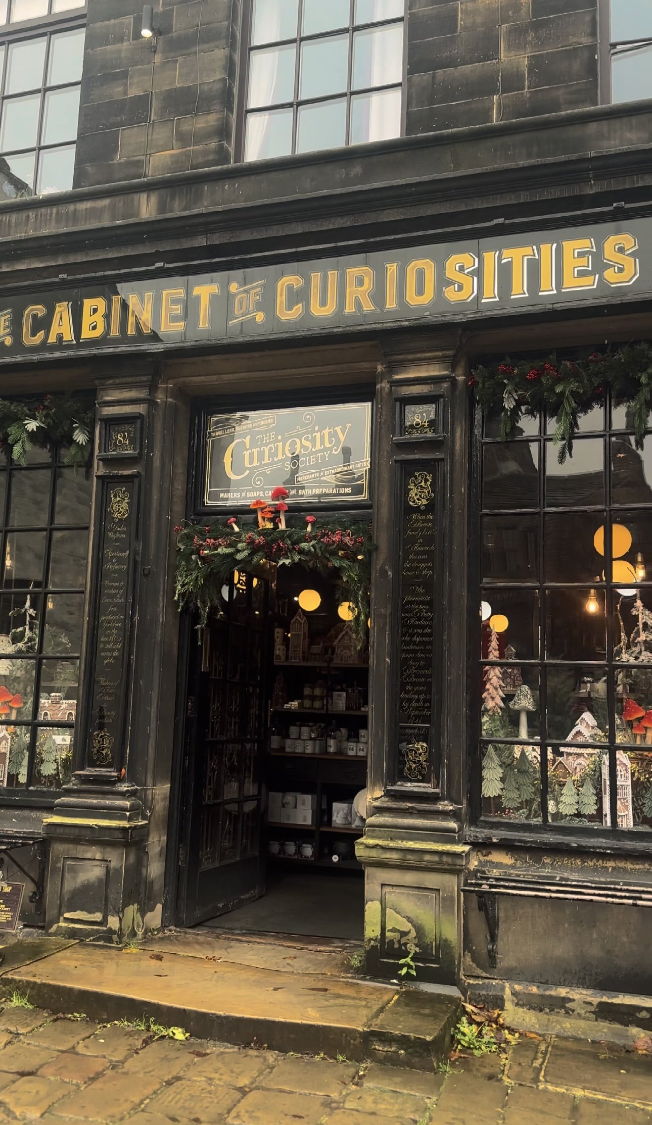
Don’t miss a visit to the Cabinet of Curiosities for a peek into local Victorian artefacts or the iconic Black Bull pub, often frequented by Branwell Brontë.
Bronte Waterfall
The Bronte Waterfall is a great place to rest on your way to Top Withens (Wuthering Heights), Alcomden Stones or Ponden Kirk (The Fairy Cave). Top Withens (also known as Top Withins) is a ruined farmhouse near which is said to have been the inspiration for the location of the Earnshaw family house in Wuthering Heights.
Just a short distance from Top Withens, the waterfall cascades down the rocks and has long attracted visitors drawn by its natural beauty and literary ties. Charlotte Brontë is said to have found solace here, and it remains a serene spot midway through the walk.
Cabinet of Curiosities
Back in Haworth, step into the Cabinet of Curiosities, a quirky shop filled with Victorian oddities, witchy trinkets, and handmade soaps that I can never seem to leave the village without. This museum-like shop truly is like stepping foot in an old apothecary store, warmly lit by glass globes, fragranced with exotic oils, and packed from floor to ceiling with rich mahogany and glass display cases. Over the years the family-run business has taken on a true labour of love, salvaging many of the shops fittings from chemists, grocery shops and museums to replicate the ‘wonder-rooms’ of a time gone by.
Wuthering Heights Pub
End your walk at the Wuthering Heights pub (close to Top Withens), a cosy spot to enjoy a pint or a hot meal after a day on the moors. This traditional Yorkshire pub has true rustic charm, with a hearty menu and an atmosphere that perfectly complements a moody moorland adventure.
Options to extend the route
For a longer hike, consider adding a detour to nearby Ponden Kirk, a rocky outcrop believed to be the inspiration for Wuthering Heights’ Penistone Crags. This can turn the walk into a full day’s outing, with more moorland views and an optional scrambling segment.
Where is Haworth?
Haworth is in West Yorkshire, England, part of “Brontë Country.” Near Keighley, within reach of Leeds and Bradford. Rural & beautiful, with moors all around.
The picturesque village is renowned worldwide as the home of the Brontë sisters, the celebrated authors of Wuthering Heights, Jane Eyre, and The Tenant of Wildfell Hall. Situated near the larger town of Keighley and easily accessible from Leeds, Haworth is part of the scenic region known as Brontë Country, an area of natural beauty that inspired much of the sisters' work.
The village itself is home to many quaint tea rooms, souvenir shops and a few quirky pitstops you can’t afford to miss. My absolute favourite is The Cabinet of Curiosities, a traditional shop that’s been restored it to its former glory as a Victorian apothecary shop.
Getting to the starting point
Arriving by car
There is limited parking along Main Street in Haworth, with additional spaces near the Brontë Parsonage Museum and pay-and-display lots available for a small fee.
Arriving by public transport
The Keighley Bus Company operates regular services to Haworth from Keighley, making it accessible by public transport from nearby towns and cities.
From Leeds
Train to Keighley (~30 mins)
Catch the Brontë Bus (B1, B2 or B3) to Haworth
From Bradford
Train or bus to Keighley
Catch transfer to the Brontë Bus to Haworth
From Hebden Bridge
Take the Brontë Bus B3 direct to Haworth (via Oxenhope)
From Keighley Station
Key transport hub with trains from Leeds, Bradford & Skipton
Then either the Brontë Bus or the KWVR heritage train to Haworth
Heritage train option
Take the Keighley & Worth Valley Railway (KWVR) steam/diesel service from Keighley direct to Haworth. It runs on weekends and daily in summer — a slower, scenic ride through the Worth Valley. Check the KWVR website for current timetables.
Travel tips:
Bus services are regular but check timetables before visiting, especially Sundays & holidays
Allow time to transfer between Keighley train & bus stations if needed
Heritage train is a great option but not daily — pre-check schedule
Parking is limited in Haworth during busy times, arrive early or use park & ride if available
✔️ Good to knows
Difficulty: This walk has gentle climbs and is suitable for all abilities.
Accessibility: This is a carrier only route. There are some steep steps and rocky paths, particularly around the waterfall itself, which aren’t suitable for pushchairs or wheelchairs. This route includes stiles.
Navigation: The walk to the falls is well signposted, but bring GPX/map for the moorland section.
Food and drink: Plenty of pubs, tearooms and shops available in Haworth at the start and end of the walk, including the café at the Brontë Parsonage Museum.
Parking: Public parking is available near Haworth’s Main Street; charges vary.
🧭 Following the route
I use komoot and OS Maps for offline navigation. To follow this walk step-by-step on komoot, simply click this link here or download the GPX file and upload it to your chosen app, such as OS Maps.
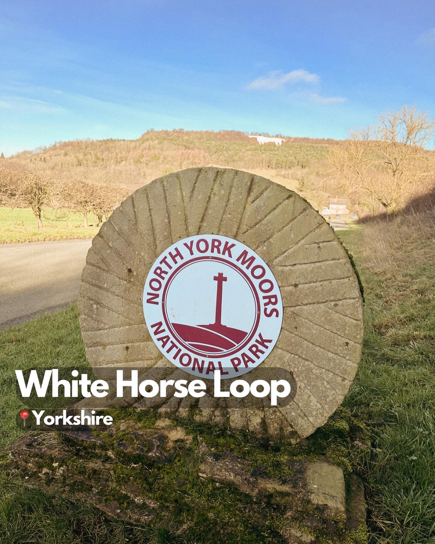
Kilburn White Horse: A walk to the ‘finest view in England’
A circular North York Moors walk featuring iconic chalk carvings, cliff-edge gliders and a tranquil glacial lake
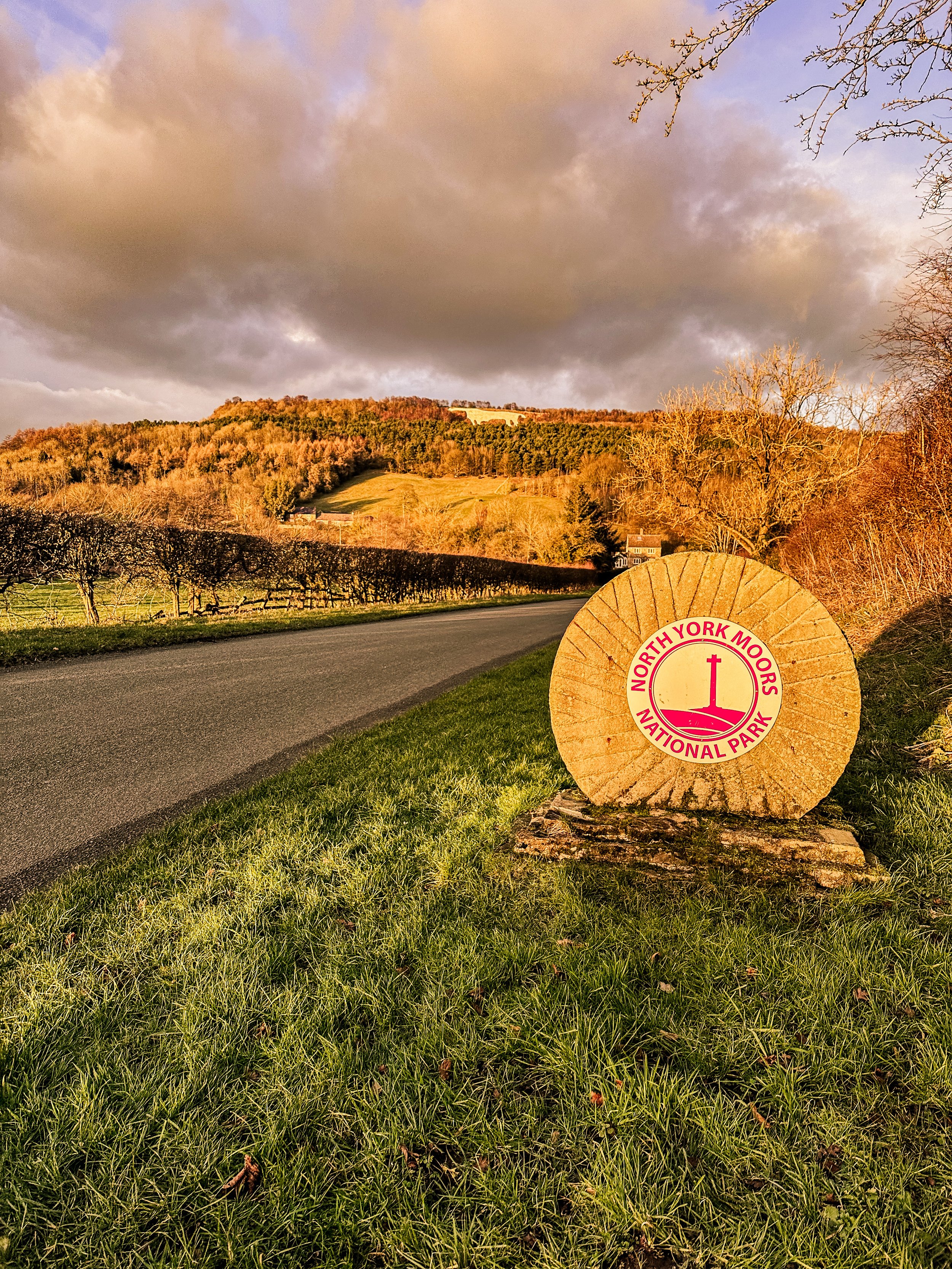
Start: Kilburn, North York Moors National Park
Distance: 7 miles
Elevation: 925 feet
Duration: 3 hours
Difficulty: Easy-moderate (with some steep sections)
Navigation: Follow step-by-step on komoot or download GPX file
About the route
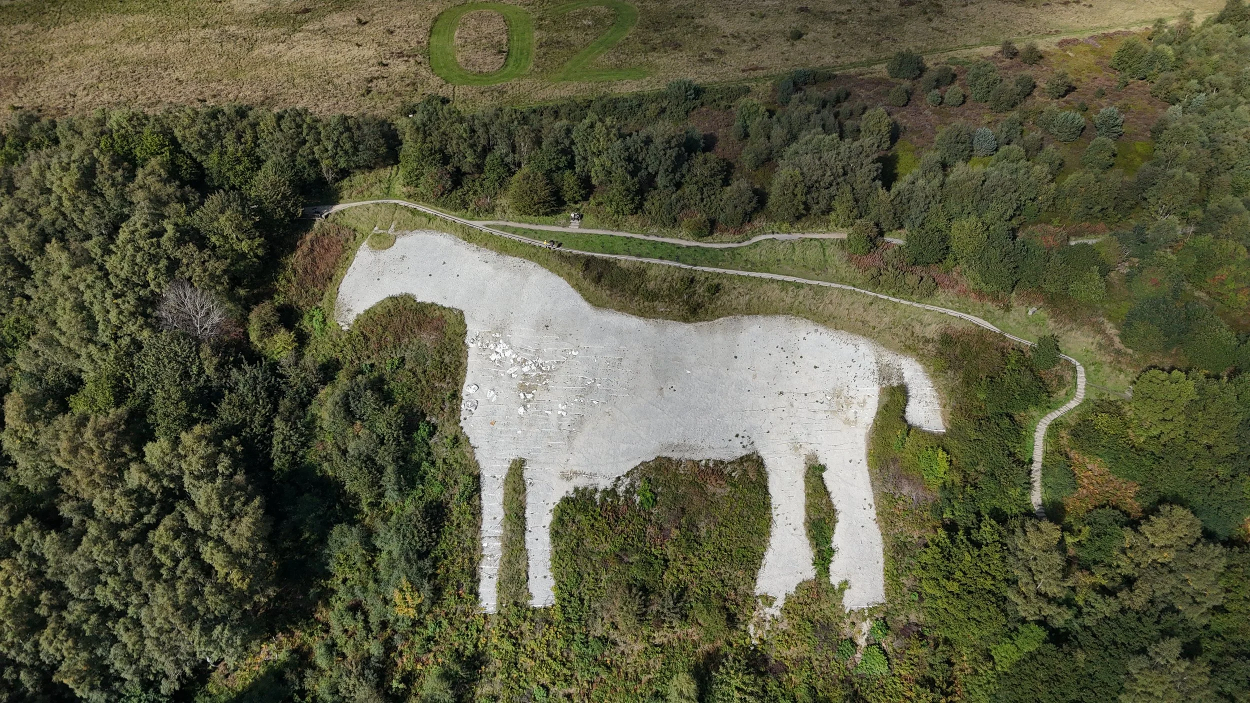
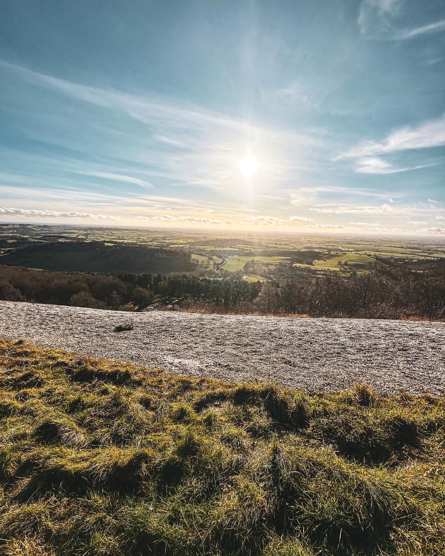
This 7-mile loop explores the dramatic southern edge of the North York Moors, starting in the charming village of Kilburn. The route climbs steadily through Forestry England woodland to reach the Kilburn White Horse—a vast chalk figure etched into the hillside. From here, follow the escarpment path, where gliders from the nearby Yorkshire Gliding Club often drift silently overhead.
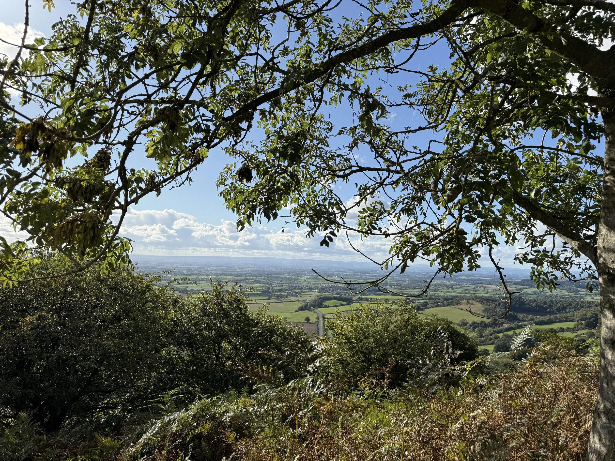
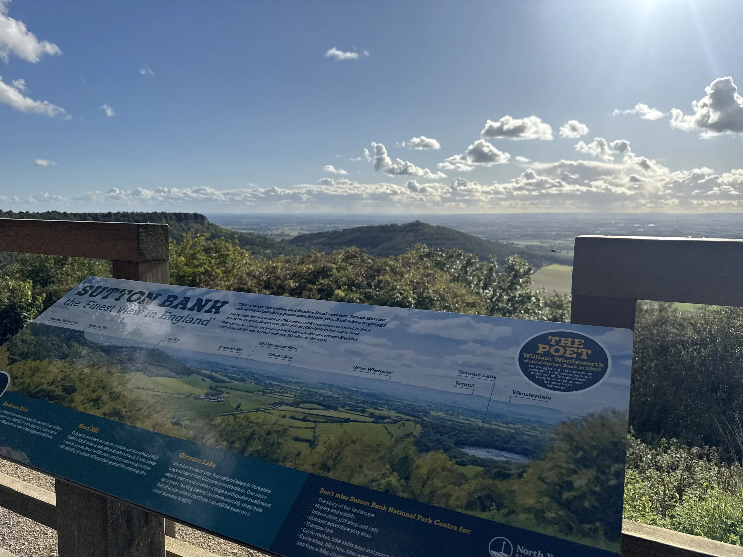
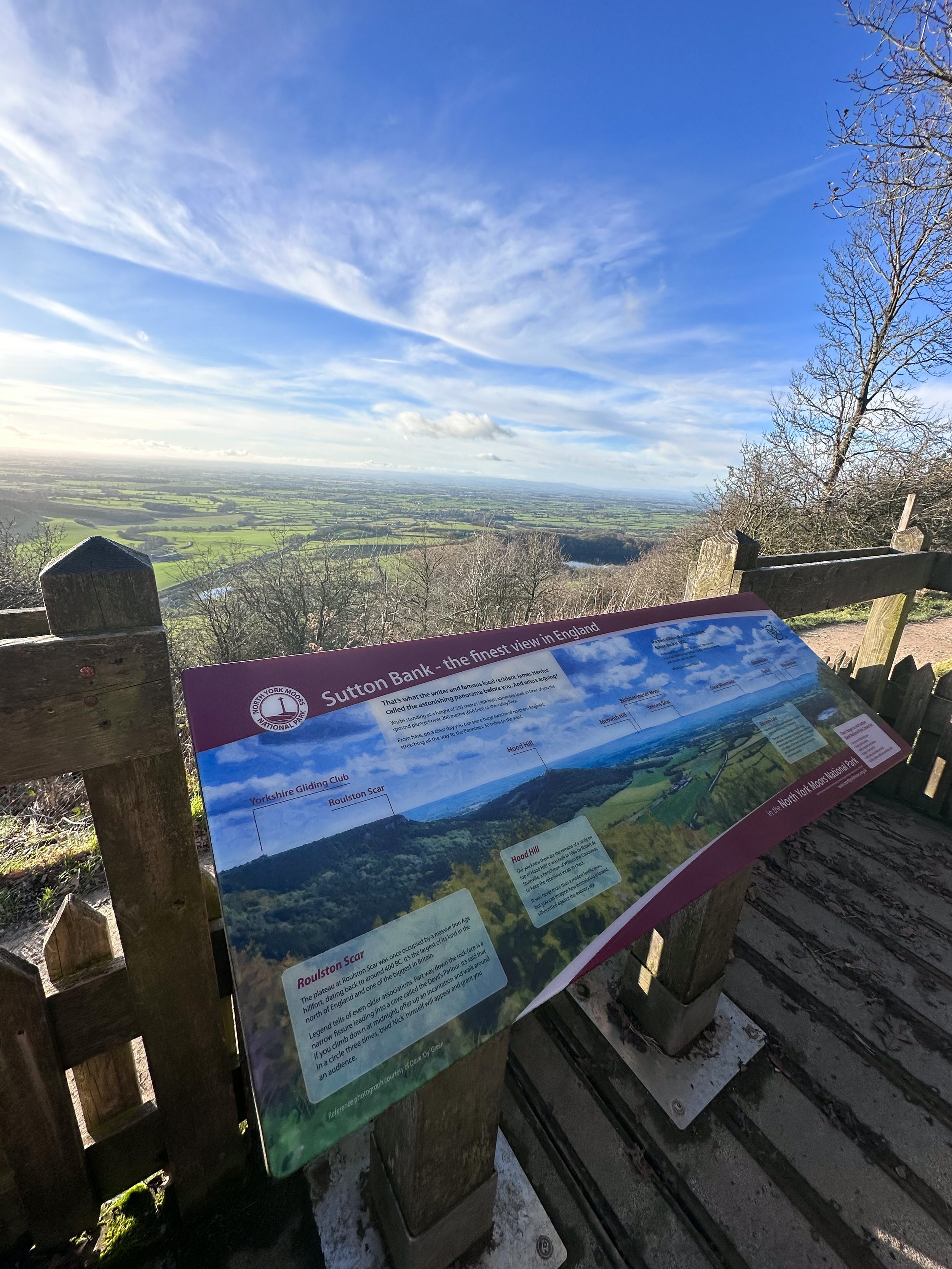
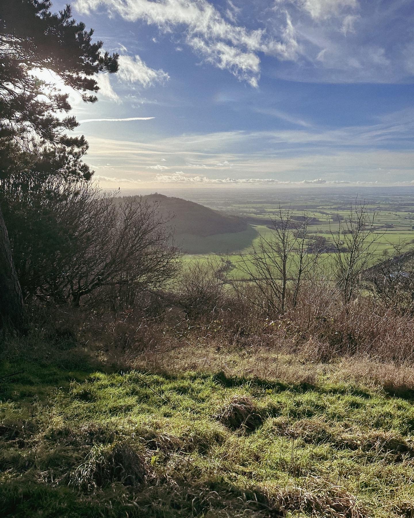
Midway, you can pause at Sutton Bank Visitor Centre, home to a popular tearoom and what James Herriot once called "the finest view in England." The route then descends to the peaceful shores of Gormire Lake, before winding back through woodland and farmland towards Kilburn.
Route difficulty
This is a moderate walk with a mix of woodland trails, escarpment paths and field edges. The climbs up to the White Horse and down to Gormire Lake can be steep and occasionally muddy, particularly after rain. Some sections follow the Cleveland Way and are well-signposted, but having a GPX route helps for the woodland return.
| Walk type | Circular |
| Distance | 7 miles / 11 km |
| Time | 2.5–3 hours (plus stops) |
| Start/finish | Kilburn village or nearby forest car park |
| Terrain | Forest trails, ridge paths, field edges, lake paths |
| Difficulty | Moderate, with some steeper and uneven sections |
| Good for | Big views, hidden lakes, plane spotting, woodland wanders |
| Facilities | Café, loos and visitor centre at Sutton Bank |
Route highlights
Kilburn White Horse
England’s most northerly chalk figure, this striking 318-foot carving dominates the hillside above Kilburn and makes for an epic early viewpoint. You can spot it from miles away—but nothing beats standing right beside it.
Yorkshire Gliding Club
Perched high above the Vale of York, this hilltop airfield adds some unexpected drama to your walk. On a good day, you’ll spot sleek gliders launching from the cliff edge and silently soaring overhead.
Sutton Bank Visitor Centre
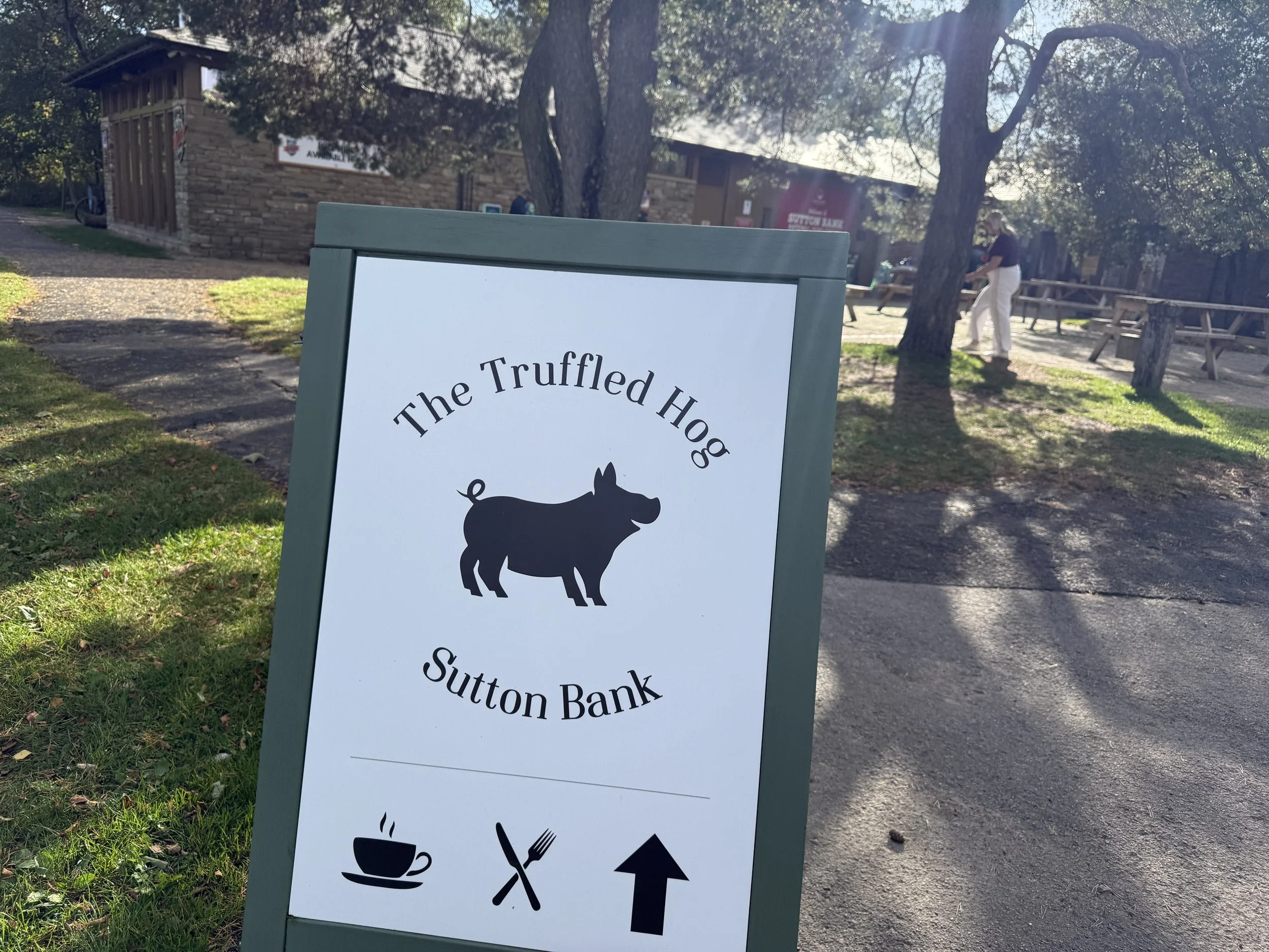
Halfway through the walk, the National Park centre is the perfect place to pause. Grab a cup of tea or cake from The Truffled Hog, refill your water, and enjoy the famous viewpoint overlooking Hood Hill and the valley below.
Gormire Lake
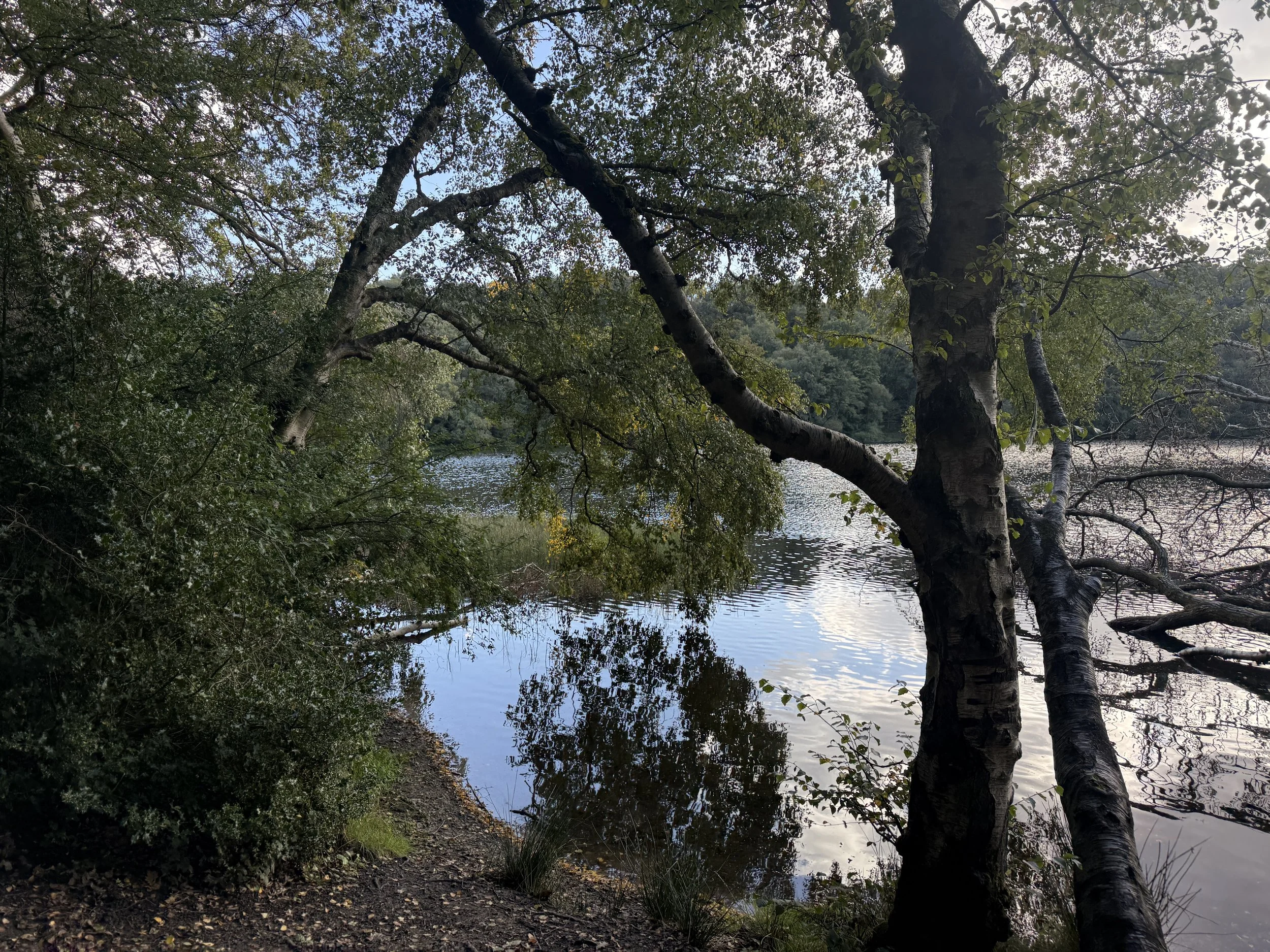
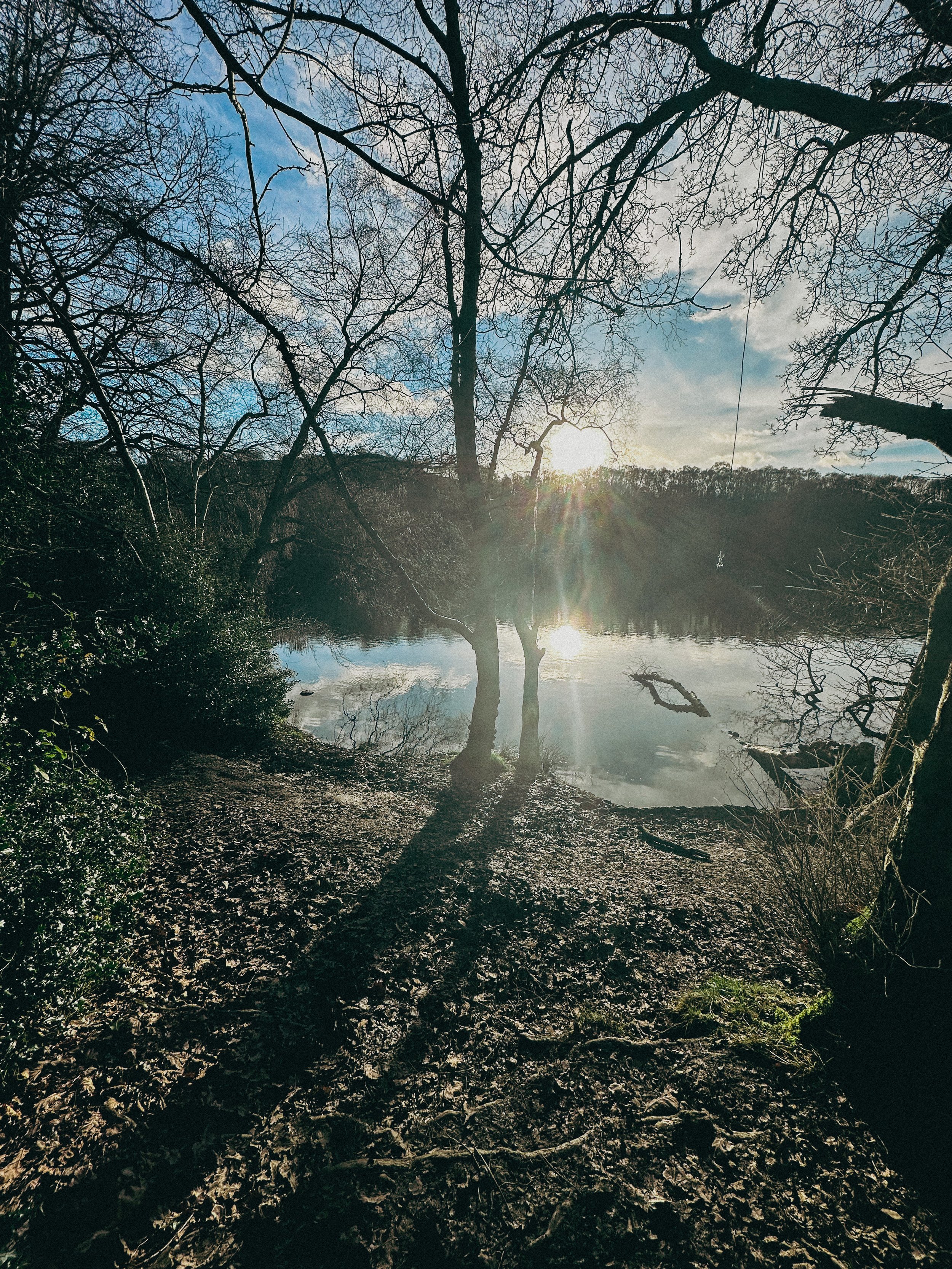
Nestled beneath the cliffs of Whitestone Scar, Gormire is one of the few natural lakes in the North York Moors. Shaded by trees and alive with birdlife, it’s a peaceful spot with local legends of ghostly horses and bottomless depths.
Where is Kilburn?
Kilburn is a small village on the southern edge of the North York Moors National Park in North Yorkshire. It’s best known for the nearby Kilburn White Horse and for its connection to Robert Thompson, the famous ‘Mouseman’ furniture maker. The village sits just off the A170, around 6 miles east of Thirsk, and is a popular starting point for walks along the Cleveland Way and surrounding escarpment.
Things to do nearby
Visit the ruins of Byland Abbey
Explore the Sutton Bank bike trails or hire bikes from the centre
Pop into Kilburn village to see local woodcarver Robert Thompson's Mouseman workshop
Is this walk suitable for beginners?
Yes, with care. The route has clear paths and signage in parts, but the inclines and descents around the escarpment can be challenging for newer walkers. Take your time and wear decent footwear. The halfway café stop helps break things up nicely.
Is the route dog-friendly?
Dogs are welcome throughout most of the route, including the trails and woodland. They must be kept on leads around livestock and near the gliding club. Dogs are also welcome at The Truffled Hog (the cafe at Sutton Bank).
When is the best time to do this walk?
The views from Sutton Bank and the escarpment make this walk special, so aim for clear or partly cloudy conditions. In fog or low cloud, visibility is limited and the best viewpoints may be missed. Always check the forecast and dress accordingly.
Late spring through early autumn offers the best mix of dry trails, active gliders and clearer views. Autumn colours add extra drama in the woods, while summer brings long daylight and ideal picnic conditions. Avoid after heavy rain, as parts of the path can be muddy.
How to extend your adventure
This route links nicely with other trails around the Kilburn and Sutton Bank area. For a longer adventure:
Explore the quiet ridge above Gormire Lake for extra views
Link with the White Rose Walk, which starts at the Kilburn White Horse
Add a climb to Hood Hill, a small peak just south of the escarpment
Include a detour to Byland Abbey for a mix of walking and history
Local legends and folklore
Gormire Lake has long been the subject of folklore. One tale tells of a knight and his horse plunging into the waters from the cliff above, cursed to rise again each century. Some say the lake is bottomless, though it’s actually around 29 feet deep.
Best photo spots
Looking out over the White Horse from the top of the escarpment
Watching gliders from the Cleveland Way ridge
Reflections at the edge of Gormire Lake, especially on calm days
Getting to the starting point
By car: Kilburn is just off the A170 near Thirsk. Park on Low Town Bank Road for direct access to the White Horse climb, or in Kilburn village for a full loop.
By public transport: The nearest rail station is Thirsk. From there, local buses or a short taxi ride will get you to Kilburn.
✔️ Good to knows
Café: The Truffled Hog at Sutton Bank Visitor Centre (open daily)
Toilets: Available at the visitor centre
Dogs: Allowed on leads, though not permitted inside the gliding club café
Footwear: Sturdy boots recommended
Map: Download route in advance as signal can be patchy
Parking: Pay & display at Sutton Bank or free lay-bys near Kilburn
🧭 Following the route
I use komoot and OS Maps for offline navigation. To follow this walk step-by-step on komoot, simply click this link here or download the GPX file and upload it to your chosen app, such as OS Maps.
A Timeless Loop: Waterfalls, Woods & Wandering from Goathland Station
A wander through railway nostalgia, hidden waterfalls and moss-draped woodland in the North York Moors
Start: Goathland Station car park, North York Moors
Distance: 5 miles
Elevation: 675 feet
Duration: 2 hours
Difficulty: Easy (with care around the waterfalls)
Navigation: Follow step-by-step on komoot or download GPX file
About the route
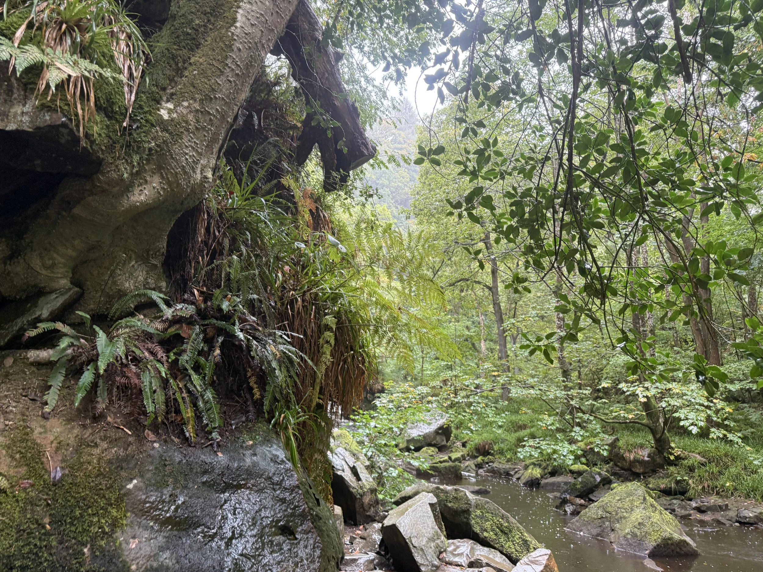
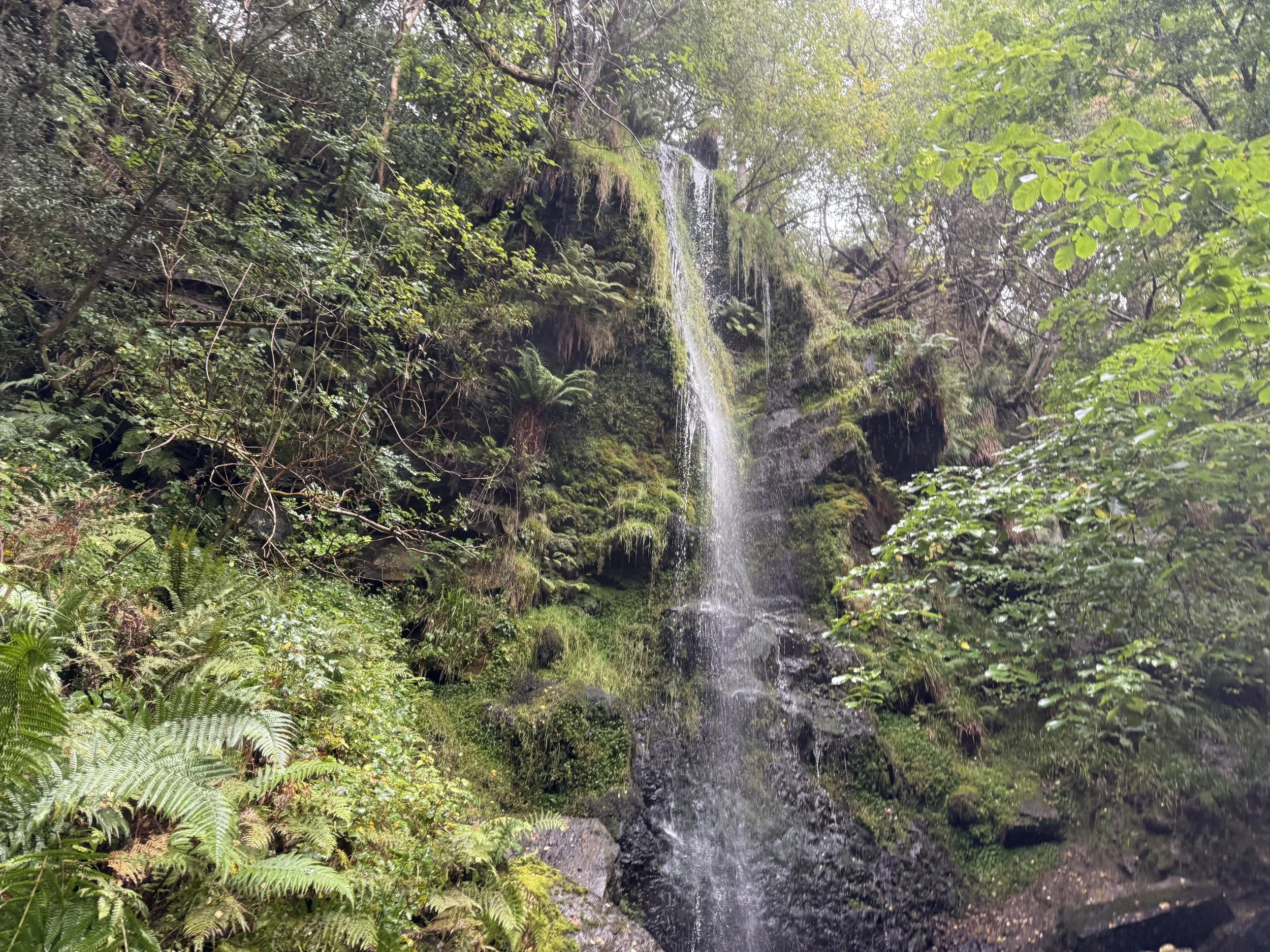
A 5-mile circular walk through the heart of the North York Moors, starting and ending at Goathland Station. This route combines woodland wanders, moorland edges, hidden waterfalls and a quirky little pub tucked into a valley. You’ll walk sections of the old railway trail, dip into the timeless hamlet of Beck Hole, discover Thomason Foss and Mallyan Spout, and loop back through Goathland village.
Time it right and you’ll catch the sound of steam engines echoing through the trees.
Route difficulty
This is a relatively gentle walk with a few sections that require care, particularly near Thomason Foss and Mallyan Spout, where paths can be steep, muddy or uneven. A bit of scrambling is needed in places, and the rocks near the waterfalls can be very slippery, especially after rain.
Most of the route is gentle underfoot, especially along the old rail trail and woodland paths, but caution is advised near water.
Distance: 5 miles / 8 km
Time: 2.5–3 hours with faff and photo stops
Start/finish: Goathland Station car park
Terrain: Woodland trails, old rail paths, rocky sections near waterfalls
Difficulty: Moderate — easy-going in places, steep/slippy near waterfalls
Good for: Waterfall lovers, moody weather wanderers, filming location fans
Facilities: Cafés, pub, loos in Goathland village
Route highlights
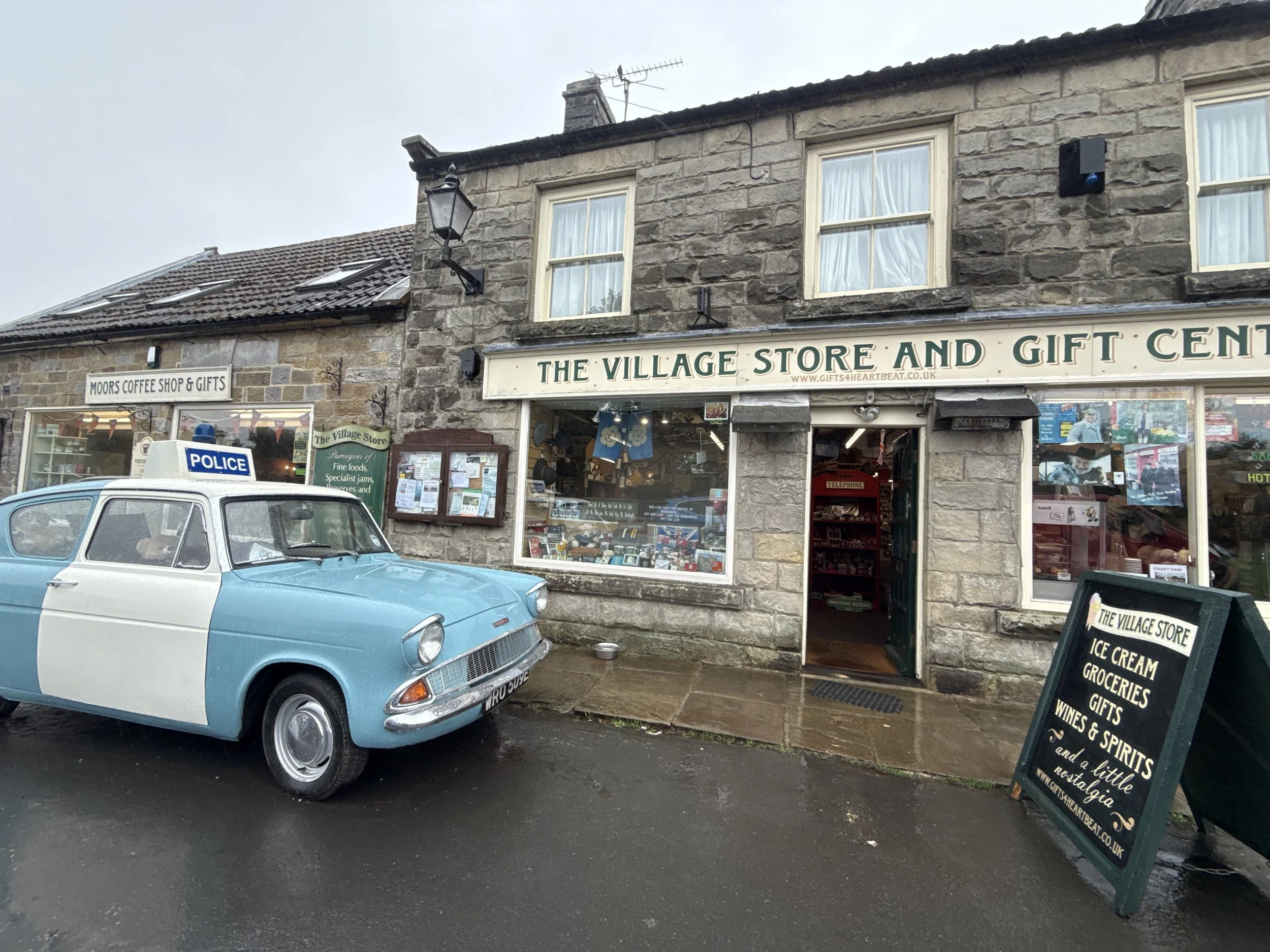
Goathland Station: Better known to many as Hogsmeade Station from Harry Potter and the Philosopher’s Stone. It’s also a popular filming location for Heartbeat, the long-running 1960s police drama. Goathland stood in for the fictional village of Aidensfield, and many of the village’s shops and buildings still reference the show today.
The Inn Way & rail trail: A wide, accessible path that traces a former railway line. Perfect for easy walking and glimpses of Victorian engineering.
Beck Hole & Birch Hall Inn: A pint-sized hamlet in a steep-sided valley. The Birch Hall Inn is part pub, part sweet shop, and a worthy detour for a snack or half pint.
Thomason Foss: A lesser-known but enchanting waterfall, nestled in a quiet wooded gorge. The path is rough in parts but worth the clamber. Care is needed here as the trail becomes narrow and rocky.
Mallyan Spout: A 70-foot waterfall tucked into a dramatic gorge. Expect mossy rocks, dripping ferns and the soothing rush of water. The route down and back up is steep and can be slippery.
Where is Goathland?
Goathland is a moorland village in the North York Moors National Park, about 9 miles southwest of Whitby. It’s surrounded by rolling heather moorland, pine forests, and old railway lines, and feels beautifully tucked away — yet is surprisingly easy to get to.
It’s best known for its vintage station, Heartbeat filming spots, and easy access to some of the area’s loveliest short walks.
Things to do nearby
Ride the North Yorkshire Moors Railway for a steam-powered view of the surrounding moorland.
Explore the moors on longer circular routes from Goathland or Grosmont.
Visit the Mallyan Spout Hotel for a post-walk cream tea.
Pop into the Goathland Tea Rooms or the Aidensfield Arms (for Heartbeat fans).
Is this walk suitable for beginners?
Yes, with caution. For anyone with impaired mobility, it’s best to skip the Thomason Foss detour and take care near Mallyan Spout. Stick to the main paths and allow time for rest stops.
When is the best time to do this walk?
This route works in any season:
Spring brings wildflowers and fast-flowing waterfalls
Summer offers leafy shade and buzzing wildlife
Autumn makes the surrounds come to life with misty moors
Winter can be magical too, though paths may be icy or boggy
Drizzly weather only adds to the old-world charm, but waterproofs are a must.
How to extend your adventure
Continue from Beck Hole towards Grosmont via the old railway incline for a longer route.
Explore Wheeldale Beck and nearby moorland paths.
Join the Lyke Wake Walk route if you’re after a much bigger day out.
Visit the nearby Hole of Horcum for another classic moorland loop.
Getting to the starting point
By car: Goathland Station has a dedicated car park (pay & display). Arrive early on weekends and holidays.
By train: Take the North Yorkshire Moors Railway steam service (seasonal) or regular train to Grosmont and walk from there (longer route).
By bus: Limited bus services run between Whitby, Pickering and Goathland. Check timetables in advance.
✔️ Good to knows
Facilities: Toilets and refreshments available at Goathland Station and some village cafés
Parking: Pay & display car park at Goathland Station
Refreshments: Birch Hall Inn, cafés in Goathland village, Mallyan Spout Hotel
Dog-friendly? Yes, but leads needed near livestock and steep sections
Accessibility: Not suitable for pushchairs or wheelchairs — uneven, narrow and steep paths
Mobile signal: Patchy — download offline maps
Waterfall warning: Paths near Mallyan Spout and Thomason Foss are steep and slippery — take care after rain
Best for: Mixed weather, film fans, nostalgia lovers
🧭 Following the route
I use komoot and OS Maps for offline navigation. To follow this walk step-by-step on komoot, simply click this link here or download the GPX file and upload it to your chosen app, such as OS Maps.
A walk through Brontë country: Brontë Waterfall and Top Withens
Wander through the landscapes that inspired a Brontë classic on this popular moorland walk
Start: Haworth Main Street, near the Brontë Parsonage Museum
Distance: 5 miles
Elevation: 400 feet
Duration: 2 hours
Difficulty: Easy (suitable for most walkers)
Navigation: Follow step-by-step on komoot or download GPX file
About the route
This relaxed walk through the Haworth moorlands makes for an ideal day out, ending with beautiful views and historic locations tied to Brontë history. The walk from Haworth leads you across scenic moorlands, rich with Brontë history and captivating scenery. The route takes you through open countryside with a dose of literary lore, including Top Withens (thought to be the inspiration behind Heathcliff’s home in Wuthering Heights) and the striking Brontë Waterfall.
Route difficulty
Walk type: Easy circular walk with limited elevation gain. Good for most walkers with, includes some uneven paths
Terrain: Mix of paved lanes, gravel paths, grassy trails, and some uneven moorland sections.
Inclines: Mostly gentle, with a short climb up to Top Withens that can be a little steep and exposed.
Surfaces: Some rocky patches and muddy stretches, especially after rain.
Navigation: Well-marked in most places, map/GPX needed for moorland section
Mobility: Not suitable for pushchairs or wheelchairs. This route contains stiles, steps, and narrow gates.
Why you’ll love this walk
A mix of moorland, waterfalls, ruins & literary lore
Great views at Top Withens + waterfall
Quiet in parts (especially the moors), lively in others (Haworth village)
Ideal for a Sunday stroll: nature + tearooms + pubs 🍵🍺
Walk highlights:
Route highlights
Haworth
Your walk begins and ends in the charming Pennine village of Haworth, nestled in the heart of West Yorkshire’s Brontë Country. This historic village is famous as the home of the Brontë sisters (Charlotte, Emily, and Anne) and is filled with cobbled streets, quaint shops, and atmospheric tea rooms that take you back to the Victorian era. In the village centre, you’ll find the Brontë Parsonage Museum, where the sisters lived and wrote their novels, along with several charming cafes and boutiques perfect for exploring before or after your walk.
Don’t miss a visit to the Cabinet of Curiosities for a peek into local Victorian artefacts or the iconic Black Bull pub, often frequented by Branwell Brontë.
Bronte Waterfall
The Bronte Waterfall is a great place to rest on your way to Top Withens (Wuthering Heights), Alcomden Stones or Ponden Kirk (The Fairy Cave). Top Withens (also known as Top Withins) is a ruined farmhouse near which is said to have been the inspiration for the location of the Earnshaw family house in Wuthering Heights.
Just a short distance from Top Withens, the waterfall cascades down the rocks and has long attracted visitors drawn by its natural beauty and literary ties. Charlotte Brontë is said to have found solace here, and it remains a serene spot midway through the walk.
Cabinet of Curiosities
Back in Haworth, step into the Cabinet of Curiosities, a quirky shop filled with Victorian oddities, witchy trinkets, and handmade soaps that I can never seem to leave the village without. This museum-like shop truly is like stepping foot in an old apothecary store, warmly lit by glass globes, fragranced with exotic oils, and packed from floor to ceiling with rich mahogany and glass display cases. Over the years the family-run business has taken on a true labour of love, salvaging many of the shops fittings from chemists, grocery shops and museums to replicate the ‘wonder-rooms’ of a time gone by.
Wuthering Heights Pub
End your walk at the Wuthering Heights pub (close to Top Withens), a cosy spot to enjoy a pint or a hot meal after a day on the moors. This traditional Yorkshire pub has true rustic charm, with a hearty menu and an atmosphere that perfectly complements a moody moorland adventure.
Options to extend the route
For a longer hike, consider adding a detour to nearby Ponden Kirk, a rocky outcrop believed to be the inspiration for Wuthering Heights’ Penistone Crags. This can turn the walk into a full day’s outing, with more moorland views and an optional scrambling segment.
Where is Haworth?
Haworth is in West Yorkshire, England, part of “Brontë Country.” Near Keighley, within reach of Leeds and Bradford. Rural & beautiful, with moors all around.
The picturesque village is renowned worldwide as the home of the Brontë sisters, the celebrated authors of Wuthering Heights, Jane Eyre, and The Tenant of Wildfell Hall. Situated near the larger town of Keighley and easily accessible from Leeds, Haworth is part of the scenic region known as Brontë Country, an area of natural beauty that inspired much of the sisters' work.
The village itself is home to many quaint tea rooms, souvenir shops and a few quirky pitstops you can’t afford to miss. My absolute favourite is The Cabinet of Curiosities, a traditional shop that’s been restored it to its former glory as a Victorian apothecary shop.
Getting to the starting point
Arriving by car
There is limited parking along Main Street in Haworth, with additional spaces near the Brontë Parsonage Museum and pay-and-display lots available for a small fee.
Arriving by public transport
The Keighley Bus Company operates regular services to Haworth from Keighley, making it accessible by public transport from nearby towns and cities.
From Leeds
Train to Keighley (~30 mins)
Catch the Brontë Bus (B1, B2 or B3) to Haworth
From Bradford
Train or bus to Keighley
Catch transfer to the Brontë Bus to Haworth
From Hebden Bridge
Take the Brontë Bus B3 direct to Haworth (via Oxenhope)
From Keighley Station
Key transport hub with trains from Leeds, Bradford & Skipton
Then either the Brontë Bus or the KWVR heritage train to Haworth
Heritage train option
Take the Keighley & Worth Valley Railway (KWVR) steam/diesel service from Keighley direct to Haworth. It runs on weekends and daily in summer — a slower, scenic ride through the Worth Valley. Check the KWVR website for current timetables.
Travel tips:
Bus services are regular but check timetables before visiting, especially Sundays & holidays
Allow time to transfer between Keighley train & bus stations if needed
Heritage train is a great option but not daily — pre-check schedule
Parking is limited in Haworth during busy times, arrive early or use park & ride if available
✔️ Good to knows
Difficulty: This walk has gentle climbs and is suitable for all abilities.
Accessibility: This is a carrier only route. There are some steep steps and rocky paths, particularly around the waterfall itself, which aren’t suitable for pushchairs or wheelchairs. This route includes stiles.
Navigation: The walk to the falls is well signposted, but bring GPX/map for the moorland section.
Food and drink: Plenty of pubs, tearooms and shops available in Haworth at the start and end of the walk, including the café at the Brontë Parsonage Museum.
Parking: Public parking is available near Haworth’s Main Street; charges vary.
🧭 Following the route
I use komoot and OS Maps for offline navigation. To follow this walk step-by-step on komoot, simply click this link here or download the GPX file and upload it to your chosen app, such as OS Maps.
A scenic circular walk to Cautley Spout (the highest waterfall in England)
A wild walk in Yorkshire: don’t miss this thrilling Howgills lollipop loop to England’s highest waterfall
Start: Layby near The Cross Keys Temperance Inn, Sedbergh (what3words: maybe.beaks.redouble)
Distance: 5 miles
Duration: 2-3 hours
Elevation: 1,600 feet
Difficulty: Moderate
Navigation: Follow step-by-step on komoot, or download GPX file
About the route
Tucked into the folds of the Howgill Fells, this satisfying lollipop route climbs from Sedbergh’s fringe to Bowderdale Head and loops around England’s highest above-ground waterfall: Cautley Spout. Starting from the 500-year-old Cross Keys Temperance Inn, you’ll enjoy gentle beginnings, a moderate high-fell climb, and a dramatic waterfall finale.
A path of contrasts, think pastoral lowlands, broad fells, and steep-sided valleys - this is one of the best routes to get a taste of the dramatic Howgill scenery without big scrambles or crowds.
Route difficulty
This is a moderate walk suitable for hillwalkers with a basic level of fitness. The loop section includes some steeper ground, exposed felltops, and one boggy stretch above the waterfall.
Walk type: Moderate
Terrain: Pasture, fell paths, rocky sections near waterfall, occasional bog
Accessibility: Not suitable for wheelchairs or pushchairs
Dog-friendly: Yes, on leads (sheep country!)
Why you’ll love this walk
England’s highest waterfall (200m tiered cascade)
Start and finish at a stunning heritage tearoom
Sweeping views from Bowderdale Head
Varied terrain: meadows, fells, ravines
Route highlights
The Cross Keys Temperance Inn Begin with tea and homemade cake at this historic National Trust inn. It’s one of the oldest temperance inns in England — no alcohol, just charm and good food.
Bowderdale Head Reach the high point of the route with views across the Howgill Fells. Wild, expansive, and surprisingly quiet.
Cautley Spout The showstopper: a dramatic, multi-step waterfall plunging nearly 200m into the valley below. Best viewed after rain, and photo-perfect with long exposure.
Things to do nearby
Sedbergh: England’s official Book Town — indie bookshops galore
Farfield Mill: Heritage craft centre with art and textile exhibits
River Rawthey: Ideal for a post-walk paddle or picnic
Getting to the starting point
By car: From Sedbergh, take the road north toward Cautley. Just past The Cross Keys Temperance Inn, you’ll find a small lay-by for parking (limited spaces, arrive early).
By public transport: Catch a train to Oxenholme, then take a Western Dales Bus (S1T, S1W, S5 or S6 depending on the day) to Sedbergh. On select days (Tues, Thurs, Fri), you can continue on the S5/S6 to the Cross Keys lay-by.
OS Grid Ref: SD 698 969 What3words: (what3words: maybe.beaks.redouble)
Following the route
I use komoot and OS Maps for offline navigation. To follow the full route step-by-step on komoot, click this link here or download the GPX file and upload it to your preferred app.
How to extend your adventure
Continue beyond Bowderdale Head for a full Howgill traverse
Detour east to Aygill Force waterfall
Explore more of the Rawthey Valley on a return loop
Is this walk suitable for beginners?
This is a good step-up for walkers used to lower-level rambles. There are some steep sections, but no scrambling. If you’re building confidence with fell walks, this one ticks all the right boxes.
When’s the best time to do this walk?
Late spring to early autumn (April to September) is ideal. May and June give lush greenery and good waterfall flow. Winter can be icy and boggy.
Good to knows
No toilets at the start (use the pub before or after)
Mobile signal fades on the fells — download offline maps
Waterproof boots essential after rain
Limited parking, especially at weekends
Paths are not always waymarked — GPX or Komoot recommended
Dragon’s Ascent Challenge: Hike from England’s tallest waterfall to the UK’s highest pub
15 miles of remote moorland, Yorkshire charm, and big-sky views—this epic point-to-point challenge connects two legendary pubs via the mighty Great Shunner Fell and the spectacular Swaledale.
The Dragon’s Ascent at a glance
Start: Green Dragon Inn, Hardraw
End: Tan Hill Inn, Richmond
Distance: 15 miles / 25km
Elevation: 3,460 ft / 700m (Great Shunner Fell = 716m)
Time: 4–7 hours
Difficulty: Moderate to challenging
Dog Friendly: Yes – on lead around livestock & cliffs
Well-waymarked? Yes by the Pennine Way + Bridleway
Navigation: Follow on komoot or download GPX file
What is the Dragon’s Ascent Challenge?
The Dragon’s Ascent Challenge is a long-distance route through the Yorkshire Dales National Park, connecting the Green Dragon Inn in Hardraw with the Tan Hill Inn, the highest pub in Britain. Along the way, you'll:
Pass Hardraw Force, England’s tallest single-drop waterfall
Summit the mighty Great Shunner Fell
Wander through Swaledale, one of Yorkshire’s most scenic valleys
Stop for tea in the idyllic village of Thwaite
Catch a glimpse of the iconic Buttertubs Pass
Finish at the famously remote Tan Hill Inn
You can walk or run the route independently like we did, or sign up for the official annual event.
About the route
Starting in the pretty village of Hardraw, the path follows the Pennine Way and later the Pennine Bridleway, offering consistently easy-to-follow navigation and incredible variety—think limestone paths, open fells, deep valleys, and traditional Yorkshire villages. The 15.5-mile trail is a satisfying mix of terrain—from steady climbs and stone paths to open moor and riverside track. Most of the route follows the Pennine Way, making navigation easy. You'll ascend Great Shunner Fell, pass through the picturesque village of Thwaite, wind through Swaledale, skirt Buttertubs Pass, and finally reach the wilds around Tan Hill.
It’s long, scenic, and surprisingly varied, with plenty of spots to rest, eat, or detour.
Highlights include:
– A visit to Hardraw Force, England’s tallest single-drop waterfall
– A steady climb to Great Shunner Fell (716m)
– Homemade scones at Kearton Tearooms in Thwaite
– A moody stretch of wild moorland leading to Tan Hill
– Pint and pie at the finish line!
Why you'll love this walk
Wild and beautiful: From rolling meadows to rugged fells, the Dales never disappoint.
Pub-to-pub adventure: Start and end your day with real Yorkshire charm.
A true challenge: Feels like an achievement without being overwhelming or too strenuous.
Tea and cake halfway: Perfect motivation to reach Thwaite’s Kearton Tearooms.
Waterfalls, wildlife, and wow-moments: There’s always something breathtaking to look at along the way (if visibility is on your side, of course).
🧭 Route difficulty
Walk type: Moderate to challenging – the distance and elevation make it a solid day out, but the route is mostly on clear, non-technical paths.
Terrain: Moorland, flagstone paths, boggy sections (especially around Shunner Fell), and grassy trails. Rocky section near Swaledale.
Time needed: 4–6 hours moving time, 7+ with stops.
Navigation: Easy in good weather—just follow the Pennine Way and Bridleway signs. Bring a paper map and download GPX file. Useful for the moorland around Shunner Fell and near Tan Hill if visibility is poor.
Fitness level: Reasonable fitness, especially if aiming to complete in 4–5 hours.
Route overview
1. Start at Green Dragon Inn + Visit Hardraw Force
📍 Hardraw, Wensleydale
Before heading off, pay a quick visit to Hardraw Force, England’s highest single-drop waterfall (100 feet), accessible via the Green Dragon pub garden.
🎟️ Entry fee applies – bring a couple of pounds.
2. Climb to Great Shunner Fell (4 miles in)
Gradual but persistent climb to the summit of Great Shunner Fell—the third highest in the Dales. A stone wind shelter greets you at the top, along with sweeping views toward the Moors and Lake District on a clear day.
🥾 Conditions: Often boggy year-round – gaiters recommended.
3. Descend to Thwaite (~8 miles)
The descent to Thwaite is gentle and scenic, winding into the heart of Swaledale. Stop at the charming Kearton Tearooms for tea and cake—or a light lunch.
🍰 Kearton Tearooms: Open March–Oct, indoor + outdoor seating.
4. Around Kisdon Hill + optional Keld detour
Head north toward Keld, where you'll pass through lush green valleys, hidden waterfalls, and the River Swale. Take a 10-minute detour for Kisdon Force—it’s totally worth it.
5. Wild moorlands + final ascent to Tan Hill
Climb gradually across remote open moors. This stretch is exposed, with little shelter or signage. Keep eyes peeled for Pennine Way markers. Eventually, you’ll spot the Tan Hill Inn seemingly appearing from nowhere. A very welcome sight after 15+ miles.
🧭 Tip: In fog or snow, navigation here is trickier—use GPS or OS Map OL30.
🏁 Finish at Tan Hill Inn (the highest pub in the UK)
The highest pub in Britain (1,732 feet), the Tan Hill Inn is a classic stop for weary adventurers. Expect hearty food, a roaring fire, and proper Yorkshire hospitality. They also offer rooms if you want to stay over after your challenge.
How Long Does the Dragon’s Ascent challenge take?
The full 15-mile route typically takes between 4 to 7 hours to complete, depending on your pace, weather conditions, and how often you stop. Here’s a rough breakdown to help you plan:
Pace Estimated time
Trail runners: 2-4 hours
Fast hikers: 4-5 hours
Moderate walkers 5–6 hours
Casual pace with stops: 7+ hours
🥾 Our experience: We completed it in around 5-6 hours moving time at a relatively leisurely pace, with 7 hours total including a tea stop in Thwaite and a slight detour exploring the waterfalls near Keld. I’d definitely leave yourself at least 7 hours so you can enjoy the pitstops along the way.
Things that can affect timing:
Weather: Heavy rain, wind, or fog can slow you down—especially across the moorlands.
Terrain: Parts of the path can be boggy, particularly near Great Shunner Fell.
Stops: Waterfalls, tearooms, photo ops—there are plenty of tempting reasons to pause!
🔄 If you’re doing the challenge as part of an overnight pub-to-pub stay, there’s no need to rush—soak it all in and enjoy the journey.
Logistics & transport tips
🚗 Getting there
Start: Park at the Green Dragon Inn (Hardraw, DL8 3LZ)
End: Tan Hill Inn has a car park if you're arranging a pick-up or shuttle.
🚌 Return Options: This is a one-way route. You can:
Pre-arrange a taxi from Tan Hill back to Hardraw (recommended)
Do it as a there-and-back over two days, staying at each pub
Walk with a friend and leave one car at each end
Navigation
The path follows well-signed Pennine Way and Bridleway tracks. Still, it’s smart to carry:
What to pack
Waterproof boots or trail shoes
Waterproof jacket + layers
OS Map OL30 or digital GPX
Power bank
First aid kit
Water + high-energy snacks
Phone + offline route app (Komoot/OS Maps)
Trekking poles (optional for descent)
❓ Frequently asked questions
Can I do the walk in reverse?
Yes, but it’s more fun to finish at Tan Hill with a celebratory drink!
Is it dog-friendly?
Yes, but dogs should be kept on leads—there’s livestock, cliffs, and boggy moorland.
Do I need to train?
It’s not technical, but 15+ miles of hills can be tiring. Try a few 10–12 mile walks first.
Can I do it solo?
Absolutely. But let someone know your plans, especially in winter conditions.
When to do the challenge
Spring–Autumn (April to October) is ideal for good light and conditions.
Summer brings wildflowers to Swaledale and longer days.
Winter is possible but requires prep—some sections become boggy or icy, and moorland visibility can vanish quickly.
Weather tip: Conditions can shift fast on the fells—always bring layers, waterproofs, and a map/GPS device.
Join the official challenge
Held annually, walkers and runners gather to complete the route as part of the Dragon’s Ascent Challenge event:
Supported by trained safety & medical staff
Proceeds go to local Yorkshire charities
Sign up solo or with friends
Accommodation + meals available at start and end
🛏️ Stay the Night
Start: Green Dragon Inn, Hardraw – cosy rooms + waterfall access
Midpoint (Optional): Kearton Country Hotel, Thwaite
Finish: Tan Hill Inn – famously remote, full of character, great food
🍰 Food & Drink
Hardraw: Food + drinks at Green Dragon
Thwaite: Kearton Tearooms for lunch or cake
Keld: Keld Green Café (seasonal)
Tan Hill: Pub meals, snacks, and accommodation
🐾 Dog Friendly?
Yes – but keep dogs on leads near livestock and waterfalls. Some boggy sections might be tricky for smaller pups.
✔️ Good to knows
Difficulty:
Moderate – A long-distance walk with a steady climb up Great Shunner Fell in the first half and some remote, boggy terrain later on. Manageable for most walkers with a good level of fitness.
Footwear:
Sturdy, waterproof walking boots are highly recommended, especially after rain. The path can be boggy and uneven in places, particularly on the ascent to Shunner Fell and across the open moorland.
Dog-friendly:
Dog friendly (on leads). Dogs are welcome along the route but should be kept on leads around livestock and moorland nesting birds. There are streams en route, but it’s worth packing extra water for your pup.
Facilities:
There are toilets and food available at both pubs (start and end), and a tearoom close to midway in Thwaite. Be prepared with essentials and time your rest stops well.
Food & drink:
The Green Dragon Inn (Hardraw) – Pre-walk breakfast or coffee, and a quick visit to Hardraw Force behind the pub.
Kearton Tearooms (Thwaite) – A perfect halfway point with light lunches, tea, and sweet treats.
Tan Hill Inn – Your endpoint! Great for a hot meal and well-earned pint. Accommodation also available.
Optional detour to Keld Green Cafe for extra refreshments.
🧭 Following the route
I use komoot and OS Maps for offline navigation. To follow the full walk step-by-step on komoot, simply click this link here or download the GPX file and upload it to your chosen app, such as OS Maps.
A beautiful circular walk in Yorkshire: Bolton Abbey, Posforth Gill Waterfall & Simon’s Seat
Up for a longer day out? This stunning walk takes you to some of the best hidden gems in the Yorkshire Dales
Start: Bolton Abbey Car Park, BD23 6EX
Distance: 10 miles
Elevation: 1,425 feet
Duration: 4 hours
Difficulty: Moderate
Navigation: Follow step-by-step on komoot, or download GPX file
About the route
Looking for a walk that combines stunning scenery, a bit of history, and a challenge? This 10-mile circular in the Yorkshire Dales ticks all those boxes — taking you from the historic Bolton Abbey, past the charming Posforth Gill Waterfall, and all the way up to the panoramic views found on Simon’s Seat.
Starting at the iconic Bolton Abbey, the route takes you through lush woodlands, before climbing up to Simon’s Seat. Along the way, you’ll visit Posforth Gill Waterfall, a peaceful spot that’s perfect for a picnic or photo stop. The path is well-marked, though some sections can be a little steep and rocky, so it’s best suited to walkers who’re up for a bit of a challenge.
Route difficulty
Walk type: Moderate – This walk is manageable for most walkers, but there are some challenging sections, especially when climbing to Simon’s Seat.
Terrain: Expect a mix of well-maintained paths, rocky stretches, and some steeper ascents, particularly when heading up towards Simon’s Seat. The descent is more gradual but still requires attention due to uneven terrain.
Accessibility: This walk is not suitable for wheelchairs or pushchairs due to the uneven and rocky terrain.
Dog-Friendly: Dog friendly (on leads) around the Bolton Abbey Estate, but are no longer permitted for this full circular walk. Dogs not permitted to the Valley of Desolation or Simon’s Seat. They should also be kept on leads near livestock, waterfalls, and the steeper sections of the route.
Why you’ll love this walk
Stunning scenery: From riverside paths to panoramic hilltop views, and of course the stunning Posforth Gill waterfall.
Historical landmarks: Explore the centuries-old Bolton Abbey ruins and discover some hidden gems along the way.
A rewarding challenge: While not overly strenuous, the climb to Simon’s Seat will definitely make you work for those views. But once you arrive up top, you’ll realise it’s well worth the effort!
Route highlights
Bolton Abbey
You can’t start a walk at Bolton Abbey without taking in the beauty of this historic spot. The abbey ruins are set right next to the River Wharfe, offering a peaceful atmosphere to kick things off. Whether you’re wandering the grounds or admiring the views of the river, it's a perfect place to get into the walking spirit. Plus, the area has some great spots for a bite to eat—if you fancy a pre-walk coffee or a post-hike treat, check out the Abbey Tearooms or the Cavendish Pavillion. Both offer delicious snacks and hot drinks with a view of the abbey and river.
Posforth Gill Waterfall
As you head further into the route, make sure to stop at Posforth Gill Waterfall. This spot feels like something out of a fairytale—quiet, serene, and surrounded by nature. It’s a great place to pause, take a few photos, or simply take a snack break. It’s a perfect hidden gem that you wouldn’t want to miss.
Simon's Seat
Arguably the main event—Simon's Seat. The climb up to this iconic viewpoint is a bit of a challenge, but it’s worth every step. From the top, you'll get 360-degree views of the surrounding Yorkshire Dales. On a clear day, you can spot everything from the Lake District to The Moors.
The River Wharfe
At the start of your walk, you’ll follow the River Wharfe, and it’s one of those peaceful parts of the route that’s perfect to save for a summer’s day.
Options to extend the route
If 10 miles isn’t quite enough, there are a couple of options to extend the walk. After reaching Simon's Seat, you can continue along the ridge for even more spectacular views. Alternatively, head towards the village of Appletreewick for an additional 2-3 miles that will take you through more beautiful valleys and remote paths.
Getting to the starting point
By Car
Bolton Abbey Car Park (BD23 6EX) is the best place to park, and it’s right at the start of the walk. Parking fees apply.
By Public Transport
The nearest train station is in Skipton. From there, you can catch a local bus or taxi to Bolton Abbey, which will take you straight to the car park and starting point.
✔️ Good to knows
Difficulty: Moderate – some steep sections, particularly near Simon’s Seat.
Footwear: Sturdy, waterproof walking boots are recommended, especially if it’s been rainy.
Dog-friendly: Part of the route is dog-friendly, unfortunately dogs are not permitted up to Simon’s Seat.
Facilities: There are public toilets at Bolton Abbey Car Park and a café for post-walk refuelling.
Food & drink: The Bolton Abbey Estate has a café and tearoom for snacks, drinks, or a well-earned meal after your walk.
🧭 Following the route
I use komoot and OS Maps for offline navigation. To follow the full walk step-by-step on komoot, simply click this link here or download the GPX file and upload it to your chosen app, such as OS Maps.
RAMSDEN AND RIDING WOOD RESERVOIR WALK
A picturesque five mile circular walk near Holme, combining reservoirs, woodland, and charming pubs
Start: The Fleece Inn, Holme, West Yorkshire
Distance: 5.5 miles
Elevation: 800 feet
Duration: 2.5 hours
Difficulty: Easy-moderate
Navigation: Follow step-by-step on komoot or download GPX file
About the route
If you're looking for a peaceful countryside walk with scenic reservoirs, lush woodlands, and the chance to finish your day at a cosy pub, this walk is perfect for your next Sunday Stroll. Starting and ending at The Fleece Inn in Holme, this easy-to-moderate 5.48-mile circular walk showcases the beauty of the Yorkshire countryside.
You'll meander through serene woodland, cross open fields dotted with stiles, and enjoy the tranquility of three stunning reservoirs: Ramsden, Riding Wood, and Digley. Midway through, a stop at the delightful Pickled Pheasant pub in Holmbridge makes for an ideal pistop — before finishing up at cosy pub, The Fleece Inn.
Route highlights
The Fleece Inn, Holme
This charming country pub is the perfect place to begin and end your walk. Serving hearty food, a range of drinks, and offering a welcoming atmosphere, The Fleece Inn is a fantastic spot to relax after your adventure.
Ramsden Reservoir
Tucked away in a serene setting, Ramsden Reservoir is the first of the three you'll encounter on this walk. Its peaceful surroundings make it a great spot for taking photos or just pausing to appreciate the beauty of the surrounds.
Riding Wood Reservoir
A short distance from Ramsden, Riding Wood Reservoir is a smaller but equally beautiful highlight. The path here offers picturesque views framed by trees and rolling hills. It’s a beautiful spot in all seasons, but an absolute must-visit in autumn when the surrounding backdrop comes to life.
Digley Reservoir
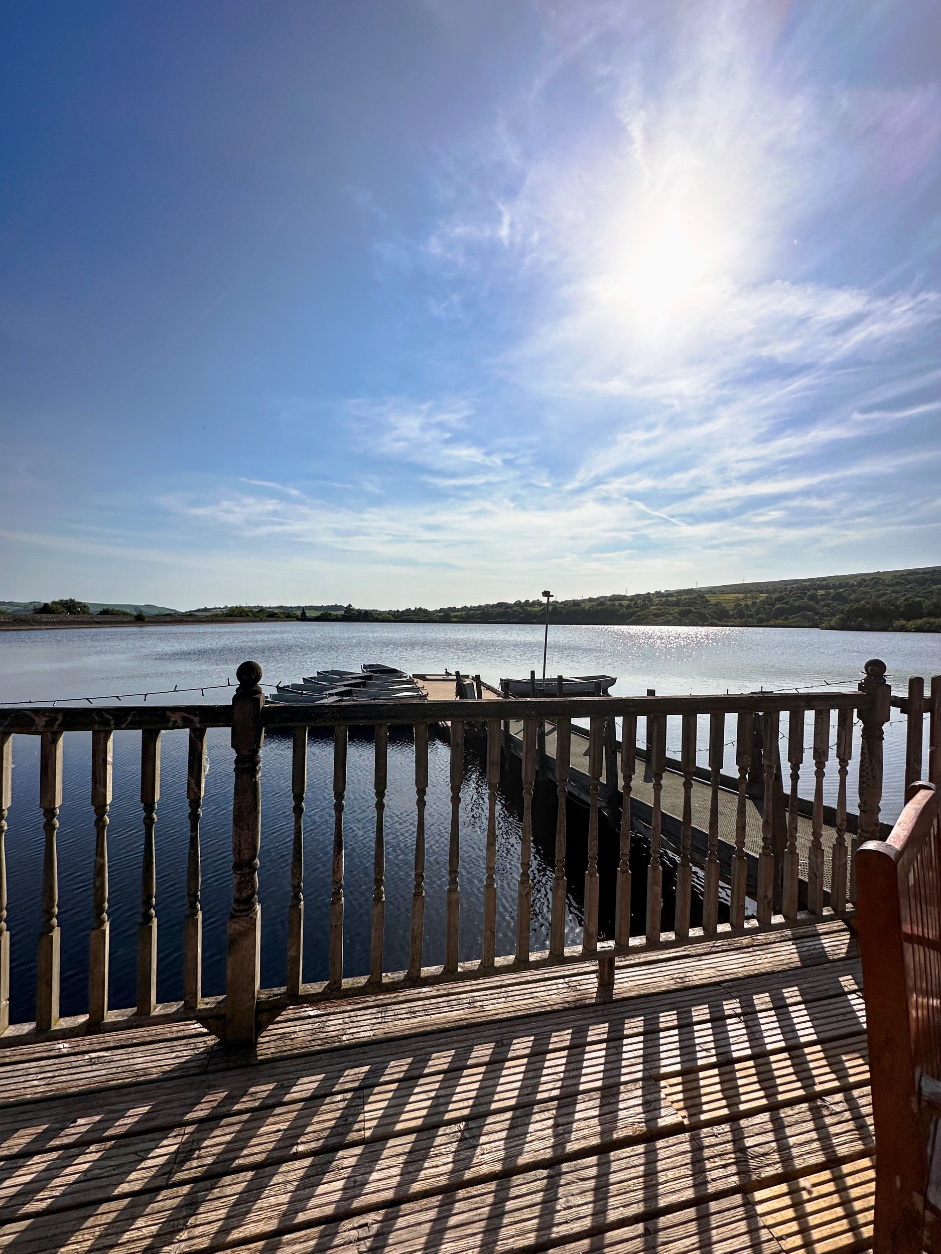
The largest of the three reservoirs, Digley Reservoir offers expansive waterside paths and some of the best views on the route. This area is particularly popular for its scenic picnic spots.
Options to extend the route
If you’re keen to explore more of the area, there are a couple of options to extend the walk:
Circular extension via Brownhill Reservoir: Add an extra mile to your walk by incorporating Brownhill Reservoir into your route. This peaceful stretch is a favourite among locals — and for good reason.
Hiking towards Holme Moss: For those seeking more of a challenge, extend the route to include the climb up Holme Moss, which offers breathtaking panoramic views of the surrounding countryside
Things to do nearby
Holmfirth Vineyard
Just a short drive from Holme, Holmfirth Vineyard offers tours, wine tasting, and a bistro with stunning views over the valley.
Digley Reservoir Circular Walk
If you're looking for a shorter walk, the Digley Reservoir Circular Walk is a 1.5-mile route with equally stunning views.
Cycling Trails
The Holme Valley is a popular spot for cyclists, with a variety of routes catering to different abilities.
Getting to the starting point
Arriving by car
The walk begins at The Fleece Inn in Holme (postcode: HD9 2QG), where there is parking available for customers and limited roadside parking surrounding. Please check with the pub if parking is intended for longer stays.
Public transport
Holme is accessible by bus from Holmfirth, with services running regularly. Be sure to check the timetable in advance, as rural routes can be infrequent.
✔️ Good to knows
Difficulty: Easy to moderate, with some stiles and gentle inclines.
Footwear: With stiles and uneven terrain, sturdy walking boots are essential for this one. The path can get muddy in wet weather, so waterproof footwear is a good idea.
Food and drink: Both The Fleece Inn and The Pickled Pheasant provide excellent options for food and drink. Alternatively, pack a picnic to enjoy by one of the reservoirs.
Parking: Roadside parking is available near The Fleece Inn.
🧭 Following the route
I use komoot and OS Maps for offline navigation. To follow this walk step-by-step on komoot, simply click this link here or download the GPX file and upload it to your chosen app, such as OS Maps.
HARDCASTLE CRAGS, HEBDEN BRIDGE
This 8-mile walk near Hebden Bridge makes for the perfect for autumn adventure — featuring stunning woodland, historic sites, and the charm of the Yorkshire countryside.
Start: Bowling Green Car Park, Heptonstall
Distance: 7.82 miles
Elevation: 950 feet
Duration: 3 hours
Difficulty: Easy-moderate
Navigation: Follow step-by-step on komoot or download GPX file
About the route
This circular walk begins at Bowling Green Car Park in Heptonstall, a beautiful historic village near Hebden Bridge. The 8-mile route weaves through Hardcastle Crags’ dramatic landscape, full of ancient woodlands, river crossings, and a beautiful woodland cafe. Along the way, you'll encounter Gibson Mill, a historic 19th-century mill run by the National Trust, and the resting place of literary legend, Sylvia Plath.
Route difficulty
Walk type: Easy-moderate circular walk with some inclines and rocky paths
Parking: Bowling Green Car Park, Heptonstall
Walk highlights:
Hardcastle Crags’ stunning rocky ravines and deep woodlands
Gibson Mill and its eco-friendly Weaving Shed Café
Sylvia Plath’s grave
Stepping stones
Route highlights
Hardcastle Crags Woods
Managed by the National Trust, Hardcastle Crags offers a varied landscape, from lush, rocky ravines to open woodlands of oak, beech, and pine. This diverse ecosystem is home to birds, insects, and even occasional deer. The National Trust has created several waymarked trails for all abilities, including stepping-stone river crossings, perfect for families and solo walkers alike.
Gibson Mill
Gibson Mill is a must-visit stop on your walk, located at the heart of Hardcastle Crags beside Hebden Water. This historic mill, operated by the National Trust, regularly hosts exhibitions showcasing the area's natural and industrial history.
The Weaving Shed Café serves delicious, ethically sourced food and drinks, providing a perfect spot to relax and refuel amid stunning woodland views. Don’t forget to visit the shop for unique souvenirs and locally crafted gifts.
Sylvia Plath’s grave
At the starting point in Heptonstall, you’ll find the grave of poet Sylvia Plath. Her grave is located in the churchyard of St. Thomas the Apostle, a peaceful place that attracts visitors from around the world.
White Lion pub
After your walk, head to the White Lion pub in Heptonstall for a warm and welcoming atmosphere. This traditional pub, with its charming stone exterior and cosy interior, serves a range of local ales and hearty meals, making it the perfect spot to unwind after your adventure.
Other things to see and do in Hebden Bridge
After your walk, neighbouring Hebden Bridge has so much to offer. Known for its vibrant arts scene, local markets, and independent shops, it’s a wonderful place to explore and make a full day of it. The town is famous for its quirky charm, making it a lovely end to a day of walking. Make sure you check out the local art galleries or pop into one of the many cosy pubs or cafés.
Getting to the starting point
Arriving by car
Parking is available at the Bowling Green Car Park in Heptonstall. Payment is by donation.
Public transport
You can reach Hebden Bridge from Manchester by train in under 30 minutes. From Hebden Bridge, Heptonstall is a short bus ride or walk up the hill.
✔️ Good to knows
Difficulty: This walk is moderately challenging, with some steep sections and uneven terrain. To navigate, you can use offline apps such as Komoot or download a GPX file for ease of tracking.
Accessibility: This is a carrier only route. There are some steep steps and rocky paths which aren’t suitable for pushchairs or wheelchairs. This route includes stiles.
Food and drink: Gibson Mill’s Weaving Shed Café offers delicious food made with locally-sourced ingredients. You’ll find the cafe mid route. We also visited Town Gate Tea Room at the start of the route, ideal for grabbing a coffee or snack before setting out. And if you’re looking to make an evening of it, you’ll find plenty of pubs and restaurants in Hebden Bridge after your hike.
Parking: We parked at The Bowling Green car park in Heptonstall.
🧭 Following the route
I use komoot and OS Maps for offline navigation. To follow this walk step-by-step on komoot, simply click this link here or download the GPX file and upload it to your chosen app, such as OS Maps.
BRONTE WATERFALL WALK, HAWORTH
Take a trip back in time on this popular waterfall and moorland walk
Start: Haworth Main Street, near the Brontë Parsonage Museum
Distance: 5 miles
Elevation: 400 feet
Duration: 2 hours
Difficulty: Easy
Navigation: Follow step-by-step on komoot or download GPX file
About the route
This relaxed walk through the Haworth moorlands makes for an ideal day out, ending with beautiful views and historic locations tied to Brontë history. The walk from Haworth leads you across scenic moorlands, rich with Brontë history and captivating scenery. The route highlights both natural beauty and literary lore, including Top Withens—the inspiration behind Wuthering Heights—and the striking Brontë Waterfall.
Route difficulty
Walk type: Easy circular walk with limited elevation gain and some uneven paths
Parking: Village parking near Haworth Main Street or the Brontë Parsonage Museum
Walk highlights:
Haworth Village
The Cabinet of Curiosities
Wuthering Heights pub
Route highlights
Haworth
Your walk begins and ends in the enchanting village of Haworth, nestled in the heart of West Yorkshire’s Brontë Country. This historic village is famous as the home of the Brontë sisters—Charlotte, Emily, and Anne—and is filled with cobbled streets, quaint shops, and atmospheric tea rooms that take you back to the Victorian era. Here, you’ll find the Brontë Parsonage Museum, where the sisters lived and wrote their novels, along with several charming cafes and boutiques perfect for exploring before or after your walk.
Don’t miss a visit to the Cabinet of Curiosities for a peek into local Victorian artifacts or the iconic Black Bull pub, often frequented by Branwell Brontë.
Bronte Waterfall
The Bronte Waterfall is a great place to rest on your way to Top Withens (Wuthering Heights), Alcomden Stones or Ponden Kirk (The Fairy Cave). Top Withens (also known as Top Withins) is a ruined farmhouse near which is said to have been the inspiration for the location of the Earnshaw family house in Wuthering Heights.
Just a short distance from Top Withens, this lovely waterfall cascades down the rocks and has long attracted visitors drawn by its natural beauty and historical ties. Charlotte Brontë is said to have found solace here, and it remains a serene spot for reflection or a quick picnic.
Top Withens
Perched atop the moors, Top Withens is reputedly the site that inspired Emily Brontë’s Wuthering Heights. Although the building itself is now a ruin, the sense of desolation and beauty is vivid. This spot offers panoramic views over the Yorkshire moors, best enjoyed on a breezy day to truly feel the spirit of the landscape. Originally known as ‘Top of th'Withens’, Top Withens is thought to have been built in the second half of the 16th century by George Bentley. At the time of the Brontës, it was inhabited by Jonas Sunderland and his wife Ann Crabtree (from 1811) and then their son, Jonas, with Mary Feather (from 1833). It was last inhabited by Ernest Roddy in 1926.
Today, it attracts literary fans from across the globe wanting to take a peek at Heathcliff’s house.
Cabinet of Curiosities
Back in Haworth, step into the Cabinet of Curiosities, a quirky little shop filled with Victorian oddities, local curios, and trinkets that evoke the historical and imaginative spirit of the village. It’s a treasure trove for those interested in the unique and unusual. This museum-like shop truly is like stepping foot in an old apothecary store, warmly lit by glass globes, fragranced with exotic oils, and packed from floor to ceiling with rich mahogany and glass display cases. Over the years the family-run business has taken on a true labour of love, salvaging many of the shops fittings from chemists, grocery shops and museums to replicate the ‘wonder-rooms’ of a time gone by.
You could easily spend a full day here, but we were dying to check out Bronte Waterfall and Top Withens, a ruined farmhouse which is thought to be the inspiration for Heathcliff’s home in Wuthering Heights.
Wuthering Heights Pub
End your walk at the Wuthering Heights pub in Stanbury, a cosy spot to enjoy a pint or a hot meal after a day on the moors. This traditional Yorkshire pub has rustic charm, providing a hearty menu and an atmosphere that perfectly complements a moody moorland adventure.
Options to extend the route
For a longer hike, consider adding a detour to nearby Ponden Kirk, a rocky outcrop believed to be the inspiration for Wuthering Heights’ Penistone Crags. This can turn the walk into a full day’s outing, with more moorland views and a touch of rock scrambling for the adventurous.
Where is Haworth?
Haworth is a picturesque village located in West Yorkshire, England, renowned worldwide as the home of the Brontë sisters, the celebrated authors of Wuthering Heights, Jane Eyre, and The Tenant of Wildfell Hall. Situated near the larger town of Keighley and easily accessible from Leeds, Haworth is part of the scenic region known as Brontë Country, an area of natural beauty that inspired much of the sisters' work.
The village itself is home to many quaint tea rooms, souvenir shops and a few quirky pitstops you can’t afford to miss. Our favourite is The Cabinet of Curiosities, a traditional shop that’s been restored it to it's former glory as a Victorian druggists and apothecary shop.
Getting to the starting point
Arriving by car
There is limited parking along Main Street in Haworth, with additional spaces near the Brontë Parsonage Museum and pay-and-display lots available for a small fee.
Public transport
The Keighley Bus Company operates regular services to Haworth from Keighley, making it accessible by public transport from nearby towns. Check current schedules as timings vary, especially on weekends and holidays.
✔️ Good to knows
Difficulty: This walk has gentle climbs and is suitable for all abilities.
Accessibility: This is a carrier only route. There are some steep steps and rocky paths, particularly around the waterfall itself, which aren’t suitable for pushchairs or wheelchairs. This route includes stiles.
Navigation: The walk to the falls is pretty well signposted, and if you’re following our route on komoot you can’t go wrong.
Food and drink: Options are available in Haworth at the start and end of the walk, including tearooms, pubs, and the café at the Brontë Parsonage Museum.
Parking: Public parking lots are available near Haworth’s Main Street; charges vary. We parked in the main pay and display car park in Haworth.
🧭 Following the route
I use komoot and OS Maps for offline navigation. To follow this walk step-by-step on komoot, simply click this link here or download the GPX file and upload it to your chosen app, such as OS Maps.
WESSENDEN VALLEY LOOP
This 6 mile walk in the Wessenden Valley is perfect to save for a summer’s afternoon, featuring a trig, a wild dipping spot, and unspoilt views as far as the eye can see
Start: Wessenden Head Road Car Park, HD9 4EU
Distance: 5.89 miles
Duration: 2.5 hours
Elevation: 750 feet
Difficulty: Easy—Moderate
Navigation: Follow step-by-step on komoot, or download GPX file
Route Highlights:
Route details
This Wessenden Valley walk explores the valley and visits some of the waterfalls before heading up to West Nab. At 500m above sea level it’s one of the higher peaks in the Peak District and has amazing views over the moors. On the return leg, you’ll tackle the steep climb up to Raven Rocks, then scramble your way round to West Nab. There is a path running through the rocks which leads up to West Nab.
West Nab is a mystical place which has a history steeped in folklore. There are curious rock formations, including the Druid Stone which has three round indentations in, said to be seats for 3 priests to watch the sunrise before conducting a ritual.
West Nab Trig
Looking for the best place near Holmfirth to catch a sunset? You can’t go wrong with West Nab Trig. West Nab is one of the easiest trigs to bag, with parking closeby. While our walk first takes you deep into the valley (meaning there’s an ascent to get back up to West Nab on the return leg), you could easily plan a trip to West Nab itself without having to tackle the climb.
West Nab is a bit of a hidden gem in the Peak District. Being at the northern boundary of the Peak District, it’s not very well known, but a quick climb up the hill gives you incredible views over Huddersfield, Holmfirth, over to Saddleworth, Manchester and beyond.
The area also has a spirtual past. One of the largest rocks has three circular bowls and is thought to be the seat of three priests or druids. Whether this is true or not, it’s a beautiful and atmospheric place – well worth a visit. The area is designated as a Site of Special Scientific Interest and dogs are excluded. There is a sign on the stile warning you of this so if you are a dog owner, please skip out West Nab on the return leg.
Blakely Clough Waterfall
This beautiful waterfall is tucked away on the Pennine Way. The plunge pool is about 2m deep at the deepest spot, making it great for a mid-route wild dipping spot to cool off on a hot summer’s day.
Wessenden Valley
This circular walk over superb moorland starts up high from a parking area on Wessenden Head Road. The route drops gently across moorland with stunning views all the way to Deer Hill reservoir on the outskirts of Meltham. From here, a bridleway leads uphill to Wessenden Head Road, the first real climb on the walk. On a clear day the deer are out in the field and are a lovely sight.
Framing the landscape
Easily accessed from the parking layby on Wassenden Head Road, this frame is one of a series of open air art installations by Ashley Jackson in partnership with the National Trust. There are six frames in total, with another located at Holme Moss car park. The views in this frame points towards Wassenden Head Reservoir and are simply stunning.
Getting to the Wessenden Valley
Reaching the Wessenden Valley is most convenient by car. This circular walk over superb moorland starts up high from a parking area on Wessenden Head Road. Driving time from Manchester is around 40 mins.
If you’re arriving by public transport, you can take the train to Greenfield then board the 352 bus from Stop D towards Wessenden Head Road. The bus stops a 5 min walk away from the starting point.
Good to knows
Hazards: With an absence of footpaths on the final stretch of the return leg, it's necessary to return to the parking area along the grass verges of Wessenden Head Road. Take care as cars travel at speed on this road.
Footwear: The area around West Nab Trig can get incredibly boggy after rainfall, so definitley boot up for this one if you’re including West Nab in the route.
Food and drink: There are no facilities along this route, but you’ll find plenty in nearby Holmfirth and Meltham. You’ll also find Snoopy's snack van on the A635 Holmfirth to Greenfield road at the junction with Wessenden Head Road. The Huntsman Inn and The Ford Inn are on the A635 towards Holmfirth. Shops, cafes and pubs available in both Meltham and Holmfirth.
Parking: We parked at the car park on Wessenden Head Road (free of charge). This is a small, rough car park with space for 8-10 cars, but there are also roadside spaces nearby.
Wild swimming: You’ll find a wild dipping spot around half way round at Blakely Clough Waterfall, perfect for cooling off on a hot summer’s day.
BRONTE WATERFALL WALK, HAWORTH
Take a trip back in time on this popular Howarth waterfall walk…
Start: Bronte Village, Haworth, BD22 8QN
Distance: 5 miles
Duration: approx. 2 hours
Elevation: 400 feet
Navigation: follow the route here
Lace up your walking shoes and let the echoes of Wuthering Heights guide the way as you explore the landscape that inspired some of the most iconic works in English literature.
Haworth
The village itself is home to many quaint tea rooms, souvenir shops and a few quirky pitstops you can’t afford to miss. Our favourite is The Cabinet of Curiosities, a traditional shop that’s been restored it to it's former glory as a Victorian druggists and apothecary shop.
Cabinet of Curiosities
The museum-like shop truly is like stepping foot in an old apothecary store, warmly lit by glass globes, fragranced with exotic oils, and packed from floor to ceiling with rich mahogany and glass display cases. Over the years the family-run business has taken on a true labour of love, salvaging many of the shops fittings from chemists, grocery shops and museums to replicate the ‘wonder-rooms’ of a time gone by.
You could easily spend a full day here, but we were dying to check out Bronte Waterfall and Top Withens, a ruined farmhouse which is thought to be the inspiration for Heathcliff’s home in Wuthering Heights.
Bronte Waterfall and Top Withens
The Bronte Waterfall is a great place to rest on your way to Top Withens (Wuthering Heights), Alcomden Stones or Ponden Kirk (The Fairy Cave). Top Withens (also known as Top Withins) is a ruined farmhouse near which is said to have been the inspiration for the location of the Earnshaw family house in Wuthering Heights.
Originally known as ‘Top of th'Withens’, Top Withens is thought to have been built in the second half of the 16th century by George Bentley. At the time of the Brontës, it was inhabited by Jonas Sunderland and his wife Ann Crabtree (from 1811) and then their son, Jonas, with Mary Feather (from 1833). It was last inhabited by Ernest Roddy in 1926.
On 18 May 1893, Top Withens was struck by lightning during a thunderstorm. Holes were made in the wall, the roof was partially torn off, flags were cracked, and around 30 windows were almost completely removed. Today, it attracts literary fans from across the globe, each wanting to take a peek at Heathcliff’s house.
Nature, literature, and history truly converge in this short walk, inviting you to experience the setting that inspired some of the most enduring works in English literature. Let the words of the Brontës echo in the Yorkshire winds—here, among the moors and waterfalls, the stories truly come alive.
Fancy giving this one a go? Follow the route here
SCAMMONDEN WATER WALK
Short on time but want to get your Sunday steps in? Then take a trip to this idyllic reservoir just off the M62…
Start: Scammonden Water Car Park, HX6 4LD
Distance: 3.4 miles
Duration: 1 hour
Elevation: 250 feet
Navigation: follow the route here
Tucked away in the foothills of West Yorkshire, Scammonden Water offers a peaceful escape from the hustle and bustle of city life. This stunning little spot is surrounded by some of Yorkshire’s finest landscapes, and with the route itself clocking up just 3 miles, it’s the perfect place for a leisurely walk.
Looking for a quieter but more adventurous walk? Head up to Deanhead Reservoir where the surrounds are spectacular and the views plentiful.
Good-to-knows:
Parking: Free parking at Scammonden Reservoir car park, HX6 4LD
Transport: For those needing to use public transport, you can take a train from Manchester to Huddersfield then transfer to a local bus service. There is a bus stop on Saddleworth Road/Church Lane which is 0.8 miles from the Western side of the reservoir. Check train and bus schedules for the most up-to-date information.
Extend the route: Why not walk along the Standedge Trail or head to nearby Marsden Moor? Both locations are perfect for a full day’s adventure.
Places to eat: Peaks, canals, valleys, reservoirs… and plenty of places to rest your legs — Marsden has it all. Stop off at the nearby village and explore a wealth of outdoor delights and a rich industrial heritage.
Fancy giving this one a go? Follow our route step-by-step here
DIGLEY RESERVOIR
Wander alongside woods, through fields and up on the the moor on our Digley walk
Start: Digley Quarry Car Park, (nearest postcode HD9 2QD).
Distance: 5.38 miles
Elevation: 700 feet
Duration: 2 hours
Navigation: follow step-by-step
Located just outside the lovely town of Holmfirth, a walk up to Blackpool Bridge around the outskirts of Digley Reservoir makes a very enjoyable escape into some of Yorkshire’s most glorious countryside. Legend has it that the name Blackpool Bridge comes from the black pools below the bridge that once upon a time local people used to swim in.
This easy going five-mile circular walk will reward you with stunning views across the tops and down into the valley surrounding. You’ll walk through some typical Yorkshire scenes across moorland paths and streams, along lanes and drystone walls in the company of nothing but sheep. Have a well-earned rest and maybe a picnic alongside the Blackpool Bridge along the way, taking a moment to breathe in the fresh air and soak up the peaceful setting.
To begin your journey, park at Digley Quarry Car Park close to the reservoir. The car park is free, but be sure to arrive early to secure a spot, especially on weekends and public holidays. As you start your walk, take a moment to take in the breathtaking views of the surrounding moorlands.
From here, you’ll follow the footpath towards Digley Reservoir, following the footpath that skirts the reservoir. On a sunny day, Digley Reservoir creates picturesque scene you won't soon forget.
Continue your walk towards the moorlands, following the well-marked trail that winds its way through the heather and bracken. The moorlands offer breathtaking views of the surrounding countryside, with panoramic vistas stretching for miles in every direction. Take a moment to catch your breath and appreciate the stunning beauty of this unique landscape.
About half way, you’ll find Blackpool Bridge — a great place to pause and take in the beauty of the moorland surrounding. The wooden footbridge sits high above the streams underneath, which flow through Dean Clough and Reap Hill Clough, join here before flowing down through Marsden Clough and into nearby Bilberry Reservoir.
It's quite a steep climb away from the bridge, but fortunately not a very long one. You are soon at the top of the hill and then into the heather-covered open moorland. As you walk along here, the hills in front of you carry the Pennine Way as it climbs towards the desolate peat-bog of Black Hill just to the south.
After dropping down to cross the stream at Hey Clough, there is then a short climb to reach the ruler-straight track known as Issues Road. As you walk along here, there are wonderful long-distance views to the east. The skyline is dominated by Emley Moor television transmitter, but on a clear day you can see the power stations at Ferrybridge and Drax, some forty miles away.
From here, you’ll travel along the outskirts of the reservoir and back up to the quarry at the starting point. Alternativley, if you want to take a short detour into Holme village, there’s a lovely pub called The Fleece which serves great food.
If you manage to resist the temptation of the villlage pub, it’s just a short walk alongside Digley Reservoir before we climb back the starting point.. and that’s it! Your easygoing, 5-mile walk complete.
Fancy giving it a go yourself? Follow our route here
BEST WALKS NORTH YORKSHIRE: KILBURN WHITE HORSE
If you’re after a walk that has it all - from hidden lakes to cosy pubs - this route in North York Moors won’t disappoint
Start: Kilburn, YO61 4AH
Distance: 6 miles
Elevation: 875 feet
Duration: 2-3 hours
Navigation: Follow the route here
Tired of the same old boring treadmill walks? Want to spice up your exercise routine and take in some breathtaking views at the same time? Look no further than the North York Moors. The North York Moors is a beautiful and diverse area of natural beauty — making for a great base to explore the stunning landscapes, charming villages, and rich history of the region.
Walking in the North York Moors is like taking a step back in time. The rolling hills, lush green countryside, and charming villages will transport you to a simpler, more peaceful era. But don't let the idyllic scenery fool you, this area is also home to some serious natural beauty.
One of the must-see landmarks on a walk in the North York Moors is the Kilburn White Horse. This impressive hill figure, carved into the side of a hill, is believed to have been created in the 18th century and is a true marvel to behold. The best part? You can burn some calories and work those leg muscles while hiking up to get a closer look.
After you've had your fill of the Kilburn White Horse, head over to Gormire Lake for a more serene walking experience. This beautiful lake is surrounded by woods and heathland, and is a Site of Special Scientific Interest (SSSI) due to the diverse range of plants and animals that call it home. Plus, the flat footpaths make it a great option for those who aren't quite ready for a mountain hike… as long as you start at the white horse, that is. Our route starts just below and features a steady (and breathy) climb up to the start.
The origins of the Kilburn White Horse are shrouded in mystery, but it is believed to have been created in the 18th century. Some historians believe that it was created by a local farmer as a tribute to King George III, who was the reigning monarch at the time. Others believe that it was created by a group of local residents as a way to promote the area and attract tourists.
Over the years, the Kilburn White Horse has undergone several renovations and repairs. In 1857, a group of local residents formed the Kilburn White Horse Preservation Society, which was responsible for maintaining the horse and ensuring that it remained visible to the public. In the early 20th century, the horse was re-cut and re-chalked to ensure that it remained visible.
Today, the Kilburn White Horse is a popular destination for walkers and visitors to the North York Moors. It's a fascinating piece of history, and a testament to the enduring popularity of this ancient art form. The horse stands as a symbol of the area's rich history and culture, and a reminder of the importance of preserving our cultural heritage.
So next time you're considering a stroll up in’t the North York Moors, make sure to stop by the Kilburn White Horse and take a closer look. Not only is it a great workout for the ol’ legs, but a novel way to experience a piece of history that’s stood the test of time.
From the Gormire Lake to cosy country pub The Forresters Arms, the North York Moors is the perfect destination for nature lovers and pub dwellers alike. So scribble that gym sesh out your diary and head to the North York Moors for a walk you'll never forget. Trust me, your legs (and your Instagram feed) will thank you.
Ready to get going? Follow the route here
BEST WALKS WEST YORKSHIRE: LUMB FALLS
Lumb Falls, located just above the charming Hebden Bridge, is a hidden gem that’s not to be missed.
Start: Bowling Green Car Park, Heptonstall
Distance: 6.7 miles
Duration: 2-3 hours
Elevation: 1,250 feet
Navigation: follow the route here
Nestled in a lush, green valley surrounded by rolling hills that look out onto nearby Heptonstall, this picturesque waterfall is the perfect spot for a peaceful and idyllic walk.
The walk to Lumb Falls is fairly easy, with well-marked trails that lead you through fields and wooded areas. The route takes you along a small stream, with plenty of opportunities to spot wildlife and enjoy the peace and quiet of the countryside. As you approach the falls, the sound of rushing water becomes louder and louder, until you finally reach the viewing platform where you can take in the full majesty of the falls.
After taking in the beauty of the falls, you can continue your walk along the winding path that follows the river. The path takes you through a peaceful wooded area, where you may spot a variety of wildlife.
As you make your way back to the starting point, it's worth stopping off at the nearby village of Heptonstall for a bite to eat and a drink. The village is home to a number of charming pubs and restaurants, including the friendly and welcoming The Cross Inn country pub. Here you can sit outside in the sunshine and enjoy a refreshing drink and a hearty meal, surrounded by stunning views of the surrounding countryside.
Lumb Falls is a must-visit destination for anyone who loves the outdoors. The walk is easy and the views are breathtaking, and the nearby village of Hebden Bridge offers a charming and welcoming place to stop off afterwards. So if you're in the area, be sure to add Lumb Falls to your itinerary – you won't be disappointed!
Whether you're looking for a relaxing escape from the hustle and bustle of daily life or simply want to appreciate the beauty of nature, a walk through Lumb Falls is an experience you won't soon forget.
If you're feeling more adventurous, why not try the Hebden Hey Trail? This challenging route takes you through the heart of the Pennine hills, with stunning views of the surrounding landscape. The trail is around 13 miles in total, so it's best suited to experienced walkers.
No matter what your fitness level or interests, there's a walking route in Hebden Bridge to suit you. So pack your walking boots, grab your camera, and discover the beauty of this charming village on foot.
Fancy giving this one a go? Follow the route here
UPHILL CHALLENGES:
WALKS WITH WATERFALLS:


