Kilburn White Horse: A walk to the ‘finest view in England’
A circular North York Moors walk featuring iconic chalk carvings, cliff-edge gliders and a tranquil glacial lake
Start: Kilburn, North York Moors National Park
Distance: 7 miles
Elevation: 925 feet
Duration: 3 hours
Difficulty: Easy-moderate (with some steep sections)
Navigation: Follow step-by-step on komoot or download GPX file
About the route
This 7-mile loop explores the dramatic southern edge of the North York Moors, starting in the charming village of Kilburn. The route climbs steadily through Forestry England woodland to reach the Kilburn White Horse—a vast chalk figure etched into the hillside. From here, follow the escarpment path, where gliders from the nearby Yorkshire Gliding Club often drift silently overhead.
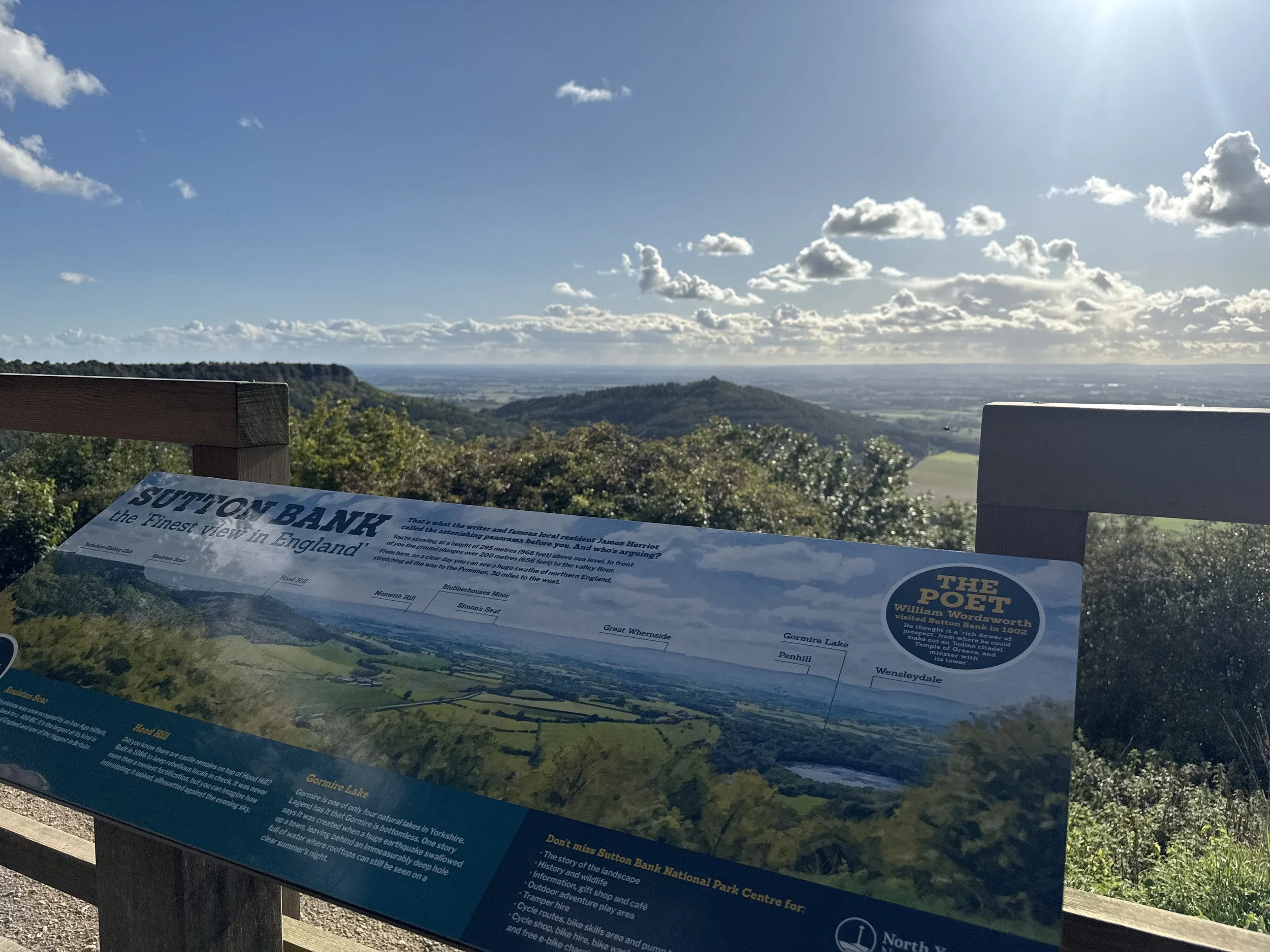
Midway, you can pause at Sutton Bank Visitor Centre, home to a popular tearoom and what James Herriot once called "the finest view in England." The route then descends to the peaceful shores of Gormire Lake, before winding back through woodland and farmland towards Kilburn.
Route difficulty
This is a moderate walk with a mix of woodland trails, escarpment paths and field edges. The climbs up to the White Horse and down to Gormire Lake can be steep and occasionally muddy, particularly after rain. Some sections follow the Cleveland Way and are well-signposted, but having a GPX route helps for the woodland return.
| Walk type | Circular |
| Distance | 7 miles / 11 km |
| Time | 2.5–3 hours (plus stops) |
| Start/finish | Kilburn village or nearby forest car park |
| Terrain | Forest trails, ridge paths, field edges, lake paths |
| Difficulty | Moderate, with some steeper and uneven sections |
| Good for | Big views, hidden lakes, plane spotting, woodland wanders |
| Facilities | Café, loos and visitor centre at Sutton Bank |
Route highlights
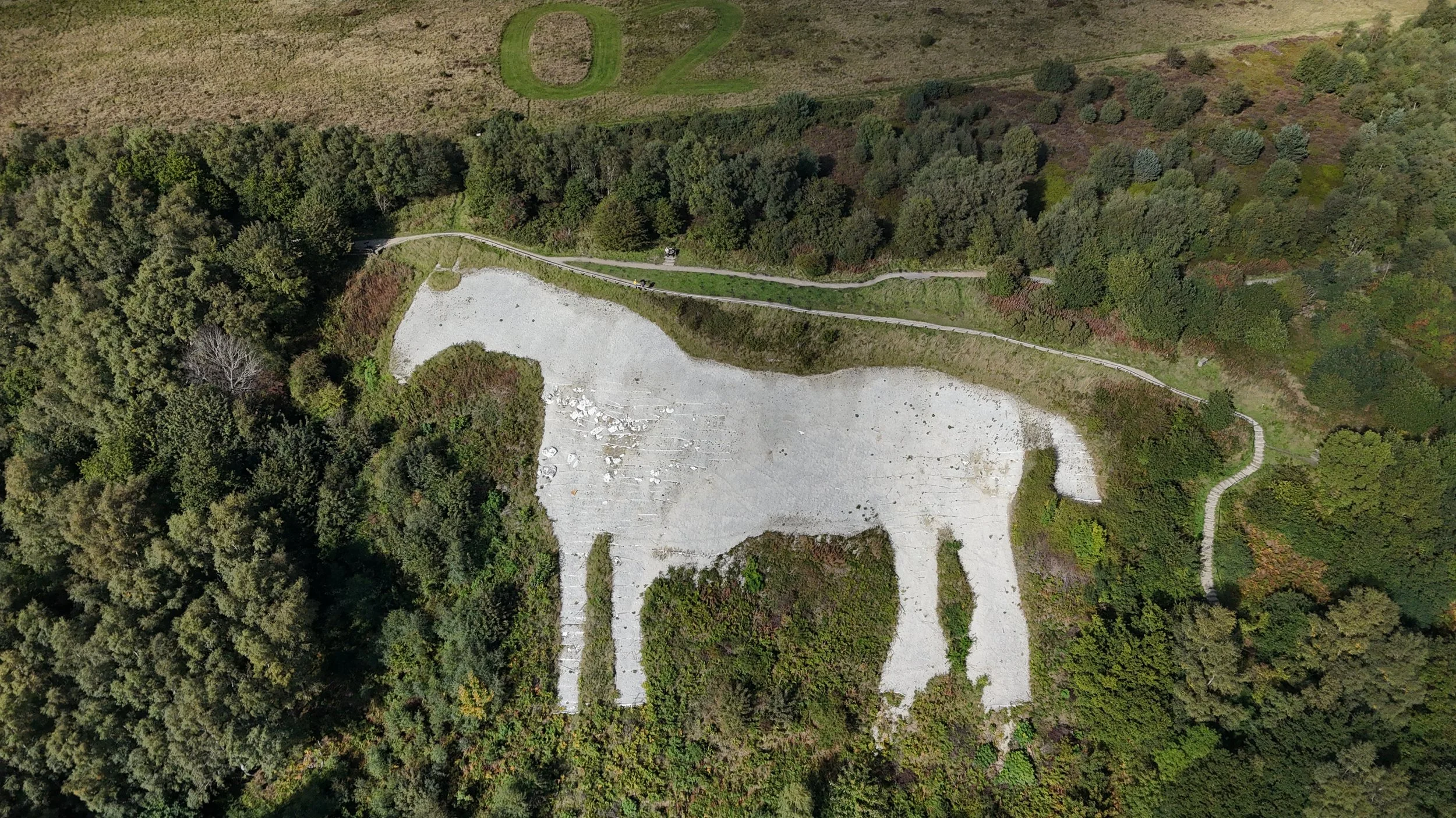
Kilburn White Horse
England’s most northerly chalk figure, this striking 318-foot carving dominates the hillside above Kilburn and makes for an epic early viewpoint. You can spot it from miles away—but nothing beats standing right beside it.
Yorkshire Gliding Club
Perched high above the Vale of York, this hilltop airfield adds some unexpected drama to your walk. On a good day, you’ll spot sleek gliders launching from the cliff edge and silently soaring overhead.
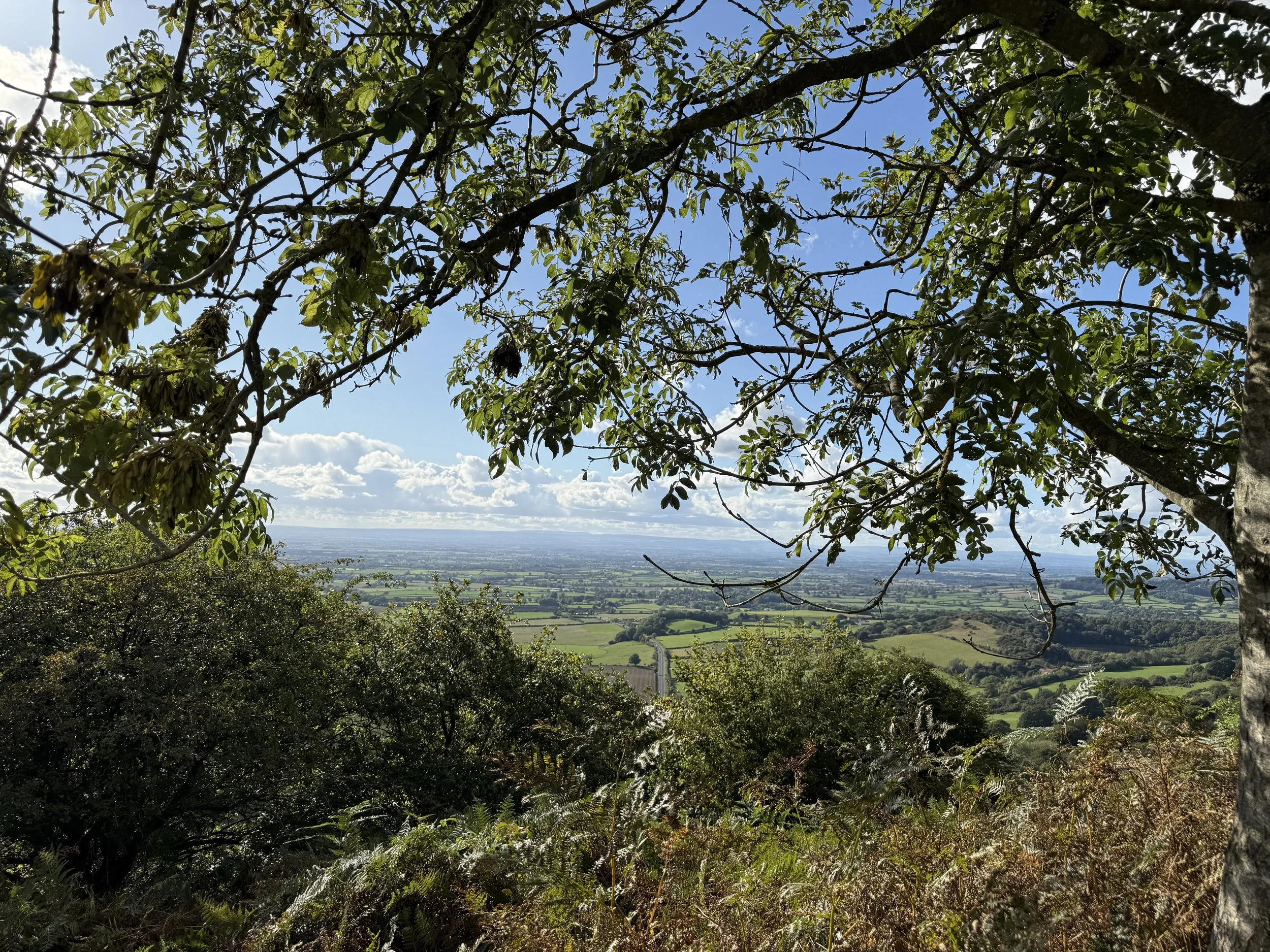
Sutton Bank Visitor Centre
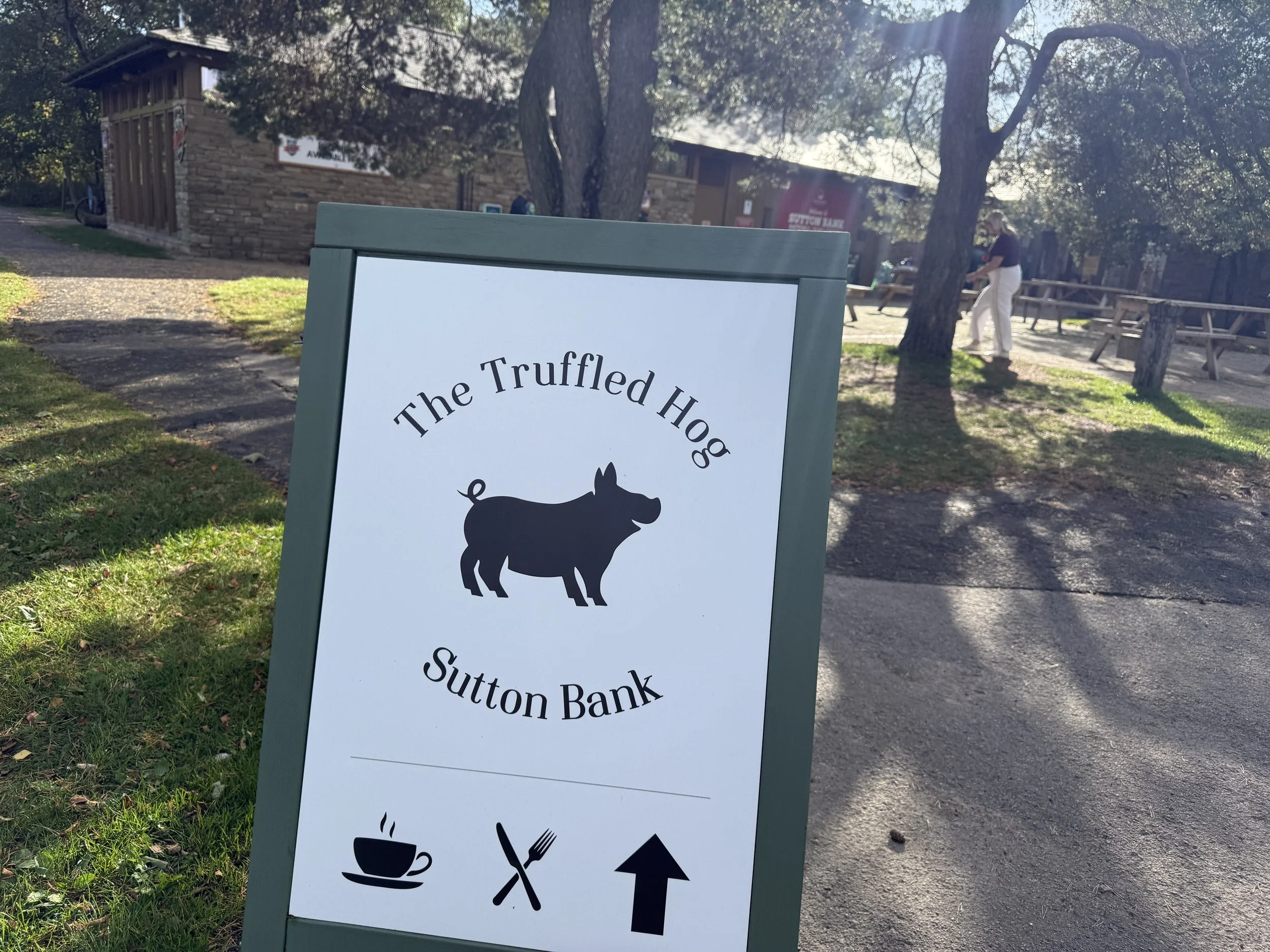
Halfway through the walk, the National Park centre is the perfect place to pause. Grab a cup of tea or cake from The Truffled Hog, refill your water, and enjoy the famous viewpoint overlooking Hood Hill and the valley below.
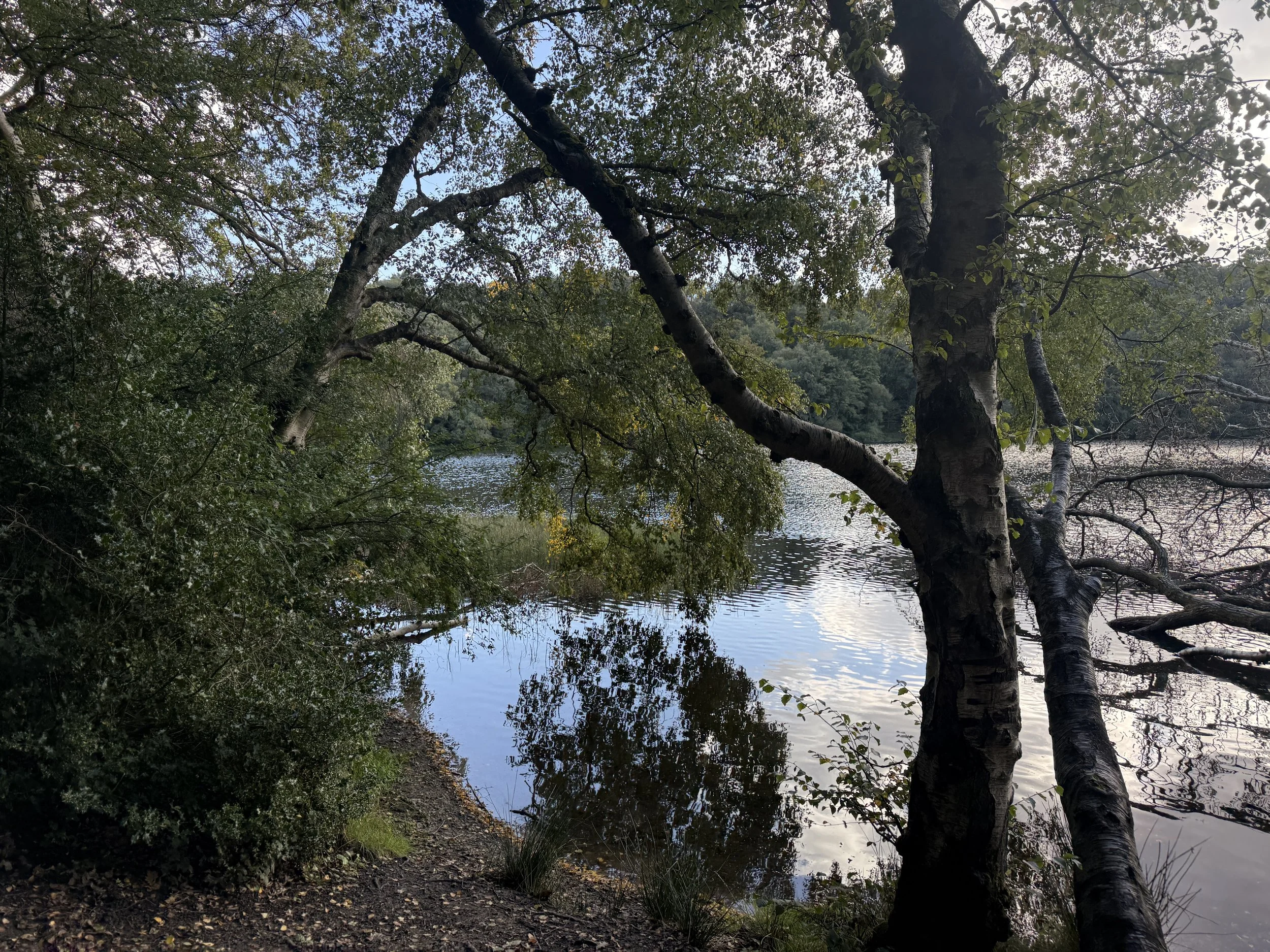
Gormire Lake
Nestled beneath the cliffs of Whitestone Scar, Gormire is one of the few natural lakes in the North York Moors. Shaded by trees and alive with birdlife, it’s a peaceful spot with local legends of ghostly horses and bottomless depths.
Where is Kilburn?
Kilburn is a small village on the southern edge of the North York Moors National Park in North Yorkshire. It’s best known for the nearby Kilburn White Horse and for its connection to Robert Thompson, the famous ‘Mouseman’ furniture maker. The village sits just off the A170, around 6 miles east of Thirsk, and is a popular starting point for walks along the Cleveland Way and surrounding escarpment.
Things to do nearby
Visit the ruins of Byland Abbey
Explore the Sutton Bank bike trails or hire bikes from the centre
Pop into Kilburn village to see local woodcarver Robert Thompson's Mouseman workshop
Is this walk suitable for beginners?
Yes, with care. The route has clear paths and signage in parts, but the inclines and descents around the escarpment can be challenging for newer walkers. Take your time and wear decent footwear. The halfway café stop helps break things up nicely.
Is the route dog-friendly?
Dogs are welcome throughout most of the route, including the trails and woodland. They must be kept on leads around livestock and near the gliding club. Dogs are also welcome at The Truffled Hog (the cafe at Sutton Bank).
When is the best time to do this walk?
The views from Sutton Bank and the escarpment make this walk special, so aim for clear or partly cloudy conditions. In fog or low cloud, visibility is limited and the best viewpoints may be missed. Always check the forecast and dress accordingly.
Late spring through early autumn offers the best mix of dry trails, active gliders and clearer views. Autumn colours add extra drama in the woods, while summer brings long daylight and ideal picnic conditions. Avoid after heavy rain, as parts of the path can be muddy.
How to extend your adventure
This route links nicely with other trails around the Kilburn and Sutton Bank area. For a longer adventure:
Explore the quiet ridge above Gormire Lake for extra views
Link with the White Rose Walk, which starts at the Kilburn White Horse
Add a climb to Hood Hill, a small peak just south of the escarpment
Include a detour to Byland Abbey for a mix of walking and history
Local legends and folklore
Gormire Lake has long been the subject of folklore. One tale tells of a knight and his horse plunging into the waters from the cliff above, cursed to rise again each century. Some say the lake is bottomless, though it’s actually around 29 feet deep.
Best photo spots
Looking out over the White Horse from the top of the escarpment
Watching gliders from the Cleveland Way ridge
Reflections at the edge of Gormire Lake, especially on calm days
Getting to the starting point
By car: Kilburn is just off the A170 near Thirsk. Park on Low Town Bank Road for direct access to the White Horse climb, or in Kilburn village for a full loop.
By public transport: The nearest rail station is Thirsk. From there, local buses or a short taxi ride will get you to Kilburn.
✔️ Good to knows
Café: The Truffled Hog at Sutton Bank Visitor Centre (open daily)
Toilets: Available at the visitor centre
Dogs: Allowed on leads, though not permitted inside the gliding club café
Footwear: Sturdy boots recommended
Map: Download route in advance as signal can be patchy
Parking: Pay & display at Sutton Bank or free lay-bys near Kilburn
🧭 Following the route
I use komoot and OS Maps for offline navigation. To follow this walk step-by-step on komoot, simply click this link here or download the GPX file and upload it to your chosen app, such as OS Maps.