Dragon’s Ascent Challenge: Hike from England’s tallest waterfall to the UK’s highest pub
15 miles of remote moorland, Yorkshire charm, and big-sky views—this epic point-to-point challenge connects two legendary pubs via the mighty Great Shunner Fell and the spectacular Swaledale.

The Dragon’s Ascent at a glance
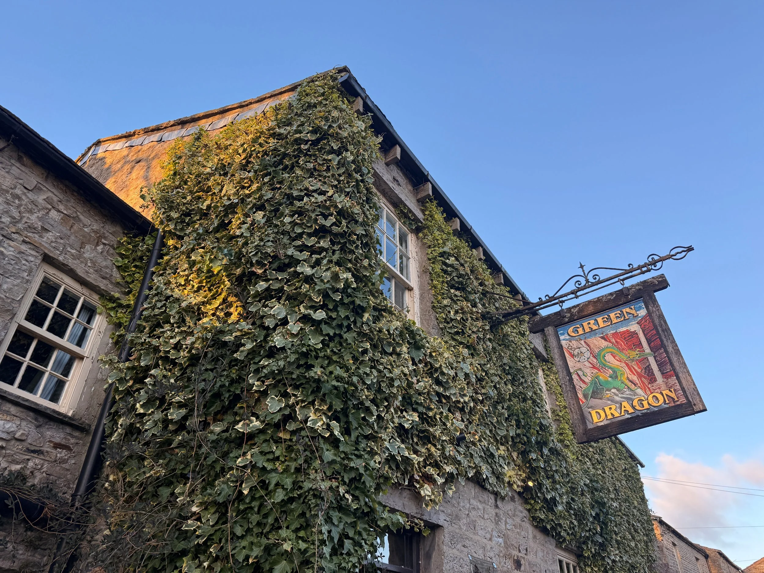
Start: Green Dragon Inn, Hardraw
End: Tan Hill Inn, Richmond
Distance: 15 miles / 25km
Elevation: 3,460 ft / 700m (Great Shunner Fell = 716m)
Time: 4–7 hours
Difficulty: Moderate to challenging
Dog Friendly: Yes – on lead around livestock & cliffs
Well-waymarked? Yes by the Pennine Way + Bridleway
Navigation: Follow on komoot or download GPX file
What is the Dragon’s Ascent Challenge?
The Dragon’s Ascent Challenge is a long-distance route through the Yorkshire Dales National Park, connecting the Green Dragon Inn in Hardraw with the Tan Hill Inn, the highest pub in Britain. Along the way, you'll:
Pass Hardraw Force, England’s tallest single-drop waterfall
Summit the mighty Great Shunner Fell
Wander through Swaledale, one of Yorkshire’s most scenic valleys
Stop for tea in the idyllic village of Thwaite
Catch a glimpse of the iconic Buttertubs Pass
Finish at the famously remote Tan Hill Inn
You can walk or run the route independently like we did, or sign up for the official annual event.

About the route
Starting in the pretty village of Hardraw, the path follows the Pennine Way and later the Pennine Bridleway, offering consistently easy-to-follow navigation and incredible variety—think limestone paths, open fells, deep valleys, and traditional Yorkshire villages. The 15.5-mile trail is a satisfying mix of terrain—from steady climbs and stone paths to open moor and riverside track. Most of the route follows the Pennine Way, making navigation easy. You'll ascend Great Shunner Fell, pass through the picturesque village of Thwaite, wind through Swaledale, skirt Buttertubs Pass, and finally reach the wilds around Tan Hill.
It’s long, scenic, and surprisingly varied, with plenty of spots to rest, eat, or detour.
Highlights include:
– A visit to Hardraw Force, England’s tallest single-drop waterfall
– A steady climb to Great Shunner Fell (716m)
– Homemade scones at Kearton Tearooms in Thwaite
– A moody stretch of wild moorland leading to Tan Hill
– Pint and pie at the finish line!
Why you'll love this walk
Wild and beautiful: From rolling meadows to rugged fells, the Dales never disappoint.
Pub-to-pub adventure: Start and end your day with real Yorkshire charm.
A true challenge: Feels like an achievement without being overwhelming or too strenuous.
Tea and cake halfway: Perfect motivation to reach Thwaite’s Kearton Tearooms.
Waterfalls, wildlife, and wow-moments: There’s always something breathtaking to look at along the way (if visibility is on your side, of course).

🧭 Route difficulty
Walk type: Moderate to challenging – the distance and elevation make it a solid day out, but the route is mostly on clear, non-technical paths.
Terrain: Moorland, flagstone paths, boggy sections (especially around Shunner Fell), and grassy trails. Rocky section near Swaledale.
Time needed: 4–6 hours moving time, 7+ with stops.
Navigation: Easy in good weather—just follow the Pennine Way and Bridleway signs. Bring a paper map and download GPX file. Useful for the moorland around Shunner Fell and near Tan Hill if visibility is poor.
Fitness level: Reasonable fitness, especially if aiming to complete in 4–5 hours.
Route overview
1. Start at Green Dragon Inn + Visit Hardraw Force
📍 Hardraw, Wensleydale
Before heading off, pay a quick visit to Hardraw Force, England’s highest single-drop waterfall (100 feet), accessible via the Green Dragon pub garden.
🎟️ Entry fee applies – bring a couple of pounds.
2. Climb to Great Shunner Fell (4 miles in)
Gradual but persistent climb to the summit of Great Shunner Fell—the third highest in the Dales. A stone wind shelter greets you at the top, along with sweeping views toward the Moors and Lake District on a clear day.
🥾 Conditions: Often boggy year-round – gaiters recommended.
3. Descend to Thwaite (~8 miles)
The descent to Thwaite is gentle and scenic, winding into the heart of Swaledale. Stop at the charming Kearton Tearooms for tea and cake—or a light lunch.
🍰 Kearton Tearooms: Open March–Oct, indoor + outdoor seating.
4. Around Kisdon Hill + optional Keld detour
Head north toward Keld, where you'll pass through lush green valleys, hidden waterfalls, and the River Swale. Take a 10-minute detour for Kisdon Force—it’s totally worth it.
5. Wild moorlands + final ascent to Tan Hill
Climb gradually across remote open moors. This stretch is exposed, with little shelter or signage. Keep eyes peeled for Pennine Way markers. Eventually, you’ll spot the Tan Hill Inn seemingly appearing from nowhere. A very welcome sight after 15+ miles.
🧭 Tip: In fog or snow, navigation here is trickier—use GPS or OS Map OL30.
🏁 Finish at Tan Hill Inn (the highest pub in the UK)
The highest pub in Britain (1,732 feet), the Tan Hill Inn is a classic stop for weary adventurers. Expect hearty food, a roaring fire, and proper Yorkshire hospitality. They also offer rooms if you want to stay over after your challenge.

How Long Does the Dragon’s Ascent challenge take?
The full 15-mile route typically takes between 4 to 7 hours to complete, depending on your pace, weather conditions, and how often you stop. Here’s a rough breakdown to help you plan:
Pace Estimated time
Trail runners: 2-4 hours
Fast hikers: 4-5 hours
Moderate walkers 5–6 hours
Casual pace with stops: 7+ hours
🥾 Our experience: We completed it in around 5-6 hours moving time at a relatively leisurely pace, with 7 hours total including a tea stop in Thwaite and a slight detour exploring the waterfalls near Keld. I’d definitely leave yourself at least 7 hours so you can enjoy the pitstops along the way.
Things that can affect timing:
Weather: Heavy rain, wind, or fog can slow you down—especially across the moorlands.
Terrain: Parts of the path can be boggy, particularly near Great Shunner Fell.
Stops: Waterfalls, tearooms, photo ops—there are plenty of tempting reasons to pause!
🔄 If you’re doing the challenge as part of an overnight pub-to-pub stay, there’s no need to rush—soak it all in and enjoy the journey.

Logistics & transport tips
🚗 Getting there
Start: Park at the Green Dragon Inn (Hardraw, DL8 3LZ)
End: Tan Hill Inn has a car park if you're arranging a pick-up or shuttle.
🚌 Return Options: This is a one-way route. You can:
Pre-arrange a taxi from Tan Hill back to Hardraw (recommended)
Do it as a there-and-back over two days, staying at each pub
Walk with a friend and leave one car at each end
Navigation
The path follows well-signed Pennine Way and Bridleway tracks. Still, it’s smart to carry:
What to pack
Waterproof boots or trail shoes
Waterproof jacket + layers
OS Map OL30 or digital GPX
Power bank
First aid kit
Water + high-energy snacks
Phone + offline route app (Komoot/OS Maps)
Trekking poles (optional for descent)
❓ Frequently asked questions
Can I do the walk in reverse?
Yes, but it’s more fun to finish at Tan Hill with a celebratory drink!
Is it dog-friendly?
Yes, but dogs should be kept on leads—there’s livestock, cliffs, and boggy moorland.
Do I need to train?
It’s not technical, but 15+ miles of hills can be tiring. Try a few 10–12 mile walks first.
Can I do it solo?
Absolutely. But let someone know your plans, especially in winter conditions.

When to do the challenge
Spring–Autumn (April to October) is ideal for good light and conditions.
Summer brings wildflowers to Swaledale and longer days.
Winter is possible but requires prep—some sections become boggy or icy, and moorland visibility can vanish quickly.
Weather tip: Conditions can shift fast on the fells—always bring layers, waterproofs, and a map/GPS device.
Join the official challenge
Held annually, walkers and runners gather to complete the route as part of the Dragon’s Ascent Challenge event:
Supported by trained safety & medical staff
Proceeds go to local Yorkshire charities
Sign up solo or with friends
Accommodation + meals available at start and end

🛏️ Stay the Night
Start: Green Dragon Inn, Hardraw – cosy rooms + waterfall access
Midpoint (Optional): Kearton Country Hotel, Thwaite
Finish: Tan Hill Inn – famously remote, full of character, great food
🍰 Food & Drink
Hardraw: Food + drinks at Green Dragon
Thwaite: Kearton Tearooms for lunch or cake
Keld: Keld Green Café (seasonal)
Tan Hill: Pub meals, snacks, and accommodation
🐾 Dog Friendly?
Yes – but keep dogs on leads near livestock and waterfalls. Some boggy sections might be tricky for smaller pups.

✔️ Good to knows
Difficulty:
Moderate – A long-distance walk with a steady climb up Great Shunner Fell in the first half and some remote, boggy terrain later on. Manageable for most walkers with a good level of fitness.
Footwear:
Sturdy, waterproof walking boots are highly recommended, especially after rain. The path can be boggy and uneven in places, particularly on the ascent to Shunner Fell and across the open moorland.
Dog-friendly:
Dog friendly (on leads). Dogs are welcome along the route but should be kept on leads around livestock and moorland nesting birds. There are streams en route, but it’s worth packing extra water for your pup.
Facilities:
There are toilets and food available at both pubs (start and end), and a tearoom close to midway in Thwaite. Be prepared with essentials and time your rest stops well.
Food & drink:
The Green Dragon Inn (Hardraw) – Pre-walk breakfast or coffee, and a quick visit to Hardraw Force behind the pub.
Kearton Tearooms (Thwaite) – A perfect halfway point with light lunches, tea, and sweet treats.
Tan Hill Inn – Your endpoint! Great for a hot meal and well-earned pint. Accommodation also available.
Optional detour to Keld Green Cafe for extra refreshments.
🧭 Following the route
I use komoot and OS Maps for offline navigation. To follow the full walk step-by-step on komoot, simply click this link here or download the GPX file and upload it to your chosen app, such as OS Maps.
