THIS WEEK’S FEATURED WALKS:


ALL TRAILS

KINDER TRESPASS: HAYFIELD TO KINDER SCOUT
The Peak District ‘big one’… follow our route up to the highest point in the Peaks

Distance: 8.15 miles
Duration: allow approx. 3-4 hours
Elevation: 1,500 feet
Start: Bowden Bridge Car Park, SK22 2LH
Navigation: follow our route here

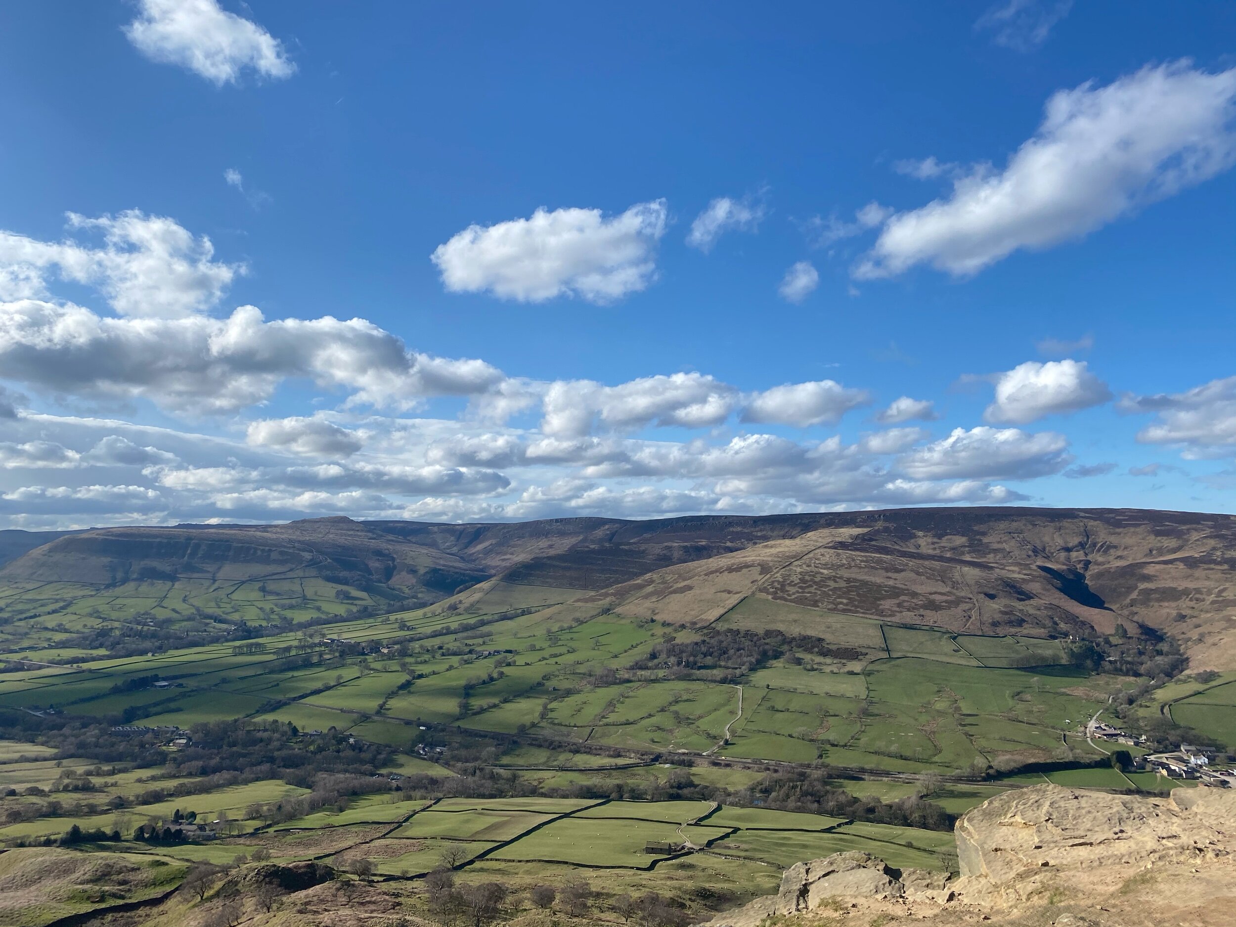
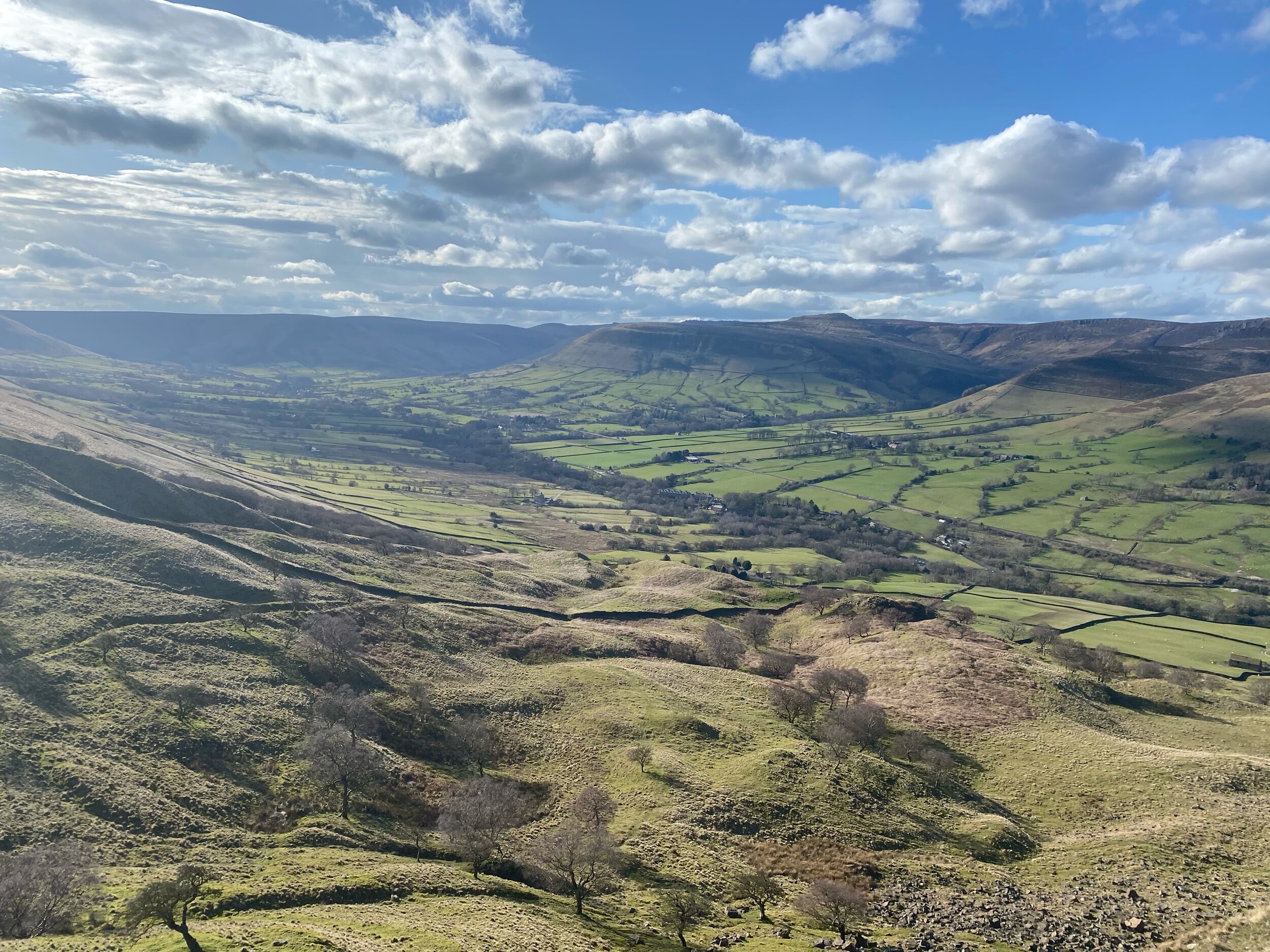
Starting at Bowden Bridge, this trail takes you up to one of the Peak Districts most famous—and arguably, best— natural landmarks: Kinder Scout.
Along the way, you’ll follow in the footsteps of 500 walkers who, back in 1932, trespassed en masse from Hayfield to Kinder Scout to secure access right to open country for all to enjoy.

Bowden Bridge Quarry is where protester Benny Rothman addressed the crowd of ramblers before they set off to Kinder Reservoir. In Hayfield, you’ll find a large information board which explains the pivotal role the Trespass had in opening up routes for all to enjoy.

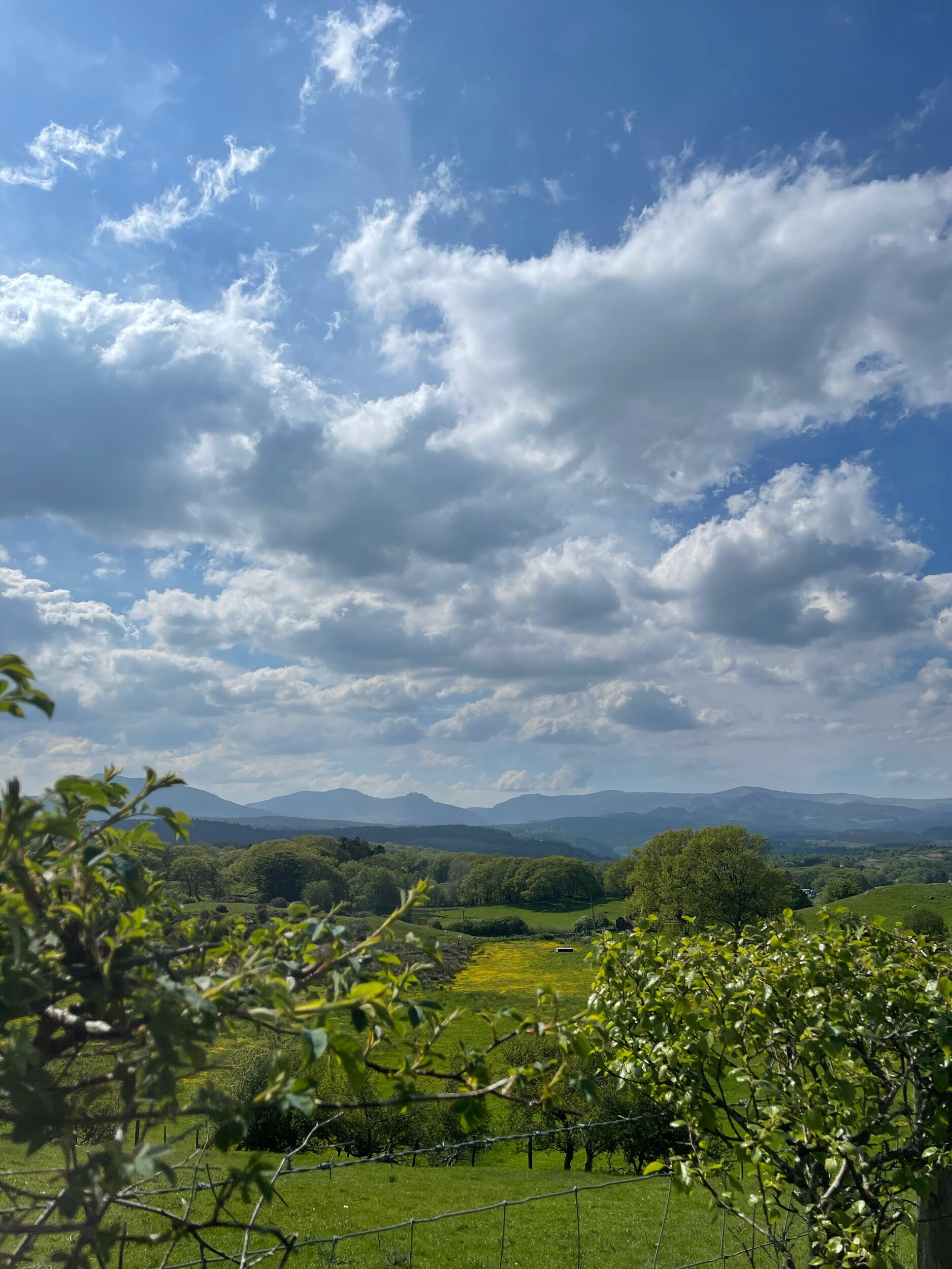
At the carpark, you’ll find public toilets and a pop-up coffee shop to fuel up for your climb. On a clear day, you can see right across Manchester and as far as Snowdonia, making this trail one of the best views in the Peak District. It’s an iconic hike, taking in the expansive moorland plateau of Kinder Scout as you ascend towards the highest point in the Peaks.

There are two routes up to the plateau, starting from Edale or Hayfield. Both make for a great day out, but the Hayfield walk takes in the most spectacular scenery along the way.

During the ascent, you’ll pass Kinder Downfall—the highest waterfall in the Peaks. Be prepared for uneven terrain and steep uphill climbs, so walking boots and proper preparation are needed for this one.

Up top, you’ll come across the Kinder Low trig pillar, marking the unofficial high point of Kinder Scout that makes for a great photo stop.

The descent takes you along steep grassy terrain and farmland, with some (easy) scrambling required on one rocky section, so take care during these parts. As you return towards Bowden Bridge, you’ll pass The Sportsman Inn, a great place to reward your efforts with a well-earned post-walk pint.
Ready to give this one a go? Follow our route step-by-step here

THE TORRS CIRCULAR
An idyllic 10 mile loop taking in the best of Stockport’s forgotten history

Distance: 10.5 miles
Duration: allow approx. 4 hours
Elevation: 1,200 feet
Start: Peak Forest Canal, Marple SK6 7NP
Navigation: follow the route here

On initial glance, New Mills may look like any ordinary Peak District village: small, picturesque with little much-to-do around the town. Venture just a few steps downwards towards the River Sett, and you enter another landscape entirely.

Below the hustle and bustle of the main shopping centre lies New Mill’s (not so) hidden gem: The Torrs. We’ve done this walk a few times, and every time we’re amazed by the astounding natural gorge that lies below.
Expect colourful cliffs, enormous viaducts and a long bridge that transports you to the Goyt Way; making for one of the best walks in Derbyshire.

The Torrs itself makes for a great short circular route if you’re not planning on venturing far, but our trail starts and ends in nearby Stockport. From Marple, you’ll head towards The Roman Lakes and passed the site of Mellor Mill Ruins. Once a shining star or the Oldknow Empire, Mellor Mill was the biggest spinning mill the world had seen during its time of construction.

What remains of the mill have since been taken over by the natural world, making for a gorgeous pitstop by the Peak Forest Canal and River Goyt.
Passing the ruins, you’ll make the ascent towards Mellor Cross—a local landmark on Cobden Edge. The cross was originally erected in March 1970, made by a carpenter local to the area. From The Cross, you’ll reach Mellor Moor, where you’ll be rewarded with views across the western edge of the Peak District and the Cheshire Plain.

The moor’s umpteen tracks date back to prehistoric Old Mercian trackways, and make great aids for exploration. The line of an ancient trackway is said to be the route of monks and pilgrims, with waymarkers signifying Old Mercian landmarks and monasteries.

Descending from the moorland, we head towards New Mills where you can stop for a well-earned refuel. The town boasts an impressive mix of independent shops, cafes and pubs, perfect for that much-needed pitstop before the homeward leg. We stopped off at Clockwork Cafe, which has all your caffeine (and Derbyshire Oatcakes!) cravings covered.

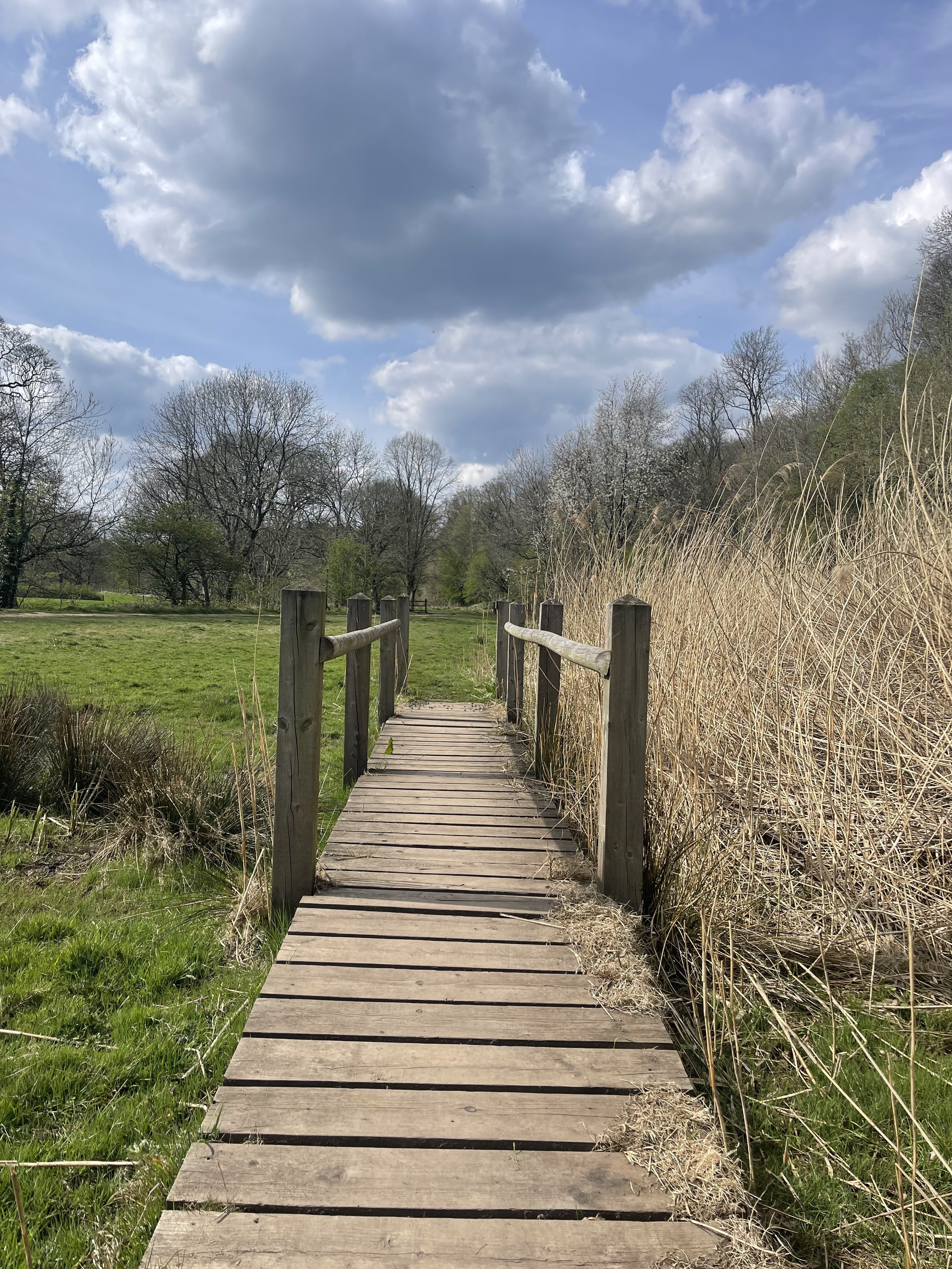
After a refuel is where you’ll be greeted with the trail’s main event: The Torrs Millennium Walkway. This 175-yard aerial walkway spans the cliffsides above the River Goyt, with links to many walking and cycling routes should you choose to travel a different way home. New Mills Heritage Centre provides maps and guides for several nearby walks, including the iconic Kinder Trespass Trail.

In 1932, around 500 walkers from Manchester trespassed en masse from Hayfield to Kinder Scout to secure access right to open country for all to enjoy. Back then, walkers across England and Wales were denied access to areas of open country—luckily for us, the trespass helped pave the way for the establishment of the Pennine Way and other long-distance footpaths enjoyed today.
Fancy following in their footsteps? You can follow our Hayfield to Kinder Scout route here.
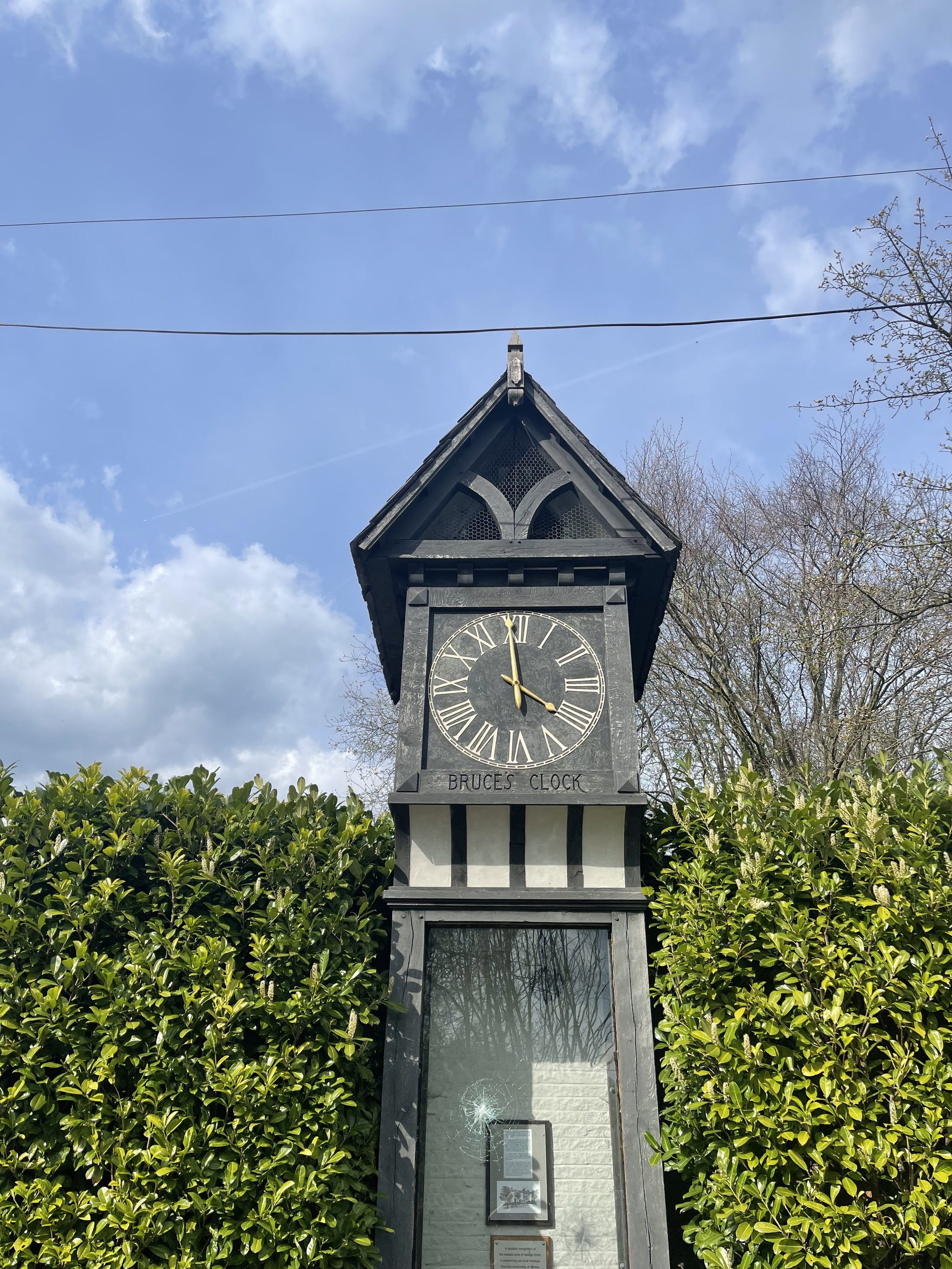
On the home stretch, the Goyt Way makes for a relaxing, flat stroll—taking you passed landmarks such as Bruce’s Clock in Strines. In medieval times, Strines stood as a large hunting forest—The Forest of the Peak—before local gentry settled here during the Elizabethan period.

Bruce’s Clock was originally found on the grounds surrounding Strines Hall, with the comings and goings of local people ordered by the striking of its bell in days when clocks and watches were rare household acquisitions.

After briefly meeting back up with The Roman Lakes footpath, you’ll finally reach The Peak Forest Canal to make the last stretch back to Marple.
The Waltzing Matilda sometimes moors here, so keep an eye out if you’re looking to refuel on woodfired pizza.

Fancy giving this walk a go? You can follow our GPX directions here

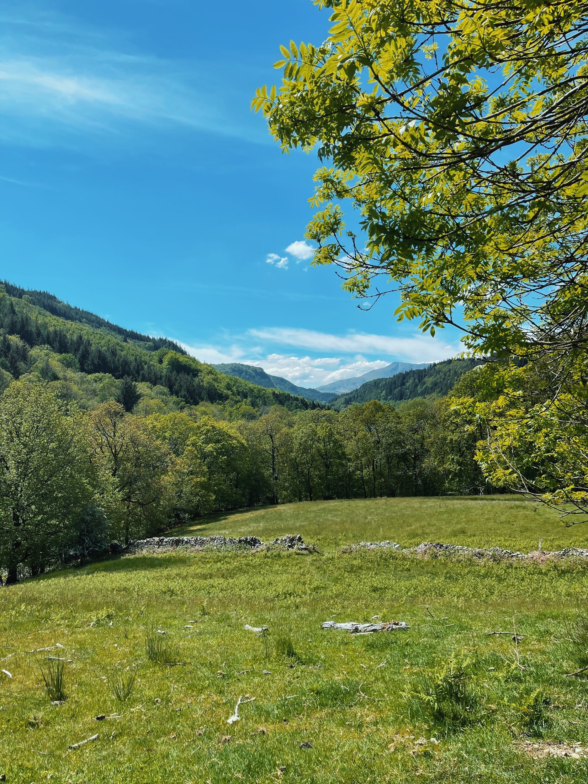
FAIRY GLEN GORGE
Move over Snowdonia — could this be one of North Wales’ best circular walks?
Start: Betws Y Coed, LL24 0BW
Distance: 4.78 miles
Duration: allow approx. 2 hours
Elevation: 900 feet
Navigation: follow our route here
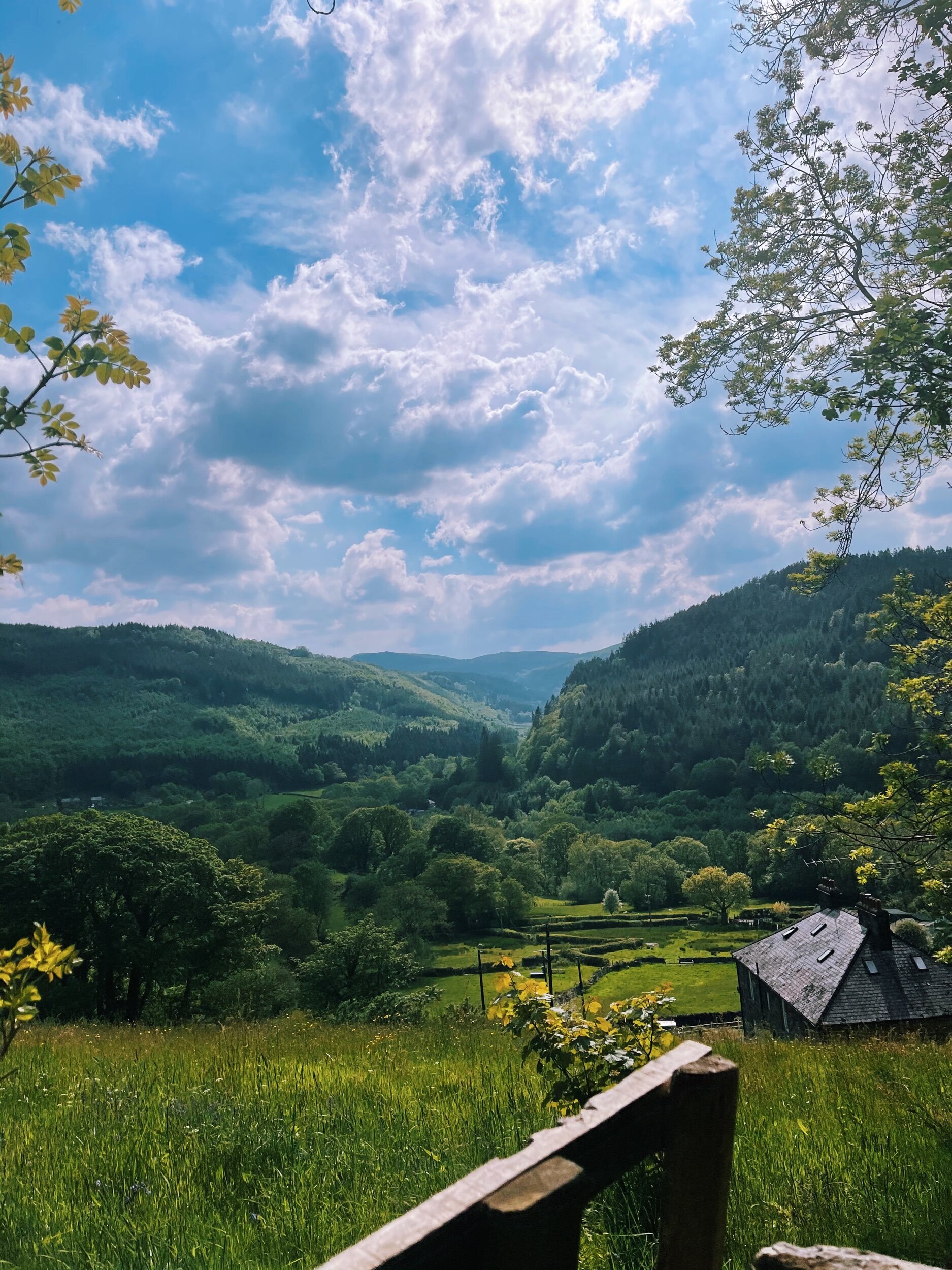
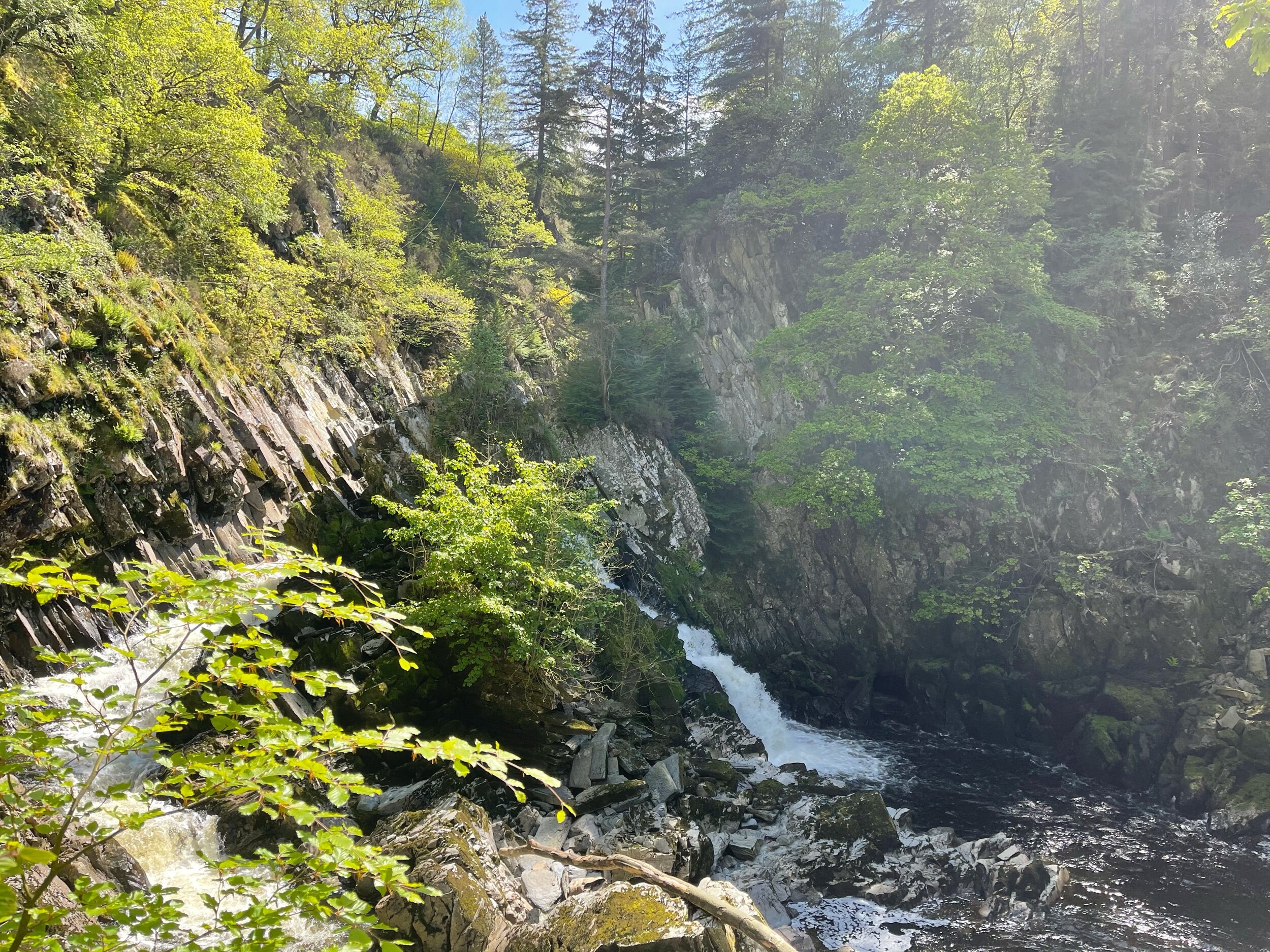
Nestled in the heart of the Snowdonian countryside lies a magical circular walk in Betws y Coed. This place is rich in folklore and oozes magic from the moment you step onto the grounds. This secluded beauty spot is tucked away just off the Conwy River, and it’s not just it’s mystical vibe that attracts tourists from all corners of the country here.
With stunning views of the Snowdonian landscape every way you turn, it’s no wonder this one was on our wish-list for a fair while—and it’s safe to say it didn’t disappoint.
Please note, to walk down to Fairy Glen Gorge incurs a fee of £1 per adult and 50p per child. This contribution goes towards the upkeep of the facilities while helping keep a small business up-and-running.
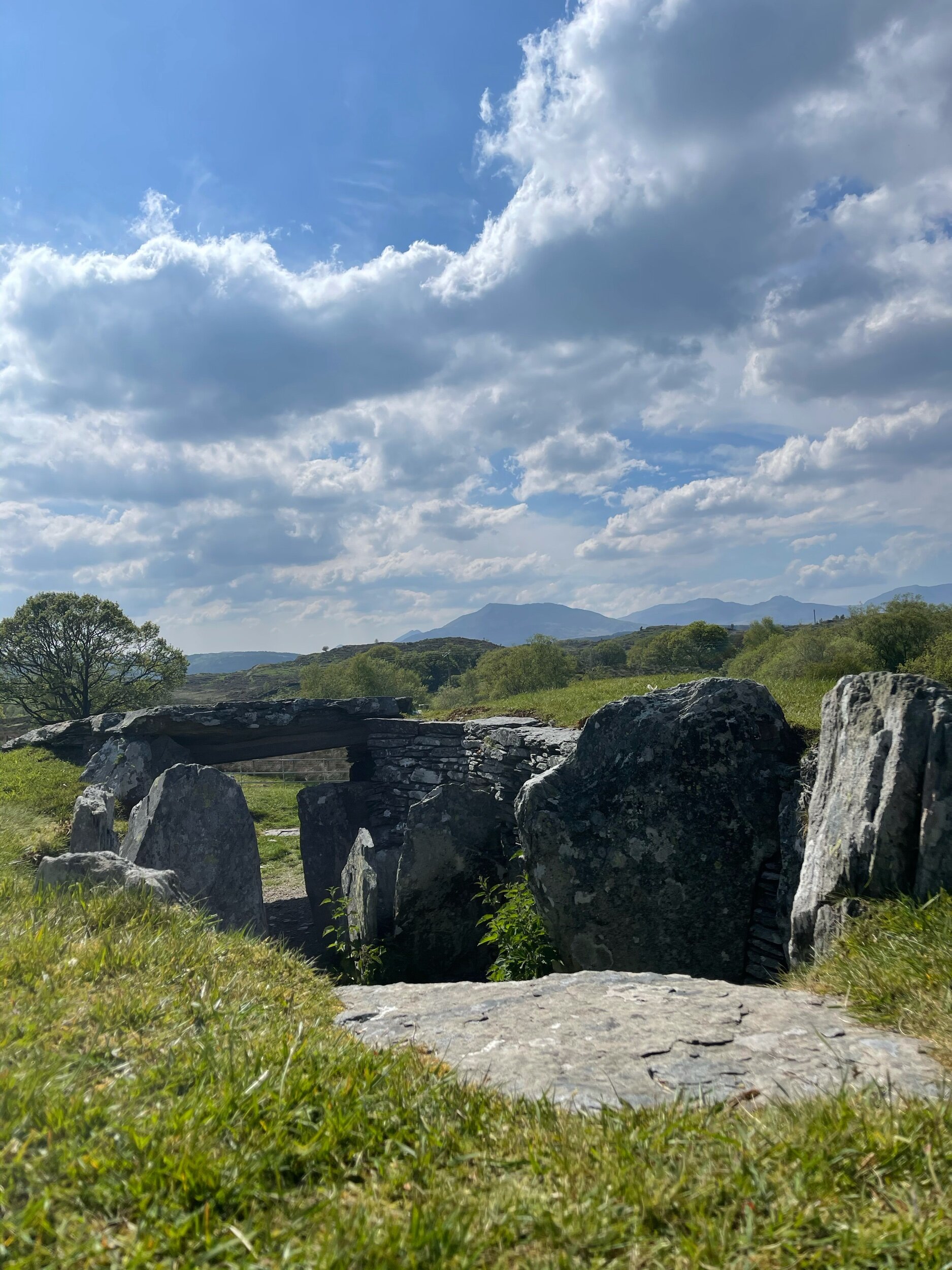
Heading away from the gorge, you travel up towards Carpel Garmon Burial Chamber—a neolithic tomb steeped in mystery. Due to its unexplained location, the New Stone Age burial ground is something of a conundrum for historians. Burial chambers of this type are archeologically grouped to an area of the Cotswolds, so Capel Garmon’s location so far up north remains an oddity.
On the home leg, you’ll pass Dinas Mawr— a small but charming peak that offers views across the area and beyond. You’ll also pass Conwy Falls Cafe where you can stop to refuel and enjoy the view.
Just a two-hour drive from Manchester, this route makes for an ideal day trip that combines the best of both — a short walk in nature, and incredibly rewarding views.
Why not give it a go yourself? Navigation details can be found here
Happy exploring!

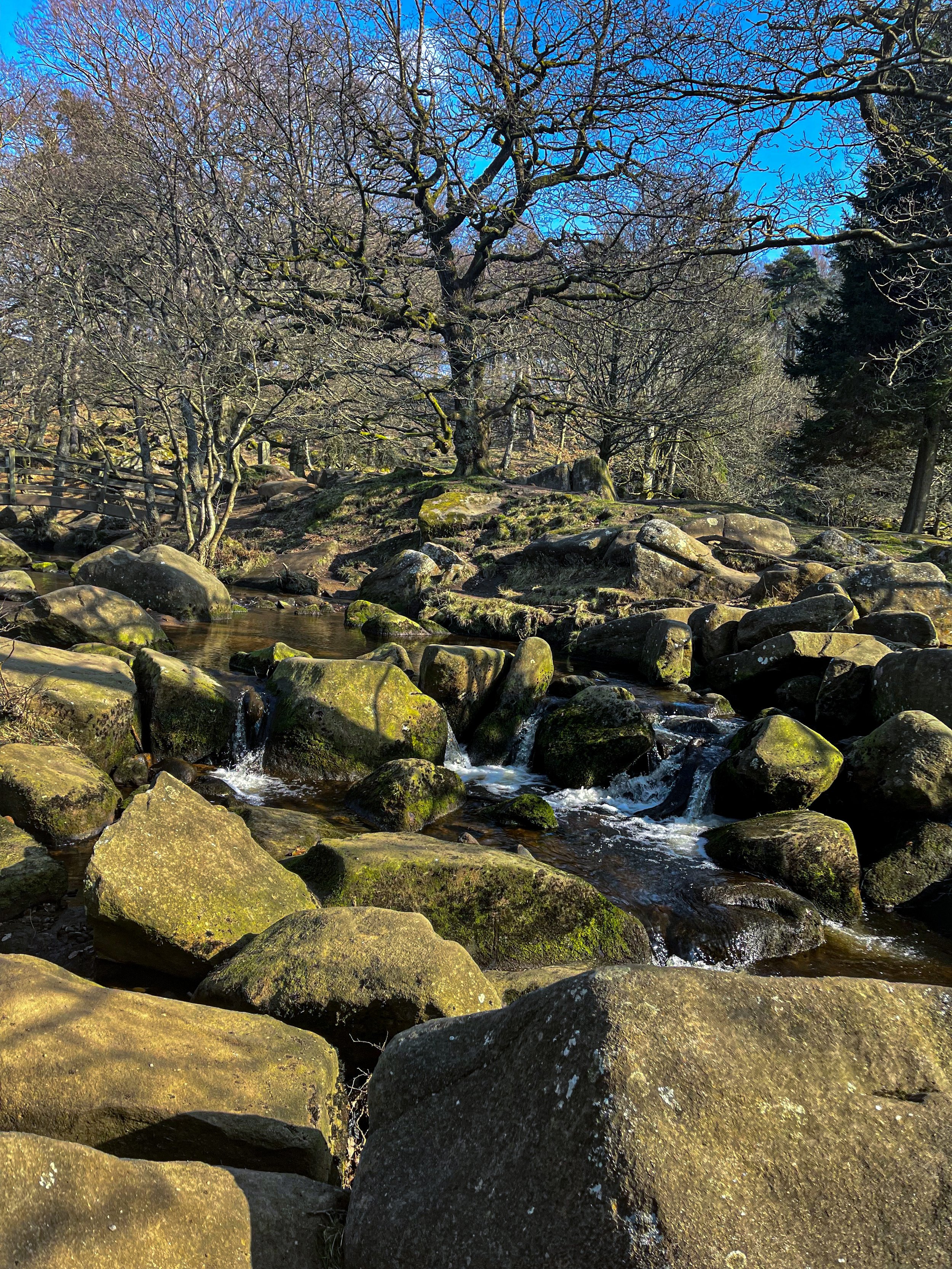
PADLEY GORGE
Gently flowing waterfalls… easy-going ascents… impeccable views and a pub pit-stop, Padley Gorge loop is one of the Peak District’s best circular walks

Start: Upper Burbage Bridge Car Park, Hope Valley, S32 1BR
Distance: 5.3 miles
Elevation: 650 feet
Duration: allow approx. 2 hours
Navigation: follow step-by-step

Route Overview:
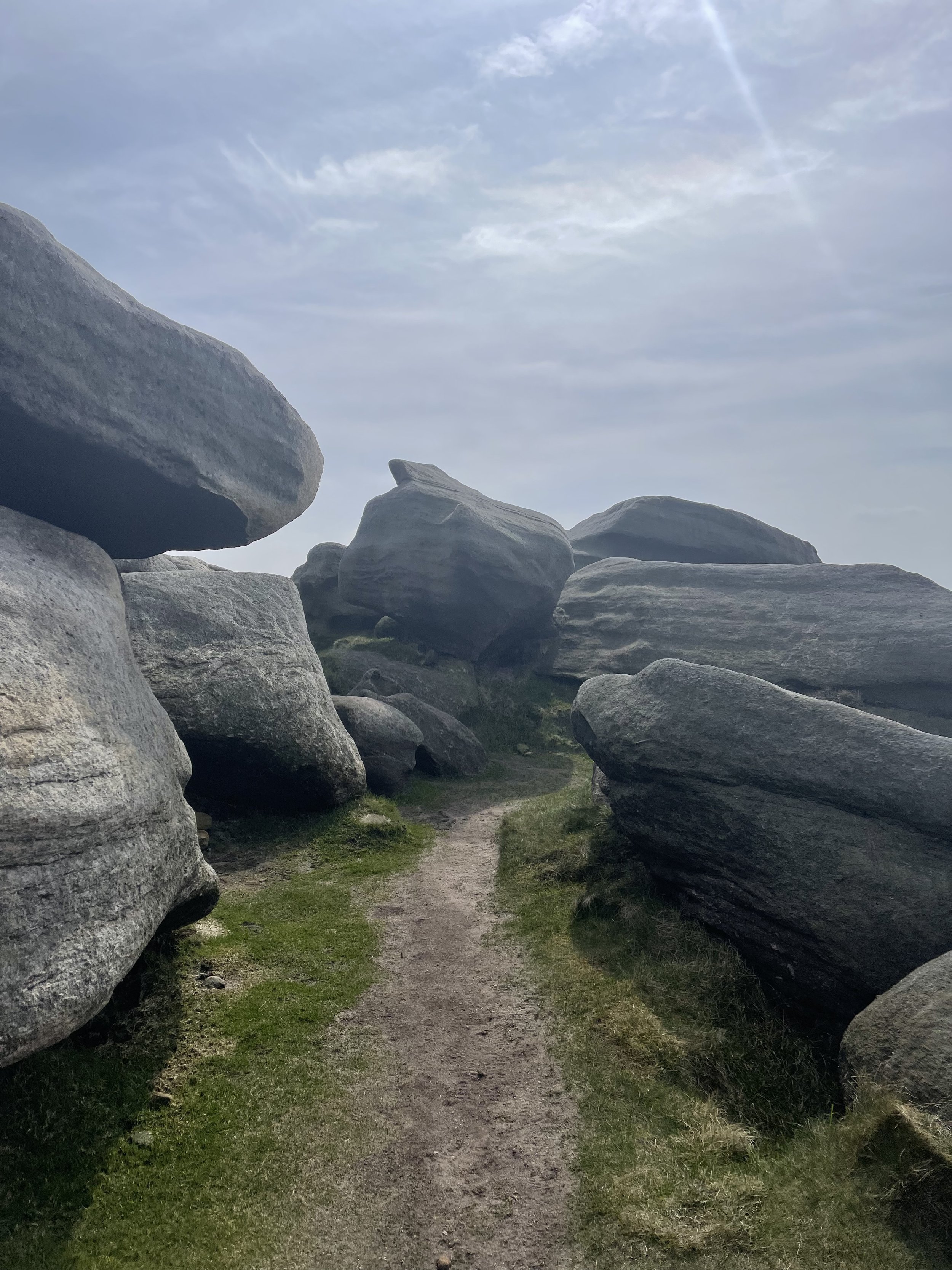
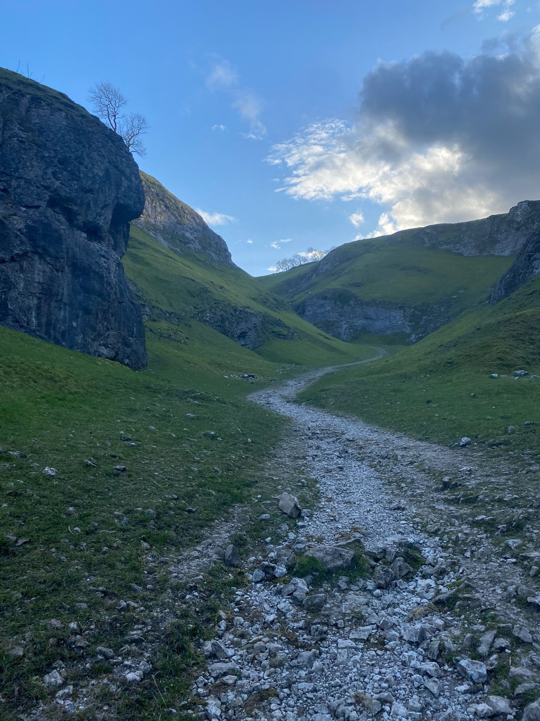
This circular walk takes in less-populated trails from the busy Stanage Edge routes around Hathersage, with equally impressive views. Starting at Upper Burbage Bridge Car Park just outside of the town centre, this trail takes you to the magical Padley Gorge, before meandering back for a short scramble up Carl Wark — an awe-inspiring rocky tor.

Higger Tor, Hathersage Moor, Carl Wark and Burbage Edge are all included in this loop. Starting at the free car park at Burbage Bridge, you’ll be hard-pressed to see another soul for the first half of the walk, as you walk along side a stream and through the forest away from the more popular trails.

Be prepared for a slight scramble as you reach the tops of Higger Tor and Carl Wark. The approach from Burbage Bridge can also get a little boggy, so make sure to grab your waterproof boots before attempting this one.

Why not extend your walk with a visit to Little John’s grave? As you head towards Hathersage, you can expect magical panoramic views of faraway landmarks, moors and meadows.
Follow our route step-by-step here - happy exploring!

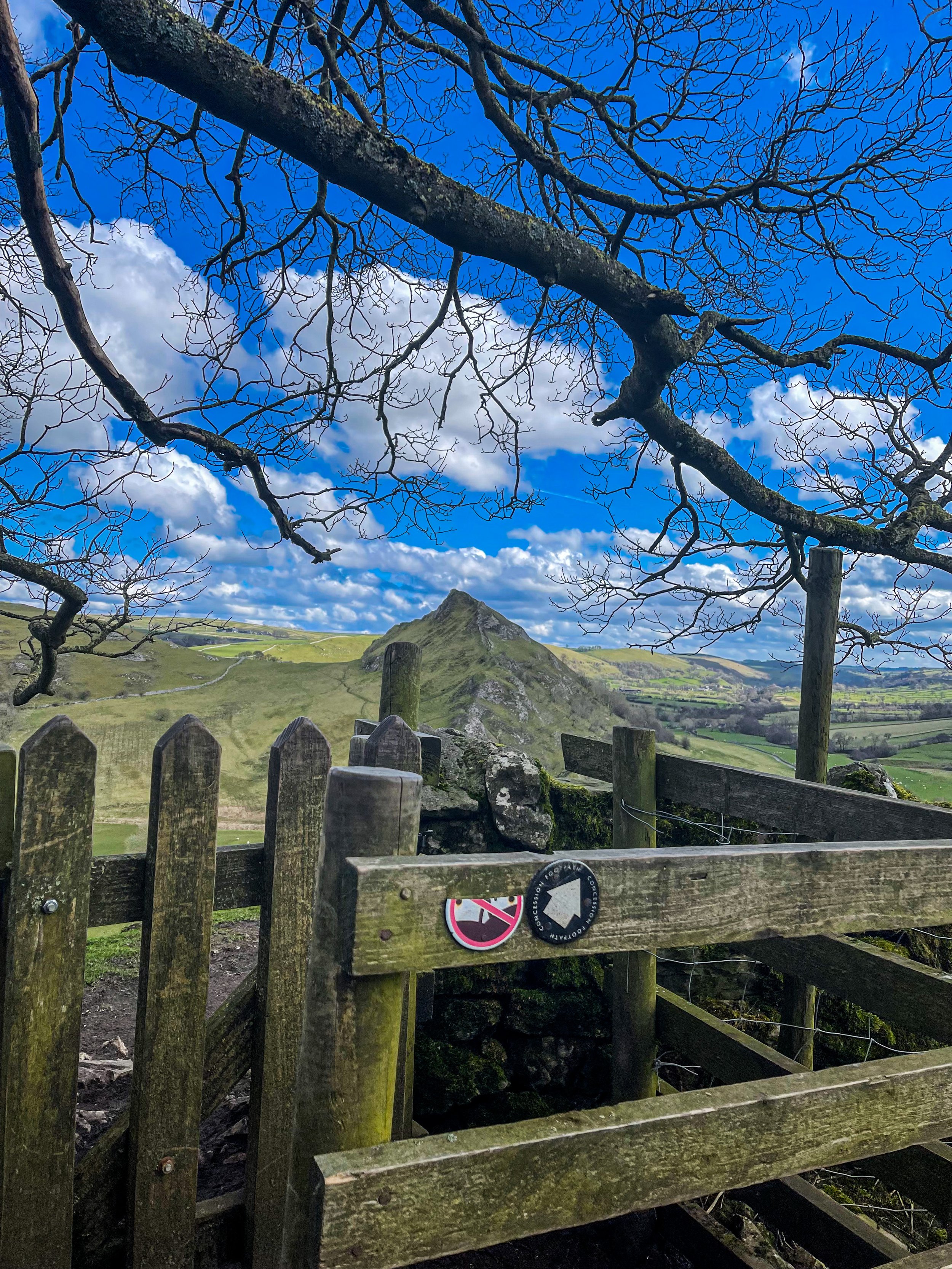
DRAGON’S BACK LOOP
Want to feel like you’ve spent the day in Middle Earth? This route’s for you.

Start: Hollinsclough, SK17 0RH
Distance: 5 miles
Ascent: 1,000 feet
Duration: allow approx. 2 hours
Navigation: follow step-by-step

Starting and finishing in the pretty hamlet of Hollinsclough, this walk has it all: magnificent views across the Staffordshire and Peak District wilds, paths criss-crossed with ancient stone walls, and summits galore… taking you through the breath-taking landscapes of the famous Dragon’s Back over the tops of Chrome Hill (424m), before meandering back up Parkhouse Hill (360m).
From here, you descend through untouched farmland and idyllic country lanes to make the return back to Hollinsclough.
With challenging terrain in places, our route to the summit of Parkhouse Hill should only be taken on if you’re confident at scrambling. There’s free street parking in the village but spaces are limited to so plan ahead if you’re arriving by car.

The views of the landscapes surrounding are sure to take your breath away at every part of this route. But the real highlight for us came in the form of a wonderfully idyllic pitstop, The Honesty Shop.
This perfectly stocked café-come-hut-come-shop has all your refuel needs covered, with hot drinks, sweet treats and fresh local produce aplenty. The Honesty Shop has no staff and relies solely on the good nature of passers-by to do the right thing - a comforting reminder that we were far away from the hustle of the city.

The walk can be shorted by cutting out the final ascent over Parkhouse Hill or extended by following your nose to the summit of High Wheeldon.

Another option is to start at The Quiet Woman pub in Earl Sterndale, not far from Buxton. Unsurprisingly, the many routes surrounding the limestone reef knolls of Chrome and Parkhouse Hills make for magnificent views throughout.

You can follow our route step-by-step here.
Fancy having a go? Tag us using #getlostmcr, we love seeing your wild adventures!

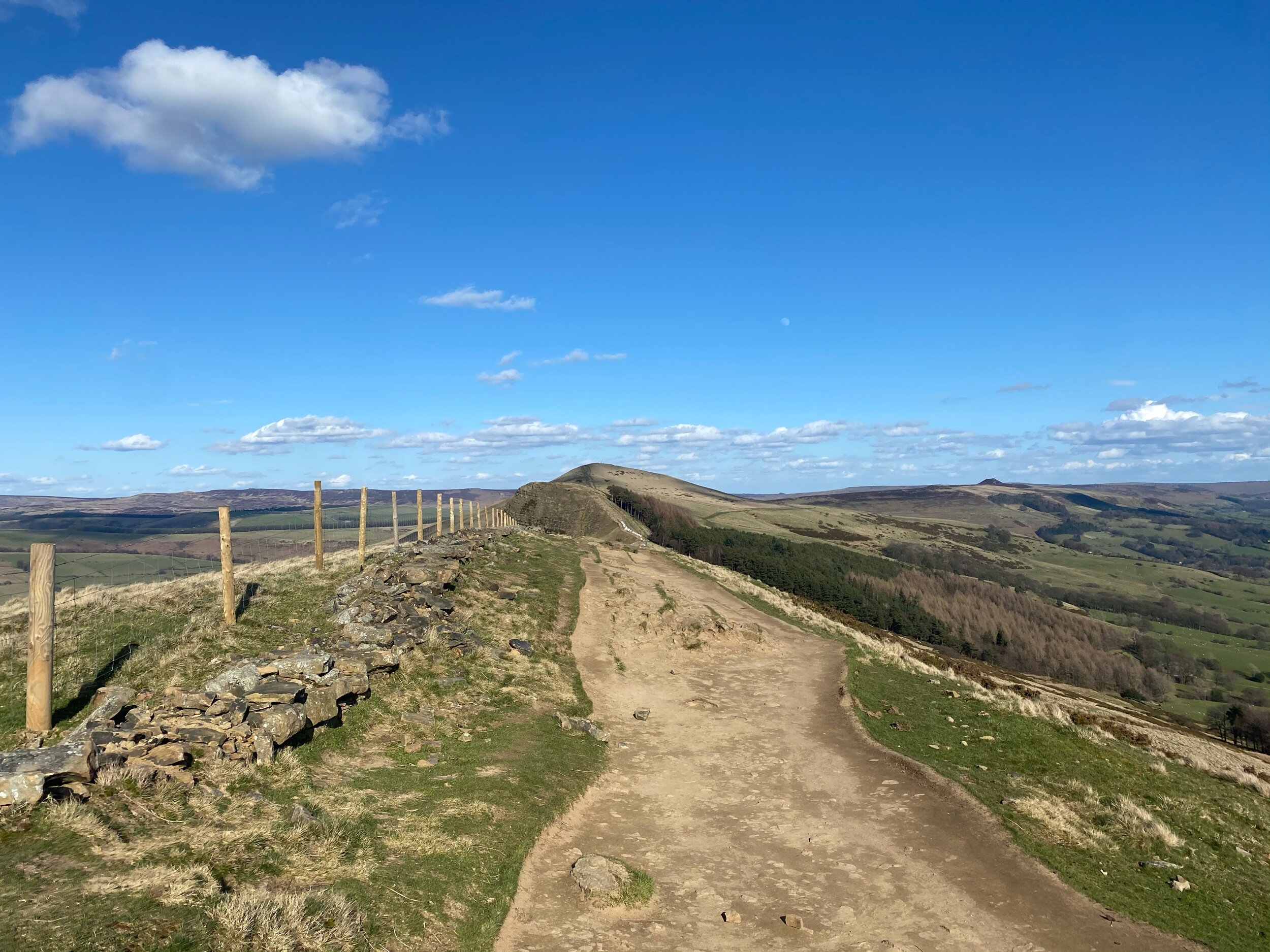
MAM TOR, SHIRE
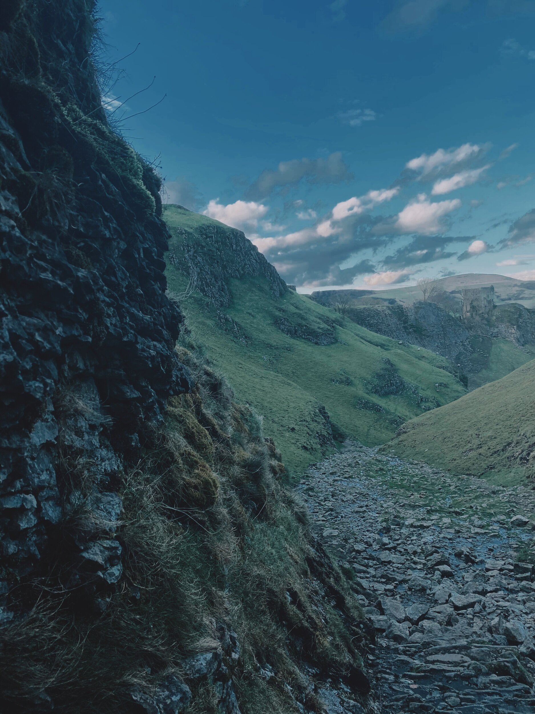
An alternative climb to the usual Mam Tor route — taking in the beauty of Cave Dale and Castleton’s best bits
A stunning walk starting in Castleton taking in some of The Peak District’s most incredible views
Start: Peak Cavern, Castleton
Distance: 7.41 miles
Duration: 3-4 hours
Ascent: 1,700 feet
Navigation: follow the trail step-by-step here
Offering more scenery than you can shake a walking pole at, The Peak District offers a plethora of adventures — and Mam Tor is certainly up there. If green valleys, friendly summits and routes for all abilities sounds like your cup of tea, then a trip to Mam Tor is a must.
Nestled on the foothills of Castleton and Edale, Mam Tor offers something for everyone — the route below is a little on the challenging side, but by following the waymarked paths set out by National Trust, a day out here is never hindered by ability.
Arguably the star attraction of the Peak District, Cave Dale and Mam Tor attracts walkers from all across the globe. Standing at 517 metres tall, Mam Tor sits on the edge of the Dark Peak and the White Peak — boasting spectacular views for miles around, including every photographer’s favourite: Winnats Pass.
On a really clear day, you can even see our city in all its glory — keep an eye out for a good weather day before you plan your trek, the views are definitely worth it.
This route itself is a little on the challenging side — but should you want to take in the views with a little less of a climb, parking at Mam Tor’s National Trust carpark gives you the best of both worlds.

The weather changes fast on this peak — so remember to pack extra layers, and enjoy the view!
UPHILL CHALLENGES:


WALKS WITH WATERFALLS:


