ALL TRAILS

DRAGON’S BACK WALK (5 MILES)
Want to feel like you’ve spent the day in Middle Earth? This route’s for you.

Start: Hollinsclough, SK17 0RH
Distance: 5 miles
Ascent: 1,000 feet
Duration: allow approx. 2 hours
Navigation: follow step-by-step

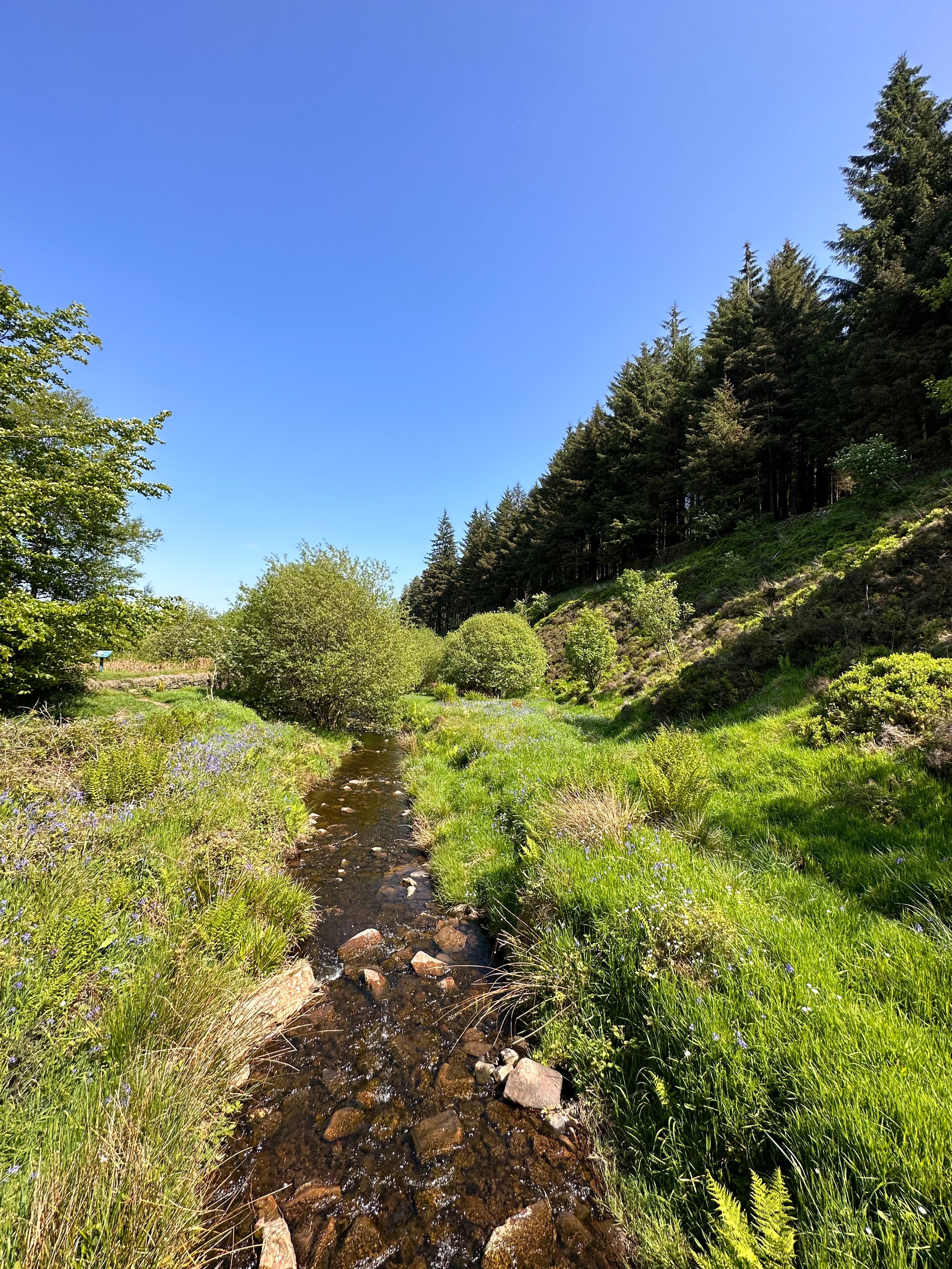
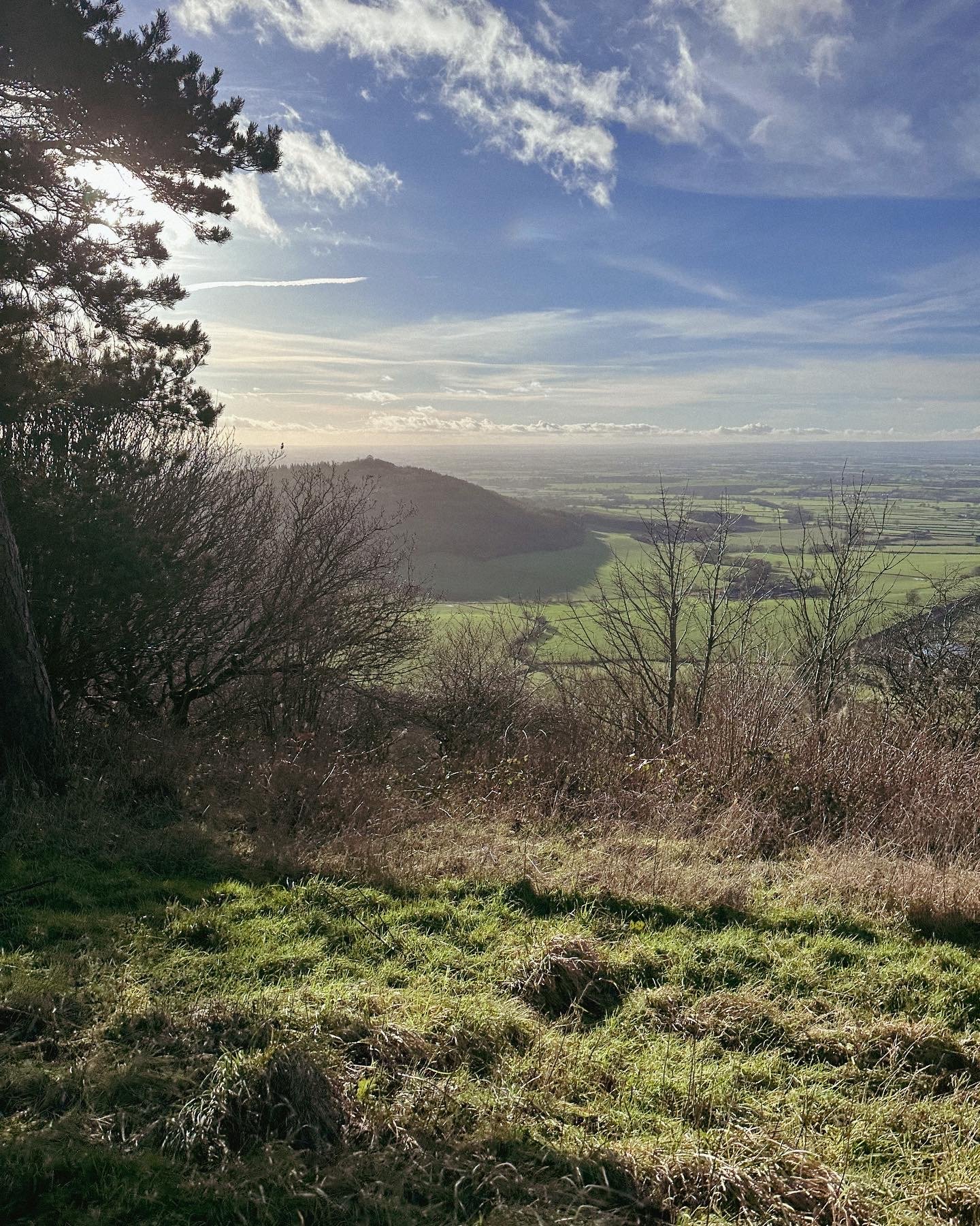
Starting and finishing in the pretty hamlet of Hollinsclough, this walk has it all: magnificent views across the Staffordshire and Peak District wilds, paths criss-crossed with ancient stone walls, and summits galore… taking you through the breath-taking landscapes of the famous Dragon’s Back over the tops of Chrome Hill (424m), before meandering back up Parkhouse Hill (360m).
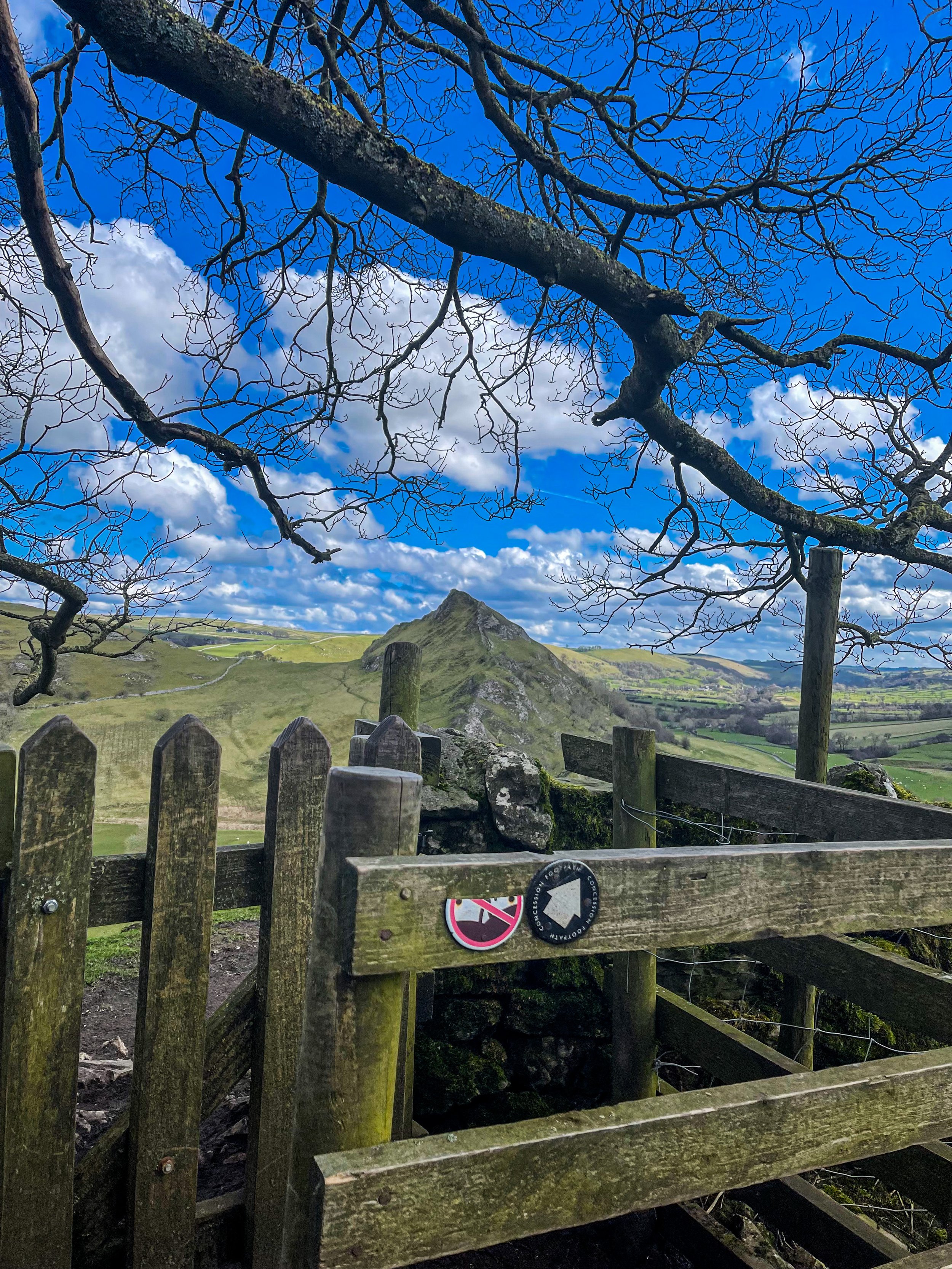
From here, you descend through untouched farmland and idyllic country lanes to make the return back to Hollinsclough.
With challenging terrain in places, our route to the summit of Parkhouse Hill should only be taken on if you’re confident at scrambling. There’s free street parking in the village but spaces are limited to so plan ahead if you’re arriving by car.

The views of the landscapes surrounding are sure to take your breath away at every part of this route. But the real highlight for us came in the form of a wonderfully idyllic pitstop, The Honesty Shop.
This perfectly stocked café-come-hut-come-shop has all your refuel needs covered, with hot drinks, sweet treats and fresh local produce aplenty. The Honesty Shop has no staff and relies solely on the good nature of passers-by to do the right thing - a comforting reminder that we were far away from the hustle of the city.

The walk can be shorted by cutting out the final ascent over Parkhouse Hill or extended by following your nose to the summit of High Wheeldon.

Another option is to start at The Quiet Woman pub in Earl Sterndale, not far from Buxton. Unsurprisingly, the many routes surrounding the limestone reef knolls of Chrome and Parkhouse Hills make for magnificent views throughout.


BAMFORD AND STANAGE EDGE CIRCULAR
Breathtaking scenery? Check. Two iconic Peak District landmarks in one walk? This route has you covered…

Start: Heatherdene Car Park, S33 0BY
Distance: 7 miles
Duration: 3 hours
Elevation: 1,150 feet
Difficulty: Moderate
Navigation: Download the GPX file here
This scenic Bamford Edge walk also visits Stanage Edge, taking in some of the best views in the Peak District.
Walk Highlights
Bamford Moor
As you ascend from Heatherdene, Bamford Moor presents itself with rugged landscapes and untamed beauty. This expanse of open moorland offers panoramic views, babbling brooks, and a stone circle dating back to The Bronze Age. Keep your camera ready!
Stanage Edge
Situated north of Hathersage, Stanage Edge is a popular place for walkers and for rock climbing with stunning views of the Dark Peak moorlands and the Hope Valley. The gritstone edge stretches for approximately 4 miles and featured in the classic film ‘Pride & Prejudice’ starring Keira Knightley.
Bamford Edge
Bamford Edge is an overhang of gritstone that sticks out over the beautiful Bamford Moor. The ridge is renowned for its distinctive rock formations, including the photogenic 'Great Tor'. It lies elevated on the moor, close to the quintessential Derbyshire village of Bamford in the Peak District National Park.
Bamford Edge is approximately 1381 ft above sea level or 420 metres high. From the top, you get some of the best views of Ladybower Reservoir, Win Hill, Lose Hill, The Great Ridge, Crook Hill, and Hope Valley — all from just a relatively short walk to the top.
It’s extremely popular with rock climbers, walkers, and those wanting to get some fabulous photos on an iconic overhanging ledge.
Tips
Facilities are limited on this one. You’ll find public toilets available at the start of the walk (Heatherdene Car Park) and a cafe at nearby Derwent Reservoir if you’re looking to extend the route.
Check the weather: The weather atop the moor can be unpredictable. Dress in layers and be prepared for changes.
Respect the environment: The Peak District is a protected area. Stick to paths, and don't disturb wildlife.
Arrive early: Heatherdeane Car Park gets incredibly crowded during the weekend, visit off-peak where you can.
Catch a sunset: Looking for a shorter walk? Check out our Bamford Edge sunset variation below, clocking up just 3 miles.
Plan ahead: Ensure you have enough water, snacks, and a map. Mobile signal can be patchy, so physical maps are handy.
Leave the white trainers at home! The area around the moors can get incredibly boggy — so definitely bring your boots for this one.
Best time to visit: Early morning or late afternoon to avoid the crowds and catch the golden light.
Safety first: The edges can be slippery, especially after rain. Wear sturdy boots and watch your step.
Leave no trace: Preserve the beauty of the Peaks. Take your rubbish with you and stick to the paths.
SUNSET WALK VARIATION

Short on time, or simply want to head up for sunset? This short loop up to Bamford Edge is a great alternative. The walk up to the edge only takes approx. 20 minutes with just a short ascent up to the ridge — the perfect route to watch the sun set over Ladybower.
Tip: The walk up can get incredibly boggy after rainfall, so definitely bring your boots for this one.
Bamford Circular Walk

Distance: 3.53 miles
Elevation: 650 feet
Duration: 1.5 hours
Start: Heatherdene Car Park, S33 0BY
Navigation: follow the route here
Despite clocking up just a few miles overall, this Bamford loop offers some of the best views in the Peak District. With just a short climb at the start, you walk towards Bamford Edge and are instantly rewarded with incredible views of Ladybower and Derwent Reservoirs.
Just opposite, you’ll also find another great vantage point in the form of Win Hill. The easygoing nature of this route makes it a popular location for sunrise and sunset.
Up top, you’ll be spoilt choice if you’re looking to extend the walk—with the option to include both Ladybower and Derwent Reservoirs if you prefer to skip the climb and soak up the views at the bottom.
Looking for more walks like this one? Check out our latest adventures on Instagram

KERRIDGE HILL LOOP
Discover the beauty of Cheshire from up above in this 6 mile circular walk…

Start: Clough Bank, Bollington, Macclesfield SK10 5NY
Distance: 6.88 miles
Duration: 2-3 hours
Elevation: 1,000 feet
Navigation: follow the route here

Looking for a bit of history on your next trip outdoors? Look no further than this uphill hike around the Cheshire countryside. Not only does this walk provide excellent views that sweep right across the surrounding area, but you’ll also pass White Nancy fairly early on — a memorial site atop Kerridge Hill, built to commemorate the victory of coalition forces at the Battle of Waterloo.

With its comically shaped physique, White Nancy isn’t your typical historical landmark. Thanks to its lofty position, the site White Nancy sits on had been used as a warning beacon of invasion for centuries, featuring other small structures before Nancy took up residence.
In 1817, the Gaskell family of Ingersley Hall built the structure you see today, in belated commemoration of the victory at Waterloo, 1815. Originally, White Nancy had a door and was used as a summerhouse, but was soon sealed off due to vandalism over the early 20th century.

Whether you’re here for the views or the stories of yesteryear, you’re sure to be taken aback by the undisturbed peacefulness of this route. On a clear day, you can see as far as Snowdonia, Liverpool’s coastal line and the windmills off the Wirral peninsula.

After admiring the views surrounding White Nancy, walking across Kerridge Hill is a must. The route’s quite steep in parts — but the views? So worth it.
So if you’re after a walk that offers incredible views every way you turn, make sure you stop by and see our Nancy soon. With multiple footpaths, woods and fields to explore nearby, you can easily extend this route into a full date out.

Fancy stopping by to visit Nancy soon? Follow the route here

NEW MILLS MILLENIUM WALKWAY WALK
Come with us on this short (but oh so scenic) walk just 20 minutes from Manchester…

On initial glance, New Mills may look like any ordinary Peak District village: small, picturesque with little much-to-do around the town. Venture just a few steps downwards towards the River Sett, and you enter another landscape entirely.
We’ve partnered with In Our Nature, Manchester’s biggest climate movement, to show you don’t always need to grab for the car keys to enjoy a wonderful day out in the Peaks.

Whether you want a lazy Sunday stroll or are seeking a fully day of exploring, New Mills is a great base for all types of adventures.
That’s why we’ve got two routes for you to choose from. The first, a short 4 mile loop that leaves plenty of time to explore the many wonderful independent shops and cafes in New Mills town centre. The second is a 10 mile loop which you can start from either New Mills or Marple, with easy train links from Manchester to both starting points.
Route #1: The Torrs Circular
Start: New Mills Central Station
Distance: 4 miles
Elevation: 300 feet
Difficulty: Easy
Duration: 1.5 hours
Navigation: Download the GPX file here
The Millenium Walkway and The Tours
Below the hustle and bustle of the main shopping centre lies New Mill’s (not so) hidden gem: The Torrs. We’ve done this walk a few times, and every time we’re amazed by the astounding natural gorge that lies below.
Expect colourful cliffs, enormous viaducts and a long bridge that transports you to the Goyt Way — making for one of the best lesser-known walks in Derbyshire.

Millers Refillers
The beauty of this shorter route means, not only can you take it at your own leisure, but you have the full day to explore the many wonderful shops, pubs and cafes that New Mills has to offer. Make sure you check out this iconic zero waste shop, stocking everything from baking essentials, flours sugars, pulses, rice, pasta, nuts, dried fruits, seeds, spices, oils, vinegars, sweet treats and snacks, and so much more.

Route #2: Mellor Cross
Distance: 10.5 miles
Duration: Allow approx. 4 hours
Elevation: 1,200 feet
Difficulty: Moderate
Navigation: Download the GPX file here
If you’re wanting to make a full day of it and check out some of Stockport’s forgotten while you’re at it, then this route’s for you. While The Torrs itself makes for a great short circular route if you’re not planning on venturing far, this longer walk is perfect for summer days spent exploring.
From Marple, you’ll head towards The Roman Lakes and passed the site of Mellor Mill Ruins. Once a shining star or the Oldknow Empire, Mellor Mill was the biggest spinning mill the world had seen during its time of construction. What remains of the mill have since been taken over by the natural world, making for a gorgeous pitstop by the Peak Forest Canal and River Goyt.

Passing the ruins, you’ll make the ascent towards Mellor Cross—a local landmark on Cobden Edge. The cross was originally erected in March 1970, made by a carpenter local to the area. From The Cross, you’ll reach Mellor Moor, where you’ll be rewarded with views across the western edge of the Peak District and the Cheshire Plain.

The moor’s umpteen tracks date back to prehistoric Old Mercian trackways, and make great aids for exploration. The line of an ancient trackway is said to be the route of monks and pilgrims, with waymarkers signifying Old Mercian landmarks and monasteries.

Descending from the moorland, we head towards New Mills where you can stop for a well-earned refuel. The town boasts an impressive mix of independent shops, cafes and pubs, perfect for that much-needed pitstop before the homeward leg. We stopped off at Clockwork Cafe, which has all your caffeine (and Derbyshire Oatcakes!) cravings covered.

After a refuel is where you’ll be greeted with the trail’s main event: The Torrs Millennium Walkway. This 175-yard aerial walkway spans the cliffsides above the River Goyt, with links to many walking and cycling routes should you choose to travel a different way home. New Mills Heritage Centre provides maps and guides for several nearby walks, including the iconic Kinder Trespass Trail.

In 1932, around 500 walkers from Manchester trespassed en masse from Hayfield to Kinder Scout to secure access right to open country for all to enjoy. Back then, walkers across England and Wales were denied access to areas of open country—luckily for us, the trespass helped pave the way for the establishment of the Pennine Way and other long-distance footpaths enjoyed today.
Fancy following in their footsteps? You can follow our Hayfield to Kinder Scout route here.
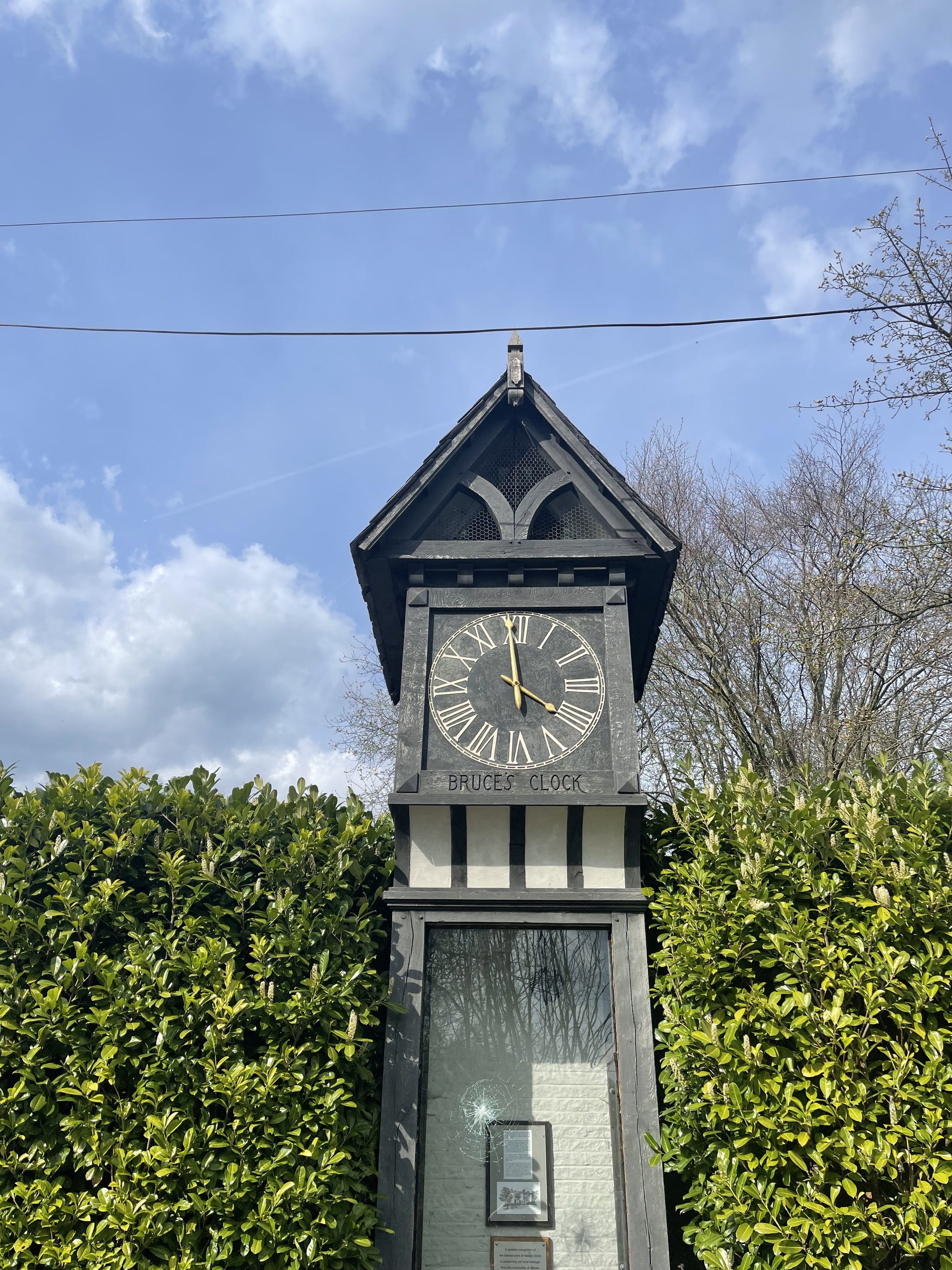
On the home stretch, the Goyt Way makes for a relaxing, flat stroll—taking you passed landmarks such as Bruce’s Clock in Strines. In medieval times, Strines stood as a large hunting forest—The Forest of the Peak—before local gentry settled here during the Elizabethan period.

Bruce’s Clock was originally found on the grounds surrounding Strines Hall, with the comings and goings of local people ordered by the striking of its bell in days when clocks and watches were rare household acquisitions.

After briefly meeting back up with The Roman Lakes footpath, you’ll finally reach The Peak Forest Canal to make the last stretch back to Marple.
The Waltzing Matilda sometimes moors here, so keep an eye out if you’re looking to refuel on woodfired pizza.


THE TRINNACLE: DOVE STONE LOOP
Fancy spending the weekend climbing Saddleworth’s most-snapped landmark? Then a scramble up The Trinnacle is a must…

Start: Binn Green Car Park, Oldham, OL3 7NN
Distance: 4.13 miles
Elevation: 950 feet
Duration: less than 2 hours
Navigation: follow along here

Fed up of the same old flat walking routes around the same old area?
Well, it turns out you don’t have to travel too far out of town to be transported to another world entirely…
Our route round Yeomen Hey Reservoir and up to The Trinnacle will have you feeling like you’re in a Canadian National Park, much less the outskirts of Ashton.

Located high on the hills of Saddleworth Moor, there stands a peculiar rock formation which has well and truly gripped the attention of ramblers far and wide.
Best known as ‘The Trinnacle’, this fork-shaped pillar juts out from the moorlands above Dovestone Reservoir and has attracted the attention of many keen photo opportunists as of late.

Made up of dazzling reservoirs, epic waterfalls, jaw-dropping scenery and steep inclines - alongside a couple of exhilirating scrambles along the river edge - this route really has it all.

Good-to-knows
Parking: Binn Green Car Park (RSPB). Please note, the spaces are limited and fill up quickly. We advise visiting off-peak where possible.
Public Transport: Catch the train to Greenfield Station. This extends the walk by about 50 mins each way.
Amenities: You’ll find an ice cream van and coffee truck at the base of Dove Stone Reservoir, with public toilets in the car park adjacent.
The Trinnacle: While this landmark certainly makes for a great photo opp, please only attempt scrambling if you are confident to do so. Make sure to take great care and only climb if the weather allows for it. The drop at the rear side is certainly no joke.
Fun fact: as we were climbing this one, a passerby shouted “I can’t watch! Make her get down!”, so make sure you have a head for heights whether you’re spectating or tackling it yourself.
Kit: Boots are ESSENTIAL for this one. The route is comprised of steep, slippery, boggy and rocky terrain. White trainer victims: be warned. (We certainly saw a few en-route!).
Take layers. It was a glorious day when we visited but remember where you are… layers are always a good idea.
Refreshments: Due to the idyllic Greenfield location, you’ll have your pick of pubs on this one. We recommend stopping off at The Roaches Lock, just a short drive away from the starting point.
Extending the route: Follow our extended 6 mile version here.
Fancy giving this one ago? Follow along here

WINTER HILL AND RIVINGTON PIKE CIRCULAR
Enjoy this short ascent up to two iconic Lancashire landmarks

Start: Rivington Hall Car Park, Bolton, BL6 7SD
Distance: 6.15 miles
Duration: 2-3 hours
Elevation: 1,300 feet
Navigation: follow our route here
This Lancashire walk takes you to two incredible viewpoints in one route. You begin your ascent up to Winter Hill via Rivington Country Park, taking you 1,496 feet high up to the summit.
While there are a variety of routes to choose from, our favourite is this 6 mile walk which takes in arguable the best views and scenery across Bolton, Wigan and the West Pennines Moors.
After a brisk hike from Rivington Pike you'll soon approach Winter Hill, which reaches an elevation of 1,496 feet. The views from here are nothing short of breathtaking, especially during the winter months when the landscape is adorned with a pristine layer of snow. The panoramic vista extends as far as the eye can see, with the city of Manchester on one side and the rolling hills of Lancashire on the other.

What is Winter Hill?
After reaching the almost dystopian summit of Winter Hill, you may be left thinking “what on earth is this place?”. I know we certainly were.
While the reality of Winter Hill is a little less glamorous than my imagination led me to believe, the transmitting station is a working broadcasting and telecommunications site and is responsible for bringing you all your favourite local TV channels.

Rivington
Just over the border between Greater Manchester and Lancashire, Rivington is a magical landscape where mysterious ruins are nestled between magnificent reservoirs, moor tops and woodland aplenty.
It’s a place that’s packed with wholesome things to do, whether that’s exploring Rivington Terraced Gardens or going on an aerial adventure at Go Ape. The area is so stunning it was even dubbed "the Little Lake District” by the Victorians.

good-to-knows
amenities
The pike snack shack
You’ll pass this quaint little coffee shop at the base of Rivington Pike, offering a selection of hot and cold beverages and snacks.
Location: Rivington Pike Cottage, Horwich, Bolton, BL6 6RU
The Tea Room at Rivington
For a delightful cup of tea and some light bites, visit "The Tea Room at Rivington," nestled in a picturesque spot near Rivington Hall Barn.
Location: Rivington Hall Barn, Rivington Lane, Rivington, Bolton, BL6 7SB
The Rivington PUB and grill
Before or after your hike, stop by "The Rivington," a charming pub near Rivington Pike known for its cosy atmosphere and hearty fare.
Location: Rivington Lane, Horwich, Bolton, BL6 7SB
GO APE
Located close to Bolton and only 30-minutes from Manchester, Go Ape Rivington features exhilarating 13-metre-high platforms, beautiful country views and a zip wire over the reservoir.
Location: Great House Barn, Rivington, Horwich, BL6 7SB
Parking Options
Rivington Pike Car Park
Location: Rivington Pike Car Park, Rivington Lane, Horwich, Bolton, BL6 7SB
Public Transport
If you prefer or require to travel via public transport, you can reach Rivington Pike and Winter Hill by bus or train:
Bus:
The 125 and 575 bus routes have stops near Rivington Pike.
Check the latest bus schedules and routes to plan your journey.
Train:
Take a train to Horwich Parkway station.
From there, you can catch a bus or even walk to Rivington Pike.

Fancy giving it a go? Follow our route here

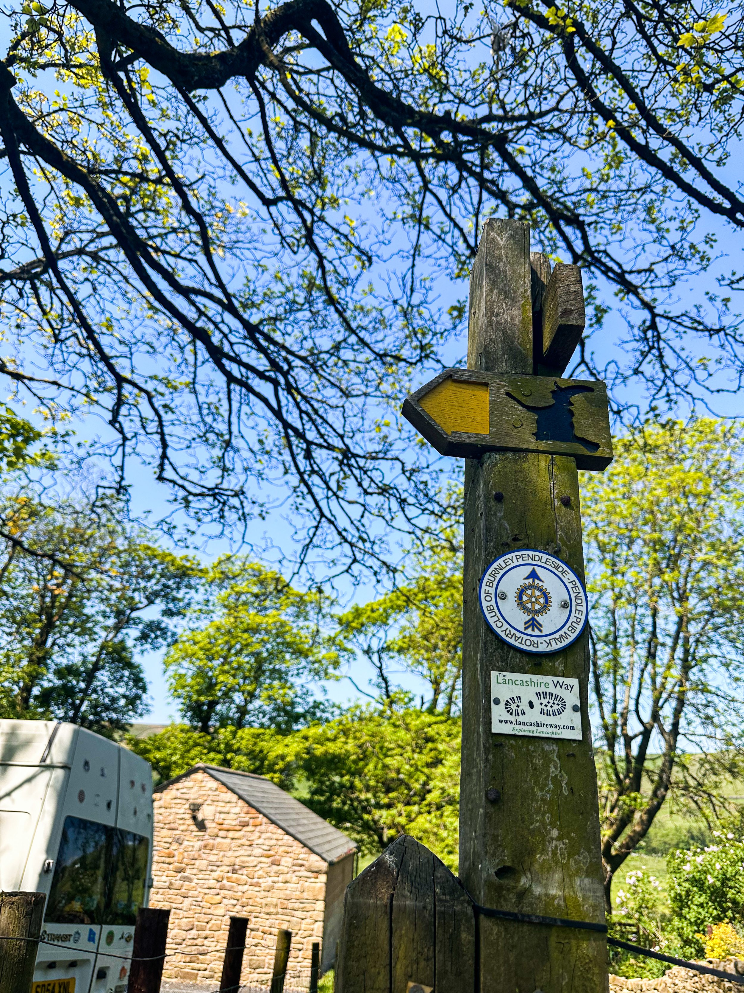
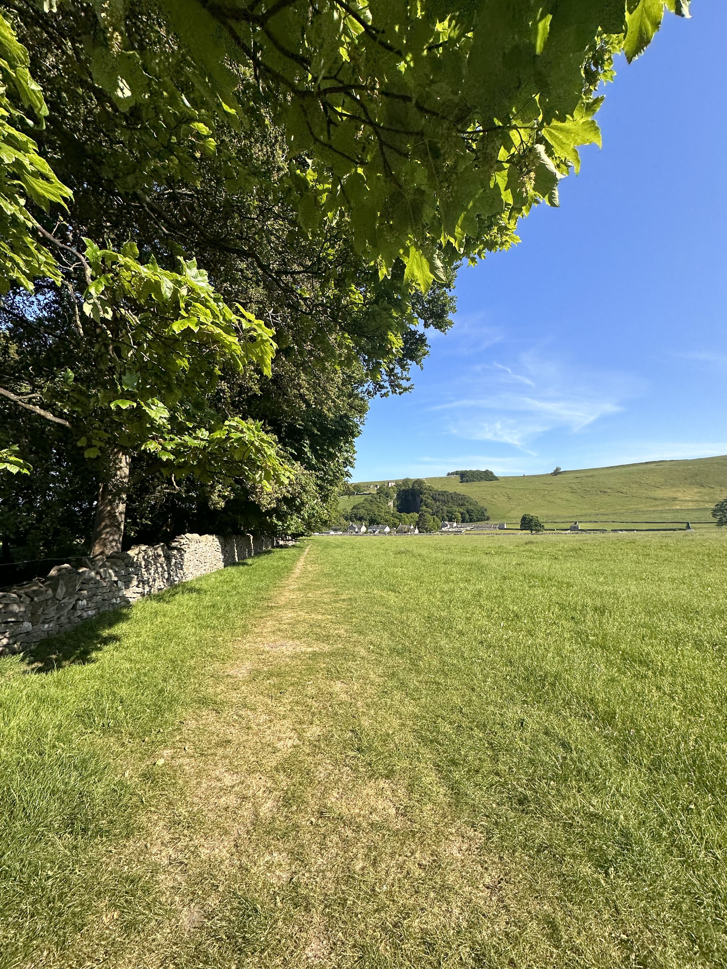
PENDLE HILL: A CHARMING WALK FROM WHEATLEY
Witch way to Pendle? Take our enchanting route up to Pendle Hill and walk where witches once roamed…
Start: Wheatley Lane, Lancashire (we parked in a roadside bay)
Distance: 6.73 miles
Elevation: 1,600 feet
Duration: approx. 3 hours
Navigation: follow our route here

Lancashire is full of beautiful walks but one of our favourites is this route that takes you up to Pendle Hill. Located in a small village called Barley, you could easily spend the day learning about it’s history and venturing up the hill to see the beautiful surroundings.
Pendle Hill is one of the area’s most impressive landmarks – you can see it for miles. It looks steep, and while it will have you huffing and puffing a little, the effort is 100% worth it! Known for its eerie history and ties to the infamous Pendle Witches, this trail promises a bewitching adventure, alongside some proper pub grub to ground you back to earth on your descent.
Ready to delve into the spooky legends, hike through hauntingly beautiful landscapes, and uncover the dark secrets that shroud this mystical destination?
Let’s dive in…

As you ascend from Wheatley Lane, the landscape transforms into the mesmerizing Forest of Bowland. This Area of Outstanding Natural Beauty offers a myriad of trails to explore, each revealing its own unique treasures. Stroll through ancient woodlands, breathe in the fresh scent of pine trees, and keep an eye out for native wildlife that calls this area home.
Pendle Hill
Pendle Hill is famous for a number of reasons. Not only is it an isolated extension of the Forest of Bowland Area of Outstanding Natural Beauty and amazing pendle walks, but it gained notoriety in the 17th century because of a group of witches that became infamous across the country. The Pendle witches, who were tried in nearby Lancaster, were part of the wider English witch trials which saw 500 people executed between the 15th and 18th centuries. The Pendle witches were so infamous in part because they made up a full ten of these executions. It’s believed that many were the cause of two feuding families, combined with a number involved actually believing their guilt.
Their legacy has remained throughout the area. The Pendle Hill is now known both for its beauty and its links to witchcraft. The area has two walks of note that take in both aspects of this, the Pendle Hill walk from Barley and the Pendle Hill witches walk.

This mysterious brooding landmark will forever be associated with the Pendle Witches, but the hill was also the subject of religious inspiration. In 1652 George Fox climbed Pendle Hill and had a vision on the hill which inspired him to found the Quaker movement. Its summit, known as "The Big End," is the site of a Bronze Age burial mound.
And at just 51 metres short of being considered a mountain, you can certainly get your cardio in on this route. In fact, Pendle Hill is the highest point in the Ribble Valley. Measuring 557 metres, the hill boasts spectacular views over the Lancashire countryside and across to Yorkshire. You can even see as far as Wales on a clear day! From the summit, take in the panoramic views that stretch across Lancashire, rewarding you for your efforts.
Points of interest:
The Cauldron: A Charming Pop-up Tea Room

Descend from Pendle Hill and follow the trail until you reach the delightful pop-up tea room known as The Cauldron. Nestled amidst the natural beauty of the countryside, this hidden gem offers a perfect spot to relax and refuel. Sip on a steaming cup of tea, indulge in homemade treats, and immerse yourself in the tranquil ambiance before continuing your journey.
Barley: Pubs, Pints, and Perfection
Finally, our walk leads us to the charming village of Barley, where good food and drink await. While you’re spoilt for choice with ‘proper’ pubs in this area, our favourite is The Barley Mow. This traditional pub serves up a delectable array of dishes, but their salt and pepper chips are a true highlight.
Options to extend the route:

Pendle Hill is a highlight of the 45-mile Pendle Way – a circular walk which passes through the stunning Lancashire countryside, passing waterfalls, ancient churches and adorable villages. It’s also a feature of the 43-mile Bronte Way – another popular route which takes in lots of famous spots from the Brontë family’s life. So if you’re looking for a long distance trail to complete over a few days, this is a great spot to do it.

Fancy walking where witches once roamed? Follow our route here

WINNATS PASS AND ODIN MINE WALK
One of the best Peak District walks just a short drive from Manchester

Start: Castleton Visitor Centre, S33 8WN
Distance: 5.02 miles
Elevation: 900 feet
Duration: allow approx. 2 hours
Navigation: follow the route here

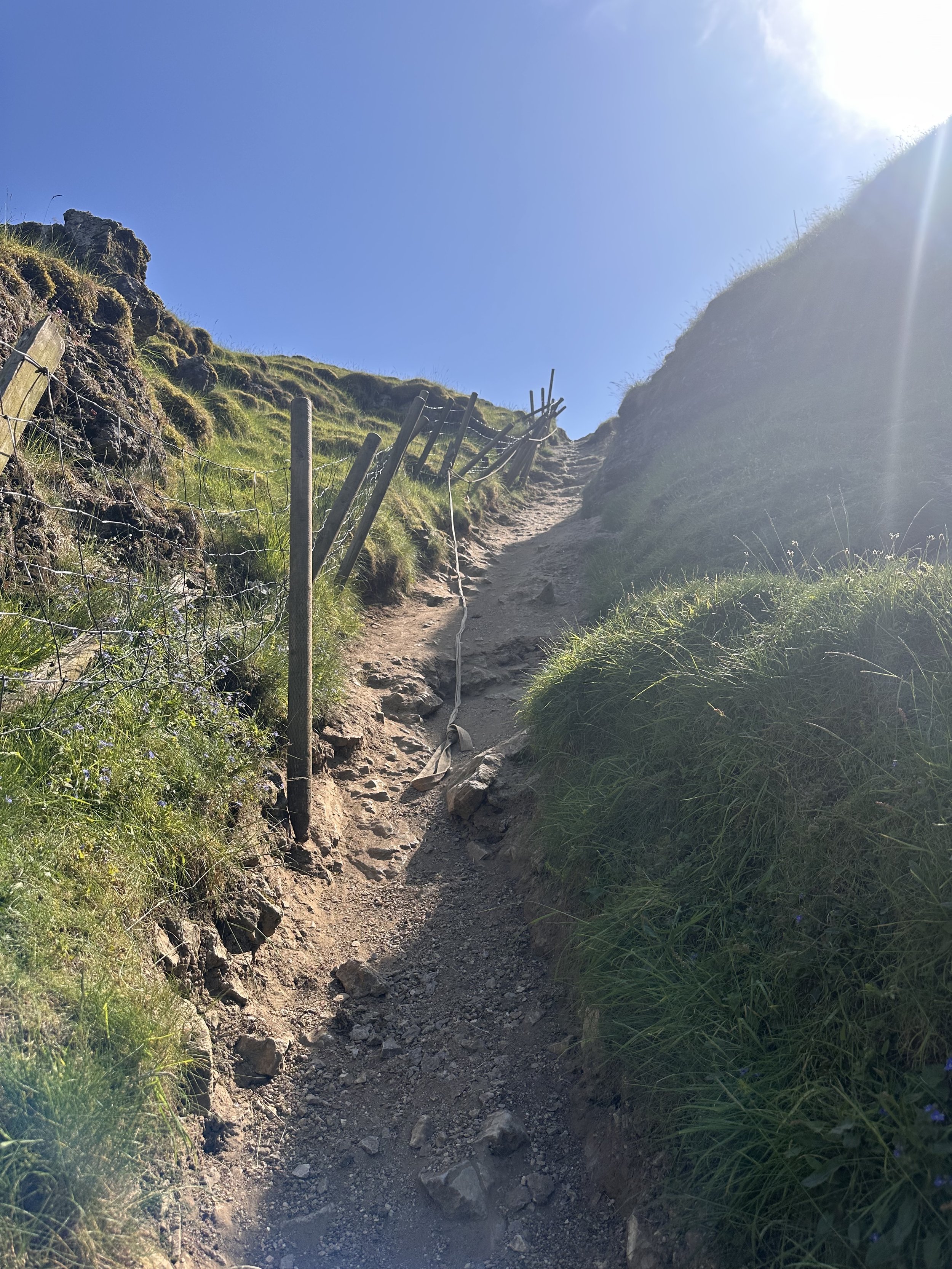
This walk takes you high above Winnats Pass and around Castleton, meaning you can take in this amazing Peak District village from all angles. The start of the route leans towards the challenging side, taking you up a steep and rocky path straight up to Winnats Pass, so consider if this one’s for you before heading out.

The first ascent is steep with scrambling required. Thankfully, a kind soul has left a climbers rope tied to a gate post which gives you all the leverage you need. We’ve been meaning to give this one a go for a while, and it didn’t disappoint.
The route starts near Castleton Visitor Centre where you’ll find a shop, cafe and toilets… among a gorgeous array of nearby pubs, eateries and cafes.
The car park is pay and display, but there’s street parking available nearby (be aware these fill up quickly during peak hours, so we recommend getting down early).

Once atop Winnats Pass, you’ll follow a trail that leads close to the boundary wall and takes you along the top of the pass. Be sure to stop and take in the views on this part of the walk, we were blown away watching the tiny cars winding their way through the Way.
From here, you’ll head along a footpath in the direction of Mam Tor, before taking a detour to Odin Mine: a disused mine thought to be in use since around 1260. The landscape surrounding makes for great exploring, leading you to the collapsed road constructed beneath Mam Tor.

Once you reach Treak Cliff Cavern, look out for signs that tell you about the history of the area. Winnats Pass and the surrounding environment was once under a tropical sea, making the site protected by law due to the many fossils of sea creatures which lived here over 350 million years ago.
The valley was created by melting glaciers which gradually dissolved, creating streams which flowed through and under cracks in the rock. One of these streams created a large underground cave system which eventually collapsed, leaving Winnats Pass you see today!

With so much to see in such a short walk, this is undoubtedly one of our favourite walks when visiting Derbyshire.
Fancy giving it a go? Follow the walk here

GIDDY EDGE WALK
Walk on the wild side along Matlock’s ‘Giddy Egde’

Take on a whirlwind adventure through the heart-stopping heights of Giddy Edge on High Tor in Matlock, while also indulging in the romance of Lover's Walk in Matlock Bath. Prepare to have your adrenaline pumping and your heartstrings tugged as we explore these two enchanting highlights in one route.

Start: Matlock Town Centre, DE4
Distance: 5.41 miles
Duration: 2.5 hours
Elevation: 1,175 feet
Navigation: follow the route here

Giddy Edge, High Tor

Giddy Edge… the name alone sends shivers down your spine! This exhilarating path is not for the faint of heart, but for the adventurous souls seeking an adrenaline rush — this one’s for you. As you walk along the narrow cliff edge, take in the awe-inspiring panoramic views of the Derbyshire Dales and don't forget to capture those Instagram-worthy moments!
Along the way, keep an eye out for the famed rock formations, including the legendary "Cromford Tooth." Rumor has it that touching it brings good luck, but be cautious, for superstitions and precipices don't always mix well!
Lover's Walk, Matlock Bath

Now that you've conquered Giddy Edge, it's time to shift gears and embrace the romantic ambiance of Lover's Walk in Matlock Bath. This picturesque riverside path, flanked by lush greenery, is perfect for lovebirds or anyone seeking a moment of tranquility. The charming Victorian-style lampposts transport you back in time… but if you’re after a post hike snack, the nearby Greggs should bring you back to 2023 in no time.
Attractions not to miss during your visit:
Heights of Abraham
After your adrenaline-fuelled adventure along Giddy Edge, make your way to the Heights of Abraham. This unique hilltop park offers cable car rides that will sweep you up into the clouds, providing breathtaking views of the surrounding countryside. It's a perfect opportunity to catch your breath and marvel at the beauty of Matlock below.
Matlock Bath Aquarium
For those fascinated by marine life, a visit to the Matlock Bath Aquarium is a must. Immerse yourself in the captivating world beneath the waves and explore an array of exotic species. From vibrant tropical fish to mesmerizing jellyfish, this aquatic adventure will leave you in awe.
The Fishpond Pub
Walking can make even the hardiest adventurer thirsty, so be sure to stop by The Fishpond Pub. Nestled in the heart of Matlock Bath, this charming establishment serves up a delightful selection of local ales, craft beers, and refreshing beverages. Unwind in their cosy beer garden or warm up by the crackling fireplace on colder days. Cheers to a well-deserved break!

Ready to brave Giddy Egde? Follow the route here
YEOMEN HEY - DOVE STONE LOOP
Discover the best walking routes around Dovestones - a hiker’s guide to the lesser-known trails
Start: Greenfield, OL3 7DD
Distance: 7.33 miles
Elevation: 1,000 feet
Duration: 3-4 hours
Navigation: follow along here
Fed up of the same old walking routes that offer nothing more than a flat path and an average view?
Well, how about getting the best of both?
Our route around Dove Stone Reservoir to Yeomen Hey Reservoir route is not only beautifully flat to begin with but offers a bit of a challenge towards the end, too.
Starting in Greenfield, the route begins with a gentle stroll up to the banks of the reservoir — a great way to warm up before the climb begins.
After about a mile or so around the reservoir, you'll come across a steep climb that leads up to the Yeomen Hey Reservoir. The climb is only short, with most of the ascent accruing in one stint — but the views from the top are more than worth it. From here, you'll be rewarded with insane views, with rolling hills as far as the eye can see.
The path continues along the edge of the Yeomen Hey Reservoir, and it's here that you'll start to hear the sound of rushing water. That's because you're approaching the waterfalls. These waterfalls are a series of cascades that run down the hillside, and they're truly beautiful.
To ascend towards the waterfalls you'll need to do a bit of scrambling. It's not too difficult, but it's worth noting that it can be a bit slippery and caution is required. We recommend climbing up our way and then down the waterfall, but the route can be reversed if you prefer. Just be careful and take your time — and hiking boots are definitely needed for this.
Once you've reached the bottom, take a moment to catch your breath and enjoy the view. You'll see the water cascading down the rocks, creating a natural pool at the bottom. It's a perfect spot for a quick dip if you're feeling brave.
From here, the route continues along the top of the hillside, offering panoramic views of the surrounding countryside. You'll eventually come to the Yeomen Hey Reservoir, where you can take a break and enjoy a picnic by the water's edge.
After your rest, it's time to head back around Dovestones and on to greenfield. The route back is a bit easier, with a gentle descent down the hillside. Take your time and enjoy the view – you'll see the reservoir in a whole new light on the way back.
And better yet, once you’re near the starting point, a pint will be waiting for you at The Clarence in Greenfield.
Enjoy!

ETHEROW TO WERNETH LOOP
Discover Greater Manchester’s best hidden gems on this multiple-country park woodland walk

Start: Etherow Country Park, SK6 5DJ
Distance: 9 miles
Duration: 4 hours
Elevation: 1,500 feet
Navigation: follow the route here

Fancy experiencing all the seasons in one day?
Well, you're in luck, because this walk from Etherow Country Park to Werneth Low Country Park and confused mid-winter weather is what Great Manchester does best.
But don’t worry, with stunning scenery throughout and a dash of history thrown in for good measure, this walk is guaranteed to be a crowd-pleaser.

Our journey begins at Etherow Country Park — one of Britain’s first country parks. With 240 acres of greenspace, this place has an abundance of wildlife… and a waterfall you don’t want to miss!
But don't get too distracted by the fauna, because we've got a hill to climb. Yup, after a short stroll around the Keg Pool its time to climb up to Werneth Low Country Park.
Along the way, take a moment to catch your breath and admire the stunning panoramic view. Once atop The ‘Low, you’ll be quickly rewarded with immense views all across Manchester, the Peak District National Park, and the Cheshire Plain.

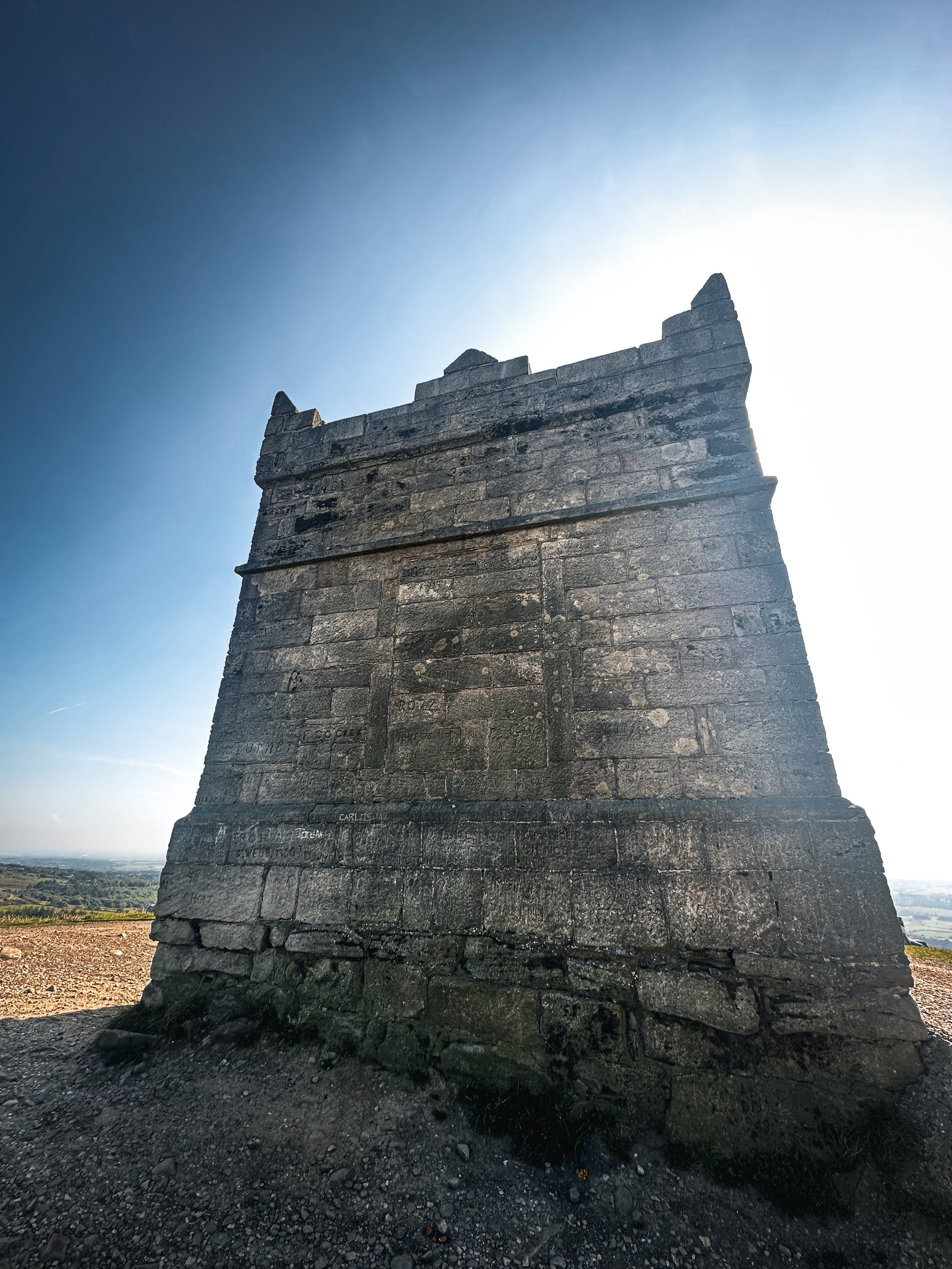
History buffs, we've got a couple of landmarks for you to check out. The first is the Werneth Low War Memorial, which was erected in 1921 to honor the soldiers who died in the First World War. It's a stunning monument, made of granite and topped with a bronze figure of a soldier.
After resting your legs and taking in the views, we make our way through the woodlands around Charlesworth and Broadbottom — each nothing short of idyllic. The trees are tall and imposing, the paths are winding and mysterious, and the wildlife is abundant. And if you’re up for a detour, the other landmark to check out is the Broadbottom Viaduct, which spans the valley between Broadbottom and Mottram.

Now, I know what you're thinking: a viaduct doesn't exactly sound like the most thrilling pit stop in the world. But trust me, this one is a real beauty. It was built in 1842, it's made of brick, and it has 27 arches. If you're an aspiring artist or photographer, this is the perfect spot to flex your creative muscles.
So, there we have it: a string of local country parks in one gorgeous route.
As local routes go, this one is a true belter.

Ready to follow along? Follow the route here

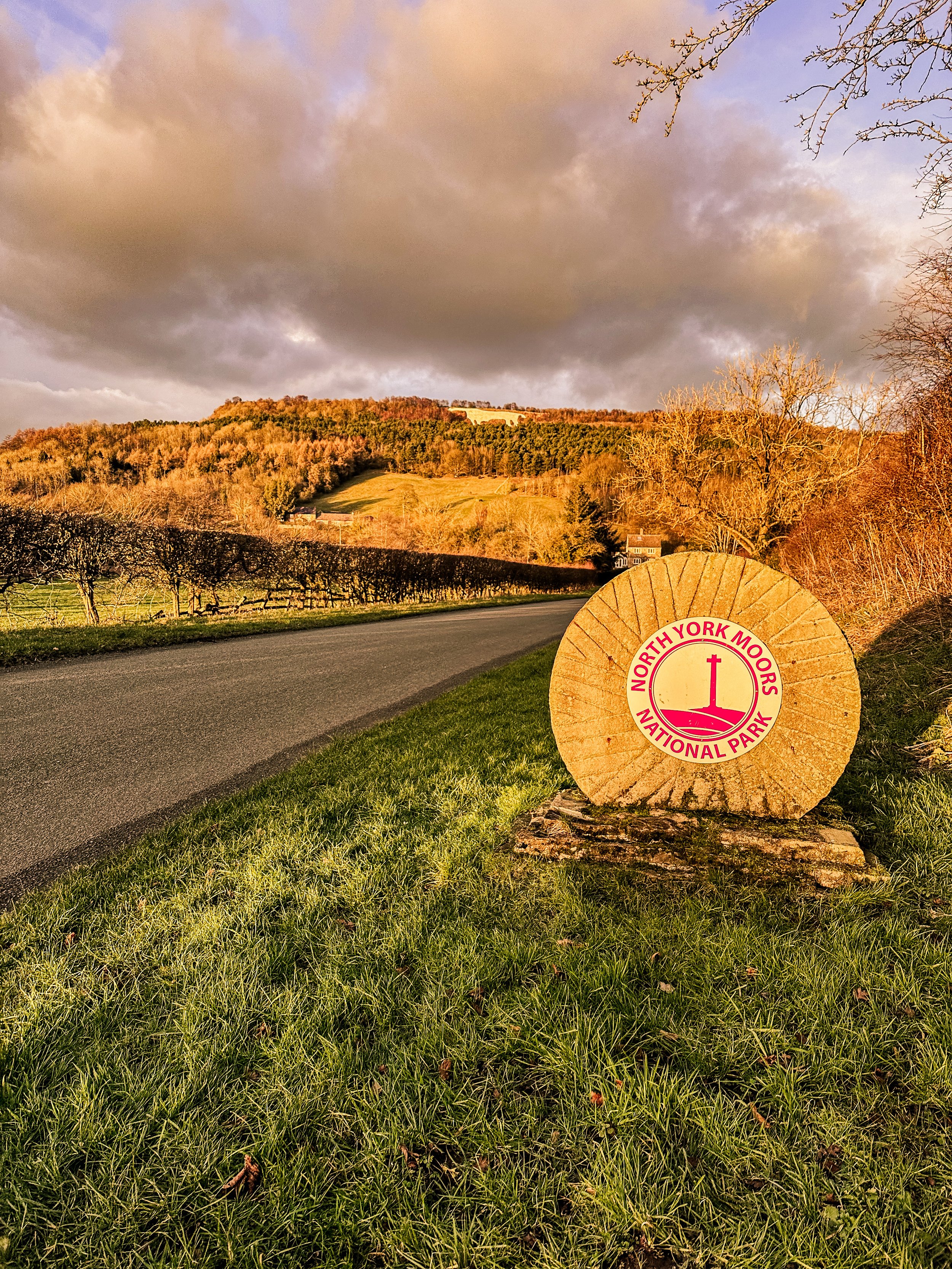
BEST WALKS NORTH YORKSHIRE: KILBURN WHITE HORSE
If you’re after a walk that has it all - from hidden lakes to cosy pubs - this route in North York Moors won’t disappoint
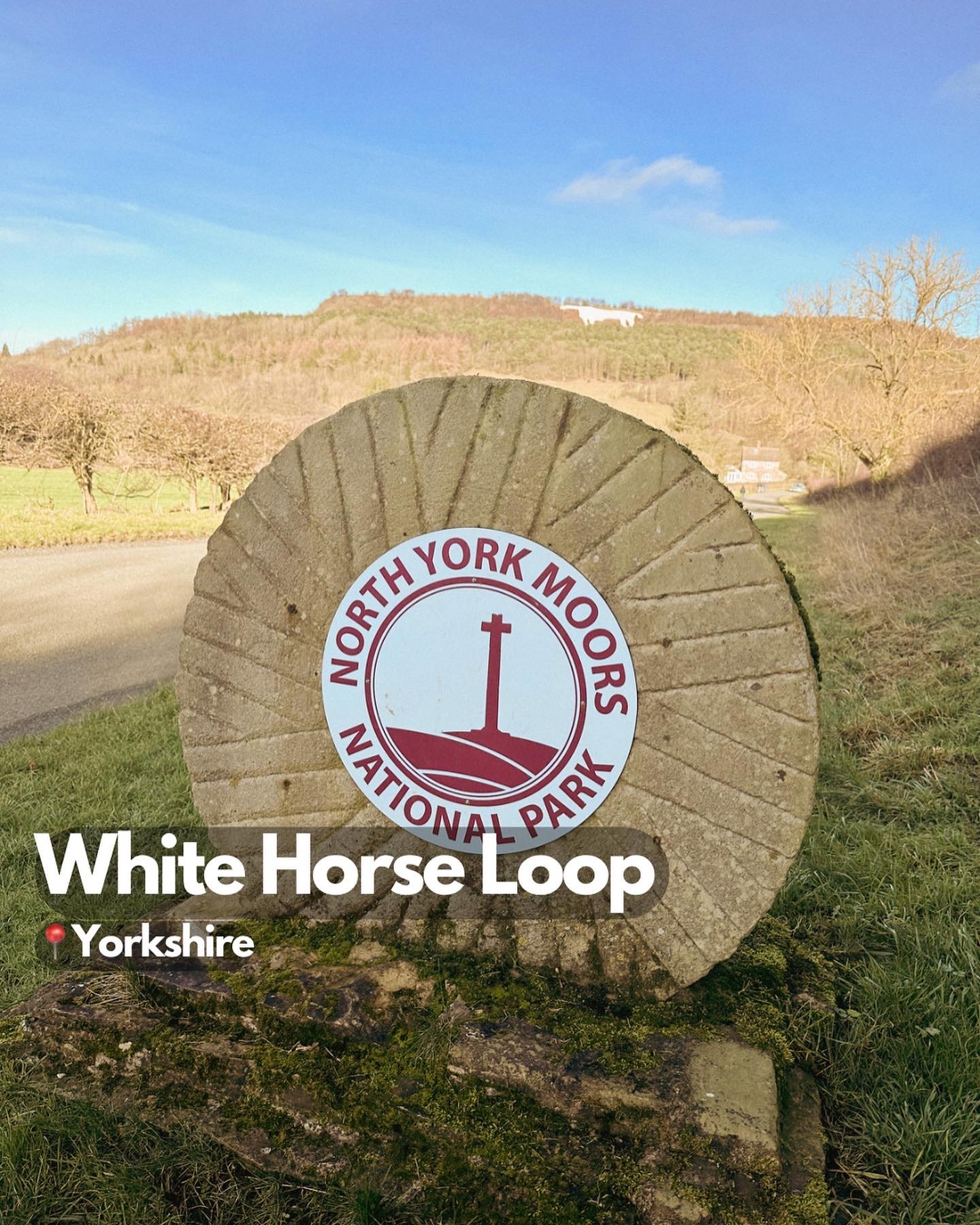
Start: Kilburn, YO61 4AH
Distance: 6 miles
Elevation: 875 feet
Duration: 2-3 hours
Navigation: Follow the route here
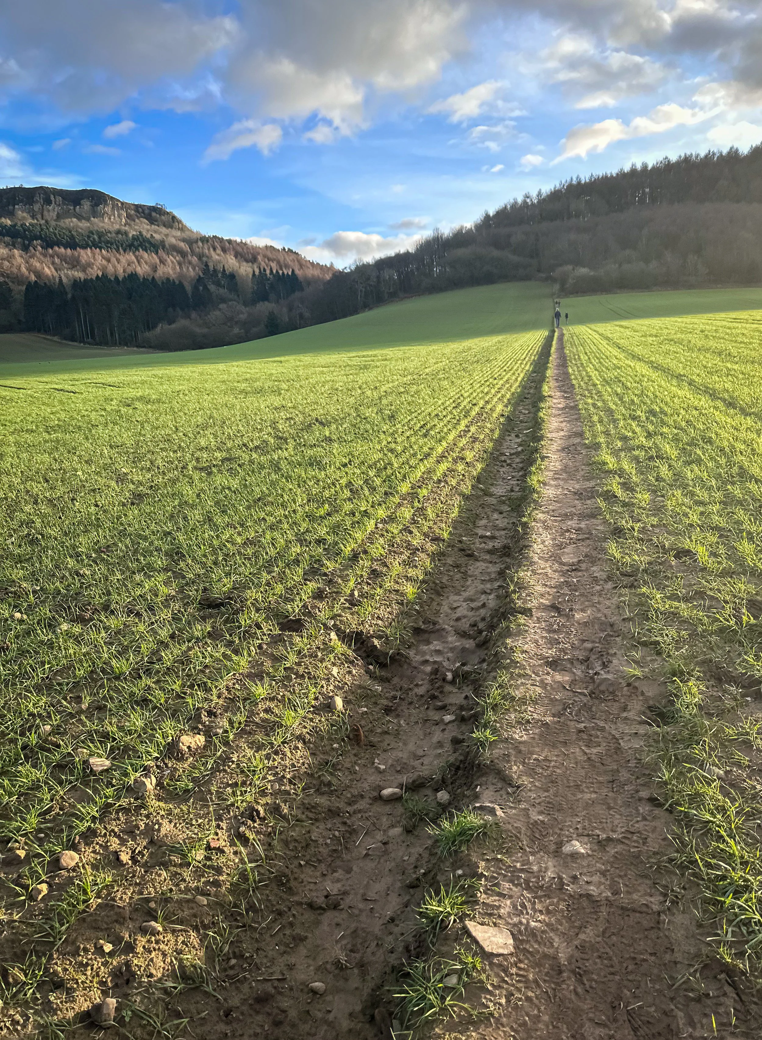
Tired of the same old boring treadmill walks? Want to spice up your exercise routine and take in some breathtaking views at the same time? Look no further than the North York Moors. The North York Moors is a beautiful and diverse area of natural beauty — making for a great base to explore the stunning landscapes, charming villages, and rich history of the region.
Walking in the North York Moors is like taking a step back in time. The rolling hills, lush green countryside, and charming villages will transport you to a simpler, more peaceful era. But don't let the idyllic scenery fool you, this area is also home to some serious natural beauty.
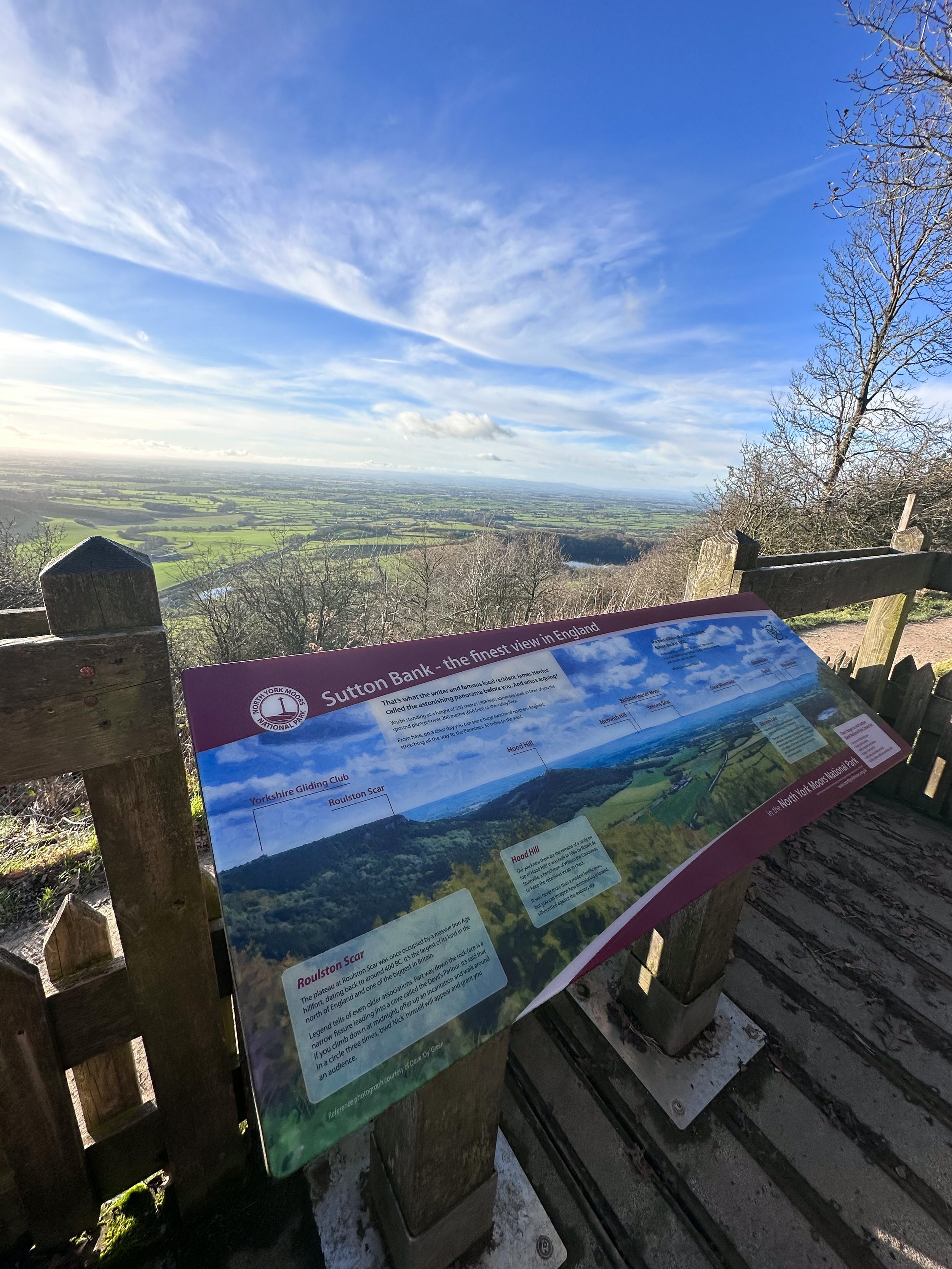
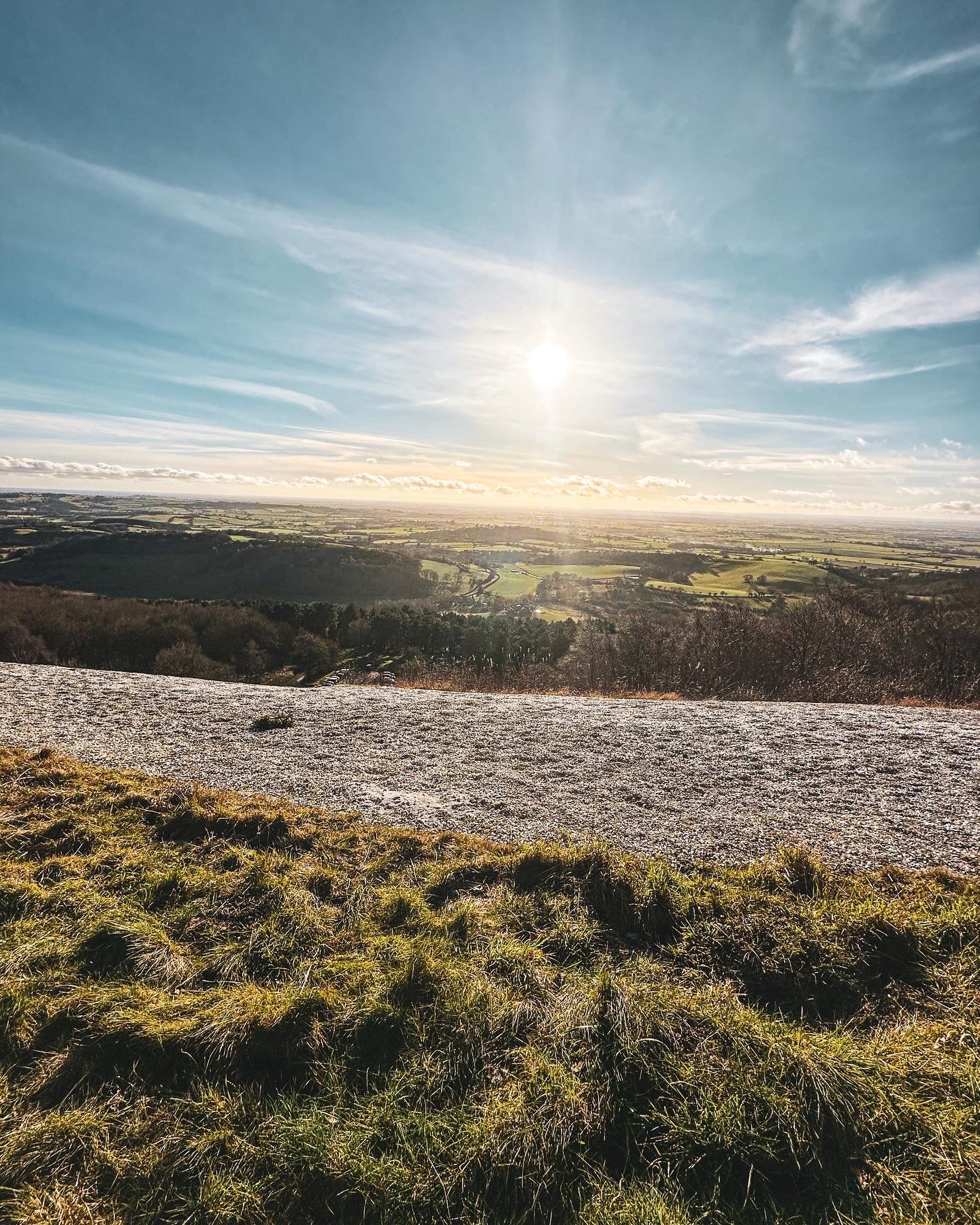
One of the must-see landmarks on a walk in the North York Moors is the Kilburn White Horse. This impressive hill figure, carved into the side of a hill, is believed to have been created in the 18th century and is a true marvel to behold. The best part? You can burn some calories and work those leg muscles while hiking up to get a closer look.
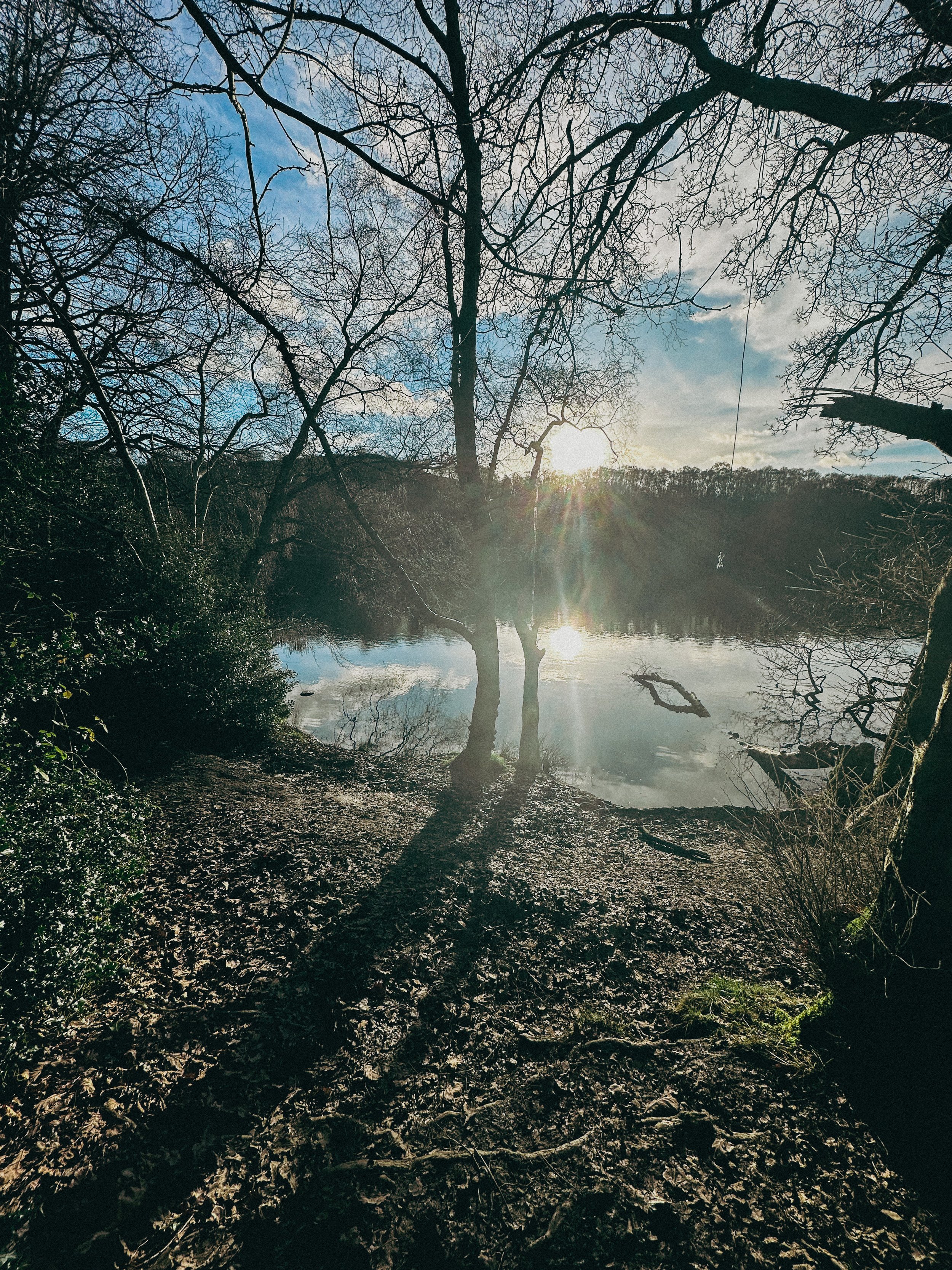
After you've had your fill of the Kilburn White Horse, head over to Gormire Lake for a more serene walking experience. This beautiful lake is surrounded by woods and heathland, and is a Site of Special Scientific Interest (SSSI) due to the diverse range of plants and animals that call it home. Plus, the flat footpaths make it a great option for those who aren't quite ready for a mountain hike… as long as you start at the white horse, that is. Our route starts just below and features a steady (and breathy) climb up to the start.
The origins of the Kilburn White Horse are shrouded in mystery, but it is believed to have been created in the 18th century. Some historians believe that it was created by a local farmer as a tribute to King George III, who was the reigning monarch at the time. Others believe that it was created by a group of local residents as a way to promote the area and attract tourists.
Over the years, the Kilburn White Horse has undergone several renovations and repairs. In 1857, a group of local residents formed the Kilburn White Horse Preservation Society, which was responsible for maintaining the horse and ensuring that it remained visible to the public. In the early 20th century, the horse was re-cut and re-chalked to ensure that it remained visible.
Today, the Kilburn White Horse is a popular destination for walkers and visitors to the North York Moors. It's a fascinating piece of history, and a testament to the enduring popularity of this ancient art form. The horse stands as a symbol of the area's rich history and culture, and a reminder of the importance of preserving our cultural heritage.
So next time you're considering a stroll up in’t the North York Moors, make sure to stop by the Kilburn White Horse and take a closer look. Not only is it a great workout for the ol’ legs, but a novel way to experience a piece of history that’s stood the test of time.
From the Gormire Lake to cosy country pub The Forresters Arms, the North York Moors is the perfect destination for nature lovers and pub dwellers alike. So scribble that gym sesh out your diary and head to the North York Moors for a walk you'll never forget. Trust me, your legs (and your Instagram feed) will thank you.
Ready to get going? Follow the route here

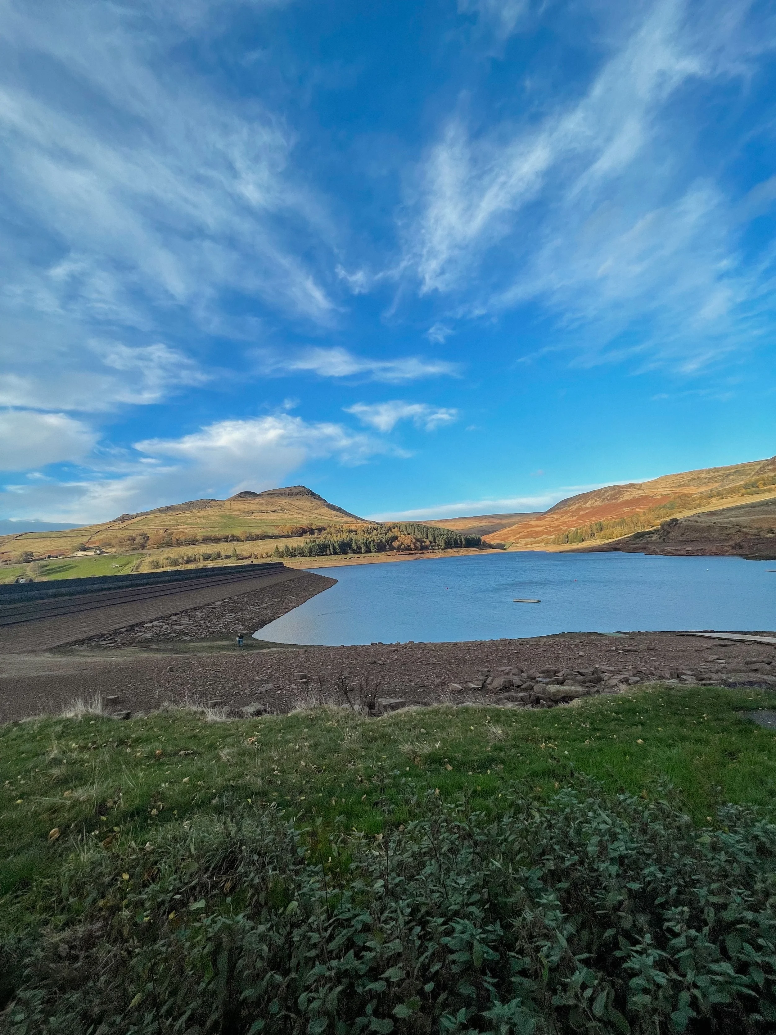
BEST LONG HIKES NEAR MANCHESTER: DOVESTONE RESERVOIR
This popular Dovestone Reservoir walk is a local favourite for a reason. We prefer visiting at Autumn, but it’s a perfect all-weather!
(Although do make sure you wrap up, it gets chilly up those in those hills)

Start: Greenfield, OL3 7DD
Distance: 7.79 miles
Duration: 2-3 hours
Elevation: 1,225 feet
Navigation: follow the route here

Dovestone Reservoir has become increasingly popular in recent years and can get quite crowded. Fortunately, routes like this one exist: taking you on the outskirts of the popular landmark for an even better view of the area, instead.
Our walk takes you along the edge of the moor to the south of the reservoir for a more secluded walk. Upon reaching Alphin Pike, you’ll enjoy an incredible vista over West Manchester and even as far as Wales, before heading over to Wimberry Rocks for a great view down onto the reservoir and surrounding valley.

Better yet, our walk has an alternative starting point to the main car park, so you won’t be left fighting over a space during those busy periods. Ticketing is rife in this area so please do park responsibly.
En route, expect lush greenery, incredible views and a variety of wildlife every way you turn. As a genuine haven not far out of the city centre, it’s no surprise this place is so popular.

Soon after passing Wimberry Rocks, you’ll be greeted with views of Pots n Pans and another reservoir of your very own: Chew Reservoir.
Fancy heading there soon? Follow our route here

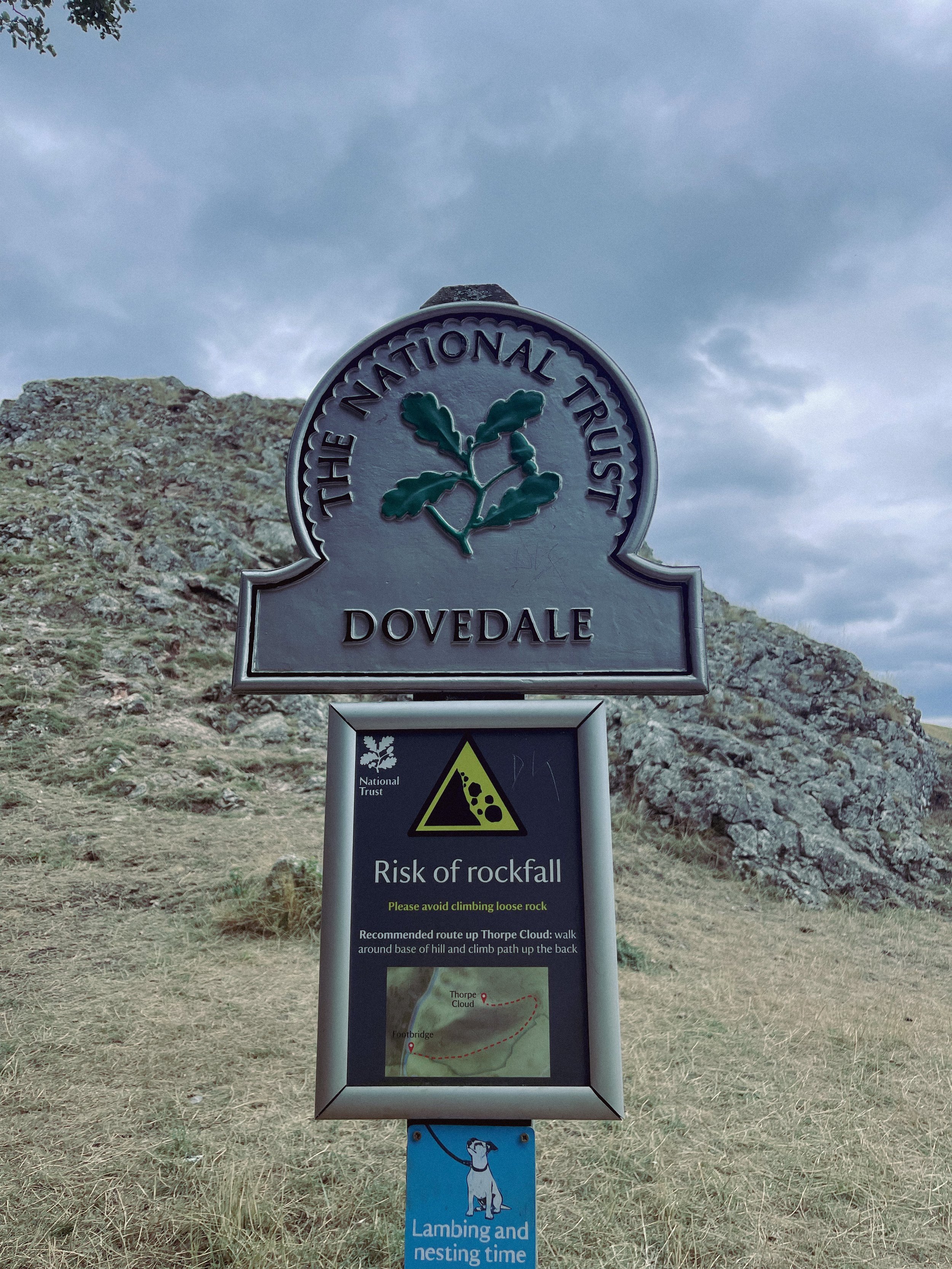
THORPE CLOUD
Gothic manors… idyllic tearooms… and a trig point to boot — this walk in Ashbourne has it all

Start: Blore Pastures Carpark, DE6 2BS
Distance: 5.49 miles
Duration: 2.5 hours
Elevation: 1,000 feet
Navigation: follow the route here

Whether you’re here for the stepping stones across the River Manifold, or fancy indulging in the history of this quaint town’s old manor house, a day trip to Ilam Park is always a good idea.
After a meander around Ilam Hall, our route takes you up Thorpe Cloud as you summit the hill for breathtaking views across the dale, and return home via the stepping stones across the River Dove.

Thorpe Cloud is found in the White Peaks on the southern end of Dovedale — a gorgeous limestone hill that attracts thousands of visitors each year thanks to its unique shape and close proximity to Dovedale Stepping Stones.
The route up to the summit is easy-to-follow, navigated by blue markers on signposts. With some steep parts that’re a good challenge for beginners, the walk is short and sweet with plenty of options to extend if you’re feeling particularly energetic.
The Stepping Stones are a very popular Peak District attraction, so if you’re wanting to explore free from pedestrian traffic, we’d definitely recommend visiting off-peak if that’s an option for you.
That said, they’re a must-do Peak activity… and well worth the visit!

Grab yer hiking boots and follow one of our favourite Peak District walks here

LANTERN PIKE
A stunning stroll around Hayfield’s lesser populated countryside

Start: Sett Valley Trail Car Park, SK22 2JG
Distance: 7.63 miles
Elevation: 1,150 feet
Duration: 3.5 hours
Navigation: follow the route here

If you’re an avid hiker, we’re sure you’re no stranger to the Peak District ‘big one’, Kinder Scout. But have you ever traversed this village’s lesser known trails?
Starting on the Sett Valley Trail. this walk leads you up to the fallen trig point at Lantern Pike, finishing off at one of our favourite country pubs this side of the Pennines, The Little Mill.

As far as trig point routes go, this is a scenic one for sure. The start of the walk takes you along Birch Vale Reservoir along a tree-lined path that’s a haven for wildlife.
From here, you journey onwards to a short climb up towards the Pennine Bridleway where the lane narrows into a stony path just before the base of Lantern Pike. Once you’ve reached this point, it’s smooth sailing up to the rig point atop the summit.
And as for the views when you’ve reached the trig? You’ll instantly forget about the slog up to the summit — rewarded with insane, far-reaching views as far as the eye can see. Expect a patchwork of fields, heather moorland and the magnificence of towering neighbour, Kinder Scout.

Don’t fancy giving the trig challenge? Fear not, The Sett Valley Trail itself makes for an incredible Sunday Stroll with 2.5 miles of traffic-free scenery perfect for walkers and cyclists alike.
The trail follows a former railway line through the beauty of Derbyshire’s countryside, taking you along the Pennine Bridleway between Hayfield and Birch Vale.

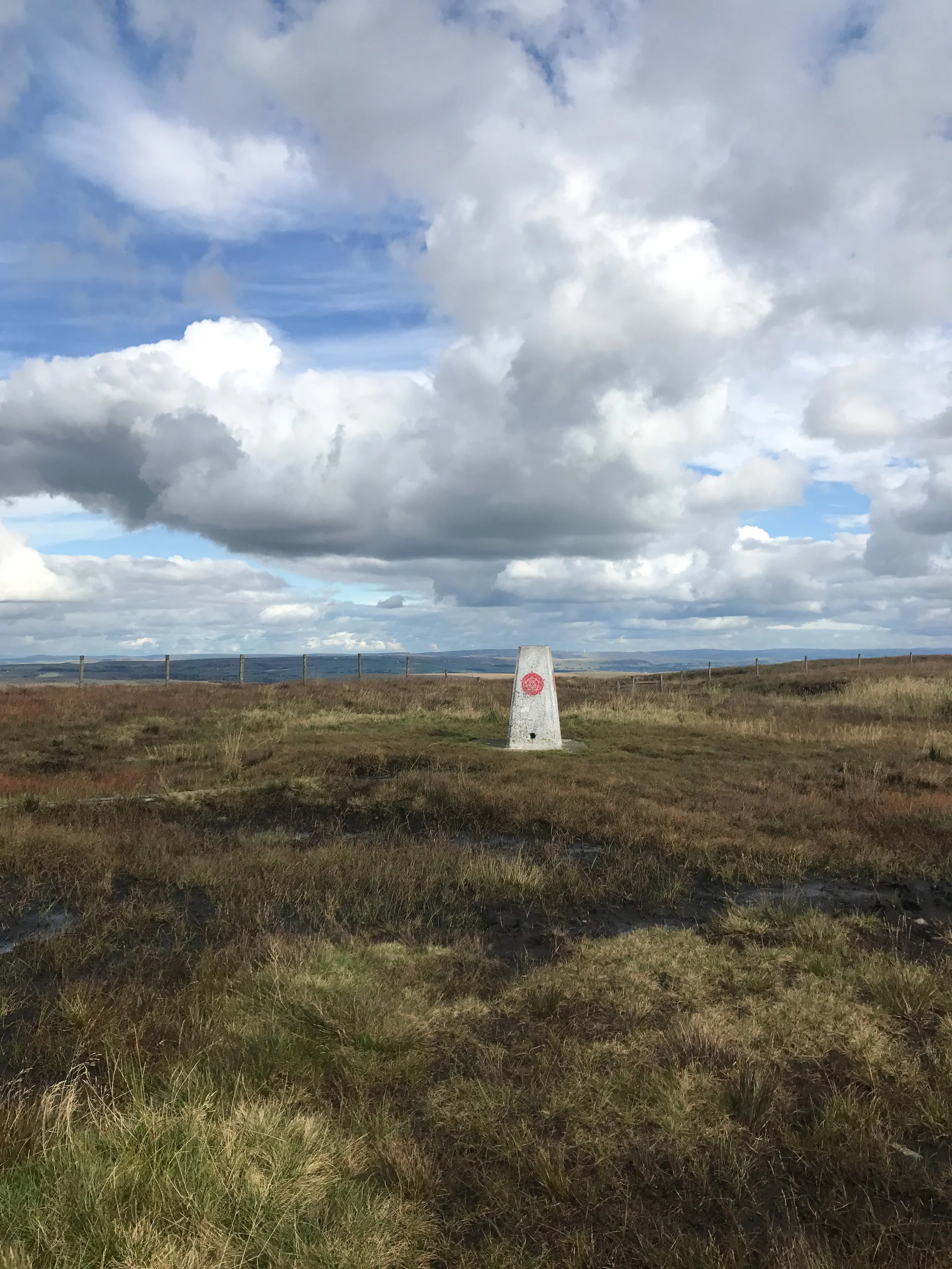
And if you’re after ticking off a few trigs in one day, why not extend the walk to include nearby Harry Hut and Burnt Hill?
Or if you fancy following our shorter route, give it a go here!
KERRIDGE HILL LOOP
Discover the beauty of Cheshire from up above with one of the best walks near Greater Manchester
Start: Pool Bank Car Park (Free Parking), SK10 5PS
Distance: 6.88 miles
Duration: 2-3 hours
Elevation: 1,000 feet
Navigation: follow the route here
Looking for a bit of history on your next trip outdoors? Look no further than this uphill hike around the Cheshire countryside. Not only does this walk provide excellent views that sweep right across the surrounding area, but you’ll also pass White Nancy fairly early on — a memorial site atop Kerridge Hill, built to commemorate the victory of coalition forces at the Battle of Waterloo.
With its comically shaped physique, White Nancy isn’t your typical historical landmark. Thanks to its lofty position, the site White Nancy sits on had been used as a warning beacon of invasion for centuries, featuring other small structures before Nancy took up residence.
In 1817, the Gaskell family of Ingersley Hall built the structure you see today, in belated commemoration of the victory at Waterloo, 1815. Originally, White Nancy had a door and was used as a summerhouse, but was soon sealed off due to vandalism over the early 20th century.
Whether you’re here for the views or the stories of yesteryear, you’re sure to be taken aback by the undisturbed peacefulness of this route. On a clear day, you can see as far as Snowdonia, Liverpool’s coastal line and the windmills off the Wirral peninsula.
After admiring the views surrounding White Nancy, walking across Kerridge Hill is a must. The route’s quite steep in parts — but the views? So worth it.
So if you’re after a walk that offers incredible views every way you turn, make sure you stop by and see our Nancy soon. With multiple footpaths, woods and fields to explore nearby, you can easily extend this route into a full date out.
Fancy stopping by to see Nancy soon? Follow the route here
WINNATS PASS
One of the best Peak District walks just a short drive from Manchester if impressive views and steep climbs are your thing!
Start: Castleton Visitor Centre, S33 8WN
Distance: 5.02 miles
Elevation: 900 feet
Duration: allow approx. 2 hours
Navigation: follow the route here

This walk takes you high above Winnats Pass and around Castleton, meaning you can take in this amazing Peak District village from all angles. The start of the route leans towards the challenging side, taking you up a steep and rocky path straight up to Winnats Pass, so consider if this one’s for you before heading out.

The first ascent is steep with scrambling required. Thankfully, a kind soul has left a climbers rope tied to a gate post which gives you all the leverage you need. We’ve been meaning to give this one a go for a while, and it didn’t disappoint.

The route starts near Castleton Visitor Centre where you’ll find a shop, cafe and toilets… among a gorgeous array of nearby pubs, eateries and cafes.
The car park is pay and display, but there’s street parking available nearby (be aware these fill up quickly during peak hours, so we recommend getting down early).

Once atop Winnats Pass, you’ll follow a trail that leads close to the boundary wall and takes you along the top of the pass. Be sure to stop and take in the views on this part of the walk, we were blown away watching the tiny cars winding their way through the Way.
From here, you’ll head along a footpath in the direction of Mam Tor, before taking a detour to Odin Mine: a disused mine thought to be in use since around 1260. The landscape surrounding makes for great exploring, leading you to the collapsed road constructed beneath Mam Tor.
Once you reach Treak Cliff Cavern, look out for signs that tell you about the history of the area. Winnats Pass and the surrounding environment was once under a tropical sea, making the site protected by law due to the many fossils of sea creatures which lived here over 350 million years ago.
The valley was created by melting glaciers which gradually dissolved, creating streams which flowed through and under cracks in the rock. One of these streams created a large underground cave system which eventually collapsed, leaving Winnats Pass you see today!
With so much to see in such a short walk, this is undoubtedly one of our favourites when visiting Derbyshire.
Fancy giving it a go? Follow the walk here

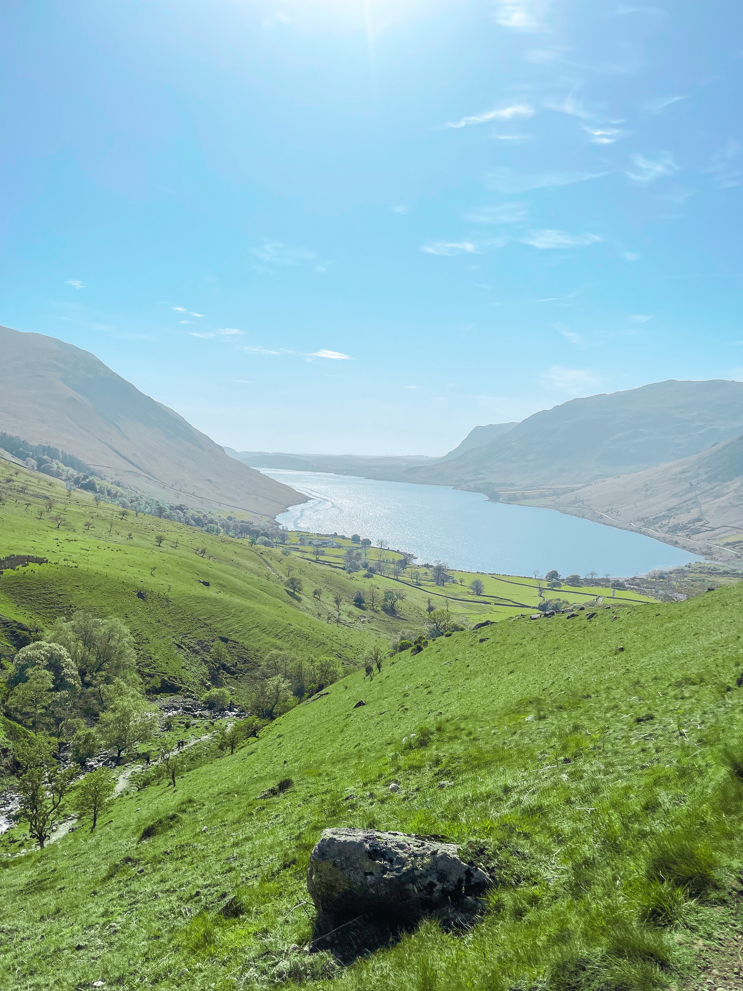
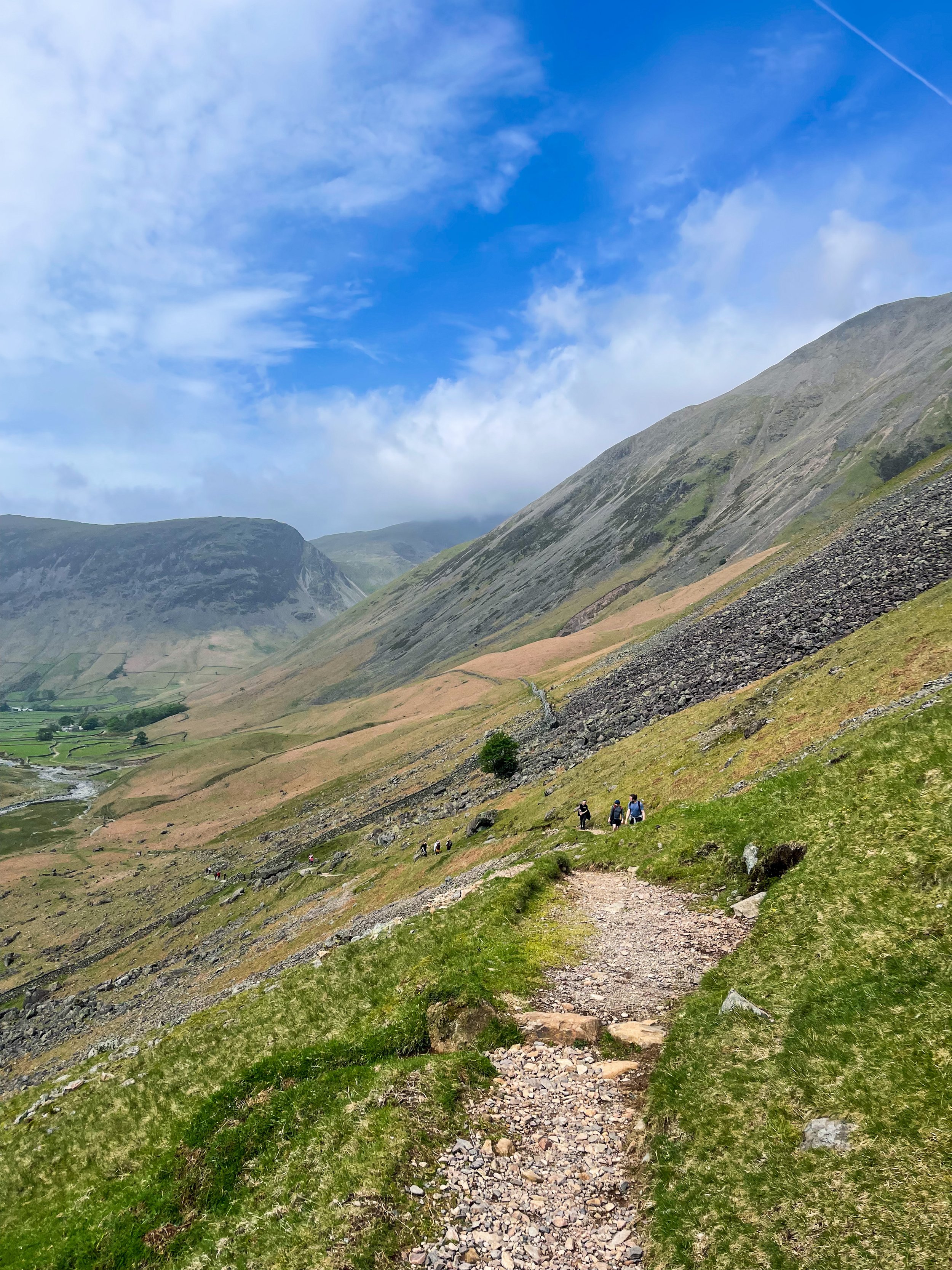
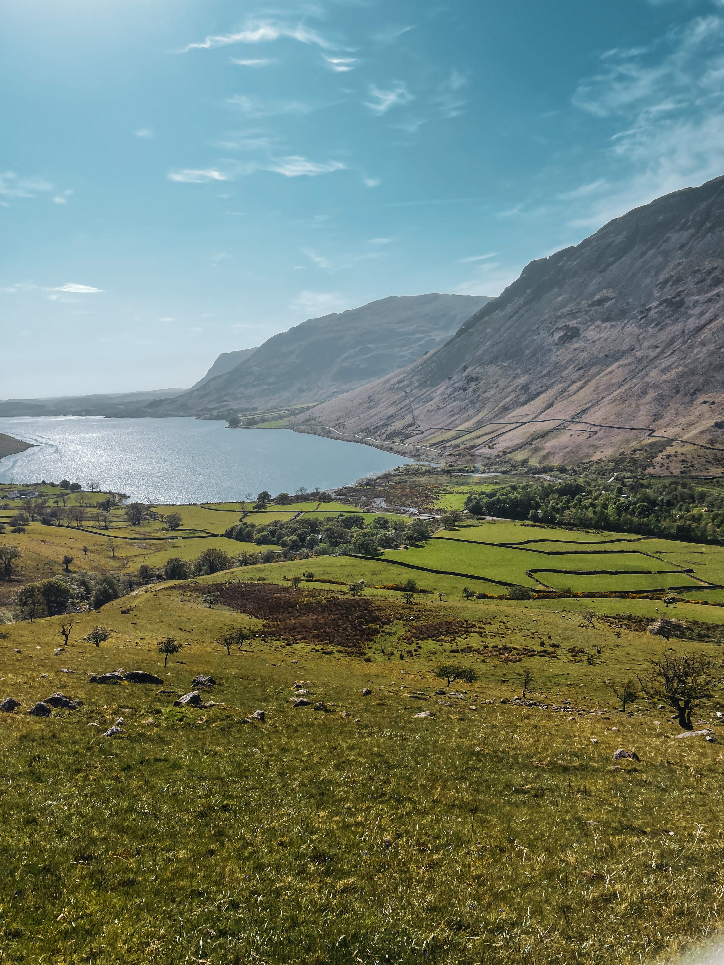
SCAFELL PIKE
Being high up in the mountains can be some of nature’s best therapy. So why not give England’s highest a go?
Start: Lake Head Carpark, Wasdale CA20 1EX
Distance: 7.7 miles
Elevation: 3,000 feet
Duration: allow 4 hours
Navigation: follow our route here
Standing at 978 metres, Scafell Pike is an absolute must for anyone looking to bag England’s biggest peak. Whichever route you take, climbing Scafell Pike is a serious undertaking and requires pre-planning to tackle it safely. That said, be sure to check the weather before you grab for your boots.
We started at Lake Head Car Park, Wasdale, a popular pay-and-display carpark so getting down early is advised. The remote and scenic valley surrounding offers an idyllic starting point. The main path up to the summit is advised for beginners, but if you’re up for more of a challenge, the corridor route offers a more scenic alternative.
Taking on the Corridor Route, in our opinion, offers better views and a more diverse variety of terrain. It’s usually walked via Styhead Tarn from Borrowdale, but you can pick up the Corridor from Wasdale as you pass under the slopes of the Great Gable. Choosing this route means scrambling is required at parts, but the incredible vistas are well worth it.
The trail is a pretty straightforward one to follow, with a clear path for most of the way. Once approaching Greta Gill, there is a slight scramble down but it’s easy enough to descend.
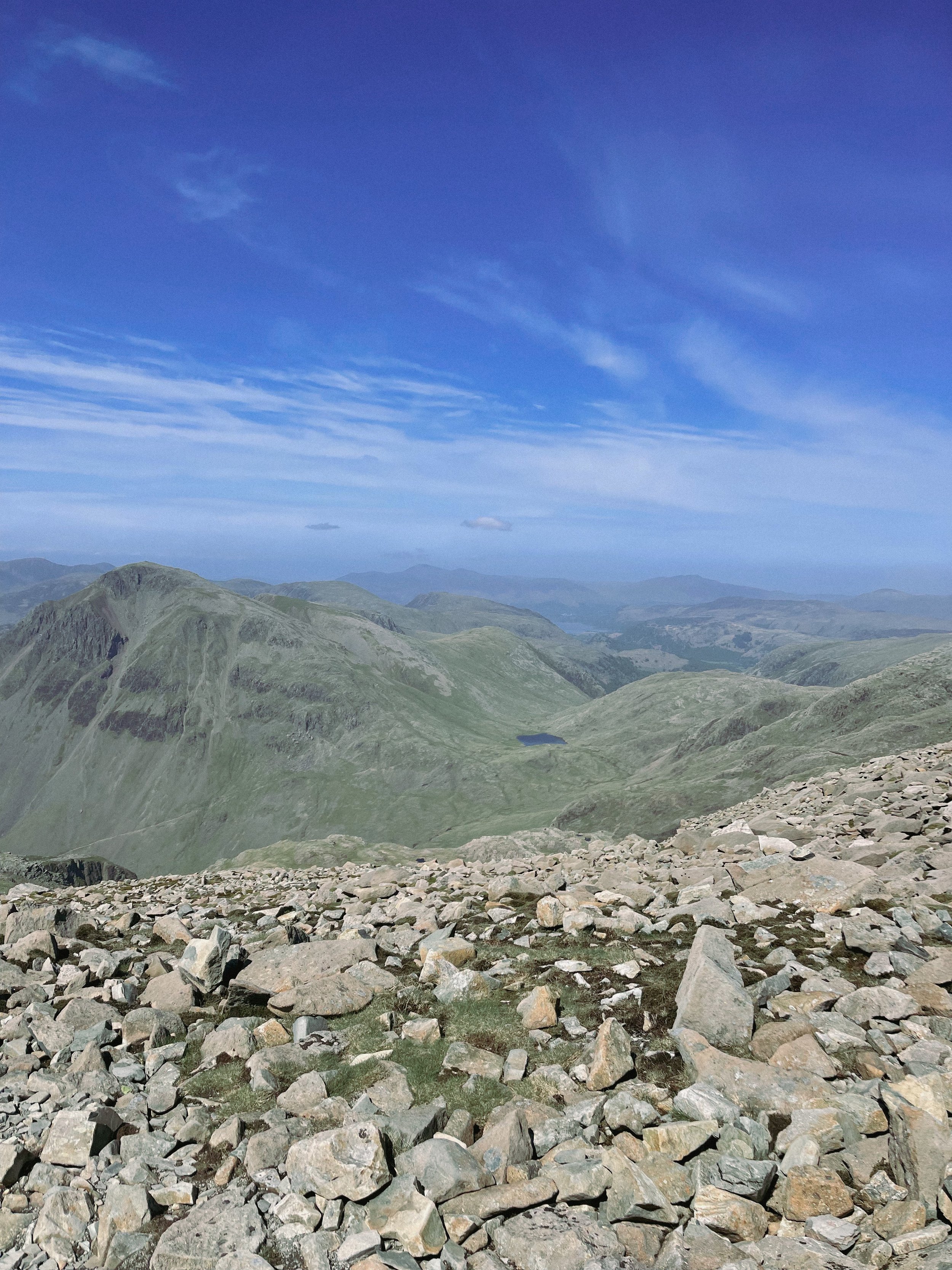
The Corridor is a real mountaineers route and rewards you with breathtaking rock scenery once you ascend on the Corridor itself. In our opinion, this circular walk is the best option for breaking up the ascent while offering incredible views everyway you turn.

Once reaching the summit, if you’re lucky enough to be blessed with a clear weather day—the views you’re rewarded with will take you back and then some. If the weather permits, you’ll be able to bask in the beautiful Cumbrian coastline, with views stretching out to the Isle of Man and beyond.
For those looking for a real challenge, why not take on Sca Fell (England’s second highest mountain) and Scafell Pike in one day? Climbing both in one day throws in bonus views —and double the bragging rights— with an exhilarating descent back to Wasdale.
Fancy following our route up to England’s biggest mountain? Click here

THOR’S CAVE
Thor’s Cave is known as one of the Peak District’s most famous caves… and with good reason.

Start: Wetton Mill, DE6 2AG
Distance: 7.74 miles
Duration: allow 3-4 hours
Elevation: 1,350 feet
Navigation: follow our route here

This is a brilliant route that takes in some of the best landmarks the Peak District has to offer: the beauty of Manifold Valley and the magnificence of Thor’s Cave. Just look at those views!

From Wetton village, this route first takes you along the Manifold Valley and past Wetton Mill with more caves to explore, before allowing you to finish at the perfect beauty spot: Thor’s Cave.

Thor’s Cave is an iconic natural cavern on the side of the Manifold Valley, making it a perfect spot to reward your efforts after a long day’s walk. Some scrambling to the chamber is required, making it perfect for big kids and little ones alike.

Thor’s Cave is a popular attraction so we recommend visiting out of season or towards the end of day to avoid a wait up to the cave. You can also shorten the walk—and fast-track your arrival on busy days— by simply heading to Thor’s Cave and back from Wetton, cutting out the meander along the Manifold Valley.

There are some steep uphill segments but the views are worth it. The views out into the valley are immense, but do make sure to take care while exploring there are steep drops shortly after the entrance and the surface can be slippery.

The origin of Thor’s Cave name is unknown but has obvious links to the Norse god Thor. Historically, evidence of human occupation of Thor’s Cave has been found dating back to the latter part of the Stone Age, around 11,000 years ago—with continued use into the Iron Age and Roman period. Excavations of the area have found living utensils such as stone tools, pottery and bronze items, as well as burial sites for seven people.

Fancy giving it a go? Follow our route here
BAMFORD RIDGE
Derwent Edge hogs the limelight around Ladybower—this short loop offers the immense views… without as much legwork
Distance: 3.53 miles
Elevation: 650 feet
Duration: 1.5 hours
Start: Heatherdene Car Park, S33 0BY
Navigation: follow the route here

This is a real treat of a walk, offering some of the best views in the Peak District. With just a short climb at the start, you walk towards Bamford Edge and are rewarded with incredible views of Ladybower and Derwent Reservoirs.

Just opposite, you’ll also find another great vantage point in the form of Win Hill. The easygoing nature of this route makes it a popular location for sunrise and sunset.
Up top, you’ll be spoilt for walking-trail choice if you’re looking to extend the walk—with the option to include both Ladybower and Derwent Reservoirs if you’re feeling particularly energetic.
Bamford Edge itself is a beautiful photo spot with many amazing rock formations. Facilities are limited on this trail, but there are public toilets available at the start of the walk (Heatherdene Car Park) and a cafe at Derwent Reservoir for those extending the route.

Fancy giving this one a go? Follow the route here
UPHILL CHALLENGES:

WALKS WITH WATERFALLS:


