ALL TRAILS

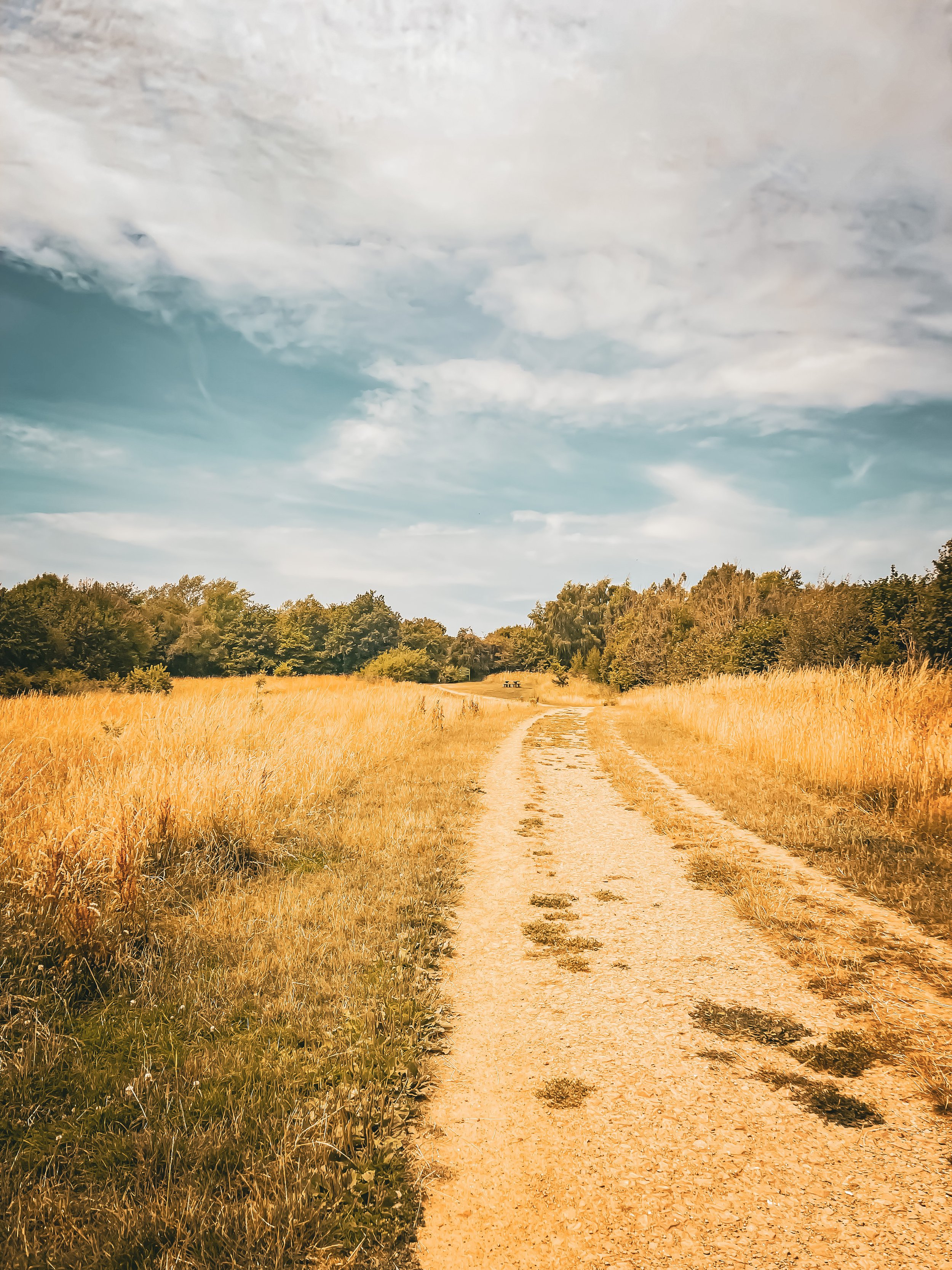
BAMFORD AND STANAGE EDGE CIRCULAR
Breathtaking scenery? Check. Two iconic Peak District landmarks in one walk? This route has you covered…

Start: Heatherdene Car Park, S33 0BY
Distance: 7 miles
Duration: 3 hours
Elevation: 1,150 feet
Difficulty: Moderate
Navigation: Download the GPX file here
This scenic Bamford Edge walk also visits Stanage Edge, taking in some of the best views in the Peak District.
Walk Highlights
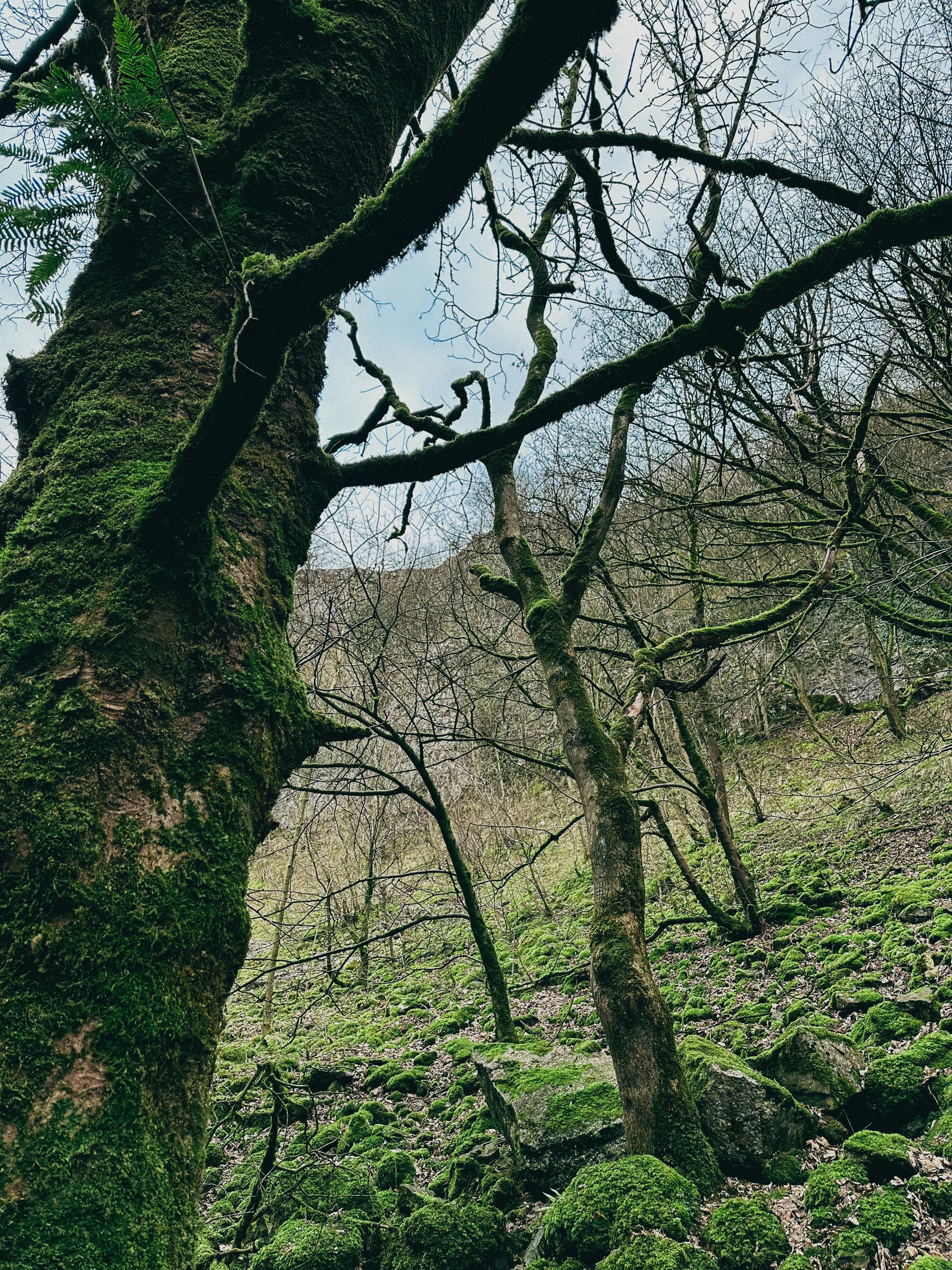
Bamford Moor
As you ascend from Heatherdene, Bamford Moor presents itself with rugged landscapes and untamed beauty. This expanse of open moorland offers panoramic views, babbling brooks, and a stone circle dating back to The Bronze Age. Keep your camera ready!
Stanage Edge
Situated north of Hathersage, Stanage Edge is a popular place for walkers and for rock climbing with stunning views of the Dark Peak moorlands and the Hope Valley. The gritstone edge stretches for approximately 4 miles and featured in the classic film ‘Pride & Prejudice’ starring Keira Knightley.
Bamford Edge
Bamford Edge is an overhang of gritstone that sticks out over the beautiful Bamford Moor. The ridge is renowned for its distinctive rock formations, including the photogenic 'Great Tor'. It lies elevated on the moor, close to the quintessential Derbyshire village of Bamford in the Peak District National Park.
Bamford Edge is approximately 1381 ft above sea level or 420 metres high. From the top, you get some of the best views of Ladybower Reservoir, Win Hill, Lose Hill, The Great Ridge, Crook Hill, and Hope Valley — all from just a relatively short walk to the top.
It’s extremely popular with rock climbers, walkers, and those wanting to get some fabulous photos on an iconic overhanging ledge.
Tips
Facilities are limited on this one. You’ll find public toilets available at the start of the walk (Heatherdene Car Park) and a cafe at nearby Derwent Reservoir if you’re looking to extend the route.
Check the weather: The weather atop the moor can be unpredictable. Dress in layers and be prepared for changes.
Respect the environment: The Peak District is a protected area. Stick to paths, and don't disturb wildlife.
Arrive early: Heatherdeane Car Park gets incredibly crowded during the weekend, visit off-peak where you can.
Catch a sunset: Looking for a shorter walk? Check out our Bamford Edge sunset variation below, clocking up just 3 miles.
Plan ahead: Ensure you have enough water, snacks, and a map. Mobile signal can be patchy, so physical maps are handy.
Leave the white trainers at home! The area around the moors can get incredibly boggy — so definitely bring your boots for this one.
Best time to visit: Early morning or late afternoon to avoid the crowds and catch the golden light.
Safety first: The edges can be slippery, especially after rain. Wear sturdy boots and watch your step.
Leave no trace: Preserve the beauty of the Peaks. Take your rubbish with you and stick to the paths.
SUNSET WALK VARIATION

Short on time, or simply want to head up for sunset? This short loop up to Bamford Edge is a great alternative. The walk up to the edge only takes approx. 20 minutes with just a short ascent up to the ridge — the perfect route to watch the sun set over Ladybower.
Tip: The walk up can get incredibly boggy after rainfall, so definitely bring your boots for this one.
Bamford Circular Walk

Distance: 3.53 miles
Elevation: 650 feet
Duration: 1.5 hours
Start: Heatherdene Car Park, S33 0BY
Navigation: follow the route here
Despite clocking up just a few miles overall, this Bamford loop offers some of the best views in the Peak District. With just a short climb at the start, you walk towards Bamford Edge and are instantly rewarded with incredible views of Ladybower and Derwent Reservoirs.
Just opposite, you’ll also find another great vantage point in the form of Win Hill. The easygoing nature of this route makes it a popular location for sunrise and sunset.
Up top, you’ll be spoilt choice if you’re looking to extend the walk—with the option to include both Ladybower and Derwent Reservoirs if you prefer to skip the climb and soak up the views at the bottom.
Looking for more walks like this one? Check out our latest adventures on Instagram

TOPLEY PIKE CIRCULAR WALK
Looking for a quieter Peak District stomping ground for your Sunday Walk? You’ve found the perfect hidden gem below…

Start: Harpur Hill, SK17 9LD
Distance: 7.11 miles
Duration: 2-3 hours
Elevation: 475 feet
Navigation: follow the route here

If you're looking to escape the crowds both in Manchester and the more populated Peak District trails, look no further than Topley Pike Nature Reserve: home of rolling hills, all-to-yourself valleys and stunning surrounds every way you turn.
This walk is one of the least populated routes you’ll find in the Peak District, making it the perfect base to escape the hustle and bustle and recharge in the incredible scenery we have on our doorstep.

Starting from Harpur Hill, this small village in Buxton is the ideal place to begin a leisurely stroll up to Topley Pike. From here, you'll set out on a winding path taking us up towards Topley Pike Nature Reserve. Please note, parts of the journey include a section of unpaved a-roads, so please take care during this part of the walk.
Once you’ve made it to the boundary, you'll be rewarded with stunning views of the Thirst House Cave, a true wonder of the Peak and a real hidden gem.
After admiring the eerily calm surroundings (you’ll struggle to see another soul along the way!), continue towards Deep Dale, a peaceful valley surrounded by rolling hills and lush vegetation. This idyllic valley makes for the perfect picnic break or a brew stop in the winter months.
From here, we head back to the starting point for what is arguably this walk’s ‘main event’, Buxton’s infamous ‘Blue Lagoon’. With its striking blue colour and picturesque white shores, Harpur Hill Quarry in the Peak District is the perfect example of a dangerous beauty. Its vivid colour is a result of freezing cold rainwater mixing with minerals discarded from decades of the industrial burning off of quicklime. And the toxic mix of chemicals in the water have the same pH value as bleach.
While its lush blue waters look like a tropical paradise, swimming in it could cause anything from skin irritation to severe sickness. This is because its high alkaline pH levels makes a dip in Blue Lagoon similar to swimming in 'a bath of bleach'.

Its vivid colour is actually a result of freezing cold rainwater mixing with minerals discarded from decades of the industrial burning off of quicklime. The toxic mix of chemicals in the water have the same pH value as bleach, which could cause anything from skin irritation to severe sickness.
Interested to know more? Scroll down to read more about the History of Blue Lagoon.

Whether you’re interested in the history or just here for the views, lease do take care and observe the ‘no swimming’ signage. This is no dipping spot!
Despite its dangers, Blue Lagoon remains one of the most popular destinations in the Peak District — and after another trip up in winter without the crowds, we can certainly see why.

The History of ‘Blue Lagoon’, Buxton

Harpur Hill, officially known as Hoffman Quarry, has a very long and rich history producing quicklime, with small-scale lime burning beginning in the 1600s, before large-scale quicklime production was carried out beside the quarry from 1835 to roughly 1952. The bigger production demands meant using larger shaft kilns, which led to the use of a multi-chambered Hoffmann kiln, operated by Buxton Lime Firms Ltd.
During the Second World War, the quarry was used by the RAF as a depot to store chemical weapons – the biggest such site in the country at some 500 acres. Later, Harpur Hill was deemed a good place to dispose of captured German chemical munitions. The surrounding hills were used to burn such weapons as phosgene and mustard gas with bleach, sending plumes of acrid smoke into the air. The depot shut in 1960 with the area remaining vacant ever since. Incidentally, the site was also home to an RAF Mountain Rescue team who would respond to air crashes the length and breadth of Derbyshire.
In 1980, the Hoffmann lime kiln was demolished in an effort to create space for an industrial estate. Massive volumes of solid waste left over from the lime burning were dumped in nearby tips, thus creating spoil heaps contaminated with traces of quicklime plus ash from the coal used in the process.
The aforementioned rainwater filtering through the waste leaches calcium hydroxide and in turn becomes heavily alkaline. Signs dotted around the site clearly say the water can cause "skin and eye irritations, stomach problems and fungal infections such as thrush" and that the quarry is known to contain all manner of things you definitely don’t want to go swimming with – including dead animals, excrement, car wrecks, and piles of rubbish.
Despite its inviting Mediterranean hue, the water is extremely cold. Yet many seem to still view the area as a popular tourist destination, causing much frustration for nearby residents.
Still here? Get out there and follow the route

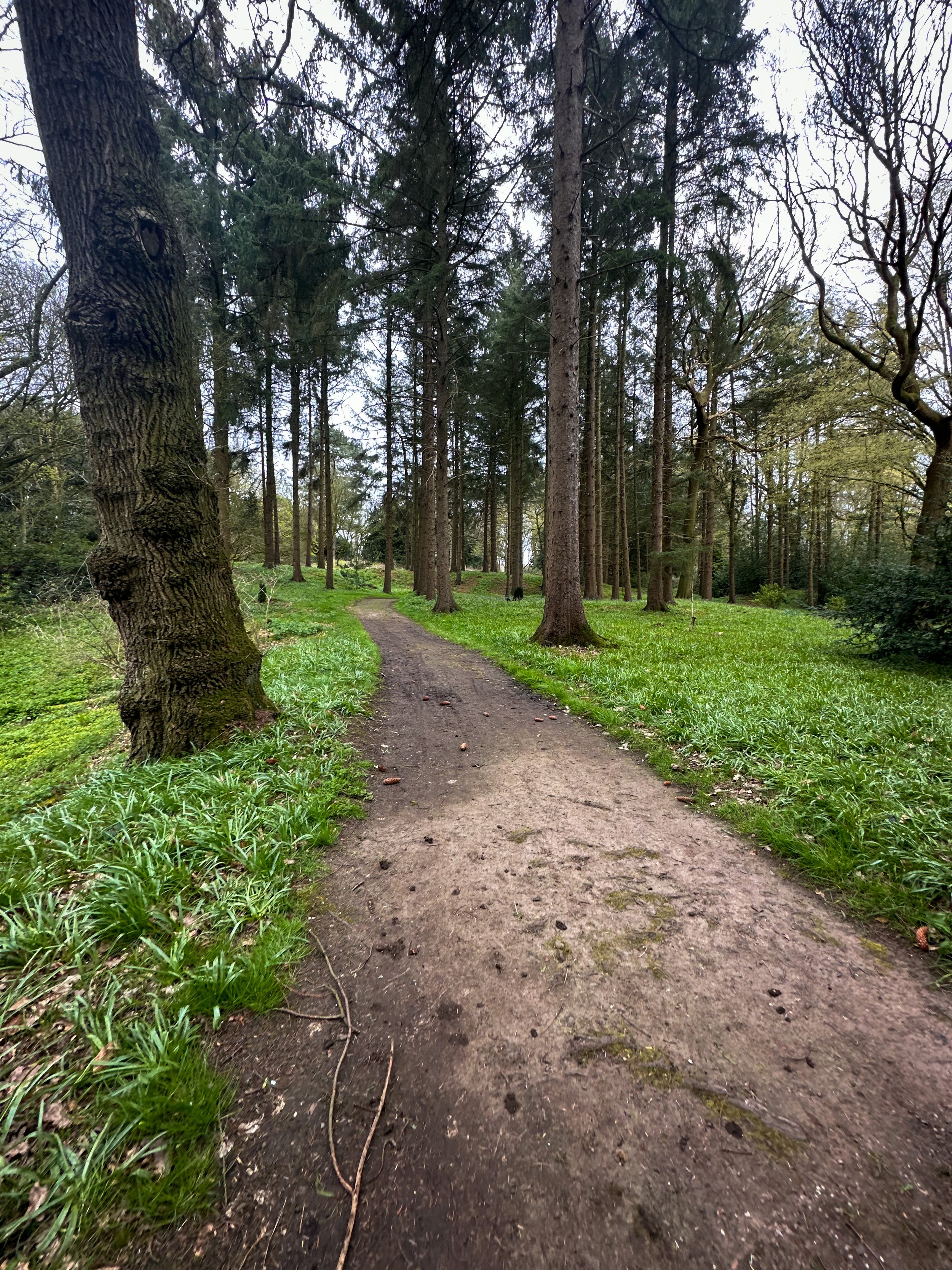
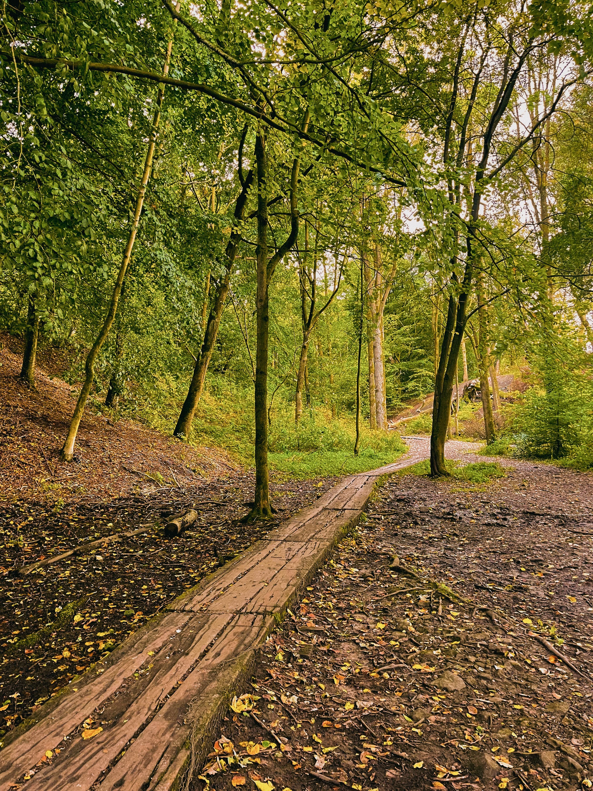
SNAKE WOODLANDS LOOP
As magical Peak District walks go, Snake Woodlands is at the top of the list…

Start: Hope Woodland Car Park, S33 0AB
Distance: 3.59 miles
Duration: 1-2 hours
Elevation: 400 feet
Navigation: follow the route here

Easily missable as you drive along Snake’s Pass (A57), this magical wonderland is hidden from view until you venture down into the woodland adjacent.
This stunning pine forest landscape will have you feeling like you’re in the depths of a Canadian national park, much less on the outskirts of Glossop…

Surrounded by rolling hills, pine trees and babbling streams, you won’t be short on fairytale-like scenery on this short circular walk. In fact, this route has a mix of everything: magical woodlands, eerie moorland and even some spooky ruins to boot.

This route in itself is an absolute gem — but if you’re looking to get a few extra miles in, popular Peak District landmarks Higher Shelf Stones and the B52 Crash Site can easily be incorporated. You can follow our Crash Site walk here,

Due limited parking spaces, we advise going off-peak when you can. The good news is, you’ll usually have the place to yourself due to its hard-to-reach location.
Ready to be transported to your very own fairytale? Follow the route here

SK WOODLAND TOUR
A trail so idyllic it’s hard to believe you’re a literal stone’s throw away from the M60…

Start: Woodbank Park, SK1 4JR
Distance: 4 miles
Duration: 1.5 hours
Elevation: 225 feet
Navigation: follow the route here

Having lived in Greater Manchester most of our lives, it always amazes us when we stumble across new-found territory just a stone’s throw away from our old stomping grounds. This route that links up to Midshires Way and Alan Newton Way is one of them!
Named after Stockport’s Olympic medal-winning cyclist, The Alan Newton Way provides a safe off-road route from Marple to Stockport via the Goyt Valley and towards the town centre.

Expect quiet, old farm lanes, a forgotten hall and a wonderful little detour back through the Woodbank’s woodland. We stopped off at Chadkirk for a quick refuel and a wander around Marple Garden Centre. Starting the route from this end means you’ll be able to have a pitstop at Pear Mill’s Vintage Emporium - a must-visit for anyone yet to have a nosey.

To extend the route, you can follow the Way to Etherow Country Park, or join up with the Middlewood Way at Chadkirk.
For us, the highlight came in discovering Goyt Hall Farm, one of Stockport’s many small halls… but due to its remote location, one of the prettiest. This Grade II listed half timbered mansion-house was built around the same time as the popular Bramall Hall. Today, it’s a working farm and stables surrounded by gorgeous bluebell-dotted woods and fields.

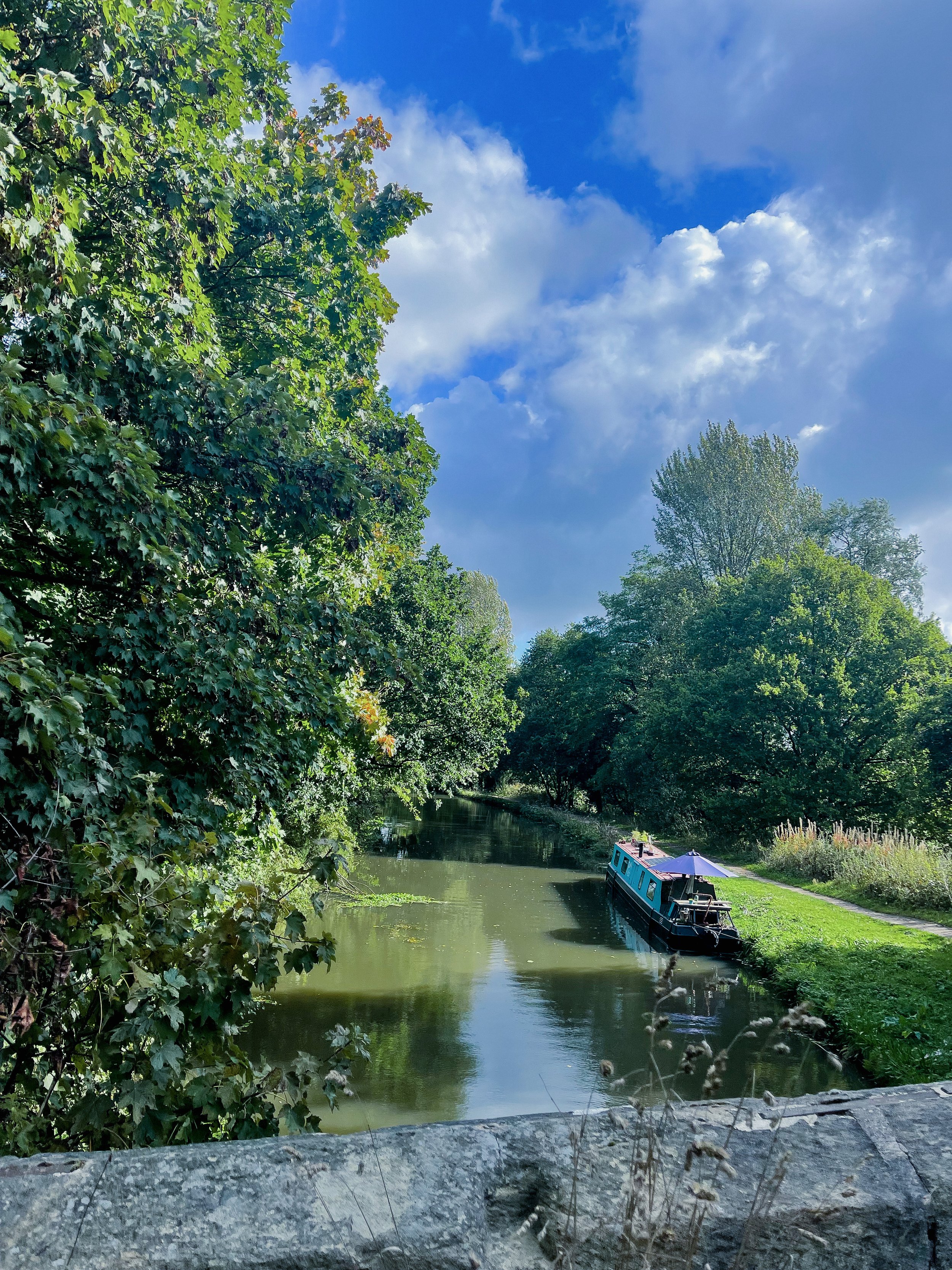
CHEE DALE STEPPING STONES WALK
An easy circular walk in the Peak District, taking you to a beautiful gorge and stepping stones…
Start: Miller’s Dale Car Park, SK17 8SN
Distance: 5 miles
Duration: Approx. 2 hours
Elevation: 525 feet
Navigation: follow our route here

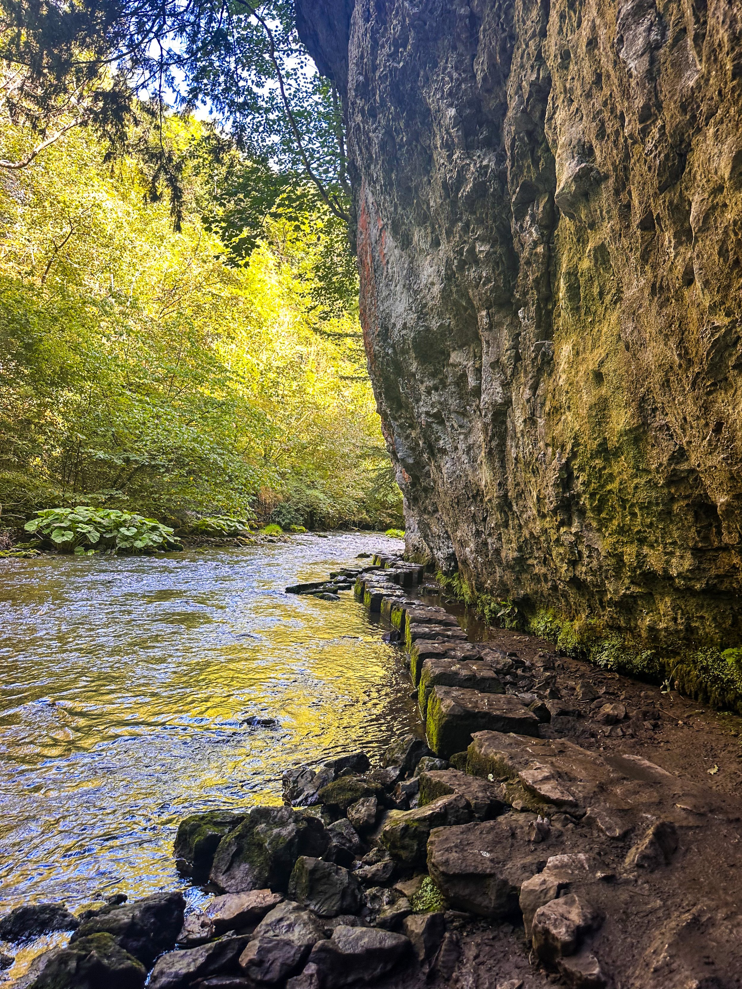
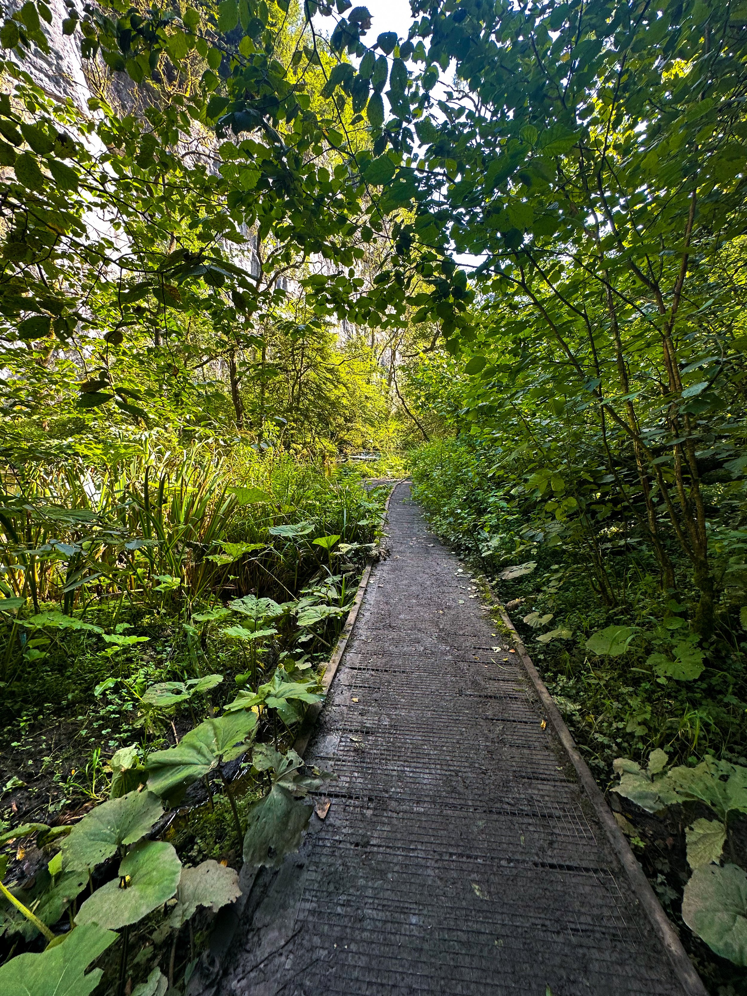
Tucked away beneath the Monsal Trail is the peaceful nature reserve of Chee Dale, where the River Wye meanders through a deep limestone gorge, providing two sets of stepping stones across the river. This route features as one of our Top 10 Walks in the Peak District, and with good reason!
Our Chee Dale Stepping Stones walk starts from Millers Dale Car Park and leads you down into a verdant gorge where you’ll cross two sets of atmospheric stepping stones along the limestone walls, before climbing back up to the Monsal Trail.
This is a slippy route on even the best of weather days, so walking boots definitely required for this one.

While the Dovedale usually takes the Peak District steppingstone limelight, lesser-known Chee Dale makes for a great off-road adventure if you want to beat the crowds.
The stepping stones and surrounding nature reserve – which lie beneath an overhanging cliff of limestone along the River Wye – are truly a must-visit Peak District attraction. So much so, this was our fourth (and certainly not last) visit…
About Chee Dale | Route Good-to-Knows
Made up of a 200ft deep limestone gorge, Chee Dale is filled with woodland, an abundance of wildlife, with the River Wye meandering through.
This walk is a 5mile circular route, first taking you through Chee Dale and along the famous stepping stones, before heading back up to the Monsal Trail and finally making your ascent through the nearby fields, with marvellous views down into the valley.
Miller’s Dale Carpark costs: £5 for the day
If the carpark is full, you can find alternative parking at a large layby just off the A6, on the west side of Chee Dale which offers free parking (Search ‘Chee Dale Layby’ on Google maps).
Public Transport: Make your way to Buxton (either via train or bus), then hop on the number 65 bus, which goes through Miller’s Dale between Tideswell, Linton and Buxton.
Facilities: You’ll find toilets and cafe at Miller’s Dale. Towards the end of the walk at Beech Croft Farm, you will also find Daisies coffee shop.

Fancy giving this one a go? Follow our route here

QUARRY BANK LOOP, STYAL
An exceptionally easy Sunday stroll starting at an exceptionally good pub…

Start: The Ship Inn, Styal
Distance: 5 miles
Elevation: 275 feet
Duration: approx. 2 hours
Navigation: follow the route here

From enchanting woodlands to proper pub grub, Styal beckons you to explore its surrounds… and with most of the routes on offer under cover of a leafy greenscape, Quarry Bank makes for a great day out, rain or shine.

The Southern Woods provide a great opportunity to explore the wider estate at Quarry Bank and to watch the river twist and turn and make its way to the mill. There are also some hidden gems... take a look at the mill pond and weir.

As well as some fantastic routes along the river Bollin on sections of the Bollin Valley Way, Quarry Bank Mill is well worth a day out of its own. Whether you prefer to take an extended pit stop here or make it your main event, there’s plenty of routes on offer. Ours takes you through Styal Woods, up to The Giant’s Castle Bridge, Norcliffe Chapel and on into Chapel Wood, before dropping down to the River Bollin at the rear of the Quarry Bank Mill Gardens.

From here, we head west following the river coming out next to Manchester Airport runway at the edge of Wilmslow and head across the fields to Pownall Park, back through Quarry Bank Mill and on to The Ship Inn — ready for some much needed pub grub and a well-deserved pint.

Looking for a longer route? This 6.5 mile walk is another great alternative for exploring Styal’s serene surroundings. Check out the route details above, and take your pick.

Fancy following along? Check out the step-by-step route here

STRETFORD MEADOWS
A scenic hideaway right on our doorstep…

Start: Hawthorn Lane, Chorlton
Distance: 7.03 miles
Duration: 2.5 hours
Elevation: 125 feet
Navigation: follow our route here

Looking for one of the best walks in South Manchester? Look no further…
Scenic views and wildlife might not be the first things that spring to mind when you think of Stretford, but that’s what makes this scenic spot just off the M60 so special.

One of the best short walks in Manchester, this route has it all: country lanes, a coffee pit stop and many links to extend the walk, including the Trans Pennine Trail.

While much of Stretford’s agricultural history has been lost to urban progression, this place is very much still teeming with wildlife. In the 19th century, Stretford was a hub for agriculture—known locally as Porkhampton due to the of pig farms which provided produce for the nearby Manchester Market. Wild, eh?

Back then, Streford was also an extensive market gardening area, described as the "garden of Lancashire" by writers of the time. In 1845, over 508 tons of vegetables were being produced each week for the Manchester Market, with their specialty being rhubarb—known locally then as “Streford beef”.
So successful was Stretford’s vegetable output, it became known as “ the Eden of Lancashire” throughout the Victorian era. In 1845, over 508 tons of vegetables were reported to be produced by Stretford market gardens for Manchester residents.

Pre-industrialisation, Romans named the area we now know as Stretford ‘Streta’—meaning street on a ford. Until the 1800s, the area existed as a cottage community dependent on hand-weaving, providing employment for almost 800 workers.

Our route takes you along a path which follows the line of the old Roman road from ‘’Deva Victrix’’ (Chester) to ‘’Mancunium’’ (Manchester), crossing the Mersey into Stretford at Crossford Bridge, a crossing point of the ancient ford.
Upon reaching the meadows, you’ll explore woodland paths, ponds and secluded spots which provide an ideal habitat for wildlife and a perfect place to unwind.

After a short stroll around the meadows, you’ll join the Trans Pennine Trail where you can enjoy panoramic views of the River Mersey. Along the way, you’ll pass Riverside Cafe, a gorgeous pop-up cafe selling hot drinks, sweet treats and homemade food.
For those looking to make a proper day of it, you can extend the route by heading to Old Ees Brook in Urmston, or by meeting up with one of the route’s many traffic-free transport links, including the Trans Pennine Trail or the Bridgewater Canal.

Fancy giving it a go? Follow the route here

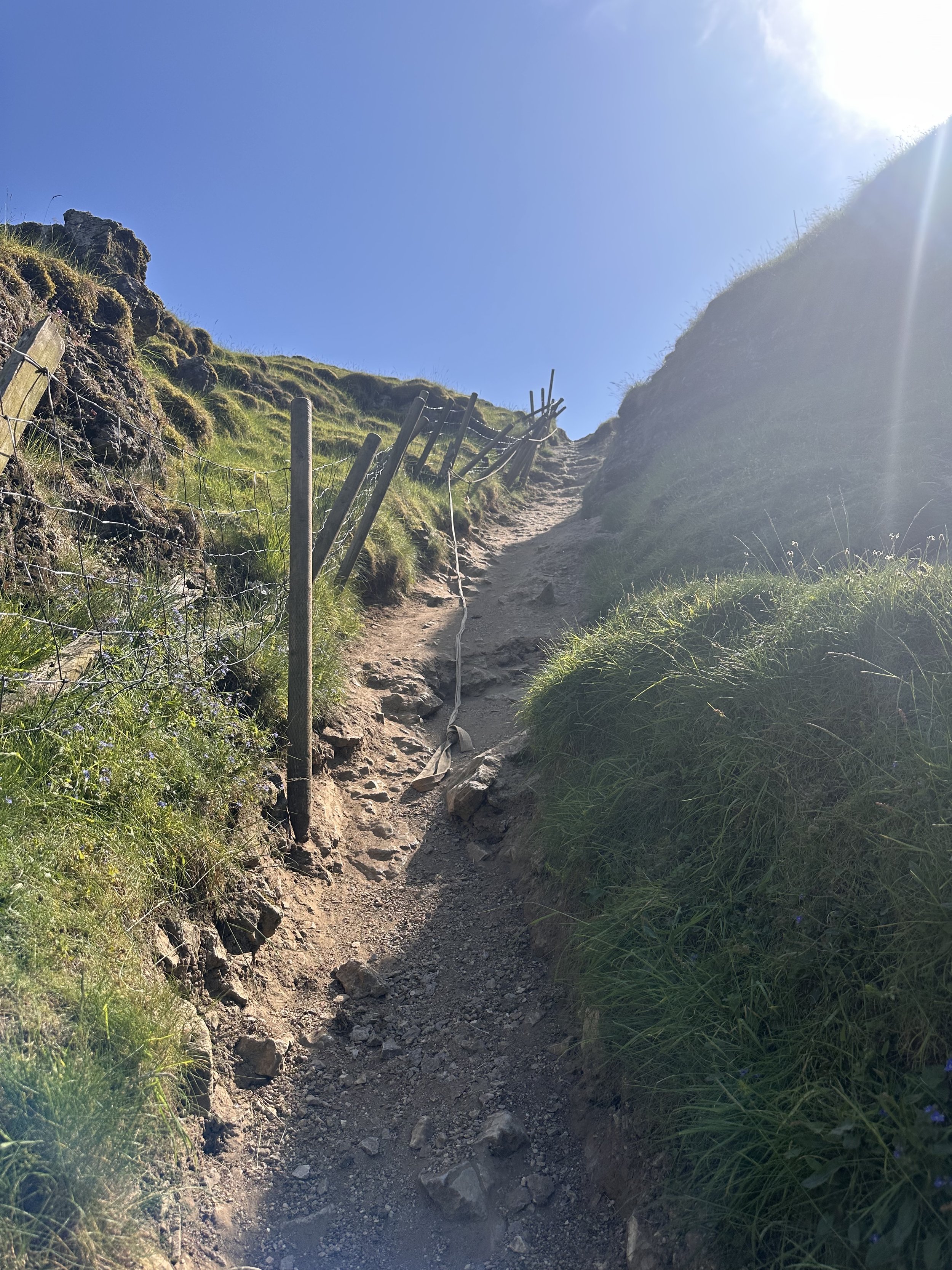
WINNATS PASS AND ODIN MINE WALK
One of the best Peak District walks just a short drive from Manchester

Start: Castleton Visitor Centre, S33 8WN
Distance: 5.02 miles
Elevation: 900 feet
Duration: allow approx. 2 hours
Navigation: follow the route here

This walk takes you high above Winnats Pass and around Castleton, meaning you can take in this amazing Peak District village from all angles. The start of the route leans towards the challenging side, taking you up a steep and rocky path straight up to Winnats Pass, so consider if this one’s for you before heading out.

The first ascent is steep with scrambling required. Thankfully, a kind soul has left a climbers rope tied to a gate post which gives you all the leverage you need. We’ve been meaning to give this one a go for a while, and it didn’t disappoint.
The route starts near Castleton Visitor Centre where you’ll find a shop, cafe and toilets… among a gorgeous array of nearby pubs, eateries and cafes.
The car park is pay and display, but there’s street parking available nearby (be aware these fill up quickly during peak hours, so we recommend getting down early).

Once atop Winnats Pass, you’ll follow a trail that leads close to the boundary wall and takes you along the top of the pass. Be sure to stop and take in the views on this part of the walk, we were blown away watching the tiny cars winding their way through the Way.
From here, you’ll head along a footpath in the direction of Mam Tor, before taking a detour to Odin Mine: a disused mine thought to be in use since around 1260. The landscape surrounding makes for great exploring, leading you to the collapsed road constructed beneath Mam Tor.

Once you reach Treak Cliff Cavern, look out for signs that tell you about the history of the area. Winnats Pass and the surrounding environment was once under a tropical sea, making the site protected by law due to the many fossils of sea creatures which lived here over 350 million years ago.
The valley was created by melting glaciers which gradually dissolved, creating streams which flowed through and under cracks in the rock. One of these streams created a large underground cave system which eventually collapsed, leaving Winnats Pass you see today!

With so much to see in such a short walk, this is undoubtedly one of our favourite walks when visiting Derbyshire.
Fancy giving it a go? Follow the walk here

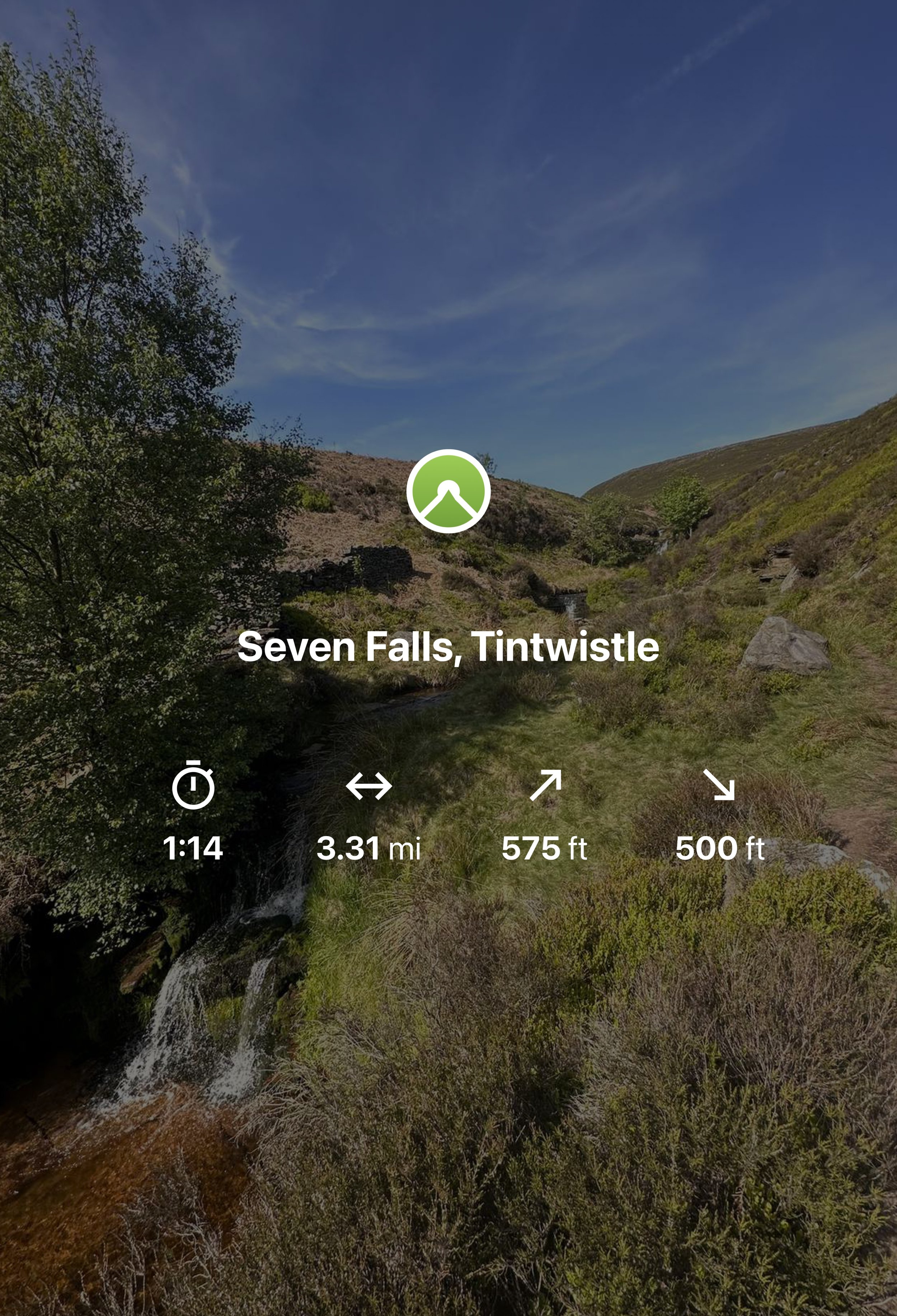
SEVEN FALLS SHORT WALK, TINTWISTLE
A short walk up to one of Greater Manchester’s (not so) hidden wild swimming spots

Start: Arnfield Fly Fishery, SK13 1HP
Distance: 3.31 miles
Elevation: 575 feet
Duration: Approx. 1.5 hours
Navigation: Follow the route here or download GPX file
Public Transport: Start the walk at Hadfield Station, with a mile walk to the start

The Peak District has a number of famous waterfalls within its boundaries that have become famous to walkers and and visitors to the area. Pretty Padley Gorge has a gentle cascading run of waterfalls along the course of Burbage Brook, Kinder Downfall, with a 30-metre drop is the tallest waterfall in the Peak District, and Three Shires Head, the meeting point of Cheshire, Derbyshire and Staffordshire is busy all year round.
But what about the less well known waterfalls in the National Park? One such place can be found in Tintwistle, an area north of Glossop on the western edge of the Peak District.
The area is well populated with several reservoirs which are great for walking but just to north of them runs Arnfield Brook which is the source of a series of cascading waterfalls and tranquil pool.
Let's dive in…
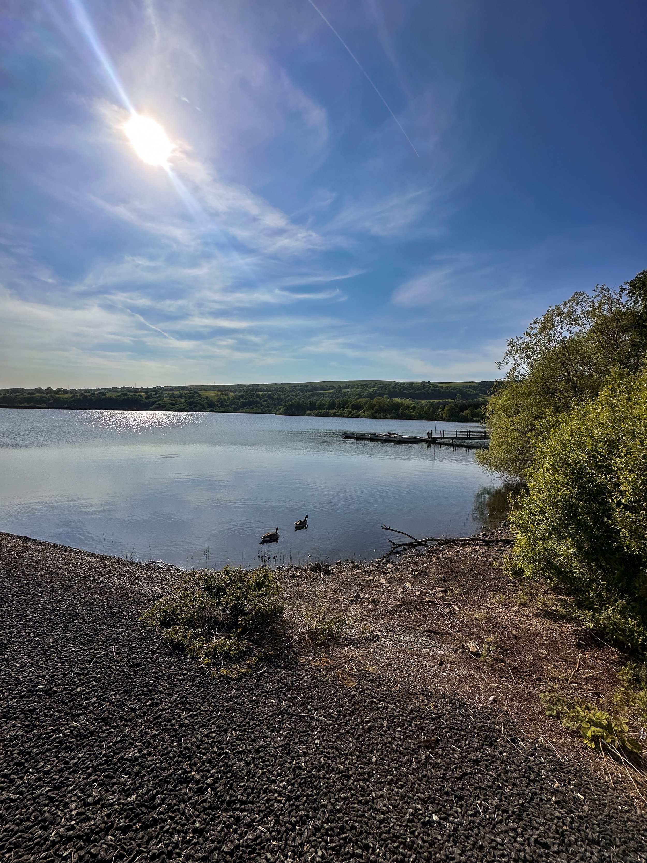
Arnfield Reservoir:

Our adventure starts at Arnfield Reservoir, a serene body of water offering a peaceful escape on the outskirts of Tintwistle and Glossop. Please note, parking here is limited, so arrive early to secure a spot. Take a moment to soak in the picturesque surroundings, grab yourself a cuppa or scan the restaurant and cafe’s menu for your post-walk treat on your return.
Arnfield Fly Fishery Cafe & Restaurant:

At the start of your hike, you'll encounter Arnfield Fly Cafe & Restaurant, a charming eatery nestled amidst the High Peak countryside. It's the perfect spot to refuel and recharge, with a selection of refreshments and delicious food to satisfy your cravings. Take a break, enjoy a cup of tea or coffee, and indulge in some delicious Thai food before continuing your journey towards the falls.
Seven Falls Waterfalls

Prepare to have your breath taken away as we arrive at the stunning Seven Falls waterfalls. While their location may no longer be a secret, it’s the perfect spot to cool off on a sunny Mancunian day. So if a wild dip is your ideal weekend pasttime, make sure to pack a cozzy because this is the ultimate wild swimming spot near Manchester.
Extend your adventure
Once you've soaked up the magic of the Seven Falls, consider extending your adventure by exploring some of the other scenic walks in the area.
Bottoms Reservoir: A leisurely stroll around Bottoms Reservoir offers peaceful surroundings and panoramic views. It's a perfect option for those seeking a shorter, more relaxed walk.
Higher Swineshaw Reservoir: For a slightly longer trek, venture to Higher Swineshaw Reservoir. This circular route treats you to breathtaking vistas and serene landscapes, making it an ideal choice for those craving more nature immersion.
Bottoms Reservoir to Dovestone Reservoir:
Start at Bottoms Reservoir and follow the trail that leads to Dovestone Reservoir. Take in the beauty of both reservoirs and the picturesque landscapes in between. The round trip is approximately 3.5 miles.
Greenfield Circular Walk:
Begin at Bottoms Reservoir and head east towards Greenfield. Explore the charming village and then return to the reservoir using a different path. This circular walk is about 4 miles in length.
Fancy giving this route ago? Follow along here

CAPESTHORNE HALL: CHESHIRE
Explore the beauty of Capesthorne Hall and its surrounding countryside in this woodland Cheshire walk
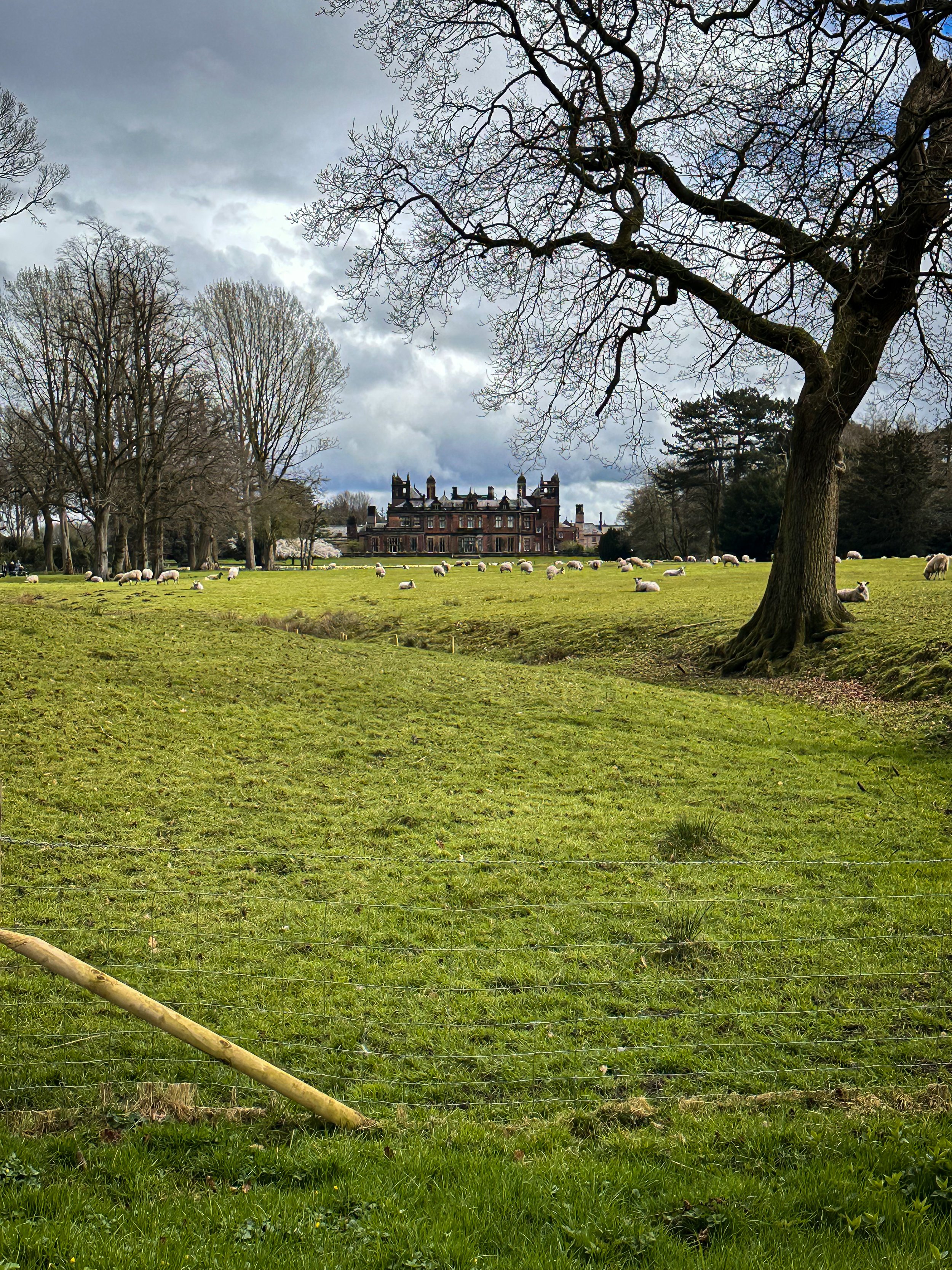
Start: Capesthorne Hall, SK11 9JY
Distance: 5 miles
Elevation: 100 feet
Duration: 2 hours
Navigation: follow the route here
Love to spend your weekends frequenting stately homes and pretending you’re in a Bronte novel?
Then you’re going to love Capesthorne Hall, a beautiful stately home located in the tranquil village of Siddington, Cheshire. This stunning historical building is surrounded by picturesque countryside, making it a popular destination for walkers and nature lovers alike. Let us take you on a route that takes in the best of this stately home and its surroundings, exploring its history, architecture, and notable features.
History of Capesthorne Hall
Capesthorne Hall was built in the early 18th century by William Smith, a successful lawyer and politician. The building's architecture is a perfect example of Jacobean style, with its impressive mullioned windows, steep gables, and ornate chimneys. Over the years, the house has been renovated and extended, but it still retains much of its original charm and character.
In the 19th century, the estate was inherited by the Bromley-Davenport family, who further developed the grounds and gardens, creating a beautiful parkland and a series of lakes. The family lived in the house until the mid-20th century when it was opened to the public as a tourist attraction.
Today, visitors can explore the grand rooms of the house, including the drawing-room, dining room, and library, which are decorated with beautiful antique furniture, paintings, and sculptures. The gardens and parkland are also a delight to explore, with their immaculate lawns, colourful flower beds, and stunning water features.
Walk around Capesthorne Hall
A walk around Capesthorne Hall and its surrounding countryside is a perfect way to appreciate the beauty of this historic estate. From the house, you can follow a path that takes you through the parkland, past the lakes and woodland, and into the open countryside beyond.
One of the highlights of the walk is the Chapel in the Woods, a picturesque 19th-century chapel located in a secluded woodland glade. The chapel was built by the Bromley-Davenport family as a private place of worship and is now open to the public.
Another notable feature of the estate is the Japanese Garden, a tranquil oasis of calm, with its meandering streams, waterfalls, and exotic plantings. The garden was created in the early 20th century and is a testament to the family's love of travel and exoticism.
Places to visit for food and drink nearby
After a day of exploring Capesthorne Hall and its surroundings, you may want to stop for a bite to eat or a drink at one of the many excellent pubs and restaurants nearby. Here are some of our top recommendations:
The Old Vicarage Hotel: This charming country hotel is located in the village of Holmes Chapel, a short drive from Capesthorne Hall. The restaurant serves delicious locally sourced food, and the bar is stocked with an impressive selection of real ales and wines.
The Swettenham Arms: This traditional 16th-century inn is located in the picturesque village of Swettenham and is renowned for its excellent food and drink. The pub has a beautiful beer garden and a roaring fire in the winter months.
The Yellow Broom Restaurant: This stylish restaurant is located on the edge of the Peak District National Park and serves contemporary British cuisine. The restaurant has a beautiful terrace with stunning views of the surrounding countryside.
Capesthorne Hall and its surrounding countryside are a beautiful and historic destination that offers something for everyone. Whether you’re interested in history, architecture, or nature, you’ll find plenty to enjoy at Capesthorne Hall. So why not plan a visit today and discover the charm of this beautiful estate for yourself?

Follow the route here

MOTTRAM ST ANDREW LOOP
Cheshire’s best hidden gem: Mottram St Andrew
A circular pub walk perfect for a Sunday stroll not too far from Manchester.

Start: The Bull’s Head, SK10 4QH
Distance: 3 miles
Duration: 1.5 hours
Elevation: 225 feet
Navigation: follow the route here

Looking for a quick escape from the hustle and bustle of city life? A short walk around Mottram St Andrew near Prestbury village may be just the ticket. With untouched countryside, a stunning waterfall, and the convenience of starting and finishing at local boozer, The Bull's Head, this route is perfect for a good old Sunday stroll.

The walk starts at The Bull's Head, a charming pub with a warm and inviting atmosphere. From there, you'll head out into the countryside, taking in quiet lanes, untouched woodlands, horse paddocks and rural footpaths. Despite being so close to the hustle and bustle of nearby Alderley Edge, this short and simple route remains untouched by modern life — giving you a sense of peace and tranquility that is hard to find in the city.

Mottram St Andrew is located about 3 miles north-west of Macclesfield in Cheshire. The walk starts and finishes at The Bull’s Head on Wilmslow Road, just a few hundred yards south of Mottram Hall. The pub has its own car park, although this place is a popular one (we can personally vouch for the delicious food!) so it’s best to avoid peak times.

The walk is relatively short, making it perfect for those who want to enjoy the great outdoors without committing to a full day of hiking. The walking route performs a simple short loop around the local countryside, taking in quiet lanes, horse paddocks and rural footpaths.
And with The Bull's Head as your starting and finishing point, you can look forward to a refreshing pint at the end of your journey.

Mottram St Andrew seems to hide its houses behind high hedges which gives the village a secretive air. We wouldn’t hazard to guess where the centre of the village is — there’s no obvious focal point and one gets the impression that, however quiet and retiring, the villagers like it that way.
But perhaps the best thing about Mottram St Andrew is its charm and character. With its cobbled streets, quaint cottages, and friendly locals, it's the perfect place to unwind and relax. And with plenty of pubs, restaurants, and cafes to choose from in nearby Prestbury Village, you won't be short on options for good food and drink.

Good to knows:
The route includes several gentle climbs and descents throughout. The paths pass through fields and horse paddocks which can be very muddy so good waterproof boots are a must. Each paddock is likely to be holding several horses so take care with dogs. You will need to negotiate 9 stiles, two kissing gates and a flight of steps. Some of the stiles are enclosed with wire fencing so dogs may need a lift over.

Ready for a short mooch & a refreshing pint? Follow the route here
BEST WALKS IN THE PEAK DISTRICT: TOPLEY PIKE
Discover the beauty of the Peak District: Harpur Hill to Blue Lagoon

Start: Harpur Hill, SK17 9LD
Distance: 7.11 miles
Duration: 2-3 hours
Elevation: 475 feet
Navigation: follow the route here
If you're looking for a fun and adventurous way to explore the best walks near Manchester, look no further than Topley Pike Nature Reserve: home of rolling hills, all-to-yourself valleys and stunning surrounds every way you turn.
It’s one of the less busy routes you’ll find in the Peak District, making it the perfect base to escape the hustle and bustle of everyday life and immerse yourself in the tranquility of the great outdoors.
Starting from Harpur Hill, this small village in Buxton is the ideal place to begin a leisurely stroll up to Topley Pike. From here, you'll set out on a winding path that will take us towards Topley Pike Nature Reserve. Please note, the outward trip to Topley Pike is via an unpaved a-road, so please take care during this section of the route.
Once you’ve made it to the boundary, you'll be rewarded with stunning views of the Thirst House Cave, a true wonder of the Peak and a must-visit for any outdoor enthusiast.
After admiring the tranquility of Thirst House Cave (you’ll struggle to see another soul along the way!), continue on to Deep Dale, a peaceful valley surrounded by rolling hills and lush vegetation. This idyllic spot is perfect for a picnic or a quiet moment to take in the serenity of the area. AWith narrow, winding paths and wildlife darting amongst the trees, this section of the route is a true feast for the senses.
Now to head back to the starting point for the main event: Buxton’s infamous ‘Blue Lagoon’.
With its striking blue colour and picturesque white shores, Harpur Hill Quarry in the Peak District is the perfect example of a dangerous beauty. The pool is no hidden gem — thousands of people visit the site each summer, which is why we much prefer a visit during winter. Plus, there’s no danger of anybody jumping in during this season… which, trust us, is something nobody wants to do.
Its vivid colour is actually a result of freezing cold rainwater mixing with minerals discarded from decades of the industrial burning off of quicklime. The toxic mix of chemicals in the water have the same pH value as bleach, which could cause anything from skin irritation to severe sickness.
Interested to know more? Scroll down to read more about the History of Blue Lagoon.
Whether you’re interested in the history or just here for the views, lease do take care and observe the ‘no swimming’ signage. This is no dipping spot!
Despite its dangers, Blue Lagoon remains one of the most popular destinations in the Peak District — and after another trip up in winter without the crowds, we can certainly see why.
Still here, are ye?
Get out there and explore the best walks near Manchester, here.
The History of ‘Blue Lagoon’, Buxton
Harpur Hill, officially known as Hoffman Quarry, has a very long and rich history producing quicklime, with small-scale lime burning beginning in the 1600s, before large-scale quicklime production was carried out beside the quarry from 1835 to roughly 1952. The bigger production demands meant using larger shaft kilns, which led to the use of a multi-chambered Hoffmann kiln, operated by Buxton Lime Firms Ltd.
During the Second World War, the quarry was used by the RAF as a depot to store chemical weapons – the biggest such site in the country at some 500 acres. Later, Harpur Hill was deemed a good place to dispose of captured German chemical munitions. The surrounding hills were used to burn such weapons as phosgene and mustard gas with bleach, sending plumes of acrid smoke into the air. The depot shut in 1960 with the area remaining vacant ever since. Incidentally, the site was also home to an RAF Mountain Rescue team who would respond to air crashes the length and breadth of Derbyshire.
In 1980, the Hoffmann lime kiln was demolished in an effort to create space for an industrial estate. Massive volumes of solid waste left over from the lime burning were dumped in nearby tips, thus creating spoil heaps contaminated with traces of quicklime plus ash from the coal used in the process.
The aforementioned rainwater filtering through the waste leaches calcium hydroxide and in turn becomes heavily alkaline. Signs dotted around the site clearly say the water can cause "skin and eye irritations, stomach problems and fungal infections such as thrush" and that the quarry is known to contain all manner of things you definitely don’t want to go swimming with – including dead animals, excrement, car wrecks, and piles of rubbish.
Despite its inviting Mediterranean hue, the water is extremely cold. Yet many seem to still view the area as a popular tourist destination, causing much frustration for nearby residents.

WORSLEY WOODS:
Short on time? This short loop around Worsley will scratch your Sunday Walk itch.

Discover the best 3 mile walk close to Manchester City Centre

Start: Worsley, M28 1XP
Distance: 3.58 miles
Duration: 1.5 hours
Elevation: 100 feet
Navigation: follow the route here

Are you looking for a scenic and peaceful walk that's just a stone's throw away from the hustle and bustle of Manchester city centre? Want to spice up your daily exercise routine with a touch of history and local charm?
Look no further than this short but scenic loop around Worsley.
This charming town has a wealth of scenic walking routes that will make you forget you're even getting a workout in. Whether you want to stroll around the village or take a leisurely mooch along the Bridgewater Canal, Worsley has something for all types of walker.

Along the way, you'll come across hiking highlights like Worsley Greenway, a flat and scenic trail that follows the route of an old railway line. Surrounded by untouched scenery, this trail is the perfect place to escape the hustle and bustle of city life and soak up that much-needed peace and quiet.

But let's be real, the best part of any walk is the pit stops along the way… and thankfully, Worsley delivers.
With plenty of cosy pubs and independent shops to choose from, you’ll be spoilt for choice on this route. A must-stop is the famous Worsley Old Hall, a 17th century pub that still serves up traditional English ales and hearty pub grub.
Fellow sweet tooths, we got you. Pop into Roccos Desserts on your joruney home.
And while you’re up this end, don't forget to take a peek at the historic Worsley Court House, a 17th century building that was once used as a court house for the local area and is now a museum showcasing the rich history of Worsley and its surroundings.

Fancy making a day of it? If you want to extend the route, you can take a stroll along the Bridgewater Canal or Worsley Greenway. Both offer even more breathtaking views and endless opportunities for a good old mooch.
The Bridgewater Canal is one of the oldest and most historic canals in England, and as for it’s exploring potential? Well there’s a reason it remains a popular destination for walkers, boaters and history buffs alike.
Over the years, the canal has undergone many changes and improvements, including the construction of several locks and the digging of numerous new branches. The canal was used extensively during the Industrial Revolution, with barges transporting raw materials, goods, and passengers to and from Manchester.
Despite its age, the Bridgewater Canal remains an important part of England's transport infrastructure to this day. In recent years, it has been restored and improved, making it a popular destination for walkers, cyclists, and boaters. The towpath that runs alongside the canal is now a well-maintained footpath and provides a peaceful and scenic route for walkers to explore the local area and enjoy the wildlife and scenery.

Whether you're a local or just visiting, this 3 mile walk around Worsley is the perfect way to escape the city and immerse yourself in the natural beauty of Greater Manchester… yes, it does exist.
With its stunning views, quaint pubs and shops, and rich history, this short walking loop is one of the best you'll find so close to Manchester city centre.

Still here? Go grab your comfy shoes and head out on a walking adventure in Worsley, instead.
Who knows, you might even find your new favourite pub.
Follow the route here

PRESTBURY CIRCULAR
If you're looking for a leisurely stroll not too far from home, then a walk round Prestbury village is a must.

Start: Prestbury Village, SK10
Distance: 4.96 miles
Duration: 2 hours
Elevation: 200 feet
Navigation: follow the route here

You can’t beat a local walk, and for us, it doesn’t get much better than one with the holy trinity: quiet surrounds, independent shops and a traditional pub stop to boot. Not only will this short loop around Prestbury Village give you a chance to stretch your legs, but it'll also give you a chance to stretch your Instagram feed with picturesque views of the local area.
The route starts at the village green, where you can take in the views of the picturesque Cheshire countryside. From there, head down Church Street, where you'll be greeted by charming houses and cottages that will make you feel like you've stepped back in time. As you stroll down Church Street, make sure to pop into St. Peter's Church for a dose of medieval architecture and some impressive carvings and stained glass windows.

Next up is the Prestbury War Memorial, a sobering reminder of the sacrifices made by the local community during World War I and II. But don't let the heavy thoughts weigh you down for too long, because the village cricket ground is just around the corner. Take in the sights and sounds of a local game in progress, or just enjoy the quiet surrounds as you meander through the winding bridge-lined woods.
But the real highlight of this walking route is the quaint and charming Bull's Head pub. This traditional pub serves a variety of delicious local ales and ciders, as well as a selection of hearty pub grub. And if the weather's nice, grab a seat in their beer garden for some al fresco dining with a view.
After a pint of the good stuff and a bite to eat, you’re halfway through the route and ready to make your way back to the starting point at the village green.
But don't worry, your journey doesn't have to end here. Prestbury village in Cheshire offers a variety of scenic walking routes, and the charming Bull's Head pub is always open for a well-deserved break. So, pack your comfortable shoes, grab your camera and head to Prestbury Village.
Ready to go? Follow along step-by-step here

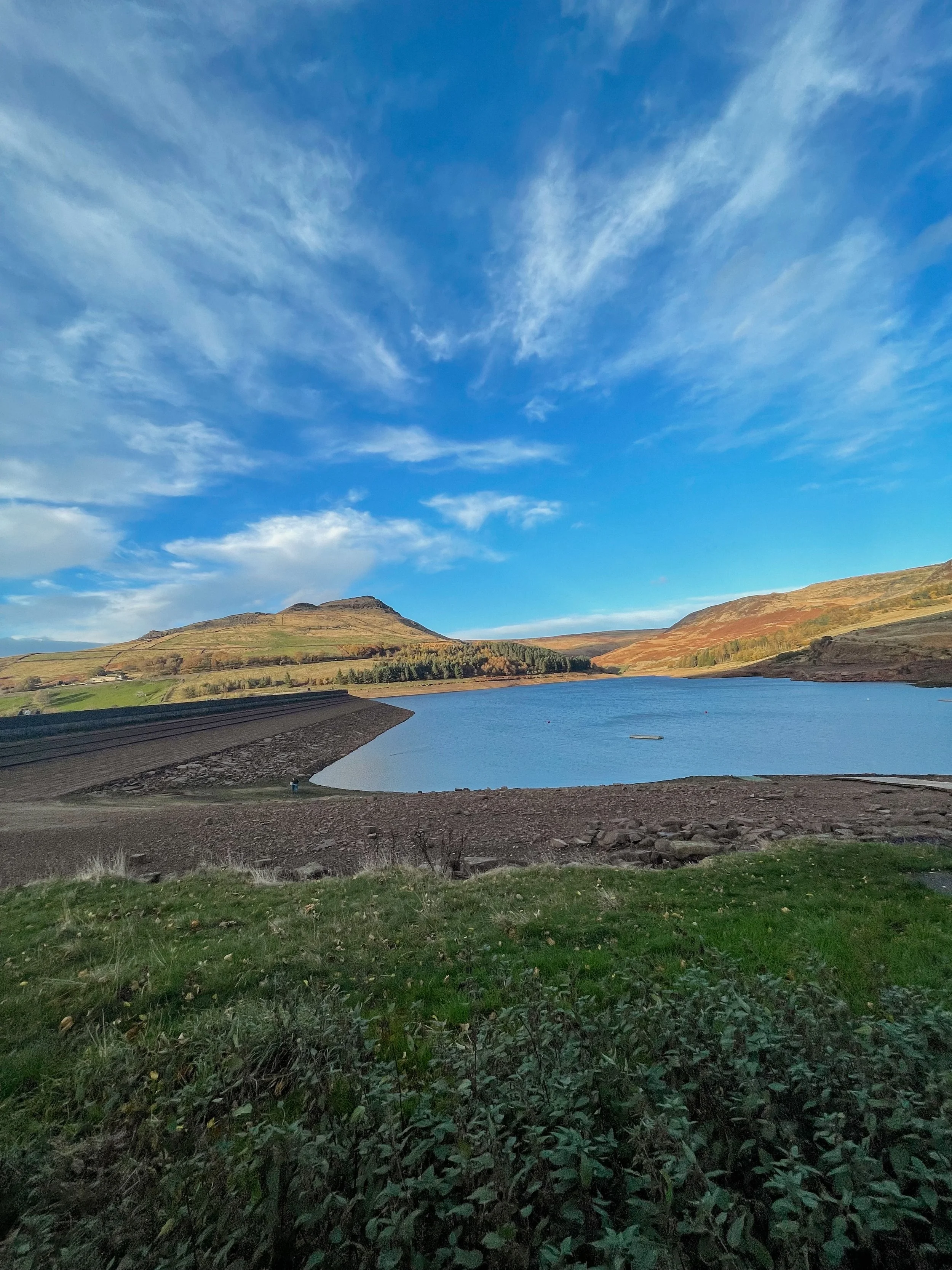
BEST LONG HIKES NEAR MANCHESTER: DOVESTONE RESERVOIR
This popular Dovestone Reservoir walk is a local favourite for a reason. We prefer visiting at Autumn, but it’s a perfect all-weather!
(Although do make sure you wrap up, it gets chilly up those in those hills)

Start: Greenfield, OL3 7DD
Distance: 7.79 miles
Duration: 2-3 hours
Elevation: 1,225 feet
Navigation: follow the route here

Dovestone Reservoir has become increasingly popular in recent years and can get quite crowded. Fortunately, routes like this one exist: taking you on the outskirts of the popular landmark for an even better view of the area, instead.
Our walk takes you along the edge of the moor to the south of the reservoir for a more secluded walk. Upon reaching Alphin Pike, you’ll enjoy an incredible vista over West Manchester and even as far as Wales, before heading over to Wimberry Rocks for a great view down onto the reservoir and surrounding valley.

Better yet, our walk has an alternative starting point to the main car park, so you won’t be left fighting over a space during those busy periods. Ticketing is rife in this area so please do park responsibly.
En route, expect lush greenery, incredible views and a variety of wildlife every way you turn. As a genuine haven not far out of the city centre, it’s no surprise this place is so popular.

Soon after passing Wimberry Rocks, you’ll be greeted with views of Pots n Pans and another reservoir of your very own: Chew Reservoir.
Fancy heading there soon? Follow our route here
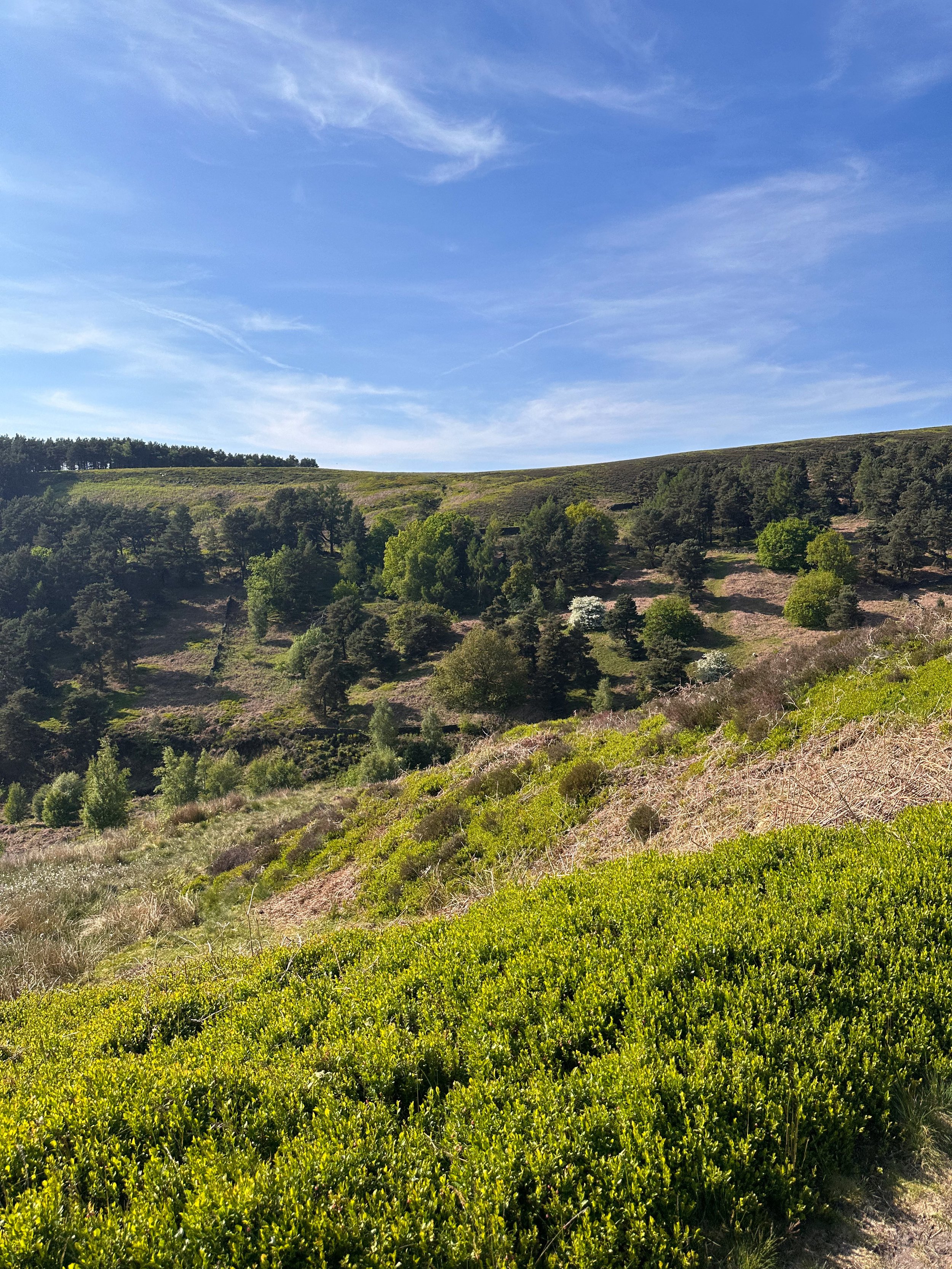
BEST WOODLAND WALKS NEAR MANCHESTER: ASHOP CLOUGH
If you’re looking for a magical walk as we head towards the most magical time of the year, a trip to Ashop Clough and the Snake Woodlands is a must
Start: Hope Woodland Car Park, S33 0AB
Distance: 3.59 miles
Duration: 1-2 hours
Elevation: 400 feet
Navigation: follow the route here
Easily missable as you drive along Snake’s Pass (A57), this magical wonderland is hidden from view until you venture down into the woodland adjacent.
This stunning pine forest landscape will have you feeling like you’re in the depths of a Canadian national park, much less on the outskirts of Glossop…
Surrounded by rolling hills, pine trees and babbling streams, you won’t be short on fairytale-like scenery on this short circular walk. In fact, this route has a mix of everything: magical woodlands, eerie moorland and even some spooky ruins to boot.
This route in itself is an absolute gem — but if you’re looking to get a few extra miles in, popular Peak District landmarks Higher Shelf Stones and the B52 Crash Site can easily be incorporated. You can follow our Crash Site walk here,
Due limited parking spaces, we advise going off-peak when you can. The good news is, you’ll usually have the place to yourself due to its hard-to-reach location.
Ready to be transported to your very own fairytale? Follow the route here

BEST WALKS NEAR WIGAN: FAIRY GLEN LOOP
Looking to escape to an enchanting woodland over the weekend? This short Greater Manchester walk has your back
Start: Parbold Hill Viewpoint, Wigan, WN8 7TH
Distance: 4.24 miles
Elevation: 400 feet
Duration: 1-2 hours
Navigation: follow the route here
From pie trails to the infamous pier… there’s no doubt a day in Wigan is a day well spent. It’s said the Manchester town has become the centre of the pie-making and pie-eating world, and who are we to argue with that?
So if you’re after a day of fine pastry once you’ve headed off on your Sunday stroll, you’re in for a treat with this one.
Starting from Parbold Hill Viewpoint, this short loop is great for a Sunday stroll with four-legged pals in tow. Before long, you’ll start your descent towards the Liverpool-Leeds canal, before ascending back up to Appley Bridge, which is where the real gem of this walk lies: Fairy Glen.
Nestled on the side of Parbold Hill, Fairy Glen is a serene patch of forest with picturesque cascades, streams and waterfalls, with plenty of hiking trails perfect for extending your walk should you wish to venture further.

Fancy giving this woodland walk in Manchester a go? Follow the route here

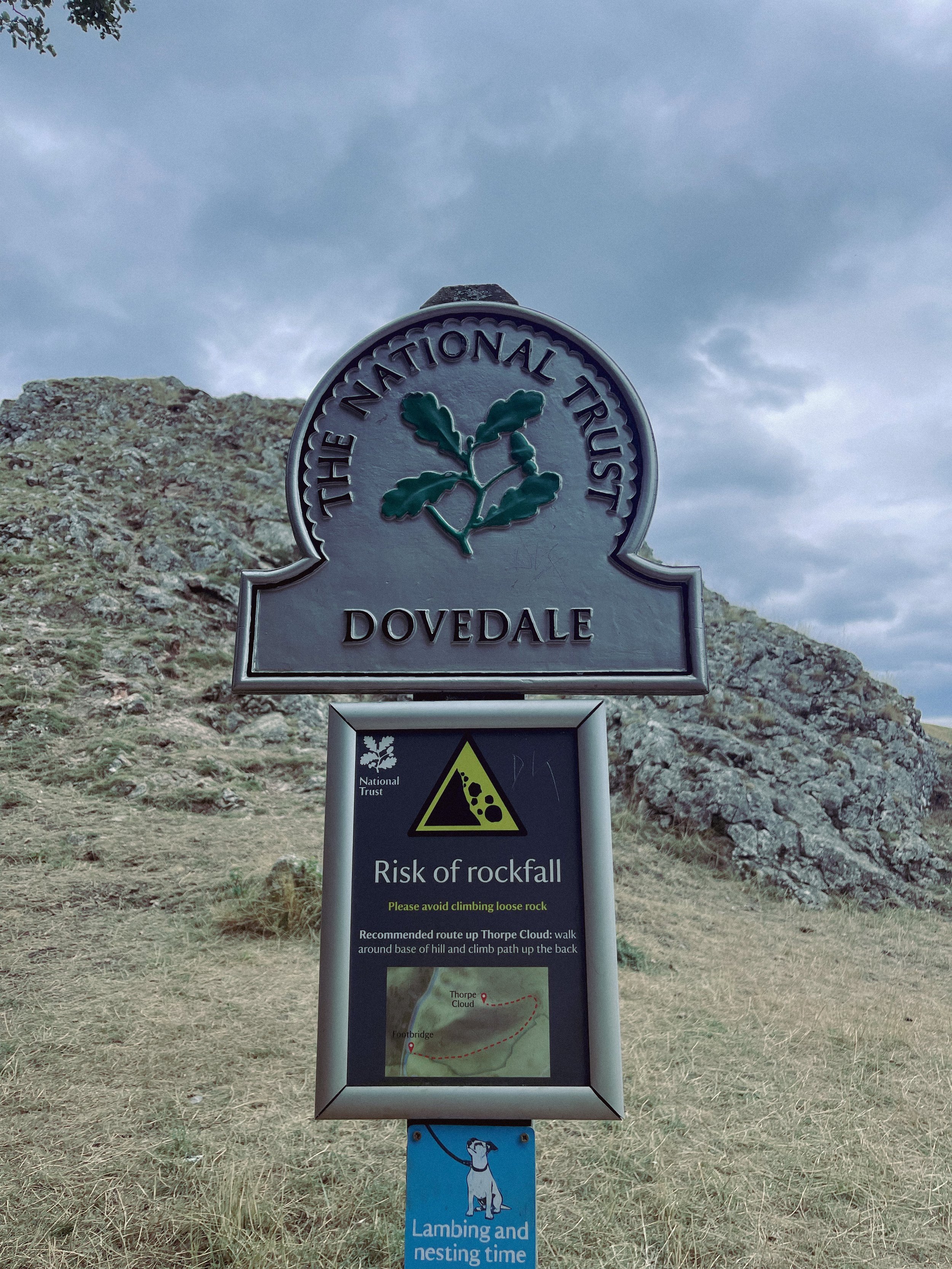
THORPE CLOUD
Gothic manors… idyllic tearooms… and a trig point to boot — this walk in Ashbourne has it all

Start: Blore Pastures Carpark, DE6 2BS
Distance: 5.49 miles
Duration: 2.5 hours
Elevation: 1,000 feet
Navigation: follow the route here

Whether you’re here for the stepping stones across the River Manifold, or fancy indulging in the history of this quaint town’s old manor house, a day trip to Ilam Park is always a good idea.
After a meander around Ilam Hall, our route takes you up Thorpe Cloud as you summit the hill for breathtaking views across the dale, and return home via the stepping stones across the River Dove.

Thorpe Cloud is found in the White Peaks on the southern end of Dovedale — a gorgeous limestone hill that attracts thousands of visitors each year thanks to its unique shape and close proximity to Dovedale Stepping Stones.
The route up to the summit is easy-to-follow, navigated by blue markers on signposts. With some steep parts that’re a good challenge for beginners, the walk is short and sweet with plenty of options to extend if you’re feeling particularly energetic.
The Stepping Stones are a very popular Peak District attraction, so if you’re wanting to explore free from pedestrian traffic, we’d definitely recommend visiting off-peak if that’s an option for you.
That said, they’re a must-do Peak activity… and well worth the visit!

Grab yer hiking boots and follow one of our favourite Peak District walks here

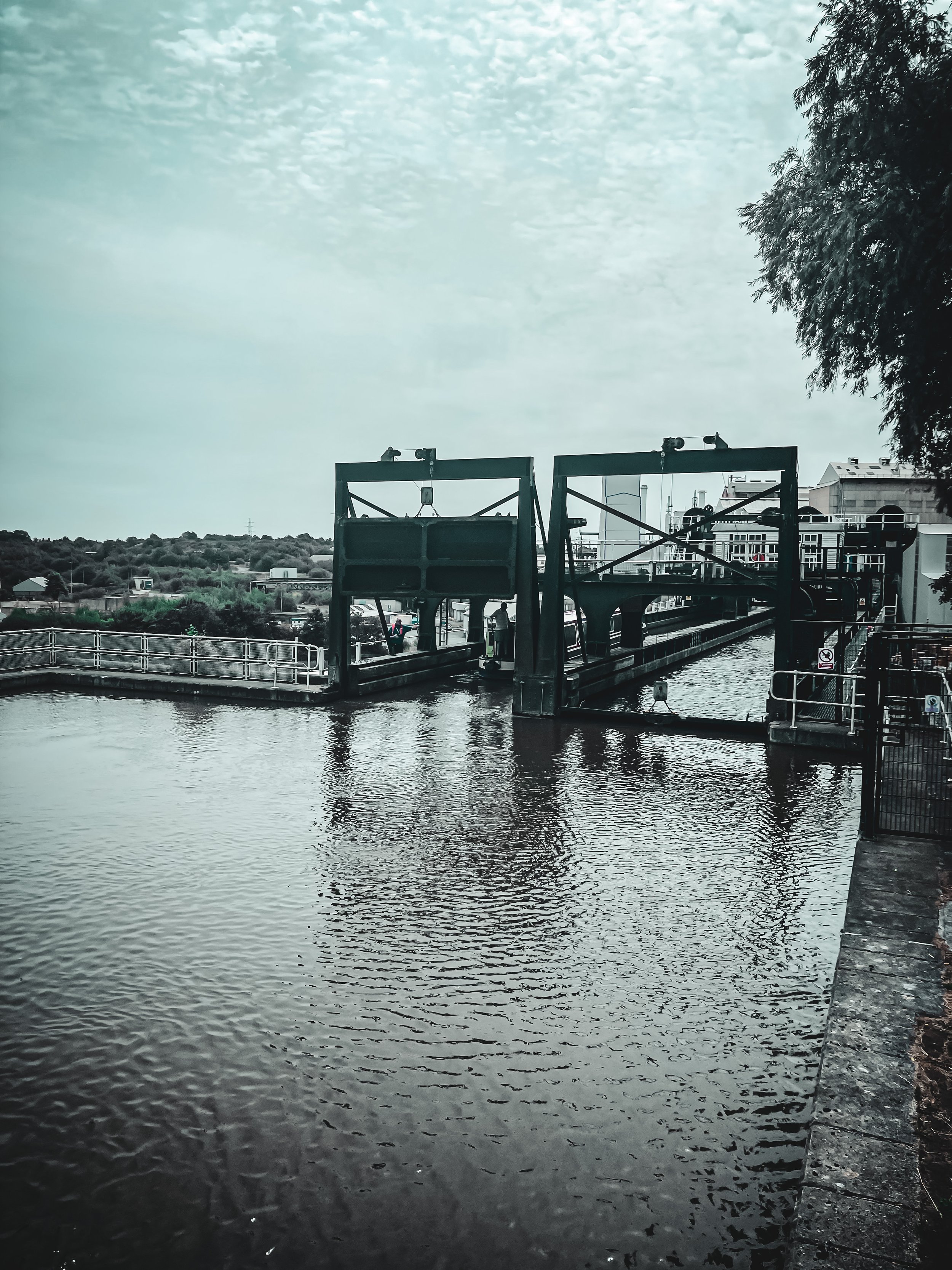
ANDERTON BOAT LIFT WALK
Fancy a wander round Cheshire’s historic boat lift? With the Mersey Canal and the River Weaver as your backdrop, this is one of Cheshire’s best walks for scenic trails and uninterrupted re-charging

Start: Barnton, CW8 4EL
Distance: 3.45 miles
Duration: allow approx. an hour
Elevation: 100 feet
Navigation: follow the route here
Searching for a day out that’s perfect for the whole fam? A trip to Anderton Boat Lift is a must. This mighty lift is dubbed one of the Seven Wonders of the Waterways — but for us, it’s the nearby woodlands and nature trails that make this place truly special.
Starting in Northwich, you’re never far away from the area’s many impressive waterways; taking you through some quintessential Cheshire countryside.
Plus, with its close proximity to nearby Cheshire walking gems like Marbury Country Park, Pickmere and Great Budworth, you can easily extend this walk into a full day’s adventure.

On arrival to the boat lift, you’ll soon learn this monument dates back to 1875, designed by Edwin Clark to transfer narrow boats from the River Weaver, or what’s now known as the Weaver Navigation.
It’s a steel superstructure capable of taking two narrow boats side by side… and seeing it in operation is something else, if not a little nerve-wracking!

Should you prefer to start at the Boat Lift, there’s ample parking to begin your adventure there. As for its surrounds, we were surprised at just how many trails you can take your pick from. On one side you have the Mersey Forest, the next a country park, a good pub, a pretty village and lots of waterways to reflect.
After wanting to head down to the Boat Lift for a while, we were taken aback by the unexpected scenery every way you turn — a must-visit if you ever find yourself in the area.

Sound like your ideal day out? Follow the walk here

FLETCHER MOSS
This tranquil stretch of Didsbury is perfect for recharging after a busy week in the office.

Start: Chorlton
Distance: 6.13 miles
Elevation: 75 feet
Duration: allow approx. 2 hours
Navigation: follow the trail here
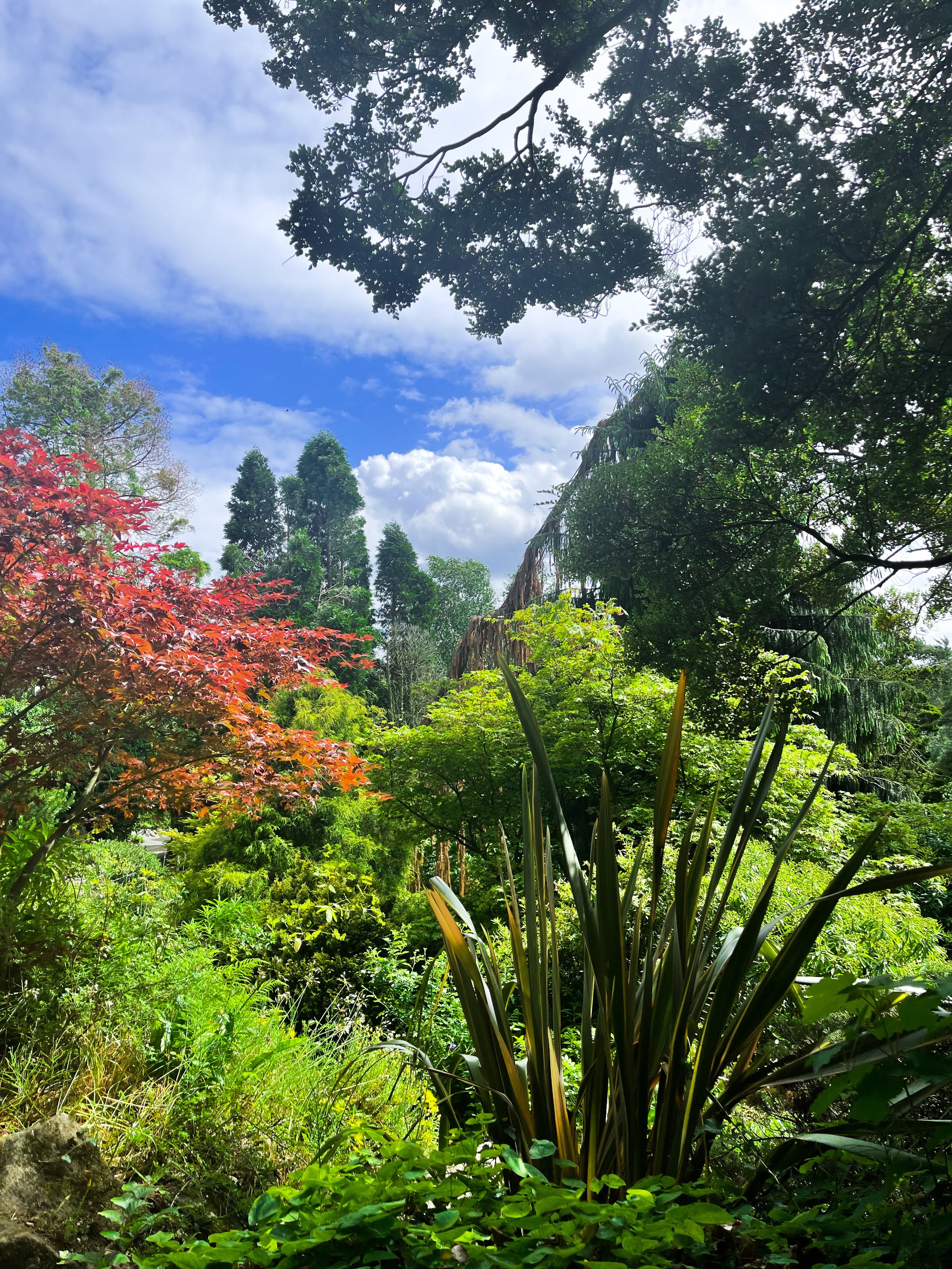
Tucked away between numerous Mancunian green spaces, you’ll find Fletcher Moss Botanical Gardens in all of its unsuspecting glory. It’s an oasis, that’s for sure, and given its location just a stone’s throw away from lively South Manchester, an unexpecting one at that.
Better yet, entry into this incredible garden and surrounding woodland is completely free.

There are several different sections and terrains to cover, from the nature reserve itself, to the Parsonage gardens, river Mersey, a trail through the woods… and most people’s favourite: the rockery.
The rockery is well-maintained and a real gem to escape the hustle and bustle of city life for an hour or so. The Old Parsonage is the second oldest building in Didsbury and has only ever been lived in by two of the church ministers.
Back in 1915, Fletcher Moss gifted the house and gardens to the City of Manchester and much of the present layout was designed by Moss himself and his mother.
Today, you’ll find a large number of ornamental trees, a striking neo-Norman stone arched gate and numerous species of wildlife.

Thanks to the park’s clever layout, the stunning rock gardens are protected from the elements — home to a south-facing slope for shelter, perfect for sitting in the garden on a Mancunian summer’s day.
Aside from its perfectly groomed gardens, Fletcher Moss is home to an array of wildlife, and even a Bug Hotel.

And in true Manchester style, you’ll even find a little slice of hipster heaven in the form of The Alpine Tearoom, selling up a gorgeous selection of alcoholic spirtzers, NQ-approved hot drinks and tasty food.

Our route starts in Chorlton-cum-Hardy, meaning you can take in numerous hidden South Mancunian scenic delights in one stretch. With a short stroll along the River Mersey en-route, it’s a calming walk with plenty to see along the way, making it one of our best walks to set off on in Manchester.

Like what you see? Follow the route step-by-step here
UPHILL CHALLENGES:


WALKS WITH WATERFALLS:


