ALL TRAILS

DRAGON’S BACK WALK (5 MILES)
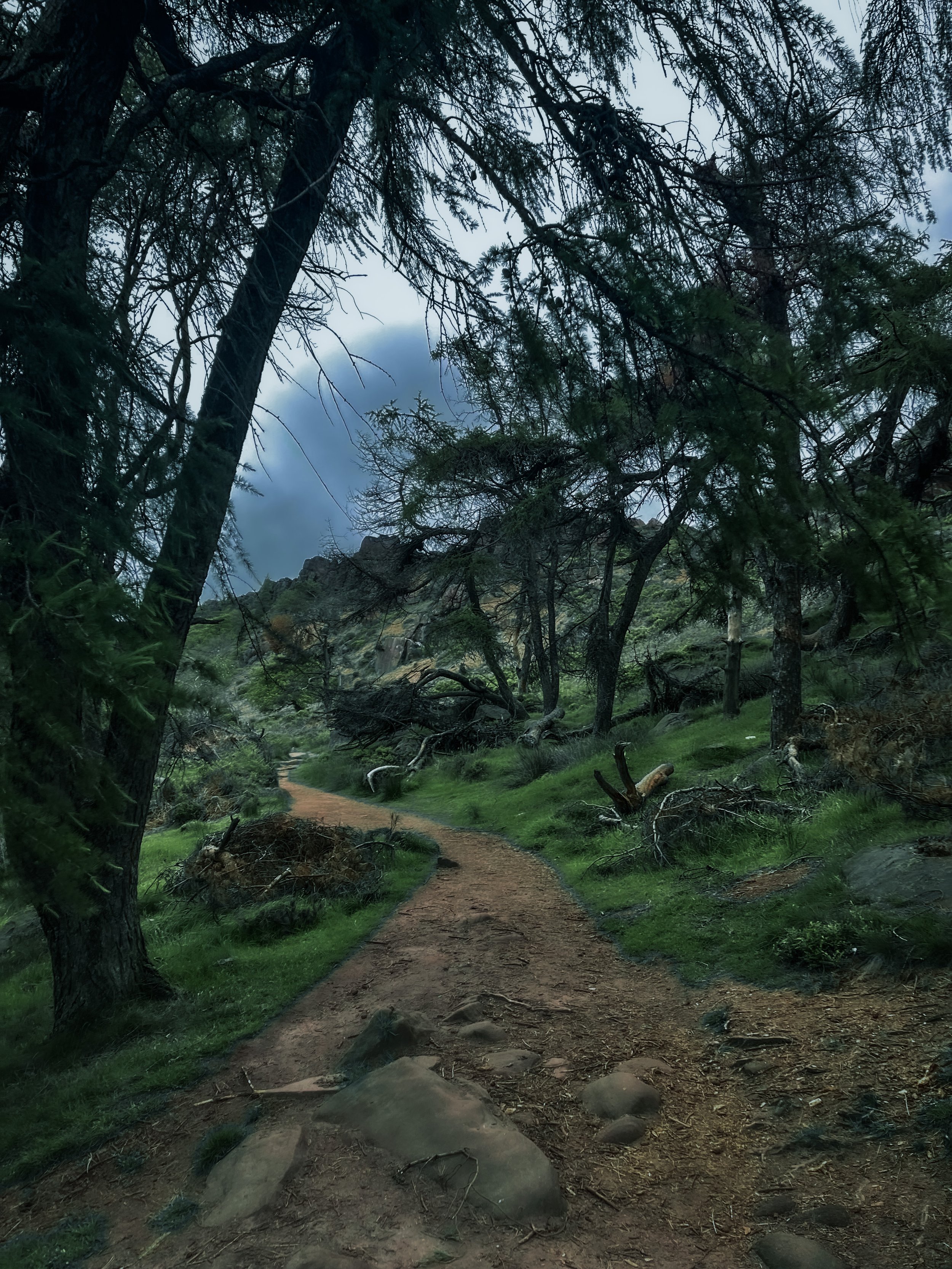
Want to feel like you’ve spent the day in Middle Earth? This route’s for you.

Start: Hollinsclough, SK17 0RH
Distance: 5 miles
Ascent: 1,000 feet
Duration: allow approx. 2 hours
Navigation: follow step-by-step

Starting and finishing in the pretty hamlet of Hollinsclough, this walk has it all: magnificent views across the Staffordshire and Peak District wilds, paths criss-crossed with ancient stone walls, and summits galore… taking you through the breath-taking landscapes of the famous Dragon’s Back over the tops of Chrome Hill (424m), before meandering back up Parkhouse Hill (360m).
From here, you descend through untouched farmland and idyllic country lanes to make the return back to Hollinsclough.
With challenging terrain in places, our route to the summit of Parkhouse Hill should only be taken on if you’re confident at scrambling. There’s free street parking in the village but spaces are limited to so plan ahead if you’re arriving by car.

The views of the landscapes surrounding are sure to take your breath away at every part of this route. But the real highlight for us came in the form of a wonderfully idyllic pitstop, The Honesty Shop.
This perfectly stocked café-come-hut-come-shop has all your refuel needs covered, with hot drinks, sweet treats and fresh local produce aplenty. The Honesty Shop has no staff and relies solely on the good nature of passers-by to do the right thing - a comforting reminder that we were far away from the hustle of the city.

The walk can be shorted by cutting out the final ascent over Parkhouse Hill or extended by following your nose to the summit of High Wheeldon.

Another option is to start at The Quiet Woman pub in Earl Sterndale, not far from Buxton. Unsurprisingly, the many routes surrounding the limestone reef knolls of Chrome and Parkhouse Hills make for magnificent views throughout.


KERRIDGE HILL LOOP
Discover the beauty of Cheshire from up above in this 6 mile circular walk…

Start: Clough Bank, Bollington, Macclesfield SK10 5NY
Distance: 6.88 miles
Duration: 2-3 hours
Elevation: 1,000 feet
Navigation: follow the route here

Looking for a bit of history on your next trip outdoors? Look no further than this uphill hike around the Cheshire countryside. Not only does this walk provide excellent views that sweep right across the surrounding area, but you’ll also pass White Nancy fairly early on — a memorial site atop Kerridge Hill, built to commemorate the victory of coalition forces at the Battle of Waterloo.

With its comically shaped physique, White Nancy isn’t your typical historical landmark. Thanks to its lofty position, the site White Nancy sits on had been used as a warning beacon of invasion for centuries, featuring other small structures before Nancy took up residence.
In 1817, the Gaskell family of Ingersley Hall built the structure you see today, in belated commemoration of the victory at Waterloo, 1815. Originally, White Nancy had a door and was used as a summerhouse, but was soon sealed off due to vandalism over the early 20th century.

Whether you’re here for the views or the stories of yesteryear, you’re sure to be taken aback by the undisturbed peacefulness of this route. On a clear day, you can see as far as Snowdonia, Liverpool’s coastal line and the windmills off the Wirral peninsula.

After admiring the views surrounding White Nancy, walking across Kerridge Hill is a must. The route’s quite steep in parts — but the views? So worth it.
So if you’re after a walk that offers incredible views every way you turn, make sure you stop by and see our Nancy soon. With multiple footpaths, woods and fields to explore nearby, you can easily extend this route into a full date out.

Fancy stopping by to visit Nancy soon? Follow the route here

NEW MILLS MILLENIUM WALKWAY WALK
Come with us on this short (but oh so scenic) walk just 20 minutes from Manchester…

On initial glance, New Mills may look like any ordinary Peak District village: small, picturesque with little much-to-do around the town. Venture just a few steps downwards towards the River Sett, and you enter another landscape entirely.
We’ve partnered with In Our Nature, Manchester’s biggest climate movement, to show you don’t always need to grab for the car keys to enjoy a wonderful day out in the Peaks.

Whether you want a lazy Sunday stroll or are seeking a fully day of exploring, New Mills is a great base for all types of adventures.
That’s why we’ve got two routes for you to choose from. The first, a short 4 mile loop that leaves plenty of time to explore the many wonderful independent shops and cafes in New Mills town centre. The second is a 10 mile loop which you can start from either New Mills or Marple, with easy train links from Manchester to both starting points.
Route #1: The Torrs Circular
Start: New Mills Central Station
Distance: 4 miles
Elevation: 300 feet
Difficulty: Easy
Duration: 1.5 hours
Navigation: Download the GPX file here
The Millenium Walkway and The Tours
Below the hustle and bustle of the main shopping centre lies New Mill’s (not so) hidden gem: The Torrs. We’ve done this walk a few times, and every time we’re amazed by the astounding natural gorge that lies below.
Expect colourful cliffs, enormous viaducts and a long bridge that transports you to the Goyt Way — making for one of the best lesser-known walks in Derbyshire.

Millers Refillers
The beauty of this shorter route means, not only can you take it at your own leisure, but you have the full day to explore the many wonderful shops, pubs and cafes that New Mills has to offer. Make sure you check out this iconic zero waste shop, stocking everything from baking essentials, flours sugars, pulses, rice, pasta, nuts, dried fruits, seeds, spices, oils, vinegars, sweet treats and snacks, and so much more.

Route #2: Mellor Cross
Distance: 10.5 miles
Duration: Allow approx. 4 hours
Elevation: 1,200 feet
Difficulty: Moderate
Navigation: Download the GPX file here
If you’re wanting to make a full day of it and check out some of Stockport’s forgotten while you’re at it, then this route’s for you. While The Torrs itself makes for a great short circular route if you’re not planning on venturing far, this longer walk is perfect for summer days spent exploring.
From Marple, you’ll head towards The Roman Lakes and passed the site of Mellor Mill Ruins. Once a shining star or the Oldknow Empire, Mellor Mill was the biggest spinning mill the world had seen during its time of construction. What remains of the mill have since been taken over by the natural world, making for a gorgeous pitstop by the Peak Forest Canal and River Goyt.

Passing the ruins, you’ll make the ascent towards Mellor Cross—a local landmark on Cobden Edge. The cross was originally erected in March 1970, made by a carpenter local to the area. From The Cross, you’ll reach Mellor Moor, where you’ll be rewarded with views across the western edge of the Peak District and the Cheshire Plain.

The moor’s umpteen tracks date back to prehistoric Old Mercian trackways, and make great aids for exploration. The line of an ancient trackway is said to be the route of monks and pilgrims, with waymarkers signifying Old Mercian landmarks and monasteries.

Descending from the moorland, we head towards New Mills where you can stop for a well-earned refuel. The town boasts an impressive mix of independent shops, cafes and pubs, perfect for that much-needed pitstop before the homeward leg. We stopped off at Clockwork Cafe, which has all your caffeine (and Derbyshire Oatcakes!) cravings covered.

After a refuel is where you’ll be greeted with the trail’s main event: The Torrs Millennium Walkway. This 175-yard aerial walkway spans the cliffsides above the River Goyt, with links to many walking and cycling routes should you choose to travel a different way home. New Mills Heritage Centre provides maps and guides for several nearby walks, including the iconic Kinder Trespass Trail.

In 1932, around 500 walkers from Manchester trespassed en masse from Hayfield to Kinder Scout to secure access right to open country for all to enjoy. Back then, walkers across England and Wales were denied access to areas of open country—luckily for us, the trespass helped pave the way for the establishment of the Pennine Way and other long-distance footpaths enjoyed today.
Fancy following in their footsteps? You can follow our Hayfield to Kinder Scout route here.
On the home stretch, the Goyt Way makes for a relaxing, flat stroll—taking you passed landmarks such as Bruce’s Clock in Strines. In medieval times, Strines stood as a large hunting forest—The Forest of the Peak—before local gentry settled here during the Elizabethan period.

Bruce’s Clock was originally found on the grounds surrounding Strines Hall, with the comings and goings of local people ordered by the striking of its bell in days when clocks and watches were rare household acquisitions.

After briefly meeting back up with The Roman Lakes footpath, you’ll finally reach The Peak Forest Canal to make the last stretch back to Marple.
The Waltzing Matilda sometimes moors here, so keep an eye out if you’re looking to refuel on woodfired pizza.


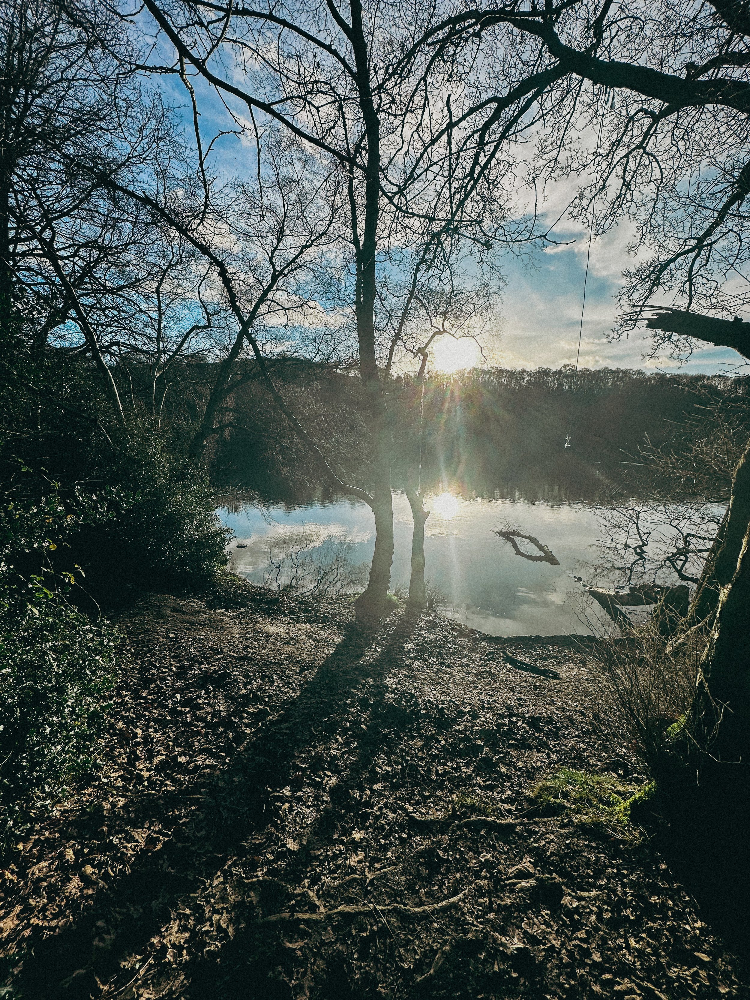
ERRWOOD HALL LOOP, GOYT VALLEY
Panoramic views, magical woodlands and peaceful picnic spots are just some of the reasons you’ll want to head to Goyt Valley — and at just 3 miles for a round trip, you won’t find a better local short walk than this one…

Start: Errwood Hall Car Park, SK11 0AR
Distance: 3 miles
Elevation: 500 feet
Duration: 1-2 hours
Navigation: follow the route here

This relaxed Peak District walk is beautiful in any season, but the way the woods are painted with gorgeous auburn hues come late September should make this route appear high on your list of autumn woodland walks.
Lying just a few miles northwest of Buxton, Goyt Valley is magical place — one that’s gained popularity from visitors since Victorian times.
Once a prosperous and industrious community, the signs of a time gone by are all but extinct, bar from the ruins of Errwood Hall. Back in 1937, the construction of Fernilee Reservoir completely changed this beauty spot’s landscape, but the area remains a wonderfully peaceful place to visit to this day.
Walk Overview
This leisurely three-mile walk takes in three of the most historic sites in this part of the Goyt Valley; the ruins of Errwood Hall, the hilltop cemetery of the Grimshawe family who lived here from around 1840 to 1930, and St Joseph’s Shrine, the small circular stone building dedicated to the Spanish companion of Mrs Jessie Grimshawe. From here the walk ascends a gentle slope to reach the summit of Foxlow Edge before returning to Errwood Hall carpark.

Errwood Hall: A Glimpse into the Past
Errwood Hall, now a ruined site, was once the centerpiece of the Grimshawe estate. Constructed in the 1830s by Samuel Grimshawe, this grand mansion boasted Victorian Gothic architecture and stunning views of the Goyt Valley. The Grimshawe family, who resided here from 1840 to 1930, played a significant role in the area's history.
During its heyday, Errwood Hall hosted lavish gatherings and social events, but tragedy struck in 1930 when the estate was demolished due to financial difficulties. Today, the haunting remains of Errwood Hall stand as a testament to a bygone era, inviting visitors to explore its enchanting grounds.

Goyt Valley Highlights
Pym Chair
Folklore more your thing? Local legend has it that a highwayman called Pym used to lay in wait to ambush those who used the old packhorse route, hence the name Pym Chair given to one of the peaks in this mesmerising landscape.
Shining Tor Trig Point
Shining Tor, the highest point in Cheshire, is often included in walks through Goyt Valley… because if you can bag a few trigs in one walk, why wouldn’t you?

Fancy giving this one a go? Follow the route here

THE TRINNACLE: DOVE STONE LOOP
Fancy spending the weekend climbing Saddleworth’s most-snapped landmark? Then a scramble up The Trinnacle is a must…

Start: Binn Green Car Park, Oldham, OL3 7NN
Distance: 4.13 miles
Elevation: 950 feet
Duration: less than 2 hours
Navigation: follow along here

Fed up of the same old flat walking routes around the same old area?
Well, it turns out you don’t have to travel too far out of town to be transported to another world entirely…
Our route round Yeomen Hey Reservoir and up to The Trinnacle will have you feeling like you’re in a Canadian National Park, much less the outskirts of Ashton.

Located high on the hills of Saddleworth Moor, there stands a peculiar rock formation which has well and truly gripped the attention of ramblers far and wide.
Best known as ‘The Trinnacle’, this fork-shaped pillar juts out from the moorlands above Dovestone Reservoir and has attracted the attention of many keen photo opportunists as of late.

Made up of dazzling reservoirs, epic waterfalls, jaw-dropping scenery and steep inclines - alongside a couple of exhilirating scrambles along the river edge - this route really has it all.

Good-to-knows
Parking: Binn Green Car Park (RSPB). Please note, the spaces are limited and fill up quickly. We advise visiting off-peak where possible.
Public Transport: Catch the train to Greenfield Station. This extends the walk by about 50 mins each way.
Amenities: You’ll find an ice cream van and coffee truck at the base of Dove Stone Reservoir, with public toilets in the car park adjacent.
The Trinnacle: While this landmark certainly makes for a great photo opp, please only attempt scrambling if you are confident to do so. Make sure to take great care and only climb if the weather allows for it. The drop at the rear side is certainly no joke.
Fun fact: as we were climbing this one, a passerby shouted “I can’t watch! Make her get down!”, so make sure you have a head for heights whether you’re spectating or tackling it yourself.
Kit: Boots are ESSENTIAL for this one. The route is comprised of steep, slippery, boggy and rocky terrain. White trainer victims: be warned. (We certainly saw a few en-route!).
Take layers. It was a glorious day when we visited but remember where you are… layers are always a good idea.
Refreshments: Due to the idyllic Greenfield location, you’ll have your pick of pubs on this one. We recommend stopping off at The Roaches Lock, just a short drive away from the starting point.
Extending the route: Follow our extended 6 mile version here.
Fancy giving this one ago? Follow along here
LUD’S CHURCH VIA THREE SHIRES HEADS WALK
Always fancied venturing to Lud’s Church? Why not tick off two Wonders of the Peak in one day with a visit to Three Shires Head and go for a dip while you’re at it?

Start: Gradbach Car Park, SK17 0SU
Distance: 6.65 miles
Duration: 2-3 hours
Elevation: 900 feet
Navigation: follow our route here

Three Shires Head is where the counties of Derbyshire, Cheshire and Staffordshire meet at a waterfall and collection of pools on the River Dane. It’s a stunning spot, and perfect if you love a wild dip! Even on a cloudy day, it’s a firm favourite Peak District wild swimming location — making the ideal base for a picnic and paddle.

Lud’s Church itself is one the Peak District’s must-see landmarks, and from the moment you step foot into its surrounds, we’re sure you’ll understand why. Pictures definitely don’t do this place justice, so a trip to Lud’s is a must!

The ravine that makes up Lud’s Church is thought to have formed during the post-glacial period —some 11,000 years ago— by a large slip of Roaches Grit: a coarse form of sandstone.
It wasn’t until the 15th century that this place became a popular place to dwell— among a secret community, at least. A group of religious dissenters called the Lollards flocked here to hold covert religious meetings to escape the prosecution of the Catholic Church. It’s thought the name of a man arrested at one of these meetings, Walter de Ludank, inspired the name of the site.

Today, the area provides a dramatic nature walk through the Black Forest, transporting passers-by into old England and its many forgotten tales. You certainly don’t have to stretch your imagination too much to picture this place as the origin of many myths and mysteries.
Over the centuries, its’s been associated with tales of Robin Hood and his Merry Men, who’re thought to have hid here as a place of refuge.

Our route starts in Gradbach, first taking you up a forgiving ascent up to Three Shires Head. Once here, make the most of the opportunity for a pitstop — whether you fancy a wild dip or a quick refuel. From here, we return along the River Dane back towards Gradbach, where you can stop off at The Cafe at Gradbach. The cafe sells everything from sweet treats and coffees, to even a prosecco and a pint! Can’t find a better pitstop around, if you ask us.
From the cafe, we begin a short climb up to, what some may deem, the main event: Lud’s Church. This mystical chasm is shrouded in history and myth at every turn — we’ve visited a handful of times and it never fails to take our breath away!

With such a variety of landscapes in a relatively short walk, this is definitely one of our favourite walks in the North West. It’s a cracking walk and takes in multiple picturesque parts of this beautiful area. And if you fancy making a proper day of it, why not take a trip to The Roaches following our extended route here?
Fancy following along? Find step-by-step navigation here
GOYT DAM
Panoramic views, magical woodlands and peaceful picnic spots are just some of the reasons you’ll want to head to Goyt Valley
Start: Whaley Bridge, SK23 7LX
Distance: 7.71 miles
Elevation: 1,075 feet
Duration: 2-3 hours
Navigation: follow the route here
This relaxed Peak District walk is beautiful in any season, but the way the woods are painted with gorgeous auburn hues come late September should make this route appear high on your list of autumn woodland walks.
Lying just a few miles northwest of Buxton, The Goyt Valley is magical place — one that’s gained popularity from visitors since Victorian times.
Once a prosperous and industrious community, the signs of a time gone by are all but extinct, bar from the ruins of Errwood Hall. Back in 1937, the construction of Fernilee Reservoir completely changed this beauty spot’s landscape, but the area remains a wonderfully peaceful place to visit to this day.

Expect stunning views every way you turn, thanks to a unique landscape which was carved out by successive Ice Ages and the River Goyt. It’s the perfect location for a day of recharging your batteries, with the natural scenery and rolling hills surrounding making for a wonderfully soothing trip outdoors.
With free parking at many of the valley’s landmarks, enjoying a day’s stroll around Goyt Valley is easy — especially if you follow one of the waymarked routes starting from Errwood Car Park.
For us, though, the beauty of this trail starts not in the valley, but in nearby Whaley Bridge. Along the way, expect dense pinewoods and azalea bushes, ruins of worker cottages and even a shrine close to the ruins of an abandoned hall.

And if folklore is more your thing, local legend has it that a highwayman called Pym used to lay in wait to ambush those who used the old packhorse route, hence the name Pym Chair given to one of the peaks in this mesmerising landscape.
Fancy giving this one a go? Follow the route here
YEOMEN HEY - DOVE STONE LOOP
Discover the best walking routes around Dovestones - a hiker’s guide to the lesser-known trails
Start: Greenfield, OL3 7DD
Distance: 7.33 miles
Elevation: 1,000 feet
Duration: 3-4 hours
Navigation: follow along here
Fed up of the same old walking routes that offer nothing more than a flat path and an average view?
Well, how about getting the best of both?
Our route around Dove Stone Reservoir to Yeomen Hey Reservoir route is not only beautifully flat to begin with but offers a bit of a challenge towards the end, too.
Starting in Greenfield, the route begins with a gentle stroll up to the banks of the reservoir — a great way to warm up before the climb begins.
After about a mile or so around the reservoir, you'll come across a steep climb that leads up to the Yeomen Hey Reservoir. The climb is only short, with most of the ascent accruing in one stint — but the views from the top are more than worth it. From here, you'll be rewarded with insane views, with rolling hills as far as the eye can see.
The path continues along the edge of the Yeomen Hey Reservoir, and it's here that you'll start to hear the sound of rushing water. That's because you're approaching the waterfalls. These waterfalls are a series of cascades that run down the hillside, and they're truly beautiful.
To ascend towards the waterfalls you'll need to do a bit of scrambling. It's not too difficult, but it's worth noting that it can be a bit slippery and caution is required. We recommend climbing up our way and then down the waterfall, but the route can be reversed if you prefer. Just be careful and take your time — and hiking boots are definitely needed for this.
Once you've reached the bottom, take a moment to catch your breath and enjoy the view. You'll see the water cascading down the rocks, creating a natural pool at the bottom. It's a perfect spot for a quick dip if you're feeling brave.
From here, the route continues along the top of the hillside, offering panoramic views of the surrounding countryside. You'll eventually come to the Yeomen Hey Reservoir, where you can take a break and enjoy a picnic by the water's edge.
After your rest, it's time to head back around Dovestones and on to greenfield. The route back is a bit easier, with a gentle descent down the hillside. Take your time and enjoy the view – you'll see the reservoir in a whole new light on the way back.
And better yet, once you’re near the starting point, a pint will be waiting for you at The Clarence in Greenfield.
Enjoy!

ETHEROW TO WERNETH LOOP
Discover Greater Manchester’s best hidden gems on this multiple-country park woodland walk

Start: Etherow Country Park, SK6 5DJ
Distance: 9 miles
Duration: 4 hours
Elevation: 1,500 feet
Navigation: follow the route here

Fancy experiencing all the seasons in one day?
Well, you're in luck, because this walk from Etherow Country Park to Werneth Low Country Park and confused mid-winter weather is what Great Manchester does best.
But don’t worry, with stunning scenery throughout and a dash of history thrown in for good measure, this walk is guaranteed to be a crowd-pleaser.

Our journey begins at Etherow Country Park — one of Britain’s first country parks. With 240 acres of greenspace, this place has an abundance of wildlife… and a waterfall you don’t want to miss!
But don't get too distracted by the fauna, because we've got a hill to climb. Yup, after a short stroll around the Keg Pool its time to climb up to Werneth Low Country Park.
Along the way, take a moment to catch your breath and admire the stunning panoramic view. Once atop The ‘Low, you’ll be quickly rewarded with immense views all across Manchester, the Peak District National Park, and the Cheshire Plain.

History buffs, we've got a couple of landmarks for you to check out. The first is the Werneth Low War Memorial, which was erected in 1921 to honor the soldiers who died in the First World War. It's a stunning monument, made of granite and topped with a bronze figure of a soldier.
After resting your legs and taking in the views, we make our way through the woodlands around Charlesworth and Broadbottom — each nothing short of idyllic. The trees are tall and imposing, the paths are winding and mysterious, and the wildlife is abundant. And if you’re up for a detour, the other landmark to check out is the Broadbottom Viaduct, which spans the valley between Broadbottom and Mottram.

Now, I know what you're thinking: a viaduct doesn't exactly sound like the most thrilling pit stop in the world. But trust me, this one is a real beauty. It was built in 1842, it's made of brick, and it has 27 arches. If you're an aspiring artist or photographer, this is the perfect spot to flex your creative muscles.
So, there we have it: a string of local country parks in one gorgeous route.
As local routes go, this one is a true belter.

Ready to follow along? Follow the route here

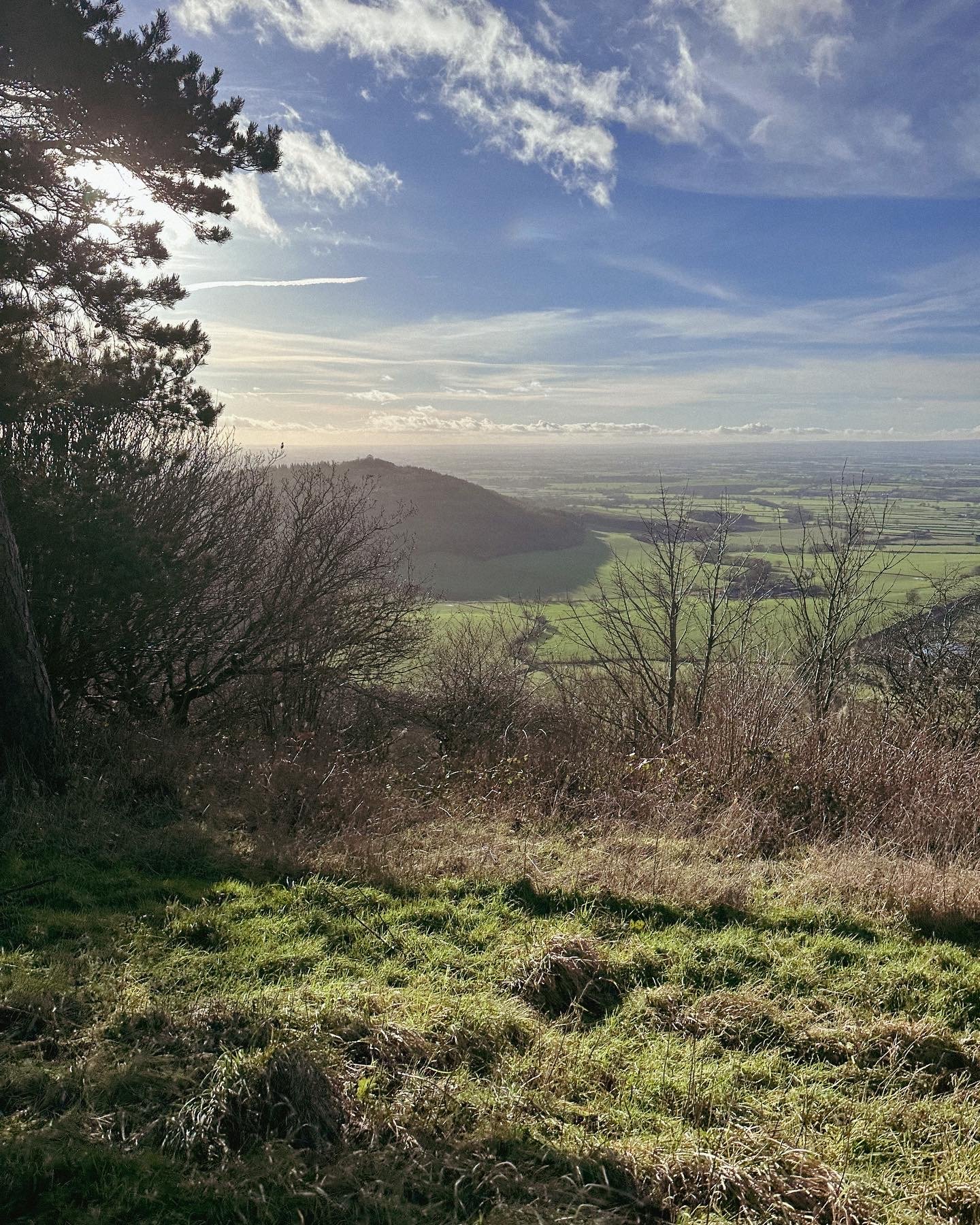
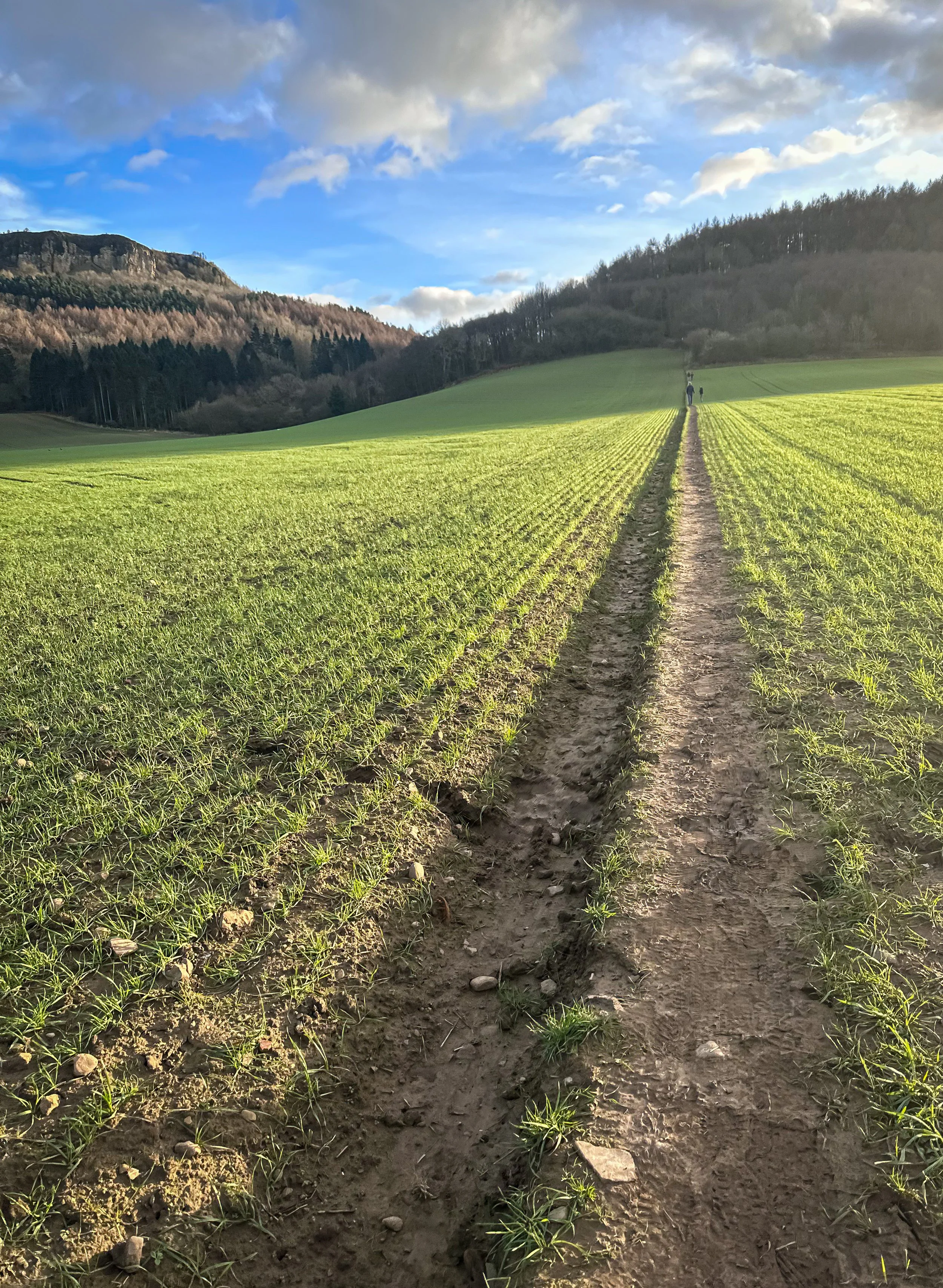
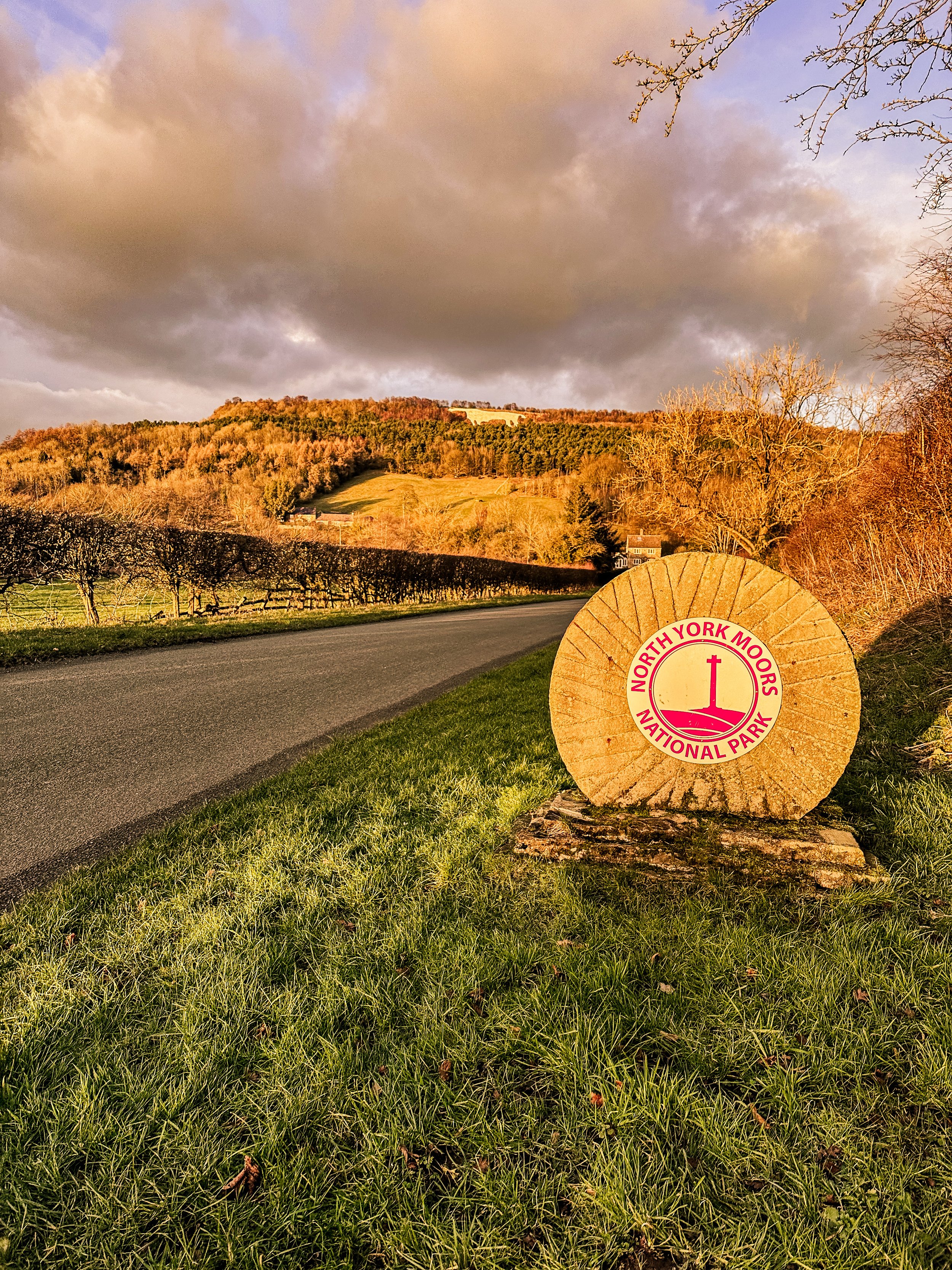
BEST WALKS NORTH YORKSHIRE: KILBURN WHITE HORSE
If you’re after a walk that has it all - from hidden lakes to cosy pubs - this route in North York Moors won’t disappoint
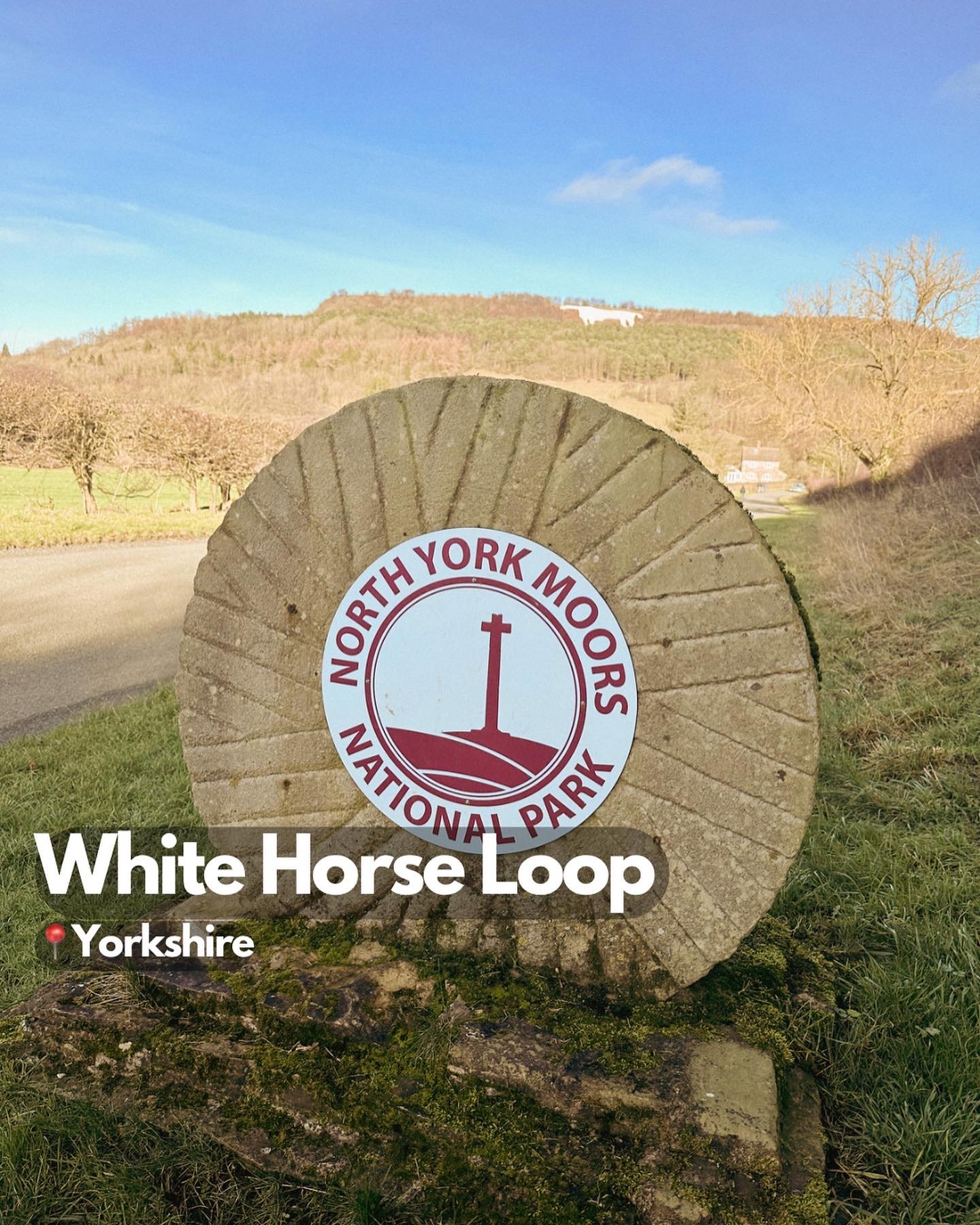
Start: Kilburn, YO61 4AH
Distance: 6 miles
Elevation: 875 feet
Duration: 2-3 hours
Navigation: Follow the route here
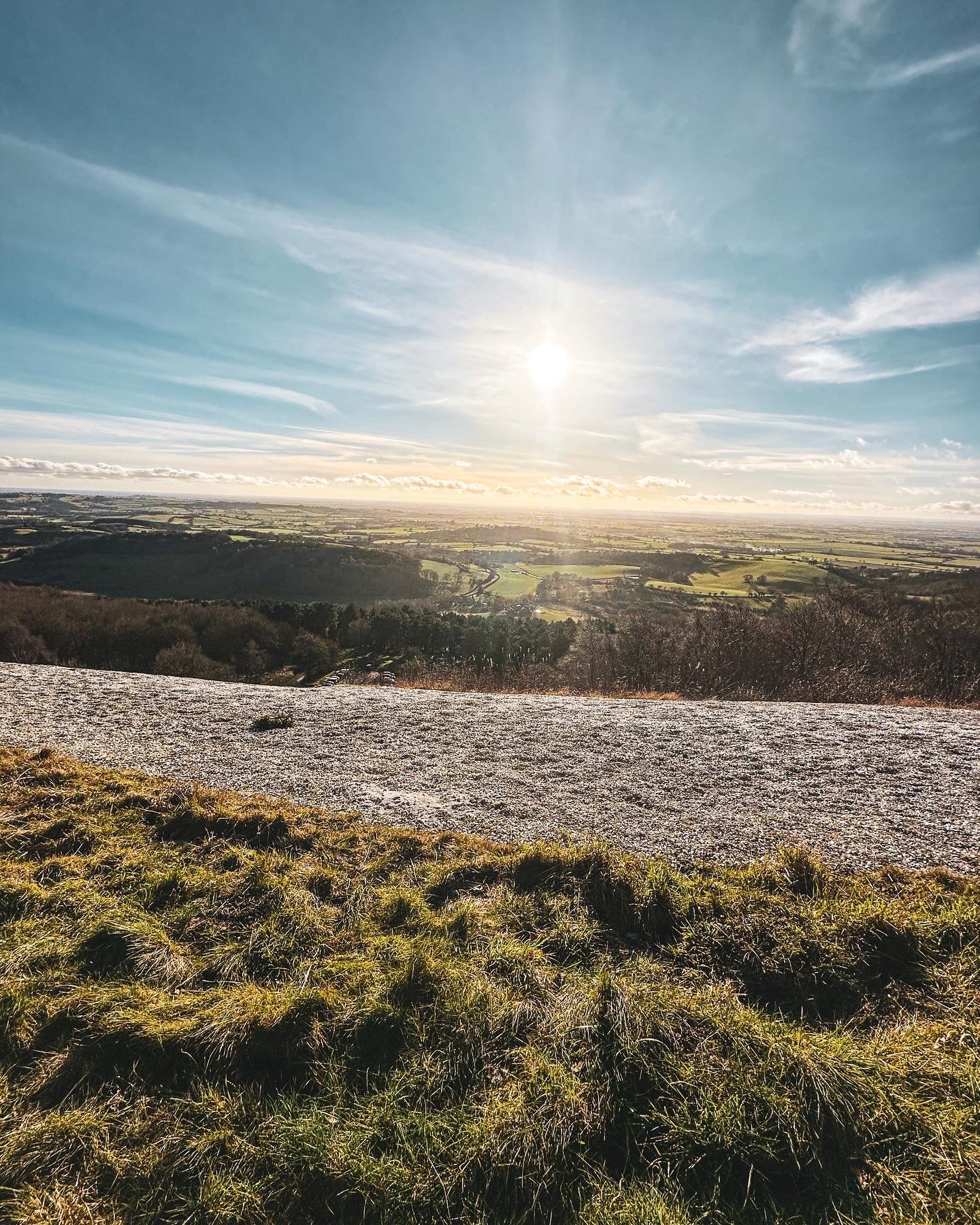
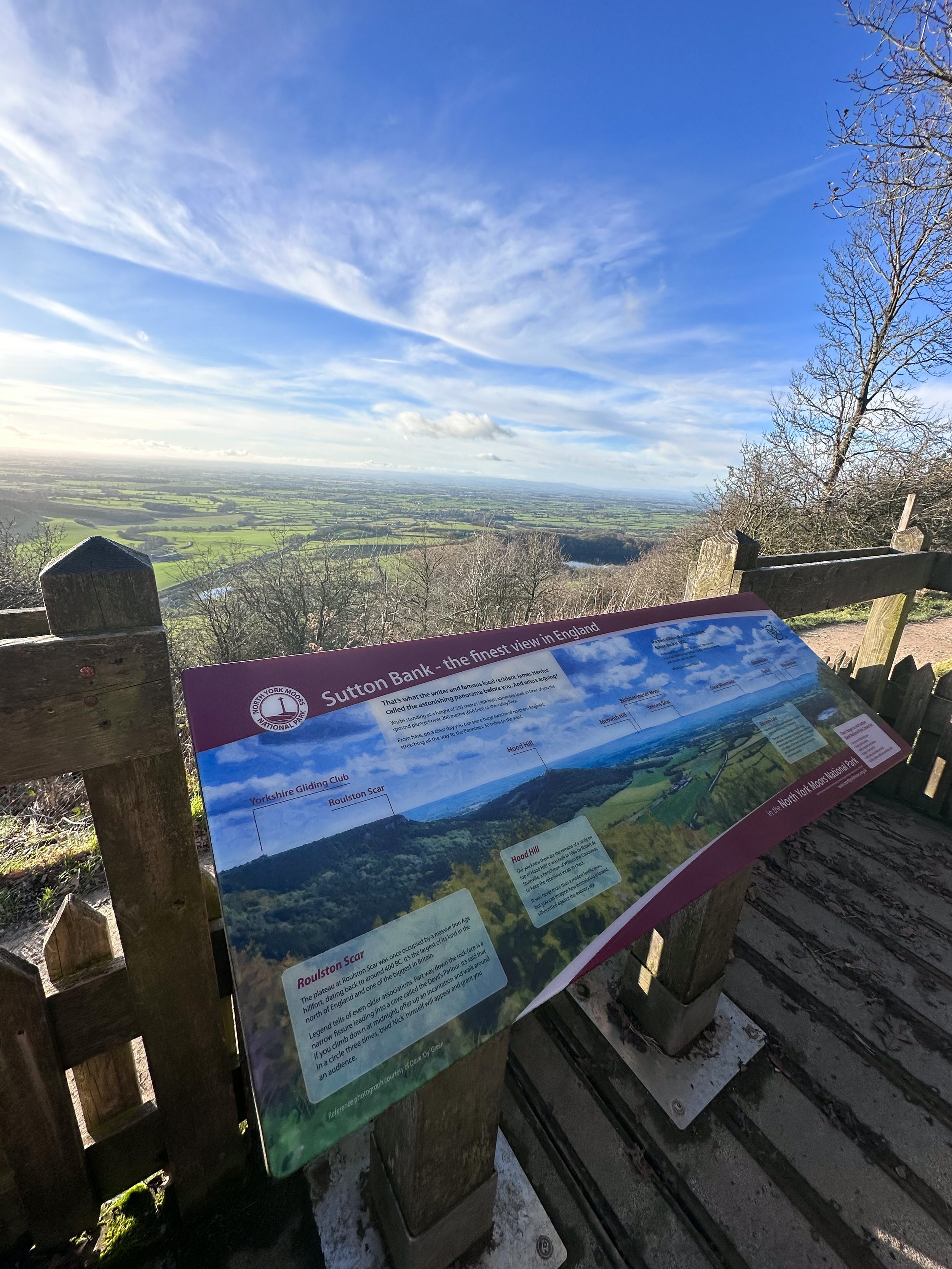
Tired of the same old boring treadmill walks? Want to spice up your exercise routine and take in some breathtaking views at the same time? Look no further than the North York Moors. The North York Moors is a beautiful and diverse area of natural beauty — making for a great base to explore the stunning landscapes, charming villages, and rich history of the region.
Walking in the North York Moors is like taking a step back in time. The rolling hills, lush green countryside, and charming villages will transport you to a simpler, more peaceful era. But don't let the idyllic scenery fool you, this area is also home to some serious natural beauty.
One of the must-see landmarks on a walk in the North York Moors is the Kilburn White Horse. This impressive hill figure, carved into the side of a hill, is believed to have been created in the 18th century and is a true marvel to behold. The best part? You can burn some calories and work those leg muscles while hiking up to get a closer look.
After you've had your fill of the Kilburn White Horse, head over to Gormire Lake for a more serene walking experience. This beautiful lake is surrounded by woods and heathland, and is a Site of Special Scientific Interest (SSSI) due to the diverse range of plants and animals that call it home. Plus, the flat footpaths make it a great option for those who aren't quite ready for a mountain hike… as long as you start at the white horse, that is. Our route starts just below and features a steady (and breathy) climb up to the start.
The origins of the Kilburn White Horse are shrouded in mystery, but it is believed to have been created in the 18th century. Some historians believe that it was created by a local farmer as a tribute to King George III, who was the reigning monarch at the time. Others believe that it was created by a group of local residents as a way to promote the area and attract tourists.
Over the years, the Kilburn White Horse has undergone several renovations and repairs. In 1857, a group of local residents formed the Kilburn White Horse Preservation Society, which was responsible for maintaining the horse and ensuring that it remained visible to the public. In the early 20th century, the horse was re-cut and re-chalked to ensure that it remained visible.
Today, the Kilburn White Horse is a popular destination for walkers and visitors to the North York Moors. It's a fascinating piece of history, and a testament to the enduring popularity of this ancient art form. The horse stands as a symbol of the area's rich history and culture, and a reminder of the importance of preserving our cultural heritage.
So next time you're considering a stroll up in’t the North York Moors, make sure to stop by the Kilburn White Horse and take a closer look. Not only is it a great workout for the ol’ legs, but a novel way to experience a piece of history that’s stood the test of time.
From the Gormire Lake to cosy country pub The Forresters Arms, the North York Moors is the perfect destination for nature lovers and pub dwellers alike. So scribble that gym sesh out your diary and head to the North York Moors for a walk you'll never forget. Trust me, your legs (and your Instagram feed) will thank you.
Ready to get going? Follow the route here

BEST WALKS WEST YORKSHIRE: LUMB FALLS
Lumb Falls, located just above the charming Hebden Bridge, is a hidden gem that’s not to be missed.

Start: Bowling Green Car Park, Heptonstall
Distance: 6.7 miles
Duration: 2-3 hours
Elevation: 1,250 feet
Navigation: follow the route here

Nestled in a lush, green valley surrounded by rolling hills that look out onto nearby Heptonstall, this picturesque waterfall is the perfect spot for a peaceful and idyllic walk.
The walk to Lumb Falls is fairly easy, with well-marked trails that lead you through fields and wooded areas. The route takes you along a small stream, with plenty of opportunities to spot wildlife and enjoy the peace and quiet of the countryside. As you approach the falls, the sound of rushing water becomes louder and louder, until you finally reach the viewing platform where you can take in the full majesty of the falls.

After taking in the beauty of the falls, you can continue your walk along the winding path that follows the river. The path takes you through a peaceful wooded area, where you may spot a variety of wildlife.
As you make your way back to the starting point, it's worth stopping off at the nearby village of Heptonstall for a bite to eat and a drink. The village is home to a number of charming pubs and restaurants, including the friendly and welcoming The Cross Inn country pub. Here you can sit outside in the sunshine and enjoy a refreshing drink and a hearty meal, surrounded by stunning views of the surrounding countryside.

Lumb Falls is a must-visit destination for anyone who loves the outdoors. The walk is easy and the views are breathtaking, and the nearby village of Hebden Bridge offers a charming and welcoming place to stop off afterwards. So if you're in the area, be sure to add Lumb Falls to your itinerary – you won't be disappointed!
Whether you're looking for a relaxing escape from the hustle and bustle of daily life or simply want to appreciate the beauty of nature, a walk through Lumb Falls is an experience you won't soon forget.

If you're feeling more adventurous, why not try the Hebden Hey Trail? This challenging route takes you through the heart of the Pennine hills, with stunning views of the surrounding landscape. The trail is around 13 miles in total, so it's best suited to experienced walkers.
No matter what your fitness level or interests, there's a walking route in Hebden Bridge to suit you. So pack your walking boots, grab your camera, and discover the beauty of this charming village on foot.

Fancy giving this one a go? Follow the route here
GOYT DAM
Panoramic views, magical woodlands and peaceful picnic spots are just some of the reasons you’ll want to head to Goyt Valley
Start: Whaley Bridge, SK23 7LX
Distance: 7.71 miles
Elevation: 1,075 feet
Duration: 2-3 hours
Navigation: follow the route here
This relaxed Peak District walk is beautiful in any season, but the way the woods are painted with gorgeous auburn hues come late September should make this route appear high on your list of autumn woodland walks.
Lying just a few miles northwest of Buxton, The Goyt Valley is magical place — one that’s gained popularity from visitors since Victorian times.
Once a prosperous and industrious community, the signs of a time gone by are all but extinct, bar from the ruins of Errwood Hall. Back in 1937, the construction of Fernilee Reservoir completely changed this beauty spot’s landscape, but the area remains a wonderfully peaceful place to visit to this day.
Expect stunning views every way you turn, thanks to a unique landscape which was carved out by successive Ice Ages and the River Goyt. It’s the perfect location for a day of recharging your batteries, with the natural scenery and rolling hills surrounding making for a wonderfully soothing trip outdoors.
With free parking at many of the valley’s landmarks, enjoying a day’s stroll around Goyt Valley is easy — especially if you follow one of the waymarked routes starting from Errwood Car Park.
For us, though, the beauty of this trail starts not in the valley, but in nearby Whaley Bridge. Along the way, expect dense pinewoods and azalea bushes, ruins of worker cottages and even a shrine close to the ruins of an abandoned hall.
And if folklore is more your thing, local legend has it that a highwayman called Pym used to lay in wait to ambush those who used the old packhorse route, hence the name Pym Chair given to one of the peaks in this mesmerising landscape.
Fancy giving this one a go? Follow the route here
KERRIDGE HILL LOOP
Discover the beauty of Cheshire from up above with one of the best walks near Greater Manchester
Start: Pool Bank Car Park (Free Parking), SK10 5PS
Distance: 6.88 miles
Duration: 2-3 hours
Elevation: 1,000 feet
Navigation: follow the route here
Looking for a bit of history on your next trip outdoors? Look no further than this uphill hike around the Cheshire countryside. Not only does this walk provide excellent views that sweep right across the surrounding area, but you’ll also pass White Nancy fairly early on — a memorial site atop Kerridge Hill, built to commemorate the victory of coalition forces at the Battle of Waterloo.
With its comically shaped physique, White Nancy isn’t your typical historical landmark. Thanks to its lofty position, the site White Nancy sits on had been used as a warning beacon of invasion for centuries, featuring other small structures before Nancy took up residence.
In 1817, the Gaskell family of Ingersley Hall built the structure you see today, in belated commemoration of the victory at Waterloo, 1815. Originally, White Nancy had a door and was used as a summerhouse, but was soon sealed off due to vandalism over the early 20th century.
Whether you’re here for the views or the stories of yesteryear, you’re sure to be taken aback by the undisturbed peacefulness of this route. On a clear day, you can see as far as Snowdonia, Liverpool’s coastal line and the windmills off the Wirral peninsula.
After admiring the views surrounding White Nancy, walking across Kerridge Hill is a must. The route’s quite steep in parts — but the views? So worth it.
So if you’re after a walk that offers incredible views every way you turn, make sure you stop by and see our Nancy soon. With multiple footpaths, woods and fields to explore nearby, you can easily extend this route into a full date out.
Fancy stopping by to see Nancy soon? Follow the route here

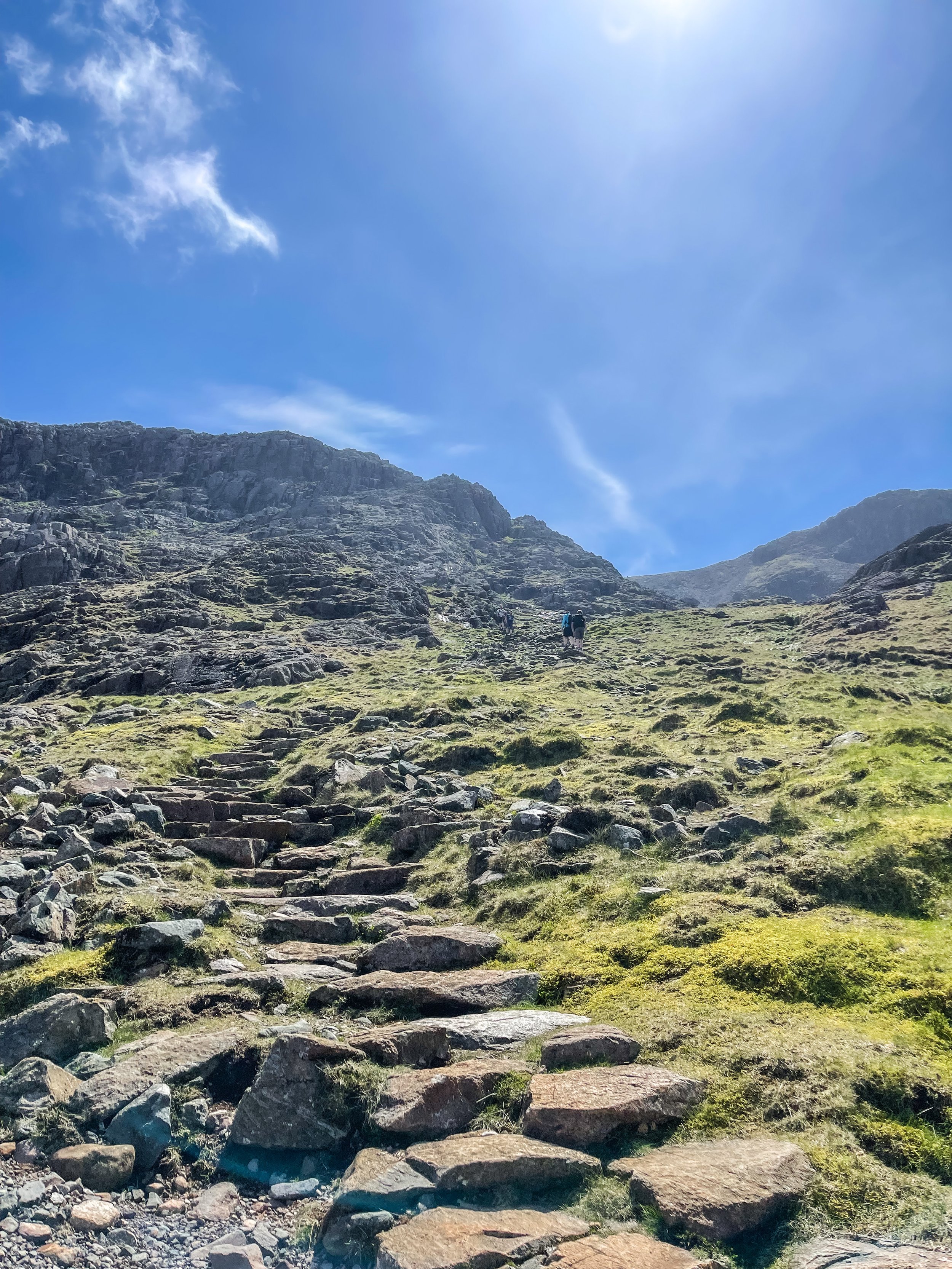
SCAFELL PIKE
Being high up in the mountains can be some of nature’s best therapy. So why not give England’s highest a go?
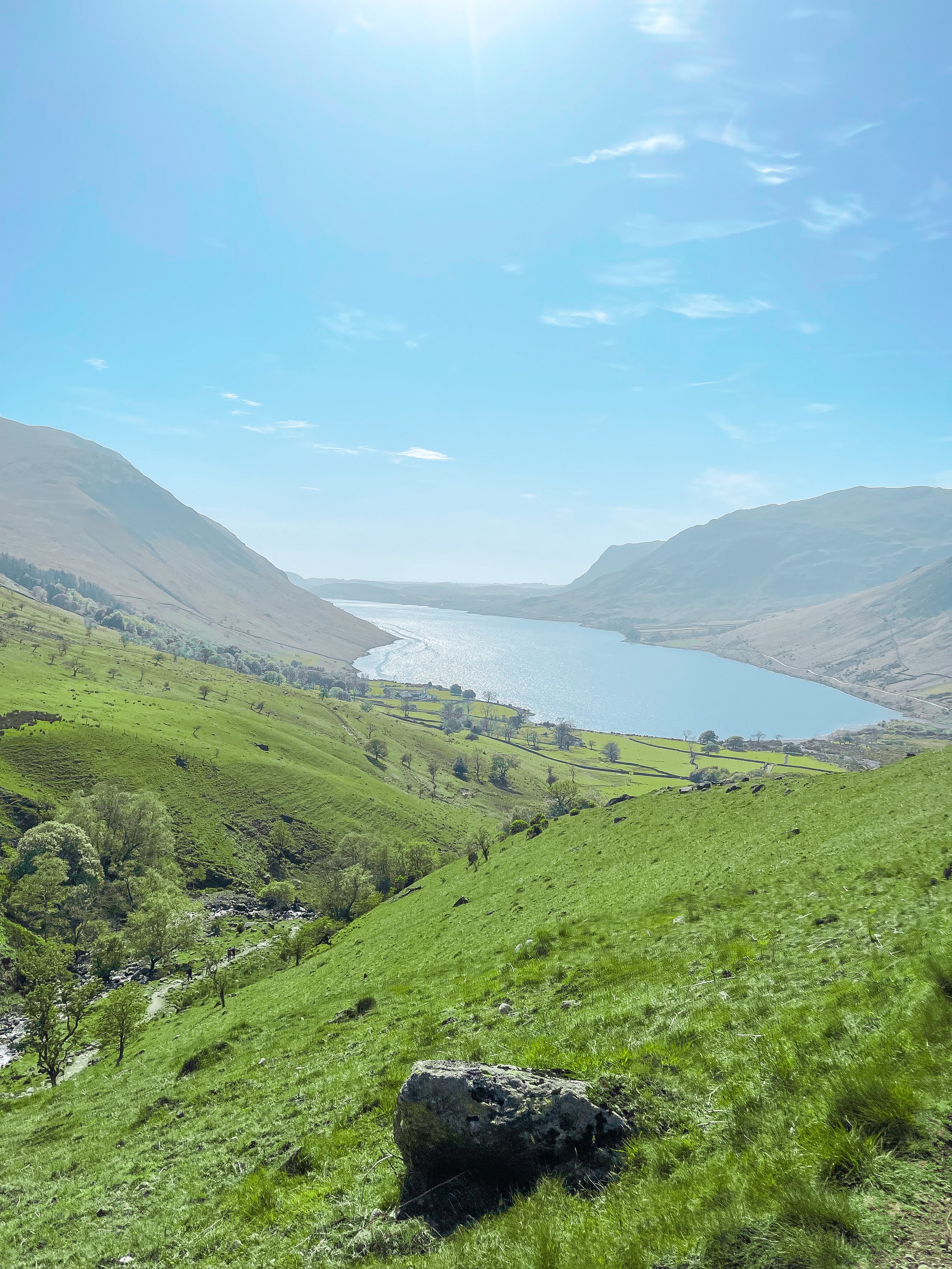
Start: Lake Head Carpark, Wasdale CA20 1EX
Distance: 7.7 miles
Elevation: 3,000 feet
Duration: allow 4 hours
Navigation: follow our route here
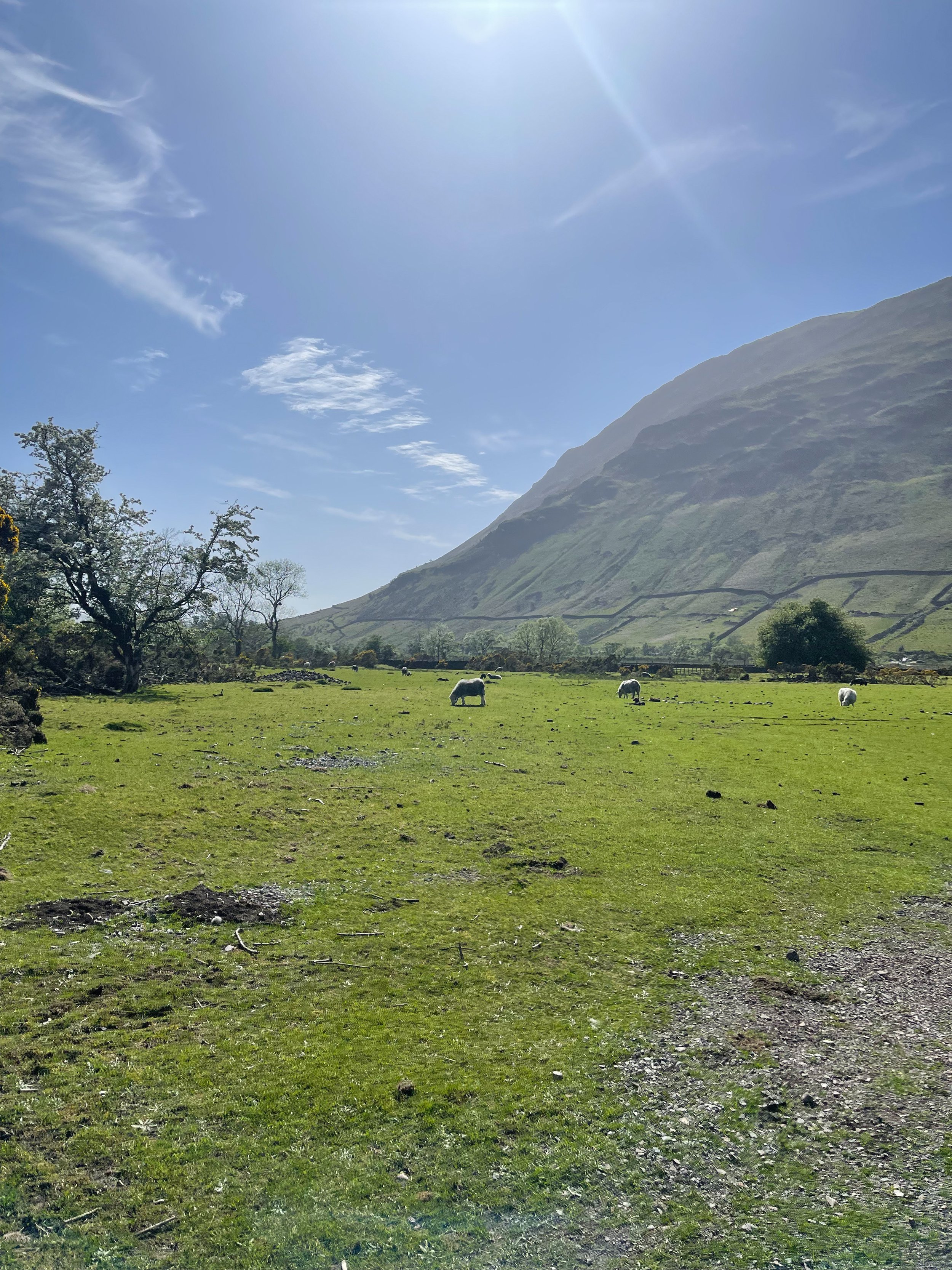
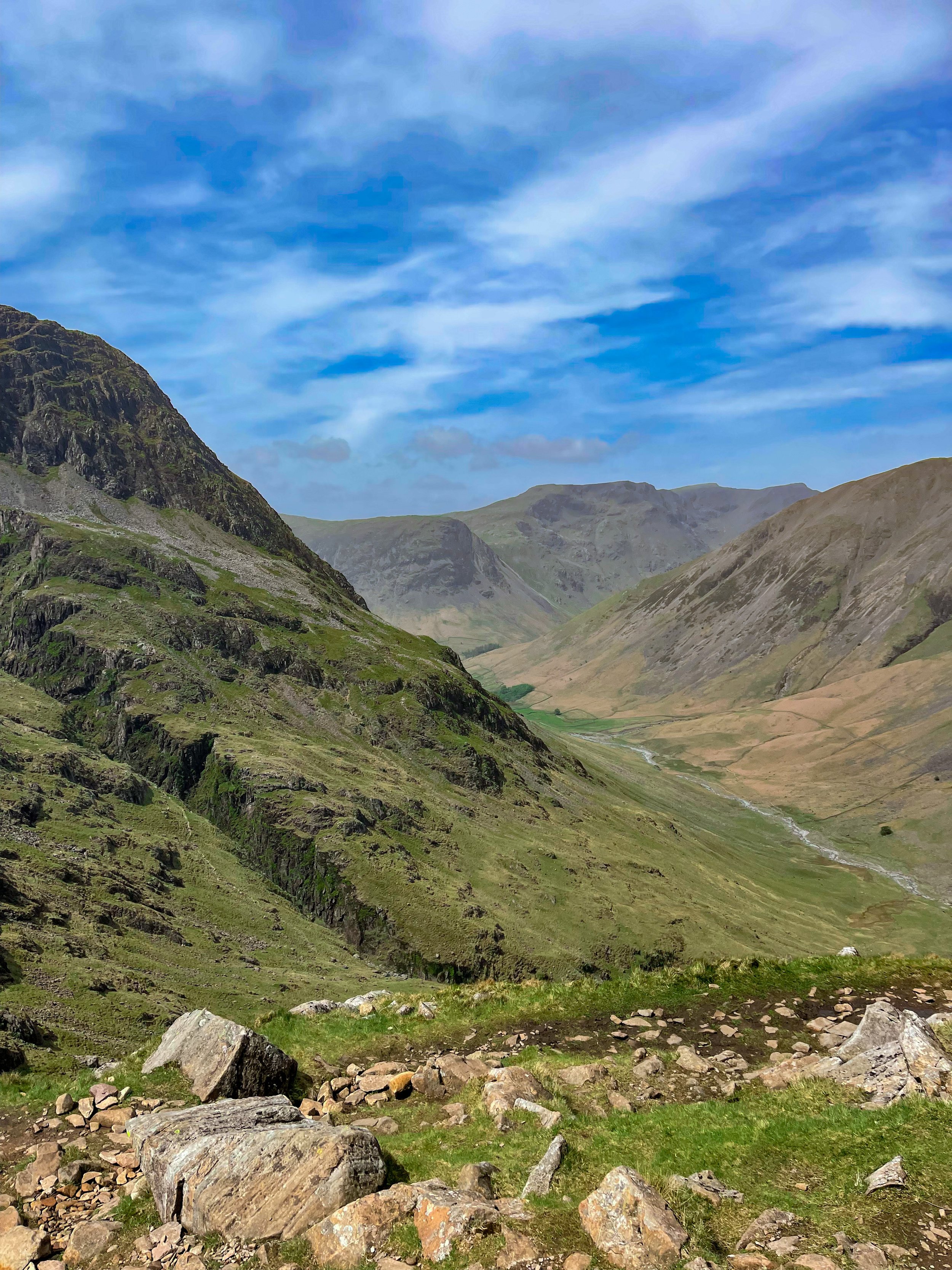
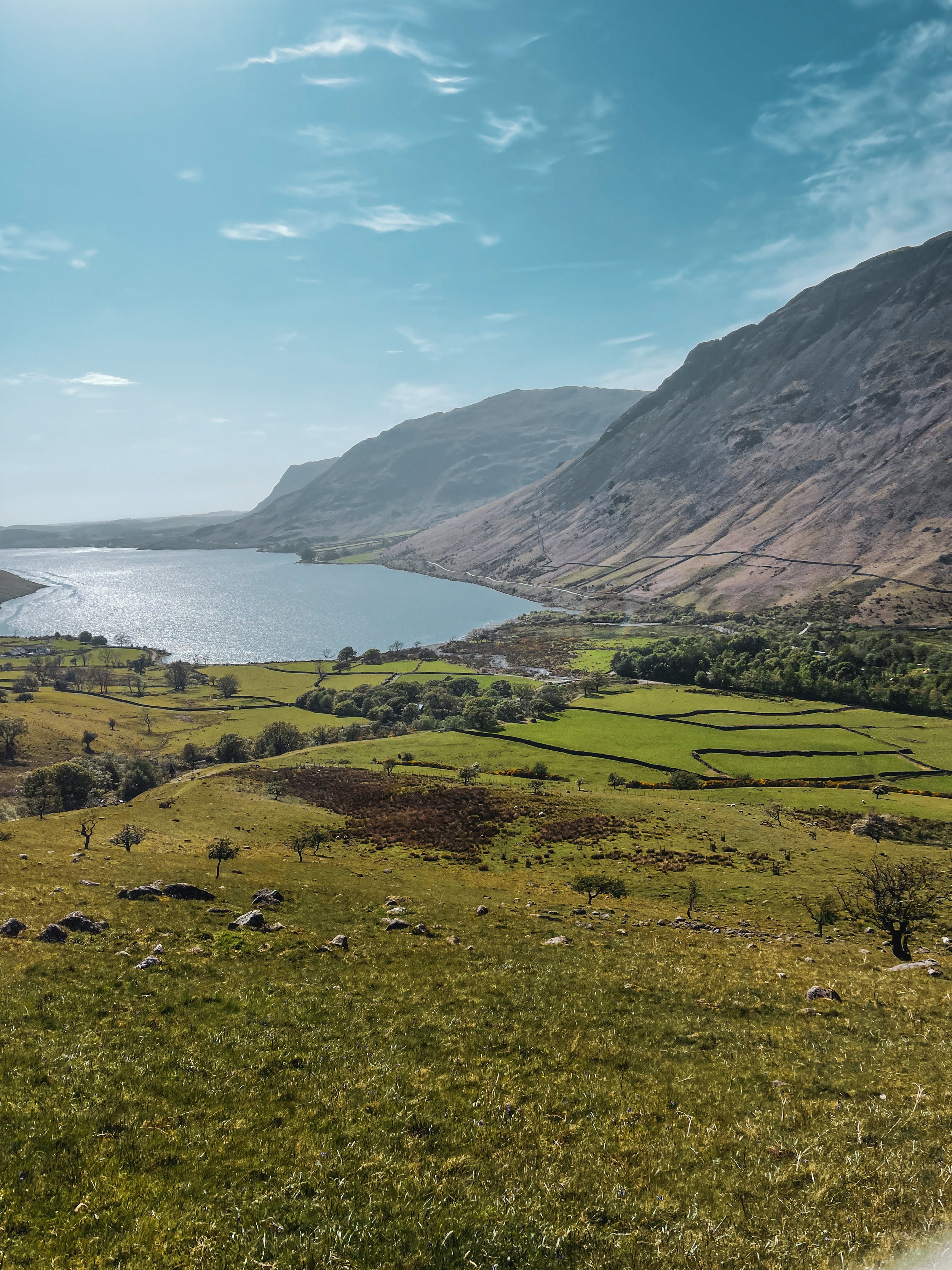
Standing at 978 metres, Scafell Pike is an absolute must for anyone looking to bag England’s biggest peak. Whichever route you take, climbing Scafell Pike is a serious undertaking and requires pre-planning to tackle it safely. That said, be sure to check the weather before you grab for your boots.
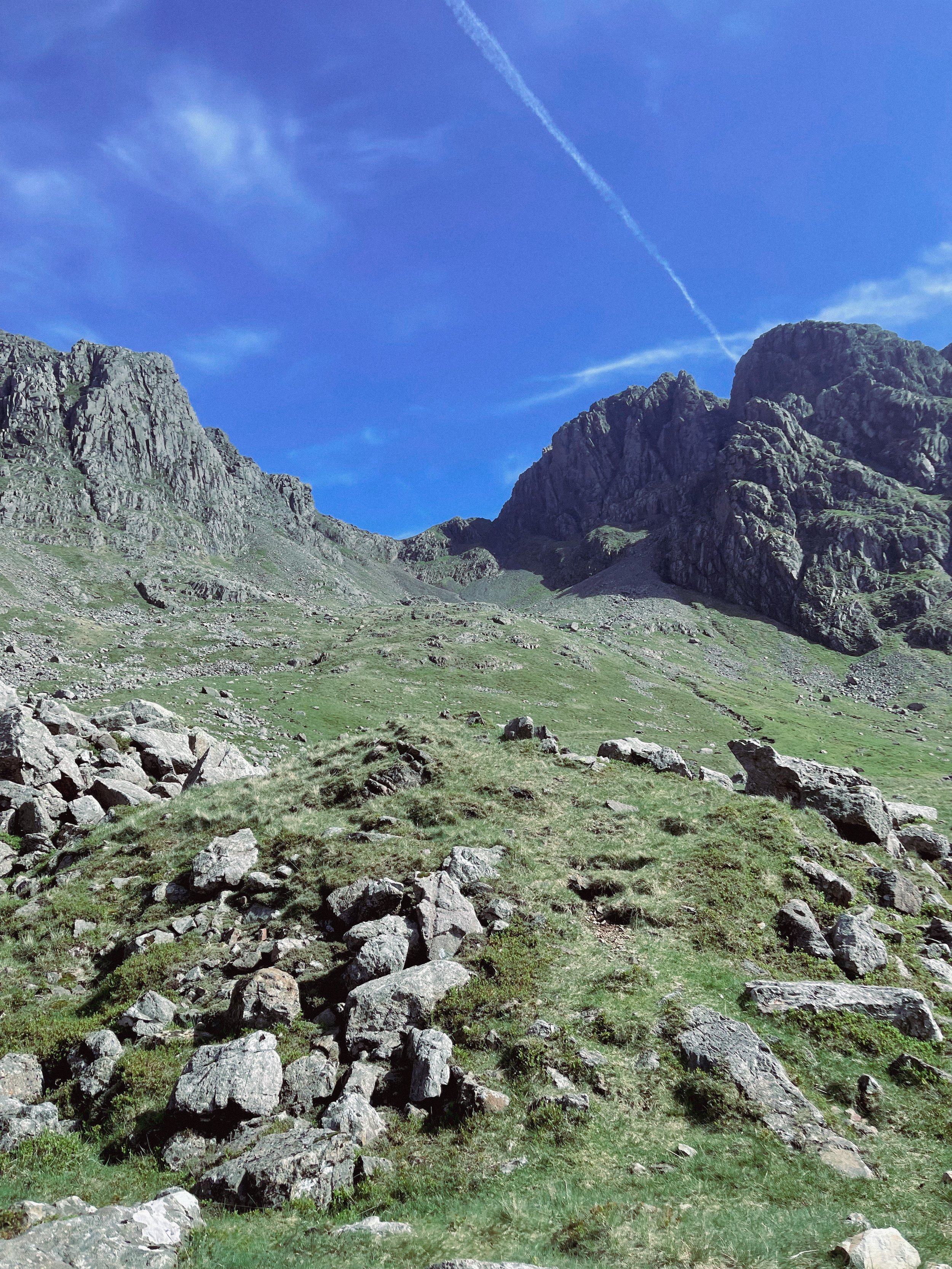
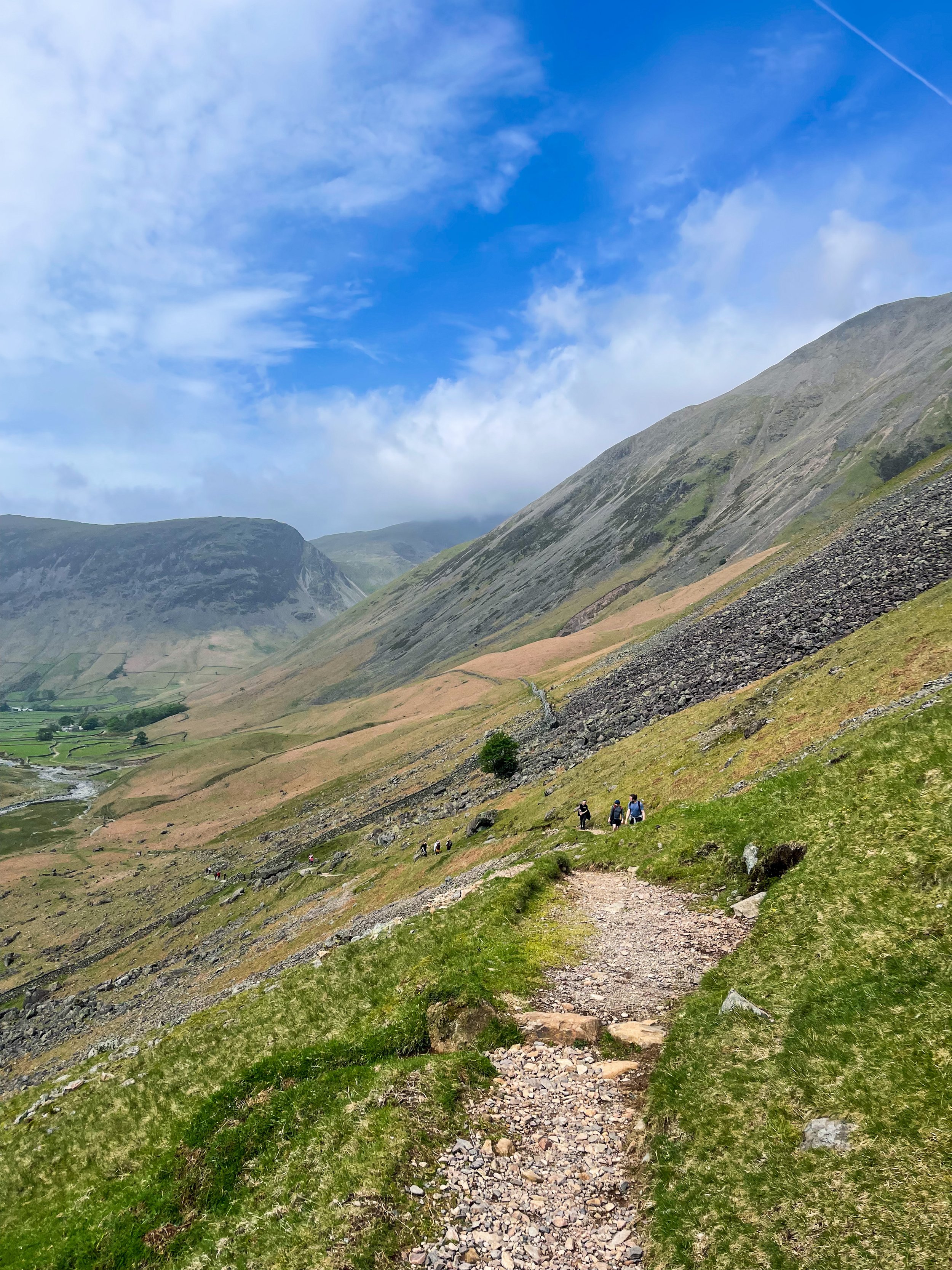
We started at Lake Head Car Park, Wasdale, a popular pay-and-display carpark so getting down early is advised. The remote and scenic valley surrounding offers an idyllic starting point. The main path up to the summit is advised for beginners, but if you’re up for more of a challenge, the corridor route offers a more scenic alternative.
Taking on the Corridor Route, in our opinion, offers better views and a more diverse variety of terrain. It’s usually walked via Styhead Tarn from Borrowdale, but you can pick up the Corridor from Wasdale as you pass under the slopes of the Great Gable. Choosing this route means scrambling is required at parts, but the incredible vistas are well worth it.
The trail is a pretty straightforward one to follow, with a clear path for most of the way. Once approaching Greta Gill, there is a slight scramble down but it’s easy enough to descend.
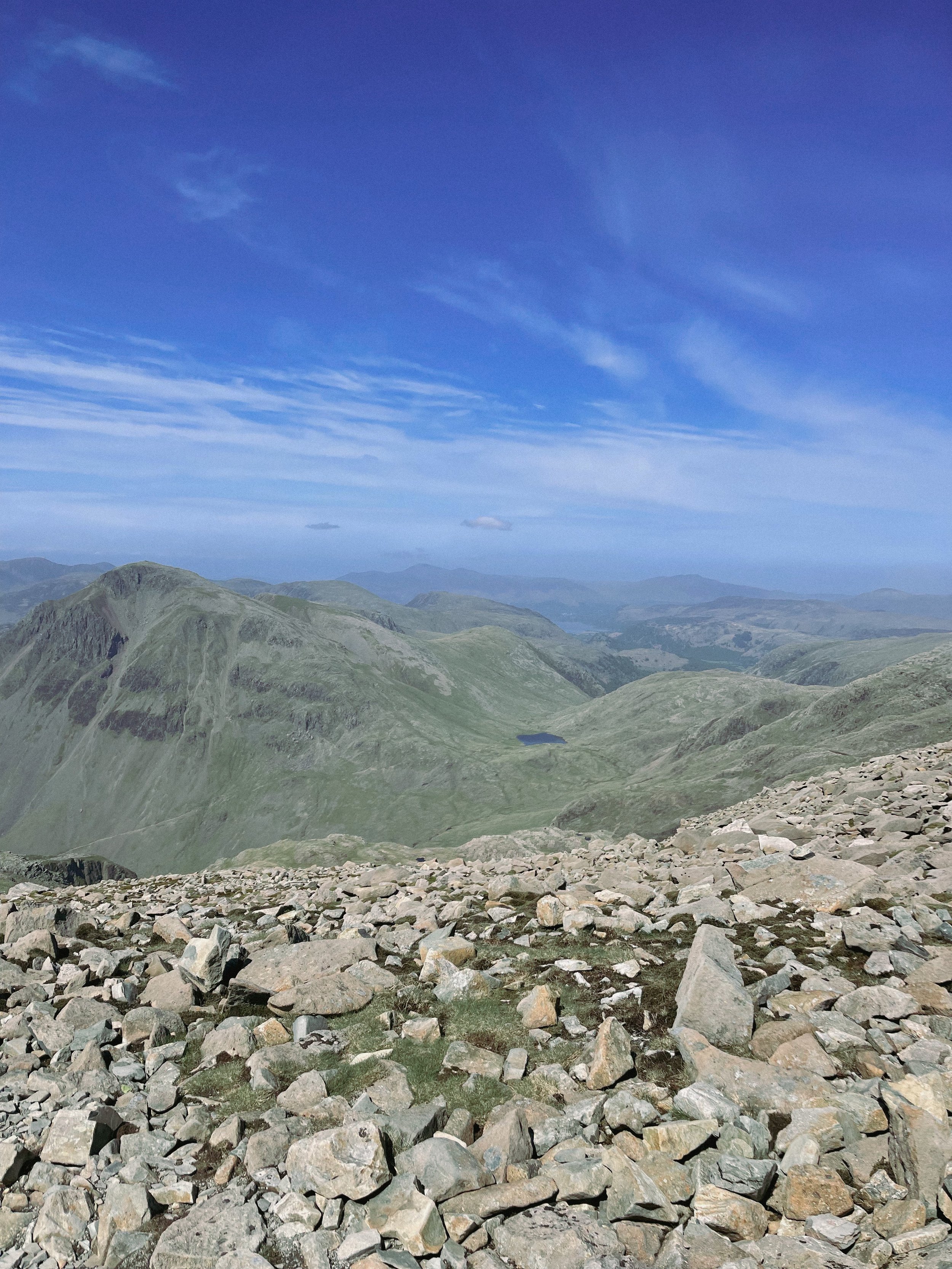
The Corridor is a real mountaineers route and rewards you with breathtaking rock scenery once you ascend on the Corridor itself. In our opinion, this circular walk is the best option for breaking up the ascent while offering incredible views everyway you turn.

Once reaching the summit, if you’re lucky enough to be blessed with a clear weather day—the views you’re rewarded with will take you back and then some. If the weather permits, you’ll be able to bask in the beautiful Cumbrian coastline, with views stretching out to the Isle of Man and beyond.
For those looking for a real challenge, why not take on Sca Fell (England’s second highest mountain) and Scafell Pike in one day? Climbing both in one day throws in bonus views —and double the bragging rights— with an exhilarating descent back to Wasdale.
Fancy following our route up to England’s biggest mountain? Click here
THE ROACHES AND LUD’S CHURCH
Always fancied venturing to Lud’s Church? This walk offers a quieter alternative route, taking in some of the best sights the Peak District has to offer…
Start: Roaches UKC Parking, ST13 8UA
Distance: 7.7 miles
Duration: 3-4 hours
Elevation: 1,100 feet
Navigation: follow our route here

The Roaches walk usually offers a quieter route up to Lud’s Church, offering the breathtaking views to match. Before approaching The Roaches trig point, you’ll meander through an unusual sandstone landscape that’ll transport you to a time gone-by.

Lud’s Church itself is one the Peak District’s must-see landmarks, and from the moment you step foot into its surrounds, we’re sure you’ll understand why. Pictures definitely don’t do this place justice, so a trip to Lud’s is a must!
The ravine that makes up Lud’s Church is thought to have formed during the post-glacial period —some 11,000 years ago— by a large slip of Roaches Grit: a coarse form of sandstone.
It wasn’t until the 15th century that this place became a popular place to dwell— among a secret community, at least. A group of religious dissenters called the Lollards flocked here to hold covert religious meetings to escape the prosecution of the Catholic Church. It’s thought the name of a man arrested at one of these meetings, Walter de Ludank, inspired the name of the site.
Today, the area provides a dramatic nature walk through the Black Forest, transporting passers-by into old England and its many forgotten tales. You certainly don’t have to stretch your imagination too much to picture this place as the origin of many myths and mysteries.
Over the centuries, its’s been associated with tales of Robin Hood and his Merry Men, who’re thought to have hid here as a place of refuge.

Our route starts in Upper Hulme, first taking you up a fairly steep climb to Hen Cloud. From here, you’ll head up towards The Roaches, strolling along the top of the moorland until you reach woodland that takes you to Lud’s Church.
The Roaches is a 505-metre high ridge that soars above Leek and Tittesworth Reservoir, making for incredible views on a clear day. Surrounding, there’s ample places to explore with lots of diversions for those wanting to spend the day discovering new paths.

With such a variety of landscapes in a relatively short walk, this is definitely one of our favourite walks up north. On a clear day up the ridge, you may even spot Snowdon in the distance.
Sound like your ideal day out? Follow the route here

MIDDLE BLACK CLOUGH
Fancy a trip to one of Derbyshire’s best waterfalls? Then this walk is a must
Start: Woodhead Tunnel Car Park, SK13 1JF
Distance: 7.66 miles
Elevation: 1,175 feet
Duration: allow approx. 3 hours
Navigation: follow our route here

Due to its hard-to-find location, once you reach Middle Black Clough you’re likely to have the waterfall and its surrounds entirely to yourself! A perfect spot for scramblers and wild swimmers alike, this hidden gem is a must-visit when passing Woodhead.

Starting on the Longdendale Trail, our route takes you through Woodhead Tunnels and over the moorland surrounding. Following our trail, the waterfall is right at the end of the walk—and you’ll want your waterproof boots for this one when you arrive as there’s a short water crossing.

Not surprisingly, this secret waterfall is a little tricky to find (even with our komoot trail) so be prepared to persevere in following the clough as far as you can until your reach a ford. Once here, follow Middle Black Clough up to the waterfall, and enjoy the surrounds!

Ready to go for a dip? Follow our route here

THOR’S CAVE
Thor’s Cave is known as one of the Peak District’s most famous caves… and with good reason.

Start: Wetton Mill, DE6 2AG
Distance: 7.74 miles
Duration: allow 3-4 hours
Elevation: 1,350 feet
Navigation: follow our route here

This is a brilliant route that takes in some of the best landmarks the Peak District has to offer: the beauty of Manifold Valley and the magnificence of Thor’s Cave. Just look at those views!

From Wetton village, this route first takes you along the Manifold Valley and past Wetton Mill with more caves to explore, before allowing you to finish at the perfect beauty spot: Thor’s Cave.

Thor’s Cave is an iconic natural cavern on the side of the Manifold Valley, making it a perfect spot to reward your efforts after a long day’s walk. Some scrambling to the chamber is required, making it perfect for big kids and little ones alike.

Thor’s Cave is a popular attraction so we recommend visiting out of season or towards the end of day to avoid a wait up to the cave. You can also shorten the walk—and fast-track your arrival on busy days— by simply heading to Thor’s Cave and back from Wetton, cutting out the meander along the Manifold Valley.

There are some steep uphill segments but the views are worth it. The views out into the valley are immense, but do make sure to take care while exploring there are steep drops shortly after the entrance and the surface can be slippery.

The origin of Thor’s Cave name is unknown but has obvious links to the Norse god Thor. Historically, evidence of human occupation of Thor’s Cave has been found dating back to the latter part of the Stone Age, around 11,000 years ago—with continued use into the Iron Age and Roman period. Excavations of the area have found living utensils such as stone tools, pottery and bronze items, as well as burial sites for seven people.

Fancy giving it a go? Follow our route here

KINDER TRESPASS: HAYFIELD TO KINDER SCOUT
The Peak District ‘big one’… follow our route up to the highest point in the Peaks

Distance: 8.15 miles
Duration: allow approx. 3-4 hours
Elevation: 1,500 feet
Start: Bowden Bridge Car Park, SK22 2LH
Navigation: follow our route here

Starting at Bowden Bridge, this trail takes you up to one of the Peak Districts most famous—and arguably, best— natural landmarks: Kinder Scout.
Along the way, you’ll follow in the footsteps of 500 walkers who, back in 1932, trespassed en masse from Hayfield to Kinder Scout to secure access right to open country for all to enjoy.

Bowden Bridge Quarry is where protester Benny Rothman addressed the crowd of ramblers before they set off to Kinder Reservoir. In Hayfield, you’ll find a large information board which explains the pivotal role the Trespass had in opening up routes for all to enjoy.

At the carpark, you’ll find public toilets and a pop-up coffee shop to fuel up for your climb. On a clear day, you can see right across Manchester and as far as Snowdonia, making this trail one of the best views in the Peak District. It’s an iconic hike, taking in the expansive moorland plateau of Kinder Scout as you ascend towards the highest point in the Peaks.

There are two routes up to the plateau, starting from Edale or Hayfield. Both make for a great day out, but the Hayfield walk takes in the most spectacular scenery along the way.

During the ascent, you’ll pass Kinder Downfall—the highest waterfall in the Peaks. Be prepared for uneven terrain and steep uphill climbs, so walking boots and proper preparation are needed for this one.

Up top, you’ll come across the Kinder Low trig pillar, marking the unofficial high point of Kinder Scout that makes for a great photo stop.

The descent takes you along steep grassy terrain and farmland, with some (easy) scrambling required on one rocky section, so take care during these parts. As you return towards Bowden Bridge, you’ll pass The Sportsman Inn, a great place to reward your efforts with a well-earned post-walk pint.
Ready to give this one a go? Follow our route step-by-step here

THE TORRS CIRCULAR
An idyllic 10 mile loop taking in the best of Stockport’s forgotten history
Distance: 10.5 miles
Duration: allow approx. 4 hours
Elevation: 1,200 feet
Start: Peak Forest Canal, Marple SK6 7NP
Navigation: follow the route here

On initial glance, New Mills may look like any ordinary Peak District village: small, picturesque with little much-to-do around the town. Venture just a few steps downwards towards the River Sett, and you enter another landscape entirely.
Below the hustle and bustle of the main shopping centre lies New Mill’s (not so) hidden gem: The Torrs. We’ve done this walk a few times, and every time we’re amazed by the astounding natural gorge that lies below.
Expect colourful cliffs, enormous viaducts and a long bridge that transports you to the Goyt Way; making for one of the best walks in Derbyshire.
The Torrs itself makes for a great short circular route if you’re not planning on venturing far, but our trail starts and ends in nearby Stockport. From Marple, you’ll head towards The Roman Lakes and passed the site of Mellor Mill Ruins. Once a shining star or the Oldknow Empire, Mellor Mill was the biggest spinning mill the world had seen during its time of construction.
What remains of the mill have since been taken over by the natural world, making for a gorgeous pitstop by the Peak Forest Canal and River Goyt.
Passing the ruins, you’ll make the ascent towards Mellor Cross—a local landmark on Cobden Edge. The cross was originally erected in March 1970, made by a carpenter local to the area. From The Cross, you’ll reach Mellor Moor, where you’ll be rewarded with views across the western edge of the Peak District and the Cheshire Plain.
The moor’s umpteen tracks date back to prehistoric Old Mercian trackways, and make great aids for exploration. The line of an ancient trackway is said to be the route of monks and pilgrims, with waymarkers signifying Old Mercian landmarks and monasteries.
Descending from the moorland, we head towards New Mills where you can stop for a well-earned refuel. The town boasts an impressive mix of independent shops, cafes and pubs, perfect for that much-needed pitstop before the homeward leg. We stopped off at Clockwork Cafe, which has all your caffeine (and Derbyshire Oatcakes!) cravings covered.
After a refuel is where you’ll be greeted with the trail’s main event: The Torrs Millennium Walkway. This 175-yard aerial walkway spans the cliffsides above the River Goyt, with links to many walking and cycling routes should you choose to travel a different way home. New Mills Heritage Centre provides maps and guides for several nearby walks, including the iconic Kinder Trespass Trail.
In 1932, around 500 walkers from Manchester trespassed en masse from Hayfield to Kinder Scout to secure access right to open country for all to enjoy. Back then, walkers across England and Wales were denied access to areas of open country—luckily for us, the trespass helped pave the way for the establishment of the Pennine Way and other long-distance footpaths enjoyed today.
Fancy following in their footsteps? You can follow our Hayfield to Kinder Scout route here.
On the home stretch, the Goyt Way makes for a relaxing, flat stroll—taking you passed landmarks such as Bruce’s Clock in Strines. In medieval times, Strines stood as a large hunting forest—The Forest of the Peak—before local gentry settled here during the Elizabethan period.
Bruce’s Clock was originally found on the grounds surrounding Strines Hall, with the comings and goings of local people ordered by the striking of its bell in days when clocks and watches were rare household acquisitions.
After briefly meeting back up with The Roman Lakes footpath, you’ll finally reach The Peak Forest Canal to make the last stretch back to Marple.
The Waltzing Matilda sometimes moors here, so keep an eye out if you’re looking to refuel on woodfired pizza.
Fancy giving this walk a go? You can follow our GPX directions here

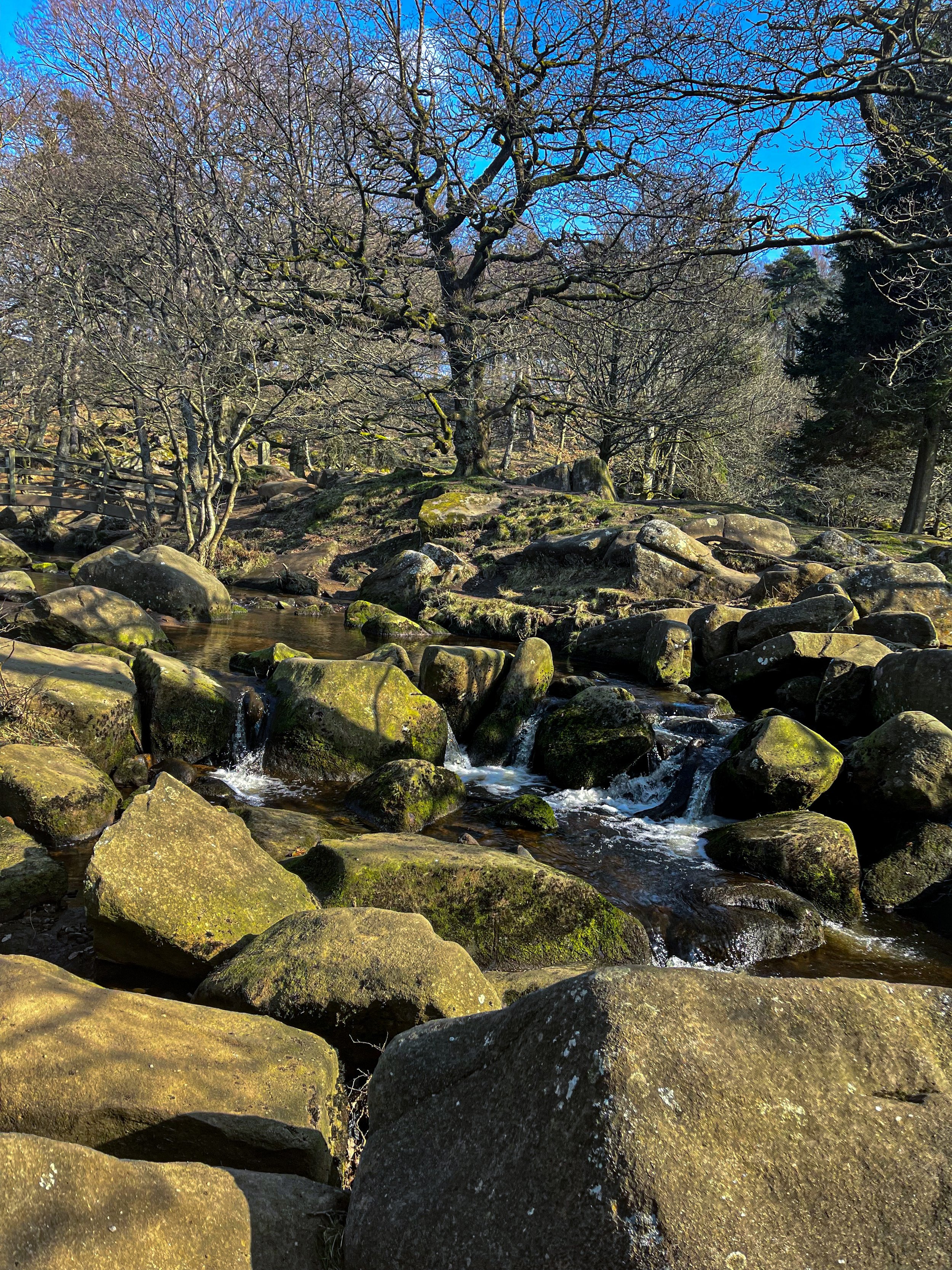
PADLEY GORGE
Gently flowing waterfalls… easy-going ascents… impeccable views and a pub pit-stop, Padley Gorge loop is one of the Peak District’s best circular walks

Start: Upper Burbage Bridge Car Park, Hope Valley, S32 1BR
Distance: 5.3 miles
Elevation: 650 feet
Duration: allow approx. 2 hours
Navigation: follow step-by-step

Route Overview:
This circular walk takes in less-populated trails from the busy Stanage Edge routes around Hathersage, with equally impressive views. Starting at Upper Burbage Bridge Car Park just outside of the town centre, this trail takes you to the magical Padley Gorge, before meandering back for a short scramble up Carl Wark — an awe-inspiring rocky tor.

Higger Tor, Hathersage Moor, Carl Wark and Burbage Edge are all included in this loop. Starting at the free car park at Burbage Bridge, you’ll be hard-pressed to see another soul for the first half of the walk, as you walk along side a stream and through the forest away from the more popular trails.

Be prepared for a slight scramble as you reach the tops of Higger Tor and Carl Wark. The approach from Burbage Bridge can also get a little boggy, so make sure to grab your waterproof boots before attempting this one.

Why not extend your walk with a visit to Little John’s grave? As you head towards Hathersage, you can expect magical panoramic views of faraway landmarks, moors and meadows.
Follow our route step-by-step here - happy exploring!
UPHILL CHALLENGES:


WALKS WITH WATERFALLS:


