THIS WEEK’S FEATURED WALKS:


ALL TRAILS

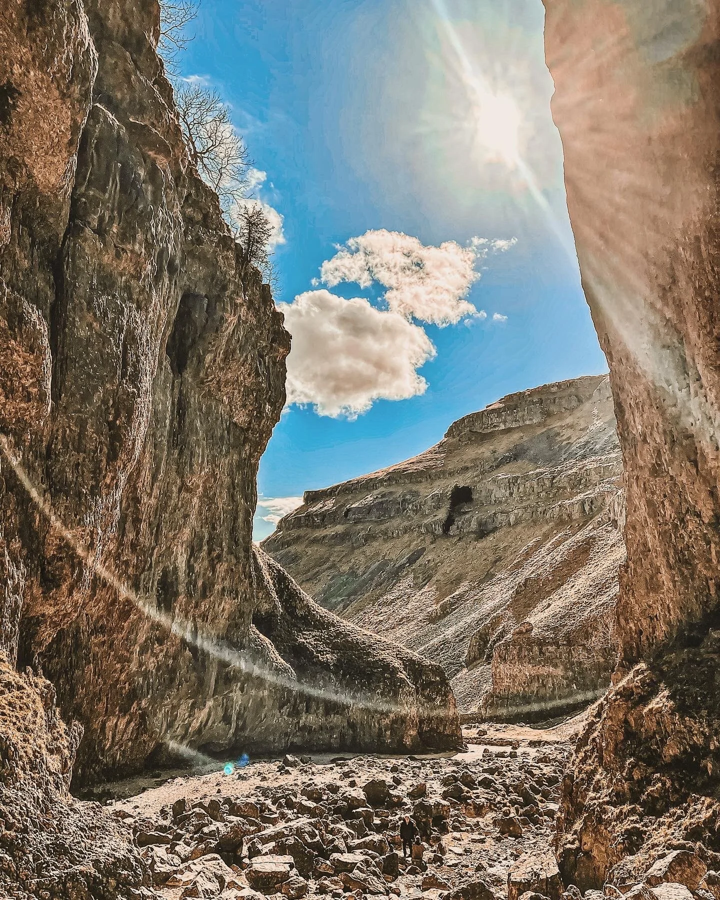
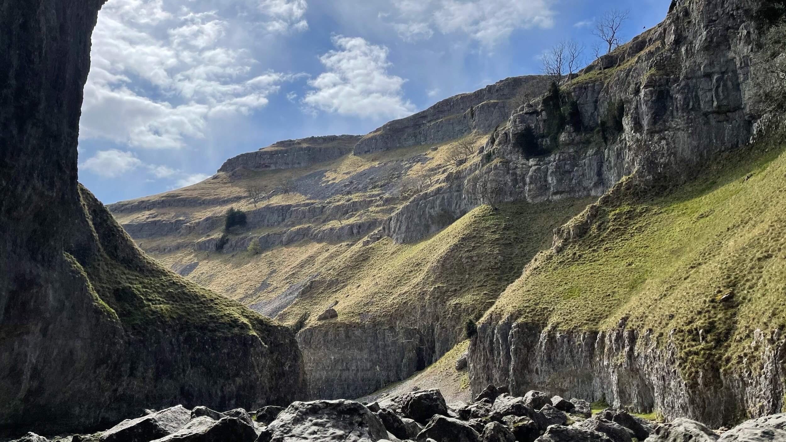
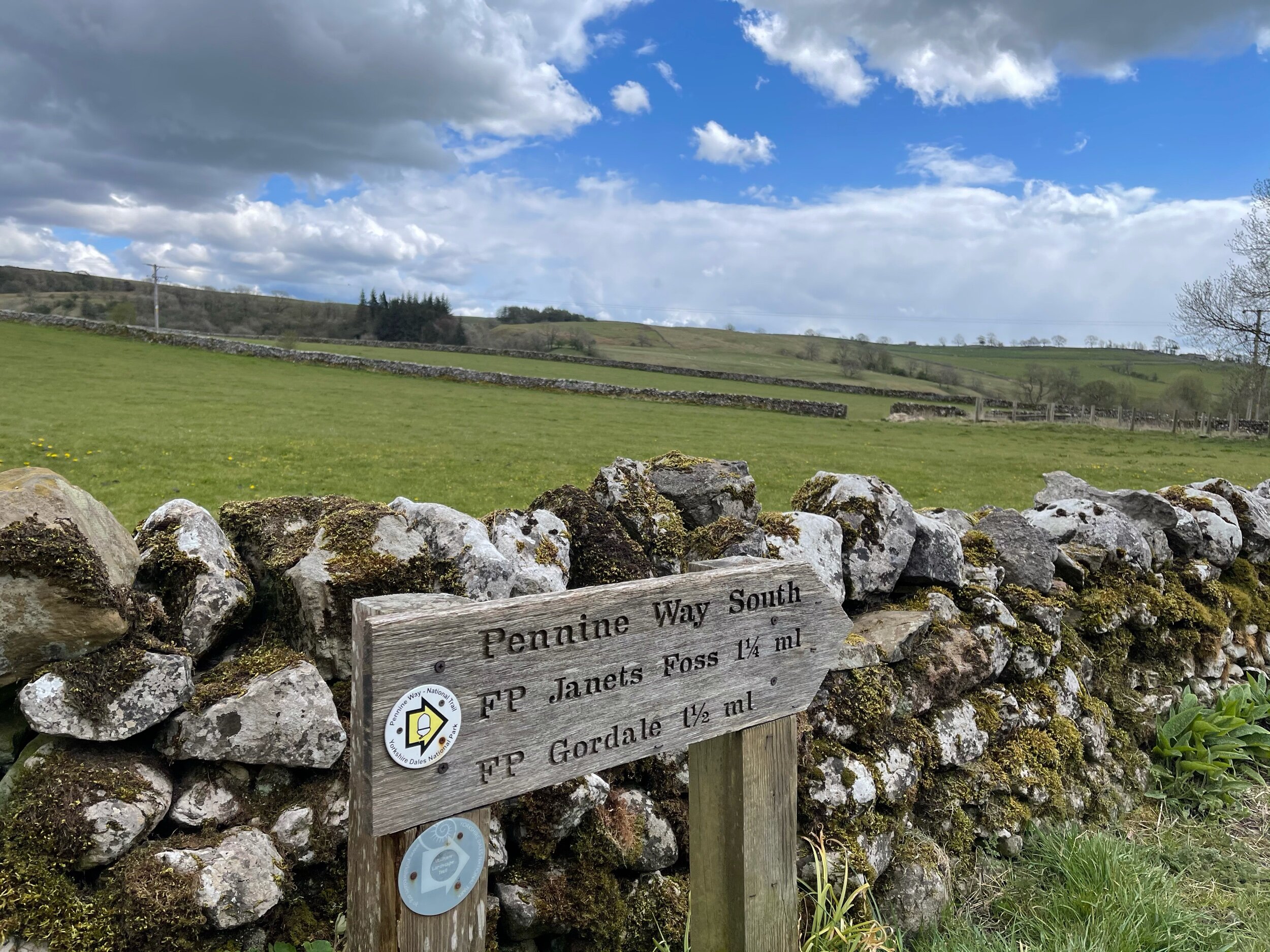
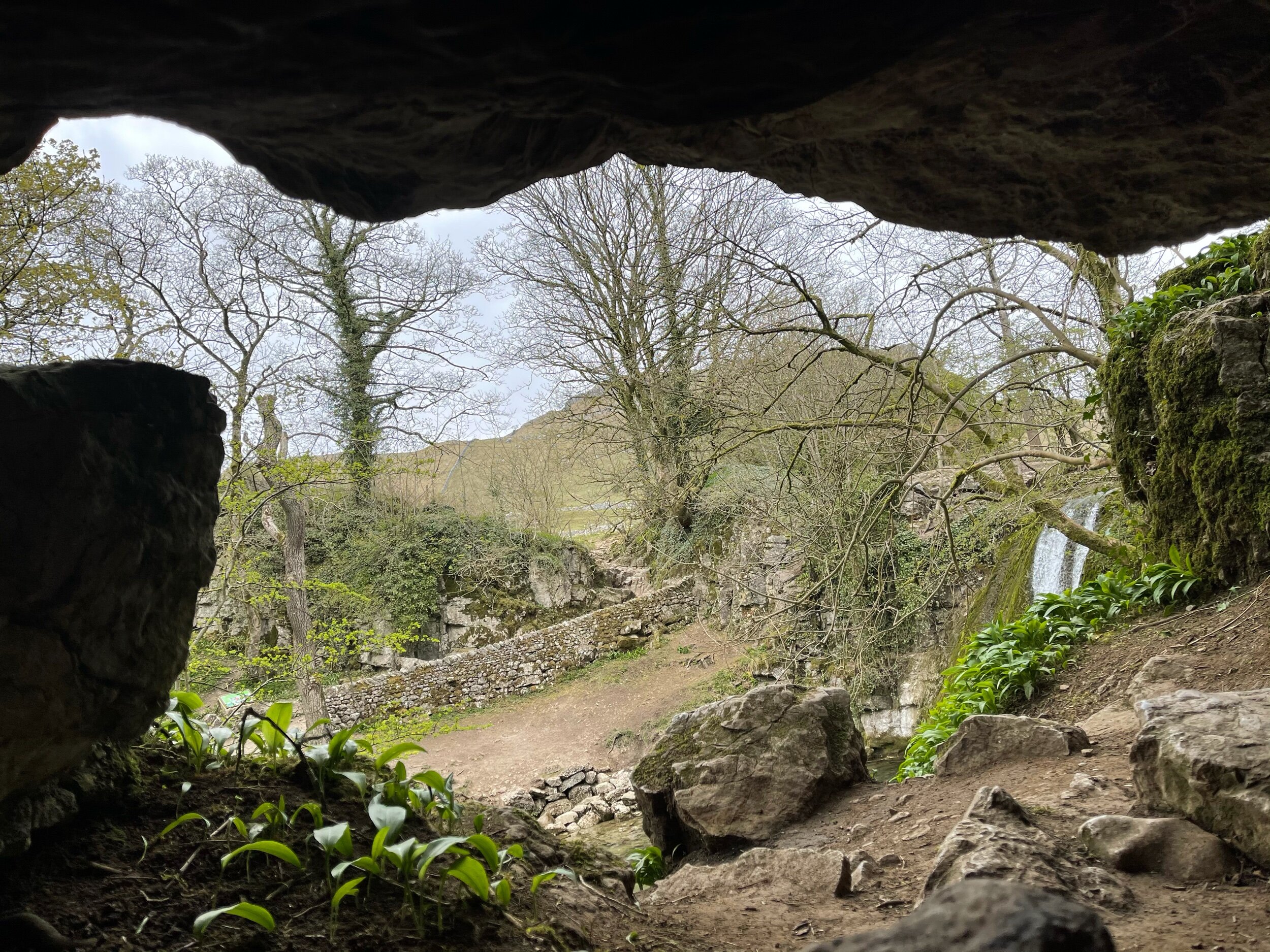
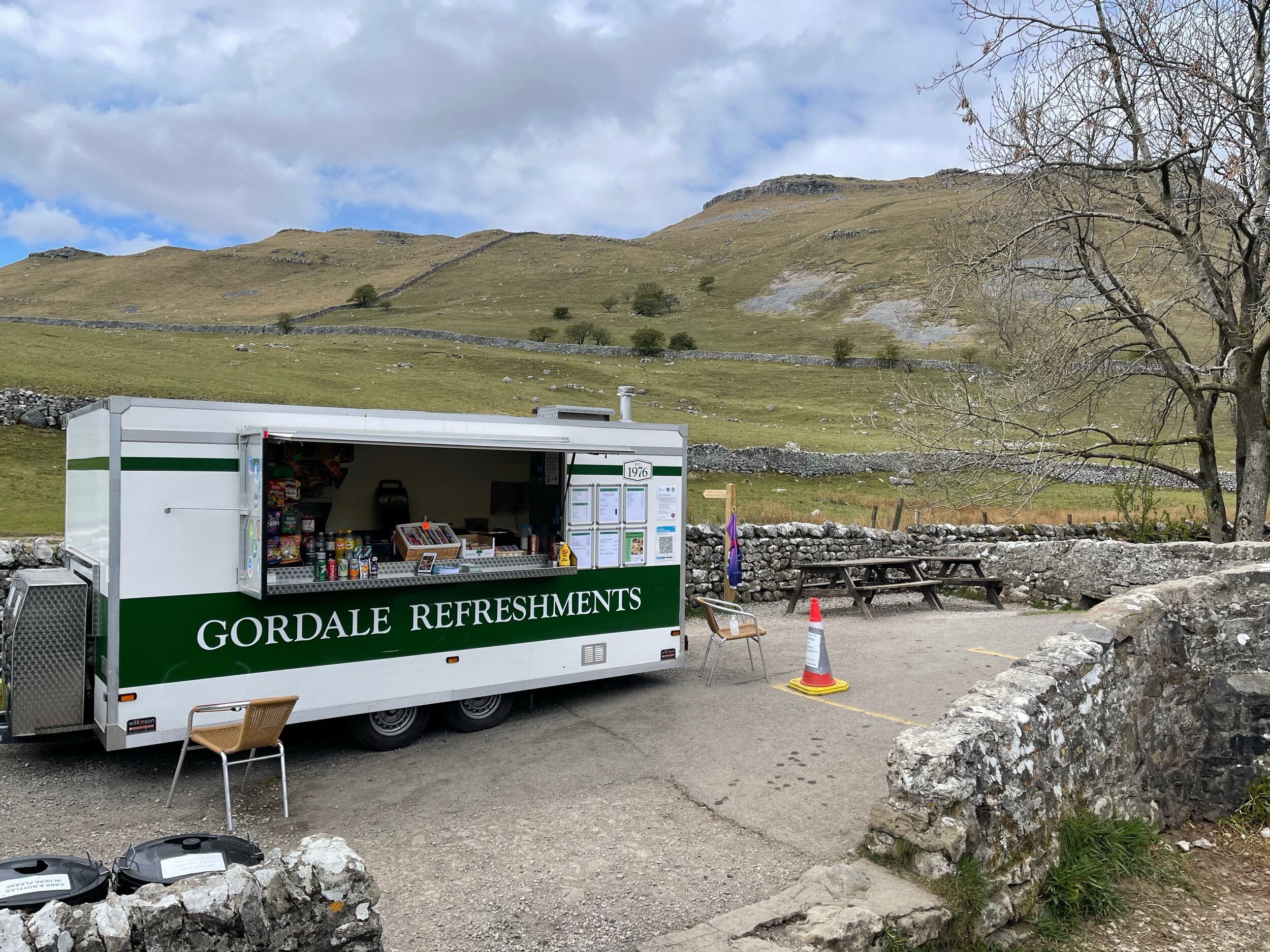
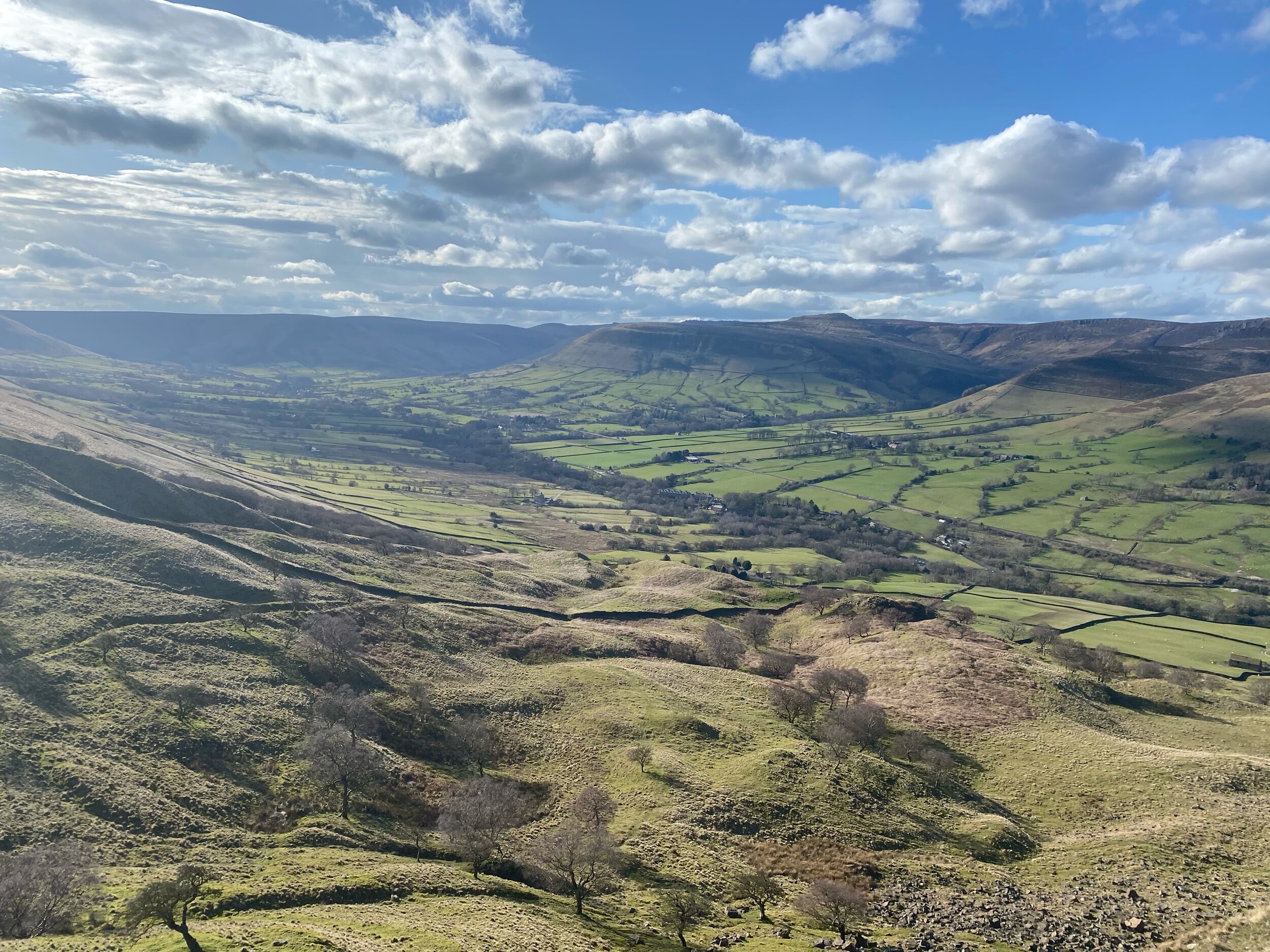
MALHAM COVE, SHIRE
A magical route through the Yorkshire Dales — waterfalls, fairytale caves and insane views throughout
Looking for best walk in the Yorkshire Dales? Look no further…
Distance: 8.32 miles
Time: 2-4 hours
Ascent: 900 feet
Start: National Park Centre, Malham
Navigation link: follow the trail here
Feel like you might’ve accidentally clicked the wrong link?
As much as these images feel like another country entirely, they’re still very much within driving distance to our rainy city! This trail truly has it all: not one, but two fairytale-esque waterfalls (Janet’s Foss and Gordale Scar), a hidden cave… and a cove that wouldn’t look out of place in Arizona… and a fairly flat route throughout!
A magnet for families and ramblers alike, Malham, North Yorkshire is home to so many enchating places to explore — that said, it can get pretty busy in the summer months, so if you’re after a less populated stroll, we’d recommend popping down during the week.
Unlike a lot of other waterfalls in the surrounding area, Gordale Scar allows walkers to discover its beauty without having to undertake a difficult climb en route.
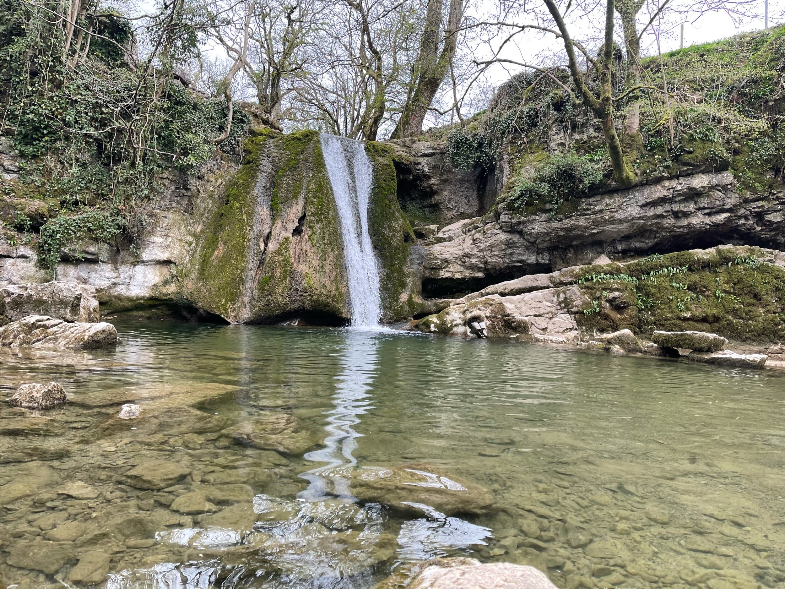
Fancy a dip? Wild swimming has become immensely popular over the past year - and we couldn’t think of a better place to dip a toe in than this one!
All in all, if you’re looking for one of the best walks in the Yorkshire Dale’s — you’re sure to find it in Malham.
Follow the route step by step here — or if you fancy shortening the route, a quick pit stop to the National Park Centre will have you set.

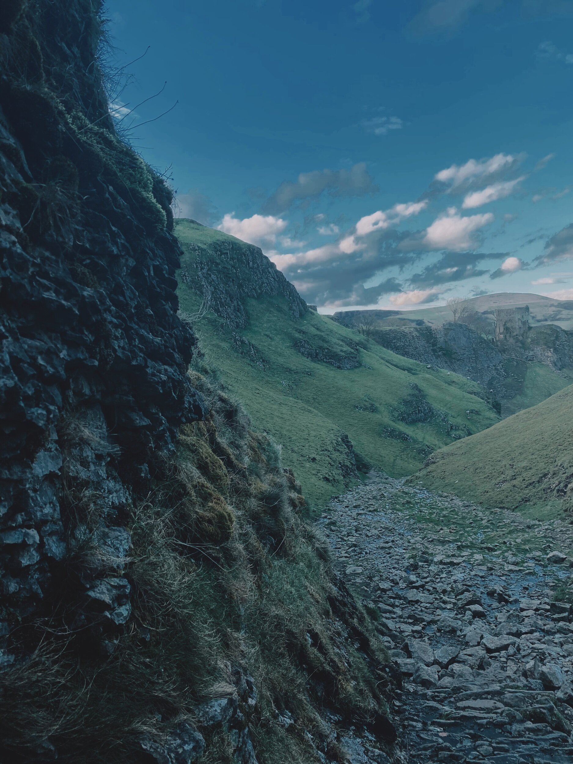
MAM TOR, SHIRE
An alternative climb to the usual Mam Tor route — taking in the beauty of Cave Dale and Castleton’s best bits
A stunning walk starting in Castleton taking in some of The Peak District’s most incredible views
Start: Peak Cavern, Castleton
Distance: 7.41 miles
Duration: 3-4 hours
Ascent: 1,700 feet
Navigation: follow the trail step-by-step here
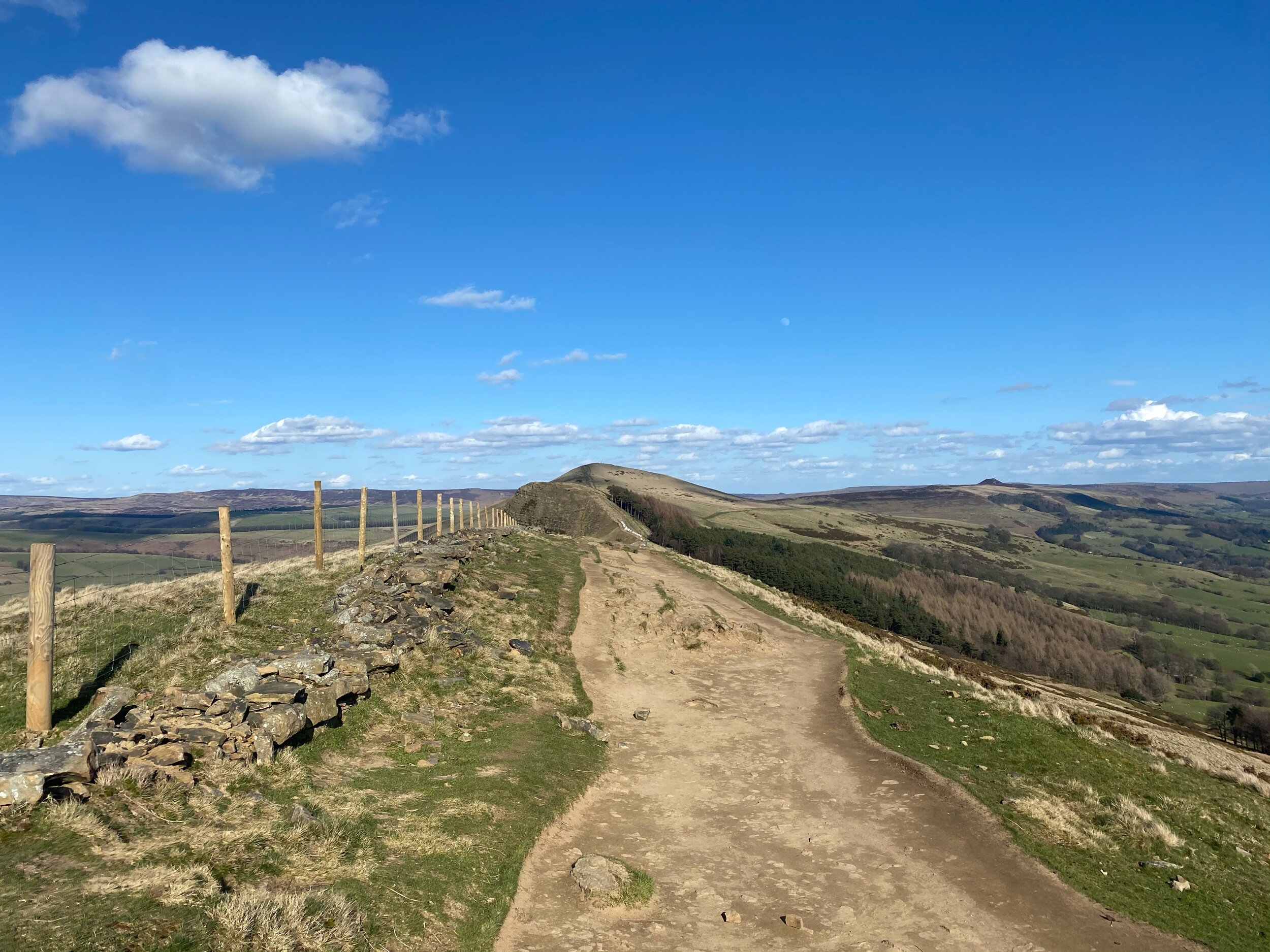
Offering more scenery than you can shake a walking pole at, The Peak District offers a plethora of adventures — and Mam Tor is certainly up there. If green valleys, friendly summits and routes for all abilities sounds like your cup of tea, then a trip to Mam Tor is a must.
Nestled on the foothills of Castleton and Edale, Mam Tor offers something for everyone — the route below is a little on the challenging side, but by following the waymarked paths set out by National Trust, a day out here is never hindered by ability.
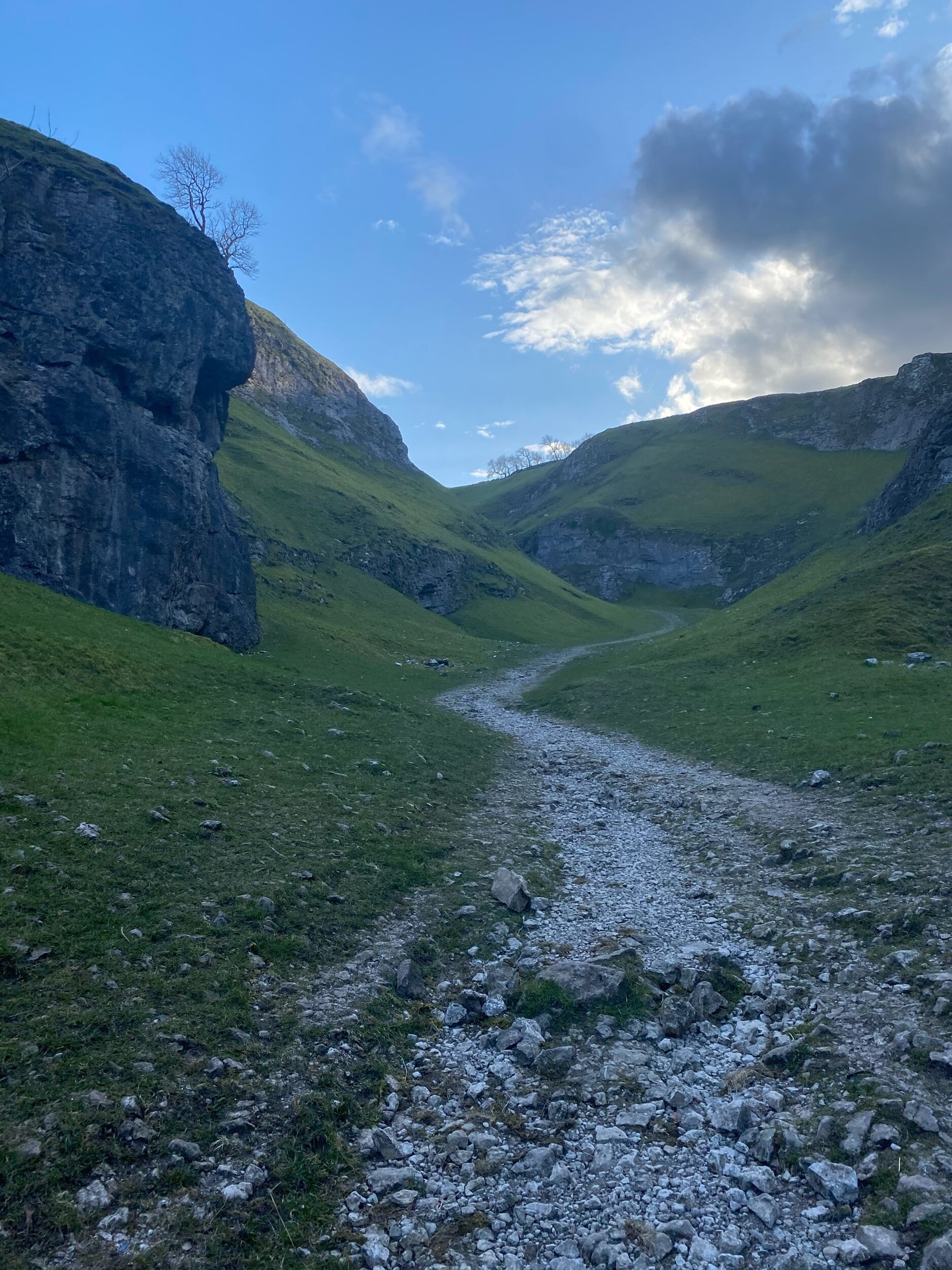
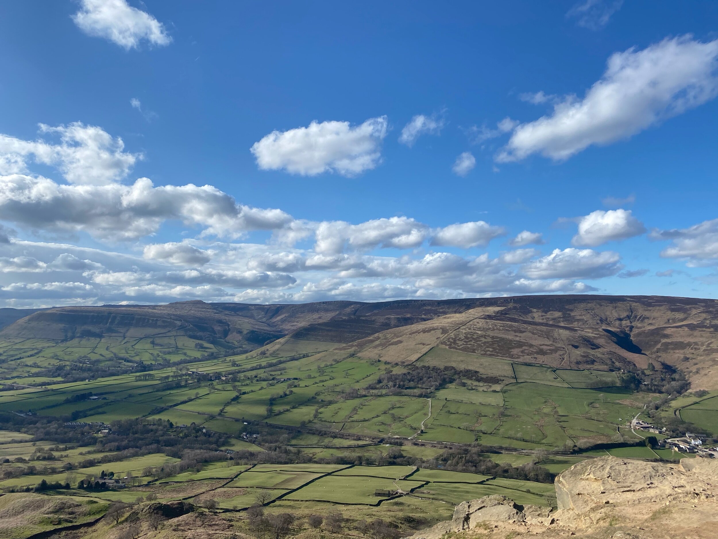
Arguably the star attraction of the Peak District, Cave Dale and Mam Tor attracts walkers from all across the globe. Standing at 517 metres tall, Mam Tor sits on the edge of the Dark Peak and the White Peak — boasting spectacular views for miles around, including every photographer’s favourite: Winnats Pass.
On a really clear day, you can even see our city in all its glory — keep an eye out for a good weather day before you plan your trek, the views are definitely worth it.
This route itself is a little on the challenging side — but should you want to take in the views with a little less of a climb, parking at Mam Tor’s National Trust carpark gives you the best of both worlds.

The weather changes fast on this peak — so remember to pack extra layers, and enjoy the view!

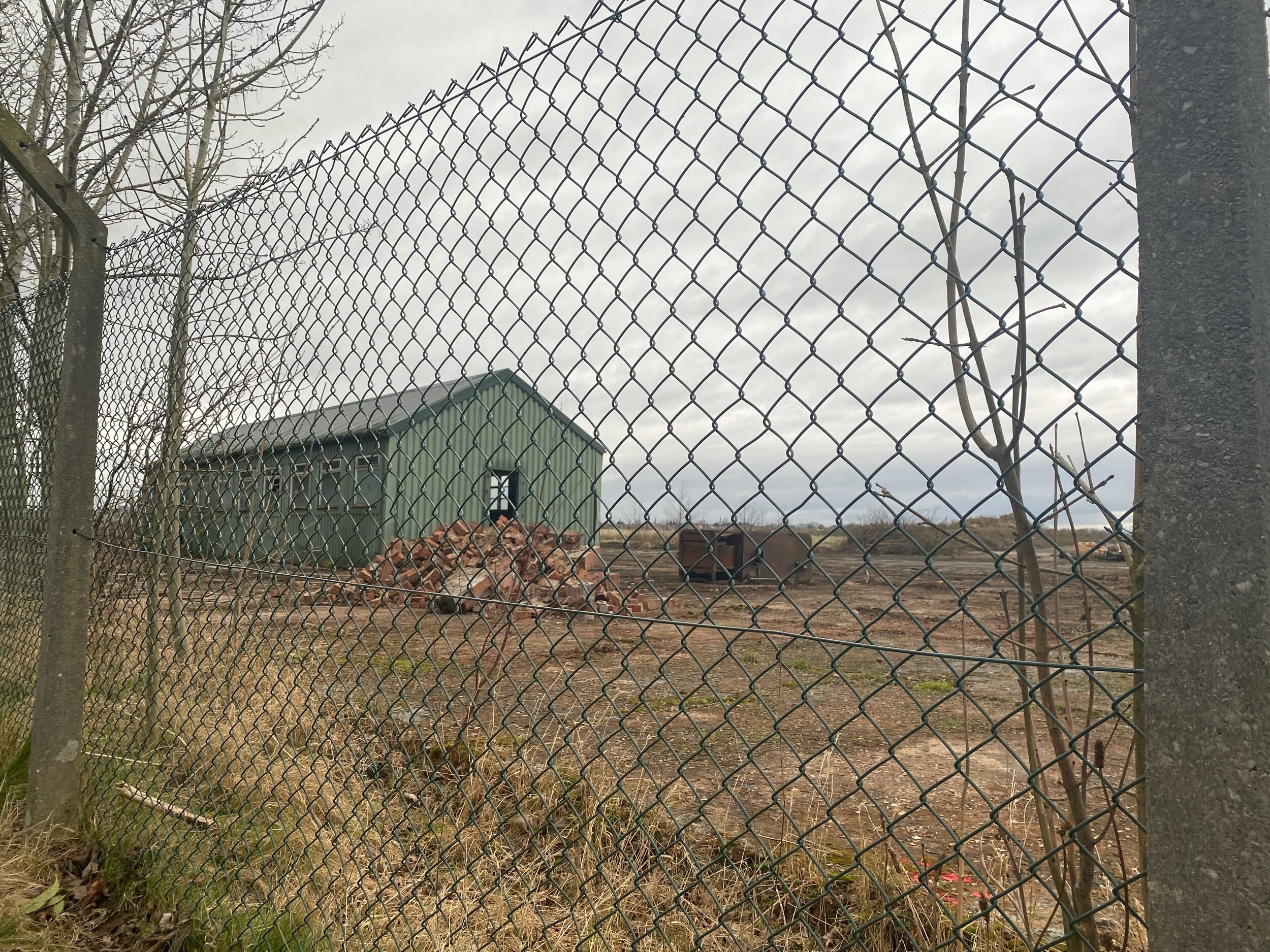
WOODFORD CIRCULAR
An atmospheric, short stroll around Woodford’s abandoned Aerodrome
As atmospheric walks go, this one’s certainly up there.

Start: Old Hall Lane
Distance: 2.5 mile circular
Ascension: 50 feet
Pitstops: Notcutts Garden Centre, The Unicorn
Navigation: follow the route here

Call us novices, but until we took a venture around this abandoned Aerodrome in Woodford (near Stockport), we’d never followed a public footpath that meanders through a golf course before.

Aside from watching out for golfers’ swings, we were pleasantly surprised by the mix of urban and natural landscapes — blending into one to create a pretty spooky (but nontheless interesting) trail so close to home.

Woodford Aerodrome first opened just after the First World War and became an important production centre for military aircraft during the Second World War. Notable planes made here include the Arvo Vulcan and the Arvo Lancaster — and most of its remains are still standing, waiting for passersby to explore but for a tiny fence blocking the view.
If you’re looking for one of the best short walks close to Stockport perfect for the whole fam, then a trip to Woodford is always a good shout!

“All truly great thoughts are conceived while walking. ”

OVER-EXPOSED! CRASH SITE, SHIRE
A gentle climb up to Higher Shelf Stones and the Over Exposed crash site
Start: Manor Park, Glossop
Distance: 9.24 miles
Duration: 3-4 hours
Ascent: 1,600 feet
Navigation: follow the route step-by-step here
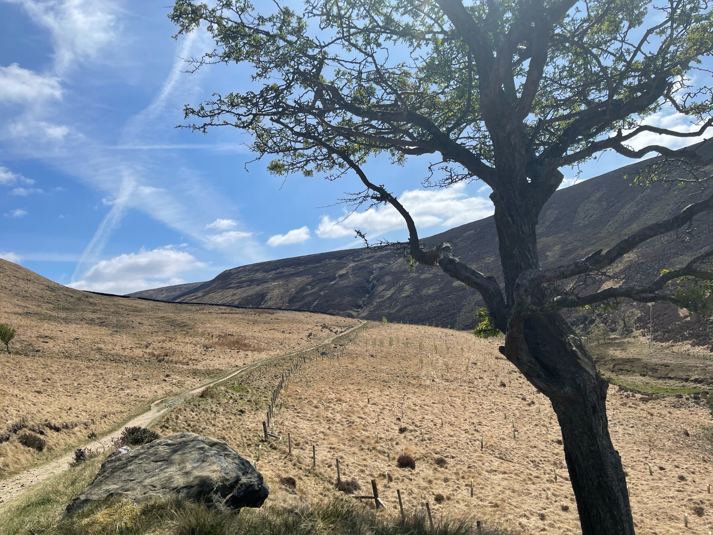
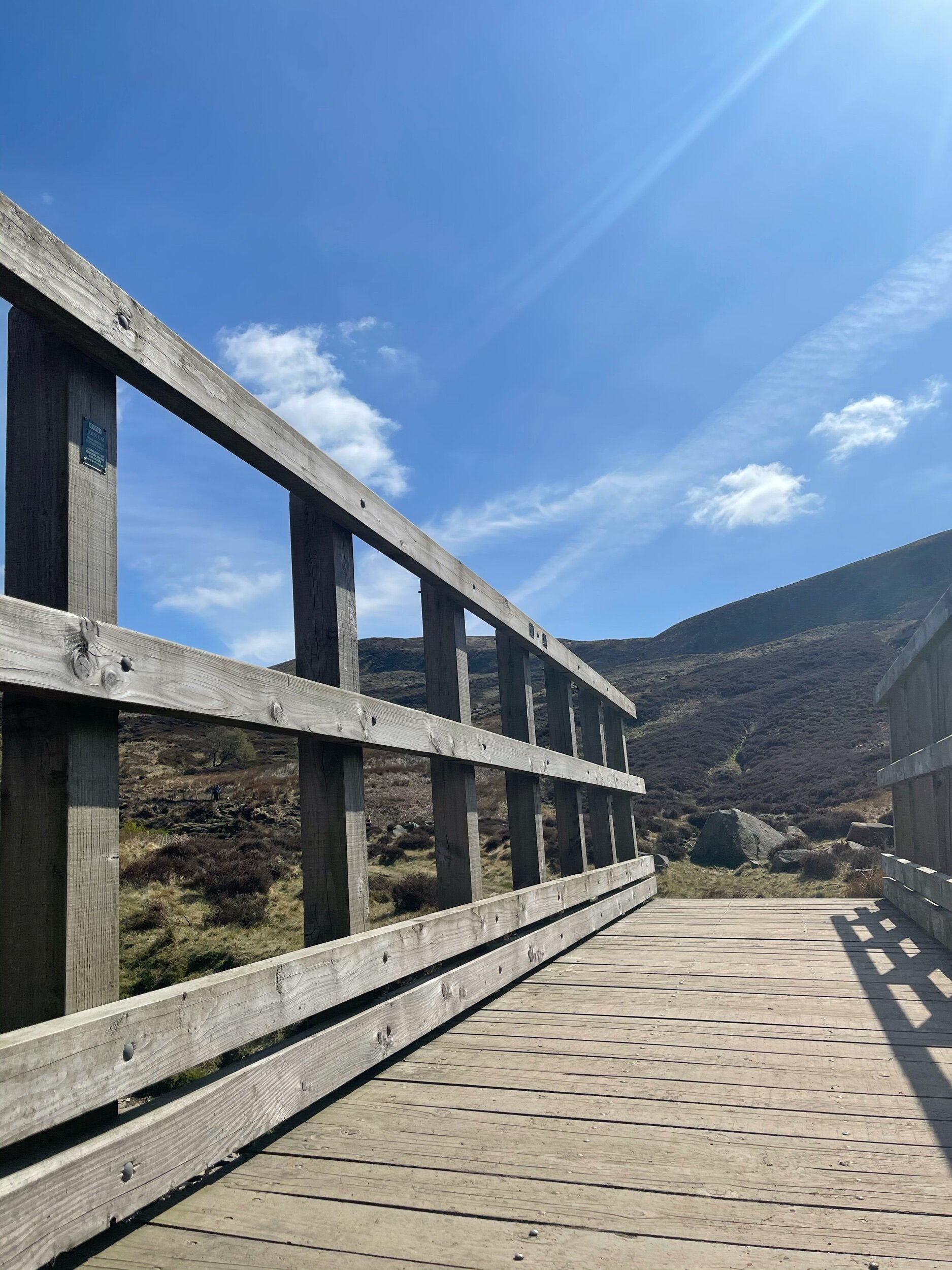
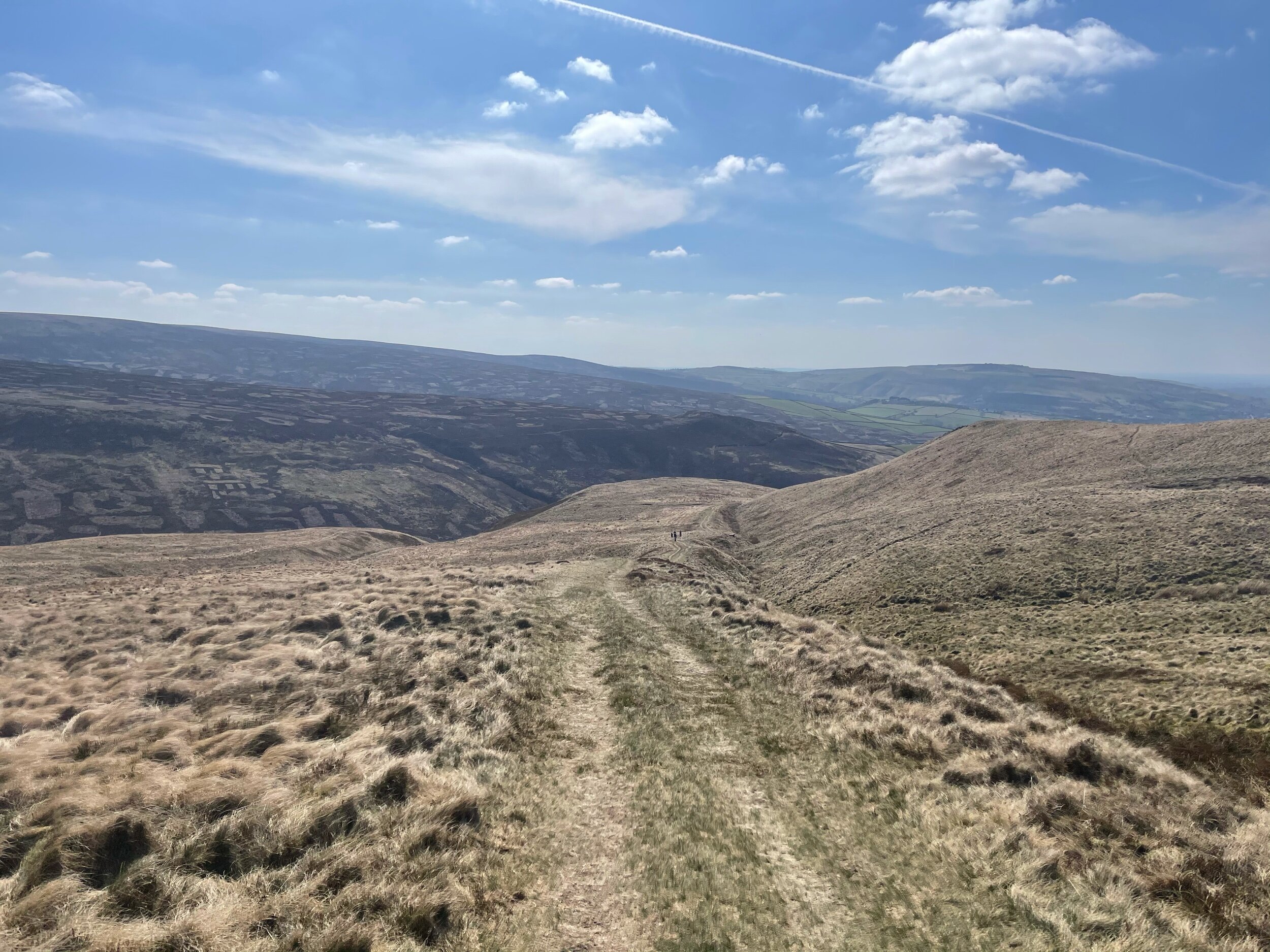
By no means the easiest walk but defintiely a firm favourite amongst locals, the climb up to Higher Shelf Stones and the Over-Exposed crash site is definitely one of the most rewarding ones close to Manchester.
Starting from Glossop makes for a longer ascent — but if you’re looking to shorten the route, parking on Snake Pass near to the Pennine Way entrance gives you the best of both worlds: a shorter trail with the same amount of rewards.
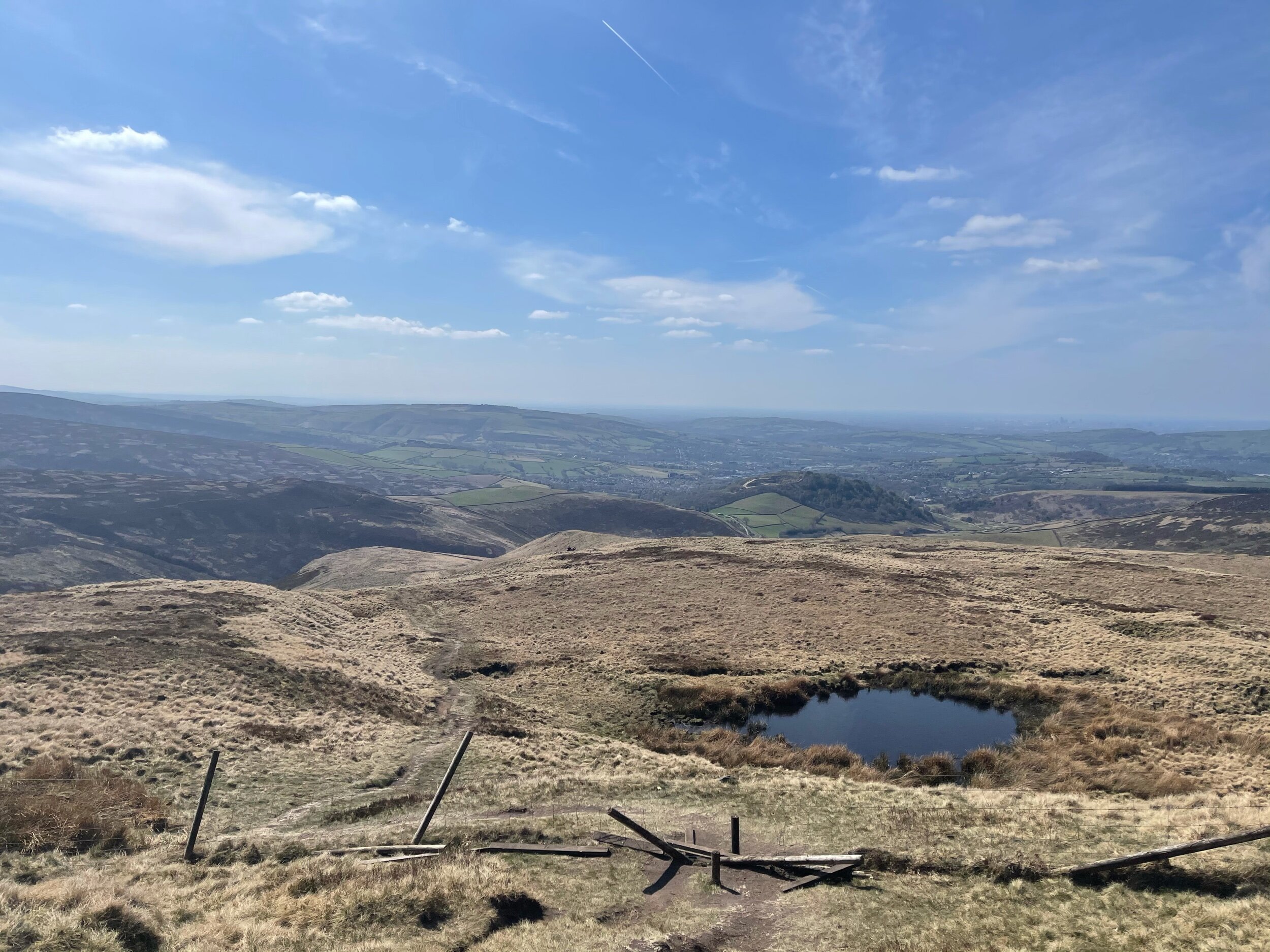
Unlike a lot of the more strenuous hikes where the best views lie way up top, this route offers you insane views with every step you take.
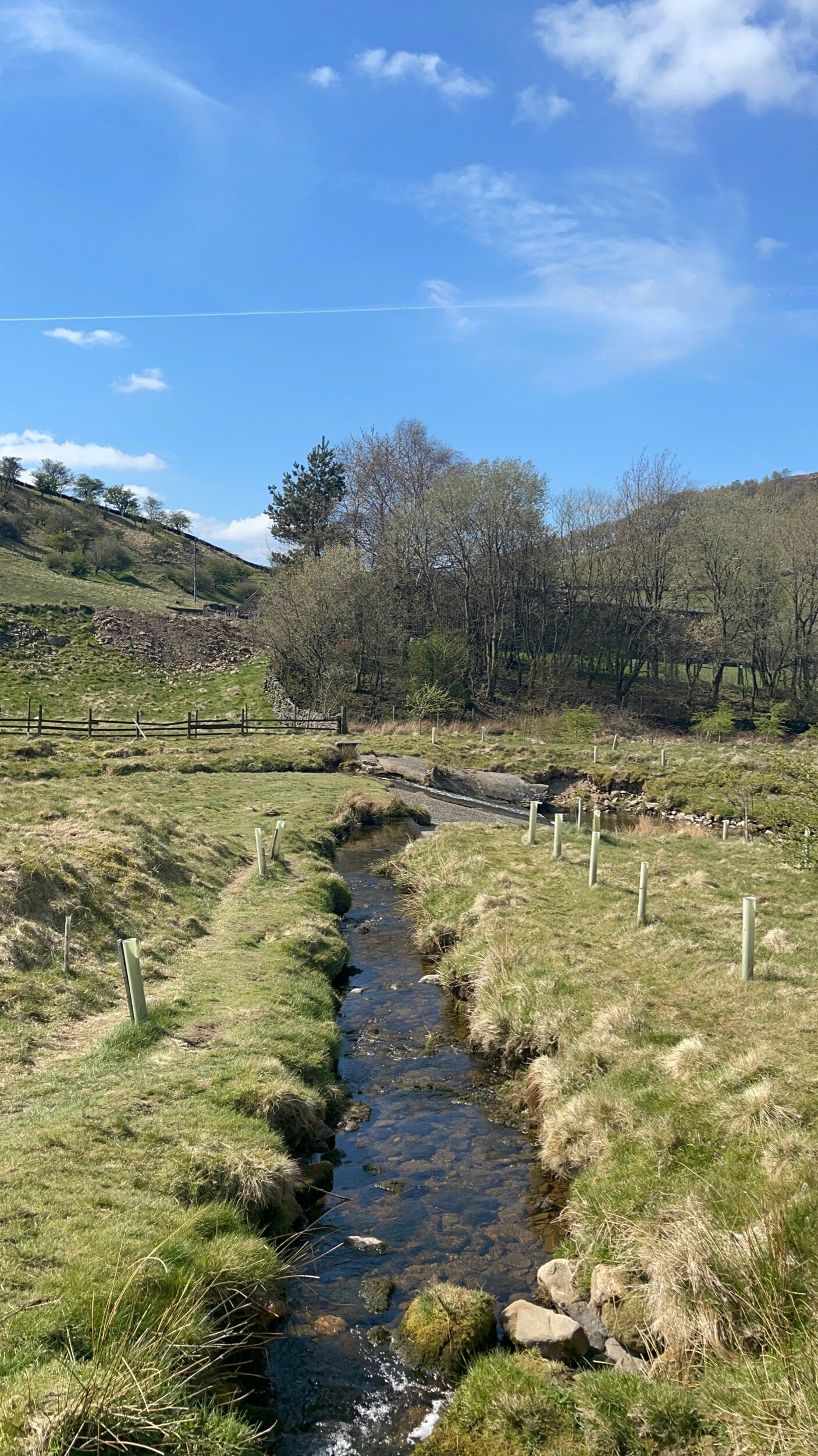
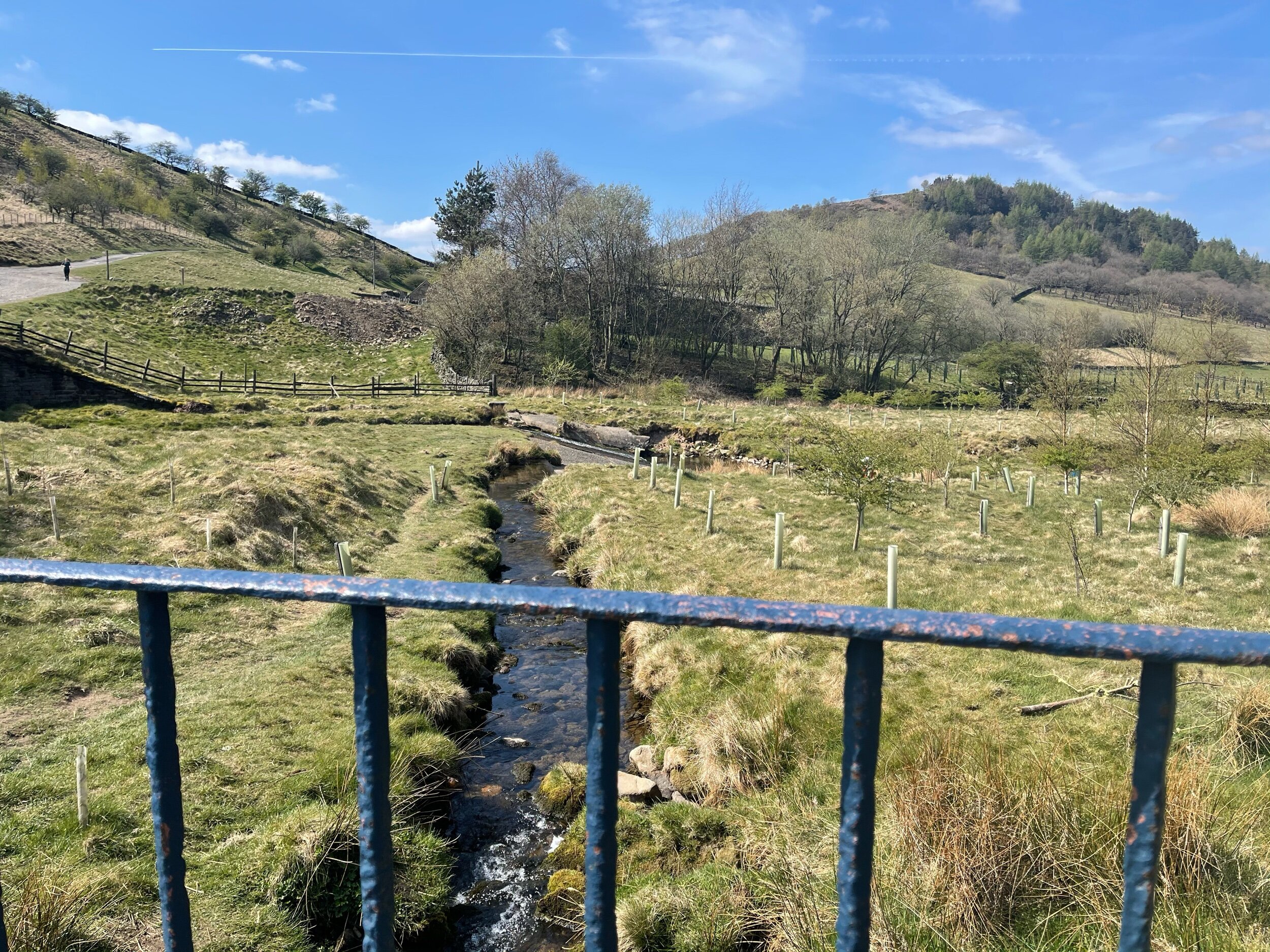
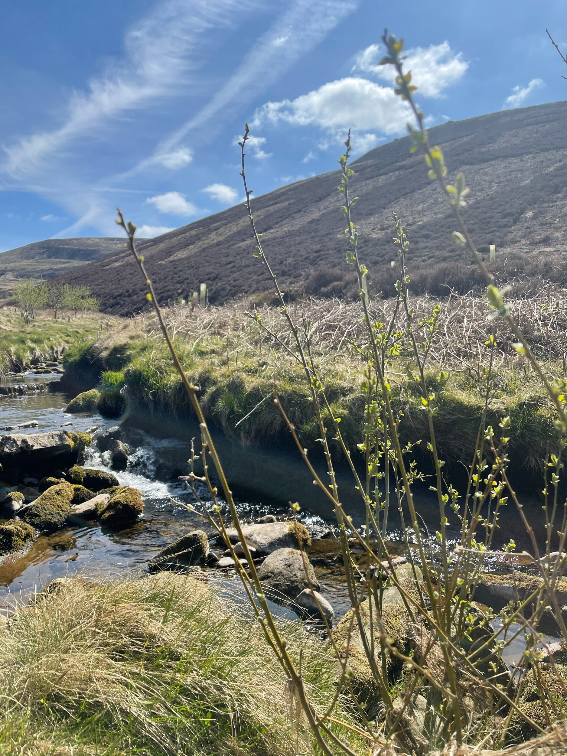
Along the way, you’ll escape the confines of the valleys in favour of the sanctuary of high moors. The streams you see along the way make for a great respite on a sunny day — but it can get quite boggy so walking boots are a must on this one.
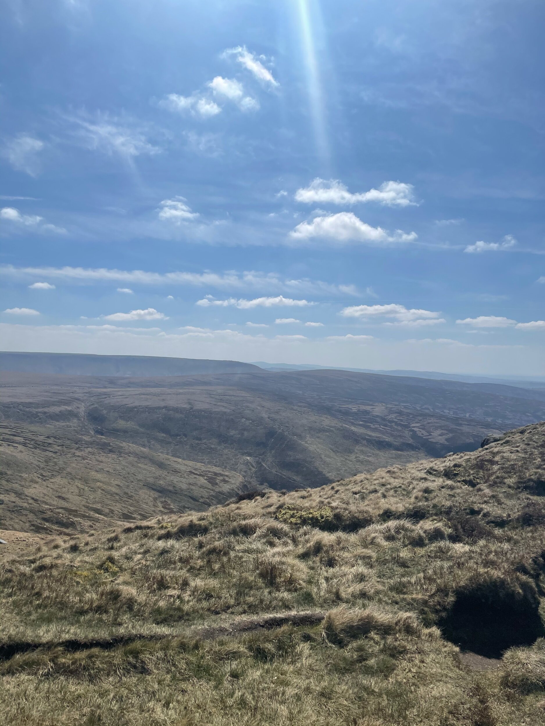
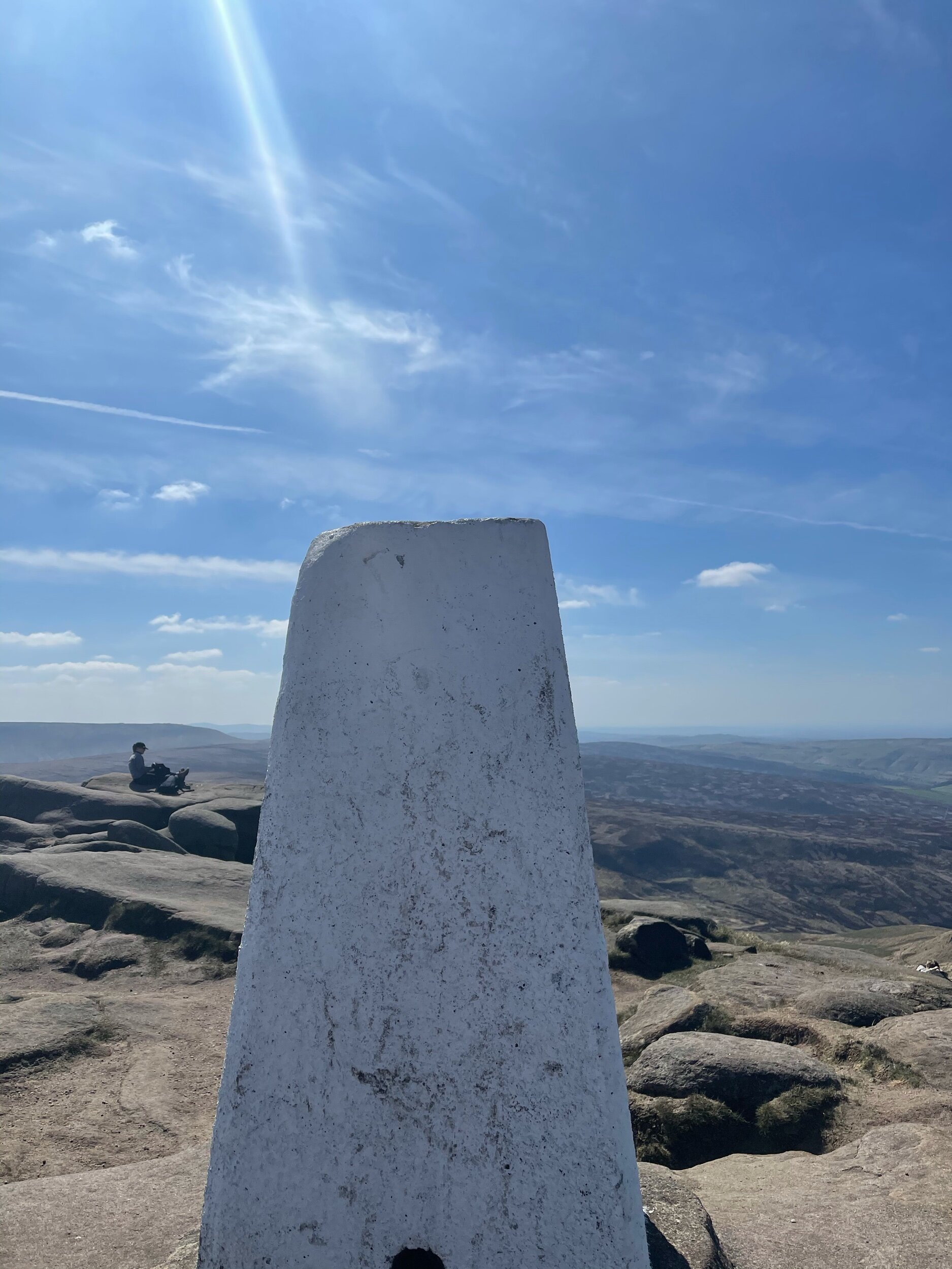
Before approaching the crash site, you’ll emerge at Higher Shelf Stones; the third highest summit in the Peak District. It’s a tremendous vantage point — and on a clear day, you can even spot Carneddau as well as a succession of endless flowing ridges.
Do bear in mind, the section across Bleaklow to the summit and crash site can become unclear if visibility isn’t great, so try and plan for a clear weather day and always take a navigation app with you.

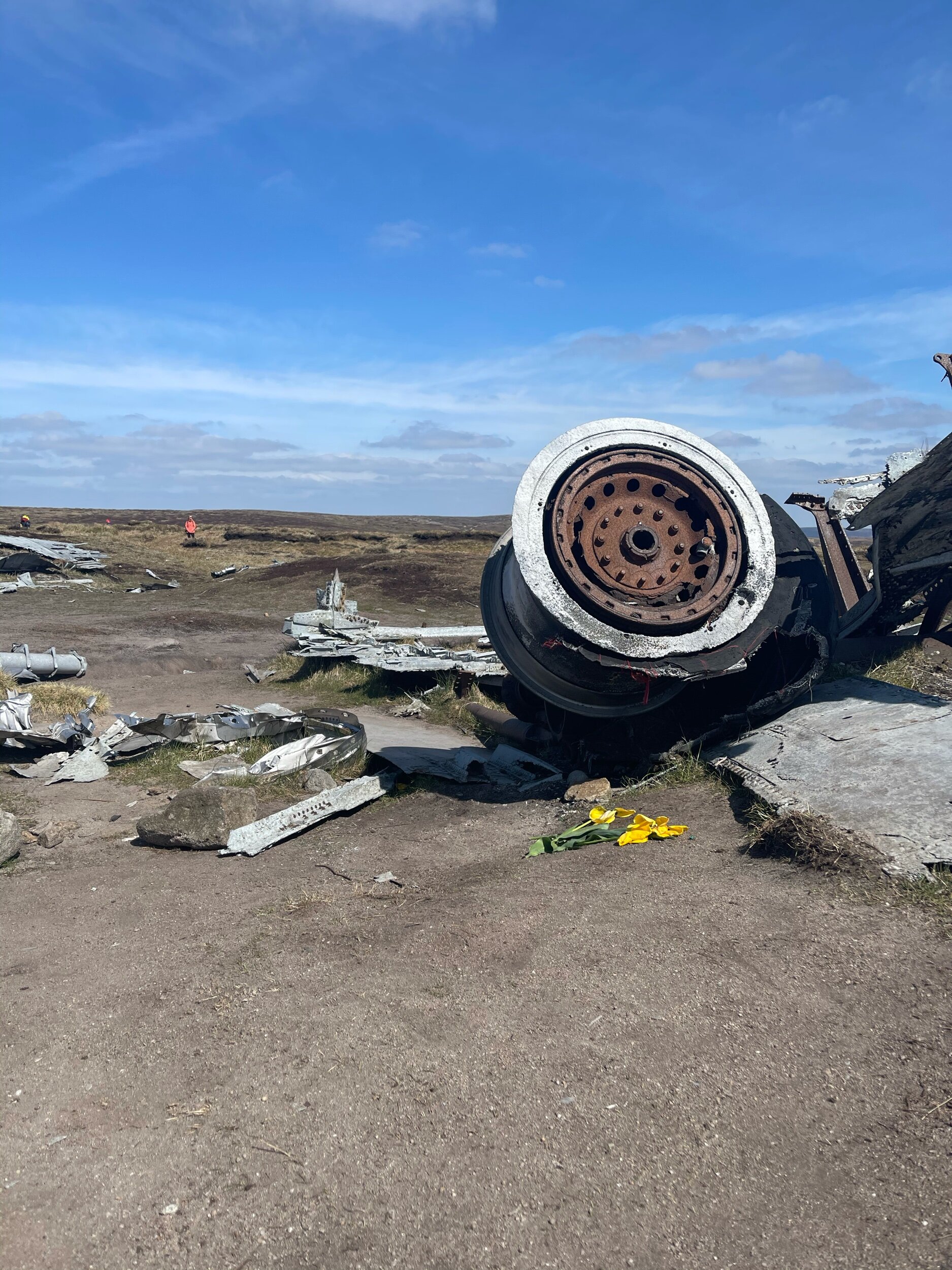
After bearing right from Higher Shelf Stones trig point, it won’t be long before you come acrross the B29 crash site.
Walking around the remains of the wreckage was a truly sobering experience. The Over-Exposed! crasbed in November 1948 while carrying wages and supplies to Burtonwood USAF airbase (near Warrington) from Lincolnsire.
The crew were due to fly back to the States just a few days later but sadly didn’t make it home.
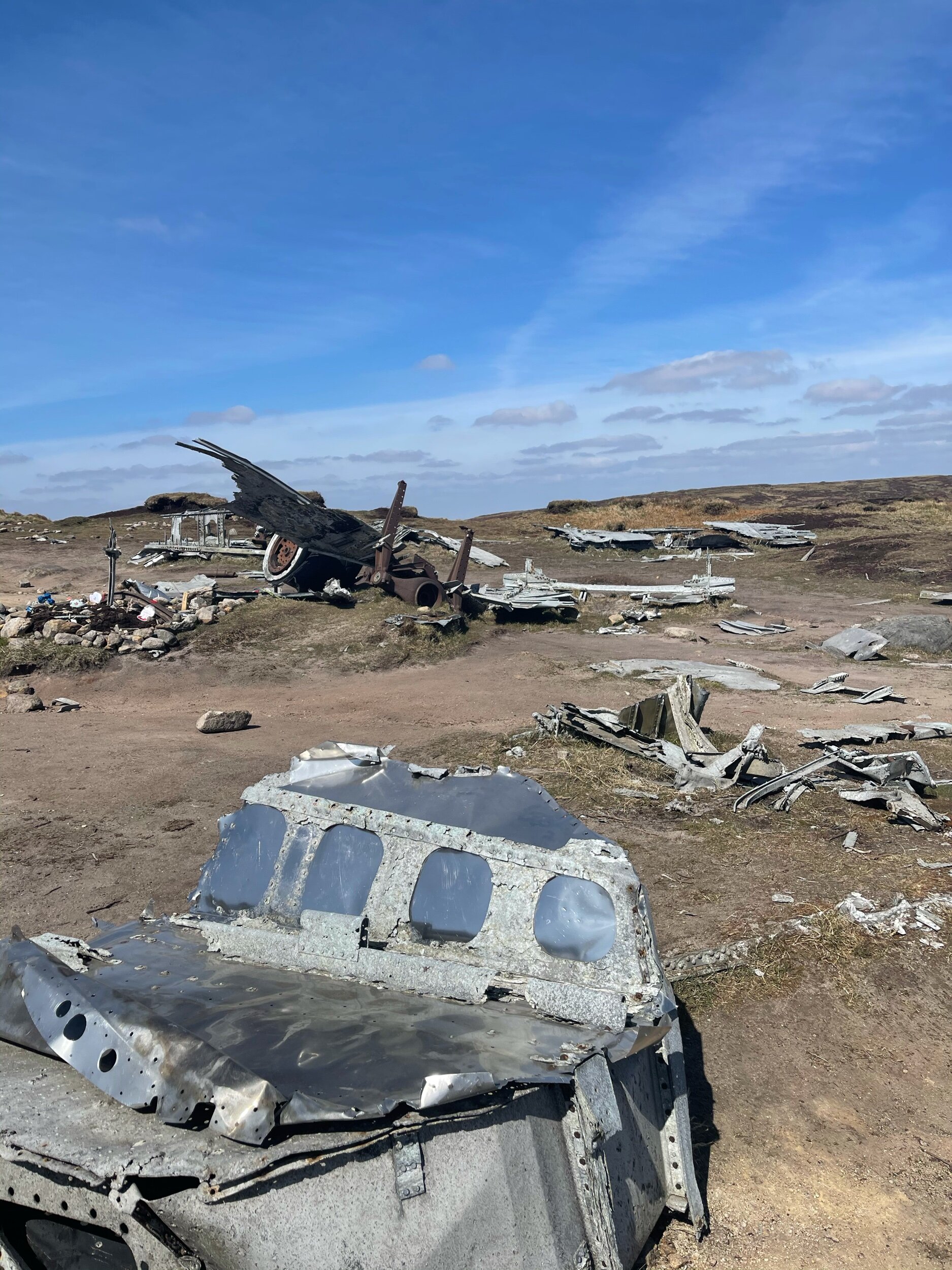
Definitely a route that tugs on your heart strings — but an important piece of our local area’s history nontheless.
A must-see if history is your bag, and an interesting route for all regardless.

Just remember the wellies!
UPHILL CHALLENGES:


WALKS WITH WATERFALLS:


