ALL TRAILS

THE TRINNACLE: DOVE STONE LOOP
Fancy spending the weekend climbing Saddleworth’s most-snapped landmark? Then a scramble up The Trinnacle is a must…

Start: Binn Green Car Park, Oldham, OL3 7NN
Distance: 4.13 miles
Elevation: 950 feet
Duration: less than 2 hours
Navigation: follow along here

Fed up of the same old flat walking routes around the same old area?
Well, it turns out you don’t have to travel too far out of town to be transported to another world entirely…
Our route round Yeomen Hey Reservoir and up to The Trinnacle will have you feeling like you’re in a Canadian National Park, much less the outskirts of Ashton.

Located high on the hills of Saddleworth Moor, there stands a peculiar rock formation which has well and truly gripped the attention of ramblers far and wide.
Best known as ‘The Trinnacle’, this fork-shaped pillar juts out from the moorlands above Dovestone Reservoir and has attracted the attention of many keen photo opportunists as of late.

Made up of dazzling reservoirs, epic waterfalls, jaw-dropping scenery and steep inclines - alongside a couple of exhilirating scrambles along the river edge - this route really has it all.

Good-to-knows
Parking: Binn Green Car Park (RSPB). Please note, the spaces are limited and fill up quickly. We advise visiting off-peak where possible.
Public Transport: Catch the train to Greenfield Station. This extends the walk by about 50 mins each way.
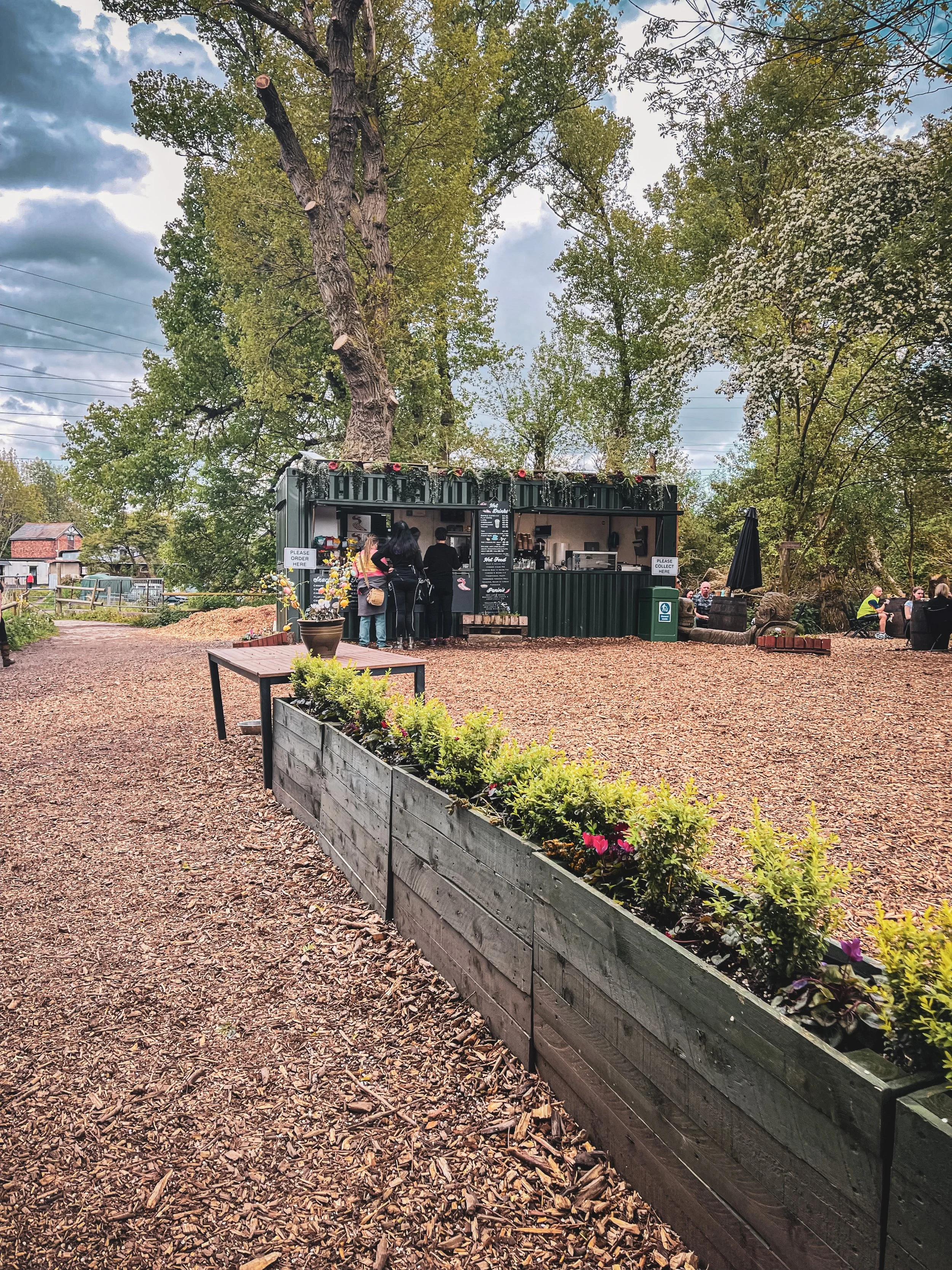
Amenities: You’ll find an ice cream van and coffee truck at the base of Dove Stone Reservoir, with public toilets in the car park adjacent.
The Trinnacle: While this landmark certainly makes for a great photo opp, please only attempt scrambling if you are confident to do so. Make sure to take great care and only climb if the weather allows for it. The drop at the rear side is certainly no joke.
Fun fact: as we were climbing this one, a passerby shouted “I can’t watch! Make her get down!”, so make sure you have a head for heights whether you’re spectating or tackling it yourself.
Kit: Boots are ESSENTIAL for this one. The route is comprised of steep, slippery, boggy and rocky terrain. White trainer victims: be warned. (We certainly saw a few en-route!).
Take layers. It was a glorious day when we visited but remember where you are… layers are always a good idea.
Refreshments: Due to the idyllic Greenfield location, you’ll have your pick of pubs on this one. We recommend stopping off at The Roaches Lock, just a short drive away from the starting point.
Extending the route: Follow our extended 6 mile version here.
Fancy giving this one ago? Follow along here

QUARRY BANK LOOP, STYAL
An exceptionally easy Sunday stroll starting at an exceptionally good pub…

Start: The Ship Inn, Styal
Distance: 5 miles
Elevation: 275 feet
Duration: approx. 2 hours
Navigation: follow the route here

From enchanting woodlands to proper pub grub, Styal beckons you to explore its surrounds… and with most of the routes on offer under cover of a leafy greenscape, Quarry Bank makes for a great day out, rain or shine.

The Southern Woods provide a great opportunity to explore the wider estate at Quarry Bank and to watch the river twist and turn and make its way to the mill. There are also some hidden gems... take a look at the mill pond and weir.

As well as some fantastic routes along the river Bollin on sections of the Bollin Valley Way, Quarry Bank Mill is well worth a day out of its own. Whether you prefer to take an extended pit stop here or make it your main event, there’s plenty of routes on offer. Ours takes you through Styal Woods, up to The Giant’s Castle Bridge, Norcliffe Chapel and on into Chapel Wood, before dropping down to the River Bollin at the rear of the Quarry Bank Mill Gardens.

From here, we head west following the river coming out next to Manchester Airport runway at the edge of Wilmslow and head across the fields to Pownall Park, back through Quarry Bank Mill and on to The Ship Inn — ready for some much needed pub grub and a well-deserved pint.

Looking for a longer route? This 6.5 mile walk is another great alternative for exploring Styal’s serene surroundings. Check out the route details above, and take your pick.

Fancy following along? Check out the step-by-step route here

STRETFORD MEADOWS
A scenic hideaway right on our doorstep…

Start: Hawthorn Lane, Chorlton
Distance: 7.03 miles
Duration: 2.5 hours
Elevation: 125 feet
Navigation: follow our route here

Looking for one of the best walks in South Manchester? Look no further…
Scenic views and wildlife might not be the first things that spring to mind when you think of Stretford, but that’s what makes this scenic spot just off the M60 so special.

One of the best short walks in Manchester, this route has it all: country lanes, a coffee pit stop and many links to extend the walk, including the Trans Pennine Trail.

While much of Stretford’s agricultural history has been lost to urban progression, this place is very much still teeming with wildlife. In the 19th century, Stretford was a hub for agriculture—known locally as Porkhampton due to the of pig farms which provided produce for the nearby Manchester Market. Wild, eh?

Back then, Streford was also an extensive market gardening area, described as the "garden of Lancashire" by writers of the time. In 1845, over 508 tons of vegetables were being produced each week for the Manchester Market, with their specialty being rhubarb—known locally then as “Streford beef”.
So successful was Stretford’s vegetable output, it became known as “ the Eden of Lancashire” throughout the Victorian era. In 1845, over 508 tons of vegetables were reported to be produced by Stretford market gardens for Manchester residents.

Pre-industrialisation, Romans named the area we now know as Stretford ‘Streta’—meaning street on a ford. Until the 1800s, the area existed as a cottage community dependent on hand-weaving, providing employment for almost 800 workers.

Our route takes you along a path which follows the line of the old Roman road from ‘’Deva Victrix’’ (Chester) to ‘’Mancunium’’ (Manchester), crossing the Mersey into Stretford at Crossford Bridge, a crossing point of the ancient ford.
Upon reaching the meadows, you’ll explore woodland paths, ponds and secluded spots which provide an ideal habitat for wildlife and a perfect place to unwind.

After a short stroll around the meadows, you’ll join the Trans Pennine Trail where you can enjoy panoramic views of the River Mersey. Along the way, you’ll pass Riverside Cafe, a gorgeous pop-up cafe selling hot drinks, sweet treats and homemade food.
For those looking to make a proper day of it, you can extend the route by heading to Old Ees Brook in Urmston, or by meeting up with one of the route’s many traffic-free transport links, including the Trans Pennine Trail or the Bridgewater Canal.

Fancy giving it a go? Follow the route here

MOTTRAM ST ANDREW LOOP
Cheshire’s best hidden gem: Mottram St Andrew
A circular pub walk perfect for a Sunday stroll not too far from Manchester.

Start: The Bull’s Head, SK10 4QH
Distance: 3 miles
Duration: 1.5 hours
Elevation: 225 feet
Navigation: follow the route here

Looking for a quick escape from the hustle and bustle of city life? A short walk around Mottram St Andrew near Prestbury village may be just the ticket. With untouched countryside, a stunning waterfall, and the convenience of starting and finishing at local boozer, The Bull's Head, this route is perfect for a good old Sunday stroll.

The walk starts at The Bull's Head, a charming pub with a warm and inviting atmosphere. From there, you'll head out into the countryside, taking in quiet lanes, untouched woodlands, horse paddocks and rural footpaths. Despite being so close to the hustle and bustle of nearby Alderley Edge, this short and simple route remains untouched by modern life — giving you a sense of peace and tranquility that is hard to find in the city.

Mottram St Andrew is located about 3 miles north-west of Macclesfield in Cheshire. The walk starts and finishes at The Bull’s Head on Wilmslow Road, just a few hundred yards south of Mottram Hall. The pub has its own car park, although this place is a popular one (we can personally vouch for the delicious food!) so it’s best to avoid peak times.

The walk is relatively short, making it perfect for those who want to enjoy the great outdoors without committing to a full day of hiking. The walking route performs a simple short loop around the local countryside, taking in quiet lanes, horse paddocks and rural footpaths.
And with The Bull's Head as your starting and finishing point, you can look forward to a refreshing pint at the end of your journey.

Mottram St Andrew seems to hide its houses behind high hedges which gives the village a secretive air. We wouldn’t hazard to guess where the centre of the village is — there’s no obvious focal point and one gets the impression that, however quiet and retiring, the villagers like it that way.
But perhaps the best thing about Mottram St Andrew is its charm and character. With its cobbled streets, quaint cottages, and friendly locals, it's the perfect place to unwind and relax. And with plenty of pubs, restaurants, and cafes to choose from in nearby Prestbury Village, you won't be short on options for good food and drink.

Good to knows:
The route includes several gentle climbs and descents throughout. The paths pass through fields and horse paddocks which can be very muddy so good waterproof boots are a must. Each paddock is likely to be holding several horses so take care with dogs. You will need to negotiate 9 stiles, two kissing gates and a flight of steps. Some of the stiles are enclosed with wire fencing so dogs may need a lift over.

Ready for a short mooch & a refreshing pint? Follow the route here
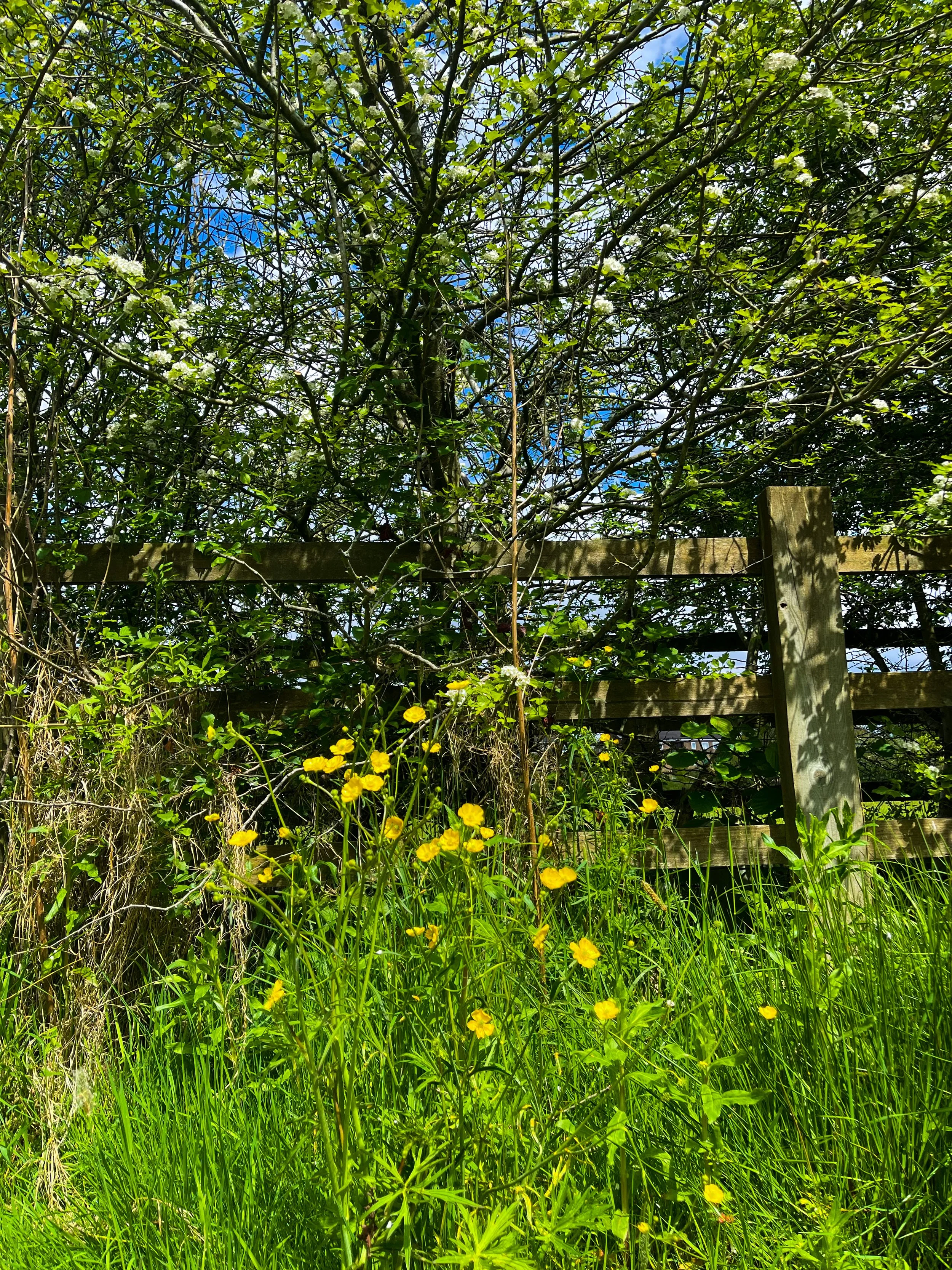
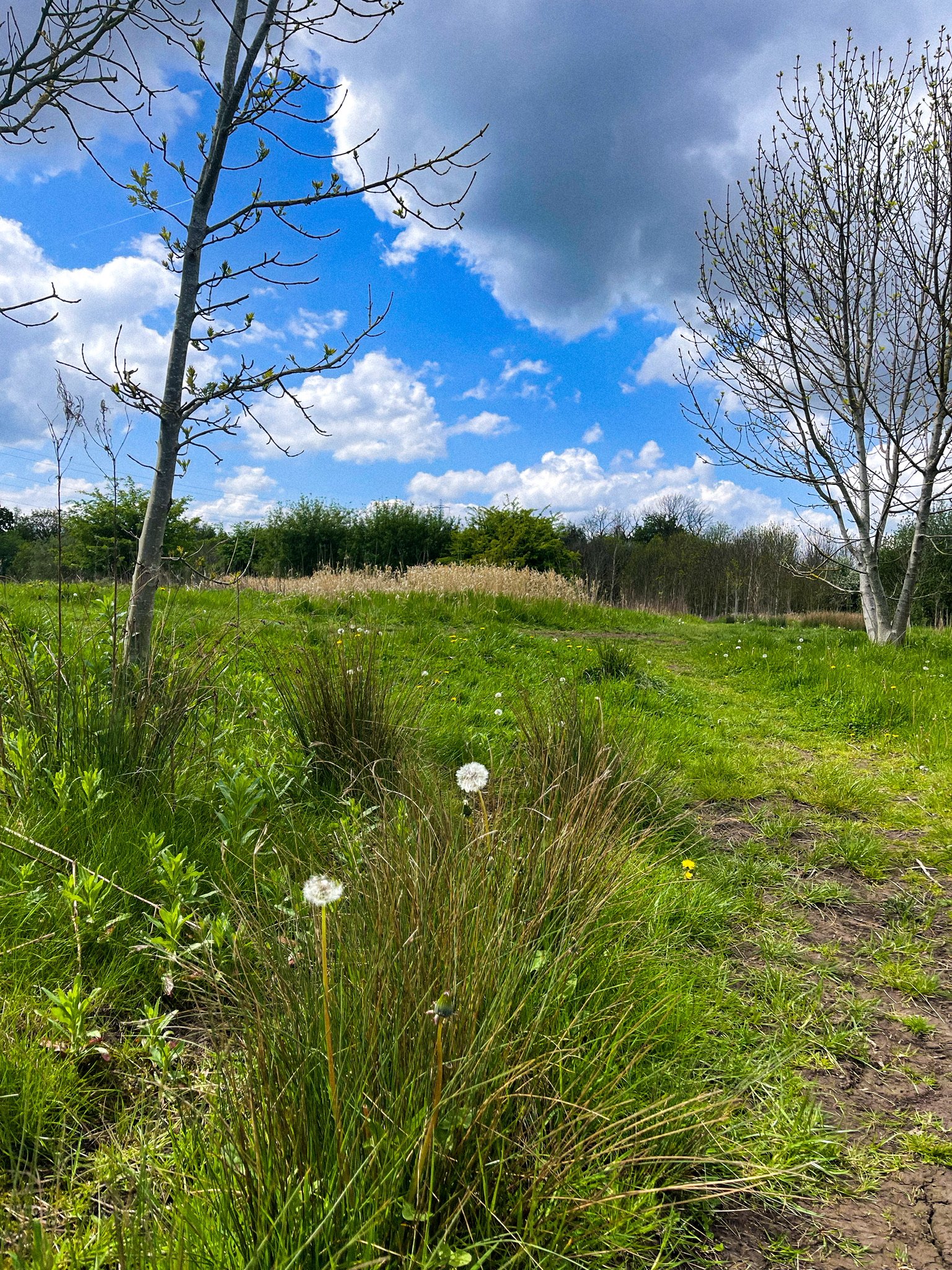
YEOMEN HEY - DOVE STONE LOOP
Discover the best walking routes around Dovestones - a hiker’s guide to the lesser-known trails
Start: Greenfield, OL3 7DD
Distance: 7.33 miles
Elevation: 1,000 feet
Duration: 3-4 hours
Navigation: follow along here
Fed up of the same old walking routes that offer nothing more than a flat path and an average view?
Well, how about getting the best of both?
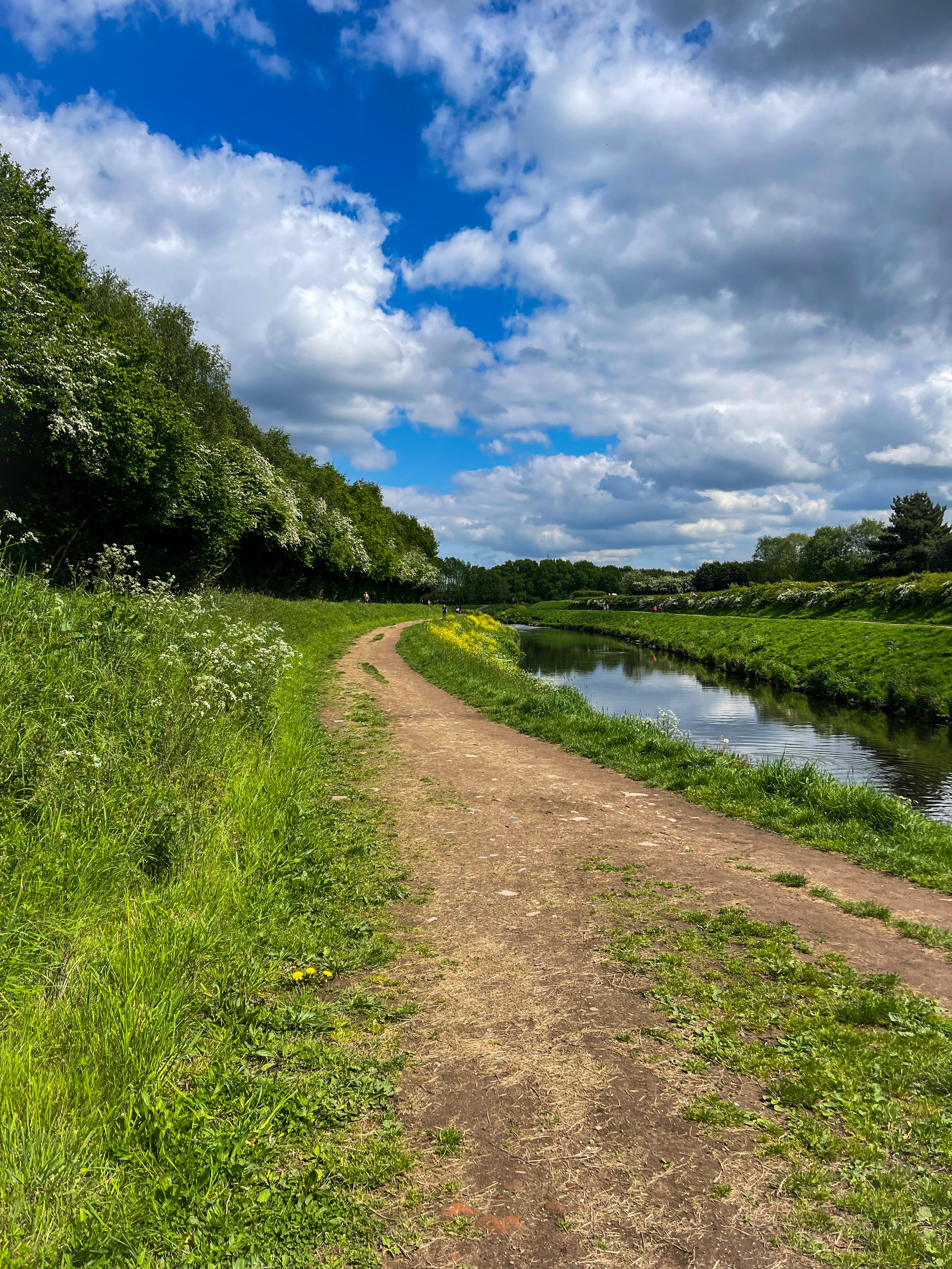
Our route around Dove Stone Reservoir to Yeomen Hey Reservoir route is not only beautifully flat to begin with but offers a bit of a challenge towards the end, too.
Starting in Greenfield, the route begins with a gentle stroll up to the banks of the reservoir — a great way to warm up before the climb begins.
After about a mile or so around the reservoir, you'll come across a steep climb that leads up to the Yeomen Hey Reservoir. The climb is only short, with most of the ascent accruing in one stint — but the views from the top are more than worth it. From here, you'll be rewarded with insane views, with rolling hills as far as the eye can see.
The path continues along the edge of the Yeomen Hey Reservoir, and it's here that you'll start to hear the sound of rushing water. That's because you're approaching the waterfalls. These waterfalls are a series of cascades that run down the hillside, and they're truly beautiful.
To ascend towards the waterfalls you'll need to do a bit of scrambling. It's not too difficult, but it's worth noting that it can be a bit slippery and caution is required. We recommend climbing up our way and then down the waterfall, but the route can be reversed if you prefer. Just be careful and take your time — and hiking boots are definitely needed for this.
Once you've reached the bottom, take a moment to catch your breath and enjoy the view. You'll see the water cascading down the rocks, creating a natural pool at the bottom. It's a perfect spot for a quick dip if you're feeling brave.
From here, the route continues along the top of the hillside, offering panoramic views of the surrounding countryside. You'll eventually come to the Yeomen Hey Reservoir, where you can take a break and enjoy a picnic by the water's edge.
After your rest, it's time to head back around Dovestones and on to greenfield. The route back is a bit easier, with a gentle descent down the hillside. Take your time and enjoy the view – you'll see the reservoir in a whole new light on the way back.
And better yet, once you’re near the starting point, a pint will be waiting for you at The Clarence in Greenfield.
Enjoy!

ETHEROW TO WERNETH LOOP
Discover Greater Manchester’s best hidden gems on this multiple-country park woodland walk

Start: Etherow Country Park, SK6 5DJ
Distance: 9 miles
Duration: 4 hours
Elevation: 1,500 feet
Navigation: follow the route here

Fancy experiencing all the seasons in one day?
Well, you're in luck, because this walk from Etherow Country Park to Werneth Low Country Park and confused mid-winter weather is what Great Manchester does best.
But don’t worry, with stunning scenery throughout and a dash of history thrown in for good measure, this walk is guaranteed to be a crowd-pleaser.

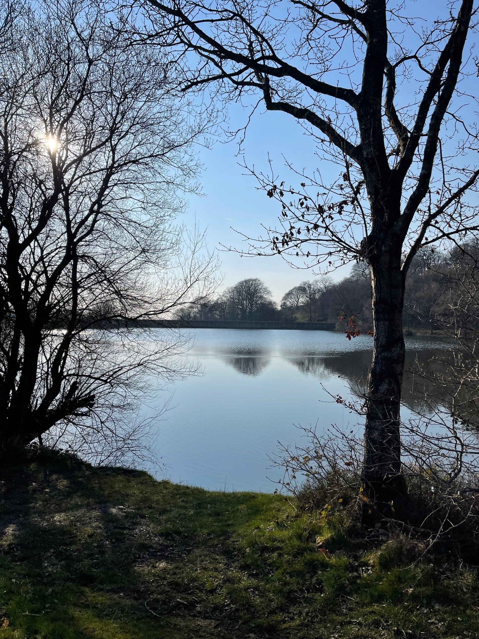
Our journey begins at Etherow Country Park — one of Britain’s first country parks. With 240 acres of greenspace, this place has an abundance of wildlife… and a waterfall you don’t want to miss!
But don't get too distracted by the fauna, because we've got a hill to climb. Yup, after a short stroll around the Keg Pool its time to climb up to Werneth Low Country Park.
Along the way, take a moment to catch your breath and admire the stunning panoramic view. Once atop The ‘Low, you’ll be quickly rewarded with immense views all across Manchester, the Peak District National Park, and the Cheshire Plain.

History buffs, we've got a couple of landmarks for you to check out. The first is the Werneth Low War Memorial, which was erected in 1921 to honor the soldiers who died in the First World War. It's a stunning monument, made of granite and topped with a bronze figure of a soldier.
After resting your legs and taking in the views, we make our way through the woodlands around Charlesworth and Broadbottom — each nothing short of idyllic. The trees are tall and imposing, the paths are winding and mysterious, and the wildlife is abundant. And if you’re up for a detour, the other landmark to check out is the Broadbottom Viaduct, which spans the valley between Broadbottom and Mottram.

Now, I know what you're thinking: a viaduct doesn't exactly sound like the most thrilling pit stop in the world. But trust me, this one is a real beauty. It was built in 1842, it's made of brick, and it has 27 arches. If you're an aspiring artist or photographer, this is the perfect spot to flex your creative muscles.
So, there we have it: a string of local country parks in one gorgeous route.
As local routes go, this one is a true belter.

Ready to follow along? Follow the route here

WORSLEY WOODS:
Short on time? This short loop around Worsley will scratch your Sunday Walk itch.

Discover the best 3 mile walk close to Manchester City Centre

Start: Worsley, M28 1XP
Distance: 3.58 miles
Duration: 1.5 hours
Elevation: 100 feet
Navigation: follow the route here

Are you looking for a scenic and peaceful walk that's just a stone's throw away from the hustle and bustle of Manchester city centre? Want to spice up your daily exercise routine with a touch of history and local charm?
Look no further than this short but scenic loop around Worsley.
This charming town has a wealth of scenic walking routes that will make you forget you're even getting a workout in. Whether you want to stroll around the village or take a leisurely mooch along the Bridgewater Canal, Worsley has something for all types of walker.

Along the way, you'll come across hiking highlights like Worsley Greenway, a flat and scenic trail that follows the route of an old railway line. Surrounded by untouched scenery, this trail is the perfect place to escape the hustle and bustle of city life and soak up that much-needed peace and quiet.

But let's be real, the best part of any walk is the pit stops along the way… and thankfully, Worsley delivers.
With plenty of cosy pubs and independent shops to choose from, you’ll be spoilt for choice on this route. A must-stop is the famous Worsley Old Hall, a 17th century pub that still serves up traditional English ales and hearty pub grub.
Fellow sweet tooths, we got you. Pop into Roccos Desserts on your joruney home.
And while you’re up this end, don't forget to take a peek at the historic Worsley Court House, a 17th century building that was once used as a court house for the local area and is now a museum showcasing the rich history of Worsley and its surroundings.

Fancy making a day of it? If you want to extend the route, you can take a stroll along the Bridgewater Canal or Worsley Greenway. Both offer even more breathtaking views and endless opportunities for a good old mooch.
The Bridgewater Canal is one of the oldest and most historic canals in England, and as for it’s exploring potential? Well there’s a reason it remains a popular destination for walkers, boaters and history buffs alike.
Over the years, the canal has undergone many changes and improvements, including the construction of several locks and the digging of numerous new branches. The canal was used extensively during the Industrial Revolution, with barges transporting raw materials, goods, and passengers to and from Manchester.
Despite its age, the Bridgewater Canal remains an important part of England's transport infrastructure to this day. In recent years, it has been restored and improved, making it a popular destination for walkers, cyclists, and boaters. The towpath that runs alongside the canal is now a well-maintained footpath and provides a peaceful and scenic route for walkers to explore the local area and enjoy the wildlife and scenery.

Whether you're a local or just visiting, this 3 mile walk around Worsley is the perfect way to escape the city and immerse yourself in the natural beauty of Greater Manchester… yes, it does exist.
With its stunning views, quaint pubs and shops, and rich history, this short walking loop is one of the best you'll find so close to Manchester city centre.

Still here? Go grab your comfy shoes and head out on a walking adventure in Worsley, instead.
Who knows, you might even find your new favourite pub.
Follow the route here

PRESTBURY CIRCULAR
If you're looking for a leisurely stroll not too far from home, then a walk round Prestbury village is a must.

Start: Prestbury Village, SK10
Distance: 4.96 miles
Duration: 2 hours
Elevation: 200 feet
Navigation: follow the route here

You can’t beat a local walk, and for us, it doesn’t get much better than one with the holy trinity: quiet surrounds, independent shops and a traditional pub stop to boot. Not only will this short loop around Prestbury Village give you a chance to stretch your legs, but it'll also give you a chance to stretch your Instagram feed with picturesque views of the local area.
The route starts at the village green, where you can take in the views of the picturesque Cheshire countryside. From there, head down Church Street, where you'll be greeted by charming houses and cottages that will make you feel like you've stepped back in time. As you stroll down Church Street, make sure to pop into St. Peter's Church for a dose of medieval architecture and some impressive carvings and stained glass windows.

Next up is the Prestbury War Memorial, a sobering reminder of the sacrifices made by the local community during World War I and II. But don't let the heavy thoughts weigh you down for too long, because the village cricket ground is just around the corner. Take in the sights and sounds of a local game in progress, or just enjoy the quiet surrounds as you meander through the winding bridge-lined woods.

But the real highlight of this walking route is the quaint and charming Bull's Head pub. This traditional pub serves a variety of delicious local ales and ciders, as well as a selection of hearty pub grub. And if the weather's nice, grab a seat in their beer garden for some al fresco dining with a view.
After a pint of the good stuff and a bite to eat, you’re halfway through the route and ready to make your way back to the starting point at the village green.
But don't worry, your journey doesn't have to end here. Prestbury village in Cheshire offers a variety of scenic walking routes, and the charming Bull's Head pub is always open for a well-deserved break. So, pack your comfortable shoes, grab your camera and head to Prestbury Village.
Ready to go? Follow along step-by-step here

BEST WALKS NEAR MANCHESTER: BLACK LAKE LOOP
A short stroll through the Cheshire Countryside, without having to venture too far from the M60…

Start: Lindow Common Car Park, SK9 5LW
Distance: 3.67 miles
Duration: allow approx. 1-2 hours
Navigation: follow the route here

Walks like this are our favourite. They’re the reason we started Getlostmcr - to showcase the hidden, untouched trails right on our doorstep. Lindow Common and its surrounds certainly falls in that category.
Located just outside of Wilmslow town centre, Lindow Common is crisscrossed by numerous idyllic footpaths perfect for a Sunday stroll. In centuries past, the common was an area of heath land where villagers could graze their cattle.
In recent years, trees have taken over the area (how dramatic), which has turned the common into a Site of Scientific Interest with its own designated local nature reserve.

With so many paths to explore. it’s perfect for big kids, little kids and four-legged pals to roam free. In the centre of the maze of idyllic paths you’ll find Black Lake — a gorgeous hidden gem home to plenty of ducks and wildlife. The views across the lake were incredible, particularly on a sunny day.

And after a short stroll around Black Lake, Wilmslow itself is well worth a visit. It’s home to lots of quaint coffee shops, chic charity shops, designer boutiques, upmarket homeware stores, and maybe even a few footballers’ houses if seeing how the other ‘alf live is your thing.
Or if you’re looking to extend your walk, why not take a stroll along the River Bollin towards Styal Village and Quarry Bank Mill? This National Trust gem is a firm favourite of ours, and you can follow our best routes around Styal here.

Fancy stopping off in Wilmslow next time you head for the Cheshire countryside? Find full navigation details here
STRETFORD MEADOWS
A scenic hideaway right on Manchester’s doorstep…
Start: Urmston Lane, M32 9BP
Distance: 4 miles
Duration: 1.5 hours
Elevation: 100 feet
Navigation: follow our route here

Scenic views and wildlife might not be the first things that spring to mind when you think of Stretford, but that’s what makes this scenic spot just off the M60 so special.

One of the best short walks in Manchester, this route has it all: country lanes, a coffee pit stop and many links to extend the walk, including the Trans Pennine Trail.
While much of Stretford’s agricultural history has been lost to urban progression, this place is very much still teeming with wildlife. In the 19th century, Stretford was a hub for agriculture—known locally as Porkhampton due to the of pig farms which provided produce for the nearby Manchester Market. Wild, eh?

Back then, Streford was also an extensive market gardening area, described as the "garden of Lancashire" by writers of the time. In 1845, over 508 tons of vegetables were being produced each week for the Manchester Market, with their specialty being rhubarb—known locally then as “Streford beef”.
So successful was Stretford’s vegetable output, it became known as “ the Eden of Lancashire” throughout the Victorian era. In 1845, over 508 tons of vegetables were reported to be produced by Stretford market gardens for Manchester residents.

Pre-industrialisation, Romans named the area we now know as Stretford ‘Streta’—meaning street on a ford. Until the 1800s, the area existed as a cottage community dependent on hand-weaving, providing employment for almost 800 workers.
Our route takes you along a path which follows the line of the old Roman road from ‘’Deva Victrix’’ (Chester) to ‘’Mancunium’’ (Manchester), crossing the Mersey into Stretford at Crossford Bridge, a crossing point of the ancient ford.
Upon reaching the meadows, you’ll explore woodland paths, ponds and secluded spots which provide an ideal habitat for wildlife and a perfect place to unwind.
After a short stroll around the meadows, you’ll join the Trans Pennine Trail where you can enjoy panoramic views of the River Mersey. Along the way, you’ll pass Riverside Cafe, a gorgeous pop-up cafe selling hot drinks, sweet treats and homemade food.
For those looking to make a proper day of it, you can extend the route by heading to Old Ees Brook in Urmston, or by meeting up with one of the route’s many traffic-free transport links, including the Trans Pennine Trail or the Bridgewater Canal.
Fancy giving it a go? Follow the route here
TEGG’S NOSE QUARRY
On the western border of the Peak District National Park lies a patchwork of wild woods, blossom-blanketed meadows, awe-inspiring reservoirs and high crags, making for one of the best circular walks in the Greater Manchester area

Start: Tegg’s Nose Country Park, SK11 0AP
Distance: 4.10 miles
Elevation: 525 feet
Duration: allow approx. 1.5 hours
Navigation: follow our route here

Just outside of Manchester, Tegg’s Nose Country Park represents a spectacular alternative to the Cheshire plain, with wild landscapes comprised of craggy hills, open moorland and dense forest.
Tap into your creative side and let your imagination run free as you meander along woodland paths. Mythological stories link the name Tegg’s Nose back to early Norse settlers — perfect for those wanting to feel like they’re half the world away… while being just down the road.

From the visitor centre, stone walls and sturdy barns add to the dramatic character of the steeply sided valleys as you set off on the trail towards the abandoned quarry. The car park provides an excellent base for numerous walks and throughout the year there are many events taking place at the visitor centre, check them out here.

The best part of this loop is the low-effort high-reward views you’ll be greeted with along the way. Despite the distance clocking up only 4 miles, you don’t have venture far to enjoy exhilarating views over the spectacular Cheshire Plain. On a clear day you may even see Liverpool’s cathedrals and Welsh hills beyond.

Situated on a number of old stone quarries, rock dominates the landscape here — with the industrial heritage of the site firmly on view as you trek across the many paths available.

While it may only be a short route, this trail offers incredible views over the beautiful Cheshire landscape that you just won’t find anywhere else. The route descends from Tegg’s Nose Country Park and skirts along the edge of Macclesfield Forest, offering you the best of both worlds.

For easy-to-follow navigation, head to our Komoot!

LYME LOOP, SK
Fancy spending the day exploring one of the best traffic-free walking and cycling routes across Greater Manchester?
Start: Macclesfield Canal, Marple SK6 6BN
Distance: 10.8 miles
Elevation: 525 feet
Duration: allow 3.5-4 hours
Navigation: follow our map step-by-step here

From an idyllic National Trust pit stop to enjoy your much-earned brew and cake, to miles upon miles of traffic-free scenery, this circular loop has it all.
While Lyme Park in itself offers plenty of places to explore, we decided to walk from Marple along the Macclesfield Canal to map out a route that required little-to-no travel by car.
Along the way, the sixteen locks raise the canal by 209 feet (64 m) over the course of about a mile (1.6 km). Whilst the rest of the canal was opened to navigation by 1796, insufficient money was available to complete the necessary flight of locks to connect the two halves, and a temporary tramway was installed until such time as the locks could be completed, which finally happened in 1804.

This route is ideal for dog walkers, families and cyclists alike - but be aware once you reach the idyllic grounds of Lyme Park, you’ll be greeted with a series of stiles so be prepared to carry your bike/four-legged pal during these parts.
Upon reaching the Lyme estate, 1400 acres of rugged moorland, ancient woodlands and formal gardens will welcome your arrival - the perfect place to stop off for a cuppa and refuel.

On the return leg, you’ll meander through untouched woodlands to reach the Middlewood Way - another completely traffic-free route that links up Stockport to Macclesfield, via Poynton.
Part of the NCN route 55, The Middlewood Way in itself is a haven for walkers and cyclists alike - offering 10-miles of scenery free from traffic.
Middlewood Way was originally created as a railway to carry cotton, silk, coal and passengers. It was redeveloped in 1985 as a recreational and wildlife trail and named the Middlewood Way

Following the route of the former Macclesfield railway line, the trail will take you through some of Cheshire’s most favoured spots. The Way provides an ideal opportunity for a quiet and enjoyable family outing… be that your four-legged fam, or with kids in tow.
Picnic sites are situated at various points along the trail and cycle hire is available from Grimshaw Lane, Bollington.

Throughout, this is a flat and gentle walk along a reclaimed railway line surrounded by woodland

Looking for an extra pitstop en route? The Waltzing Matilda - a narrowboat selling hot drinks, sweet treats and woodfire pizzas - sometimes moors here, have a check of their location before planning a day out.

To follow our route step-by-step, head on over to our Komoot - or why not plan your own? The waterways around Stockport offer ample places to explore - share yours with us using #getlostmcr
Happy exploring!

WOODFORD CIRCULAR
An atmospheric, short stroll around Woodford’s abandoned Aerodrome
As atmospheric walks go, this one’s certainly up there.

Start: Old Hall Lane
Distance: 2.5 mile circular
Ascension: 50 feet
Pitstops: Notcutts Garden Centre, The Unicorn
Navigation: follow the route here

Call us novices, but until we took a venture around this abandoned Aerodrome in Woodford (near Stockport), we’d never followed a public footpath that meanders through a golf course before.

Aside from watching out for golfers’ swings, we were pleasantly surprised by the mix of urban and natural landscapes — blending into one to create a pretty spooky (but nontheless interesting) trail so close to home.

Woodford Aerodrome first opened just after the First World War and became an important production centre for military aircraft during the Second World War. Notable planes made here include the Arvo Vulcan and the Arvo Lancaster — and most of its remains are still standing, waiting for passersby to explore but for a tiny fence blocking the view.
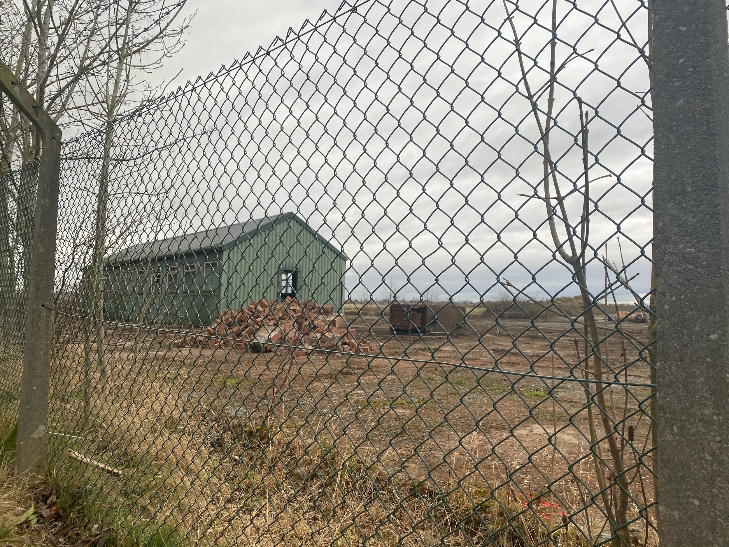
If you’re looking for one of the best short walks close to Stockport perfect for the whole fam, then a trip to Woodford is always a good shout!

“All truly great thoughts are conceived while walking. ”
UPHILL CHALLENGES:


WALKS WITH WATERFALLS:


