ALL TRAILS
WINNATS PASS
One of the best Peak District walks just a short drive from Manchester if impressive views and steep climbs are your thing!
Start: Castleton Visitor Centre, S33 8WN
Distance: 5.02 miles
Elevation: 900 feet
Duration: allow approx. 2 hours
Navigation: follow the route here
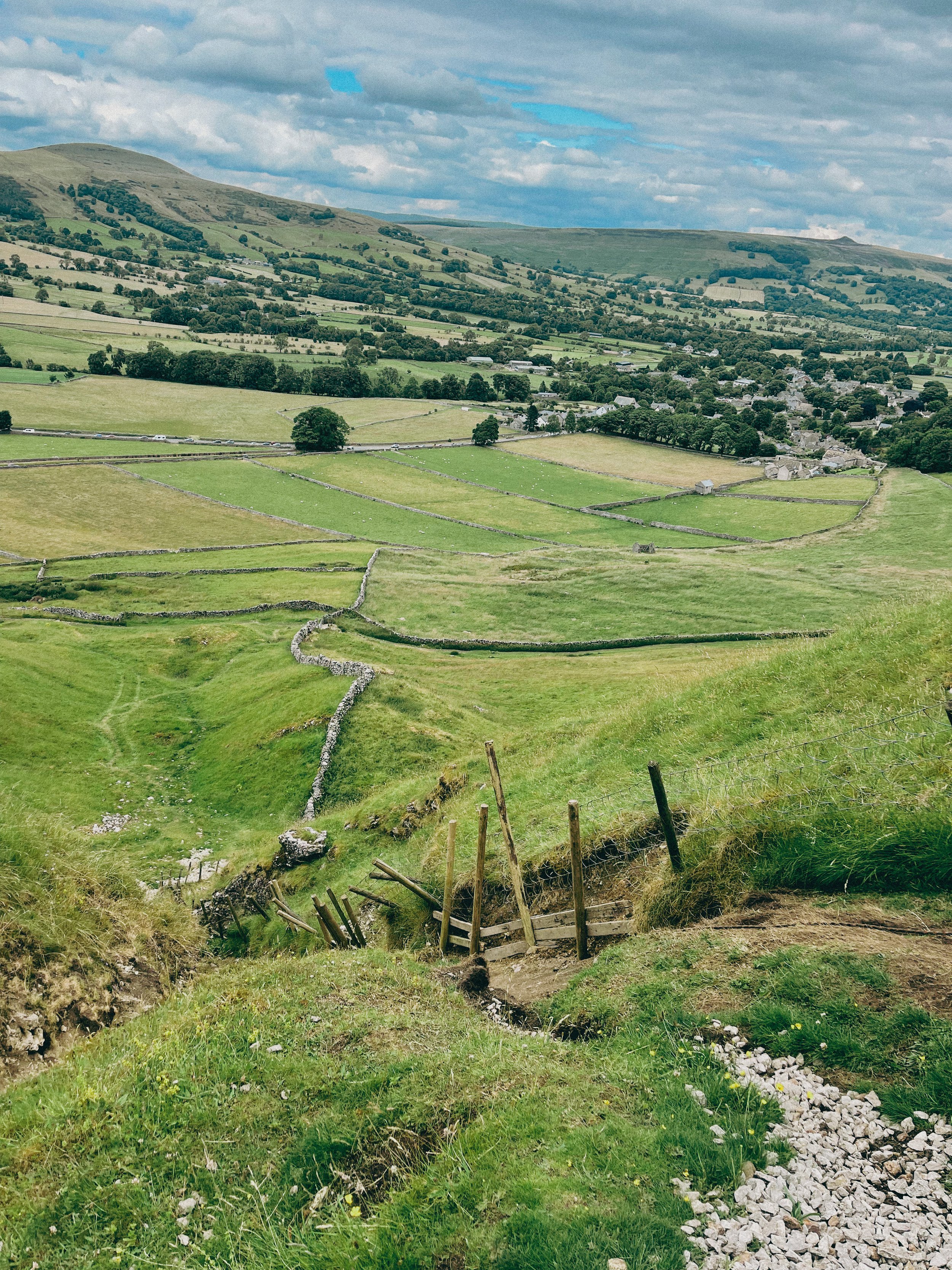
This walk takes you high above Winnats Pass and around Castleton, meaning you can take in this amazing Peak District village from all angles. The start of the route leans towards the challenging side, taking you up a steep and rocky path straight up to Winnats Pass, so consider if this one’s for you before heading out.
The first ascent is steep with scrambling required. Thankfully, a kind soul has left a climbers rope tied to a gate post which gives you all the leverage you need. We’ve been meaning to give this one a go for a while, and it didn’t disappoint.
The route starts near Castleton Visitor Centre where you’ll find a shop, cafe and toilets… among a gorgeous array of nearby pubs, eateries and cafes.
The car park is pay and display, but there’s street parking available nearby (be aware these fill up quickly during peak hours, so we recommend getting down early).
Once atop Winnats Pass, you’ll follow a trail that leads close to the boundary wall and takes you along the top of the pass. Be sure to stop and take in the views on this part of the walk, we were blown away watching the tiny cars winding their way through the Way.
From here, you’ll head along a footpath in the direction of Mam Tor, before taking a detour to Odin Mine: a disused mine thought to be in use since around 1260. The landscape surrounding makes for great exploring, leading you to the collapsed road constructed beneath Mam Tor.
Once you reach Treak Cliff Cavern, look out for signs that tell you about the history of the area. Winnats Pass and the surrounding environment was once under a tropical sea, making the site protected by law due to the many fossils of sea creatures which lived here over 350 million years ago.
The valley was created by melting glaciers which gradually dissolved, creating streams which flowed through and under cracks in the rock. One of these streams created a large underground cave system which eventually collapsed, leaving Winnats Pass you see today!
With so much to see in such a short walk, this is undoubtedly one of our favourites when visiting Derbyshire.
Fancy giving it a go? Follow the walk here
TATTON CIRCULAR
If you’re looking for a stroll steeped in history, Tatton Park is calling…
Start: Tatton Park Knutsford Entrance
Distance: 5.63 miles
Elevation: 150 feet
Duration: allow approx. 2 hours
Navigation: follow the route here
As much as we love heading for the hills, sometimes you can’t beat a leisurely stroll around one of the many country estates we’re lucky enough to be able to explore in and around Greater Manchester.
The parks surrounding these stunning stately homes are perfect for getting the steps in, with grasslands, ponds and woods aplenty. Tatton Park is no exception. With over 2,000 acres to explore, this historical estate is perfect for a weekend romp around its spacious gardens.
Many are drawn here for its stunning Japanese gardens, but for us? It was the majestic creatures above that were the real stars of the show.
Tatton has been a deer park since 1290 and is today home to herds of Red and Fallow deer which roam freely in the wide open spaces, making for a gorgeous day out!
And if you’ve got littl’uns or four legged pals in tow, good news: visitors are welcome to walk, cycle, picnic and play fetch in the park for free, with lots of great trails to explore along the way.
We decided to wander around the perimeter of the parkland, and in terms of amazing viewpoints and idyllic picnic spots, it certainly didn’t disappoint.
It’s not often we set off on a walk without knowing there’s at least one caffeine-shaped pit stop en route, and Tatton’s amenities certainly delivered. We also recommend having a browse around The Housekeepers Store if you too are fond of locally sourced, homemade goodness.
This route does involve ticketed entry to the gardens. Tickets are £8 per adult, £6 for children and free if you’re a National Trust member. You can omit this part of the walk but if you’ve never been before it’s definitely worth the visit.
Ready to discover Tatton on foot? Follow our route step-by-step here
ALAN NEWTON WAY
A trail so idyllic it’s hard to believe you’re a literal stone’s throw away from the M60…
Start: Pear Mill, SK6 2BP
Distance: 5.18 miles
Duration: 2 hours
Elevation: 200 feet
Navigation: follow the route here
Having lived in Greater Manchester most of our lives, it always amazes us when we stumble across new-found territory just a stone’s throw away from our old stomping grounds. The Alan Newton Way is one of them!
Named after Stockport’s Olympic medal-winning cyclist, The Way provides a safe off-road route from Marple to Stockport via the Goyt Valley and towards the town centre.
Expect quiet, old farm lanes, a forgotten hall and a wonderful little detour back through the Woodbank’s woodland. We stopped off at Chadkirk for a quick refuel and a wander around Marple Garden Centre.
Starting the route from this end means you’ll be able to have a pitstop at Pear Mill’s Vintage Emporium - a must-visit for anyone yet to have a nosey.
To extend the route, you can follow the Way to Etherow Country Park, or join up with the Middlewood Way at Chadkirk.
For us, the highlight came in discovering Goyt Hall Farm, one of Stockport’s many small halls… but due to its remote location, one of the prettiest. This Grade II listed half timbered mansion-house was built around the same time as the popular Bramall Hall. Today, it’s a working farm and stables surrounded by gorgeous bluebell-dotted woods and fields.
Fancy giving this trail a go? You can follow our route step-by-step here
STRETFORD MEADOWS
A scenic hideaway right on Manchester’s doorstep…
Start: Urmston Lane, M32 9BP
Distance: 4 miles
Duration: 1.5 hours
Elevation: 100 feet
Navigation: follow our route here
Scenic views and wildlife might not be the first things that spring to mind when you think of Stretford, but that’s what makes this scenic spot just off the M60 so special.
One of the best short walks in Manchester, this route has it all: country lanes, a coffee pit stop and many links to extend the walk, including the Trans Pennine Trail.
While much of Stretford’s agricultural history has been lost to urban progression, this place is very much still teeming with wildlife. In the 19th century, Stretford was a hub for agriculture—known locally as Porkhampton due to the of pig farms which provided produce for the nearby Manchester Market. Wild, eh?
Back then, Streford was also an extensive market gardening area, described as the "garden of Lancashire" by writers of the time. In 1845, over 508 tons of vegetables were being produced each week for the Manchester Market, with their specialty being rhubarb—known locally then as “Streford beef”.
So successful was Stretford’s vegetable output, it became known as “ the Eden of Lancashire” throughout the Victorian era. In 1845, over 508 tons of vegetables were reported to be produced by Stretford market gardens for Manchester residents.
Pre-industrialisation, Romans named the area we now know as Stretford ‘Streta’—meaning street on a ford. Until the 1800s, the area existed as a cottage community dependent on hand-weaving, providing employment for almost 800 workers.
Our route takes you along a path which follows the line of the old Roman road from ‘’Deva Victrix’’ (Chester) to ‘’Mancunium’’ (Manchester), crossing the Mersey into Stretford at Crossford Bridge, a crossing point of the ancient ford.
Upon reaching the meadows, you’ll explore woodland paths, ponds and secluded spots which provide an ideal habitat for wildlife and a perfect place to unwind.
After a short stroll around the meadows, you’ll join the Trans Pennine Trail where you can enjoy panoramic views of the River Mersey. Along the way, you’ll pass Riverside Cafe, a gorgeous pop-up cafe selling hot drinks, sweet treats and homemade food.
For those looking to make a proper day of it, you can extend the route by heading to Old Ees Brook in Urmston, or by meeting up with one of the route’s many traffic-free transport links, including the Trans Pennine Trail or the Bridgewater Canal.
Fancy giving it a go? Follow the route here
BAMFORD RIDGE
Derwent Edge hogs the limelight around Ladybower—this short loop offers the immense views… without as much legwork
Distance: 3.53 miles
Elevation: 650 feet
Duration: 1.5 hours
Start: Heatherdene Car Park, S33 0BY
Navigation: follow the route here
This is a real treat of a walk, offering some of the best views in the Peak District. With just a short climb at the start, you walk towards Bamford Edge and are rewarded with incredible views of Ladybower and Derwent Reservoirs.
Just opposite, you’ll also find another great vantage point in the form of Win Hill. The easygoing nature of this route makes it a popular location for sunrise and sunset.
Up top, you’ll be spoilt for walking-trail choice if you’re looking to extend the walk—with the option to include both Ladybower and Derwent Reservoirs if you’re feeling particularly energetic.
Bamford Edge itself is a beautiful photo spot with many amazing rock formations. Facilities are limited on this trail, but there are public toilets available at the start of the walk (Heatherdene Car Park) and a cafe at Derwent Reservoir for those extending the route.
Fancy giving this one a go? Follow the route here
PADLEY GORGE
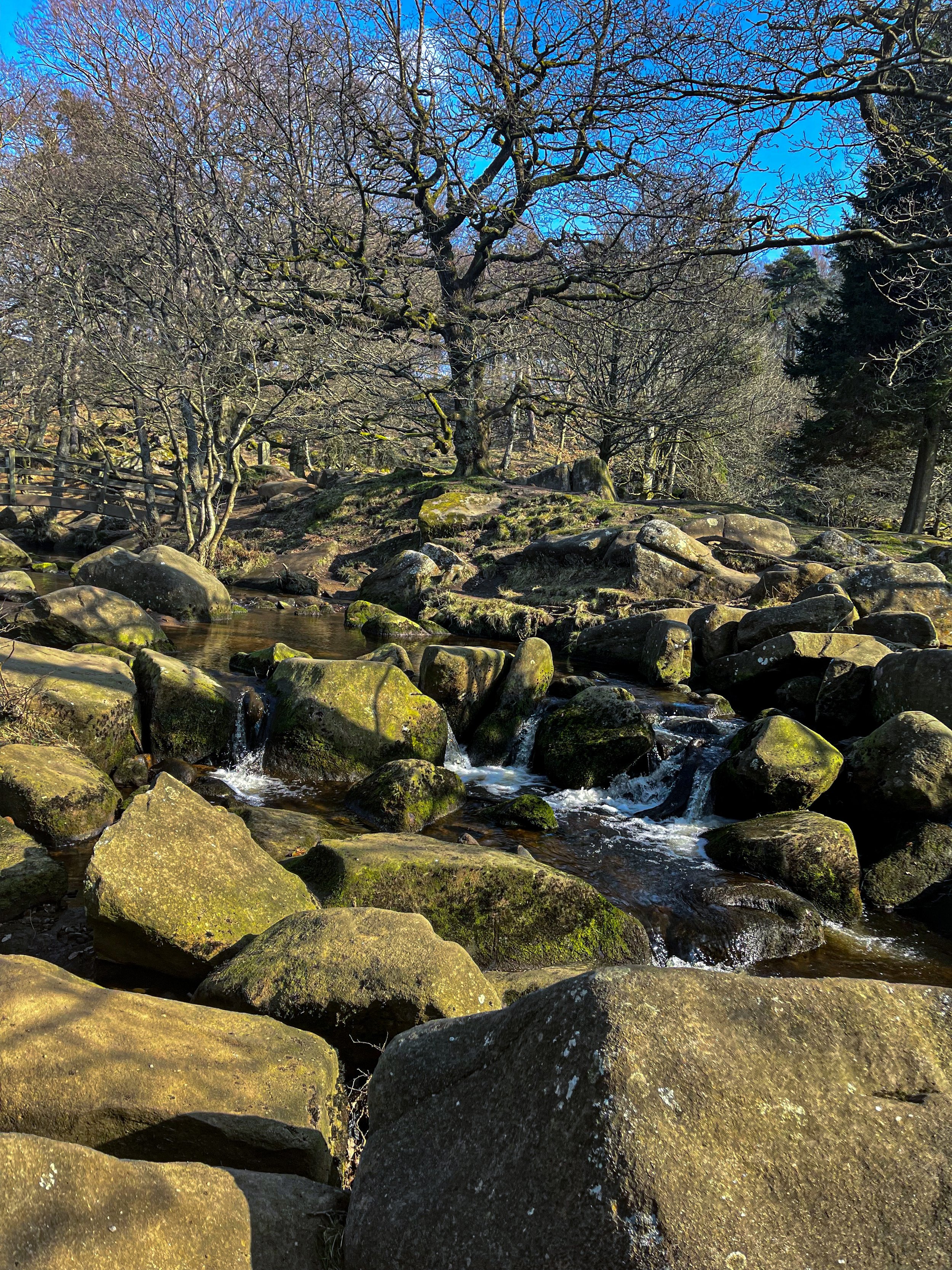
Gently flowing waterfalls… easy-going ascents… impeccable views and a pub pit-stop, Padley Gorge loop is one of the Peak District’s best circular walks
Start: Upper Burbage Bridge Car Park, Hope Valley, S32 1BR
Distance: 5.3 miles
Elevation: 650 feet
Duration: allow approx. 2 hours
Navigation: follow step-by-step
Route Overview:
This circular walk takes in less-populated trails from the busy Stanage Edge routes around Hathersage, with equally impressive views. Starting at Upper Burbage Bridge Car Park just outside of the town centre, this trail takes you to the magical Padley Gorge, before meandering back for a short scramble up Carl Wark — an awe-inspiring rocky tor.
Higger Tor, Hathersage Moor, Carl Wark and Burbage Edge are all included in this loop. Starting at the free car park at Burbage Bridge, you’ll be hard-pressed to see another soul for the first half of the walk, as you walk along side a stream and through the forest away from the more popular trails.
Be prepared for a slight scramble as you reach the tops of Higger Tor and Carl Wark. The approach from Burbage Bridge can also get a little boggy, so make sure to grab your waterproof boots before attempting this one.
Why not extend your walk with a visit to Little John’s grave? As you head towards Hathersage, you can expect magical panoramic views of faraway landmarks, moors and meadows.
Follow our route step-by-step here - happy exploring!
TEGG’S NOSE QUARRY
On the western border of the Peak District National Park lies a patchwork of wild woods, blossom-blanketed meadows, awe-inspiring reservoirs and high crags, making for one of the best circular walks in the Greater Manchester area
Start: Tegg’s Nose Country Park, SK11 0AP
Distance: 4.10 miles
Elevation: 525 feet
Duration: allow approx. 1.5 hours
Navigation: follow our route here
Just outside of Manchester, Tegg’s Nose Country Park represents a spectacular alternative to the Cheshire plain, with wild landscapes comprised of craggy hills, open moorland and dense forest.
Tap into your creative side and let your imagination run free as you meander along woodland paths. Mythological stories link the name Tegg’s Nose back to early Norse settlers — perfect for those wanting to feel like they’re half the world away… while being just down the road.
From the visitor centre, stone walls and sturdy barns add to the dramatic character of the steeply sided valleys as you set off on the trail towards the abandoned quarry. The car park provides an excellent base for numerous walks and throughout the year there are many events taking place at the visitor centre, check them out here.
The best part of this loop is the low-effort high-reward views you’ll be greeted with along the way. Despite the distance clocking up only 4 miles, you don’t have venture far to enjoy exhilarating views over the spectacular Cheshire Plain. On a clear day you may even see Liverpool’s cathedrals and Welsh hills beyond.
Situated on a number of old stone quarries, rock dominates the landscape here — with the industrial heritage of the site firmly on view as you trek across the many paths available.
While it may only be a short route, this trail offers incredible views over the beautiful Cheshire landscape that you just won’t find anywhere else. The route descends from Tegg’s Nose Country Park and skirts along the edge of Macclesfield Forest, offering you the best of both worlds.
For easy-to-follow navigation, head to our Komoot!
THE ROMAN LAKES, SK
A short but scenic stroll around Stockport’s industrial heritage and hidden wildlife
A short but scenic stroll around Stockport’s industrial history and hidden wildlife
Start: Roman Lakes, Marple, SK6 7HB
Distance: 5.2 miles
Duration: 2 hours
Facilities: Carpark, Toilets, Tea Room
Navigation: follow the route here
Tucked away down a quiet country lane in the picturesque Goyt valley, this circular walk takes you through a forgotten part of Stockport’s history.
In recent years, archeological work has been underway and transformed the spaces surrounding into a time gone-by, offering ample opportunity to explore with both easy and demanding routes on offer through the surrounding woodland and bridleways.
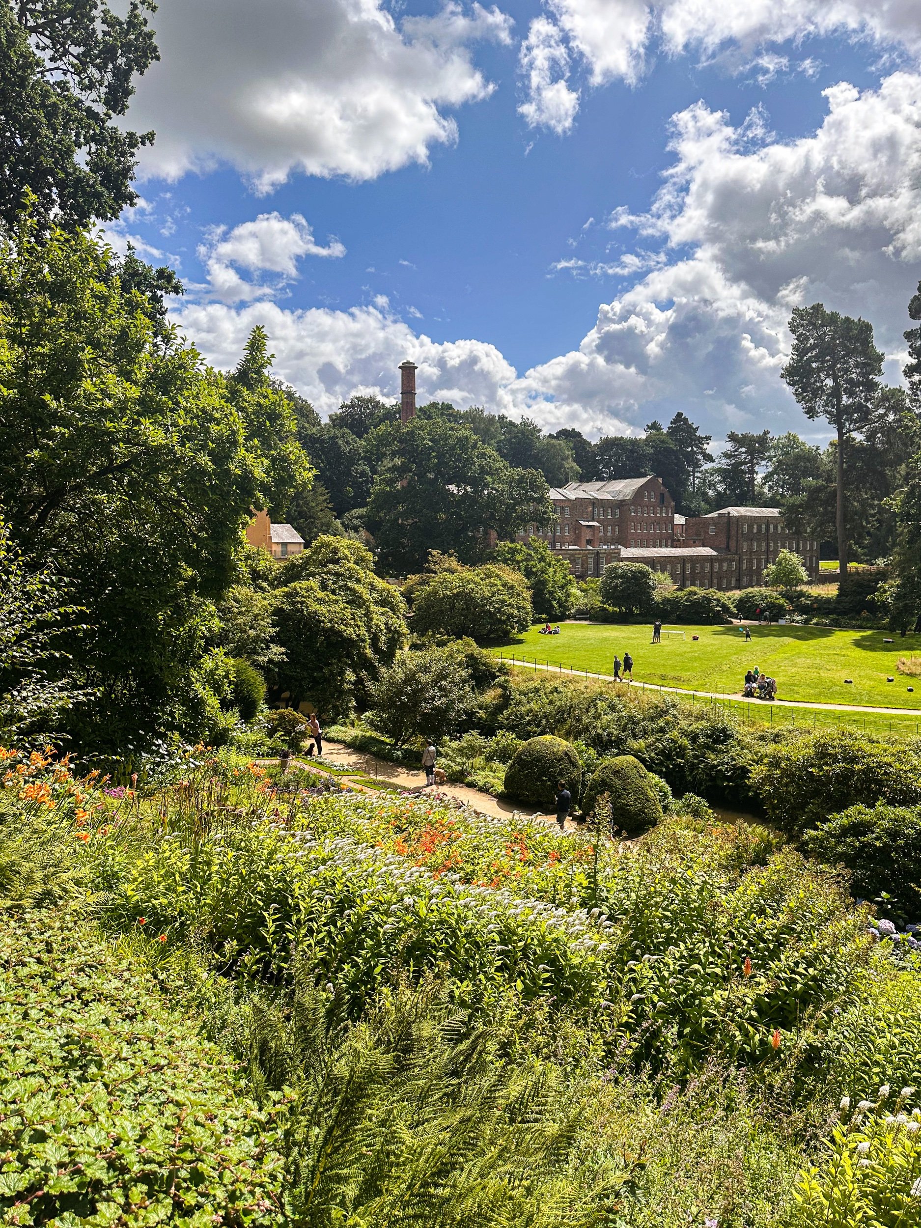
The Roman Lakes has a rich heritage stretching back to the 18th century. Excavated by the Mellor Archeological Trust, the newly unearthed sites allow you to walk around the remains of the mighty Mellor Mill — a place which, at its peak, employed more than 550 people.
Built by known industrialist Samuel Oldknow, it was the largest cotton mill in the world when it was completed in 1793, with an undeground tunnel network that connected millworkers to their nearby homes.
With gardens, lakes and woodland every way you turn, the manmade lakes you see today were originally millponds formed by diverting the River Goyt.
In 1892, the mill was destroyed by fire and the surrounding beauty spots were turned into a pleasure park with rowing boats, a dance hall and amusements that attracted thousands of people from the surrounding towns and villages — a far cry from the quiet spot we see today.
Today, the lakes are used for fishing and canoeing, while the surrounding valley provides a walker’s paradise — with the option to follow all types of distances and difficulties around the surrounding trails and bridleways.
Fancy learning a bit more about the area? Free history and nature trail leaflets are available from the tearoom — a perfect place to stop off an soak up Stockport’s history.
WOODFORD CIRCULAR
An atmospheric, short stroll around Woodford’s abandoned Aerodrome
As atmospheric walks go, this one’s certainly up there.
Start: Old Hall Lane
Distance: 2.5 mile circular
Ascension: 50 feet
Pitstops: Notcutts Garden Centre, The Unicorn
Navigation: follow the route here
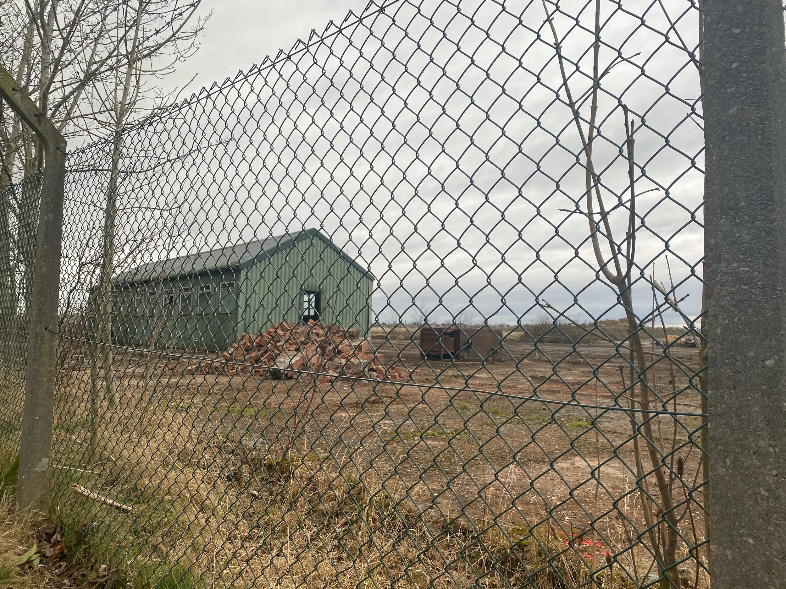
Call us novices, but until we took a venture around this abandoned Aerodrome in Woodford (near Stockport), we’d never followed a public footpath that meanders through a golf course before.
Aside from watching out for golfers’ swings, we were pleasantly surprised by the mix of urban and natural landscapes — blending into one to create a pretty spooky (but nontheless interesting) trail so close to home.
Woodford Aerodrome first opened just after the First World War and became an important production centre for military aircraft during the Second World War. Notable planes made here include the Arvo Vulcan and the Arvo Lancaster — and most of its remains are still standing, waiting for passersby to explore but for a tiny fence blocking the view.
If you’re looking for one of the best short walks close to Stockport perfect for the whole fam, then a trip to Woodford is always a good shout!
“All truly great thoughts are conceived while walking. ”
UPHILL CHALLENGES:
WALKS WITH WATERFALLS:


