ALL TRAILS
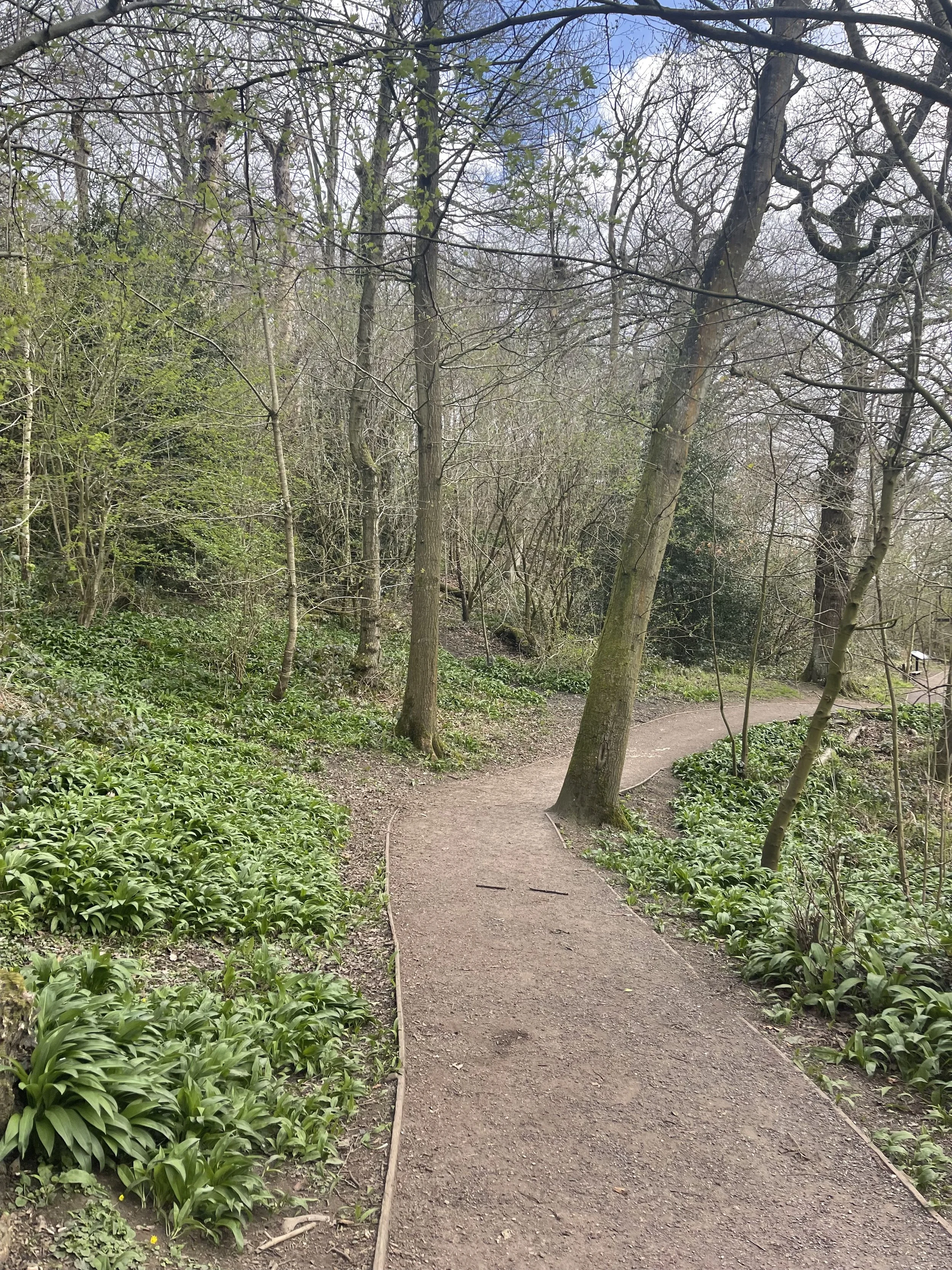
BRONTE WATERFALL WALK, HAWORTH
Take a trip back in time on this popular Howarth waterfall walk…

Start: Bronte Village, Haworth, BD22 8QN
Distance: 5 miles
Duration: approx. 2 hours
Elevation: 400 feet
Navigation: follow the route here
Lace up your walking shoes and let the echoes of Wuthering Heights guide the way as you explore the landscape that inspired some of the most iconic works in English literature.
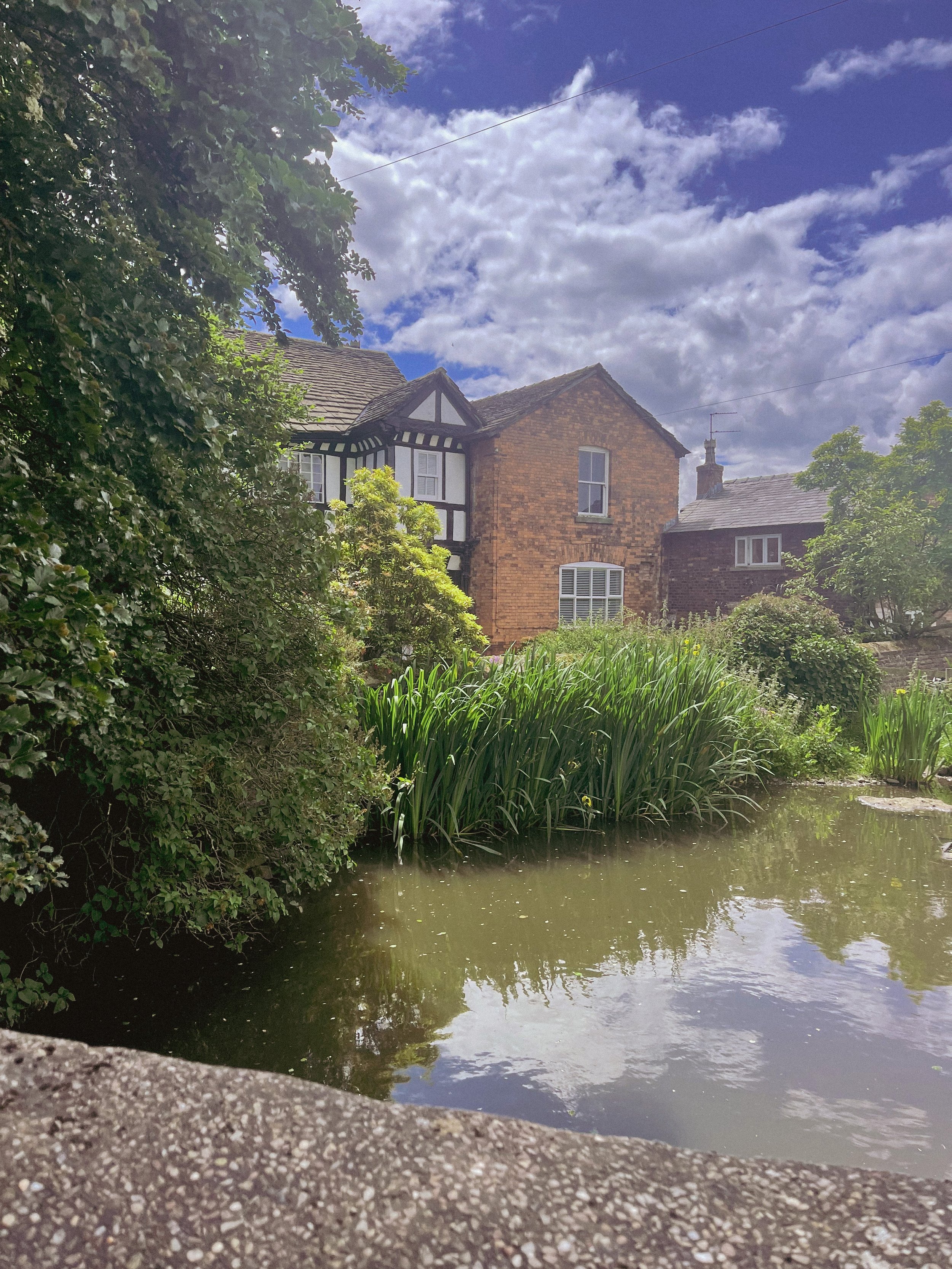
Haworth
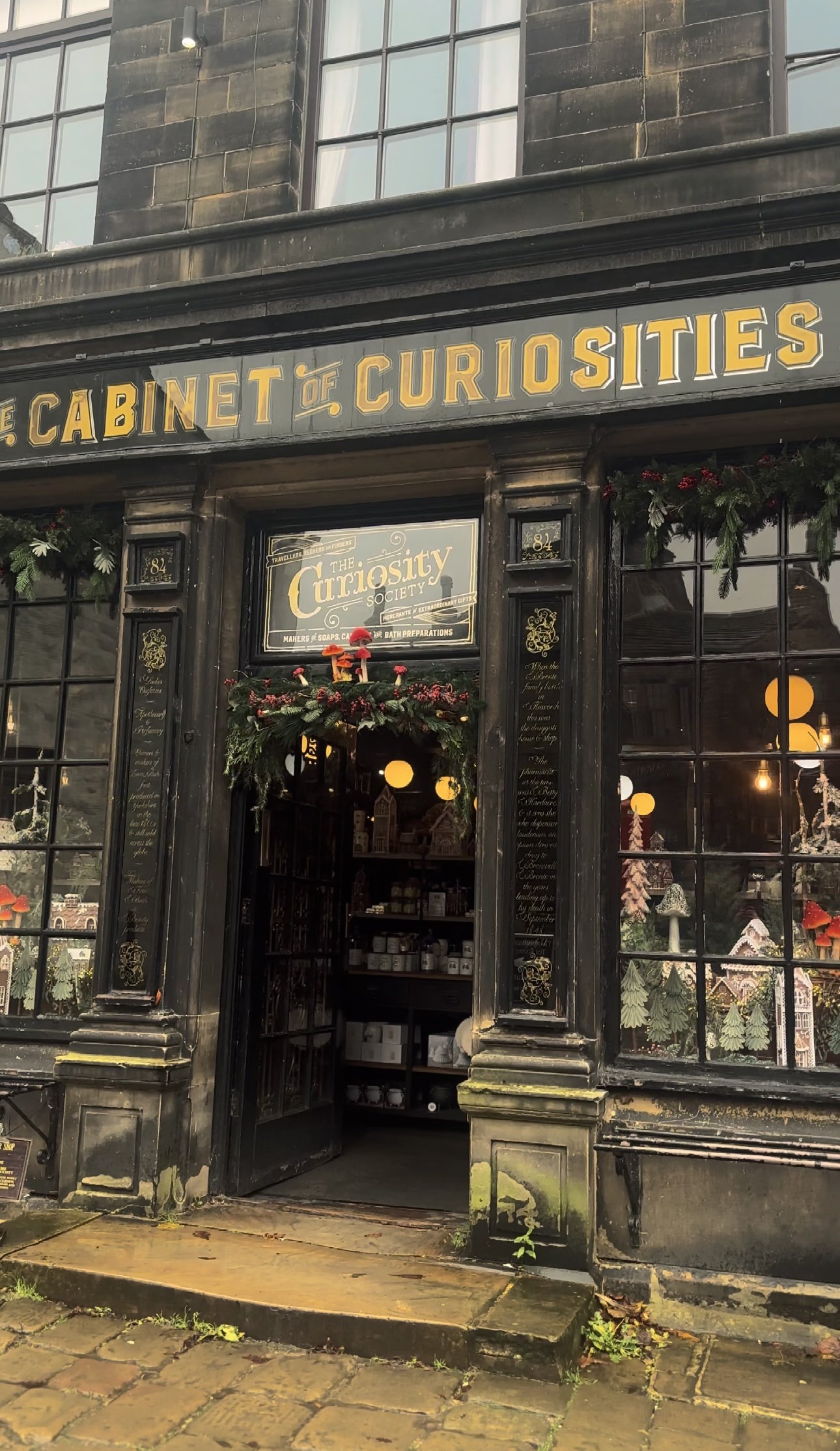
The village itself is home to many quaint tea rooms, souvenir shops and a few quirky pitstops you can’t afford to miss. Our favourite is The Cabinet of Curiosities, a traditional shop that’s been restored it to it's former glory as a Victorian druggists and apothecary shop.

Cabinet of Curiosities
The museum-like shop truly is like stepping foot in an old apothecary store, warmly lit by glass globes, fragranced with exotic oils, and packed from floor to ceiling with rich mahogany and glass display cases. Over the years the family-run business has taken on a true labour of love, salvaging many of the shops fittings from chemists, grocery shops and museums to replicate the ‘wonder-rooms’ of a time gone by.
You could easily spend a full day here, but we were dying to check out Bronte Waterfall and Top Withens, a ruined farmhouse which is thought to be the inspiration for Heathcliff’s home in Wuthering Heights.
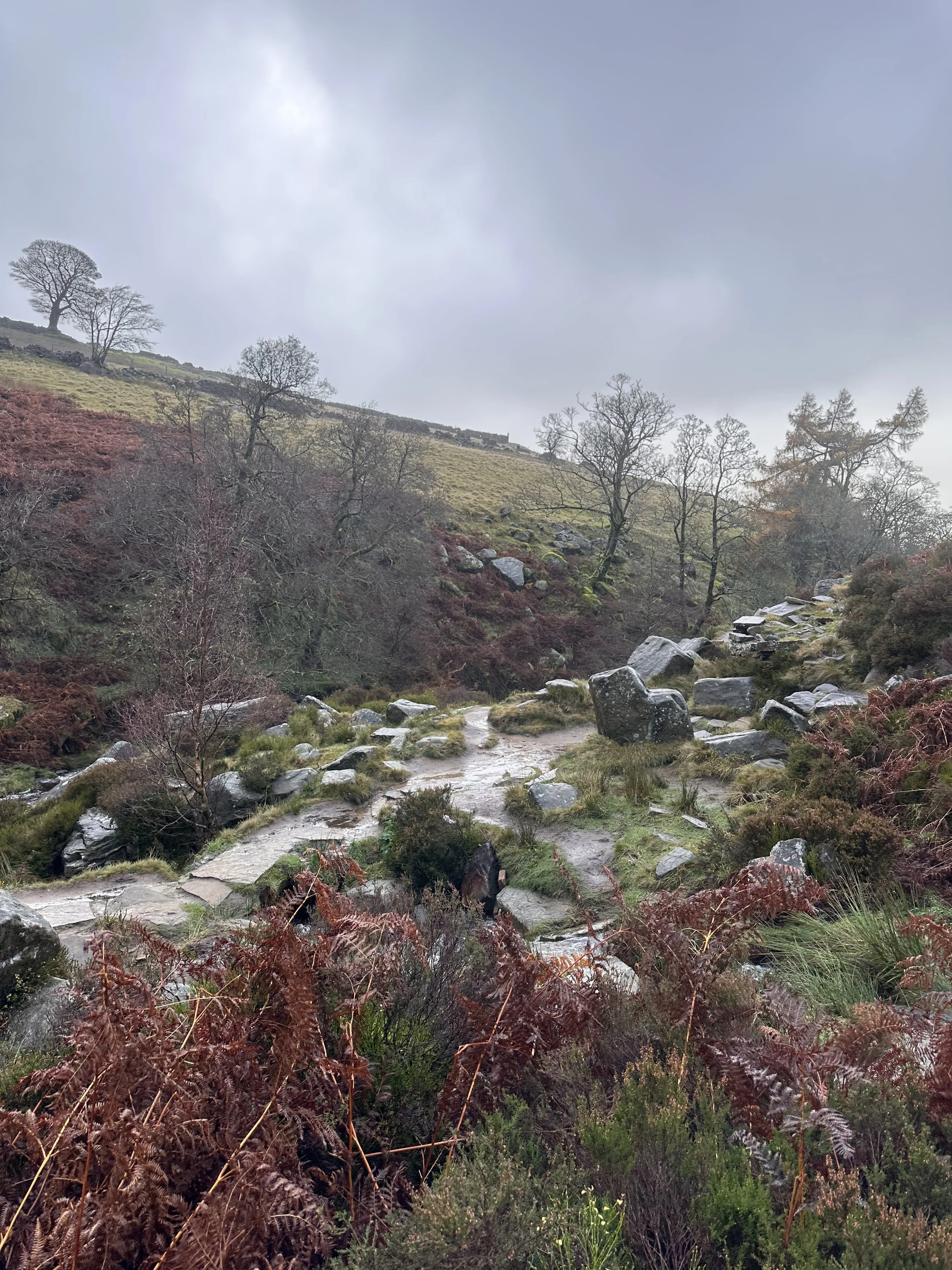
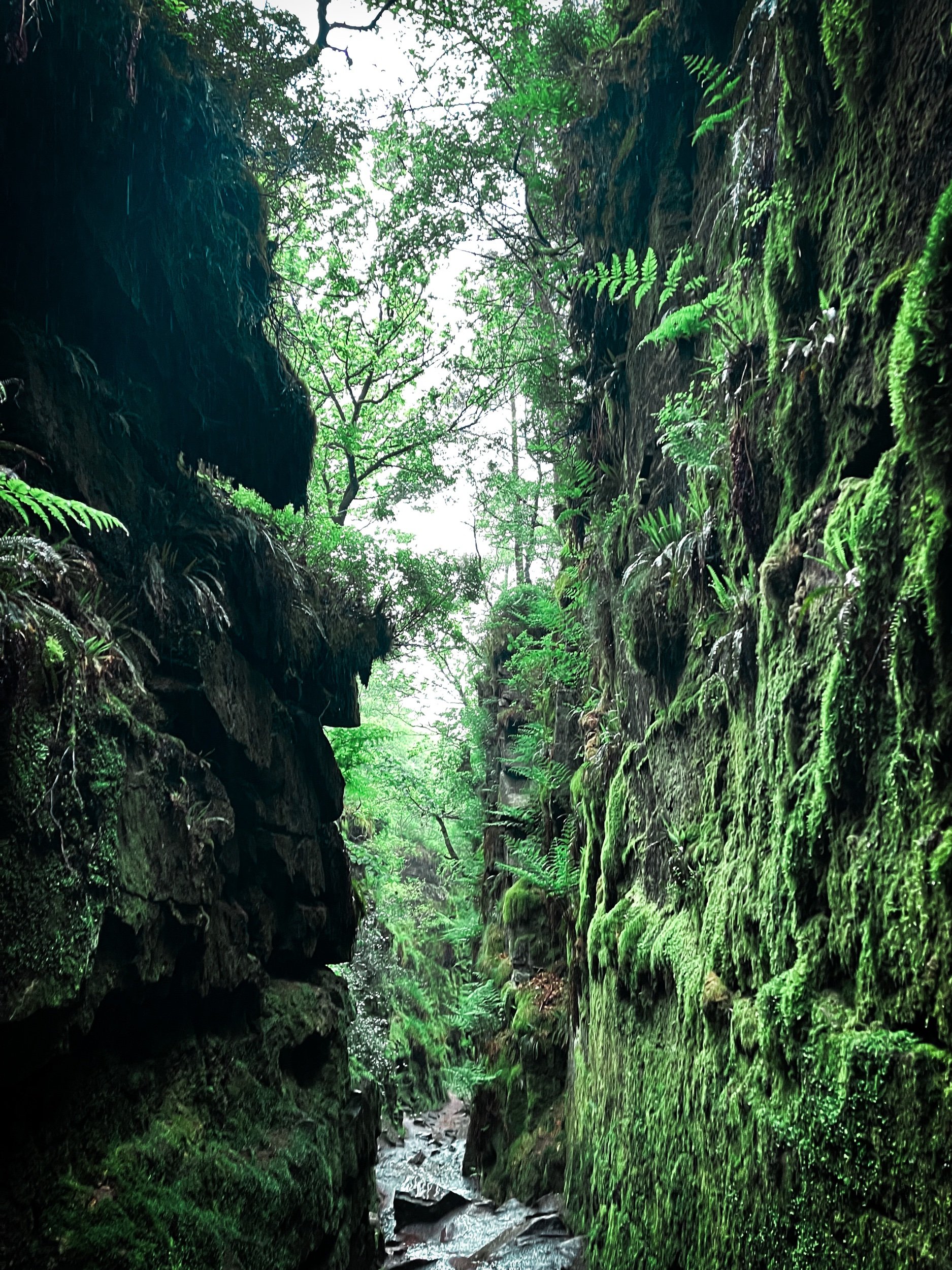
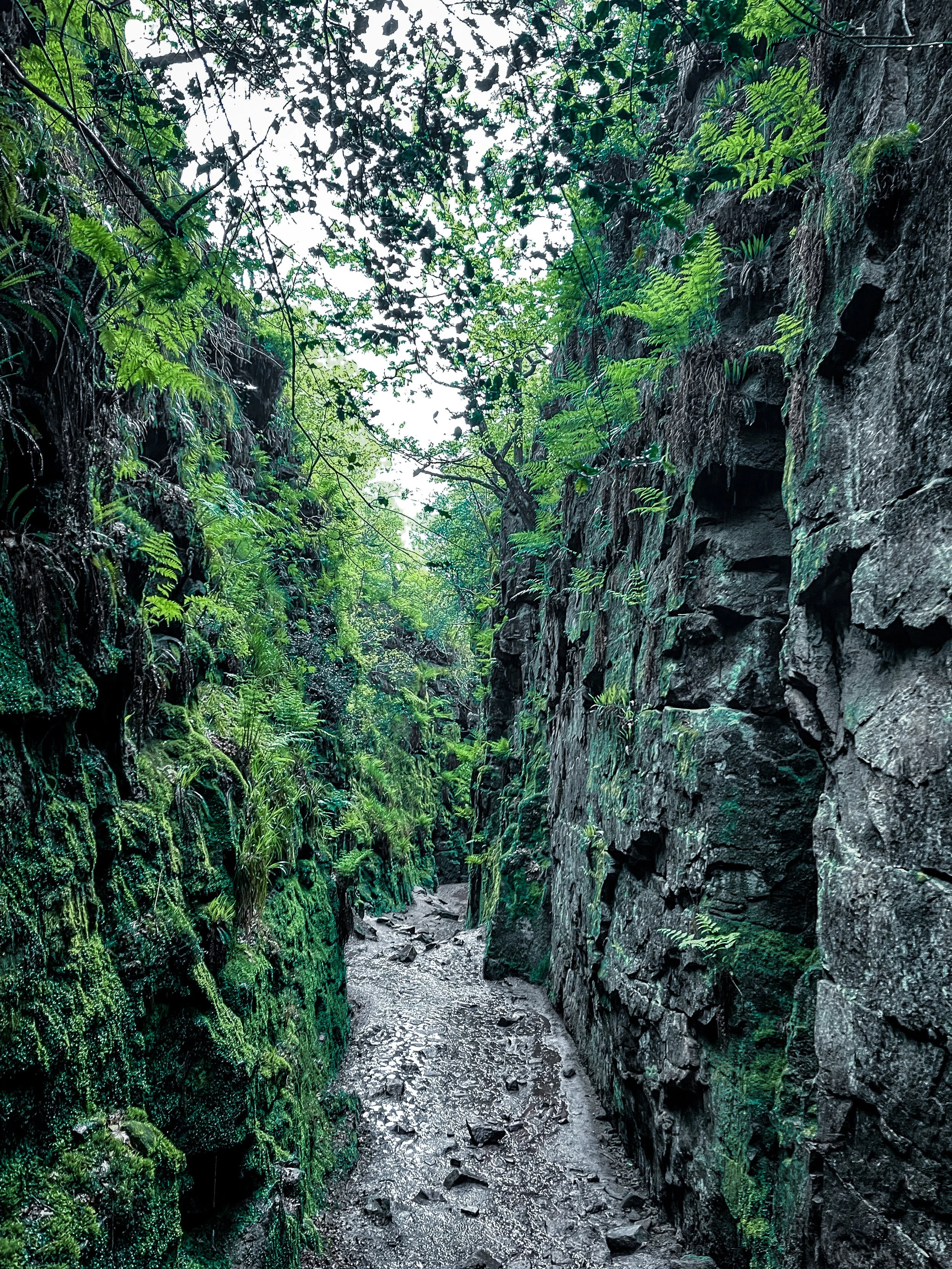
Bronte Waterfall and Top Withens
The Bronte Waterfall is a great place to rest on your way to Top Withens (Wuthering Heights), Alcomden Stones or Ponden Kirk (The Fairy Cave). Top Withens (also known as Top Withins) is a ruined farmhouse near which is said to have been the inspiration for the location of the Earnshaw family house in Wuthering Heights.
Originally known as ‘Top of th'Withens’, Top Withens is thought to have been built in the second half of the 16th century by George Bentley. At the time of the Brontës, it was inhabited by Jonas Sunderland and his wife Ann Crabtree (from 1811) and then their son, Jonas, with Mary Feather (from 1833). It was last inhabited by Ernest Roddy in 1926.
On 18 May 1893, Top Withens was struck by lightning during a thunderstorm. Holes were made in the wall, the roof was partially torn off, flags were cracked, and around 30 windows were almost completely removed. Today, it attracts literary fans from across the globe, each wanting to take a peek at Heathcliff’s house.

Nature, literature, and history truly converge in this short walk, inviting you to experience the setting that inspired some of the most enduring works in English literature. Let the words of the Brontës echo in the Yorkshire winds—here, among the moors and waterfalls, the stories truly come alive.

Fancy giving this one a go? Follow the route here

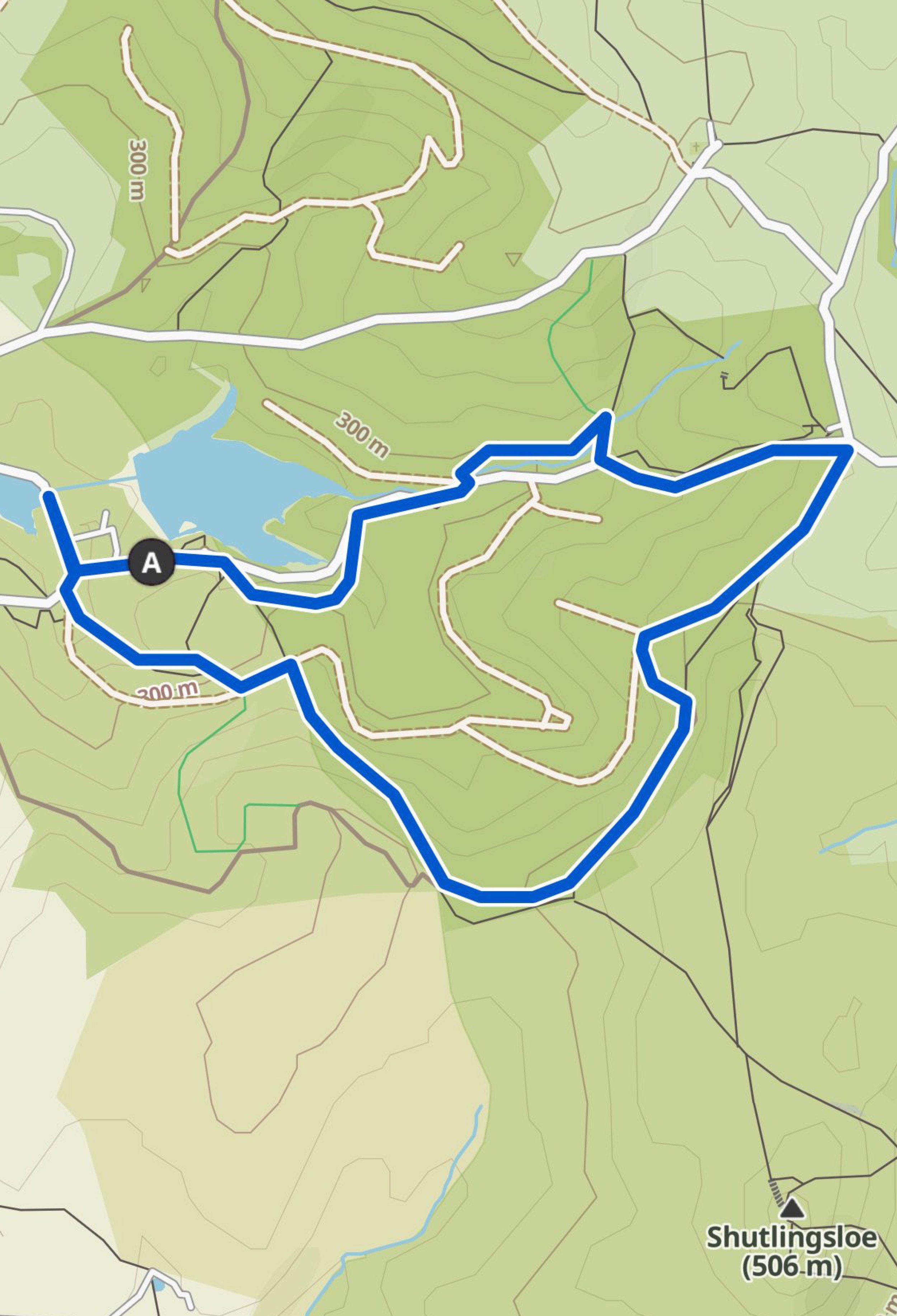
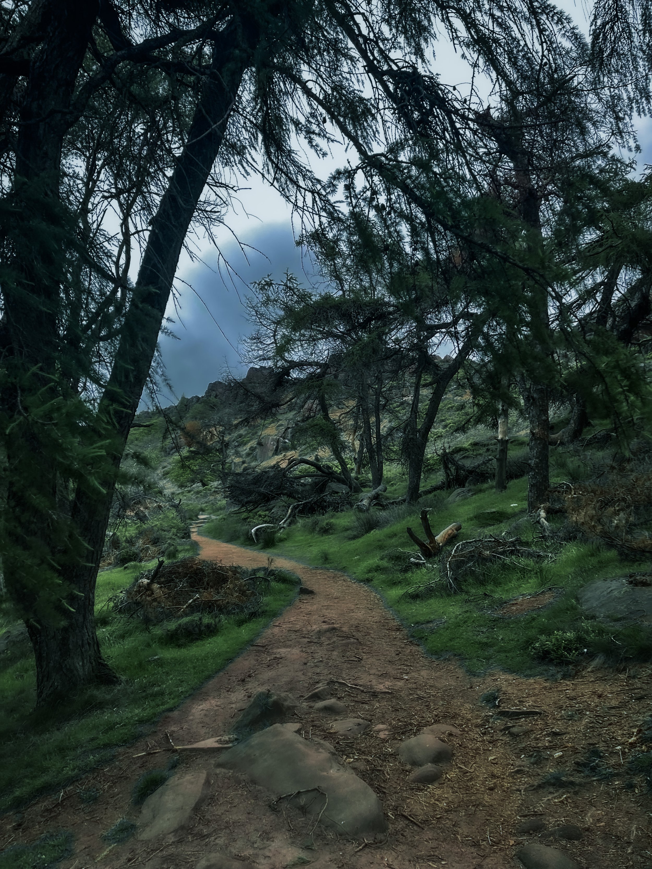
MACCLESFIELD FOREST WALK
An enchanting woodland walk perfect for the colder months…

Start: Trentabank Visitor Centre, Macclesfield, SK11 0NS
Distance: 3.66 miles
Elevation: 600 feet
Duration: 1.5 hours
Navigation: follow step-by-step here

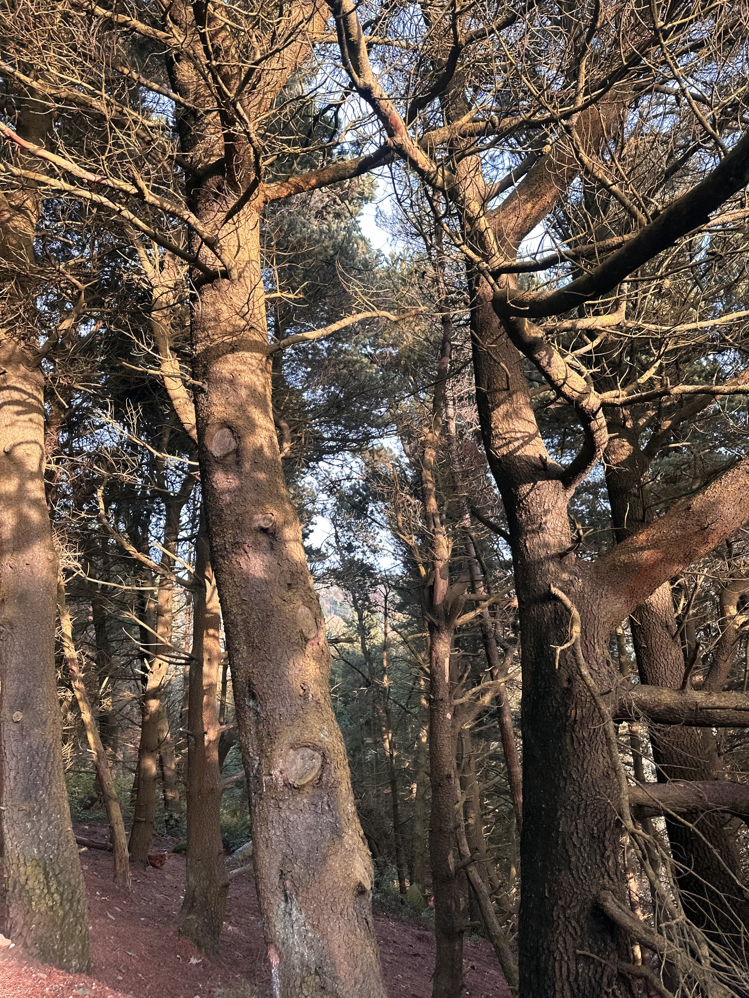
Macclesfield Forest
Now a working forest managed by United Utilities, Macclesfield Forest is the last remnant of the Royal Forest of Macclesfield. This forest isn’t just a bunch of trees; it’s a living history book. Keep an eye out for remnants of the old mining and quarrying days as you wander your way through this woodland wonderland.
The start of this walk takes you through Macclesfield Forest, which is home to the native broad-leaved tree, but mostly contains pine trees. Lately, work has been ongoing to fell sections of the forest to replant the broad-leaved tree, to retain its natural heritage.
Shuttingsloe
Nicknamed the ‘Matterhorn of Cheshire’ due to its uncannily similar shape of one of Switzerland’s most recognisable landmarks, this is a great starter trig if you have four-legged pals or little legs in tow. Thanks to its impressive 360-views, this is a short loop with big rewards — you can see as far as The Roaches, Shining Tor (the highest hill in Cheshire), Macclesfield, and even across to Wales on a clear day.

Good-to-knows
Parking: Pay and Pay and display parking at Trentabank Car Park. Charges are £4.75 all day at the car park and the machine ONLY takes coins. There is no card payment option and the authorities are very strict on issuing fines, so make sure you have coins with you. If you are visiting on a quiet day, there is FREE roadside parking just past the entrance to the car park. Please only park in designated parking spaces.
Walk Highlights: Incredible 360 degree views, Shutlingsloe Trig Point, Macclesfield Forest.
Facilities: There are toilets at Trentabank Car Park. Please note that these are locked at 6pm. On busy days, there is a refreshments van in the car park.
Public Transport: Manchester Piccadilly > Macclesfield, 20 mins. From here catch a bus or walk to the starting point.
Fancy giving this one a go? Follow along here
COMBS RESERVOIR AND ECCLES PIKE WALK
Short walk, big views — fancy a Sunday stroll that starts and ends in a country pub? Look no further…

Start: The Hanging Gate, Chapel, SK23 9UH
Distance: 3.81 miles
Duration: 1.5 hours
Elevation: 400 feet
Navigation: follow our route here

The Essentials
Combs Reservoir and Eccles Pike Overview
Starting and ending at cosy country pub, The Hanging Gate, this short loop is perfect for stretching the legs on a crisp autumn’s day. The walk takes you around the serene Combs Reservoir before climbing slightly to the summit of Eccles Pike for breahtaking panoramas of the surrounding countryside.

Trail Highlights
Comb Reservoir
Combs Reservoir was originally designed to feed a canal in the Peak District National Park. While there are lots of routes nearby to choose from, there are two main Combs Reservoir walks that you’ll want to give a go. Hint: this one is our favourite!
Eccles Pike
Eccles Pike is steeped in history, with remnants of an Iron Age hillfort, making this short loop not only visually stunning, but you can get your history fix while you’re at it. On a clear day, you can see as far as our beloved Manchester.
Chapel-en-le-Frith
This historic market town offers a delightful contrast to the natural beauty you'll encounter. It's worth exploring its charming streets and grabbing a coffee or a meal before or after your hike.
The Hanging Gate
Famed for their ability to seasonally decorate like nobody’s business, this High Peak pub is a real must-visit on any Peak District wish list.

Transportation Options from Manchester
By Train:
One of the most convenient ways to reach Chapel-en-le-Frith from Manchester is by train. The journey takes approximately 30 minutes from Manchester Piccadilly to Chapel-en-le-Frith train station. From the station, it's a short walk to The Hanging Gate pub, where your adventure begins.
By Car:
If you prefer to drive, it's about a 30-mile journey from central Manchester to Chapel-en-le-Frith. The journey takes roughly 45 minutes by car.

Fancy following along? Find step-by-step directions here

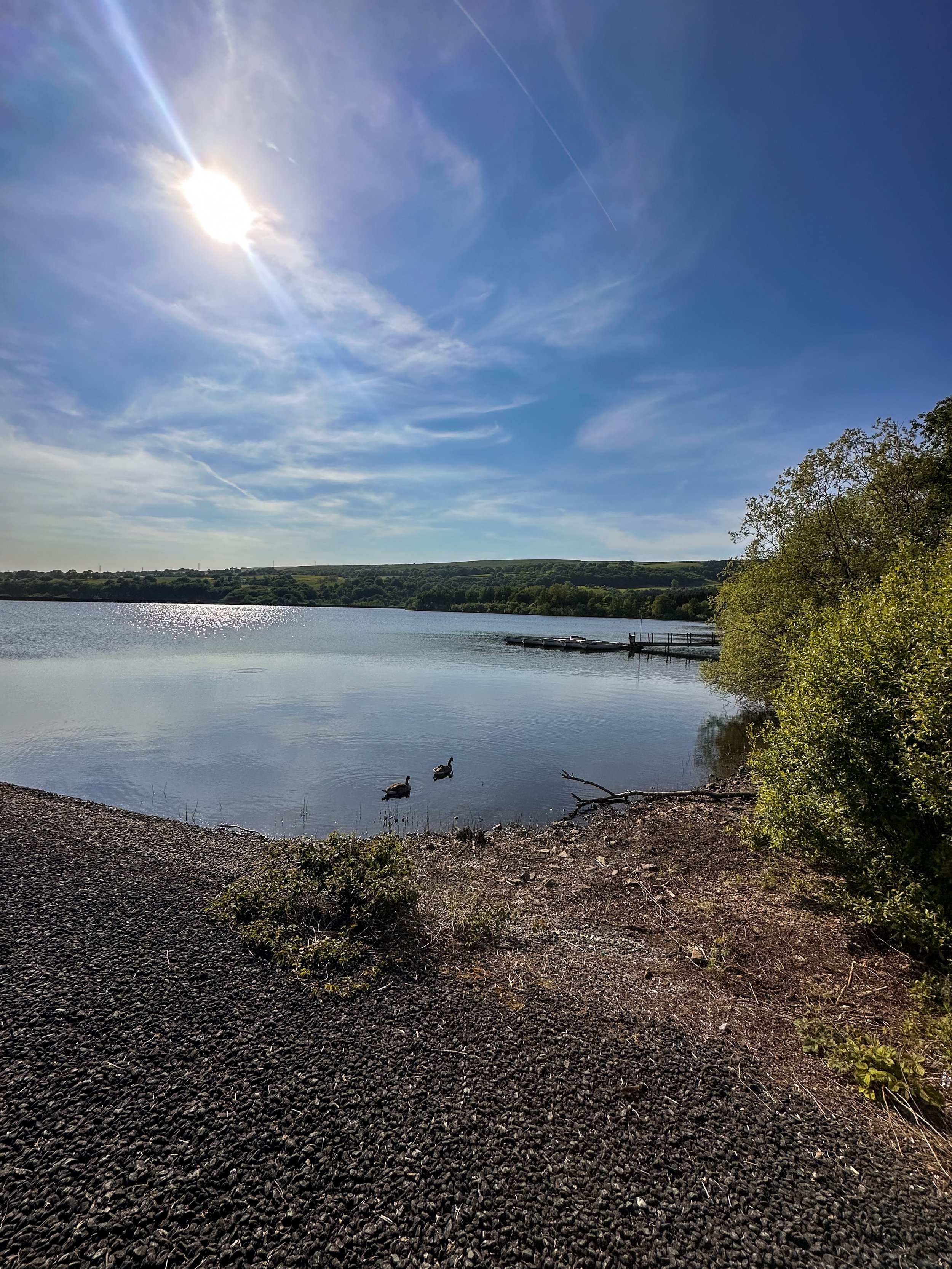
SCAMMONDEN WATER WALK
Short on time but want to get your Sunday steps in? Then take a trip to this idyllic reservoir just off the M62…

Start: Scammonden Water Car Park, HX6 4LD
Distance: 3.4 miles
Duration: 1 hour
Elevation: 250 feet
Navigation: follow the route here

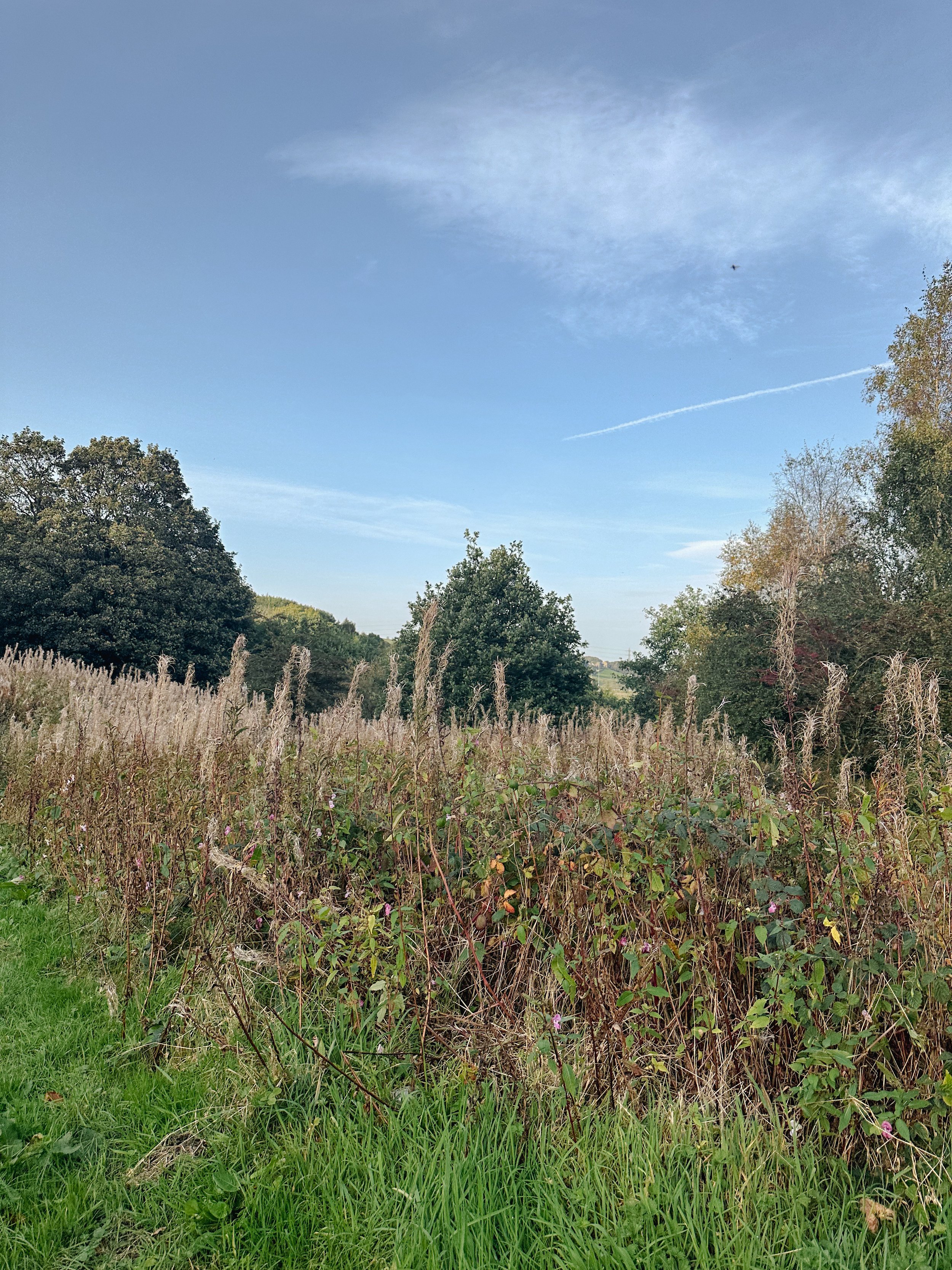
Tucked away in the foothills of West Yorkshire, Scammonden Water offers a peaceful escape from the hustle and bustle of city life. This stunning little spot is surrounded by some of Yorkshire’s finest landscapes, and with the route itself clocking up just 3 miles, it’s the perfect place for a leisurely walk.

Looking for a quieter but more adventurous walk? Head up to Deanhead Reservoir where the surrounds are spectacular and the views plentiful.
Good-to-knows:
Parking: Free parking at Scammonden Reservoir car park, HX6 4LD
Transport: For those needing to use public transport, you can take a train from Manchester to Huddersfield then transfer to a local bus service. There is a bus stop on Saddleworth Road/Church Lane which is 0.8 miles from the Western side of the reservoir. Check train and bus schedules for the most up-to-date information.
Extend the route: Why not walk along the Standedge Trail or head to nearby Marsden Moor? Both locations are perfect for a full day’s adventure.
Places to eat: Peaks, canals, valleys, reservoirs… and plenty of places to rest your legs — Marsden has it all. Stop off at the nearby village and explore a wealth of outdoor delights and a rich industrial heritage.
Fancy giving this one a go? Follow our route step-by-step here

THE TRINNACLE: DOVE STONE LOOP
Fancy spending the weekend climbing Saddleworth’s most-snapped landmark? Then a scramble up The Trinnacle is a must…

Start: Binn Green Car Park, Oldham, OL3 7NN
Distance: 4.13 miles
Elevation: 950 feet
Duration: less than 2 hours
Navigation: follow along here

Fed up of the same old flat walking routes around the same old area?
Well, it turns out you don’t have to travel too far out of town to be transported to another world entirely…
Our route round Yeomen Hey Reservoir and up to The Trinnacle will have you feeling like you’re in a Canadian National Park, much less the outskirts of Ashton.

Located high on the hills of Saddleworth Moor, there stands a peculiar rock formation which has well and truly gripped the attention of ramblers far and wide.
Best known as ‘The Trinnacle’, this fork-shaped pillar juts out from the moorlands above Dovestone Reservoir and has attracted the attention of many keen photo opportunists as of late.

Made up of dazzling reservoirs, epic waterfalls, jaw-dropping scenery and steep inclines - alongside a couple of exhilirating scrambles along the river edge - this route really has it all.

Good-to-knows
Parking: Binn Green Car Park (RSPB). Please note, the spaces are limited and fill up quickly. We advise visiting off-peak where possible.
Public Transport: Catch the train to Greenfield Station. This extends the walk by about 50 mins each way.
Amenities: You’ll find an ice cream van and coffee truck at the base of Dove Stone Reservoir, with public toilets in the car park adjacent.
The Trinnacle: While this landmark certainly makes for a great photo opp, please only attempt scrambling if you are confident to do so. Make sure to take great care and only climb if the weather allows for it. The drop at the rear side is certainly no joke.
Fun fact: as we were climbing this one, a passerby shouted “I can’t watch! Make her get down!”, so make sure you have a head for heights whether you’re spectating or tackling it yourself.
Kit: Boots are ESSENTIAL for this one. The route is comprised of steep, slippery, boggy and rocky terrain. White trainer victims: be warned. (We certainly saw a few en-route!).
Take layers. It was a glorious day when we visited but remember where you are… layers are always a good idea.
Refreshments: Due to the idyllic Greenfield location, you’ll have your pick of pubs on this one. We recommend stopping off at The Roaches Lock, just a short drive away from the starting point.
Extending the route: Follow our extended 6 mile version here.
Fancy giving this one ago? Follow along here

SNAKE WOODLANDS LOOP
As magical Peak District walks go, Snake Woodlands is at the top of the list…

Start: Hope Woodland Car Park, S33 0AB
Distance: 3.59 miles
Duration: 1-2 hours
Elevation: 400 feet
Navigation: follow the route here

Easily missable as you drive along Snake’s Pass (A57), this magical wonderland is hidden from view until you venture down into the woodland adjacent.
This stunning pine forest landscape will have you feeling like you’re in the depths of a Canadian national park, much less on the outskirts of Glossop…

Surrounded by rolling hills, pine trees and babbling streams, you won’t be short on fairytale-like scenery on this short circular walk. In fact, this route has a mix of everything: magical woodlands, eerie moorland and even some spooky ruins to boot.

This route in itself is an absolute gem — but if you’re looking to get a few extra miles in, popular Peak District landmarks Higher Shelf Stones and the B52 Crash Site can easily be incorporated. You can follow our Crash Site walk here,

Due limited parking spaces, we advise going off-peak when you can. The good news is, you’ll usually have the place to yourself due to its hard-to-reach location.
Ready to be transported to your very own fairytale? Follow the route here

WINTER HILL AND RIVINGTON PIKE CIRCULAR
Enjoy this short ascent up to two iconic Lancashire landmarks

Start: Rivington Hall Car Park, Bolton, BL6 7SD
Distance: 6.15 miles
Duration: 2-3 hours
Elevation: 1,300 feet
Navigation: follow our route here
This Lancashire walk takes you to two incredible viewpoints in one route. You begin your ascent up to Winter Hill via Rivington Country Park, taking you 1,496 feet high up to the summit.
While there are a variety of routes to choose from, our favourite is this 6 mile walk which takes in arguable the best views and scenery across Bolton, Wigan and the West Pennines Moors.
After a brisk hike from Rivington Pike you'll soon approach Winter Hill, which reaches an elevation of 1,496 feet. The views from here are nothing short of breathtaking, especially during the winter months when the landscape is adorned with a pristine layer of snow. The panoramic vista extends as far as the eye can see, with the city of Manchester on one side and the rolling hills of Lancashire on the other.

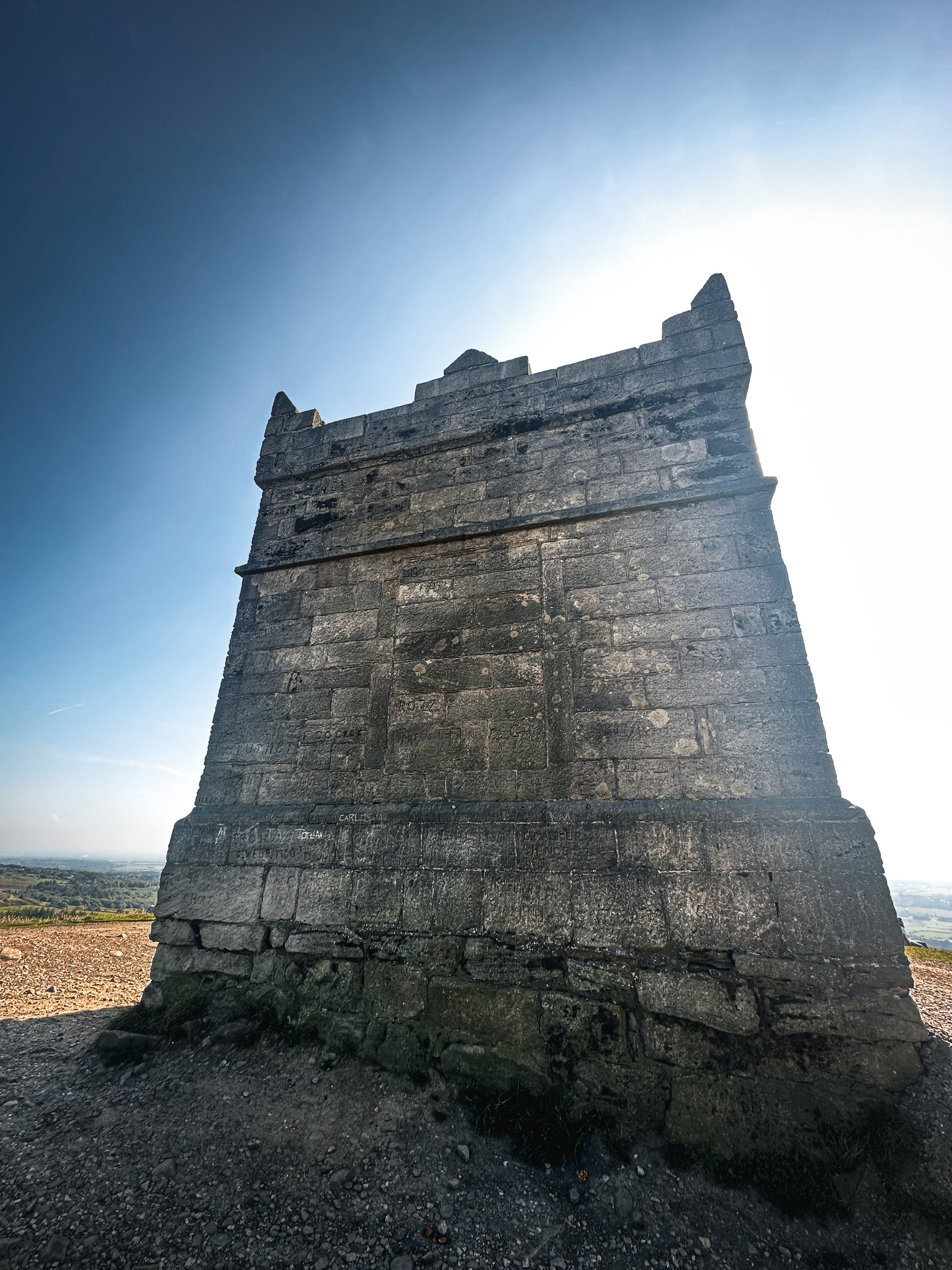
What is Winter Hill?
After reaching the almost dystopian summit of Winter Hill, you may be left thinking “what on earth is this place?”. I know we certainly were.
While the reality of Winter Hill is a little less glamorous than my imagination led me to believe, the transmitting station is a working broadcasting and telecommunications site and is responsible for bringing you all your favourite local TV channels.

Rivington
Just over the border between Greater Manchester and Lancashire, Rivington is a magical landscape where mysterious ruins are nestled between magnificent reservoirs, moor tops and woodland aplenty.
It’s a place that’s packed with wholesome things to do, whether that’s exploring Rivington Terraced Gardens or going on an aerial adventure at Go Ape. The area is so stunning it was even dubbed "the Little Lake District” by the Victorians.

good-to-knows
amenities
The pike snack shack
You’ll pass this quaint little coffee shop at the base of Rivington Pike, offering a selection of hot and cold beverages and snacks.
Location: Rivington Pike Cottage, Horwich, Bolton, BL6 6RU
The Tea Room at Rivington
For a delightful cup of tea and some light bites, visit "The Tea Room at Rivington," nestled in a picturesque spot near Rivington Hall Barn.
Location: Rivington Hall Barn, Rivington Lane, Rivington, Bolton, BL6 7SB
The Rivington PUB and grill
Before or after your hike, stop by "The Rivington," a charming pub near Rivington Pike known for its cosy atmosphere and hearty fare.
Location: Rivington Lane, Horwich, Bolton, BL6 7SB
GO APE
Located close to Bolton and only 30-minutes from Manchester, Go Ape Rivington features exhilarating 13-metre-high platforms, beautiful country views and a zip wire over the reservoir.
Location: Great House Barn, Rivington, Horwich, BL6 7SB
Parking Options
Rivington Pike Car Park
Location: Rivington Pike Car Park, Rivington Lane, Horwich, Bolton, BL6 7SB
Public Transport
If you prefer or require to travel via public transport, you can reach Rivington Pike and Winter Hill by bus or train:
Bus:
The 125 and 575 bus routes have stops near Rivington Pike.
Check the latest bus schedules and routes to plan your journey.
Train:
Take a train to Horwich Parkway station.
From there, you can catch a bus or even walk to Rivington Pike.

Fancy giving it a go? Follow our route here

SK WOODLAND TOUR
A trail so idyllic it’s hard to believe you’re a literal stone’s throw away from the M60…

Start: Woodbank Park, SK1 4JR
Distance: 4 miles
Duration: 1.5 hours
Elevation: 225 feet
Navigation: follow the route here

Having lived in Greater Manchester most of our lives, it always amazes us when we stumble across new-found territory just a stone’s throw away from our old stomping grounds. This route that links up to Midshires Way and Alan Newton Way is one of them!
Named after Stockport’s Olympic medal-winning cyclist, The Alan Newton Way provides a safe off-road route from Marple to Stockport via the Goyt Valley and towards the town centre.

Expect quiet, old farm lanes, a forgotten hall and a wonderful little detour back through the Woodbank’s woodland. We stopped off at Chadkirk for a quick refuel and a wander around Marple Garden Centre. Starting the route from this end means you’ll be able to have a pitstop at Pear Mill’s Vintage Emporium - a must-visit for anyone yet to have a nosey.

To extend the route, you can follow the Way to Etherow Country Park, or join up with the Middlewood Way at Chadkirk.
For us, the highlight came in discovering Goyt Hall Farm, one of Stockport’s many small halls… but due to its remote location, one of the prettiest. This Grade II listed half timbered mansion-house was built around the same time as the popular Bramall Hall. Today, it’s a working farm and stables surrounded by gorgeous bluebell-dotted woods and fields.

CHEE DALE STEPPING STONES WALK
An easy circular walk in the Peak District, taking you to a beautiful gorge and stepping stones…
Start: Miller’s Dale Car Park, SK17 8SN
Distance: 5 miles
Duration: Approx. 2 hours
Elevation: 525 feet
Navigation: follow our route here

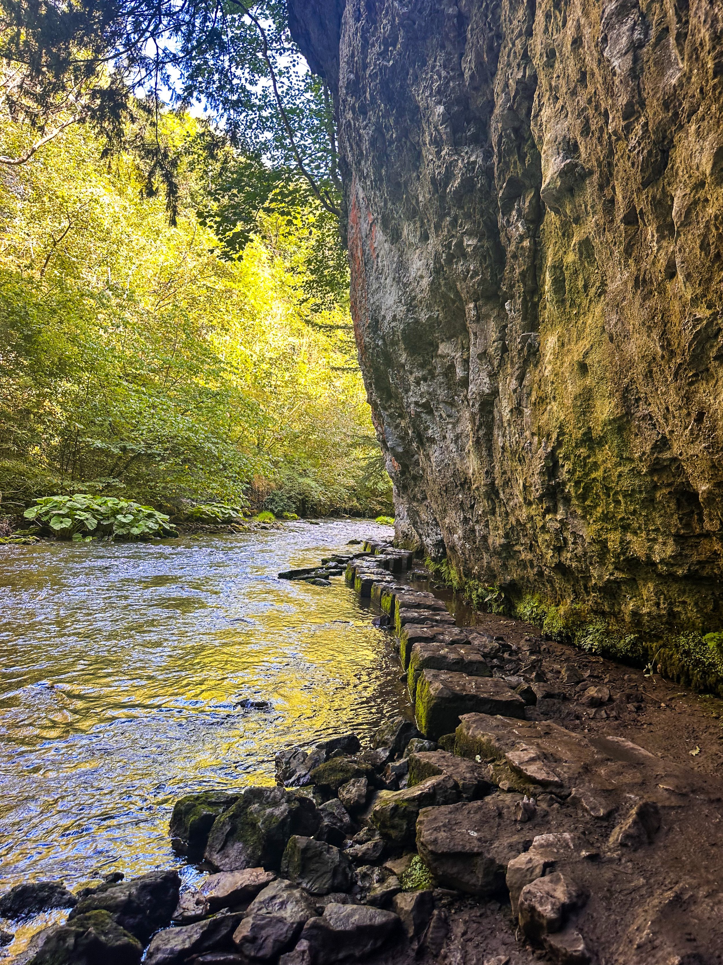
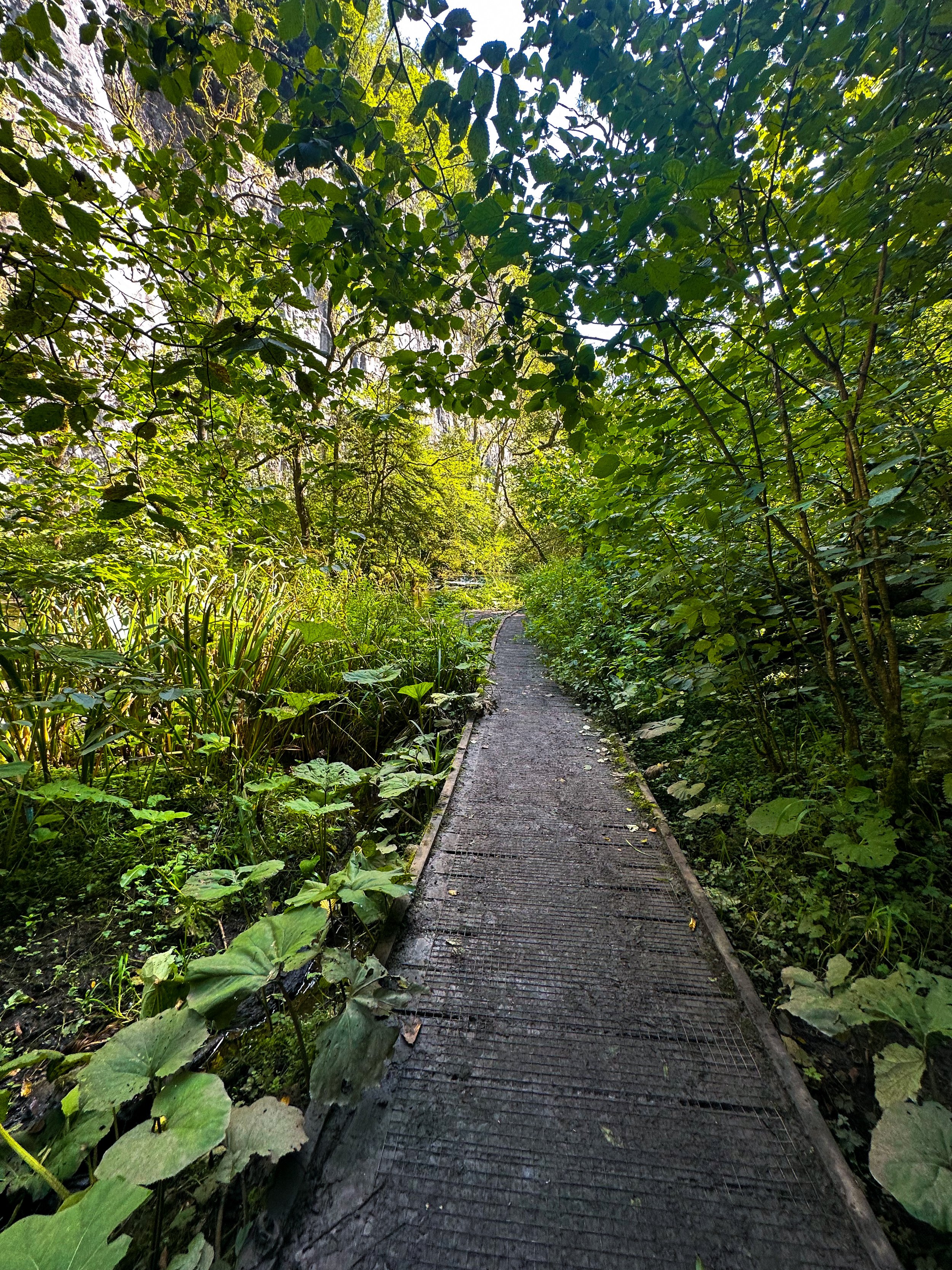
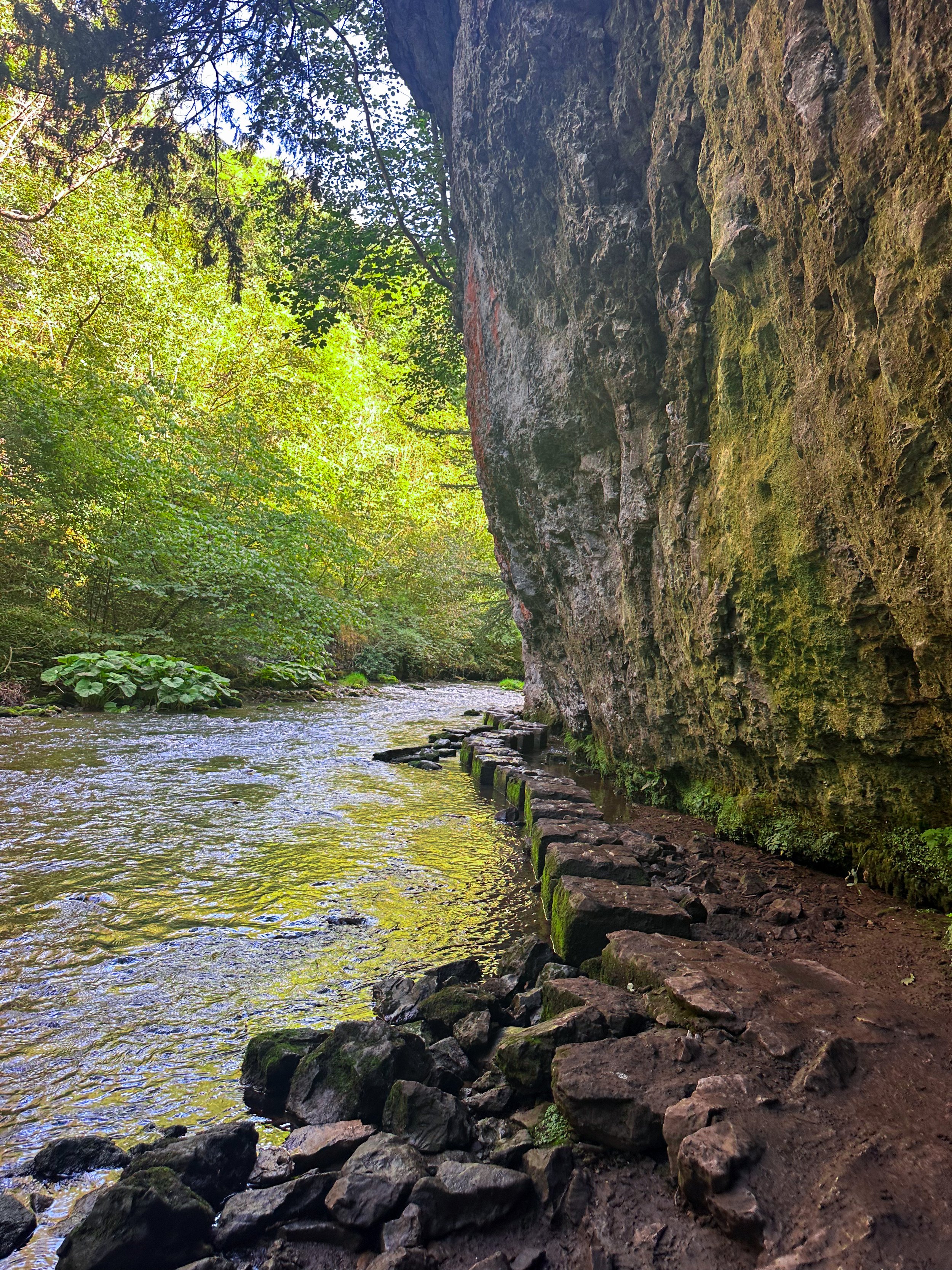
Tucked away beneath the Monsal Trail is the peaceful nature reserve of Chee Dale, where the River Wye meanders through a deep limestone gorge, providing two sets of stepping stones across the river. This route features as one of our Top 10 Walks in the Peak District, and with good reason!
Our Chee Dale Stepping Stones walk starts from Millers Dale Car Park and leads you down into a verdant gorge where you’ll cross two sets of atmospheric stepping stones along the limestone walls, before climbing back up to the Monsal Trail.
This is a slippy route on even the best of weather days, so walking boots definitely required for this one.

While the Dovedale usually takes the Peak District steppingstone limelight, lesser-known Chee Dale makes for a great off-road adventure if you want to beat the crowds.
The stepping stones and surrounding nature reserve – which lie beneath an overhanging cliff of limestone along the River Wye – are truly a must-visit Peak District attraction. So much so, this was our fourth (and certainly not last) visit…
About Chee Dale | Route Good-to-Knows
Made up of a 200ft deep limestone gorge, Chee Dale is filled with woodland, an abundance of wildlife, with the River Wye meandering through.
This walk is a 5mile circular route, first taking you through Chee Dale and along the famous stepping stones, before heading back up to the Monsal Trail and finally making your ascent through the nearby fields, with marvellous views down into the valley.
Miller’s Dale Carpark costs: £5 for the day
If the carpark is full, you can find alternative parking at a large layby just off the A6, on the west side of Chee Dale which offers free parking (Search ‘Chee Dale Layby’ on Google maps).
Public Transport: Make your way to Buxton (either via train or bus), then hop on the number 65 bus, which goes through Miller’s Dale between Tideswell, Linton and Buxton.
Facilities: You’ll find toilets and cafe at Miller’s Dale. Towards the end of the walk at Beech Croft Farm, you will also find Daisies coffee shop.

Fancy giving this one a go? Follow our route here
LUD’S CHURCH VIA THREE SHIRES HEADS WALK
Always fancied venturing to Lud’s Church? Why not tick off two Wonders of the Peak in one day with a visit to Three Shires Head and go for a dip while you’re at it?

Start: Gradbach Car Park, SK17 0SU
Distance: 6.65 miles
Duration: 2-3 hours
Elevation: 900 feet
Navigation: follow our route here

Three Shires Head is where the counties of Derbyshire, Cheshire and Staffordshire meet at a waterfall and collection of pools on the River Dane. It’s a stunning spot, and perfect if you love a wild dip! Even on a cloudy day, it’s a firm favourite Peak District wild swimming location — making the ideal base for a picnic and paddle.

Lud’s Church itself is one the Peak District’s must-see landmarks, and from the moment you step foot into its surrounds, we’re sure you’ll understand why. Pictures definitely don’t do this place justice, so a trip to Lud’s is a must!

The ravine that makes up Lud’s Church is thought to have formed during the post-glacial period —some 11,000 years ago— by a large slip of Roaches Grit: a coarse form of sandstone.
It wasn’t until the 15th century that this place became a popular place to dwell— among a secret community, at least. A group of religious dissenters called the Lollards flocked here to hold covert religious meetings to escape the prosecution of the Catholic Church. It’s thought the name of a man arrested at one of these meetings, Walter de Ludank, inspired the name of the site.

Today, the area provides a dramatic nature walk through the Black Forest, transporting passers-by into old England and its many forgotten tales. You certainly don’t have to stretch your imagination too much to picture this place as the origin of many myths and mysteries.
Over the centuries, its’s been associated with tales of Robin Hood and his Merry Men, who’re thought to have hid here as a place of refuge.

Our route starts in Gradbach, first taking you up a forgiving ascent up to Three Shires Head. Once here, make the most of the opportunity for a pitstop — whether you fancy a wild dip or a quick refuel. From here, we return along the River Dane back towards Gradbach, where you can stop off at The Cafe at Gradbach. The cafe sells everything from sweet treats and coffees, to even a prosecco and a pint! Can’t find a better pitstop around, if you ask us.
From the cafe, we begin a short climb up to, what some may deem, the main event: Lud’s Church. This mystical chasm is shrouded in history and myth at every turn — we’ve visited a handful of times and it never fails to take our breath away!

With such a variety of landscapes in a relatively short walk, this is definitely one of our favourite walks in the North West. It’s a cracking walk and takes in multiple picturesque parts of this beautiful area. And if you fancy making a proper day of it, why not take a trip to The Roaches following our extended route here?
Fancy following along? Find step-by-step navigation here

CHADKIRK LOOP
Just a short detour off the A6 in Stockport lies one of Greater Manchester’s best leisurely walks…

Start: Chadkirk Chapel, SK6 3LB
Distance: 6.29 miles
Duration: allow approx. 2 hours
Navigation: follow our GPS route
If you’re local to the area, you’ll know that this isn’t exactly a walk in the country - but it is it’s only little patch of countryside haven amidst Stockport’s urban landscape. The flat, accessible paths around Chadkirk Chapel make it great for those with four-legged pals and kids in tow, while the walk up to the canal makes for a great alternative if you’re looking to extend the walk and get some extra steps in.

Around the estate, you can relax in the peacefulness of the grounds surrounding the chapel and learn more about its history. If you’re following our route, you can bask in the picturesque woodland as you head up to the Peak Forest Canal before stopping to refuel at Dobbie’s on the home stretch.
Chadkirk was once an ancient settlement dating back to the 15th century, and a quick walk around the grounds will have you feeling like you’ve been transported to a different time.

As you venture up towards the Peak Forest Canal, you’ll find a blanket of wild garlic across the woodland floor. The leaves are edible and can be cooked for a mild garlic flavour. If you feel like giving foraging a go, why not check out our wild garlic pesto recipe?

To see the wild garlic in bloom, April or May is the best time to visit.
Happy exploring!

GOYT DAM
Panoramic views, magical woodlands and peaceful picnic spots are just some of the reasons you’ll want to head to Goyt Valley

Start: Whaley Bridge, SK23 7LX
Distance: 7.71 miles
Elevation: 1,075 feet
Duration: 2-3 hours
Navigation: follow the route here

This relaxed Peak District walk is beautiful in any season, but the way the woods are painted with gorgeous auburn hues come late September should make this route appear high on your list of autumn woodland walks.
Lying just a few miles northwest of Buxton, The Goyt Valley is magical place — one that’s gained popularity from visitors since Victorian times.
Once a prosperous and industrious community, the signs of a time gone by are all but extinct, bar from the ruins of Errwood Hall. Back in 1937, the construction of Fernilee Reservoir completely changed this beauty spot’s landscape, but the area remains a wonderfully peaceful place to visit to this day.

Expect stunning views every way you turn, thanks to a unique landscape which was carved out by successive Ice Ages and the River Goyt. It’s the perfect location for a day of recharging your batteries, with the natural scenery and rolling hills surrounding making for a wonderfully soothing trip outdoors.

With free parking at many of the valley’s landmarks, enjoying a day’s stroll around Goyt Valley is easy — especially if you follow one of the waymarked routes starting from Errwood Car Park.
For us, though, the beauty of this trail starts not in the valley, but in nearby Whaley Bridge. Along the way, expect dense pinewoods and azalea bushes, ruins of worker cottages and even a shrine close to the ruins of an abandoned hall.

And if folklore is more your thing, local legend has it that a highwayman called Pym used to lay in wait to ambush those who used the old packhorse route, hence the name Pym Chair given to one of the peaks in this mesmerising landscape.

Fancy giving this one a go? Follow the route here

PLAGUE VILLAGE LOOP
Eyam: the quaint Peak District village known to visitors and residents alike as the ‘Plague Village’. Take a trip though its fascinating and inspiring history…

Start: Eyam Hall, Hope Valley, S32 5QW
Distance: 5.35 miles
Duration: 2.5 hours
Elevation: 725 feet
Navigation: follow the route here

Most hikers are drawn to Eyam for its famous landmarks nearby, from Padley Gorge and Curbar Edge, to Sir William Hill and Eyam Moor.
But for us? To miss the atmospheric beauty of this village and its fascinating history would be a tale as sorry as Eyam’s past. Because a trip round this setting is to take a step back in time — where you can immerse yourself in the incredible story of Eyam’s unselfish villagers who sealed themselves off from the outside world to prevent the deadly disease from spreading.

Today, in a post-pandemic world, it’s even more poignant than it once was — a story we can all relate to, albeit under slightly less extreme and tragic circumstances.
First concentrated in London, the plague began to spread in 1665, with the authorities doing little to stop the spread. As the rich, including King Charles II, fled the capital to their country estates, the poor were left to face a merciless fate. Instead of providing relief measures and aid, the House of Lords decided that the policy of ‘shutting up’ infected individuals within their household would apply to all, except persons of note. Sound familiar?

The Plague was brought to this Peak District village via package in 1665, a package containing infected cloth from London. As you walk around the village, you can trace the package’s initial movements, from the Church of St Lawrence, to the Plague Cottages, the Riley Graves, and beyond.
Due to the unique actions taken by its villagers, Eyam’s people became known heroically, thanks to their actions taken to stop the spread of disease. As Eyam wasn’t able to support itself while in quarantine, you can see remains of their survival to this day.
Mompesson’s well, found today on the village boundary, was used to exchange money for food and medicine. To pay for these supplies, villagers left money in water troughs that were filled with vinegar — a substance thought back then to ward off and kill disease.

While these measures undoubtedly saved the lives of thousands in the surrounding area, Eyam became so known during the plague due to the high price they had to pay. Percentage wise, the village suffered a death toll greater than that of London.

Our route takes you past the church of St Lawrence, which dates back to Saxon times and still has its original font and Normal pillars. In the churchyard you’ll find an eighth-century Celtic Cross, decorated with a mixture of Christian and pagan symbols signifying life from a time gone-by.

Expect wells, water, plague and pilgrimage aplenty as you follow our gentle hike through Eyam and onto Stoney Middleton, wandering along old paths and tracks between two picturesque Peak District villages.

History lovers: this is one of the best hikes the Peak District has to offer. Fancy giving it a go? Follow the route here

QUARRY BANK LOOP, STYAL
An exceptionally easy Sunday stroll starting at an exceptionally good pub…

Start: The Ship Inn, Styal
Distance: 5 miles
Elevation: 275 feet
Duration: approx. 2 hours
Navigation: follow the route here

From enchanting woodlands to proper pub grub, Styal beckons you to explore its surrounds… and with most of the routes on offer under cover of a leafy greenscape, Quarry Bank makes for a great day out, rain or shine.

The Southern Woods provide a great opportunity to explore the wider estate at Quarry Bank and to watch the river twist and turn and make its way to the mill. There are also some hidden gems... take a look at the mill pond and weir.

As well as some fantastic routes along the river Bollin on sections of the Bollin Valley Way, Quarry Bank Mill is well worth a day out of its own. Whether you prefer to take an extended pit stop here or make it your main event, there’s plenty of routes on offer. Ours takes you through Styal Woods, up to The Giant’s Castle Bridge, Norcliffe Chapel and on into Chapel Wood, before dropping down to the River Bollin at the rear of the Quarry Bank Mill Gardens.

From here, we head west following the river coming out next to Manchester Airport runway at the edge of Wilmslow and head across the fields to Pownall Park, back through Quarry Bank Mill and on to The Ship Inn — ready for some much needed pub grub and a well-deserved pint.

Looking for a longer route? This 6.5 mile walk is another great alternative for exploring Styal’s serene surroundings. Check out the route details above, and take your pick.

Fancy following along? Check out the step-by-step route here

LYME WOODLAND TO POYNTON COPPICE
Rich in wildlife, Chorlton Coppice is classed as an ancient woodland — leading visitors from the Middlewood Way into the heart of the coppice

Start: Lyme Park, SK12 2NR (Alternatively, you can complete the walk in reverse by parking for free at The Coppice)
Distance: 4.5 miles
Elevation: 575 feet
Duration: allow approx. 2 hours
Navigation: follow the walk step-by-step here

It’s not news that we love walks that link up with The Middlewood Way. With 11 miles of traffic-free paths, we love hopping on here whenever we visit Stockport-way for a little mooch.
We’ve passed Poynton Coppice a few times along the way — and after realising we could walk there from our other favourite landmark in this neck of the woods, Lyme Park, we knew we had to give it a go.

Our favourite part about this part of Greater Manchester are the many off-road transport links that link up with each other. On this particular journey to the Coppice, we walked along The Middlewood Way and The Macclesfield Canal — both offering great links across Stockport.

Poynton Coppice is pretty at any time of year, with swooping trees canopying your every move. Many areas of woodland across the UK are called ‘Coppice’, ‘Copse’ or ‘Copy’ from the French word ‘couper’, meaning 'to cut’.
Traditionally, coppicing provided a continual supply of wood — a traditional method of woodland management which involves cutting young tree stems to near ground level for optimal regrowth.

Fancy a mooch in the woods this weekend? Follow the walk here

STRETFORD MEADOWS
A scenic hideaway right on our doorstep…

Start: Hawthorn Lane, Chorlton
Distance: 7.03 miles
Duration: 2.5 hours
Elevation: 125 feet
Navigation: follow our route here

Looking for one of the best walks in South Manchester? Look no further…
Scenic views and wildlife might not be the first things that spring to mind when you think of Stretford, but that’s what makes this scenic spot just off the M60 so special.

One of the best short walks in Manchester, this route has it all: country lanes, a coffee pit stop and many links to extend the walk, including the Trans Pennine Trail.

While much of Stretford’s agricultural history has been lost to urban progression, this place is very much still teeming with wildlife. In the 19th century, Stretford was a hub for agriculture—known locally as Porkhampton due to the of pig farms which provided produce for the nearby Manchester Market. Wild, eh?

Back then, Streford was also an extensive market gardening area, described as the "garden of Lancashire" by writers of the time. In 1845, over 508 tons of vegetables were being produced each week for the Manchester Market, with their specialty being rhubarb—known locally then as “Streford beef”.
So successful was Stretford’s vegetable output, it became known as “ the Eden of Lancashire” throughout the Victorian era. In 1845, over 508 tons of vegetables were reported to be produced by Stretford market gardens for Manchester residents.

Pre-industrialisation, Romans named the area we now know as Stretford ‘Streta’—meaning street on a ford. Until the 1800s, the area existed as a cottage community dependent on hand-weaving, providing employment for almost 800 workers.

Our route takes you along a path which follows the line of the old Roman road from ‘’Deva Victrix’’ (Chester) to ‘’Mancunium’’ (Manchester), crossing the Mersey into Stretford at Crossford Bridge, a crossing point of the ancient ford.
Upon reaching the meadows, you’ll explore woodland paths, ponds and secluded spots which provide an ideal habitat for wildlife and a perfect place to unwind.

After a short stroll around the meadows, you’ll join the Trans Pennine Trail where you can enjoy panoramic views of the River Mersey. Along the way, you’ll pass Riverside Cafe, a gorgeous pop-up cafe selling hot drinks, sweet treats and homemade food.
For those looking to make a proper day of it, you can extend the route by heading to Old Ees Brook in Urmston, or by meeting up with one of the route’s many traffic-free transport links, including the Trans Pennine Trail or the Bridgewater Canal.

Fancy giving it a go? Follow the route here

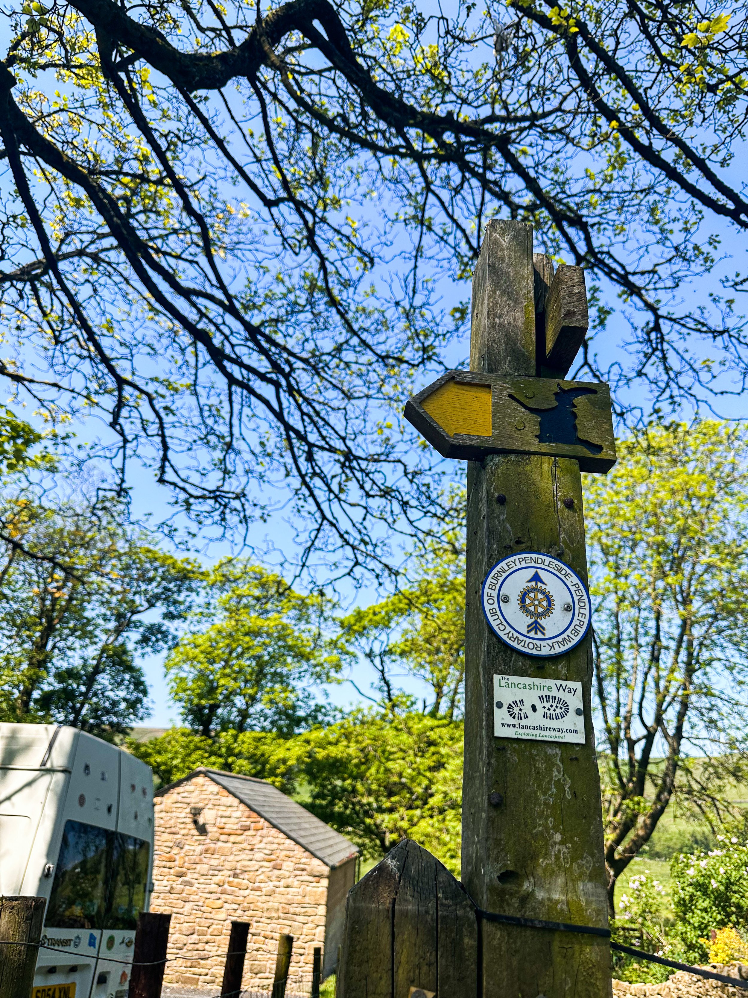
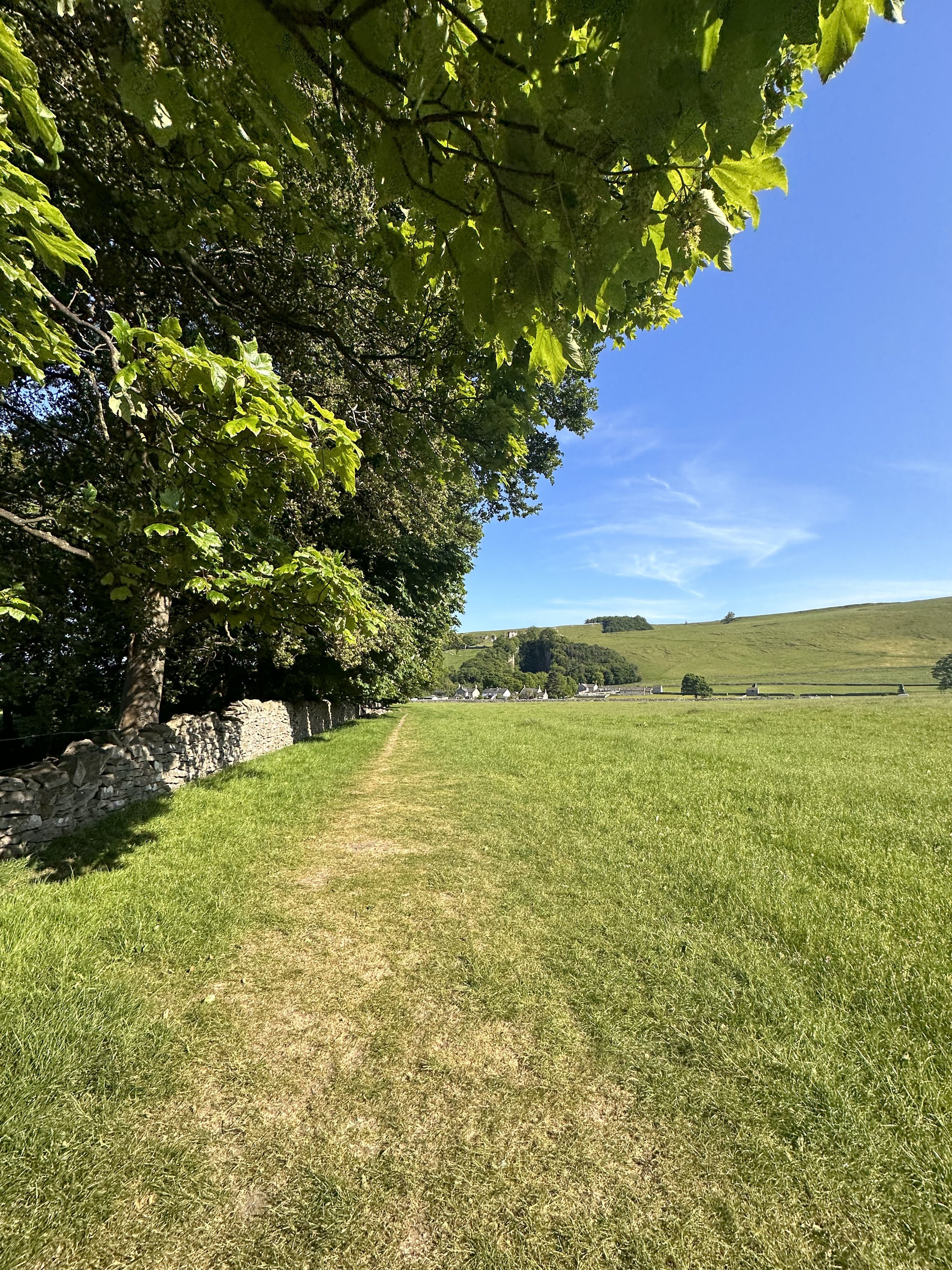
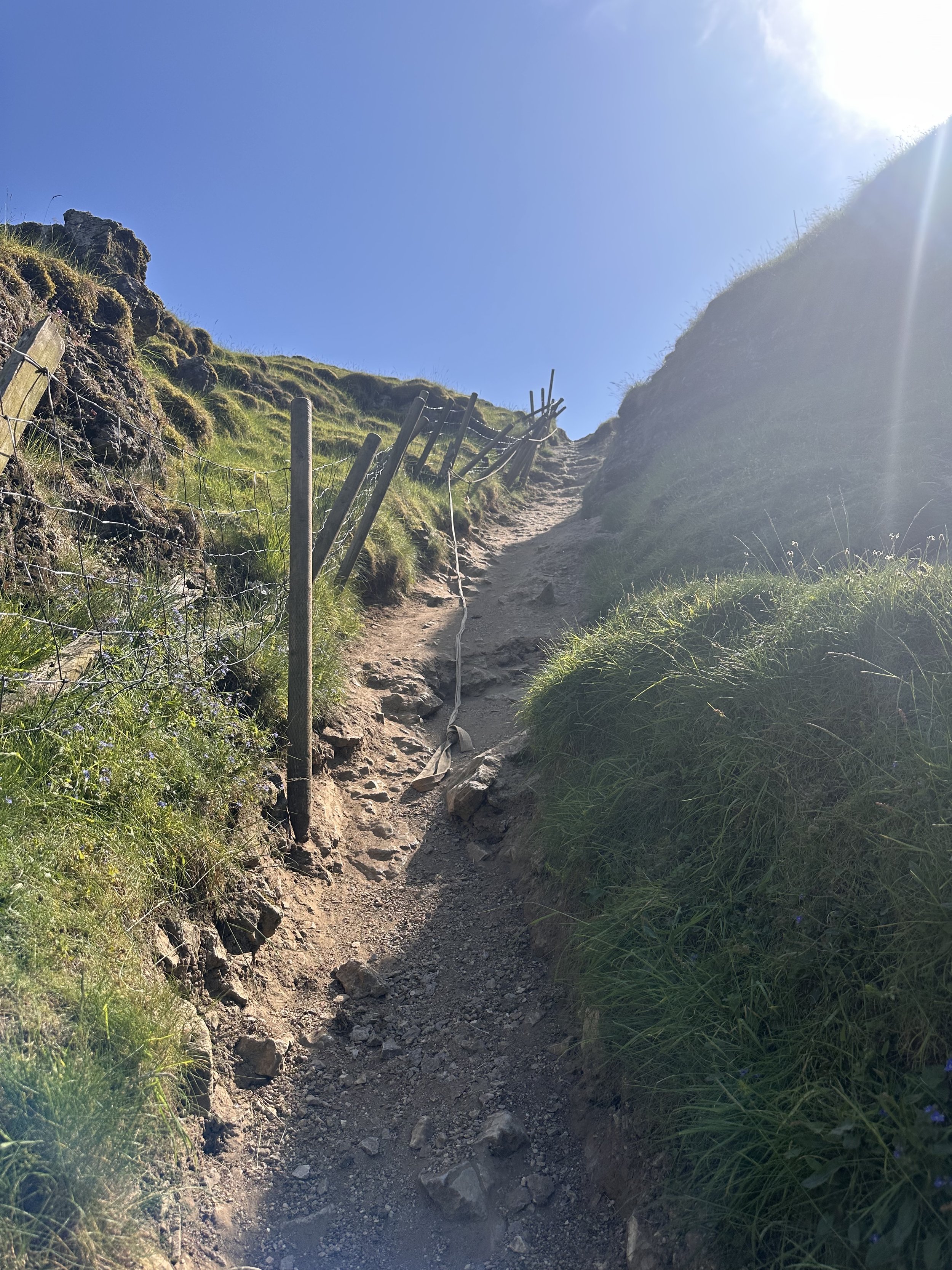
PENDLE HILL: A CHARMING WALK FROM WHEATLEY
Witch way to Pendle? Take our enchanting route up to Pendle Hill and walk where witches once roamed…
Start: Wheatley Lane, Lancashire (we parked in a roadside bay)
Distance: 6.73 miles
Elevation: 1,600 feet
Duration: approx. 3 hours
Navigation: follow our route here

Lancashire is full of beautiful walks but one of our favourites is this route that takes you up to Pendle Hill. Located in a small village called Barley, you could easily spend the day learning about it’s history and venturing up the hill to see the beautiful surroundings.
Pendle Hill is one of the area’s most impressive landmarks – you can see it for miles. It looks steep, and while it will have you huffing and puffing a little, the effort is 100% worth it! Known for its eerie history and ties to the infamous Pendle Witches, this trail promises a bewitching adventure, alongside some proper pub grub to ground you back to earth on your descent.
Ready to delve into the spooky legends, hike through hauntingly beautiful landscapes, and uncover the dark secrets that shroud this mystical destination?
Let’s dive in…

As you ascend from Wheatley Lane, the landscape transforms into the mesmerizing Forest of Bowland. This Area of Outstanding Natural Beauty offers a myriad of trails to explore, each revealing its own unique treasures. Stroll through ancient woodlands, breathe in the fresh scent of pine trees, and keep an eye out for native wildlife that calls this area home.
Pendle Hill
Pendle Hill is famous for a number of reasons. Not only is it an isolated extension of the Forest of Bowland Area of Outstanding Natural Beauty and amazing pendle walks, but it gained notoriety in the 17th century because of a group of witches that became infamous across the country. The Pendle witches, who were tried in nearby Lancaster, were part of the wider English witch trials which saw 500 people executed between the 15th and 18th centuries. The Pendle witches were so infamous in part because they made up a full ten of these executions. It’s believed that many were the cause of two feuding families, combined with a number involved actually believing their guilt.
Their legacy has remained throughout the area. The Pendle Hill is now known both for its beauty and its links to witchcraft. The area has two walks of note that take in both aspects of this, the Pendle Hill walk from Barley and the Pendle Hill witches walk.

This mysterious brooding landmark will forever be associated with the Pendle Witches, but the hill was also the subject of religious inspiration. In 1652 George Fox climbed Pendle Hill and had a vision on the hill which inspired him to found the Quaker movement. Its summit, known as "The Big End," is the site of a Bronze Age burial mound.
And at just 51 metres short of being considered a mountain, you can certainly get your cardio in on this route. In fact, Pendle Hill is the highest point in the Ribble Valley. Measuring 557 metres, the hill boasts spectacular views over the Lancashire countryside and across to Yorkshire. You can even see as far as Wales on a clear day! From the summit, take in the panoramic views that stretch across Lancashire, rewarding you for your efforts.
Points of interest:
The Cauldron: A Charming Pop-up Tea Room

Descend from Pendle Hill and follow the trail until you reach the delightful pop-up tea room known as The Cauldron. Nestled amidst the natural beauty of the countryside, this hidden gem offers a perfect spot to relax and refuel. Sip on a steaming cup of tea, indulge in homemade treats, and immerse yourself in the tranquil ambiance before continuing your journey.
Barley: Pubs, Pints, and Perfection
Finally, our walk leads us to the charming village of Barley, where good food and drink await. While you’re spoilt for choice with ‘proper’ pubs in this area, our favourite is The Barley Mow. This traditional pub serves up a delectable array of dishes, but their salt and pepper chips are a true highlight.
Options to extend the route:

Pendle Hill is a highlight of the 45-mile Pendle Way – a circular walk which passes through the stunning Lancashire countryside, passing waterfalls, ancient churches and adorable villages. It’s also a feature of the 43-mile Bronte Way – another popular route which takes in lots of famous spots from the Brontë family’s life. So if you’re looking for a long distance trail to complete over a few days, this is a great spot to do it.

Fancy walking where witches once roamed? Follow our route here

WINNATS PASS AND ODIN MINE WALK
One of the best Peak District walks just a short drive from Manchester

Start: Castleton Visitor Centre, S33 8WN
Distance: 5.02 miles
Elevation: 900 feet
Duration: allow approx. 2 hours
Navigation: follow the route here

This walk takes you high above Winnats Pass and around Castleton, meaning you can take in this amazing Peak District village from all angles. The start of the route leans towards the challenging side, taking you up a steep and rocky path straight up to Winnats Pass, so consider if this one’s for you before heading out.

The first ascent is steep with scrambling required. Thankfully, a kind soul has left a climbers rope tied to a gate post which gives you all the leverage you need. We’ve been meaning to give this one a go for a while, and it didn’t disappoint.
The route starts near Castleton Visitor Centre where you’ll find a shop, cafe and toilets… among a gorgeous array of nearby pubs, eateries and cafes.
The car park is pay and display, but there’s street parking available nearby (be aware these fill up quickly during peak hours, so we recommend getting down early).

Once atop Winnats Pass, you’ll follow a trail that leads close to the boundary wall and takes you along the top of the pass. Be sure to stop and take in the views on this part of the walk, we were blown away watching the tiny cars winding their way through the Way.
From here, you’ll head along a footpath in the direction of Mam Tor, before taking a detour to Odin Mine: a disused mine thought to be in use since around 1260. The landscape surrounding makes for great exploring, leading you to the collapsed road constructed beneath Mam Tor.

Once you reach Treak Cliff Cavern, look out for signs that tell you about the history of the area. Winnats Pass and the surrounding environment was once under a tropical sea, making the site protected by law due to the many fossils of sea creatures which lived here over 350 million years ago.
The valley was created by melting glaciers which gradually dissolved, creating streams which flowed through and under cracks in the rock. One of these streams created a large underground cave system which eventually collapsed, leaving Winnats Pass you see today!

With so much to see in such a short walk, this is undoubtedly one of our favourite walks when visiting Derbyshire.
Fancy giving it a go? Follow the walk here

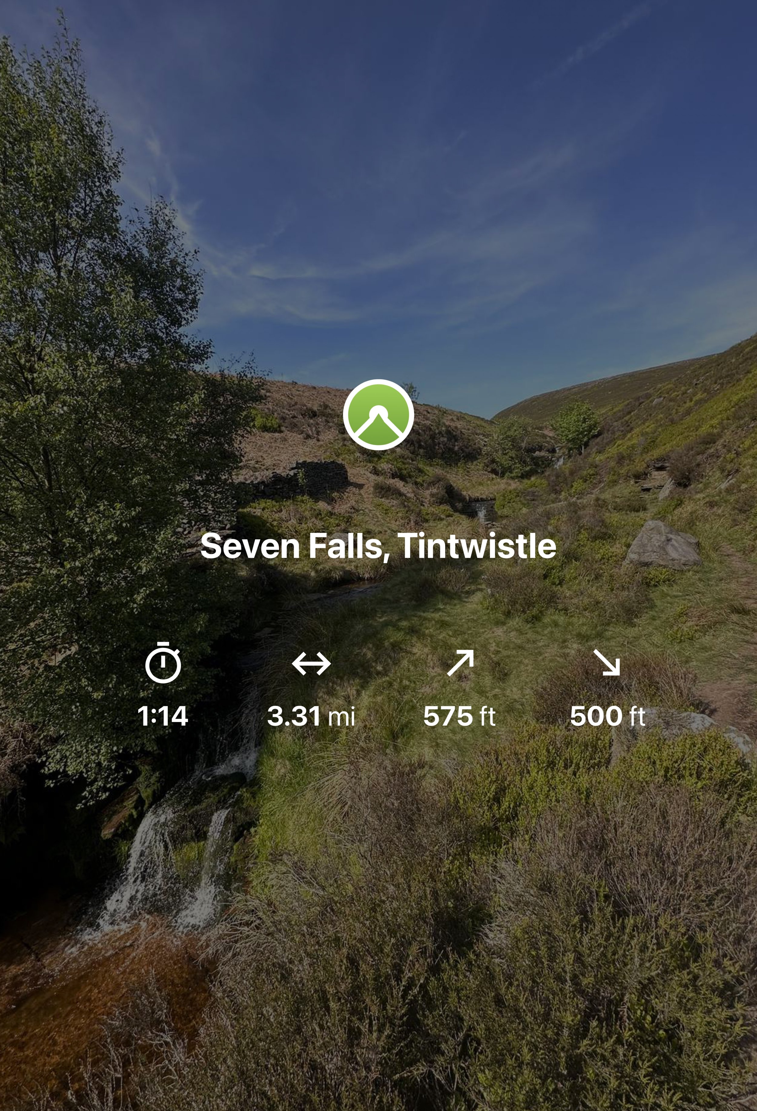
SEVEN FALLS SHORT WALK, TINTWISTLE
A short walk up to one of Greater Manchester’s (not so) hidden wild swimming spots

Start: Arnfield Fly Fishery, SK13 1HP
Distance: 3.31 miles
Elevation: 575 feet
Duration: Approx. 1.5 hours
Navigation: Follow the route here or download GPX file
Public Transport: Start the walk at Hadfield Station, with a mile walk to the start

The Peak District has a number of famous waterfalls within its boundaries that have become famous to walkers and and visitors to the area. Pretty Padley Gorge has a gentle cascading run of waterfalls along the course of Burbage Brook, Kinder Downfall, with a 30-metre drop is the tallest waterfall in the Peak District, and Three Shires Head, the meeting point of Cheshire, Derbyshire and Staffordshire is busy all year round.
But what about the less well known waterfalls in the National Park? One such place can be found in Tintwistle, an area north of Glossop on the western edge of the Peak District.
The area is well populated with several reservoirs which are great for walking but just to north of them runs Arnfield Brook which is the source of a series of cascading waterfalls and tranquil pool.
Let's dive in…
Arnfield Reservoir:

Our adventure starts at Arnfield Reservoir, a serene body of water offering a peaceful escape on the outskirts of Tintwistle and Glossop. Please note, parking here is limited, so arrive early to secure a spot. Take a moment to soak in the picturesque surroundings, grab yourself a cuppa or scan the restaurant and cafe’s menu for your post-walk treat on your return.
Arnfield Fly Fishery Cafe & Restaurant:

At the start of your hike, you'll encounter Arnfield Fly Cafe & Restaurant, a charming eatery nestled amidst the High Peak countryside. It's the perfect spot to refuel and recharge, with a selection of refreshments and delicious food to satisfy your cravings. Take a break, enjoy a cup of tea or coffee, and indulge in some delicious Thai food before continuing your journey towards the falls.
Seven Falls Waterfalls

Prepare to have your breath taken away as we arrive at the stunning Seven Falls waterfalls. While their location may no longer be a secret, it’s the perfect spot to cool off on a sunny Mancunian day. So if a wild dip is your ideal weekend pasttime, make sure to pack a cozzy because this is the ultimate wild swimming spot near Manchester.
Extend your adventure
Once you've soaked up the magic of the Seven Falls, consider extending your adventure by exploring some of the other scenic walks in the area.
Bottoms Reservoir: A leisurely stroll around Bottoms Reservoir offers peaceful surroundings and panoramic views. It's a perfect option for those seeking a shorter, more relaxed walk.
Higher Swineshaw Reservoir: For a slightly longer trek, venture to Higher Swineshaw Reservoir. This circular route treats you to breathtaking vistas and serene landscapes, making it an ideal choice for those craving more nature immersion.
Bottoms Reservoir to Dovestone Reservoir:
Start at Bottoms Reservoir and follow the trail that leads to Dovestone Reservoir. Take in the beauty of both reservoirs and the picturesque landscapes in between. The round trip is approximately 3.5 miles.
Greenfield Circular Walk:
Begin at Bottoms Reservoir and head east towards Greenfield. Explore the charming village and then return to the reservoir using a different path. This circular walk is about 4 miles in length.
Fancy giving this route ago? Follow along here

GIDDY EDGE WALK
Walk on the wild side along Matlock’s ‘Giddy Egde’

Take on a whirlwind adventure through the heart-stopping heights of Giddy Edge on High Tor in Matlock, while also indulging in the romance of Lover's Walk in Matlock Bath. Prepare to have your adrenaline pumping and your heartstrings tugged as we explore these two enchanting highlights in one route.

Start: Matlock Town Centre, DE4
Distance: 5.41 miles
Duration: 2.5 hours
Elevation: 1,175 feet
Navigation: follow the route here

Giddy Edge, High Tor

Giddy Edge… the name alone sends shivers down your spine! This exhilarating path is not for the faint of heart, but for the adventurous souls seeking an adrenaline rush — this one’s for you. As you walk along the narrow cliff edge, take in the awe-inspiring panoramic views of the Derbyshire Dales and don't forget to capture those Instagram-worthy moments!
Along the way, keep an eye out for the famed rock formations, including the legendary "Cromford Tooth." Rumor has it that touching it brings good luck, but be cautious, for superstitions and precipices don't always mix well!
Lover's Walk, Matlock Bath

Now that you've conquered Giddy Edge, it's time to shift gears and embrace the romantic ambiance of Lover's Walk in Matlock Bath. This picturesque riverside path, flanked by lush greenery, is perfect for lovebirds or anyone seeking a moment of tranquility. The charming Victorian-style lampposts transport you back in time… but if you’re after a post hike snack, the nearby Greggs should bring you back to 2023 in no time.
Attractions not to miss during your visit:
Heights of Abraham
After your adrenaline-fuelled adventure along Giddy Edge, make your way to the Heights of Abraham. This unique hilltop park offers cable car rides that will sweep you up into the clouds, providing breathtaking views of the surrounding countryside. It's a perfect opportunity to catch your breath and marvel at the beauty of Matlock below.
Matlock Bath Aquarium
For those fascinated by marine life, a visit to the Matlock Bath Aquarium is a must. Immerse yourself in the captivating world beneath the waves and explore an array of exotic species. From vibrant tropical fish to mesmerizing jellyfish, this aquatic adventure will leave you in awe.
The Fishpond Pub
Walking can make even the hardiest adventurer thirsty, so be sure to stop by The Fishpond Pub. Nestled in the heart of Matlock Bath, this charming establishment serves up a delightful selection of local ales, craft beers, and refreshing beverages. Unwind in their cosy beer garden or warm up by the crackling fireplace on colder days. Cheers to a well-deserved break!

Ready to brave Giddy Egde? Follow the route here
UPHILL CHALLENGES:


WALKS WITH WATERFALLS:


